Around Kidbrooke Station
In Development At Kidbrooke Station, I wrote about how a partnership had been formed between Transport for London and developers, that is aimed at creating revenue for London.
I also said I would be going with my camera.


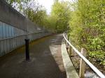

In some ways it was all a bit depressing.
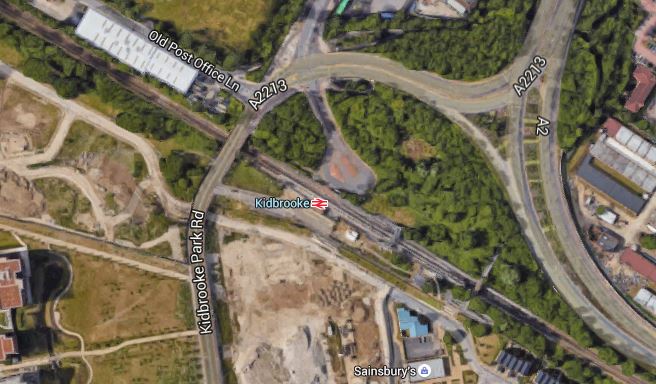
This Google Map shows the area where I walked.
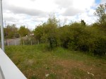
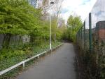
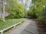
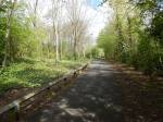
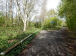
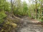
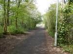
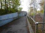
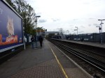
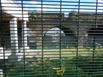
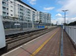
Kidbrooke Station
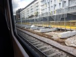
It looked like a rather nice wooded landscape had been trashed to build the A2 through the area in the last century.
Pretty it is not!
I would hope if housing is developed at Kidbrooke to the north of the station, that something could be done to improve the dreadful feel of the area.
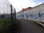
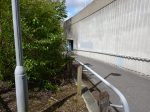
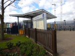
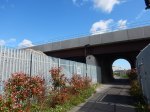
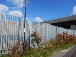
Is This The Worst-Placed Bus Map In London?
These pictures show the bus map at Kidbrooke station.

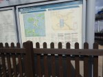
I was checking if I could get a bus to Abbey Wood station.
To read anything, you had to stand in the flower bed, but then the fence was in the way of the entries under A.
You can’t! But how could I find out?
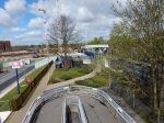
The Millwall Path
This path wasn’t here, the last time I walked this way. So I had to explore.


It eventually led to South Bermondsey station.
I think that this could become a popular walking route, as it links up to the path I took from Surrey Quays station, that goes to the still-to-br-built New Bermondsey station and on to Queens Road Peckham station.
It would appear that there is the possibility of opening another path through the arches close to the Millwall Path.
This would probably.
- Give good walking and cycling access between the development between the railway lines of the dive-under and South Bermondsey station.
- Open up more uses for the land between and the buildings under the dive-under.
- Create a direct walking route between the Surrey Quays area and Millwall Football Ground.
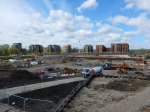
I think the whole area could make a very good designer shopping outlet or perhaps a high-technology or design cluster, as there are stations at each of the three corners of the site.
It is certainly a site with possibilities!
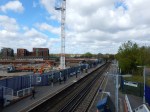
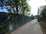
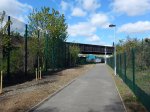
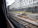
Walking Beneath The Dive-Under
I took these pictures, as I walked along the path beside the London Overground between Surrey Quays station and Millwall Football Ground.


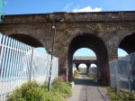


The path is crossed by the massive arches and viaducts of the various tracks that form the Bermondsey Dive-Under.
If you look at A Tribute To Victorian Engineering, it shows the structure from a train on the last viaduct I walked under.
I was talking to a lorry driver, who was probably on standby with a powerful road-sweeper, in case the road got covered in mud. He said it was impressive from inside and that it looks like they are creating a lot of small business units.
He also speculated, that there might be cafes and some retail.
But whatever happens, it looks like London is getting an impressive railway structure, to rival some of the best in the world.
It’s Less Than Twenty Days Until The Rail Timetable Change
The new rail timetable for the UK comes into affect on the 15th May 2016.
The Oracle (the National Railweb site) has a page that lists all the timetable changes. This page gives all the changes for December 2015.
But where is the page for May 2016?
Some of the changes are reflected in the timetables, like the start of services from Lea Bridge station, which I wrote about in The Full Service From Lea Bridge Station Starts On The 16th May 2016.
But other services are not in the on-line timetable!
Some companies also seem to have decided that not to publicise their plans for May 2016.
It is just not good enough!
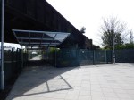
Work On The Platforms At Hayes And Harlington Station
I took these pictures of the extended Platforms 4 and 5 at Hayes and Harlington station on Wednesday.

Obviously, there would appear to be some work needed before the services to Hayes can start, as I wrote about in Hayes Shuttles To Start.
