A Short Cruise At Greenwich
I had taken the Emirate air-line to North Greenwich with friends and we decided we needed to go to the Cutty Sark.
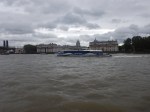
So we took one of the Thames Clippers, from where I took these pictures.
About the pictures.
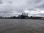
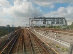
- The first pictures show Greenwich Power Station, which generates electricity for Transport for London on a standby basis. It must be one of oldest power stations still producing electricity, although nowadays it doesn’t use coal, but six massive gas turbines.
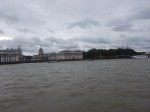
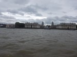
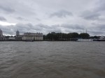
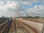
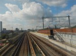
- The rest of the pictures show the Maritime Greenwich World Heritage Site.
The trip between the two piers took only a few minutes.
A Tourist Route Between Bank/London Bridge/Tower of London And Maritime Greenwich
I do this route on a sunny day, when I perhaps want to show a guest around London.
- Take the Docklands Light Railway (DLR) from Bank or Tower Gateway stations to Royal Victoria station.
- Take the Emirate Air-Line across the Thames to Greenwich. Peninsular
- North Greenwich isn’t overloaded with attractions, unless you’re seeing a show or event at the O2. But it’s getting better!
- Take the Thames Clipper one stop to Greenwich. They run every twenty minutes.
If you want to be boring you can always catch the DLR to Cutty Sark station.
A few points.
Docklands Light Railway
The Docklands Light Railway is often thought by Londoners, commuters and visitors as a bit of a Cinderella.
However, like Cinderella she works hard all day and provides reliable and efficient transport, where the only alternatives are buses, bicycles, taxis and Shank’s pony.
Just after the 2012 Olympics, I met a big cheese in Transport for London on a DLR train. He felt that the DLR had been the star in getting everybody to the games.
It must be one of the most successful light railways in the world!
And yet, no-one has ever thought to build another running on the same principles.
- Mainly elevated track.
- Mainly step-free stations
- Universal step-free train-to-platform access.
- High-visibility trains for passengers.
- Trains every three or four minutes.
- Friendly, interested, visible staff.
- Driverless operation with a train captain looking after passengers and driving in emergency.
- Contactless ticketing
Perhaps the lack of a full-time driver on every train, means that many other places would have massive union problems.
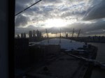
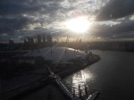
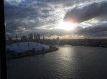
Emirates Air-Line
I’ve taken many people on the Emirates Air-Line and few haven’t been impressed.
The best time in my view is just as the sun sets, as these pictures show.

Note that unless you want a souvenir ticket, just use your bank card to touch-in and touch-out! My last one-way trip cost me £3.50 and appeared on my credit card statement labelled TFL TRAVEL CH Conractactless.
Thames Clippers
Since I moved back to London in 2010, the Thames Clippers have been continuously expanding and improving.
- .Five new boats have been delivered since the Olympics.
- Several piers have been improved, rebuilt or added in recent years.
- Cpmtactless ticketing can be used for all services. Payments are labelled THAMES CLIPPERS.
It should be noted that if you are a holder of a London Freedom Pass, you can get a discount on tickets at a machine.
Plans exist for the following.
- Extending the route to new housing developments at Barking and Thamesmead in the East.
- A new pier at Silvertown in October 2019, which could have a walking or bus link to the City Airport.
I can also see the following.
- Extensions to the West past Putney Pier to places like new housing at Brentford and Kew Gardens.
- Further extensions to the East to support the massive housing developments.
- Better connections to the London Underground, London Overground and National Rail stations.
- More use being made of the Thames Barrier as a tourist attraction.
- Thames Clippers becoming a river tube line.
- Thames Clippers appearing on the Tube map, just as the Emirate Air-Line does!
- A quick and easy connection between the City Airport, Canary Wharf and the Cities of London and Westminster being developed.
The last would surely appeal to City businessmen and those wanting to celebrate a special event.
If Venice can run a boat between the Airport, and St. Mark’s Square why can’t London do the equivalet?
Crossrail
Crossrail is the Elephant-in-the-Room, that will surely make its presence felt along the South Bank of the Thames, when it is extended to Ebbsfleet, as it surely will be.
- There will be a short walking interchange at Woolwich between Crossrail and the Tghames Clippers.
- If Crossrail build a station at Silvertown for London City Airport, this could be another interchange.
- If Crossrail eventually terminates at Gravesend, there could even be possibilities that far East.
The possibilities of designing the Crossrail Extension in conjunction with the Thames could open up the river has as both a leisure attraction and a transport artery.
Conclusion
London will reach towards the sea, to further enhance and add space to the undoubted Capital of the World!
A
The Crossrail Portal At Pudding Mill Lane Station
These pictures show the Crossral portal at Pudding Mill Lane station, as it is approached on a DLR train from Stratford station.
The portal does appear to be rather functional.
The New Bank Station Entrance At Cannon Street Is Taking Shape Nicely
The title of this post, is the same as that of this article on The Londonist.
The article contains some good pictures and says this.
- The building has now been topped out!
- The station is underneath an eleven storey block.
- The entrance will give direct escalator and lift access to the Northern Line.
These are some pictures of my own.
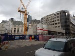
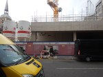
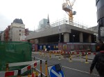
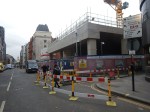
The entrance and the building above should be open by 2022.
Penge Interchange
This map from carto.metro.free.fr shows the lines through Penge West and Penge East stations.
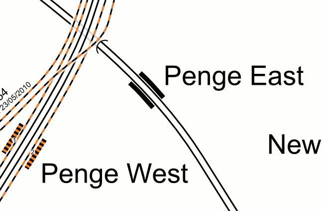
The two stations are a valid out-of-station interchange, but neither is step-free.
Penge East station could be difficult to make step-free, as the footbridge is listed.
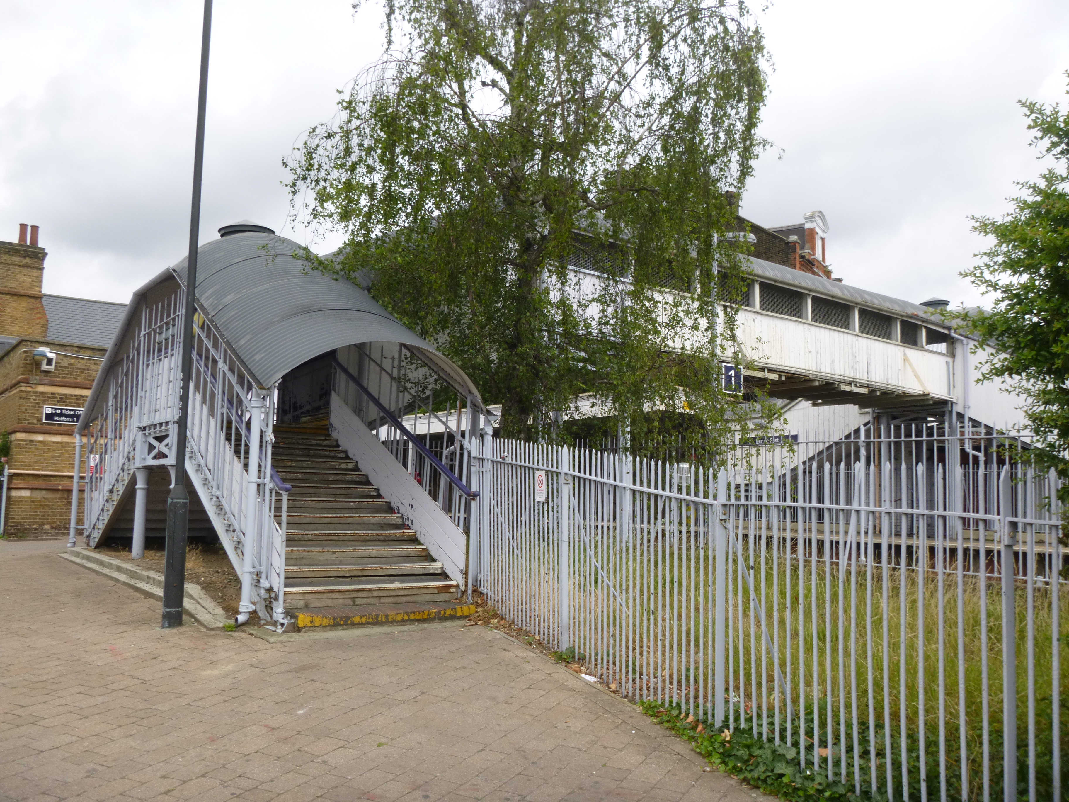
I think that it is one of those structures that Network Rail wouldn’t miss, if it was decided to install it at the National Railway Museum.
This Google Map shows the two stations and their distances from, where the two lines cross.
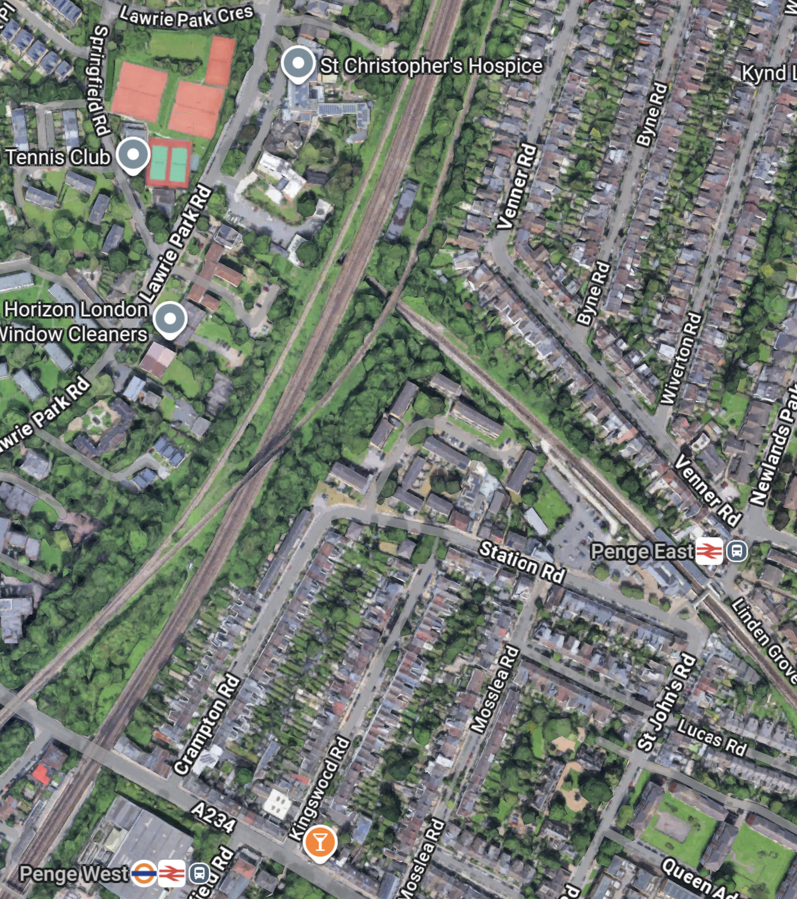
Note.
- Penge West station is in the South-West corner of the map on the East London Line.
- Penge East station is in the East of the map on the Chatham Main Line.
- The new Penge Interchange station could be located, where the East London Line and the Chatham Main Line cross.
- The two tracks of the Crystal Palace branch of the Overground can be seen either side of the East London Line.
Could this be one of the reasons, why it has been suggested by Transport for London, that a new station be built, where the lines through the two Penge stations? cross?
- The station would be built on railway land.
- The station could be a step-free four-poster station like Smethwick Galton Street station, which I wrote about in Birmingham’s Four-Poster Station.
- It would have four tph between Victoria and Bromley South stations.
- It would have four tph between Highbury & Islington and West Croydon stations.
- It would have two tph between London Bridge and Caterham stations
- It might also be possible to have platforms on the Crystal Palace branch, thus adding six tph between Highbury & Islington and Crystal Palace. stations.
- The station could have Thameslink platforms.
I feel it would offer the following benefits.
- Better connection between South East and North London, by changing at Penge and Whitechapel.
- Better connection between South East London and Crossrail, with all its connections, by changing at Penge and Whitechapel.
Penge Interchange might allow the two older Penge stations to be closed.
These are some further thoughts.
Southeastern Stations Served From Penge East
These stations are served from Penge East station.
- Beckenham Junction
- Bickley
- Brixton
- Bromley South
- Herne Hill
- Kent House
- Petts Wood
- Shortlands
- Sydenham Hill
- West Dulwich
Each station would get four trains per hour (tph) with two on Sundays.
What Does Artificial Intelligence, Think Of Penge Interchange?
I asked Google AI and received this answer.
Penge Interchange refers to a long-proposed but unbuilt Transport for London (TfL) project to create a major new railway station in Penge, London, combining Penge East (Chatham Main Line) and Penge West (Overground) stations, allowing seamless, step-free transfers between the East London Line (Overground) and Southeastern services, potentially linking to Thameslink, to improve capacity and connectivity in South London. Currently, there’s an “out-of-station interchange” (OSI) between Penge East and Penge West, requiring a walk.
Connecting to Thameslink could be worthwhile.
Note too, that Google AI refers to the East London Line by its traditional not its woke name.
What Does Artificial Intelligence, Think Of Brockley Interchange?
I asked Google AI a similar question for Brockley and received this answer.
“Brockley Interchange” can refer to two main things: the busy M1 Junction 4 near London (a motorway junction with the A41) or proposed future transport links for Brockley railway station in South East London, aiming to connect more rail lines, possibly reusing the old Brockley Lane site for better links to the Nunhead-Lewisham line. The current Brockley Station serves London Overground and Southern Rail but lacks step-free platform-to-platform access, with a proposed interchange potentially fixing this.
Note.
- The reference to the M1 Junction 4 is of course not relevant here.
- Brockley station also doesn’t have an entrance on the Up side.
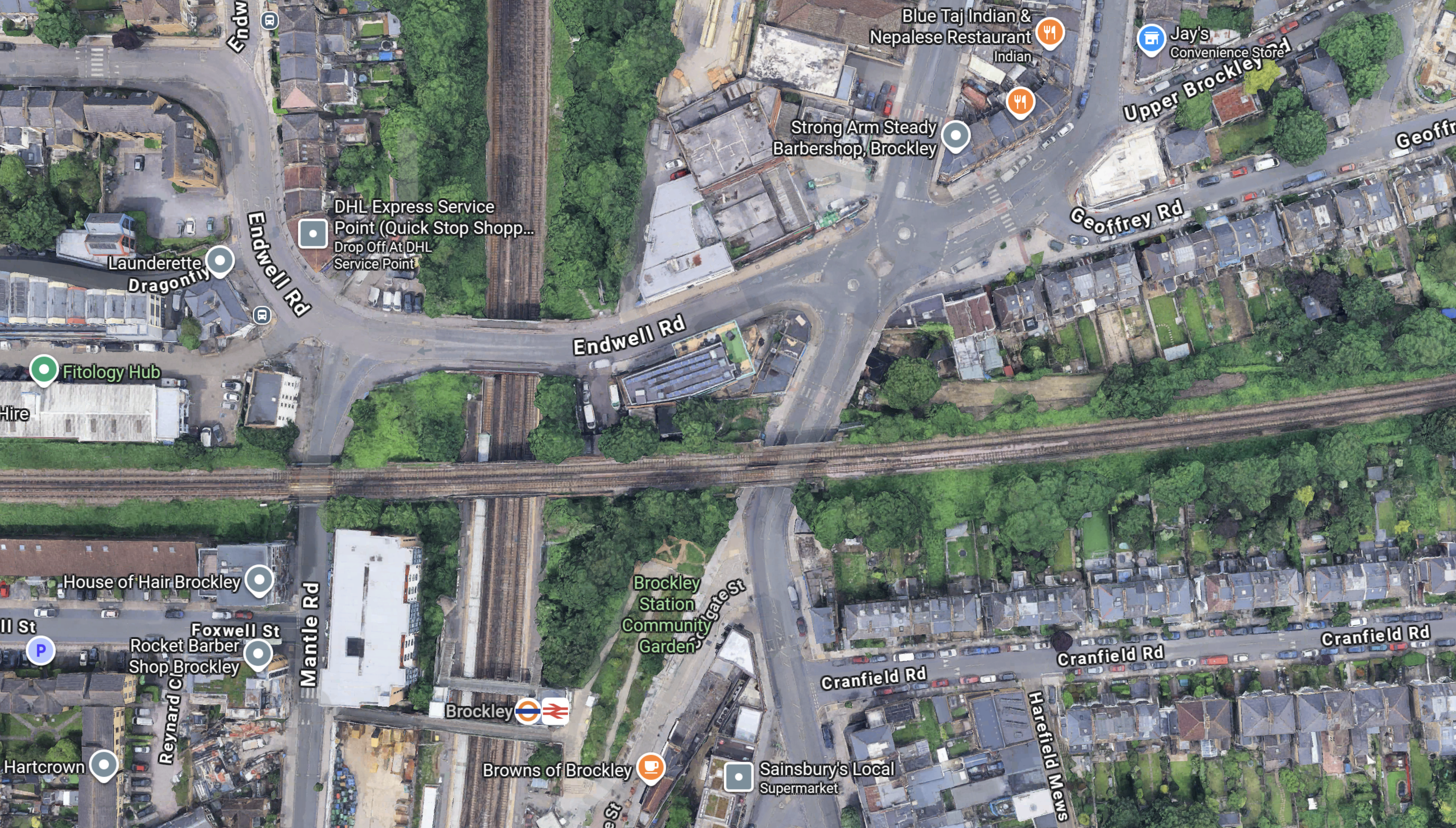
This Google Map shows Brockley station and the Nunhead-Lewisham Line over the top.
Note.
- The East London Line runs North-South.
- The Nunhead-Lewisham Line runs East-West.
- Brockley Lane station was just to the East of the East London Line.
- There is quite a few hectares of spare land along the Nunhead-Lewisham Line.
- A development called Brockley Yard has been given planning permission to the West of Brockley station.
It looks like the station could be redeveloped to join the two lines, with a certain amount of housing above the station.
Conclusion
It strikes me, that there are possibilities for station and network improvements, that would benefit passengers at both Penge and Brockley, that would release sites for housing.
The developments could also be self-funded, by property sales and more passengers on the rail network.
