No-Frills Mini Trains Offer Route To Reopening Lines That Beeching Shut
That long title appeared in The Times today above a picture of a stylish single-carriage lightweight train.
This page on the Warwick University web site is entitled Revolution Very Light Rail Project, describes the project on which the Times article is based.
This is said.
The main objective of the project is to reduce the weight and cost of a railcar by half in order to facilitate low cost connectivity of suburban and rural areas. The Radical Train will demonstrate unique self-powered bogies (with integral hybrid propulsion and kinetic energy recovery system) combined with a modular, lightweight body-shell utilising advanced materials. WMG will be transferring expertise in lightweighting technology from the automotive sector into this project. Automotive lightweighting solutions are already employing advanced materials including ultra-high strength steels and fibre-reinforced polymer composites.
Other points from The Times include.
- 18m. long, but could be 12m. or 9m.
- 3.8 litre Cummins diesel hybrid engines. Routemaster buses have 4.5 litre Cummins engines
- Speed of up to 70 mph.
- Lithium-titanate battery similar to a Routemaster bus.
- Target price of £500,000
The Times also says that the prototype could be running in 18 months.
So how feasible is what the article says?
The Short Branch Or Connecting Line
The most obvious application is the short branch or connecting line, which is worked by either a single train or perhaps a small number of small trains.
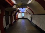
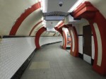
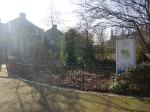
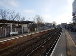
On their web site, Warwick University have an image of the train at St. Erth station, ready to depart on the St. Ives Branch. I wrote about this branch in St. Erth Station And The St. Ives Branch.

You have to admire the group in picking a station of character for their web site.
But it would also make a good test site for the train.
- St. Erth station has two platforms.
- The line is single track throughout.
- There is a two trains per hour (tph) service run by a single Class 150 train.
- The route has a high level of baggage.
- The Class 150 train takes 14-15 minutes for each journey.
- A well-designed modern train could save a few minutes.
But above all Cornwall has better weather than many places.
This line probably gets very busy in the Summer and I also suspect that Great Western Railway would like to run four tph on the branch.
They could probably do this with a passing loop around halfway and two trains with a better station calling performance than the Class 150 train. ERTMS, which would probably be fitted to the trains, would ease the problems of signalling on the line.
There are several branch lines in the UK, which are currently run by a single train and perhaps 1-2 tph, that could benefit with a 4 tph service, which these trains could provide.
In A Look At New Station Projects and also in The Times article, there are some branch line projects that may be suitable.
- The reopened Anglesey Central Railway.
- The reopened Brentford Branch Line.
- The reopened Cheadle Branch Line.
- The reopened Fawley Branch Line.
- The reopened Cockermouth, Keswick and Penrith Line.
- The reopened Bramley Line.
- The reopened Aldeburgh Branch Line.
Most of these lines are reopened lines that were closed in the Beeching era.
Are The Trains Big Enough?
At eighteen metres long, I reckon that the capacity of a single unit is slightly less than a twenty-three metre long Class 153 train. An estimate gives somewhere between 50-55 passengers.
But pictures in The Times and on the Warwick University web site show a standard railway coupling, which can be used for the following.
- Creating longer trains of two or more units working together.
- Allowing one train to rescue another.
- Allowing a train to be rescued by a compatible train.
So it would seem that creation of a train with a capacity of around 100 passengers by linking two units together is probably in the specification.
Working With Other Trains
The Times article says that the lightweight design means they can probably only run on captive lines with no other heavy trains.
But it also says that this will change with ultra-safe digital signalling, that enforced separation between trains.
By the time, these trains enter service, ERTMS will have been proven to be safe on UK railways.
I also suspect that the trains will use the most modern automotive industry structures. Pacers they are not!
The Longer Distance Service
A typical longer distance service would be one shown in The Times, which is to run a service between Newcastle station and a new Ashington station in the North East.
- Most if not all of the track is intact.
- Stations would need to be rebuilt or built from scratch.
- To work the desired frequency of two tph would probably need two units.
- Digital signalling would be needed, as there are freight trains on the same lines.
More details of the route are given on the South East Northumberland Rail User Group web site.
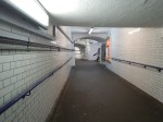
Running Under The Zwickau Model Into A Town Centre
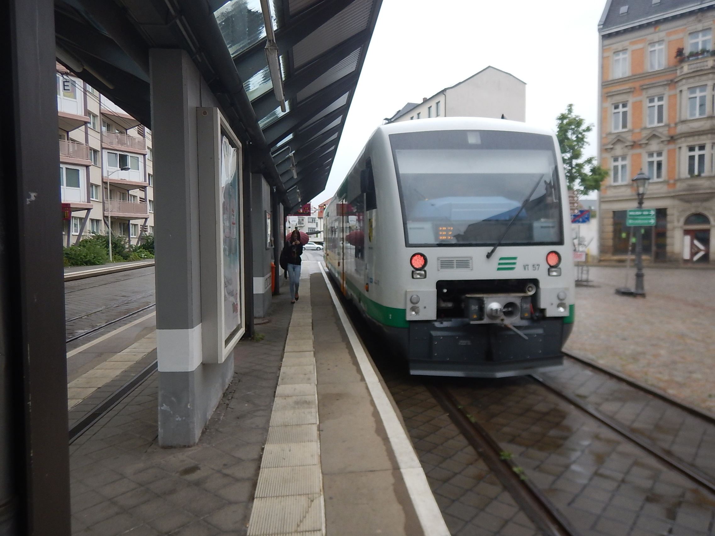
These trains could almost have been designed to run as trams, as the diesel multiple units of the Vogtlansbahn do in Zwickau town centre.

The picture shows one of the trains at the terminus of Zwickau Zentrum, after arriving at the town centre terminus from the Hauptbahnhof over a tram-style track under tram tram-style rules.
- Note the tram-style infrastucture with a simple stop and track laid into the roadway.
- The driver has large windows to keep a good look-out.
- Horns and other warning devices are fitted.
- Note the orange warning lights.
- The train travels at a slow safe speed.
- The stations or are they stops have no footbridges. Pedestrians and cyclists can cross the track, as they need.
I think that Warwick’s vehicles could travel like this to provide route extensions into a city or town centre of perhaps to an attraction like a theme park.
Have track! Will travel!
Conclusion
I think that Warwick have come up with a fresh design, that shows a lot of innovation and flexibility.
Not only is it affordable to build, but also probably can work with lower-cost infrastructure.
I look forward to seeing the prototype in action.
Crossrail 2 is a ‘threat to Soho’s soul’ says Stephen Fry
This is the title of an article on the BBC.
This is the sort of attitude displayed by Victorians who thought that railways would upset their grouse or disturb their dinner psarties.
Stephen Fry should stick to comedy!
Or is he being ironic?
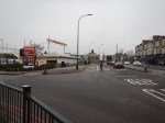
A Station For Maltby And Other Villages
Maltby in South Yorkshire is a village of around 17,000 people, with transport links, based on buses and private cars.
This Google Map shows the village, which shares a mini-connurbation with Hellaby and Bramley, as you go West.
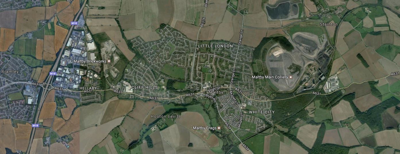
Bramley, Hellaby And Maltby
Note the massive Maltby Main Colliery, which thankfully closed in 2013. Curving round this scar on the face of Yorkshire is a railway, which starts in the North East corner and disappears South-Westerly out of the bottom of the map.
This railway is the South Yorkshire Joint Railway, which is described in this page in Grace’s Guide.
The line ran from Kirk Sandall Junction on the Great Central’s Doncaster-Cleethorpes line to a junction with the Great Central and Midland Joint Railway, just south of Dinnington. The N.E.R. had access over the G.C.R. from Hull, the M.R. had access from the Nottingham-Worksop line, over G.C.R. metals from Shireoaks, the L&Y joined at St. Catherine’s Junction from their Dearne Valley Railway and the G.N.R. had connections to the south of Doncaster. As opened the S.Y.J.R. was 21.25 miles (34km) in length, including its colliery branch lines and connections to the several lines it crossed in its path. It opened to freight on 1 January 1909, and to passengers on 1 December 1910.
Wikipedia says this about services on the line.
Passenger trains on the line ended in 1929; freight work continued on the line, with eight collieries served at peak. Most of the collieries closed by the 1990s; as of 2011, the line remains an important freight line for coal transportation both north and southwards to the Trent and Aire Valley power stations.
So now that coal is virtually in the dustbin of history, except in Trummkopf’s mind, perhaps it is time to do something positive with this railway.
The route between Doncaster and the Sheffield-Lincoln Line would appear to have the following characteristics.
- It is single-track and looks intact.
- There is no trace of any station.
- The line passes through several large villages including Anston and Dinnington.
- The line passes through the town of Doncaster and even goes close to the racecourse.
- The Northern end joins the South Humberside Main Line just to the West of Hatfield and Stainforth station.
- The Southern end joins the Sheffield-Lincoln Line at a partially-closed triangular junction between Kiveton Park and Shireoaks stations.
But the biggest factor in developing the line is that the South Yorkshire Joint Railway goes straight through the site of the proposed Doncaster Inland Port or Doncaster iPort. This is Wikipedia’s introduction for the iPort.
Doncaster iPort or Doncaster Inland Port is an intermodal rail terminal; a Strategic Rail Freight Interchange,[note 1] under construction west of Rossington and south of Doncaster at junction 3 of the M18 motorway in England. It is to be connected to the rail network via the line of the former South Yorkshire Joint Railway, and from an extension of the former Rossington Colliery branch from the East Coast Main Line.
The development includes a 171 hectares (420 acres) intermodal rail terminal to be built on green belt land, of which over 50 hectares (120 acres) was to be developed into warehousing, making it the largest rail terminal in Yorkshire; the development also included over 150 hectares (370 acres) of countryside, the majority of which was to remain in agricultural use, with other parts used for landscaping, and habitat creation as part of environment mitigation measures.
This Google Map shows the location of the Doncaster iPort.
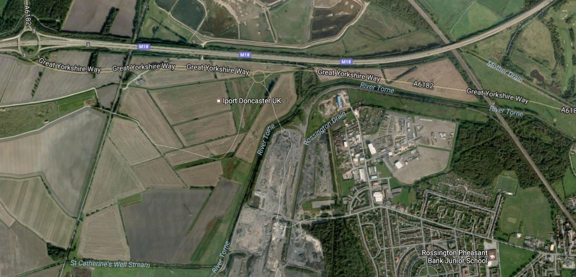
Note.
- Junction 3 of the M18 in the North-West corner of the map.
- The South Yorkshire Joint Railway crossing the site from North to South.
- The under-construction A6182 or Great Yorkshire Way, which is described in this news article on the BBC, with a headline of New £56m Robin Hood Airport to M18 link road opens.
- The scar of Rossington colliery, to the North of the village of Rossington.
- The East Coast Main Line to the East of the village.
The only thing that missing is a way to get large container ships to the iPort. Air freight will be sorted, as I wrote in A Station At Doncaster Sheffield Airport, with a choice of road or rail links between the iPort and Doncaster Sheffield Airport.
Some questions come to mind.
- Will the Rossington Colliery Branch, when extended to the iPort have a junction with the East Coast Main Line that enables traffic to arrive at and leave from the iPort in both directions?
- Will the Rossington Branch have a connection to the Joint Railway to give a route for passenger trains between Doncaster and the Joint Railway?
- How will freight trains get from the iPort to the Great Northern Great Eastern Joint Line to go South for Felixstowe?
But it does seem that Maltby and all those villages will be getting a busy railway through their midst.
It would surely be sensible to add in a few passenger services, that connect Maltby and all the other villages to perhaps Doncaster, Sheffield and Worksop.
.
Exeter To Plymouth Via Okehampton
\since the 2014 Sea Wall Breach at Dawlish station, Network Rail have looked at various routes that can bypass Dawlish, should a sea wall breach happen again.
One route is the old Exeter to Plymouth railway of the LSWR, which is best described as partly open.
- Exeter St. David station to Crediton station using the Tarka Line.
- Crediton station to Okehampton station using the Dartmoor Railway.
- Bere Alston station from Plymouth station using the Tamar Valley Line.
There is a just over twenty mile gap between Okehampton and Bere Alston stations.
The original route between those two stations included several stations, with the most important being Lydford and Tavistock.
It will be interesting to see if the trains ever run again between Okehampton and Bere Alston stations.
Even if the link was reinstated as a 55 mph line like the Tamar Valley Line, it would surely be valuable as a local line for residents and tourists.
The Worksites Of The Bakerloo Site Extension
Building the Bakerloo Line Extension will hopefully finish around 2028/29.
So I’m publishing these maps of the areas, that could be affected by works, so if perhaps you’re thinking of moving house, you can take an appropriate decision.
The Route
This is TfL’s latest route map between Elephant and Castle and Lewisham stations.
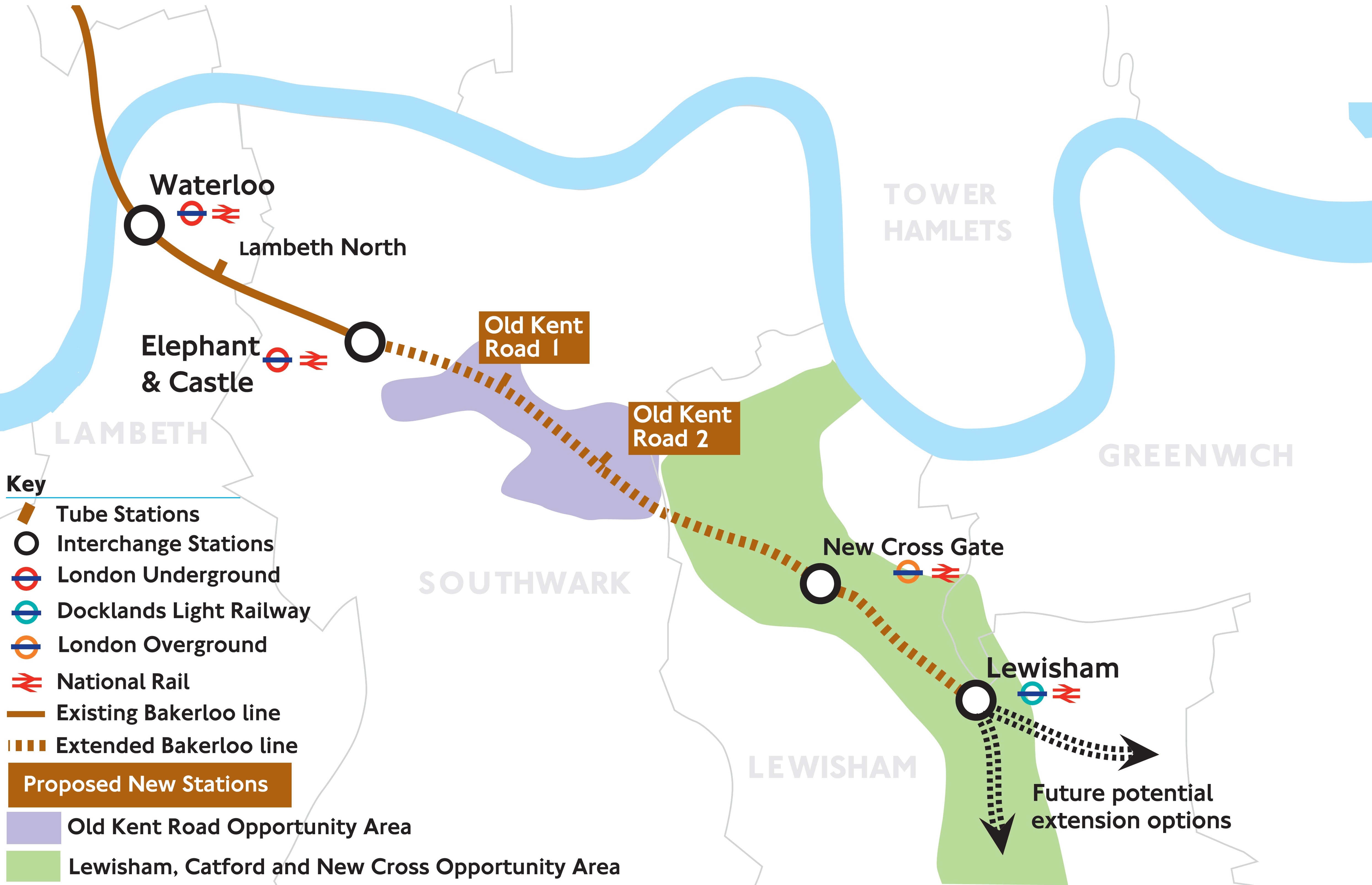
Note the two completely new stations with the imaginative names of Old Kent Road 1 and Old Kent Road 2.
The full document is here on the Transport for London web site.
The Worksites
The sites are given in route order from the North.
Elephant And Castle
The map from carto.metro.free.fr shows the lines through the station.
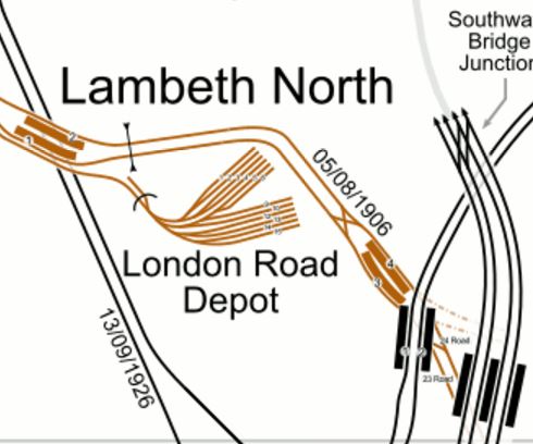
The North-South lines across the map are from West to East.
- The Charing Cross Branch of the Northern Line – Dated 13/09/1926
- The Bakerloo Line – Dated 05/08/1906
- The Bank Branch of the Northern Line.
- Thameslink to Blackfriars and Orpington, Rainham, Sevenoaks, Sutton and Wimbledon.
Just below this map is Kennington station, where the two branches of the Northern Line meet and will divide to Morden and Battersea Power Station stations.
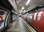
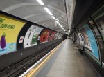
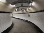
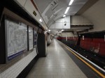
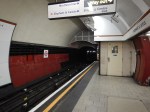
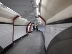
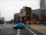
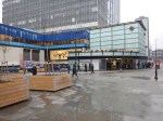
Elephant and Castle is effectively two separate stations at present, with one for the Bakerloo Line and one for the Northern Line. Both stations have lifts and narrow, dingy platforms and passageways. Connections between the two stations underground is not good.
These pictures of Elephant and Castle station were taken on February 12th, 2017


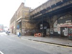
Works envisaged at Elephant and Castle station include.
- A new larger ticket hall for the Bakerloo Line
- Wider platforms for the Bakerloo Line
- Escalators aren’t mentioned, but would probably be included for the Bakerloo Line
- New ticket hall for the Northern Line
- Three escalators and more lifts for the Northern Line to provide step-free access.
- Better connections between the two lines.
I would hope that a comprehensive design would include a step-free link to the Thameslink station.
I suspect, that the two stations could be rebuilt as two separate projects, with the Northern Line station being updated before the Bakerloo Line station.
If the two projects were properly planned, I believe that trains could continue to run on the Northern Line throughout the works, with trains running to the Bakerloo Line platforms until they needed to be closed for updating and connection to the new tunnels.
I wouldn’t be surprised to see an updated pedestrian connection between the Bakerloo and Northern Line platforms created first, so that at least one entrance to the platforms is available throughout the works.
This Google Map shows the area around Elephant and Castle.
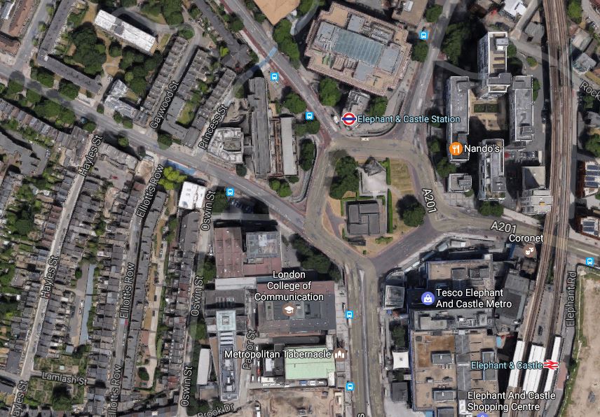
Eephant And Castle
Transport for London have said they need a worksite in the area.
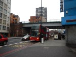
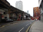
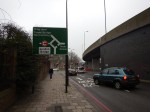
Bricklayers Arms
Bricklayers Arms is known to many as a roundabout and flyover on the A2 into London.
This Google Map shows the roundabout.
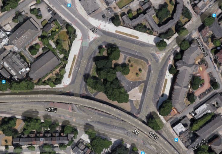
Bricklayers Arms
It is one of two possible locations for a shaft that will be needed between Elephant and Castle and Old Kent Road 1 stations.
These pictures of Bricklayers Arms were taken on February 12th, 2017.


The worksite could be in the middle of the roundabout.
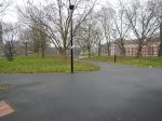
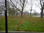
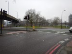
Faraday Gardens
This Google Map shows the South-East corner of Faraday Gardens.
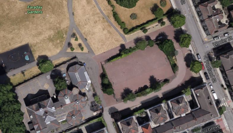
Faraday Gardens
It is one of two possible locations for a shaft that will be needed between Elephant and Castle and Old Kent Road 1 stations.
These pictures of Faraday Gardens were taken on February 13th, 2017


The worksite could be in the a hard playground.
My personal view is that the Bricklayers Arms site is the better from a working point of view, but is it in the best position?
Old Kent Road 1 Station
This Google Map shows the area, where Old Kent Road 1 station will be located.
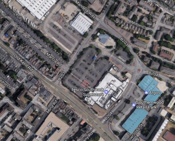
Old Kent Road 1 Station
There are two options given for the location of the station.
Note the Tesco Southwark Superstore in the middle of the map, with its car park alongside.
- Option A for the station is on the other side of Dunton Road and slightly to the North West of the car park.
- The other Option B is on the Old Kent Road on the site of the store itself.
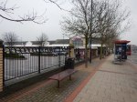
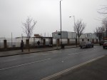
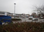
These pictures of the area around the Tesco store were taken on February 12th, 2017.


The group of people most affected by the construction of the station will be those who shop at this Tesco.
I suspect that given the company’s current position, Tesco would be happy to co-operate with TfL. After all there must be advasntages in having a superstore on top of an Underground station.
If the Tesco Superstore had to be knocked down, there are lots more anonymous architectural gems like this one.
So I wouldn’t be surprised to see Option B implemented, with a brand new station alongside the Old Kent Road.
Old Kent Road 2 Station
There are two options for this station.
This Google Map shows the location of Option A opposite B & Q.
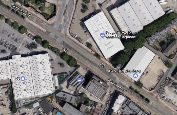
Option A For Old Kent Road 2 Station
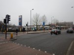
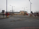
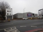
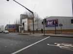
The station will be on the the Currys PCWorld site along the road.
These pictures of the area around the Currys PCWorld store were taken on February 12th, 2017.
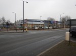

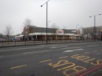
This Google Map shows the location of Option B on the Toys R Us site on the other side of the Old Kent Road.
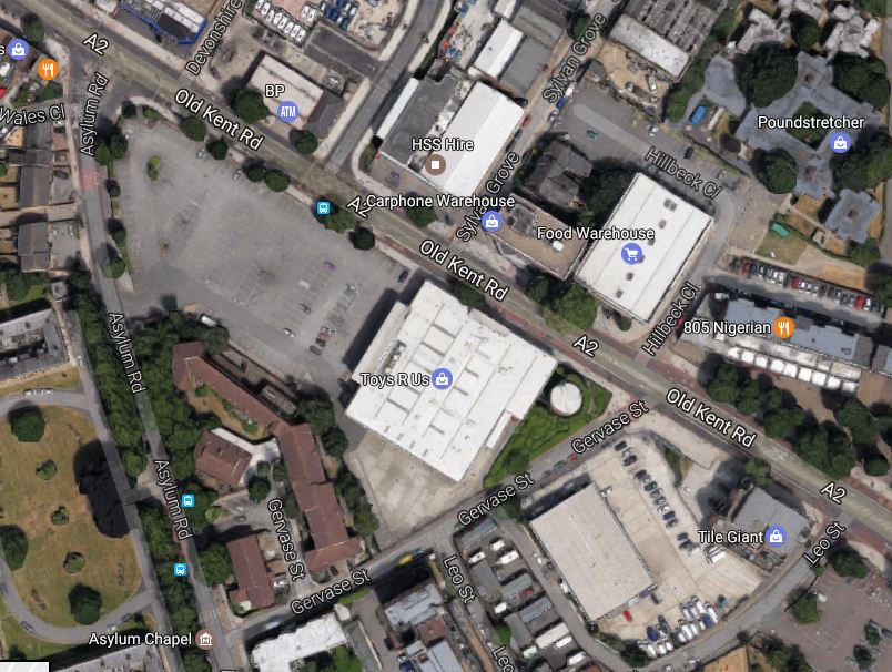
Option B For Old Kent Road 2 Station
These pictures of the area around the Toys R Us store were taken on February 12th, 2017.

Both chosen sites would appear to have plenty of space and wouldn’t require the demolishing of any housing.
Note that the Toys R Us stored was closed in April 2018. Did Transport for London rewrite their plans and are they in negotiation for the now-vacant site?
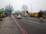
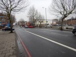
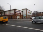
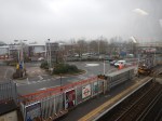
New Cross Gate Station
New Cross Gate station is an existing Overground and National Rail station.
This Google Map shows the station and the Retail Park, that is alongside the station to the West.
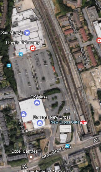
New Cross Gate Station
These pictures of the area around the Sainsburys store were taken on February 12th, 2017.


The worksite would take over the car park, with the station being built underneath.
This worksite is very much the most important site of the extension. The consultation says this.
The size of the proposed site provides several opportunities for the project. It could allow soil to be taken away by train rather than using local roads. We could also start the tunnel machinery from this site.
When the station is completed, I can envisage New Cross Gate becoming an important transport hub, with a quality shopping experience.
Alexandra Cottages
Alexandra Cottages, a short road off Lewisham Way has been proposed as the location of a shaft between New Cross Gate and Lewisham stations.
This Google Map shows the location.
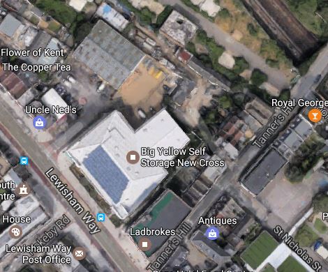
Alexandra Cottages
I suppose the site has been chosen, as the site contains a Big Yellow Self Storage facility and a Ladbrokes betting shop.
These pictures of the area around the storage facility were taken on February 13th, 2017.

Will the shaft be buried in the basement of a development suitable for the area?
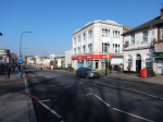
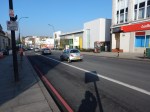
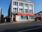
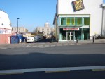
Lewisham Station
This Google Map shows the current Lewisham station.
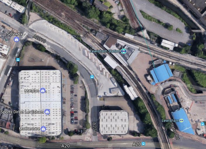
These pictures of the area around the Lewisham station were taken on February 13th, 2017.


The new Bakerloo Line station will be underground between the station and Matalan. The area is currently bus parking.
Because of the different levels and tunnels and some railway arches in good condition, the addition of the Bakerloo Line station could be a challenging one, but also one that could be architecturally worthwhile.
Consider.
- Is the current station built on arches, that could allow passengers to circulate underneath?
- Could escalators and lifts connect the main line and ?Underground stations?
- Could there be significant oversite development on top of the station?
- Could the Bakerloo Line station be built without a blockade of the current station?
- Will Lewisham station be reorganised to be less of a bootleneck?
It will be interesting to see the final design.
Wearside Road
This Google Map shows the worksite in Wearside Road, which will be used to create a shaft to the overrun tunnels.
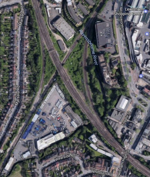
The multi-track line going North-West to South-East is the South Eastern Main Line, whilst the line going South-West to North-East is the Hayes Line.
The worksite will go at the Northern end of the light-coloured area South of where the two lines cross.
This map from carto.metro.free.fr shows the lines in the area.
I think it is quite likely that the overrun tunnels will be under the Hayes Line.
Extension To Hayes
This document on the Lewisham Borough Council web site is a must-read document, as it gives the view of the Council and their consultants; Parsons Brinckerhoff about the Bakerloo Line Extension.
The report is very much in favour of the Extension being built and it hopes that it can be extended using the Hayes Line, where the trains would terminate at either at Hayes or Beckenham Junction stations.
Currently, Elephant and Castle station handles 14 tph, so as there would appear to be no terminal platform at that station, at least this number of trains will connect between the Bakerloo Line at Lewisham station and the Hayes Line..
But as other deep-level tube lines handle more trains, with the Victoria Line handling 36 tph by the end of this year, I don’t think it unreasonable to expect a service frequency in excess of 20 tph.
The Wikipedia entry for the New Tube for London is quoting 27 tph.
So could this give at least 10 tph to both Southern terminals?
To handle 10 tph, I think it reasonable to assume that two terminal platforms are needed.
Hayes has two platforms, but Beckenham Junction has only one spare platform, as this Google Map shows.
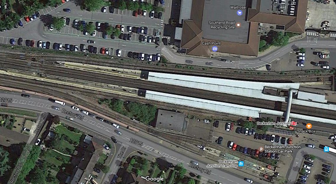
But I suspect if Waitrose are reasonable, a deal can be done.
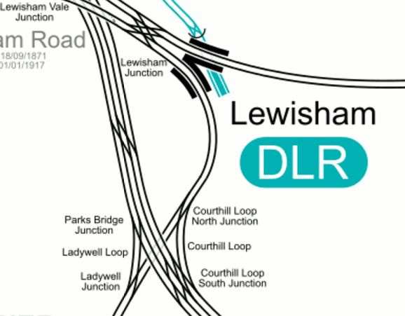
If the overrun tunnels at Lewisham station,are more-or-less under the Hayes Line, these tunnels would be easily connected to the Hayes Line in the following manner.
, with all other services using the Courthill Loop to go on their way.
Hayes station would swap its two tph services to both Cannon Street and Charing Cross stations for at least a 10 tph service on the Bakerloo Line.
I also think, that services could go direct between Hayes and London Bridge, Cannon Street or Charing Cross using the Ladywell Loop.
Beckenham Junction would have a similar service and I’m sure this would please Lewisham Borough Council.
Network Rail would gain four paths per hour through Lewisham station to use for other services.
Lewisham Borough Council also suggests the following for the Hayes Line.
- Move Lower Sydenham station further to the North.
- Create an interchange between Catford and Catford Bridge stations.
- Look seriously at the zones of stations on the Hayes Line.
They are certainly forcible in what they want.
Conclusion
This extension, looks like it is a railway designed to be built without too much fuss and objections.
Most of the worksites seem to have good access and it would appear that few residential properties will be affected.
Greater Anglia’s Ten Point Wish List
This article in Rail Technology Magazine is entitled Greater Anglia to lobby government for investment in 10-point upgrade plea.
So what do they want?
- Haughley Junction upgrade.
- Ely area upgrade.
- Ely to Soham track doubling
- Trowse swing bridge replacement with a double track fixed link.
- Long loops at Colchester and Witham to allow fast trains to pass slow ones.
- Digital re-signalling between Colchester and London.
- Capacity upgrade to allow four trains between Angel Road and Stratford.
- Four-tracking between Coppermill Junction and Broxbourne.
- Wider level-crossing upgrade program.
- Platform and concourse upgrade at Liverspool Street station.
Should we call it ambitious, greedy or sensible?
1. Haughley Junction Upgrade
This has been requested for years, so I suspect it has been thought about for a long time.
But the new East Anglia Franchise has plans that will affect the traffic through Haughley Junction.
- Three express trains per hour (tph) between Ipswich and Norwich – Up from 2 tph.
- Two tph between Ipswich and Bury St. Edmunds – Up from three trains per two hours.
To make matters worse, an increasing number of freight trains between Felixstowe and Peterborough will be going through the junction.
This Google Map shows the junction.
Note.
- Stowmarket, Felixstowe and Ipswich are to the South.
- There is a handy level crossing where station road crosses the tracks.
- Diss and Norwich is to the North.
- Bury St. Edmunds, Cambridge and Peterborough are to the North West.
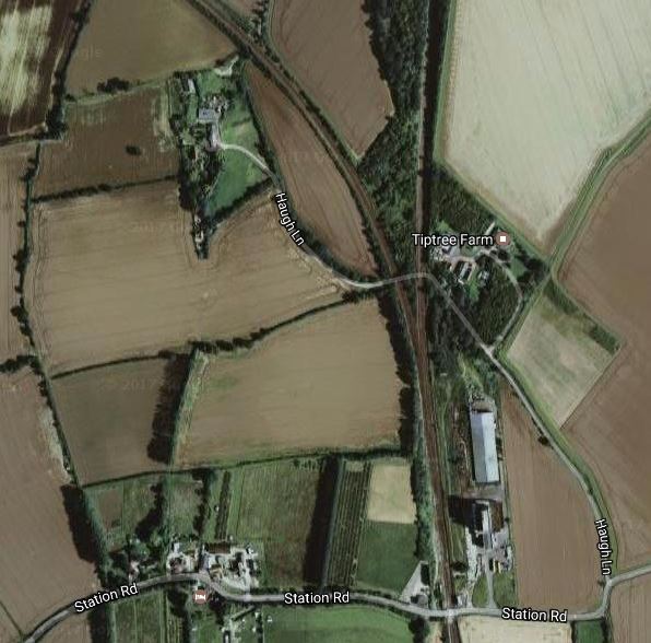
You could naively think, that around the junction is nothing but farmland and a few trees, but the owners of |Tiptree Fram probably have lived three for decades.
You are the driver of one of Greater Anglia’s new crack Stadler express electric multiple units scheduled to reach Norwich in ninety minutes from London
Going North, you have just stopped at Stowmarket station. But you can’t leave as Haughley Junction is blocked by one of the many long freight trains crossing the flat junction from the line to Peterborough to go South to Felixstowe.
So bang goes your schedule!
Going South, you have a similar problem, in that freight trains could delay progress, whilst they cross from the Peterborough Line.
Freight trains and passenger trains joining the Peterborough line from the South, would appear to not cause such a large problem, as they just turn left without crossing any lines.
In an ideal world, there probably needs to be a single-track flyover, so that trains from Peterborough to Stowmarket can cross the Norwich lines without delaying trains. A similar flyover at Hitchin cost £47million.
So it wouldn’t be cheap and would the locals fight the construction of such a structure in the midst of Suffolk countryside to benefit commuters from Norfolk?
A complete scheme would also add a loop line just to the West of Haugthley Junction, so that long freight trains could wait without getting in the way, until there was a suitable time to cross.
I suspect, that to keep costs down and avoid annoying the natives, all that will happen at Haughley Junction is a limited scheme so that trains can wait before crossing.
Over the last few years, Network Rail have developed some innovative junctions and crossings, so let’s hope that they come up with a scheme that’s efficient, affordable and can be built without closing either of the important routes through the area.
But whatever is done here will certainlt help Greater Anglia achieve their objective of three tph between London and Norwich in ninety minutes.
Knowing the area well, I suspect that there will also be an enormous fight over if Network Rail decided to close the level crossing shown on the map.
2. Ely Area Upgrade
I looked at this in Are The Trains In Ely Finally To Be Sorted?
Whatever is proposed here will not be just a few millions and probably very disruptive to implement, but it is essential to acommodate the planned extra services through the area.
3. Ely To Soham Track Doubling
Upgrading this six miles of single track might appear to be easy across the flat lands of Cambridgeshire, but the line does include a couple of level crossings and a couple of bridges.
This Google Map shows the ely end of the route at Ely Dock Junction.
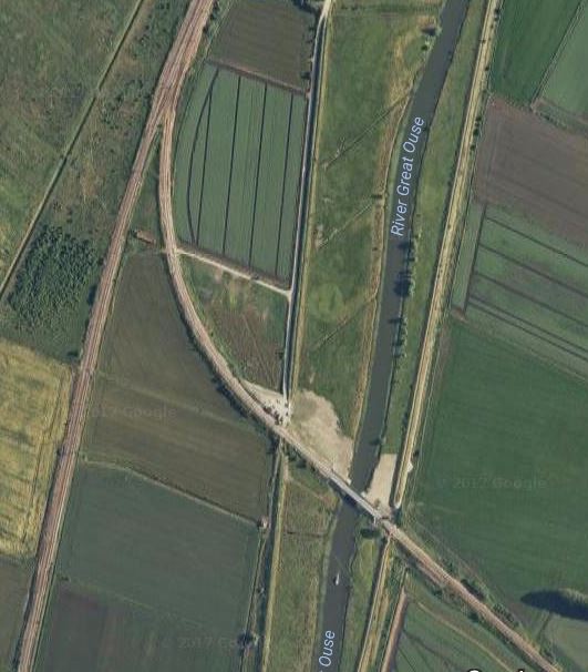
Ely Dock Junction And Hawk Bridge
Note the single-track Hawk Bridge over the Great Ouse.
Luckily, a freight train derailed on the original single-track bridge and virtually demolished it. The new bridge may be only single-track, but provision was made for a second track.
A few times, I’ve passed Ely Dock Junction on a train or stood on the platform at Ely and seen a freight train waiting at the Dock Junction to pass through the spaghetti at Ely.
Double-tracking would mean waiting freight trains wouldn’t delay Eastbound services on the Ipswich to Ely Line.
But will a chord be built so services can go directly between Cambridge North station and the Ipswich line?
This could enable Colchester Peterborough services to take a route of Bury St. Edmunds-Cambridge North
The Google Map shows the site of the original Soham station.

The Site Of The Former Soham Station
Note that the line reverts back to double-track, just South of the former station site.
So will doubling of line include provision for building a new station at Soham, as Cambridgeshire Council have proposed?
You can certainly see, why Greater Anglia want this section of line to be doubled.
4. Trowse Swing Bridge Replacement
The Trowse Swing Bridge is a major bottleneck on the Great vEastern Main Line, as not only does it restrict operations into Norwich station, but it makes access to Crown Point Depot difficult.
It’s definitely the railway equivalent of having a single-lane section for both directions on a motorway.
In Is This The Worst Bottleneck On The UK Rail Network?, I proposed the following under An Affordable Alternative.
It has to be said, that perhaps the most affordable solution would be to build a stylish fixed link, probably with a double-track railway and foot and cycle bridges.
As to the boat users, all boats that need to go under the bridge regularly would be modified so their masts could be lowered at no cost to their owners.
Other bribes could be given to occasional users.
There will be many bridges to cross, before Trowse bridge is replaced with a modern structure, more suited to a modern railway.
Unless of course, the rusting and decrepit bridge decides to do the honourable thing and falls down of its own volition.
It’s probably too much to hope, that a freight train derails on the bridge, as one fortunately did on the Hawk Bridge at Ely.
5. Long Loops At Colchester And Witham
Colchester station is not a station that would win awards for efficiency.
This description of the platforms is from Wikipedia.
The “up” (London-bound) side comprises two platforms, numbers 3 and 4, which have an unusual layout: 3 is on the up main line and is served by intercity trains from Norwich, while 4 is on the up branch line which merges with the up main line where the two platforms join end-to-end. The junction is protected by a trap leading to friction buffer stops. There are also bay platforms at both ends of the up main platform. The London-end bay (platform 6) is used for peak trains to and from London. Previously this platform was used for frequent services for the Sudbury Branch Line. However, most of these services were truncated to terminate at Marks Tey from the mid-1990s. The other bay platform (platform 5) is used for services to Colchester Town and Walton-on-the-Naze. The “down” side platform is an island platform with two faces, one on the down main, and one on the down branch line. Platform 1 is mainly used for Clacton-on-Sea trains and occasionally for Norwich trains.
The new franchise has plans, that should make the station more efficient, but much busier.
- Norwich to London trains will have a frequency of three tph.
- A new one tph service will link Colchester and Peterborough, which would mean that Colchester to Stowmarket via Manningree and Ipswich would have a frequency of four tph.
But the interesting idea is to extend the service between Sudbury and Marks Tey stations to Colchester Town station via Colchester.
The service between Sudbury and Colchester Town could be two tph, as the trains could pass each other between Colchester and Marks Tey, if the track allowed.
This Press Release from Network Rail is entitled More Reliable Railway For Essex As £100M+ Upgrade Is Completed.
This is said.
The last piece of the jigsaw included the commissioning of new ‘bi-directional’ signalling on the Great Eastern main line between Colchester and Marks Tey – meaning trains can now travel in both directions on both lines. This allows them to bypass problems should they occur and will improve flexibility and help reduce delays.
I have just flown my helicopter over the junction at Marks Tey and it looks like there is a short loop line of about a kilometre on the South side of the main line, which is connected by a series of crossovers to the \Gainsborough Line. On the other side of the main line, there would also appear to be a connection between the two lines.
So a train from Colchester Town could do the following.
- Travel to Colchester station on the Sunshine Coast Line.
- Stop in Platform 4 at Colchester station.
- Travel on the main line towards Marks Tey.
- Switch to the loop North of Marks Tey.
- Cross over the main lines and enter the Gainsborough Line to stop in Marks Tey station.
- Travel to Sudbury and back.
- After stopping at Marks Tey station return via the main line to Colchester and then on to Colchester Town.
Currently, a train is scheduled to go from Colchester Town to Marks Tey in 13 minutes, with the round trip from Marks Tey to Sudbury taking about 45 minutes.
If the service between Colchester Town and Sudbury was to be two tph, the Marks Tey to Sudbury round trip must be under thirty minutes, so that only one train is on the branch line at a time.
The service is currently run using various trains like a Class 153 train, which have a top speed of 75 mph and acceleration to match, whereas the mosdern Class 170 train has a 100 mph capability. The Gainsborough Line also has a speed limit of just 50 mph.
So I suspect, that with some judicious engineering on the branch and modern trains, that a thirty minute round trip is possible, thus making two tph on the Gainsborough Line a distinct possibility.
All these service changes could simplify the pattern of trains through Colchester station.
- Most trains stop in the station and continue on their journey.
- Peterborough trains could use the bay platform 5 or a reversing siding to turn back.
- The bay platform 6 could be used as a terminus for trains from London as now.
So will the tracks be arranged so that there is an avoiding line between the platforms just as there is at Ipswich station and used to be at Chelmsford station?
The certainly would appear to be enough space.
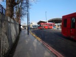
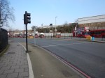
This picture illustrates the problems at Witham station.
Note.
- The freight train was going towards London and was slowly going through the station.
- The two lines in the middle are the two main lines, where trains generally stop.
- When the new Stadler and Aventra trains enter service in a couple of years, there will be more trains going through the station.
- At times, trains could be separated by just a few minutes.
- As these trains are designed expedite stops, I wouldn’t be surprised to see more trains doing a Touch-and-Go.
This article on the EssexLive web site is entitled Witham loop could happen by 2024 with added faster trains to Liverpool Street.
It says that the loop will be built North of Witham station and would allow faster trains to pass slower ones by 2024, but that Simon Burns MP will be pushing to have it built sooner.
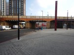
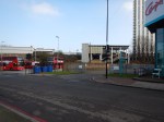
This Google Map shows Witham station and the line to the North.

Note the Braintree Branch Line going off to the North-West.
It does appear that there would be space for the necessary extra tracks to create passing loops North of Witham station.
These would mean that passing wouldn’t have to be dome with the slower train blocking a slow platform.
It certainly looks as if that both loops will be beneficial to all train operators and passengers.
6. Digital re-signalling between Colchester and London
Given the following on the Great Eastern Main Line South of Colchester.
- Increased numbers of trains.
- Speeds of 100 mph and possibly more.
- The need to do very fast stops and maintain headway of a few minutes.
- The trains will be new.
I suspect that digital signalling will be a necessity to maintain the required service frequency.
7. Capacity upgrade to allow four trains between Angel Road and Stratford
There is certainly pressure for this service from the local Councils in the area.
Would it include the preliminary works from the upgrade of Angel Road station?
8. Four-tracking between Coppermill Junction and Broxbourne
This is important both for Greater Anglia services to Stansted Airport and Cambridge and Crossrail 2.
I wrote about this in Crossrail 2 ‘Cannot Go Ahead’ Without Four-Tracking Of West Anglia Line.
But it will be a large and very disruptive project.
9. Wider level-crossing upgrade program
I have been held up so many times by level crossing incidents, this can’t happen to soon.
10. Platform and concourse upgrade at Liverpool Street station
I thought that this was going to happen, as soon as the Crossrail trains go into the tunnels.
Conclusion
Greater Anglia are not asking for the stars and it is a generally sensible wish list.
Possibly the most expensive projects are the following.
- Ely area upgrade.
- Trowse swing bridge replacement with a double track fixed link.
- Digital re-signalling between Colchester and London.
- Four-tracking between Coppermill Junction and Broxbourne.
But some like the four-tracking of the West Anglia Main Line are not urgent, until Crossrail 2 gets an opening date.
A Branch Line For Ludgershall
In the Wikipedia entry for Andover station, this is said under Future.
The new open-access operator Go! Cooperative has proposed operating a light rail service from Andover using the branch line to Ludgershall.
This sounds like another branch line that could work under Zwickau rules.
- Single track with no passing loop.
- Single self-powered train, like a Class 172 train providing a two trains per hour service.
- Simple one platform stations, with step-free level access to the train.
- Slow speed with train warning devices like horns and lights and good driver lookout.
- Standard railway signalling.
Note.
- There would appear to be a disused platform at Andover station.
- Trains with onboard energy storage couldn’t be used, as Andover isn’t electrified.
- The route might be an ideal trial for a Class 230 train.
- In Zwickau, the train goes through parkland, the town centre and across full-barrier level crossings.
- In Zwickau, pedestrians and cyclists can cross the tracks, just like they can cross the Blackpool Tramway or the London Tramlink.
- The Zwickau trains have a driver and conductor, as is normal on German trains.
- Rules would have to be developed for the Army to move in their tanks by train on the branch.
You might argue that we’ve used Zwickau rules in the UK on some branch lines for years.
But, usually branch lines are worked using some ancient diesel multiple unit with these characteristics.
- Bad driver visibility.
- Inadequate warning systems.
- Poor passenger comfort.
- Terrible access from station to train.
The train at Zwickau is a standard Stadler diesel multiple unit of a modern design, with large windows and a few extra orange lights and warning devices.
But because it is a standard train, once it joins the main railway, it can speed under normal train rules along a convenient route to an important terminus, some distance away.
Off the main line, all it needs is a single-track railway and one platform stations.
Advantages
The Zwickau approach has several advantages.
- Virtually standard train with a few extra features.
- No electrification.
- Single-track with no passing loops.
- Standard railway signalling.
- Single platform stations aligned for step-free access.
- No station footbridges.
- Pedestrians and cyclists cross the line, as they would a tramway.
Perhaps the biggest advantage is that the same train runs under normal railway rules on a heavy rail line and then can switch to slow running under tram rules on a branch or perhaps an extension to a town centre station.
Disadvantages
There are a couple of drawbacks.
- Train must be a modern design with extra safety features, like lights and warning devices.
- Train must be self-powered; diesel or onboard energy storage.
- Network Rail don’t like pedestrians and cyclists crossing the tracks willy-nilly.
If the train is a modern design with good driver visibility, then the risks associated with last point are probably minimised, or at least reduced to the level of a well-designed and run tramway.
A Reopened Levenmouth Rail Link
This article in Global Rail News has a title a title of Levenmouth – Scotland’s next railway?.
According to the article, the figures look good, for the reopening of the Levenouth Rail Link, with a Benefit Cost Ration of 1.3, which compares well with a figure of 0.96 for the successful Borders Railway.
It would be a five mile extension from the Fife Circle Line and would serve a station at Leven and a large Disgeo distillery.
