Squeezing Blood Out Of A Stone On The Northern Line
The Northern Line is not the most popular or glamorous line of the London Underground.
It is a line I try to avoid for various reasons.
- It’s often too crowded.
- I have buses, Victoria Line and the London Overground as alternatives. For example, I use Camden Road station instead of Camden Town station and walk.
- In recent months, stations I want to use have been renewing escalators.
- I also want to get to stations, that are on the Charing Cross branch of the line.
I also wonder, if I’m prejudiced against the Northern Line, as I spent so much of my formative years on the Piccadilly Line.
I have just read this article on London Reconnections, which is entitled Twin Peaks: Timetable Changes On The Northern Line.
I have extracted these points from the article.
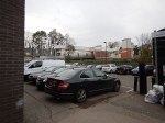
- Until mid-2014, both central sections and both northern branches of the Northern Line in the peak hours were only able to handle twenty trains per hour (tph). This compares with 30 tph on the Jubilee Line, 33 tph for the Victoria Line and 34 tph for the Central Line.
- In June 2014, with the full introduction of automatic train operation (ATO), this was raised to 22 tph.
- Engineers were working hard to improve the track to allow better speeds and from December 2014, the train frequency in the peak was raised to 24 tph.
- The line is now running at 30 tph between Kennington and Morden.
- The Off Peak service at the start of 2014 was 15-16 tph and it is now 20 tph.
All of this frequency improvement has been attained because they have got ATO working well and they’ve done a good job to allow trains to run faster on much better track.
You could say it’s all down to quality engineering. With probably the input from someone, who understands scheduling.
The article has a section entitled As Good As It Can Get For The Moment?, where this is said.
No doubt the ATO system will continue to be refined but the dramatic time reductions already achieved are unlikely to be improved on much more. Unless more available trains or speed can be coaxed of the existing fleet it is hard to see how the peak timetable can be improved until new trains arrive.
So have we got to the limit of the current lines and the 1995 Stock trains?
If you read the article, you’ll see that Transport for London are talking about peak hour services of 30 tph with new trains after the reworking of track in Summer 2020.
But given the skilful way, the frequency of this line has been ramped up over the last couple of years, I suspect, there’s more blood to come from this particular stone!
Corbyn Not Happy With Shoot-To-Kill
This article on the BBC web site is entitled Jeremy Corbyn ‘not happy’ with shoot-to-kill policy.
What would this mean for armed police officers, who came across a group of Islamic State terrorists murdering people in a theatre?
- They could offer themselves up as human shields.
- They could wait until the attackers ran out of bullets and arrest them.
- They could call Corbyn and ask him to negotiate.
Jeremy Corbyn’s thought processes are useless against the nutters of Islamic State.
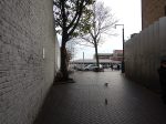
The Dalston Eastern Curve
In several posts like Improving The East London Line, An Opportunity For Dalston, Platforms 11 And 12 At Stratford and Missing Links On The Overground, I mention the Dalston Eastern Curve. Currently, the land is occupied by a community garden called unsurprisingly the Dalston Eastern Curve Garden.
The Google Map shows the area.
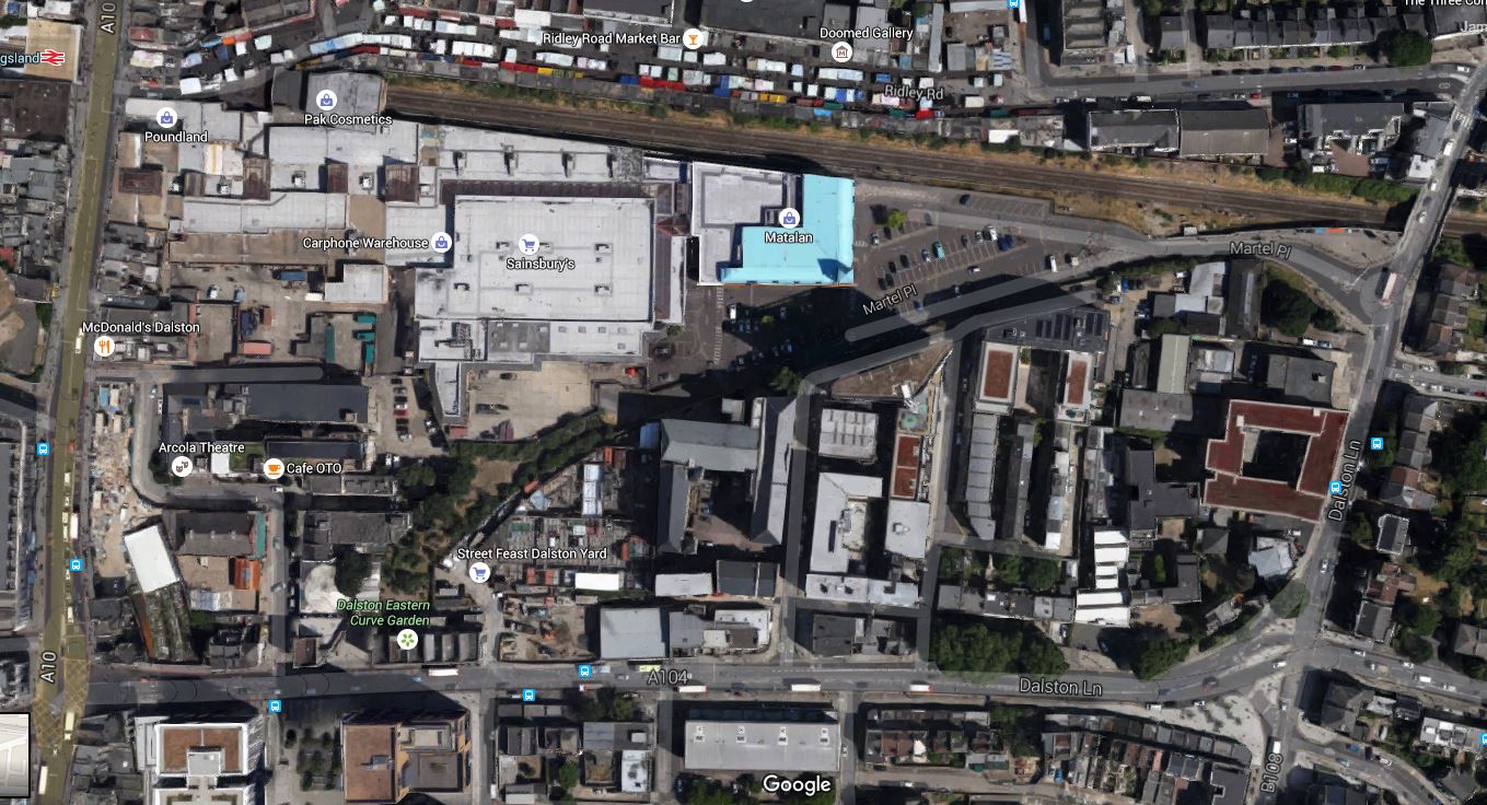
Dalston Eastern Curve
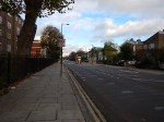
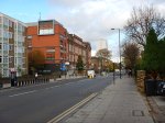
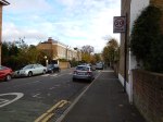
The line of the Dalston Eastern Curve is clearly shown, as it leaves the North London Line that goes across the map, and curves its way down to Dalston Junction station on Dalston Lane. The garden occupies the Southernmost section and has an entrance on the Lane.
These pictures show the area of the Curve.
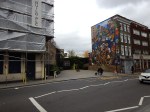
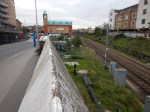
If it were to be reinstated the big losers would be the car park of the Shopping Centre and the Garden.
A new reinstated Dalston Eastern rail curve would probably be covered, as is much of the Western Curve. After all, railway lines in tunnels or covered over can be used as building land for houses, offices, shopping centres or gardens.
The rebuilding plans for Dalston Shopping Centre,shown many months ago, showed an open-aired concept, rather than the dated layout it has today. It also appears that the landlord of the Dalston Eastern Curve Garden is the owner of the Shopping Centre.
So I suppose that what Transport for London and the Shopping Centre agree is needed, will be implemented.
Other trends and facts must also be taken into account.
- The walking route between the two Dalston stations is terrible.
- Car parking is increasingly non-profitable for Shopping Centres to provide.
- More people will use bicycles and public transport to get to Dalston.
- Four extra trains an hour, are already planned on the East London Line.
- The East London Line has a capacity of twenty-four trains an hour. TfL has stated these could be six cars after some platform extensions.
- The East London Line will be given better connectivity to South East London, possibly by extending from New Cross or creating interchanges at Brockley and Penge.
- The North London Line could have more passenger trains. Especially, if freight trains on the line can be reduced.
- Waltham Forest Council has ambitions to have trains from Walthamstow Central and Chingford to Stratford by a reinstated Hall Farm Curve.
- Crossrail 2 or not, there will be massive developments up the Lea Valley, including housing and the Walthamstow Wetlands.
- Crossrail will connect to the East London Line at Whitechapel. What effects will this have on Dalston?
- Joining services back-to-back is always a good idea, as Thameslink showed years ago. It reduces the number of trains, staff and platforms needed to provide the service.
And then there is Crossrail 2, which once it is defined and started, will change everybody’s plans for Central Dalston.
I believe that the Dalston Eastern Curve will eventually be reinstated.
The main reason will be the need to have more Northern destinations for all of those trains going up and down the East London Line. A reinstated curve will allow services to go to and from Stratford and possibly if the Hall Farm curve was also to be reinstated as far as Walthamstow and Chingford.
So a series of short routes are converted into one long one, from Stratford or Chingford to say West Croydon, Orpington, Ebbsfleet or wherever!
It should be noted that at present Chingford/Walthamstow to South London is a difficult crowded journey on the Victoria Line to get a train going south from either St. Pancras or Victoria. A reinstated Hall Farm Curve would make things better by giving access at Stratford to the Jubilee Line and Crossrail in 2019.
Savvy passengers going from Stratford to South London destinations, change at Canonbury. But they would probably prefer a direct train via the Dalston Eastern Curve.
One thing that will happen, is that when the Shopping Centre is rebuilt, then space will be left to reinstate the Dalston Eastern Curve.
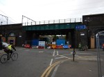
Beware The Tosser With A Digger!
This story from the Standard is entitled Digger cripples London Overground route after tearing down overhead wiring at level crossing.
This accident happened on a Sunday between Shepherd’s Bush and Willesden and it doesn’t appear anybody was hurt.
But it just illustrates how dangerous level crossing are.
Currently, several hours later,there is no service on the line.
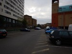
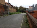
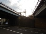
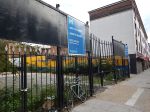
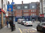
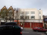
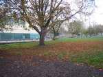
The Redevelopment Of Hackney Central Station
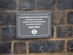
On Saturday night, I was passing through Hackney Downs station, as I came home from having supper with my son and his partner in Walthamstow.
As I needed some food for today, instead of getting the 56 or 30 bus home, I came down the walkway to Hackney Central station, with the intention of going to the Marks and Spencer by the exit from the station.
The shop was shut, but before I took a 38 bus home, I saw this notice, announcing the redevelopment of Hackney Central station.
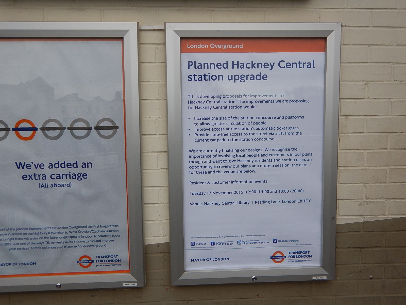
The Redevelopment Of Hackney Central Station
When I got home, I searched the Internet and found nothing. Even Hackney Central Library, which is hosting the exhibition on Tuesday, the 17th, has nothing on its web site.
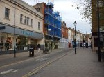
But I did find this article on the Hackney Gazette entitled Narrow Way in line for multi-million pound revamp, where this is said.
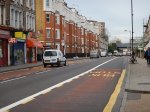
Hackney Council has billed the works as a “dramatic reimagining of one of the borough’s oldest and most vibrant shopping districts”. The proposal is to change the former road and footpath in the Narrow Way with a more attractive pedestrian-friendly surface, with the new-look extending to the junction of Graham Road.
So it looks like the area from Marks and Spencer and St. Augustine’s Tower to Graham Road, is in for a substantial upgrading.
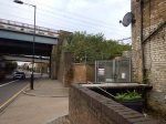
This is a Google Map of the station and the lower end of Narrow Way.

Hackney Central Station
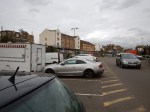
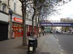
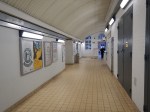
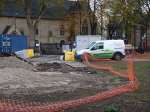
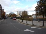
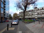
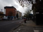
If a decent architect can’t do something superb with the area, I’ll be very surprised. These are pictures of the buildings in the area.


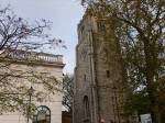


One of the ideas in the Hackney Gazette article is a new public square in front of the Grade 1 Listed Tower.
But dramatic entrance squares like St. George’s Plateau in Liverpool need to be served by proper transport interfaces.
So the development of Hackney Central station is needed to complement the work done on the Narrow Way.
From what I read from the notice, the proposals will solve some of the problems of access to the station from the Narrow Way and other places to the North of the North London Line.
But I believe that there also needs to be an entrance to the station on the South side of the Line onto Graham Road, where there would be access to the buses.
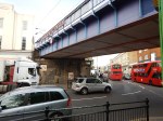
Underneath And Above The Arches
London Fields station has improved in some ways with Overgroundisation since I wrote Before Overground – London Fields in September 2014.
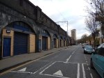


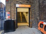


It just shows what you can do with an army of cleaners and painters. And a touch of Overground Orange!
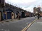
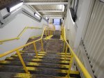
But there is still the problem of step-free access to solve.
This Google Map shows how difficult this could be.
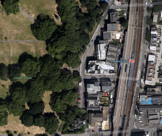
London Fields Station
The site is cramped, with the platform and stairs for the Liverpool Street platform squeezed between the slow and fast lines.
I wouldn’t be surprised if Transport for London, put the addition of step-free access to this station at the very back of the queue.
Unless of course, they could persuade a developer to do something very imaginative and expensive, which they can market as having its own station and a large park with an Olympic-sized swimming pool.
Walking From De Beauvoir Town To London Fields
This walk follows the route that I traced in Cycling Across De Beauvoir Town.
I’ll show the Google Map from that post
Cycling Across De Beauvoir Town
The route, which I started on Southgate Road is traced by the blue line. I continued up Middleton Road to London Fields.
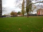
These are pictures I took on the way.


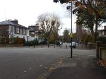


It is an absolutely flat route, except for the dip under the railway. This will surely encourage people to walk and cycle along it.
Cycling Across De Beauvoir Town
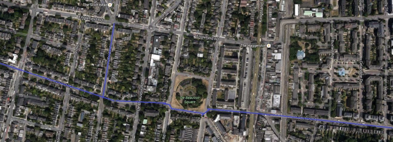
When I wrote Walking From Haggerston Station To Mare Street, I hadn’t realised how the scheme to effectively convert Middleton Road into a car-free route, would affect De Beauvoir Town.
Look at this Google Map, which shows the car-free route across London Fields.

Car-Free Route Through London Fields
The map is rather vague about what happens when it crosses the Kingsland Road and all it shows is a wavy line, which if you enlarge it and use a magnifying glass, has something like Northchurch Road written on it. This Google Map shows the area from Southgate to Kingsland Roads.
Cycling Across De Beauvoir Town
I think as Middleton Road links up to the South Side of De Beauvoir Square, that the downward kink in the route is De Beauvoir Square, so the route goes past St.Peter’s Church and then up Northchurch Road. For the first part of Northchurch Road, the route is following the route of the Cycle Superhighway CS1, that goes up Culford Road.
The two cycling routes are marked in blue on the map.
If the traffic scheme in London Fields is made permanent, I think I will be pleased, as it would give me a car-free cycle route from my house to the Cultural Quarter of Hackney.
If there were Boris Bike stations in De Beauvoir and London Fields, I wouldn’t even have to buy a bike.
On the other hand the London Fields scheme could generate a lot of cycling traffic through De Beauvoir Town.
Others might not be so pleased!
Later I walked the route and there are photographs of it in Walking From De Beauvoir Town to London Fields
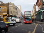
Walking From Haggerston Station To Mare Street
I did this walk as the area from East of Haggerston Road through London Fields is going to be traffic calmed, as described in this page on the Hackney Council website.
This report in the Hackney Citizen is entitled London Fields residents clash over car-cutting measures. This is said.
Residents are at loggerheads over council proposals for a car-free zone to the west of London Fields.
During the three-month trial period, due to begin in January, Middleton Road and surrounding streets will be blocked off to motorists, allowing cyclists and pedestrians to travel freely down Middleton Road.
Residents will still be permitted motor access to all streets.
Nothing is as difficult as getting the correct mix of traffic. They also provided this map.
Car-Free Route Through London Fields
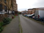
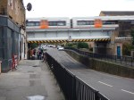
So I took a lot of pictures as I walked.


My observations.
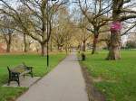
- It was a charming walk, through fairly wide streets with lots of trees. Hackney is no crime-ridden wasteland!
- There was no sign of any traffic calming.
- The area has a high level of cycling. I suppose being flat helps.
- There were a few cases of traffic rushing about.
- Stonebridge Gardens is being upgraded with a new design.
I remember the area from the 1970s, when C ran a short life house for ex-prisoners, just off Mare Street. You could say the area has improved, without too much drastic change. This Google Map shows the area, where I walked.

Haggerston To London Fields
Haggerston station is on the East London Line at the West (left) and London Fields station on the Lea Valley Line is to the right of the green space that is London Fields, with its fifty metre heated outdoor pool. Mare Street is the A107 running down the map to the right of the railway.
I live just a few hundred metres from the top left corner of the map.
It will be interesting to repeat this walk, when the traffic calming is complete and they’ve finished painting the bridge.
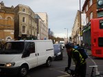
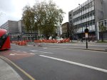
A Lesson In Traffic Management
On Friday, next door got low water pressure. So now we have a chicane around the hole that Thames Water have dug, whilst they look for the problem!
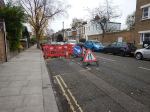


My road certainly seems quieter, as traffic could be much less and slower.
Perhaps Thames Water and National Grid, should be asked to dig holes in rat runs as a traffic-calming measure!
