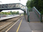
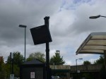
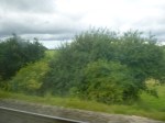
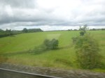
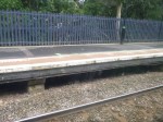
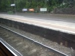
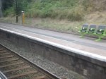
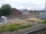
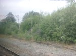
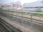
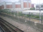
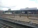
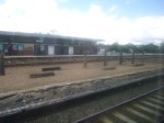
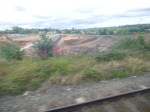
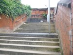
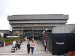
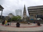
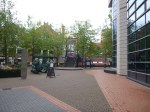
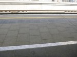
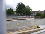
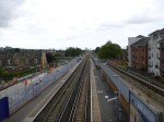
Bromsgrove Station
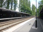
Bromsgrove station is unusual in that it is at the bottom of the historic Lickey Incline, which for in railway terms is a very steep hill. Wikipedia says this about the station.
Bromsgrove is only one of four stations in the UK which get annual usage of over half a million journeys with just an hourly service (Blackrod, Hartlepool and Inverurie being the other 3 stations).
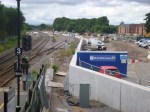
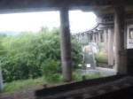
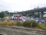
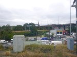
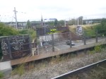
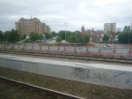
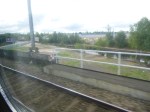
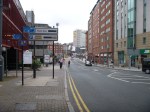
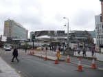
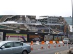
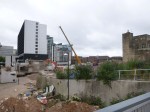
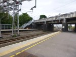
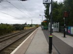
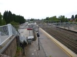
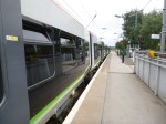
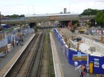
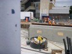
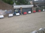
So Network Rail are rebuilding the station and electrifying the Lickey Incline to add Bromsgrove to Birmingham’s Cross-City Line as described in this section in Wikipedia. These pictures show the current station and the works for the new one.
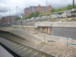
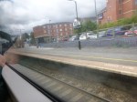
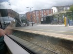
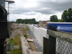
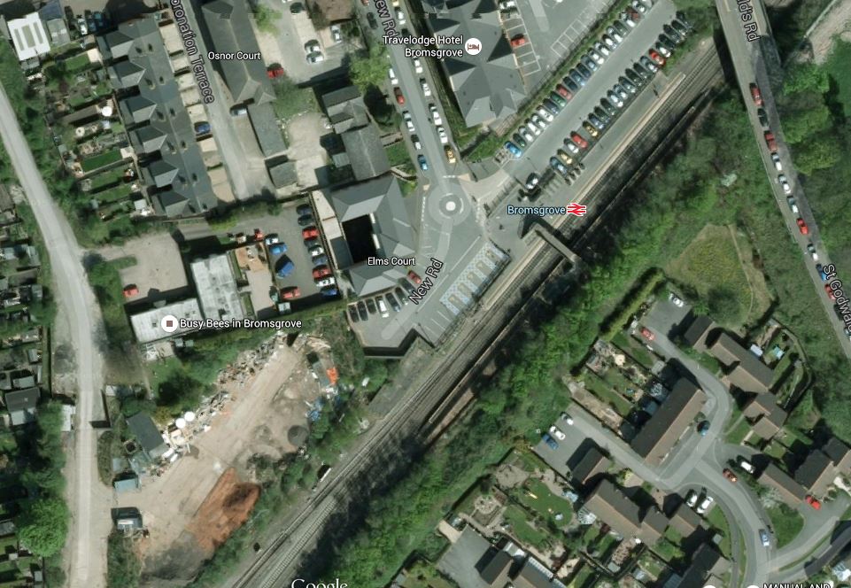
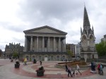
There will be four platforms and a large car-park, so obviously they are expecting an increase in passenger numbers. This Google Map shows the station and its relationship to the town.
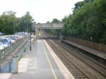
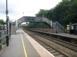
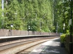
Bromsgrove Station
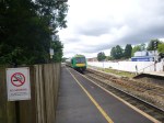
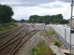
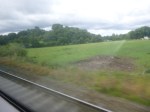
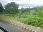
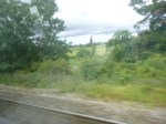
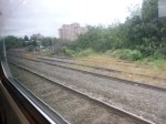
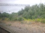
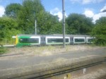
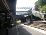
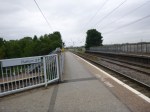
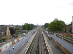
I can’t visit Bromsgrove station without commenting on the Lickey Incline, which I talked about in Up And Down The Lickey Incline. The views are pretty good as you look out over the Worcestershire countryside.
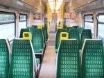
Going down, I felt that the train was very quiet, as the driver was relying on Newton’s friend, but going back to Birmingham, the underfloor diesel engines on my fully-loaded Class 172 train, were working very hard.
My train had taken the Lickey Incline from a standing start at Bromsgrove station, unlike the trains going straight through, which seemed to use the extra momentum of higher speed to climb the slope as easily as possible.
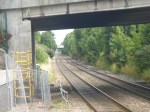
Sadly, I wasn’t treated to a show, as a banking engine pushed a heavy freight train up the hill.
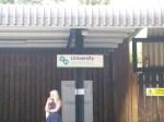
Along The Cross-City Line
The Cross-City Line stretches across Birmingham between Lichfield Trent Valley and Redditch stations, calling in the city centre at New Street. There pictures are from Wednesday’s trip from Lichfield into the centre.


And these are some images from between New Street and Redditch.

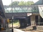
The line has the feel and in some cases look of the London Overground, except that a lot of the stations were obviously built using a kit of standard parts.
The Cross-City Line has an advantage that a lot of the London Overground would like – Space and platforms long enough for more than six carriages.
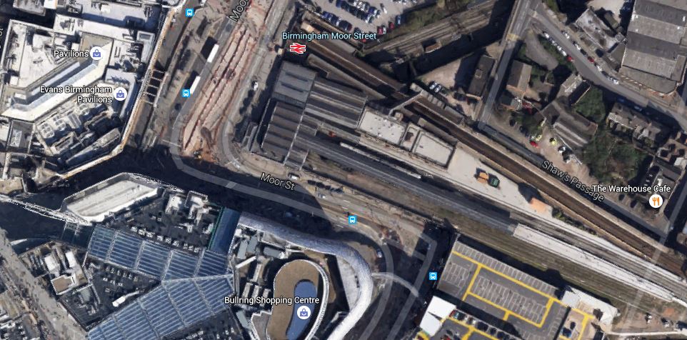
If I have a criticism of the Cross-City Line, it is that it doesn’t have enough stations in the city centre, with too much reliance on the busy New Street. As the line passes underneath Moor Street and through important areas east and west of the major station, surely a couple of extra stations would make the line much more customer-friendly. Especially, if it could link up better with the Midland Metro.
, The frequency is higher than the London Overground’s four trains an hour, which is becoming the accepted lower limit for a Metro service.
Camp Hill Line
There are aspirations to incorporate the Camp Hill Line into the system, to effectively give another East-West route, south of the city centre. With the West Midlands getting responsibility for transport in the next few years, this will happen. But if you look at Birmingham’s rail lines, history says, it might not be done in the obvious way, but in something much better.
According to Wikipedia, the Council is talking about a three trains per hour service between reopened platforms at Kings Norton and Moor Street.
Without doubt in Germany, this service would be operated by tram-trains, which on arriving at Moor Street would join the Midland Metro. This Google Map shows Moor Street station.
Could The Metro Squeeze Through Here?
It is a tight area, but then so it was at Snow Hill and they have got the Midland Metro through that concrete jungle.
Sutton Park Line
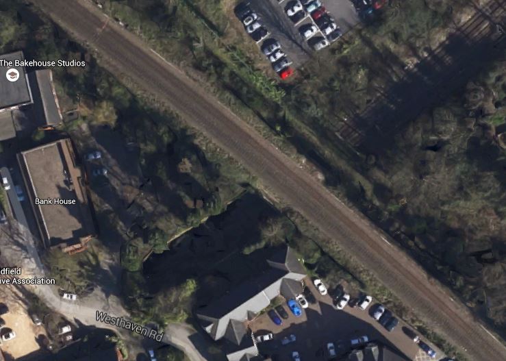
The Sutton Park Line is another aspiration of the authorities for opening as a passenger route between Rugeley and Water Orton. At its northern end, it will connect to the route between Rugeley and Walsall, which is currently being electrified and at the southern, it will connect to the route between New Street and Nuneaton.
The line also crosses the Cross-City Line at Sutton Coldfield. This map show the two-level crossing.
Sutton Park And Cross-City Lines
So is there scope for a new interchange station here. Only traffic statistics will know.
But above all the future for the Cross-City Line must be very bright, even if the direction of expansion has yet to be decided.
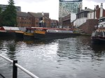
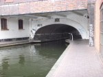
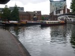
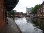
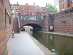
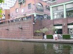
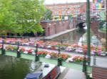
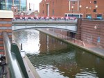
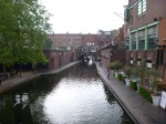
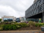
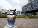
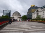
The Canals Of Birmingham
My Premier Inn was on the Canal Side and I took these pictures as I walked up back to the hotel after breakfast in Carluccio’s in Brindley Place.


Unfortunately, there wasn’t a canal entrance to the hotel, but it wasn’t too far to get between the two. I suspect, they didn’t want to have to fish drunken guests out of the canal.
Canals are important to Birmingham, as this section in Wikipedia says. It says this.
However, Birmingham is at the hub of the country’s canal network. There are 35 miles (56 km) of canals within the city, of which most are navigable. Birmingham is often described as having more miles of canal than Venice. This is technically correct (Venice has 26 miles). However, Birmingham is far larger than Venice, so the latter has a far higher concentration of canals; and the type of waterway is very different. Counting water volume and taking into account depth measurements, Birmingham has more cubic meters of water pass through its canals than any other city in the world.
Birmingham is certainly trying to use the canals creatively, as the pictures show.
And according to this article in the Wolverhampton Express and Star, there are even otters in the canals, who see the ciy’s garden fish-ponds as a source of fresh fish!
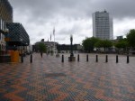
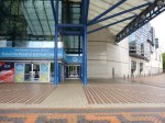
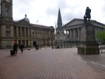
Walking The Contours In Birmingham City Centre
I tend to walk the contours, when I walk. This means you tend to walk on the level and you often only have one stiff uphill section when you feel you can tackle it.
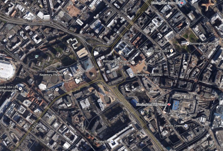
Birmingham is on a hill with the cathedral on the top. Now that I know the city better, if I’m walking across the city, I might walk towards the cathedral, as although some of the route will be uphill, as I’m probably going on my way from any of the three stations at Moor Street, New Street and Snow Hill and it will be downhill all the way from the cathedral. This is a Google Map of Birmingham city centre.
Birmingham City Centre
The canal behind the hotel runs South-Esterly from the Sea Life Centre.
My plan when I left the hotel in the morning was fairly simple. It was to walk down the hill and then walk across to New Street station, which is the other side of the dual-carriageway road, hoping that most of the route was flat. Once at the station, I would buy my West Midlands Day Ranger ticket and my paper and then walk up the hill to Carluccio’s for some breakfast. After breakfast, when the Museum opened, I would would go and see the Staffordshire hoard. I tok these pictures as I walked.

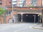


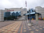


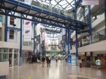
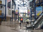

Very little of the walk was uphill. In fact some parts like through the ICC, were actually inside.
I think one of the troubles Birmingham has is that the road layout was determined in the 1960s, when the powers that be felt that everybody would have a car and would want to drive it into the city centre.
Now that the Midland Metro is coming and this will go from New Street Station, up to the Town Hall and then past Centenary Square and Brindley Place on its way to Five Ways, the priorities are all different. The tram route will give people two ways from New Street to get up the slight hill to the axis of the city running from Brindley Place through Centenary Square, past the Town Hall and the Museum to the Cathedral. Someone has thought out how the tram can benefit Birmingham city centre.
Incidentally, I do hope passengers don’t have to buy tickets on the tram by then, as they do now. I will celebrate with joy, when I enter a tram or bus, somewhere in the UK outside of London, by just tapping in with my contactless bank card.
It’s not paying my fare that I object to, it’s having to give over money and get a flimsy piece of paper in return. Drivers on the whole think cash in unsafe! For them! What’s wrong with tapping my bank card on a reader?
Incidentally, I think that the Cross-City Line crossed under my walk by my hotel. Why does it not have more stops in the city centre? The building that is the Nitenite hotel, should have been built over the railway with a station underneath. It certainly would be nowadays.
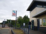
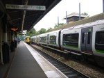
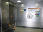
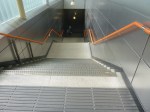
Birmingham’s Four-Poster Station
When I put forward the concept of a Four Poster Station, I was kite flying and didn’t know one had already been built.
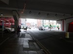
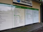
Smethwick Galton Bridge station has been built where the electrified New Street to Wolverhampton Line crosses the Snow Hill to Worcester Line. This is a Google Map of the station.
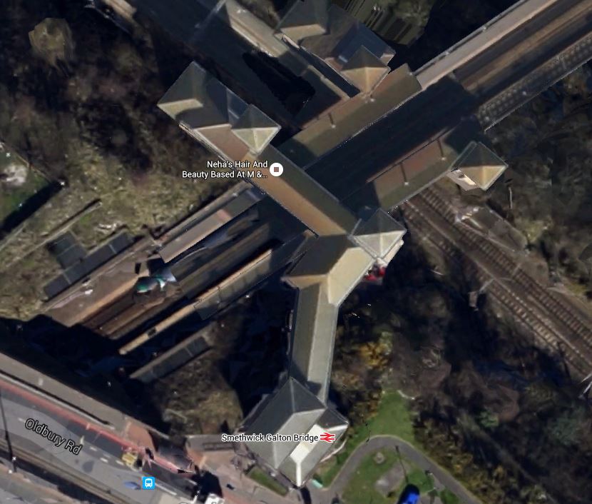
Smethwick Galton Bridge Station
Note the pyramids on top of each of the four lifts.
New Street is towards the South East, with Wolverhampton to the North West.
Worcester is to the South West with Snow Hill to the North East
I just had to go and see the station and took these pictures.


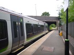

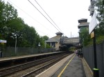
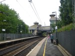
Considering it was opened in 1995, it was pretty radical for the time.
But it seemed to be working well, when I saw the station in the middle of the rush hour.
I do think, if they were building a station like this today, the various platforms and walkways would be made wider and if one was on the London Overground, they would leave spaces to put coffee stalls, passenger shelters and staff refuges. It probably illustrates how much more people friendly new stations are compared with twenty years ago.
I have a feeling that the design principles used here might be used at Brockley, Brixton and Penge.
But how many other places in the UK and perhaps the wider world could copy the basically simple design principles used here in Smethwick.
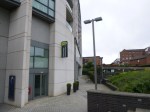
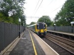
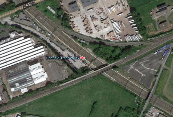
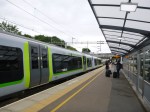
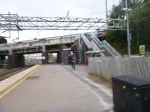
Lichfield Trent Valley Station
I went to Birmingham via Lichfield Trent Valley station using London Midland, paying just £13.20 for the First Class ticket to Lichfield.
It is an unusual station with two platforms on the West Coast Main Line and a third at right-angles on the Cross-City Line. This Google Map shows the station layout.
Lichfield Trent Valley Station
These are some pictures of the station.
My only problem with the station was that there were no staff to ask about buying the West Midlands Ranger ticket, I needed to continue my journey.
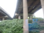
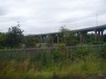
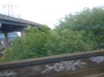
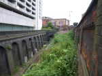
Lichfield Trent Valley station is on the South Staffordshire Line, and is on one the few sections of the line that still has a passenger service. On investigating further I found this description of the line’s state today on Wikipedia. This is the first two paragraphs.
Very little of the South Staffordshire line is used today, although Lichfield City and the connection to Lichfield Trent Valley high-level remain as part of London Midland’s Cross-City Service to Redditch via Birmingham New Street. Freight usage on the OW&WR portion of the route has once again become more common thanks to the Round Oak Steel Terminal.
In terms of infrastructure, nearly all of the trackbed still remains, and indeed so does much of the track. The closed section South Staffordshire line has gradually fallen into disrepair over the last decade or so, with much of the trackbed heavily overgrown – in some areas almost totally concealed by vegetation.
So we have a railway across the West Midlands from Lichfield to Stourbridge, that has been mothballed and left in a state to be rebuilt, if the need should arise.
As to the future of the South Staffordshire Line, Wikipedia has a long section on its Future.
It would appear that Westfield, who own the Merry Hills Shopping Centre, even offered funds to help with some reopening. As two of their centres in London have excellent rail and Underground connections, they must know the value of such a link.
The line is also part of plans to build an extension of the Midland Metro from Wednesbury to Merry Hill. This could use tram-trains, as Network Rail would like to use the line for freight. As with many rail lines in the country, freight is often there to provide reasons for rebuilding or reopening.
I also found a report on the BBC, which led to this post about a Very Light Rail Innovation Centre at Dudley.
The line also goes through Walsall, where it links to the Chase Line to Rugeley Trent Valley, that is being electrified, and to the Sutton Park Line, that the Local Authorities want to reopen.
So many diverse plans!
Isn’t it a pity, that the Varsity Line from Oxford to Cambridge or the Waverley Route from Carlisle to Edinburgh, weren’t closed in a similar way to the South Staffordshire Line. Removing the track and turning the line into a long-distance walking or cycling path, is surely another alternative and much more beneficial to the community, than digging it up to build housing or a new road.
I think the only certainty about the South Staffordshire Line is that those enterprising Brummies, will find a better use for the line than growing weeds.
Could The Various Lines At Brixton Be Connected?
In their Transport Infrastructure Plan for 2050, Transport for London are proposing a Brixton High Level station.
As they have also proposed interchanges at also Brockley and Penge in the plan, I suspect they have found expertise and equipment to create multi-level stations, where lines cross, in an affordable manner.
The problem at Brixton is best explained in this Google Map.
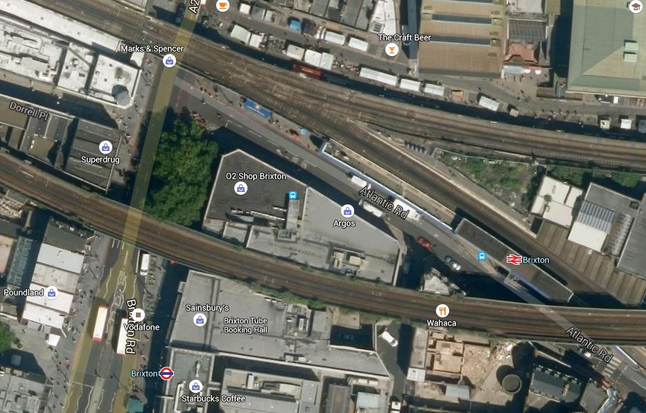
Brixston Station
The line across the middle of the map carries Overground services to and from the terminus at Clapham Junction, whereas the two merged lines go off roughly north-westerly towards Victoria. The southerly of the branches goes south towards Herne Hill, whilst the northernly branch going towards Loughborough Junction. This schematic from Wikipedia may explain it better.

Lines Through Brixton
The Overground, Thameslink and the Victoria Line are shown in orange, pink and blue respectively.
The only conclusion that is worth saying is that it’s all very complicated. The big advantage that they now have compared to a few years ago, is that much better 3D design software is available.
In TfL’s plan a rough estimate of £25million is given for each of these interchange stations. Some will cost less and some will cost more.
I think Brixton will not be one of the more affordable stations, although it could be one with a high return.
There are various options for connections at Brixton and TfL will probably limit the interchanges to the ones that are most used.
For instance, would there be much point in linking the Victoria Line to the services between Victoria and Orpington, as they both serve Victoria?
Also, as after this summer, the big constraint on frequency on the Victoria Line will be the reversing of trains at Brixton. Under Future Projects for the Victoria Line, Wikipedia says this.
For many years there have been proposals to extend the line one stop southwards from Brixton to Herne Hill. Herne Hill station would be on a large reversing loop with one platform. This would remove a critical capacity restriction by eliminating the need for trains to reverse at Brixton. The Mayor of London’s 2020 Vision, published in 2013, proposed extending the Victoria line “out beyond Brixton” by 2030.
I would suspect this will be done in the near future, as it both increases Victoria Line capacity and it gives an alternative link between the Victoria Line and services between Victoria and Orpington.
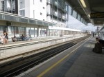
Brixton Underground station has recently been refurbished and is pretty-much step-free from the street.
So it would appear that substantial improvement at Brixton could be achieved by creating a High Level station linking the various lines together and perhaps using an iconic lift tower to the ground.
Brixton needs an iconic creation to go with the vibrancy of the area, that doesn’t destroy everything. This could be the High Level station. Having seen the way that the walkway was threaded through at Hackney, I think there are at least one set of engineers and architects up to the challenge.
Brixton doesn’t need a boring station, but one that is exciting, bold and supremely practical for passengers and staff.
The Importance Of The Victoria Line
In an ideal world, Crossrail 2 would be a follow-on to Crossrail 1, but there is not enough money to do that.
So in the time before Crossrail 2 is built, we must make the most of other lines.
The Victoria Line is by some measures one of the most heavily used Underground lines in London and this summer a bottleneck is being removed at Walthamstow Central to increase the frequency of trains on the line.
After this wirk, the big constraint on frequency on the Victoria Line will be the reversing of trains at Brixton. Under Future Projects for the Victoria Line, Wikipedia says this.
For many years there have been proposals to extend the line one stop southwards from Brixton to Herne Hill. Herne Hill station would be on a large reversing loop with one platform. This would remove a critical capacity restriction by eliminating the need for trains to reverse at Brixton. The Mayor of London’s 2020 Vision, published in 2013, proposed extending the Victoria line “out beyond Brixton” by 2030.
I would suspect this will be done in the near future, as it both increases Victoria Line capacity and gives the line a new station at Herne Hill, which has good interchange possibilities.
Although the Victoria Line is important to London, I do find it strange, that it has no interchange with Crossrail.
Hopefully, during the wait for Crossrail 2, improvements to the Victoria Line will soothe some of the problems.
Haggerston – A Simple Viaduct Station
Haggerston station is on the East London Line. It sits on top of the Kingsland Viaduct that used to take the line between Dalston Junction and Broad Street.
The platforms and the access are about as simple as you can get, but they are not of a low quality and standard.
Hoxton station which is the next one south on the line is similar.
I must have gone through the old Hoxton and Haggerston stations several times, when in the 1980s, I took the East and North London Lines to get to Stonebridge Park, where Metier’s offices were situated.
I can remember slam-door trains smelling of urine, but that could have been from earlier times.
New Tracks And Platforms At Abbey Wood Station
These pictures show construction work going on, mainly on the Southern side of the North Kent Line at Abbey Wood station.


The current southern platform, which is numbered 1, will become an island platform for the North Kent Line between the two tracks., The current Up line will become the Down line , with the new Up line being created to the South side of the platform. As the pictures show work is progressing well on creating a concrete channel for the track.
