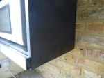
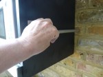
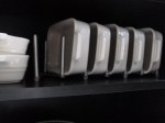
Fixing The Shortened Grundtal Rail To The Wall
When I improvised the utensil rack, I wasn’t sure how to fit the cut end to the brick wall.
These pictures show how I did it.
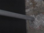

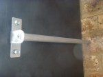
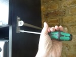

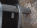
Note that the single bracket now holding the rail can support the weight, unless I put too much in the pot, so all the dowel does is locate the rail in the correct position.
An Innovative Use Of The School Holidays
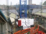
In trying to find out what was going on at Whitechapel station because of Crossrail this weekend, I found this document entitled Crane and site related activity in Swanlea School on the Whitechapel Current Works page of the Crossrail web site. he document says this.
We will position a small crane at the western end of Swanlea Schools grounds and use the crane to lift material over the school perimeter wall and in to the Crossrail Essex Wharf, Durward Street site. Delivery vehicles will access Swanlea School between 08:00 and 22:00 on Mondays to Sundays during this time. In addition to this, the Crossrail site boundary area will extend into Swanlea School grounds during the school holiday period. We will use the area to carry out preparatory work including the creation of wooden frames for future concrete pours and steel reinforcement pre-fabrication.
This Google Map image shows the relationship between Swanlea School and the Whitechapel station site.
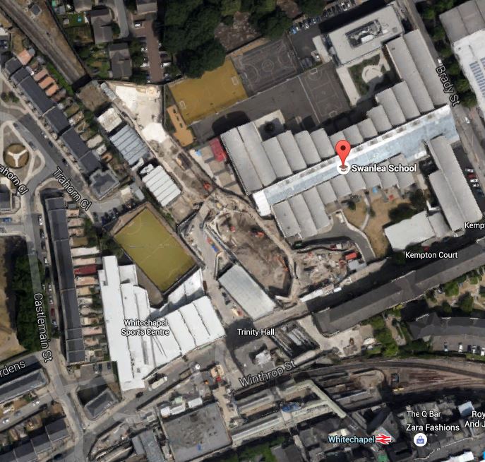
Swanlea School And Whitechapel Station
I would assume that Crossrail are paying an appropriate fee for the disruption to the school grounds.
Whitechapel station is a very congested site in a busy area of East London and Crossrail seem to have used every trick in the book, to avoid unnecessary pain and disruption to residents, visitors and passengers.
There are a lot of people worried about what will happen, if Crossrail 2 gets built through their area. They should take a trip to Whitechapel and have a look round to see how intricate heavy construction work should be done.
Improvising A Utensil Rack
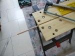
I use a set of utensils from Joseph Joseph which sit on a carousel. The trouble is they take up space in my small kitchen, so I thought I might put them on the side of one of my new wall cabinets above the cooker. In the end I took an IKEA Grundtal rail, but as it was too long, I shortened it and supported it from one end.

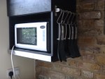

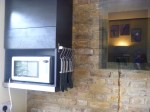

Obviously the end on the brick wall will have to be fixed and tomorrow, I’ll be going to a well-known DIY store to get the bits to create the fitting.
A Rack For Le Creuset Dishes
I have a selection of smaller Le Creuset dishes; in both 1.1 an 0.6 litre sizes.
They have a problem in that they don’t stack well. In fact, a couple of weeks ago, one pole fell onto one of the 1.1 litre dishes and reduced it to several smaller pieces.
I then found this Variera pot lid organiser in IKEA at just £5. Which is less than a replacement dish!


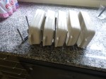
It certainly did the job, even if they are not pot lids.
Before Crossrail 2 – Walthamstow Wetlands
The Walthamstow Wetlands have nothing really to do with Crosrail 2, but like Meridian Water they will have connections and interactions with the railway.
So how will the wetlands interact with Crossrail 2?
This image, which I clipped from this page, shows the layout of the wetlands.
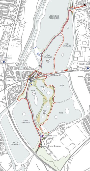
Map Of Walthamstow Wetlands
And this is a Google Map of the same area.
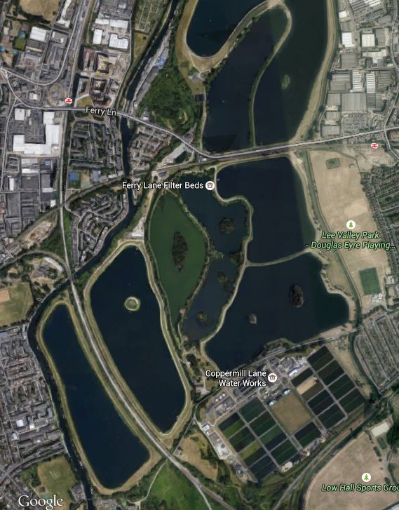
Google Map Of Walthamstow Wetlands
There are plans for entrances at Blackhorse Lane by Blackhorse Road station and at Coppermill Lane, just below the pair of Warwick reservoirs at the bottom left of the Google Map. The West Anglia Main Line runs between the reservoirs and Crossrail 2 will probably emerge from its tunnels between these reservoirs and Tottenham Hale station.
I also suspect that some means to get into the wetlands will be provided at Tottenham Hale station, That will probably be walking and bicycle routes,perhaps coupled with a shuttle bus. I do wonder whether the Gospel Oak to Barking Line, which borders the wetlands and passes just to the south of Tottenham Hale station might be brought into the mix. Nothing within the limits of sensible engineering should be ruled out.
After all Waltham Forest Council has obtained £4.4million from the Heritage Lottery Fund and that is a lot of reasons to think, that everybody wants the unique project of the Walthamstow Wetlands to be extremely successful.
Big projects work best from co-operation and not annoying the locals. Crossrail showed with the East-West line that they are masters at pulling it all together and used archaeology to get the locals enthused with the project, I suspect that they will use every opportunity to get the general public and politicians behind Crossrail 2.
I think that we will see Crossrail 2, Meridian Water and the Walthamstow Wetlands working together to develop the Lee Valley into London’s lung.
If
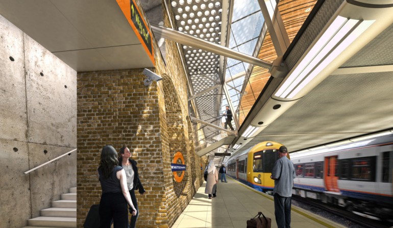
Whitechapel Station – 24th July 2015
I did think about calling this post either Fun With Meccano or Wetchapel Station – 24th July 2015.
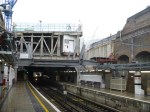
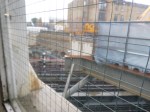
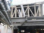
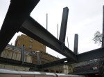

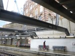

The pictures show upright steel beams pointing slightly outwards fixed to the top of the main cross-beams. Are these going to be part of the supports shown in this image from the Whitechapel station page on the Crossrail web site?
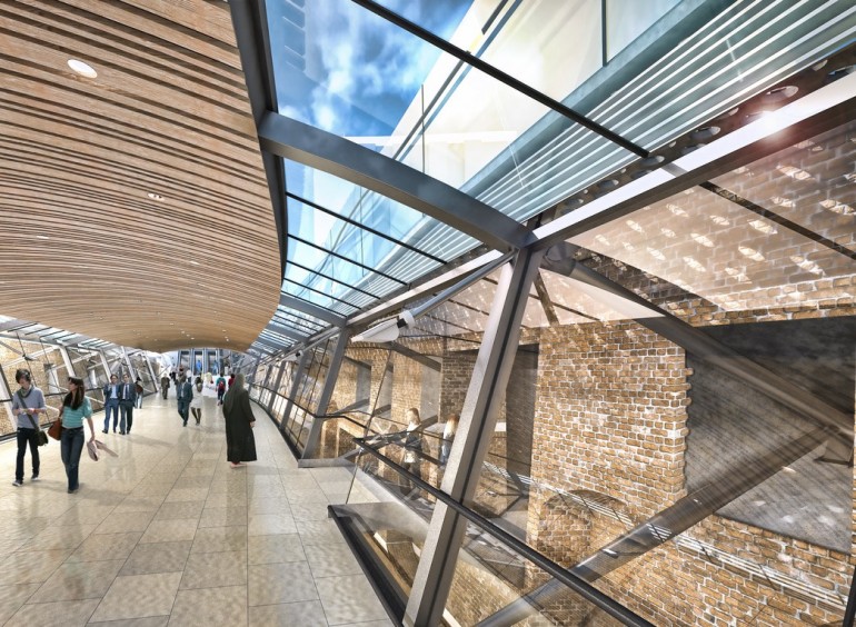
Whitechapel Station Walkway
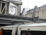
The image taken from the same page of Crossrail’s web site, shows a cross-section through the Overground station.
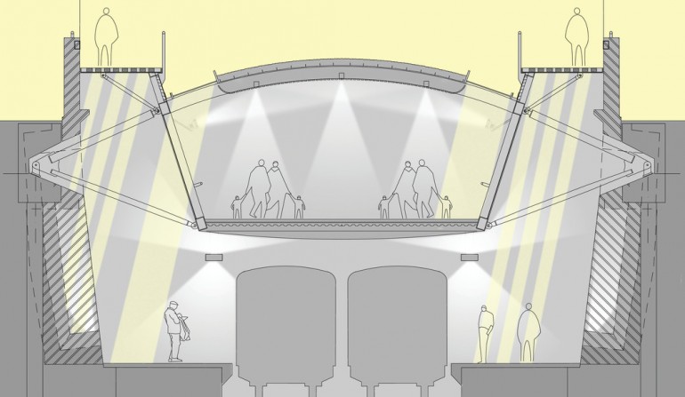
Whitechapel Overground Station Cross Section
Note that there seems to be two further walkways at the top of the station.
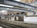
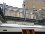
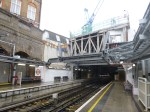
A third image is worth looking at, as it shows the walkway from the Overground platforms.
Overground Platforms At Whitechapel Station
You can pick out, quite a few features, like the cross beams, that you can see in reality in the station.
As the Overground station at Whitechapel is closed all weekend, it will be interesting to return on Monday to see what other pieces have been added to the three-dimensional jigsaw, whilst the passengers are safely out of the way.
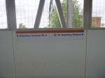
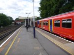
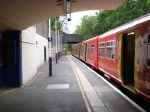
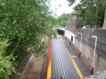
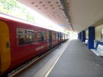
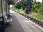
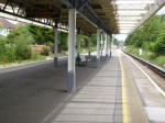
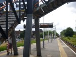
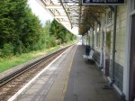
The Hackney Downs/Central Link Is Now Open
The Hackney Downs/Central Link opened at 11:00 this morning.
I’d thought something was finally happening, as there was a group of suits with clipboards about when I had passed through earlier. So after my trip to Surrey, I popped back to get my supper at the Hackney Marks and Spencer. As the link was now open, I took these pictures.

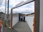
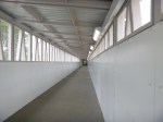
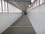
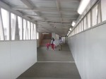
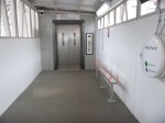

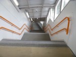
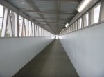


I shall certainly use the walkway regularly, as I often come from Walthamstow or on one the other Lea Valley Lines and either need to go West on the North London Line or like today, get some food at Marks. The walkway will of course be dry in the rain and some might feel safer at night!
I suspect that London Overground might get some ticketing issues with this link.
Take a little old lady with a Freedom Pass, who lives near the current Hackney Downs entrance to what is now a large double-station complex, who perhaps wants to go to the shops on Mare Street in the rain. Being as she’s from Hackney, she would be streetwise and would therefore use her Freedom Pass to work the barrier at the Hackney Downs entrance and then climb up the stairs to Platform 1. She’d then walk down the platform and take the walkway to Central, where she would exit into Mare Street using her Freedom Pass. In other words, she would have done the long walk substantially out of the rain, at no cost to herself.
So what do Transport for London do with someone, who uses an Oyster or contactless card to do the same trip? Will they be charged?
An engineer on Crossrail, who has walked some of the enormous stations, said to me, that in the rain, some of Crossrail stations are so comprehensive, she would use them to keep out of the rain. So we could have the same problem here?
If Transport for London charges, are we discriminating against those who pay for their transport?
Surely, if you come out of the same station complex within the time it takes to walk from one end to the other, you shouldn’t be charged!
What do you get charged now, if you enter a station through the barriers and then you realise you perhaps didn’t pick up your paper or coffee before you did and you return through the barriers virtually immediately?
Remember that if there’s a walking short-cut, Londoners and especially East Enders will find it!
Before Crossrail 2 – Raynes Park
Raynes Park station will be an important station on Crossrail 2, as it will be the first station, after all the south western branches hsve joined together.
As this Google Map shows it is a station with an unusual layout.
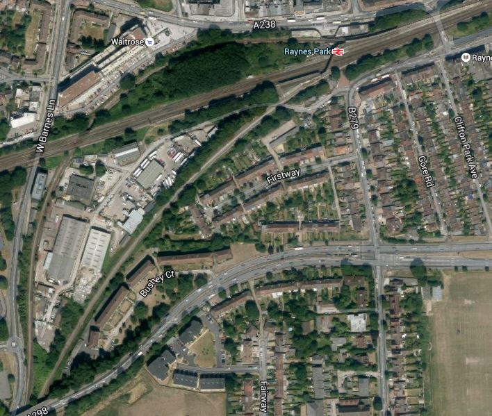
Raynes Park Station
The South Western Main Line runs through the middle of the station and there are two London-bound platforms on the north side of the main line and one platform for trains going towards Guildford via Epsom and to the Crossrail 2 destination of Chessington South and another for those going down the South Western Main Line to Surbiton and then to the Crossrail 2 destinations of Twickenham, Shepperton and Hampton Court.
There has been nothing to indicate how many trains go to each branch, but I would assume it is four trains per hour to each terminus or twenty trains per hour in total. As Crossrail and Thameslink are both planned to handle 24 tph in each direction, then this should be within the capability of the line. Currently, there are just twelve trains per hour to and from Waterloo.
These pictures show more of the unusual layout of the station.
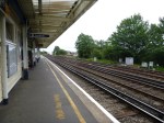
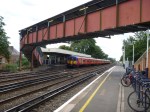

It does appear that Crossrail 2 has the capacity to handle more trains through Raynes Park, but there will have to be some rebuilding to make the station a friendly place fit all passengers and the staff that work there.
One problem that needs to be solved at Raynes Park, is what happens if a passenger comes towards London on one branch and then wants to go down another. The same problem exists on Crossrail, where say you are travelling between Canary Wharf and Gidea Park. As the Central London stations have island platforms, you just go to the most convenient station on the central tunnel, which in the example is Whitechapel, and walk across to get the first train on the required branch.
Raynes Park would be the ideal station for a change, as all branches come together here. So the pattern of lines and plstforms will probably need a substantial remodelling.
Or you could always go to Wimbledon, which is the next station towards Central London and change there.
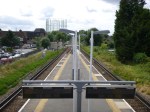
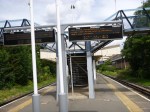
Before Crossrail 2 – Chessington South
Chessington South station is rather an oddity, in that it wasn’t designed as a terminus, but ended up that way as the Chessington Branch was foreshortened by the Second World War and didn’t reach Leatherhead.


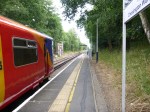

This Google Map clearly shows the abandoned line continuing southwards.
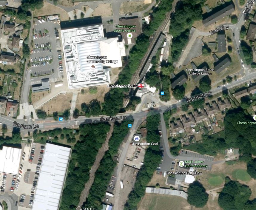
Chessington South Station
The station has an extra platform that has never been used, so at least as a Crossrail 2 terminus, it could easily have two platforms.
All of the other stations on the branch, share the same concrete Art Deco design, which could probably be easily brought up to a standard very acceptable for Crossrail 2.
I don’t get Theme Parks, as cities are reality rather than fantasy and offer so much more, but I accept that others find them enjoyable places to visit.
So look at this Google Map showing Chessington South station, the route of the unbuilt branch and Chessington World of Adventures.

Chessington South Station And Chessington World Of Adventures
If I was the Managing Director of the Theme Park, I’d be doing everything I could to get a short extension of the railway to a station alongside the park, so that I could boost the green credentials of my business and hopefully attract more punters.
Before Crossrail 2 – Motspur Park
Motspur Park station has an island layout, with all the facilities between the two lines and it is also close to a level crossing.

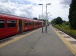
The station is also the last before the Chessington Branch splits from the line to Epsom and Guildford. So it is an easy interchange if you’re going up one branch and then down the other, as this Google Map shows.
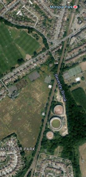
Motspur Park Station
Obviously, a new bridge with lifts could be added to this station, but I have a feeling that there might be a more imaginative design that might be better and more affordable.
