The Streatham Virtual Tube
In the June 2016 Edition of Modern Railways, there was an article entitled Turning South London Orange.
One of the proposals in the article is to create a virtual tube through Streatham.
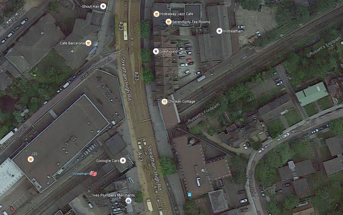
This Google Map shows the area.
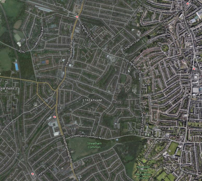
Streatham Stations
The stations shown on the map are.
- Streatham Hill station is at the top of the map just to the left of the middle.
- Tulse Hill station is in the top right.
- West Norwood station is on the right in the middle.
- Streatham Common station is at the bottom left.
- Streatham station is almost on a line between Streatham Common and Streatham Hill stations.
The Modern Railways article also says.
TfL has proposed the creation of a Streatham Interchange south of the town centre at the convergence of the Thameslink, London Bridge and Victoria routes near Streatham Common. But it is suggested that with such a move Streatham town centre would still be poorly served for travel in the direction of Clapham Junction, Victoria and the West End.
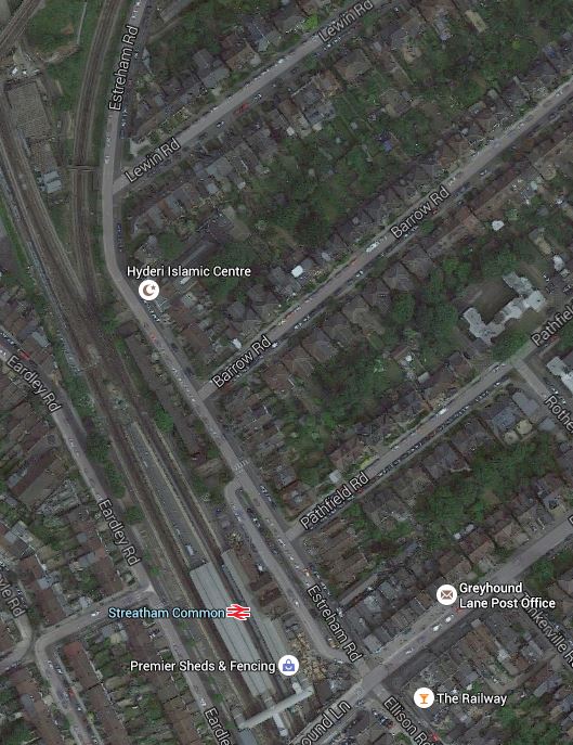
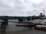
To take a quick snapshot of the complexity of the Streatham Interchange problem, look at this Google Map of the lines in the area.
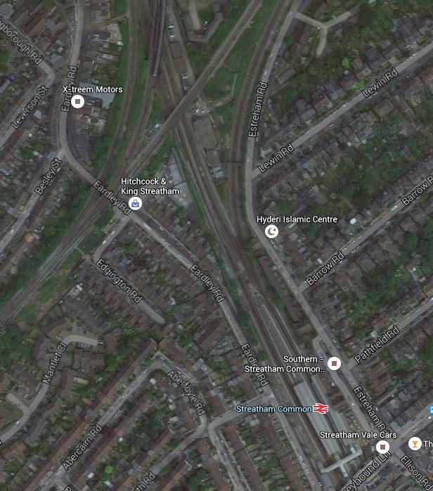
Streatham Common Station And The Tangle Of Lines
In an attempt to sort the problems, the Centre for London is proposing something radical in the form of a virtual tube giving a frequent service between all three Streatham stations; Streatham Common (Interchange), Streatham and Streatham Hill.
The connection would be achieved by.
- A tunnelled flying junction between Streatham and Streatham Hill stations.
- Streatham station would be four-tracked to give within-station interchange.
- A flying junction with the local lines would be provided at Streatham Common.
This would enable some stopping services to Victoria to stop at all three Streatham stations.
A Tunnelled Flying Junction Between Streatham And Streatham Hill Stations
This is a Google Map of the area between Streatham and Streatham Hill stations.
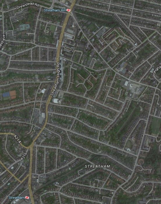
From Streatham To Streatham Hill
Streatham Hill station is at the top of this map and Streatham station is at the bottom.
This map from carto.metro.free.fr shows the rail lines in the area.
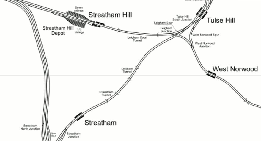
Lines From Streatham To Streatham Hill
The proposed tunnel would leave the line between Streatham and Tulse Hill stations just after the Streatham Tunnel and curve Northwards to join the line between Streatham Hill and West Norwood stations, probably at the Western end of the Leigham Court Tunnel.
As this is in a serious report produced by professional consultants, I would suspect that subject to full surveying and design, that this is a feasible idea. In the Modern Railways article it is stated to be a three kilometre tunnel.
Four-Tracking Through Streatham Station
The Centre for London proposal states that two pairs of tracks with within-station interchange, should go through Streatham station.
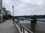
This Google Map shows Streatham station.
Streatham Station
It looks to be tight for four-tracking, but as the report says, two could be below ground.
Streatham Common
This map from carto.metro.free.fr shows the rail lines in the area.

Streatham Common Lines
Simple it isn’t!
I think that there would be a flyover, so that trains going from Streatham Common to Streatham didn’t interfere with other trains going through Streatham.
But there is plenty of space in the area to take the right actions!
Learning From The Tube And Crossrail
If the line through the three Streatham stations is to be a virtual tube, it should take some design clues from the Underground and its bigger and newer sister; Elizabeth.
I’ve probably ridden the Northern part of the Piccadilly Line, hundreds of times and the below-ground layout of stations like Southgate, Wood Green, Arsenal and others is two platforms separated by a wide central concourse, which is linked to the surface by escalators. It is a very workable format, that is used on the Victoria, Central, Northern and Jubilee Lines and from what I’ve seen Crossrail will use the layout at a lot of Central London stations.
It is a layout, that offers many advantages, especially, if the distance between the lines allows a wide and spacious area.
- Passengers have somewhere to wait.
- Some newer stations have kiosks, where drinks, snacks or something to read can be bought.
- Information can be bigger and better.
- Passengers can reverse direction.
- Passengers can change easily to a train going the same way, but to a different destination.
- Escalators and lifts in the centre serve both platforms.
- Three escalators are often provided, so if one needs refurbishment, the station stills has one up and one down escalator.
- Toilets can be provided that serve both platforms.
It is a design that has worked for nearly a hundred years and I believe that Crossrail will improve it sufficiently, so it lasts a thousand.
The S Stock trains of the Underground, the Class 378 trains of the Overground, the new Class 700 trains of the Thameslink route and the new Class 345 trains of Crossrail, are all walk-through trains, which bring several advantages.
Passengers can adjust themselves to the best place for their destination.
Passengers can move along the train to find a seat.
The capacity of the trains is greater.
The Modern Railways article says this about the difference between traditional and walk-through trains.
Analysis by TfL, has shown that station dwell times between Selhurst and Clapham Junction could be cut by up to 42%, if the current Class 377 EMUs were replaced with London Underground’s S Stock, which would be more suited to this type of operation.
So the trains actually go faster, as they spend less time in the stations.
The next generation of trains that replace the Class 377 trains on Metro routes in South London, may well be walk-through.
Trains Between The Stations
I will look at the number of direct trains in the Peak and Off Peak between stations in a typical hour. I have chosen 08-09 for the Peak and 10-11 for the Off Peak.
- Streatham to Streatham Common – Peak – 2 tph – Off Peak – 2 tph
- Streatham to Streatham Hill – None
- Streatham to Tulse Hill – Peak – 8 tph – Off Peak – 8 tph
- Streatham to West Norwood – None
- Streatham Common to Balham – Peak – 8 tph – Off Peak – 7 tph
- Streatham Common to Streatham – Peak – 2 tph – Off Peak – 2 tph
- Streatham Common to Steatham Hill – None
- Streatham Common to Tulse Hill – Peak – 2 tph – Off Peak – 2 tph
- Streatham Common to West Norwood – None
- Streatham Hill to Streatham – Peak – None
- Streatham Hill to Steatham Common – None
- Streatham Hill to Tulse Hill – Peak – None
- Streatham Hill to West Norwood – Peak – 5 tph – Off Peak – 4 tph
- Tulse Hill to Streatham – Peak – Peak – 8 tph – Off Peak – 7 tph
- Tulse Hill to Steatham Common – Peak – 2 tph – Off Peak – 2 tph
- Tulse Hill to Streatham Hill – Peak – None
- Tulse Hill to West Norwood – Peak – 2 tph – Off Peak – 2 tph
- West Norwood to Streatham – None
- West Norwood to Steatham Common – None
- West Norwood to Streatham Hill – Peak – Peak – 4 tph – Off Peak – 4 tph
- West Norwood to Tulse Hill – None
Note.
- Streatham Common to Balham is included, as the proposal assumes some of these will take the new route.
- 4 tph between Streatham and Tulse Hill are Thameslink
Frequencies are generally low compared to the 16 tph on the East London Line or the projected 24 tph on Thameslink and Crossrail.
What Would Be The Termini Of The Virtual Tube?
The Modern Railways article talks about Victoria and Clapham Junction being Northern termini, but what about the new station at Battersea?
But the article doesn’t mention the Southern termini.
So would the line go to the places shown on the map in the article; Mitcham, Selhurst, Sutton and Wimbledon?
We mustn’t forget West Croydon.
In How Trains Reverse At West Croydon, I investigated how trains reversed at West Croydon.
There are two methods; a bay platform and a reversing siding and I reckon with some good driving and signalling and some clever timetabling, that some more trains could be squeezed in. So if the virtual tube goes ahead, I suspect that West Croydon could reverse a few trains.
West Croydon station is also linked to the Tramlink.
Frequencies Through The Virtual Tube
The Modern Railways article says this about the frequency of trains through the virtual tube.
Using this link, some stopping services to Victoria could be rerouted via all three Streatham stations, while it is proposed that Streatham would see a peak service interval between trains of just two to three minutes. To maintain times to Sutton and Croydon, it is anticipated that 4 tph would continue to run directly from Streatham Common to Balham.
So are we really going to see trains every two or three minutes through Streatham station in the peak?
Where are twenty trains going to come from?
On the current provisional timetable for Thameslink, four eight-car Trains trains from the Sutton Loop Line going to London Bridge and on to St. Albans and Luton.
As Thameslink expands to cope with more passengers, surely these trains will go to twelve-cars, once all platforms are long enough. But Thameslink’s provisional timetable already uses all paths through the core, I can’t see any more trains on this route.
At present between eight and nine in the morning peak, nine trains go between Streatham Common and Balham, so this might give us another five trains through Steatham, with four trains still taking the direct route. They will also be trains of at least ten-cars.
So we now have nine trains of 10-12 cars trains going through Streatham. That still means that to attain a twenty tph frequency, we need to add eleven trains.
Perhaps four tph could run between a Southern terminus like West Croydon and Clapham/Battersea/Victoria.
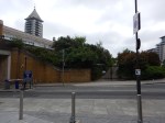
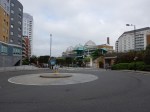
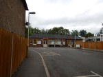
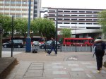
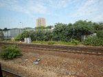
Streatham Common Station
This is the first of the Streatham stations coming into London.
If the virtual tube was built, then inbound services to London would split here, with according to the Centre for London proposals, four tph would go via Balham and the rest would take the Streatham route.
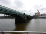
This Google Map shows the station.
Streatham Common Station
Note.
- All services use the Eastern pair of tracks at Streatham Common station.
- Lots of fast services on the Brighton Main Line pass through on the Western pair of lines.
- Services to and from Steatham station curve away to the East.
I think it could be a tight fit to squeeze a bay platform into Streatham Common station, to act as a terminus of the virtual tube.
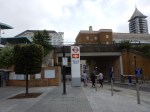
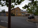
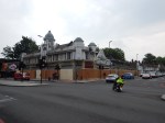
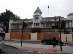
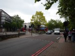
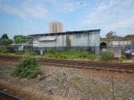
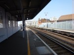
Streatham Station
This is the second of the Streatham stations coming into London.
It strikes me that the plan for a peak service interval of just two to three minutes is over-ambitious, although the Centre for London report is planning for 2050. Note that the capacity of a twelve-car Thameslink Class 700 train is eighteen-hundred passengers and that the next generation of trains on the Victoria routes will probably be similar in terms of passengers per car.
In a couple of years time on the East London Line, the properly designed two-platform stations like Canada Water, Whitechapel and Shoreditch High Street, with the help of sophisticated modern signalling, will be handling twenty tph.
So surely a well-designed two-platform station at Streatham could handle a similar number of trains! Provided of course, provision was made in the design to four-track the station if that was required in the future.
I think that if it could be done, Streatham needs a single wide island platform, with London-bound services on one side and Sutton, Wimbledon, West Croydon and other services on the other. This would enable single-platform interchanges between all trains, just as is being implemented on Crossrail at Whitechapel.
Escalators and lifts would provide step-free access to both sides of Streatham High Road. Remember the Thameslink trains will be walk-through as will probably be the next generation trains into Victoria, so most of the savvy passengers will position themselves correctly, when they board the train at their initial station.
I think the problems will be more about passengers getting to the station, by foot, bicycle or bus, rather than in properly designed and rebuilt stations and on the trains.
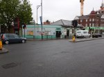
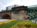
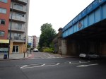
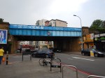
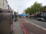
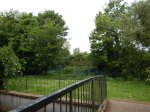
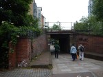
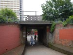
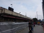
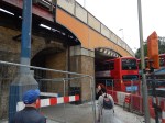
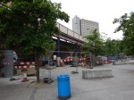
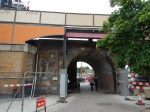
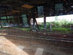
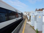
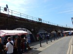
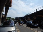
I took these pictures of Streatham station on the first of June 2016.


Note.
- There is a large bus parking area between the Streatham station and the Tesco next door, which could be developed into a full interchange.
- The station has little architectural merit.
- Opposite the station, there is a large gap in the buildings.
- The Morrisons supermarket next door is derelict and could be part of any development.
- It is a drab, dark station with all the style of a 1960s pedestrian underpass.
It is one of those sites where any decent architect could create a practical and good station with the following characteristics.
- A wide island platform capable of taking twelve-car trains on both sides.
- Two sets of escalators and lifts, one on each side of Streatham High Road.
- Appropriate over-site development of flats or offices, that would enhance the area and help pay for the scheme.
- A proper bus station linked to the station.
- A design that would enable two extra lines and platforms to be added in the future.
I’m fairly certain, that whatever Network Rail decide they want at Streatham to meet the required level of service, they will get.
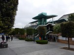
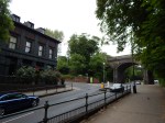
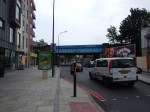
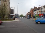
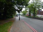
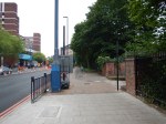
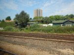
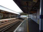
Streatham Hill Station
This is the third of the Streatham stations coming into London.
If the tunnel is built between Streatham and Streatham Hill station, then the traffic through Streatham Hill in the morning peak could be.
- From Streatham Common – 5 tph
- From West Norwood – 4 tph
- Extra Trains – 4 tph
Which makes a total of 13 tph.
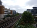
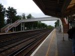
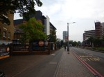
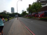
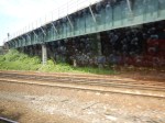
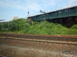
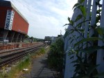
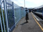
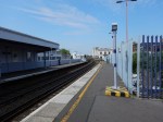
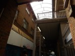
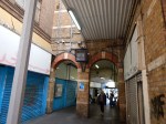
These pictures show Streatham Hill station.


It is step-free to both platforms and could certainly handle the required number of twelve-car trains.
But I doubt there is no way that the layout of the station could be improved to allow passengers to go between West Norwood and Streatham stations, without going over the bridge.
Conclusion
I think that a higher service between the three Streatham stations is a possibility, where perhaps four tph between Streatham Common and Balham are diverted through the three Streatham stations.
This could be reinforced by extra trains from West Croydon and possibly Sutton.
A rebuilt Streatham station would give cross-platform interchange with Thameslink and give services to London Bridge.
At the northern end, the trains would terminate at one of these stations.
- Victoria – Is it too crowded though?
- Battersea – For the Northern Line Extension
- Clapham Junction – Perhaps possible, but not the right place!
Or it could take the West London Line at Clapham Junction and go all the way to Stratford or Watford!
TfL will pay their money and take their choice.
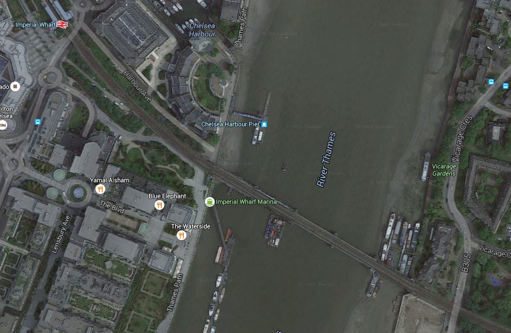
Improving Imperial Wharf Station
In the June 2016 Edition of Modern Railways, there was an article entitled Turning South London Orange.
One of the proposals is to create a walkway across Battersea Railway Bridge to give access to Imperial Wharf station from the South Bank of the River Thames.
This Google Map shows the station, the river and the South Bank.

Just to look at this map, shows that the scheme has potential.
- I estimate that the distance is probably about five hundred metres.
- The walkway would also give access to the Thames Clippers at Chelsea Harbour Pier.
- The walkway would give better walking routes in the area and across the river.
Unfortunately, the design of the station is possibly not one, that could accept passengers walking in and out at track level, so without a lot of work at the station, passengers might have to climb down and up to get between the walkway and the platforms.
Battersea Railway Bridge is also a Listed structure and it may be difficult to add a walkway.
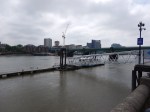
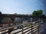
These pictures show the station and the bridge.
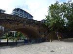
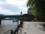
However, it would appear that help is at hand. There are plans for a new footbride called the Diamond Jubilee Footbridge, which will be directly upstream of the railway bridge. This page from the Diamond Jubilee Footbridge web site has a picture and the reasons, why it should be built.
Incidentally, there used to be a Battersea station on the South bank of the River, in the area of Battersea High Street.
This Google Map shows the area.
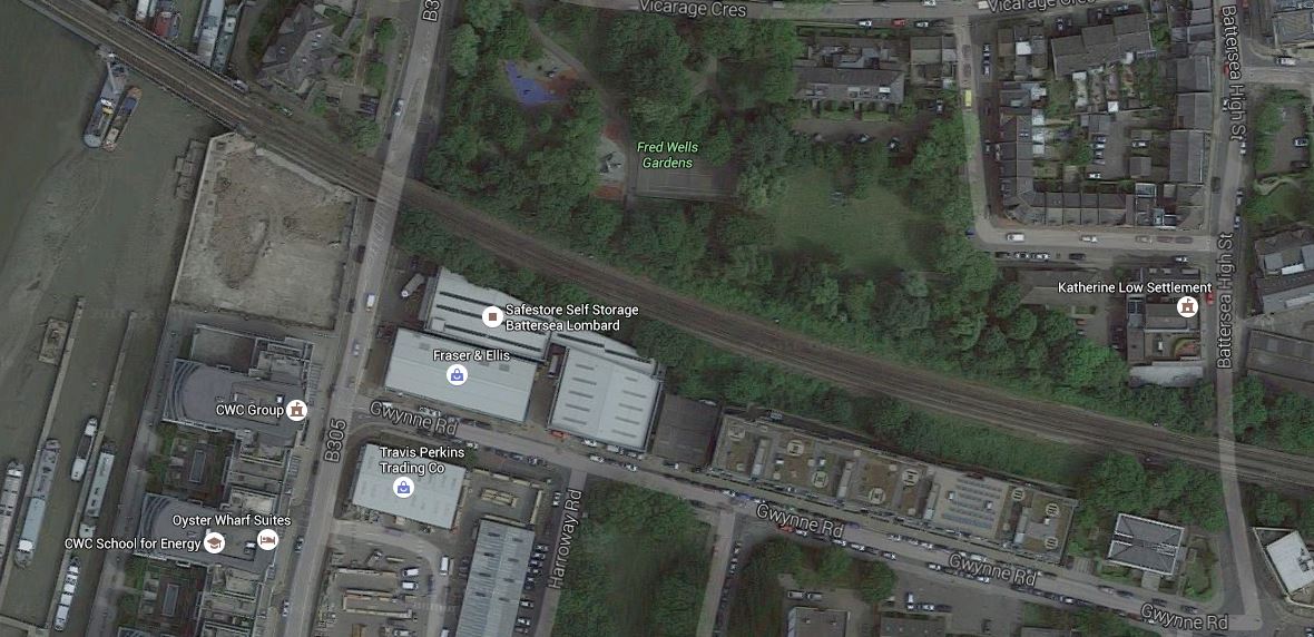
The Location Of Battersea Station
Although, it looks like the station, which was destroyed in 1940s by German bombing, could be rebuilt, I feel that the Diamond Jubilee Footbridge, is a much better way to spend the money.
A South London Metro
Some of my recent posts including.
- An Improved South London Line Is Proposed
- A New Station For Battersea
- The Lines At Battersea Power Station On the Way Into Victoria
- A Tunnel Under Brixton
Are leading me to the conclusion that it would be possible to create a South London Metro, that worked under similar principles to the East London Line.
The East London Line
If anybody doesn’t believe that the East London Line is one of the best creations on the world’s railways in recent years, then they should go and read something else now.
Consider.
- There is a core section between Dalston Junction and Surrey Quays stations, where sixteen trains per hour (tph) shuttle passengers under the river in modern trains.
- In Increased Frequencies On The East London Line, I indicated that TfL are planning to increase this frequency to 20 tph.
- At the Northern end four dedicated platforms at two different termini; Dalston Junction and Highbury and Islington give passengers choices of onward routes.
- At the Southern end, there are four separate termini; Clapham Junction, Crystal Palace, New Cross and West Croydon.
- Three of the southern termini have excellent onward connections and if the Tramlink is sorted at West Croydon, then that would be improved.
- The line has excellent connections to the Victoria and Jubilee Lines of the Underground and other rail lines.
It has been a marvellous success.
The North London Line
The North London Line is not as radical in its design as the East London Line, as it effectively just a a simple line across North London, that carries up to eight trains per hour and a lot of freight.
It has been successful, but not as successful as the East London Line.
The Future Of The Overground In North And East London
The success of removing, third-rate trains on the North and East London Lines is now being repeated on the Gospel Oak to Barking Line, where two-car diesel trains are being replaced with four-car electric ones.
But this is only the start, as other plans are being put together in North London.
- Will electrification be completed in North London by wiring the Dudding Hill Line?
- New stations like Brent Cross Thameslink, Old Oak Common and Angel Road are being created to support development.
- In the Walthamstow area, new curves will improve services on the Chingford Branch.
- Chiltern Railways have plans for a Chiltern Metro to West Ruislip station.
- The Metropolitan Line is being extended to Watford Junction.
- Thameslink will integrate and expand the suburban services out of Kings Cross and St. Pancras.
But to use the well-known phase – “You ain’t seen nothing yet!”
South London In The Slow Lane
South London is very second-rate compared to the North with respect to railways.
My mother always told me to never go South of the River, as I’d get lost.
Look at the historic radial routes out of East, North and West London termini like Euston, Fenchurch Street, Kings Cross, Liverpool Street, Marylebone, Paddington and St. Pancras and the lines have a simple structure that the average child of ten could understand. The Underground also follows a simple structure.
But if you look at trains South of the River, there is not even any logic as to which terminus you use to get your train, with the exception perhaps of Waterloo. Only South London’s crazy rules would mean that going to East Kent would be from the most western Southern terminus at Victoria.
It is mainly down to the fact that much of the rail network South of the River were developed by companies, whose idea of co-operation was stopping the other companies from expanding.
My mother was so very right!
There are problems galore of inadequate infrastructure.
- Some stations are in desperate need of more platforms.
- Lines often cross each other in flat junctions, which severely limit capacity.
- Many of the lines have heavy peak-hour use from commuters and infrequent services in the off-peak.
- Any electrification is non-standard third-rail.
- The main lines don’t have enough capacity.
- Commuters are also often very vocal opponents of even the smallest change.
Even new lines like the Channel Tunnel Rail Link at Ebbsfleet International and Crossrail at Abbey Wood are only partly integrated into the existing network and don’t share a station.
The engineers are doing their best with innovative schemes like the Bermondsey Dive-Under, but the railways in South London need a whole new philosophy to meet the challenges of the twenty-first century.
North London may have a long list of projects in the pipeline, but after the upgrading of Thameslink and the Northern Line Extension to Battersea, South London’s future plan is very thin.
In some ways Crossrail 2 sums up the South. North London will be affected by this line’s construction, but all of the protests are from Chelsea, which can probably be ignored, and South London.
The Centre For London Proposals
In the June 2016 Edition of Modern Railways, there was an article entitled Turning South London Orange, which is a radical set of proposals from an organisation called the Centre for London, with the aim of improving rail services in South London.
This is a summary of their proposals, as they affect the lines across South London from Victoria to Peckham Rye, Herne Hill and Surrey Quays.
- A tunnel should be built from Battersea to South of Herne Hill under Brixton to remove fast services from Victoria to Kent from the area.
- The four-track South London Line should be reconfigured so that London Overground services use the Northern rather than the Southern pair of tracks.
- A new station is built at Battersea linking the Northern Line Extension to the South London Line.
One of the consequences of this, is that it would be possible to create three modern step-free stations at Wandsworth Road, Clapham High Street and Brixton, with the latter two connected to the Northern and Victoria Lines of the Underground using escalators and/or lifts.
A South London Metro
So what would a South London Metro look like?
I will assume the following.
- The fast line tunnel under Brixton is built.
- The South London Line is reconfigured to put the London Overground service on the Northern pair of tracks.
- A new interchange station is built at Battersea.
In the next few sections, I will look at the various parts of the South London Metro.
The Brixton Tunnel
Although not actually part of the South London Metro, the Brixton Tunnel must be built before the Metro can be created, as it removes all the fast Chatham Main Line services between Victoria and Kent, from the lines across South London.
Trains will use a tunnel between Battersea and South of Herne Hill.
So what Southeastern Mainline services, that serve Victoria could use the tunnel?
- 1 tph to Ramsgate via Chatham with a first stop at Bromley South.
- 1 tph to Dover via Chatham with a first stop at Bromley South.
- 1 tph to Dover via Chatham with a first stop at Orpington and a second at Bromley South.
- 1 tph to Canterbury West via Maidstone East with a first stop at Bromley South.
- 1 tph to Ashford International via Maidstone East with a first stop at Bromley South.
There are another nine trains per day running in the peak.
The question has to be asked, if extra services can be provided through a fast tunnel, as the current number of trains might even be within the capacity of a single-track tunnel.
But I suspect that for redundancy and safety reasons that the five-kilometre tunnel would probably be built as double track or a twin-bore tunnel.
At present non-stop services take sixteen minutes between Victoria and Bromley South stations, which is a distance of 20.4 kilometres, which gives a start-to-stop average speed of about 75 kph. At that speed the trains would take around four minutes to pass through the tunnel. So even if the Class 375 trains, that generally work the line went through at full speed of 160 kph, not much would be saved on the journey.
But given the transit time through the tunnel of four minutes or less and the generally low number of trains through the tunnel, I suspect that a single-track tunnel is under serious consideration.
But I would future-proof the line by providing a double-track tunnel.
As Bombardier have said, that the Class 375 trains could be retro-fitted with on-board energy storage, I suspect too that the tunnel could even be left without electrification, as an electrically-dead tunnel must be safer in the unlikely event of a train needing to be evacuated. Evacuation will probably be through the side doors of the trains onto a walkway, as is proposed for Crossrail.
I think that the developments in infrastructure creation and the powering of trains in the last few years could enable a very radical and affordable approach to building this tunnel.
I think there’s a chance we’ll see this five kilometre tunnel bored as a single bore, with either one or two tracks, but no electrification.
Remember that the Severn Tunnel, which is the longest main line rail tunnel in the UK and was built by the Victorians, is seven kilometres long.
London’s latest tunnel which is the Lee Tunnel for sewage is just under seven kilometres long, seven metres in diameter and at a depth of over seventy-five metres under East London. It is probably big enough for a third-rail electrified double-track railway. According to Wikipedia, the Lee Tunnel cost an estimated £635 million.
As we’re moving towards a Golden Age of Tunnelling, I think we’ll be seeing more tunnels proposed.
The Core Section
I would define the core section of the South London Metro as between Wandsworth Road and Peckham Rye stations, so it would also include the following intermediate stations.
- Clapham High Street
- Brixton
- Denmark Hill
If fast services from Victoria to Kent are in a tunnel under Brixton and Herne Hill, the Centre for London Report says that it would be possible for London Overground services to use the Northern pair of tracks rather than the Southern ones. Freight, empty stock movements and other non-stopping services would continue to use the Southern tracks.
At present there are just four tph each way on the Overground along the current line, but as the East London Line core is currently handling sixteen tph, I would think it possible, subject to some reorganisation of the tracks at the two ends of the core section, that all Metro and Overground services could share the Northern tracks and platforms.
Similar sharing has been done successfully between New Cross Gate and Norwood Junction on the Overground, since the East London Line was extended to West Croydon in 2010. On that existing route, the fast trains have their own separate tracks out of the way, just as under the Centre for London proposals, fast trains between Victoria and Kent will be separated in a tunnel under Brixton.
As to the ultimate capacity of the core section, who knows? Figures of 24 tph have been quoted as possible for the East London Line, but twenty through the core will do well for several years.
I suspect that as the only trains on the Northern pair of tracks through South London will be slow Overground/Metro trains, that any routing problems could be solved by simple flat junctions, of which there are many already.
So how would this affect the stations on the core section?
- Wandsworth Road would have two new Northern platforms. As the lines split for Victoria and Clapham Junction just after the station, would each pair of lines and platforms be for appropriate destinations?
- Clapham High Street would have two new Northern platforms for Metro/Overground services. As the Northern platforms are closer to Clapham North station, it might be sensible to create an escalator connection between the two stations and not generally use the Southern platforms.
- East Brixton is a station, that has been discussed for rebuilding.
- Brixton would have reopened Northern platforms for Metro/Overground services. Services via Herne Hill would still use the current platforms and as no trains on the high-level lines over the station would stop, providing step-free access between the Victoria Line and Metro/Overground services would be much easier.
- Many believe that Loughborough Junction station should be connected to the Overground. If Metro/Overground services are moved to the Northern tracks as they go over Loughborough Junction station, I believe that step-free connection between new Metro/Overground platforms and Loughborough Junction is now possible.
- Denmark Hill station would need some reorganisation, but it is already step-free.
- Peckham Rye station would need some reorganisation and it is on the list of being made step-free.
The list of projects to create a core section of the South London Metro would include.
- Build the Brixton Tunnel
- Add the extra platforms and station infrastructure at Wandsworth Road station.
- Add the extra platforms and station infrastructure at Clapham High Street station.
- Create an escalator/lift connection between Clapham High Street and the Northern Line at Clapham North station.
- Reopen the Northern platforms at Brixton station.
- Create an escalator/lift connection between the low-level platforms at Brixton with the Victoria Line.
- Add two high-level platforms at Loughborough Junction station on the Metro/Overground lines.
- Make Loughbrough Junction station fully step-free.
- Make various changes to the tracks, so that all required routes are possible.
There would obviously be other small projects, but I can’t see anything major except for the building of the Brixton Tunnel, that would be needed to create a sixteen train-per-hour route from Victoria across South London.
All projects and that includes the Brixton Tunnel could be carried out without large disruption of the existing train services, which in my view is a tribute to the Centre for London proposals.
I think that without any further major infrastructure after the Brixton Tunnel has been built, and some other smaller projects that are already being planned, the core section of the South London Metro could be a run of step-free stations interchanging with the Northern and Victoria Lines, Thameslink and other services out of Victoria and London Bridge.
Reversal Stations
I also wonder if any of the core stations could be created with an island platform, so that passengers can reverse direction without going up and down stairs. This can already be done at Queens Road Peckham station if say you are on a Dalston Junction to Clapham Junction train and want to go to South Bermondsey or London Bridge.
Never underestimate passengers’ ability to duck and dive!
Connectivity just encourages passengers to take more outrageous, faster and convenient routes.
The Western Termini
At present there are two western termini for the services along the South London Line; Victoria and Clapham Junction and Victoria.
There is probably not enough platforms, if it is desired to run sixteen tph or more through the core, as is done on the East London Line.
Clapham Junction As A Western Terminus
At present 4 tph run to Clapham Junction and as I wrote in Increased Frequencies On The East London Line, this will be increased to 6 tph in 2019.
I suspect that despite the rather unusual platform arrangements at Clapham Junction, which I call The Clapham Kiss, that 6 tph can be handled at the station.
So I think it will be very much Carry On Clapham!
Victoria As A Western Terminus
At present, the following services serve Victoria along the South London Line.
- 4 tph to Orpington, which turn off at Brixton.
- 2 tph to Dartford via Bexleyheath, which turn off at Peckham Rye.
Combined with the 6 tph from Clapham Junction, between Wandsworth Road and Brixton, there are 12 tph.
Given that Victoria is crowded and needs more platforms, would it be possible to handle the South London Metro from a dedicated platform or pair of platforms in Victoria?
Assigned platforms at Dalston Junction certainly helps passengers, as you know where your train to the various destinations will call.
- Through Platform 1 for Highbury and Islington
- Bay Platform 2 for New Cross
- Bay Platform 3 for Clapham Junction
- Through Platform 4 for Crystal Palace and West Croydon
This is certainly what is happening today as I write.
I think it would be a great advantage if you went to a particular platform or pair of platforms to pick up the South London Metro.
This mini sub-station concept is used at.
- Cheshunt for the Lea Valley Lines
- Clapham Junction for the East London Line.
- Crystal Palace for the East London Line.
- Liverpool Street for the Lea Valley Lines.
- Richmond for the North London Line.
- Stratford for the North London Line.
Usually, you just look for the orange!
Battersea As A Western Terminus
Given that Victoria is crowded and probably needs more platforms, an alternative terminus is probably needed.
Just as when Dalston Junction was rebuilt for the East London Line, two bay platforms were incorporated, could the same thing be done at the new Battersea station?
Certainly, the system works well at Dalston Junction, so why wouldn’t a similar arrangement work at Batttersea?
- Passengers needing to get to Victoria on a train terminating at Battersea would just walk across the platform and wait a couple of minutes for the train to Victoria.
- Passengers from Victoria on a train going to a wrong destination would only have to go to Wandsworth Road to get a train to any destination, including those served from Clapham Junction.
It is a system, where to do any journey you either do it direct, or with a single same-platform change.
Old Oak Common As A Western Terminus
Because of the capacity problems and the unusual layout at Clapham Junction station, it might also be possible to use somewhere on the West London Line as a Western terminus.
Old Oak Common station with its connections to the West Coast Main Line, HS2, Crossrail and the North London Line would be an obvious choice.
The Eastern Termini
At present services from Victoria and Clapham Junction, go although the South London Line to the following destinations.
- Dalston Junction – 4 tph from Clapham Junction – 6 tph from 2019
- Dartford – 2 tph from Victoria via Bexleyheath
- Orpington – 4 tph from Victoria
Even with Dartford services raised to 4 tph, that is probably still below the capacity of the core section of the line.
Dalston Junction As An Eastern Terminus
I would assume that the current Dalston Junction to Clapham Junction service will continue.
Currently there are 4 tph, but this will go to 6 tph in 2019 as I wrote about in Increased Frequencies On The East London Line.
As TfL’s predictions in the document I found for 2016 and 2017 have already happened, I would think the 6 tph is likely, if the new Class 710 trains are delivered to boost the fleet.
With the increase in service frequency, London Overground Syndrome means that the passengers using the service will increase.
Dartford As An Eastern Terminus
At present, 2 tph go between Victoria and Dartford via Bexleyheath.
But is Dartford, the best terminal in the area for the South London Metro?
Consider.
- A Crossrail extension to Gravesend has been safeguarded, which goes through Dartford.
- Crossrail surely should connect directly to HS2.
- If Crossrail served Dartford, some of the other services would be simplified.
- Dartford will probably come under TfL control.
I wouldn’t be surprised to see 4 tph service along a South London Metro to a Dartford station, where Crossrail calls to give a direct link to HS2 at Ebbsfleet International.
London Bridge As An Eastern Terminus
As London Bridge station used to be linked along the South London Line to Victoria, this important station must be added.
Especially, as there were a lot of passengers, who objected to losing the direct service along the South London Line between London Bridge and Victoria.
On the East London Line, there is a short 4 tph service between Dalston Junction and New Cross which is used as a short direct service through the core, perhaps to boost train frequencies there.
So could a service with a similar frequency be run on the South London Line between Victoria and London Bridge? It could call at.
- South Bermondsey
- Queen’s Road Peckham
- Peckham Rye
- Denmark Hill
- Loughborough Junction
- Brixton
- Clapham High Street
- Wandsworth Road
- Battersea
It would have step-free connections to the Northern and Victoria Lines and Thameslink, if the appropriate stations were upgraded.
Orpington As An Eastern Terminus
I think that Orpington has the greatest potential as a terminal.
This map from carto.metro.free.fr shows the route from Kent House station via Beckenham Junction and Bromley South to Orpington.
From Kent House Via BromleySouth To Orpington
It has very good connectivity.
- Beckenham Junction connects to the Tramlink.
- Bromley South connects to Thameslink, the Chatham Main Line and the Maidstone East Line.
- Orpington connects to the South Eastern Main Line and the Hastings Line.
Because of all this connectivity, Bromley and Orpington might be able to provide enough passengers for more than four trains per hour going to Victoria and/or Battersea.
Remember there will still be the five fast trains per hour through the Brixton Tunnel in addition to the stopping ones of the Metro.
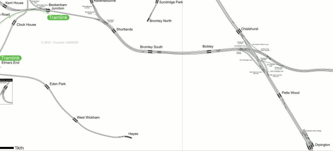
Bellingham As An Eastern Terminus
When the Overground took over the line, there was some discussion about a service between Victoria and Bellingham.
So could Bellingham station be a terminus?
This Google Map shows the area around Bellingham station.
Bellingham Station
There doesn’t seem to be much of importance in the area, except the leisure centre.
In addition.
- The station doesn’t seem to have a suitable bay platform, but there may be space to build one.
- The station would provide a link to Thameslink.
- It only handles a couple of trains an hour most of the day, so perhaps the terminating of trains was to be slipped in the large gaps.
Perhaps it was all to stimulate development in the area.
An HS1 to HS2 Link
If Old Oak Common is chosen as a Western Terminus with a 4 tph service down the West London Line and the core route of the South London Metro, what would be a suitable terminal in the East?
Given what I said about Dartford as an Eastern terminus, surely a four tph service across South London linking HS1 and HS2 must enter into the route planners’ thinking.
As Crossrail does the business linking HS1 and HS2 for North and Central London, a South London Metro could be configured to do a similar job for a whole swath of South and West London.
A Brockley Interchange
The Centre for London report proposes a new pair of platforms on the South London Line between Nunhead and Lewisham stations, providing interchange with the existing Brockley station.
I gave my views on Brockley station in A Report On The Bakerloo Line Extension, which I now repeat in an edited form.
This Google Map shows Brockley station.
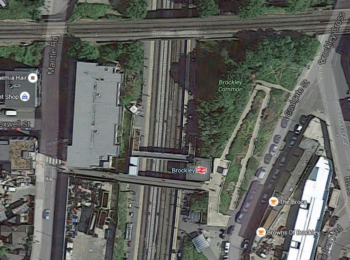
The Bexleyheath Line between Nunhead and Lewisham stations crosses the East London Line and Brockley station at a high level.
I wrote A Four-Poster Station about connecting these two lines.
It would appear that Transport for London have advanced this project from one word in their 2050 Infrastructure Plan to a proposal.
If the South London Metro included the services to Dartford via Bexleyheath, then this interchange at Brockley station might make some passengers journeys a lot easier.
A Penge Interchange
The Centre for London report proposes an interchange between Penge East station on the Chatham Main Line with Penge West station on the East London Line.
This Google Map shows the lines and the two Penge stations.
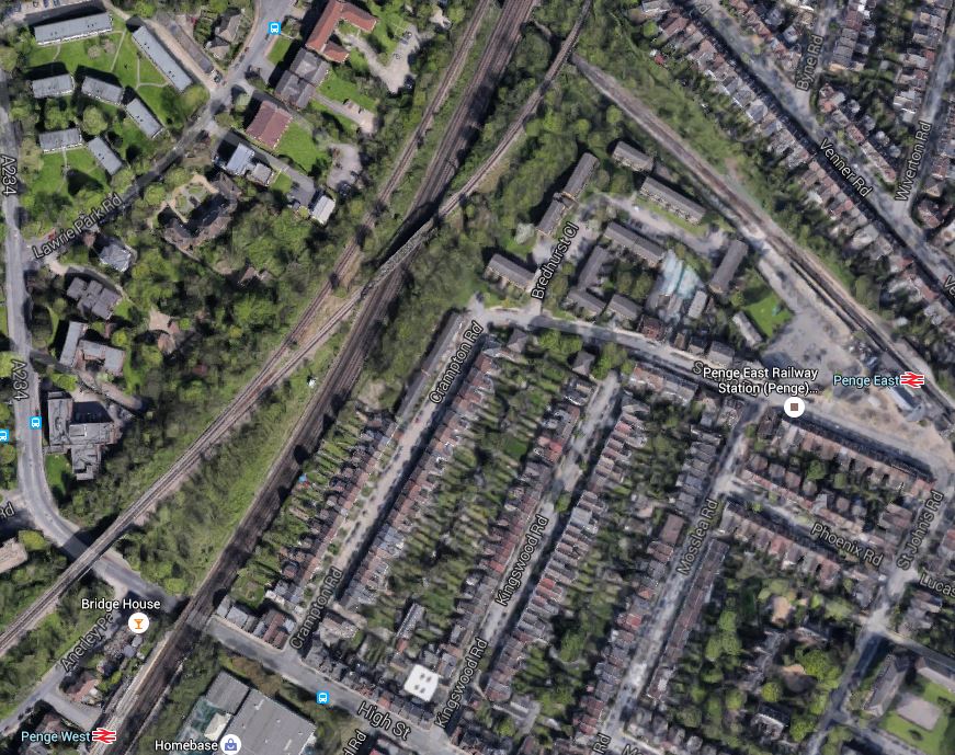
Penge Stations
The report suggests that it would be possible to reduce the walking distance between the two stations from 650 to 400 metres and there might be potential to move Penge West station to the North of the High Street.
As the walking appears substantially to be flat, I wonder if a section of travelator would be possible!
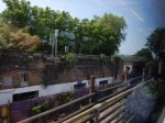
I recently walked from East to West station and took these pictures.


One of the station staff said that they need step-ladders to access the Crystal Palace line, that runs over the top.
The walk incidentally took me fifteen minutes, so if it decreases from 650 to 400 metres, by moving the station North of the High Street that should reduce the time to under ten minutes.
Will a travelator be added.
As with the extra platforms at Brockley station, this interchange has the potential to ease some passengers journeys.
My Proposed Schedule
I will give my view of the trains on a South London Metro.
- 6 tph between Dalston Junction and Clapham Junction.
- 4 tph between Dartford and Old Oak Common.
- 4 tph between Victoria/Battersea and London Bridge
- 6 tph between Victoria/Battersea and Orpington
This gives a total of 20 tph, which would be the same as the East London Line will be in 2019.
The Rolling Stock
Due to platform restrictions on the East London Line, I would envisage that the trains between Dalston Junction and Clapham Junction will probably still be the same five-car Class 378 trains.
The trains on the other destinations can probably be anything suitable and would include Class 375, Class 377 or even some new Class 710 trains.
But as there is no platform restrictions to the other destinations, the trains could probably be any desired formation between four and twelve cars.
Any new platforms would of course be built to accept twelve-car trains.
Getting To Heathrow
At the present time, getting to Heathrow can be a bit of a problem from some places in South London.
But after Crossrail and Old Oak Common station are opened, it would just be a matter of getting one of a 4 tph South London Metro train to Old Oak Common and changing for Crossrail.
It may of course be easier to use one of the other possible routes to Crossrail.
- Take the Northern Line to Tottenham Court Road from Battersea or Clapham North.
- Take Thameslink to Tottenham Court Road.
- Go via Whitechapel.
We’ll all develop our favourite routes.
Getting To Gatwick
At the present time, Thameslink haven’t published their full route yet, but anybody on the South London Metro should be able to do one of the following.
- Go to Clapham Junction and get a direct train.
- Go to Victoria and get Gatwick Express.
- Go to London Bridge and get Thameslink.
Unfortunately, it looks like I might lose my option of going to New Cross Gate and getting a direct train.
Conclusion
A South London Metro running 16 tph or more between Wandsworth Road and Peckham Rye stations, with multiple termini at either end, must be a feasible and affordable possibility, if the following is done.
- The Brixton Tunnel is built to give fast Victoria to Kent services a by-pass.
- The Overground/Metro services are moved to the Northern pair of tracks on the South London Line.
- Various station and track improvements are carried out.
It looks to me, that this project could transform South London and improve the lot of people like me, who live on the East London Line.
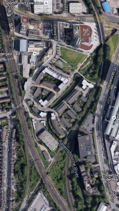
Improving Lewisham Station
In the June 2016 Edition of Modern Railways, there was an article entitled Turning South London Orange.
One of the proposals is to try to sort out Lewisham station.
My mother used to tell me never to go South of the Thames as you’ll get lost. Perhaps she had Lewisham in mind, as just look at this Google Map of the lines through the station.
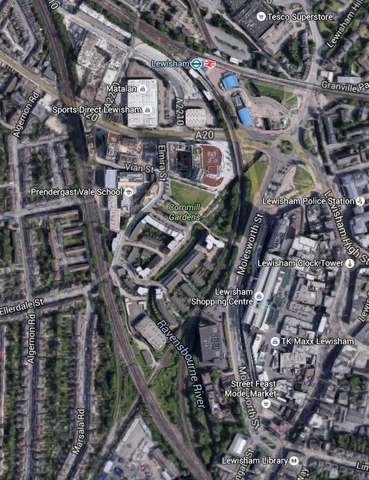
Lines Through Lewisham
The rail lines in the Lewisham area are.
- The lines to the West of the map is the South Eastern Main Line from Charing Cross to Dover and Folkestone.
- The line curving down from the station to the South Eastern Main Line is the Hayes Line, which meets it in a complicated junction.
- Going off to the East from the station is the North Kent Line.
Was the designer of the lines in this area having a laugh, as it must make running trains through Lewisham in an efficient manner extremely difficult.
I also assume that anybody going to and from Dover, can’t change trains at Lewisham, unless they an force a window and jump out.
In order to try to improve matters, the Centre for London report is proposing Lewisham South interchange platforms on the South Eastern Main Line, which are connected to the main station using a travelator running alongside the Hayes Line.
The thinking behind all this is detailed in this document from JRC consultants.
Some major points and recommendation from the document include.
- There are too many flat junctions and other track problems.
- The service levels from the area into London is erratic and nowhere near TfL’s oreferred level of four trains per hour.
- Getting to and from anywhere other than the City or Central London in the peak can be difficult.
- Connectivity to Lewisham to get the DLR to Canary Wharf could be improved.
- Southeastern’s commuter services should be taken over by TfL.
- Extending the East London Line to Lewisham wll be difficult and expensive, if not impossible.
The document also includes a map of the proposed travelator on Page 14.
It shows the travelator curving along the Eastern side of the Hayes Line to an island platform on the South Eastern Main Lines.
It also says this.
However a southern location closer to Lewisham High Street, placed over the Hayes branch line, in low value or empty land on the slow lines alongside Parks Bridge Junction and north of the Courthill loop, would permit a 12-car island platform connected into the Lewisham Interchange and making that much more of a hub station. A direct entrance to the southern part of Lewisham High Street could also be opened up. A travelator alongside the Hayes line, in several segments, would link to the interchange in 540 metres and also provide fast access to Lewisham shopping centre at an intermediate point.
This Google Map shows the area from the current Lewisham Interchange to the proposed Lewisham South.
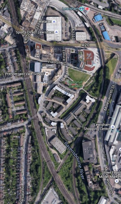
Note the blue roofs of the DLR station at the top of the map and the crossing by the South Eastern Main Line of the Hayes Line at the bottom, where it is surrounded by green space.
To get a better feel for the area. I took these pictures ass I walked from where the South Eastern Main Line crosses the High Street back to the station.
After this walk along the dual-carriageway from the Western end of Lewisham High Street to the station, I certainly think that a better walk could be created.
Let’s hope that when the current construction and road works are complete, that the current walking route between the station, the Shopping Centre and Lewisham High Street is improved.
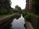
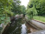
What disappointed me was that surely better use of the Ravensbourne River, which I called a Hidden Waterway in the pictures. This Google Map shows how it twists and turns through the area.
The Ravensbourne River Through Lewisham
I certainly think something better can be done.
For those who think a travelator is a bit naff, the JRC report also suggests that the DLR could be extended.
Consider.
- If it’s worth extending the DLR to Lewisham South, perhaps it should go further.
- One of the themes of the JRC report is prudence and affordability, which I think pushes the author to the travelator solution.
- The travelator route may make it easier to serve the Shopping Centre.
- A travelator might make it easier to catch the buses on the other side of the Shopping Centre, which every time I go to Lewsiham, I seem to have to do.
I also think that to extend the DLR would probably involve some impressive engineering to get over the roads by the station, whereas a walking route/travelator might even start from or beside the Hayes Line platform (2) on the bridge over the road. The latter option would mean that at the station end, all of the lifts are there for step free access to the other platforms.
I also think that not many passengers would want to transfer between Platform 1 at Lewisham station and the Lewisham South platforms, so starting the walkway from Platform 2, which has a level connection to Platform 3 and good connections to the DLR, would not be a bad idea.
Overall, I don’t think we make enough use of travelators and outside escalators.
But I do like the idea of the new platforms at Lewisham South and a travelator.
Something will have to be done at Lewisham, before the Bakerloo Line is extended to the area.
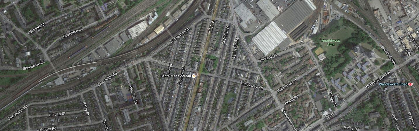
Improvements To Clapham High Street And Wandsworth Road Stations
In the June 2016 Edition of Modern Railways, there was an article entitled Turning South London Orange.
The report suggests putting platforms at Clapham High Street and Wandsworth Road stations on the Southeastern tracks to enable a direct service to Victoria to be reinstated.
This map from carto.metro.free.fr shows the lines through the two stations.
Lines Through Wandsworth Road And Clapham High Street Stations
If the proposed Brixton Tunnel were to be built, that would mean that only local stopping services and the London Overground trains would call at these two stations.
So would only two platforms be needed to handle all the trains? The frequency would probably be something in the region of twelve trains per hour, with possibly six on the Overground and six going to and from Victoria.
I know of many places in London and the rest of the UK, where a train every five minutes would be considered easy to handle. Crossrail and Thameslink will be handling a train at twice this frequency.
The great advantage of all trains in one direction being handled on a single platform face, is that if say you wanted to go from Dalston Junction to Victoria, you could get off one train at either of these stations and then get the next to your appropriate destination.
You could even use a wide island platform, which would allow changes where direction is reversed without leaving the platform. It would also only require one lift, so could the money be used for an escalator?
Because of the problems of providing platforms and a step-free connection at Brixton, undoubtedly, the platforms there would be built on the Northern pair of tracks. So I suspect that they would on these two stations.
This would have various knock-on effects.
- Freight, empty stock movements and other non-stopping services would use the Southern pair of tracks.
- There would probably need to be some reorganising of the junctions to the West of Wandsworth Road station, as part of the tunnel works.
- There would need to be some sorting out of the junctions East of Brixton to make sure all of the trains got to and from the correct places.
- Clapham High Street station could be properly integrated into Clapham North station with an escalator connection.
In some ways, it all shows how a tunnel under Brixton could be a masterstroke.
A New Station For Clapham East
In the June 2016 Edition of Modern Railways, there was an article entitled Turning South London Orange.
One of the proposals in the article is to create a new station at Clapham East. The location is half a mile North-East of Clapham Junction station on the East London Line.
This Google Map shows the location.
Location Of Clapham East Station
Note Wandsworth Road station at the East of the map, with Clapham Junction station, off the map a short distance to the West.
I’m not too sure of the exact location of the proposed station but it would appear to be on the East London Line, where it runs along Eversleigh Road, close to the junction of Culvert Road.
These pictures were taken as my East London Line train passed through in the area.
This map from carto.metro.free.fr might help.
Lines Around Clapham East Station
The bridge in the pictures is where the lines from Victoria go over the East Lo0ndon Line to get to Clapham Junction station.
I think the station will be on the East London Line, which is shown in orange, just above the words “Pouparts Junction.
The Centre for London report, says that the area rather lacks a train service and that a station is needed.
An Improved Station For Brixton
In the June 2016 Edition of Modern Railways, there was an article entitled Turning South London Orange.
One of the proposals in the article is to create an improved station at Brixton, by reopening disused platforms on the Northernmost tracks at the station.
Brixton station was designed by Topsy.and could probably be summed up by my post; Changing Trains At Brixton.
This is a Google Map of the station.

Lines Through Brixton Station
Note.
- The Northernmost lines don’t have platforms.
- The Overground uses the Southernmost lines, which also don’t have platforms and soar high above everything else.
Centre for London’s proposal envisages platforms being added to the two Northern platforms and using them for the Overground.
This map from carto.metro.free.fr shows the lines between Wandsworth Road and Brixton stations.

WandsworthRoad, Clapham High Street And Brixton Stations
This map shows all the junctions between the lines, which probably means that running Overground trains on the Northern pair of tracks is probably possible.
If the only platforms where trains stop are the low-level ones in Brixton station, surely, it would be be much easier to link them to the Victoria Line.
These are some pictures of the station.
If it was being sold by legendary Estate Agent Roy Brooks, he would describe it as a building with potential.
The four low-level platforms are on solid Victorian railway arches and I suspect that a 3-D rendition of the station, would show it was possible to tunnel from the arches into the Victoria Line platforms, to give an escalator and lift connection.
It wasn’t done in the 1960s, when the Victoria Line was built or when the Overground was created, as in both cases, money was short and no-one believed that the two lines would be as successful as they are now!
But the more I look at the pictures and the maps, Centre for London’s idea of running the Overground on the Northern pair of tracks looks more feasible.
The related proposal of creating a tunnel under Brixton to remove the fast trains between Victoria and Kent, also helps, as it removes the fast trains from passing through Brixton station.
A New Station For Battersea
In the June 2016 Edition of Modern Railways in an article entitled Turning South London Orange.
One of the proposals is to create a new station at Battersea.
The station is proposed to have platforms on the Southeastern lines into Victoria, close to the Dogs’ Home, that will adjoin the new Battersea Power Station station on the Northern Line extension.
This Google Map shows the Battersea area |South of the Thames.
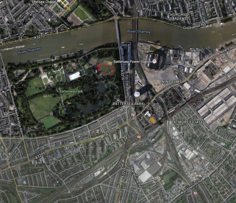
Battersea
Note the position of Battersea Power station to the East of the railway lines crossing the Thames into Victoria station.
The three stations shown are from North to South.
- Battersea Park, which is on the Brighton Main Line between Victoria and Clapham Junction stations.
- Queenstown Road is on the lines into Waterloo.
- Wandsworth Road is a London Overground station on the South London Line.
Battersea station will sit somewhere to the South West of the Power Station.
This Google Map shows the area in more detail.
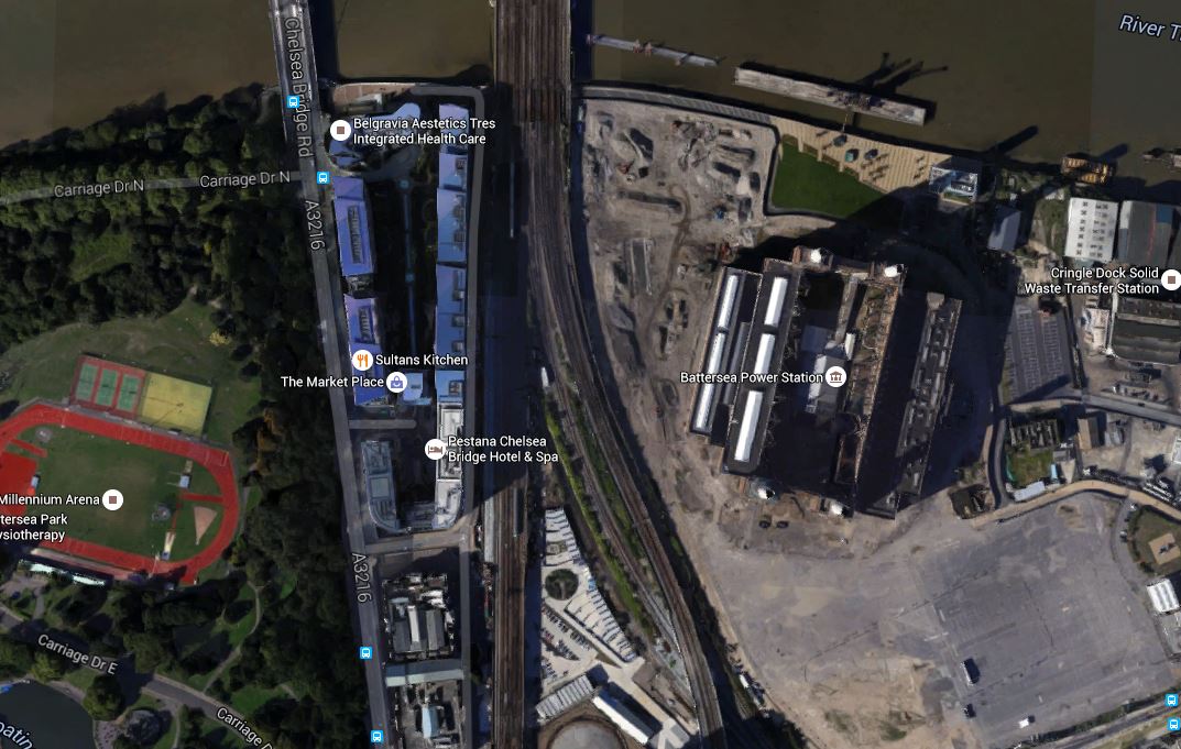
The Location Of Battersea Station
Given that there is a redesign at Battersea, that I wrote about in Is A Big Row Developing Over The Northern Line Extension?, I have this feeling that a new Battersea station might be part of the solution. If Transport for London are having to foot the bill for a stronger station box, then connecting it to a new station on the Southeastern lines might generate traffic, that would create some income.
If the Improved South London Line proposed by Centre for London is built, then the new Battersea station will be conveniently between Victoria and Wandsworth Road stations.
- It would link the Northern Line to the Southeastern lines.
- It would improve journeys between South and South East London to Central London.
According to several theories, you can’t have too many stations.
A Tunnel Under Brixton
In the June 2016 Edition of Modern Railways in an article entitled Turning South London Orange.
One of the proposals is to create a tunnel under Brixton to cut out the need for fast Sutheastern services to cross Thameslink services on the level at Herne Hill.
The map from carto.metro.free.fr, shows the current lines between Battersea and Herne Hill.
Battersea To Herne Hill
This crossing should surely have been sorted years ago, as it must be a severe bottleneck in the running of Thameslink services. It must be like having road-works controlled by traffic lights, where the M1 joins the M6. I wrote about the problems in Herne Hill Station.
Network Rail’s plan involved turning all Sutton Loop Line services at Blackfriars to ease the problem of getting the trains through the Thameslink tunnel efficiently, but politicians squashed that!
The Northern end of the tunnel would be in the Battersea railway lands North of Wandsworth Road station.
This Google Map shows the area.

North End Of Brixton Tunnel
The Southeastern lines come from Victoria and pass the Battersea Power station site on its Western side, before passing over the wide swath of lines going into Waterloo.
Fast services from Victoria to Kent would go straight into the tunnel, which would have its Northern portal somewhere between the power station and Wandsworth Road station.
Given there are proposals in the Centre for London report, for a new station at Battersea linked to the Northern Line Extension, it all seems to fit together fairly well.
A big winner could be the Battersea Bogs Home, as some of their space might be needed, but then organisations like that are much easier to deal with than irate home or business owners. I could see the charity ending up with some very good premises over the tunnel portal.
The Southern end of the tunnel would be between Herne Hill and West Dulwich stations.
This Google Map shows the area.

South End Of Brixton Tunnel
The Southern portal would be in the area, where the two railway lines cross to the North-West of the sports grounds.
It would seem with all the green space, that building the tunnel portal in the area would be easy.
But much of the land is owned by Dulwich College and they are not the most co-operative of neighbours according to various articles I’ve read.
So it would appear that the politics and public relations of a tunnel under Brixton could be much more difficult than the actual engineering.
The Centre for London report, doesn’t say much about the actual design of the tunnel, but it could be assumed that it would be a five-kilometre double-track tunnel, with or without low-level platforms beneath Herne Hill station. As none of the fast services currently stop at Herne Hill station, I would suspect that nothing more than provision for the platforms will be provided.
There will be various benefits of the tunnel.
- Eliminating the need for Thameslink services to cross the fast Southeastern services, must give benefit to both operators with respect to the robustness of services.
- Lengthening of platforms at Herne Hill will now be possible, which would allow longer trains on overcrowded services.
- Fast services would be removed from the lines through Wandsworth Road and Clapham High Street stations, allowing expansion of services on a reconfigured South London Line.
- Herne Hill station could get six ten-car trains per hour into Victoria calling at Brixton, Wandsworth Road, Clapham High Street and the new Battersea stations for the Northern Line.
It also has to be asked, if the tunnel, which would increase capacity on the Sutton Loop Line, might help with the problems of building Crossrail 2 through Wimbledon.
The other question that has to be asked is how does this all fit in with Transport for London’s possible plans to create a loop on the Victoria Line to serve Herne Hill station, which I wrote about in Will The Victoria Line Go To Herne Hill?
I think this proposal could be an idea, that could improve rail services substantially in this part of South London.
Proposed New Stations And Interchanges In South London
In the June 2016 Edition of Modern Railways in an article entitled Turning South London Orange.
In the article, there is a table of Station and Interchange Proposals. I will list them in order.
Battersea
Battersea station is proposed to have platforms on the Southeastern lines into Victoria, close to the Dogs’ Home, that will adjoin the new Battersea Power Station station on the Northern Line extension.
As this station appears to be crucial to a lot of the Centre for London reports proposals, I have given the new station its own post called A New Station For Battersea.
Beddington
Beddington station is proposed between Wallington and Waddon stations on the line between West Croydon and Sutton stations.
I don’t this area well, but here’s a Google Map between Wallington and Waddon stations.
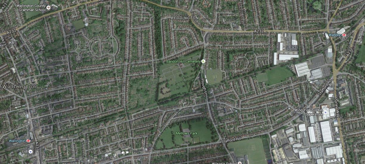
Proposed Beddington Station
According to the Centre for London report, there is a long gap between stations and there has been a loot of development in the area.
The rail line runs across the middle of the map and the station is proposed for Plough Lane, South of Bandon Hill Cemetery.
Brixton
One of the proposals in the article is to create an improved station at Brixton, by reopening disused platforms on the Northernmost tracks at the station.
I have written this a separate post at An Improved Station For Brixton
Brockley
The article proposes a new pair of platforms on the South London Line between Nunhead and Lewisham stations, providing interchange with the existing Brockley station.
I gave my views on Brockley station in A Report On The Bakerloo Line Extension, which I now repeat.
This Google Map shows Brockley station.
Brockley Station
The Bexleyheath Line between Nunhead and Lewisham stations crosses the East London Line and Brockley station at a high level.
I wrote A Four-Poster Station about connecting these two lines.
It would appear that Transport for London have advanced this project from one word in their 2050 Infrastructure Plan to a proposal.
This is the sort of connectivity, that us plebs in Dalston will like a lot. From 2018, as I wrote in Increased Frequencies on the East London Line, there will be ten services per hour between Dalston Junction and Brockley stations and one change at Brockley, will open up many transport opportunities.
Camberwell
Camberwell station is a new station on the Thameslink Line between Elephant and Castle and Loughborough Junction stations.
This Google Map shows the area around the disused Camberwell station.

Camberwell Station
Camberwell station used to be where Camberwell New Road crosses under the railway.
Wikipedia has a section about the re-opening of the station. This is said.
In March 2016 it was reported by Transport for London that proposals to re-open the station are being considered with other stakeholders, including the London Borough of Southwark. Initial feasibility indicates it would be possible to construct a modern station on the site if timetables could be modified to accommodate Camberwell as an additional stop. TfL will be working with Network Rail and the boroughs of Southwark and Lambeth to further develop the feasibility of this proposal.
I would also suspect that being able to open a new Camberwell station, at the same time as Thameslink, would be very easy to justify on a costs basis.
Clapham East
Clapham East station is proposed to be half a mile North-East of Clapham Junction station on the East London Line.
As this station is a new proposal and hasn’t come to my notice before, I have given the new station its own post called A New Station For Clapham East.
Clapham High Street And Wandsworth Road
The report suggests putting platforms at Clapham High Street and Wandsworth Road stations on the Southeastern tracks to enable a direct service to Victoria to be reinstated.
I have dealt with these two stations in Improvements To Clapham High Street And Wandsworth Road Stations.
Imperial Wharf
There is an interesting proposal to put a footpath over the Thames to give access to Imperial Wharf station from the South Bank.
This Google Map shows the station and the Thames.
Why not build the footpath?
New Cross
New Cross station is just over five hundred metres from New Cross Gate station. This Google Map shows both stations.
New Cross Gate And New Cross Stations
The Centre for London is proposing stopping East London Line services to New Cross, increasing service to New Cross Gate and building a travolator between the two stations. They say this in the report.
The proposal is to build an underground travolator between New Cross, Goldsmiths College and New Cross Gate interchange. At New Cross Gate a more frequent train service would be available on the ELL and existing Southern route. This would be a practical alternative linking the Southeastern and South Central networks, and it would also create Southeastern lines access via New Cross to the proposed Bakerloo station at New Cross Gate, for those trains which avoided Lewisham.
It is an interesting solution, that possibly could be used in many places.
