Thank You Transport for London
On the 31st May 2015, Transport for London take over the lines out of Liverpool Street to Enfield Town, Cheshunt, Chingford and Shenfield and two days ago they published this press release on their web site, which is entitled Passengers set to benefit as key commuter rail services transfer to TfL.
So what does that mean?
1. The services currently operate with National Rail pay as you go fares, which are generally higher than TfL fares. When services transfer, over 80 per cent of current rail journeys will reduce in price and TfL concessions will apply – giving customers substantial savings. The remaining 20 per cent of fares will remain unchanged.
2. All TfL concessions and discounts that currently apply to London Underground, the Docklands Light Railway, and London Overground will apply on the rail services transferring to TfL. I think that means I can travel free to Brentwood and Shenfield using my Freedom Pass.
3. There are a few other technical things that seem beneficial, like Brentwood being moved into Zone 9.
4. I suspect too, that the level of customer service will be better under TfL than Abellio Greater Anglia.
I can’t see any average passengers complaining about this package. Except perhaps those who commute on lines like c2c into London, where there are no fare reductions.
So it’s probably a big thank you to Transport for London.
Accessible Crossrail Sites
By accessible in this article, I don’t mean construction sites, where anybody could go and get around no matter what disability they have, but ones where anybody who could walk at least a few steps or be pushed in a wheel-chair can go to have a good look at the progress of London’s largest construction project.
Some sites worth visiting are stations, that are being rebuilt, at the same time as being fully operational.
Abbey Wood Station – Quite a large modern station is being created.
Hanwell Station – A Victorian gem is being improved and modernised.
Custom House Station – A new station is being built by the DLR station
Whitechapel – A massive project to create the Jewel of the East
There are also other places, where you can see a lot.
Eynsham Drive Bridge in Abbey Wood – It is over the top of the work at Abbey Wood.
Pudding Mill Lane DLR Station – In the middle of a Crossrail portal.
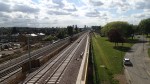
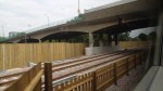
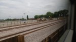
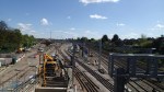
Crossrail Works At Abbey Wood Station
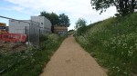
After taking the pictures from the Eynsham Road Bridge, I walked back to Abbey Road station taking pictures as I walked and crossed the line on a rusty footbridge.
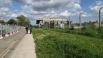
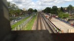


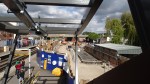
As the pictures show, there’s not much left of the original station. On the other hand, the contractors seem to be doing a good job of rebuilding a station, which is still being fully used by passengers.
It’s still not totally clear to me, where the tracks and platforms will go in Abbey Wood station. But so long as Crossrail and its contractors know, who cares?
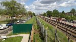
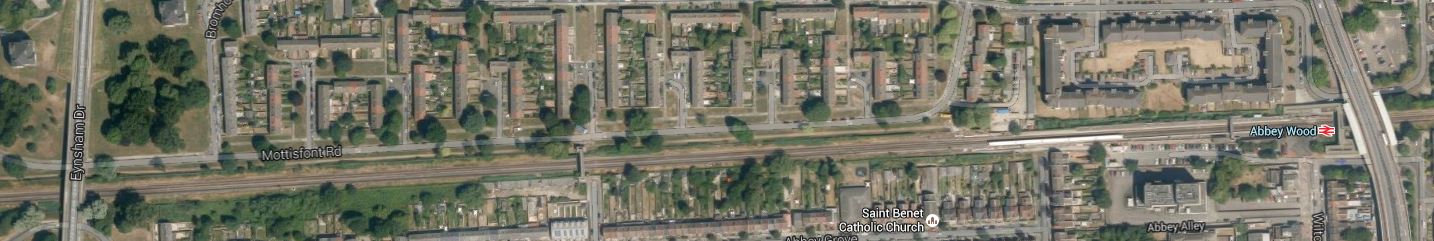
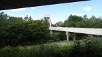
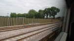
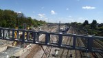
Crossrail Works From Eynsham Drive Bridge, Abbey Wood
Just to the East of Abbey Wood station a bridge carries Eynsham Drive over the North Kent Line and the new Crossrail tracks. This Google Earth image shows the area.
Eynsham Drive To Abbey Wood Station
I took these pictures of and from the road bridge.
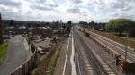


The Crossrail tracks are the ones with no third conductor rail and they are on the North side.
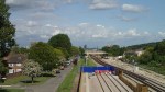
Walking To The Eynsham Drive Bridge At Abbey Wood
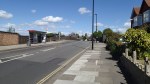
My walk yesterday to take the pictures of Crossrail at Eynsham Drive and Abbey Wood station started at Plumstead station, where I crossed the High Street and then found the end of the Ridgeway, which is on top of the Southern Outfall Sewer. I took these pictures as I walked to Harrow Manor Way, that led into Abbey Wood, where I turned off into Eynsham Drive..

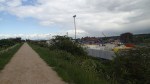


It is mostly, a typical estuarial industrial landscape with a quantity of uninspiring housing, although the space between the Ridgeway and the rail lines is going to be transformed, as Crossrail sidings are being built here.
You can understand why Stanley Kubrick shot Clockwork Orange in the area.
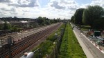
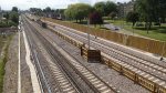
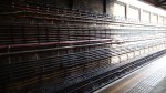
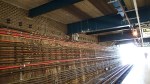
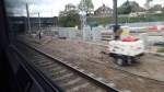
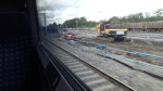
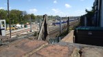
Track Laying At Abbey Wood
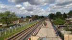
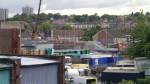
The Crossrail contractors have started laying the track between Abbey Wood station and the Plumstead portal.


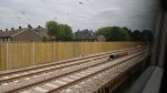
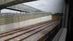

The first picture was taken from the bridge at Abbey Wood station looking towards Plumstead shows the kink in the North Kent Line, as it shifts to the right.
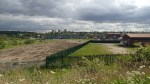
It would appear that the new Abbey Wood station has two island platforms, with the one on the Southern side serving the existing North Kent Line and the other on the Northern side giving two platforms for Crossrail. So it looks like the current platforms 1 and 2, will become 2 and 3.
Correct me, if I’ve got this wrong!
It will be an interesting site to watch in the next few years.
Walking From The Museum Of London To Liverpool Street
I walked today from the Museum of London to Liverpool Street, looking for evidence of Crossrail and the area’s rich history.


Unfortunately, Crossrail has closed the archaeological site at Liverpool Street station, so they can start building the new station. So if you’ve not seen it, then you’ll have to make do with my pictures.
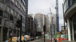
London Wall Place looks to be a quality development, that will sit over Crossrail’s Big Hole in the Barbican. I clipped this picture from their gallery, where it is one of several very informative images.

London Wall Place
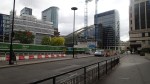
From the picture, it would appear that the walkways that have been removed that connected the flats in the Barbican to walking routes to the Bank and the south, are being recreated.
It’s certainly a lot better than the dreadful square office blocks that used to line London Wall, when I lived in the Barbican in the 1970s.
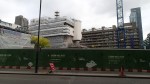
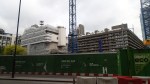
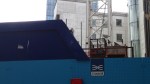
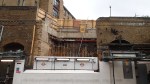
Crossrail’s Big Hole In The Barbican
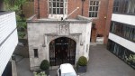
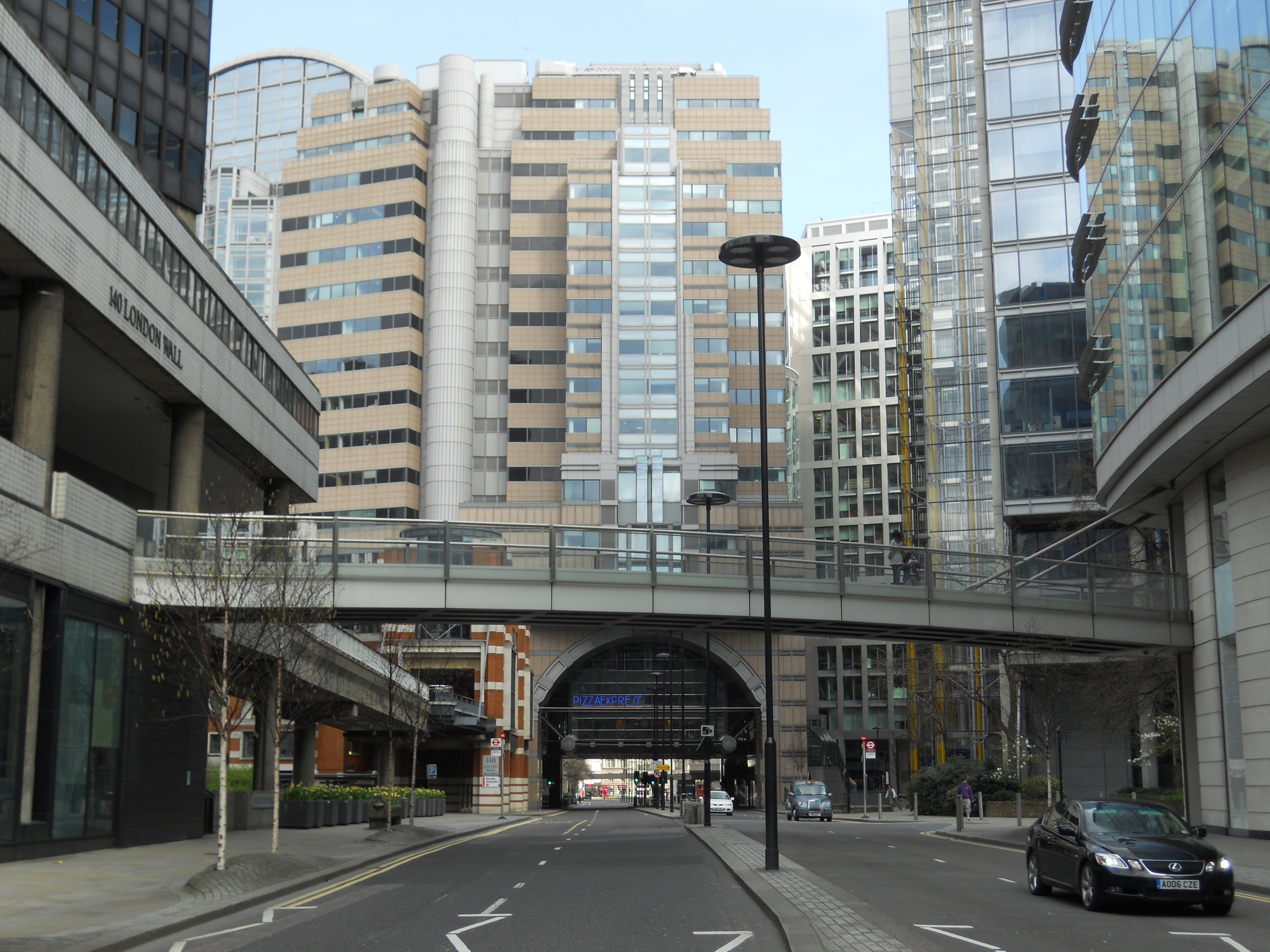
Last night, I went to a lecture about Crossrail in the City of London Girl’s School in the Barbican. It is not an area, I visit often, but I did fulfil one of the ambitions C and myself had had since it was built about twenty years ago. That was to have a meal in the Pizza Express in the building called Alban Gate, that is suspended over London Wall.
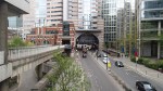
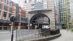
I was surprised to see this big hole in the plaza that ran south of the Barbican to London Wall.

Crossrail’s Big Hole In The Barbican
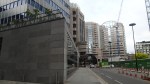
Forty years ago, when I lived in the Barbican, I used to walk across this area and take the bridge that then gave access to streets that led down to Bank, where I worked as a consultant on costing software. The buildings in this area were a group of rather unlovely office blocks, that only demolition would improve. I did find this picture taken five years ago, which shows London Wall in a picture set I uploaded, entitled Going Back to the Barbican.
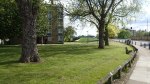
This Google Earth image shows the Barbican.
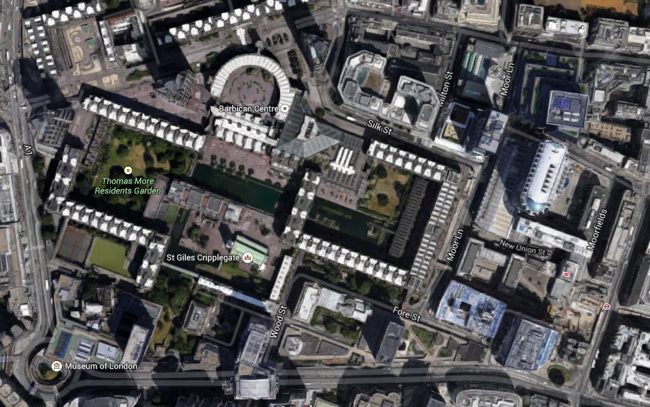
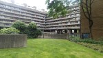
Barbican Estate
We used to live in Cromwell Tower, which is to the north of the estate. It is a triangular tower to the north-east of the semi-circular building, which is above the Barbican Centre. The dual-carriageway road at the bottom is London Wall, with Alban Gate about halway along and the Myseum of London at the western end.
The hole shown in my picture doesn’t seem to have been created, but is between Alban Gate and the distinctive Moor House, which is near to the stations at Moorgate.
Sometimes, when I look at the Barbican, I wish that I’d moved there five years ago. Especially as now, I tend to live a simple life at home, that needs just one good bed, a kitchen and good television, broadband and transport links.
I suppose I could always move! But I’ve never been one for that! I just prefer and like updating properties.
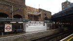
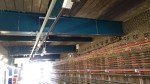
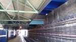
Whitechapel Station Is Emerging
As I came through Whitechapel station, I took these pictures.

In the next phase of the development the following will happen.
1. The current entrance in the front of the station will be closed for reconstruction and temporary access will be from the rear in Durward Street.
2. The two Metropolitan/District Line platforms will become one with a platform face down each side and it looks like this is happening now. Later escalators will appear in the middle to take passengers up and down to Crossrail.
3. The Overground platforms will be generally accessed from the other end fom the new footbridge.
It also looks like they are in need of a gang or two of high-class brickies.
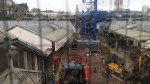
Acton Dive-Under
On my way to West Drayton yesterday, I went past the site of the Acton Dive Under, where a short tunnel is being built so that freight trains can get into and out of Acton Yard. This Google Earth image shows the area.
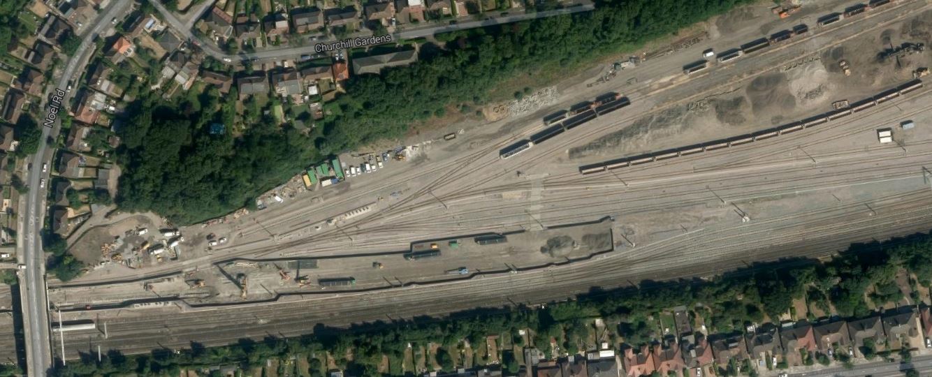
Acton Dive Under
I think that the fenced off area by the bridge over the Great Western Main Line is the work site for the dive under.
This page on the Volkerrail web site gives full details. This links to an excellent pictorial brochure about this project. This page in the brochure shows the track layouts.
I took a few pictures yesterday as the train sped through.
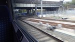

But I didn’t see much! Today, I went to the bridge on Noel Road and poked my camera over the wall.
You can see the short tunnel in some of the pictures and it would be interesting to return with a camera on a stick or a very tall photographer.
I got there on a northbound 440 bus to Lynton Road, which is close to the bridge. Afterwards, I walked to West Acton station to get a Central Line back to London.
What didn’t help either was the fact that the 440 bus is a single-decker.
