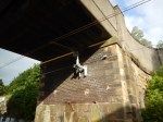
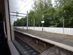
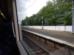
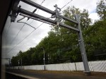
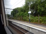
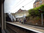
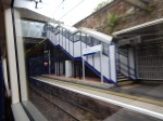
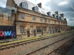
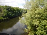
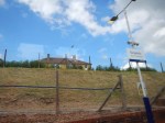
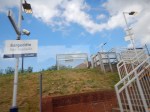
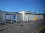
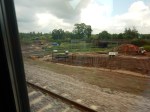
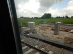
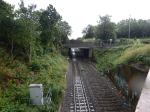
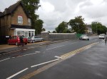
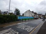
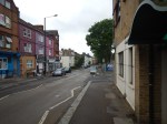
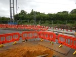
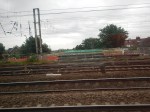
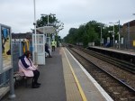
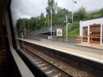
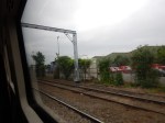
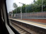
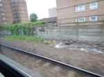
Glasgow Queen Street Station – 18th June 2016
I took these pictures of Glasgow Queen Street station.
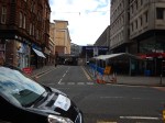
I suspect that when they have finished the station it will be rather different.
Mystery Tours Of Glasgow
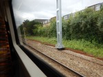
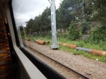
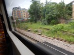
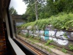
On Saturday, I was staying at Stirling near to the station and wanted to get to Glasgow to have a look at the closure of Queen Street station, for upgrading Queen Street Tunnel, platform lengthening and electrification work.
This article on Network Rail’s web site, which is entitled Glasgow Queen Street Tunnel upgrade, says this.
The work is starting just before the Easter bank holiday weekend, and lasting much longer, with a 20-week closure of the high-level Glasgow Queen Street Tunnel from Sunday 20 March to Monday 8 August so that the concrete slab track inside the tunnel can be renewed safely.
It’s the largest piece of engineering on the Edinburgh to Glasgow line since the railway was built. Renewing more than 1,800 metres of slab will mean 10,000 tonnes of existing concrete slab will be removed, as well as 4,000 metres of new rails laid, and more than 150 staff will be working on the project every day during the 140-day period.
A lot of other work will also be done at the same time.
So Network Rail and Scotrail have called up the spirit of Baldrick, and devised a cunning plan. This map shows the rail lines in the Glasgow area.
Glasgow Rail Lines
My route in from Stirling to the low-level platform at Queen Street was something like.
- Larbert
- Croy
- Lenzie
- Bishopbriggs
- Springburn
- Duke Street
- Belgrove
- High Street
Coming back from Glasgow Central, the route was something like.
- Mount Vernon
- Bargewddie
- Kirkwood
- Coatbridge Central
- Cumbernauld
Although the train didn’t stop until Stirling.
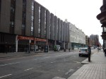
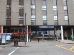
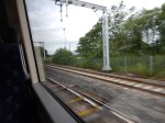
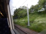
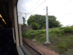
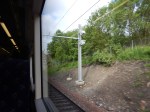
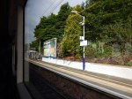
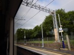
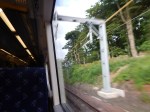
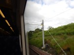
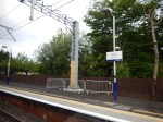
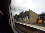
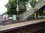
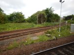
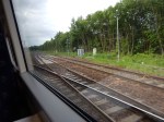
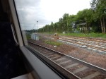
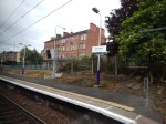
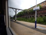
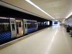
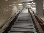
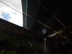
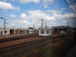
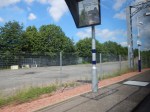
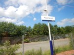
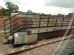
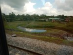
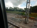
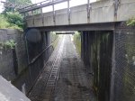
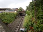
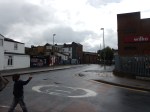
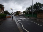
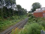
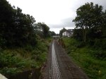
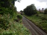
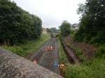
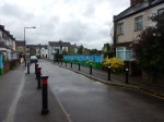
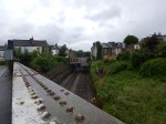
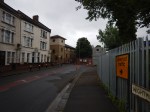
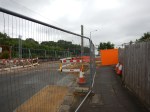
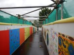
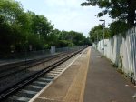
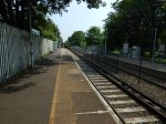
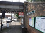
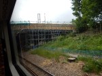
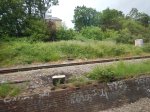
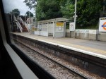
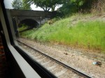
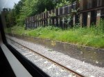
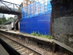
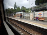
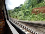
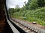
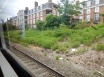
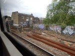
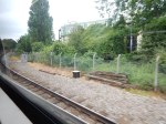
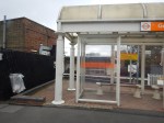
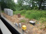
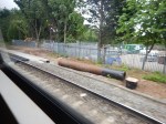
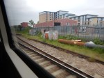
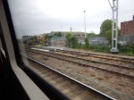
These are some pictures taken on the Jouney into Glasgow


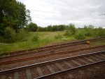


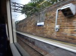

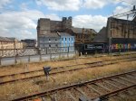
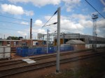
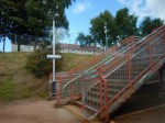
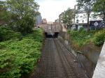
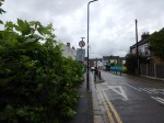
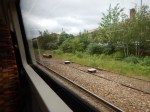
And these were taken on the way out.


It certainly seems there are more wayus of moving trains through Glasgow, than most other cities.
You almost wonder looking at these pictures and the routes that I took, that Network Rail and Scotrail have an alternative philosophy.
- Most platforms seem to have been lengthened to at least eight cars, which mean they’ll handle two Class 385 trains coupled together.
- Most of the lines through Glasgow seem to either be electrified or seem to be having wires installed.
- It should be noted that the route I took back to Stirling, would also enable a service to be run from Carlisle to Perth via Motherwell, Coatbridge, Cumbernauld and Stirling.
- Once, the TransPennine routes are electrified, Manchester to Edinburgh can go up the East Coast.
- Are Network Rail going to apply some of the innovative interchange philosophy I wrote about in Better East-West Train Services Across Suffolk?
If electric trains can get everywhere and they are twice the capacity of the current diesel trains, then mathematics and scheduling rules, says you can get more trains through the system.
So could they be looking to increase the capacity of the two Glasgow stations and open up circular routes between them?
I don’t know the answer, but I do believe that when the EGIP program is complete, it will be interesting to see if more passengers are able to use the trains. What is being done is very different to previous proposals.
The New Norton Bridge Junction In Action
I was travelling between Birmingham New Street and Manchester Piccadilly stations on a Cross-Country train.
After leaving Stafford station, the train took the new route through Norton Bridge Junction on the flyover over the West Coast Main Line to j0in the line to Manchester. The Norton Bridge page on the Network Rail web site, links to this map.
The New Norton Bridge Junction
Trains continuing up the West Coast Main Line take the black route, whereas trains to and from Manchester use the orange line and the branch to the North-East.
This pictures show my progression threough the junction.
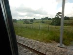
I was sitting on the right side of the train.
It looks like the new route is being electrified.
Would this mean that an electrified service could be run on the following route?
- Euston
- Birmingham International
- Birmingham New Street
- Wolverhampton
- Stafford
- Stoke-on-Trent
- Manchester Piccadilly
- Preston
- Carlisle
- Glasgow/Edinburgh
There is also a current electrified route, using the Crewe to Manchester Line and the Styal Line.
- Wolverhampton
- Crewe
- Manchester Airport
- Manchester Piccadilly
Throw in the Ordsall Chord and I suspect that Virgin Trains, TransPennine and Northern Rail have been looking at their traffic, to see if the reconfigured and electrified Norton Bridge Junction could be to their and Manchester Airport’s advantage.
It should also be pointed out, that much of the line from Preston to Crewe, Stoke and Stafford will have line speeds of on or about 100 mph and the new generation of trains like Aventras, Class 700s and Class 800s will be able to take advantage.
It seems to me, that the Norton Bridge Junction and Orsall Chord projects at £250 million according to this document and £85 million according to Wikipedia, respectively, will help to improve services all along the corridor from Preston to Rugby via Manchester, Manchester Airport, Wolverhampton, Birmingham and Coventry.
Only when you take a train from Birmingham to Manchester and look seriously at Norton Bridge Junction, do you realise its significance.
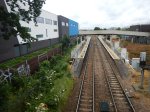
The Bridges Of Walthamstow
I have been meaning for some time to walk the route of the Gospel Oak to Barking Line (GOBlin) between Walthamstow Central station in Selborne Road to Blackhorse Road station.
But now the line is closed for electrification work, I thought it would be an appropriate time to do it, taking photographs as I walked.


To cross all the bridges, I was constantly doubling back on myself, using a route of.
- West on Selborne Road.
- Right onto Vernon Road
- Left onto Walthamstow High Street
- Right onto Palmerston Road
- Left onto Northcote Road
- Right onto Pretoria Avenue
- Right onto Warner Road and back to Northcote Road
- Left onto Palmerston Road
- Left onto Walpole Road, Suffolk Park Road and The Links
- Right onto Pretoria Road
- Left onto Forest Road
After a short detour to look at the bridge on Blackhorse Road, I arrived at the station, where I took a bus alongside of the GOBlin to Tottenham Hale station.
This Google Map shows Walthamstow Central and Blackhorse Road stations, and the portion of the GOBlin in the area.
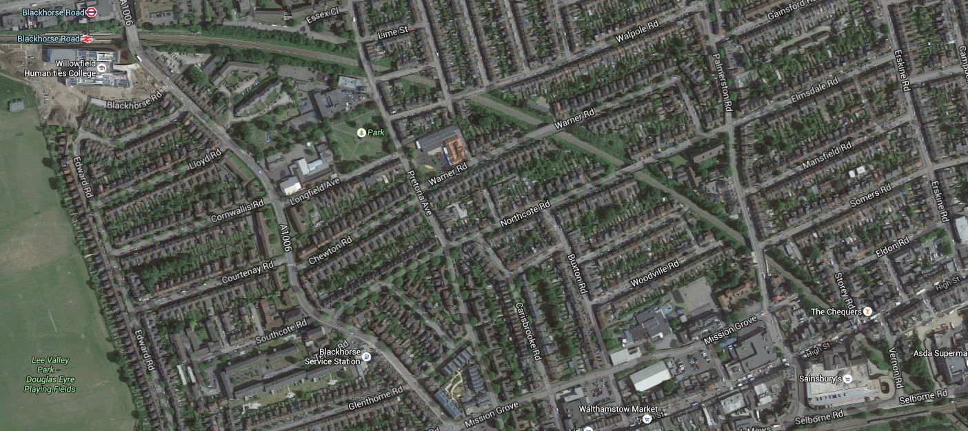
The Bridges Of Walthamstow
Note in both the photographs and the map.
- There are eleven bridges including those at Blackhorse Road and Selborne Road.
- Most seem to be in good condition, with Palmerston Road having been recently replaced and others looking as if they have been thoroughly refurbished.
- Only Suffolk Park Road and Stoneydown Avenue Bridges have restrictions on access.
- It would appear that the track going towards Blackhorse Road has been lifted and laying of new track has started at that end.
- There does appear to be some new sheet piling to stabilise the cutting.
- There is ample space on both sides of this section of the line to erect the masts and gantries for the overhead wires.
- I wonder what William Morris would think of the bridge designs.
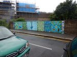
- I can’t find any information on whether more work needs to be done on the bridge at Suffolk Park Road, except a mention of new public art from 2015.
So in this section at least, it doesn’t appear that there’ll be much problem putting up the overhead wires for the electrification.
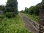
Alongside The GOBlin – June 14th 2016
I took these pictures of the Gospel Oak to Barking Line from the top of a 123 bus going between Blackhorse Road and Tottenham Hale stations.


This bus ride will be an easy way to ascertain progress on the electrification.
Nothing much seems to be happening yet!
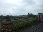
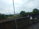
Wightman Road Bridge Is Falling Down
I went to IKEA this morning on a 341 bus (As one does?) and the area around Harringay Green Lanes station.was locked solid.
A quick check on the Internetfrom my phone, told me that Wightman Road is closed.
This Google Map shows the area between Harringay Green Lanes station and Harringay station.
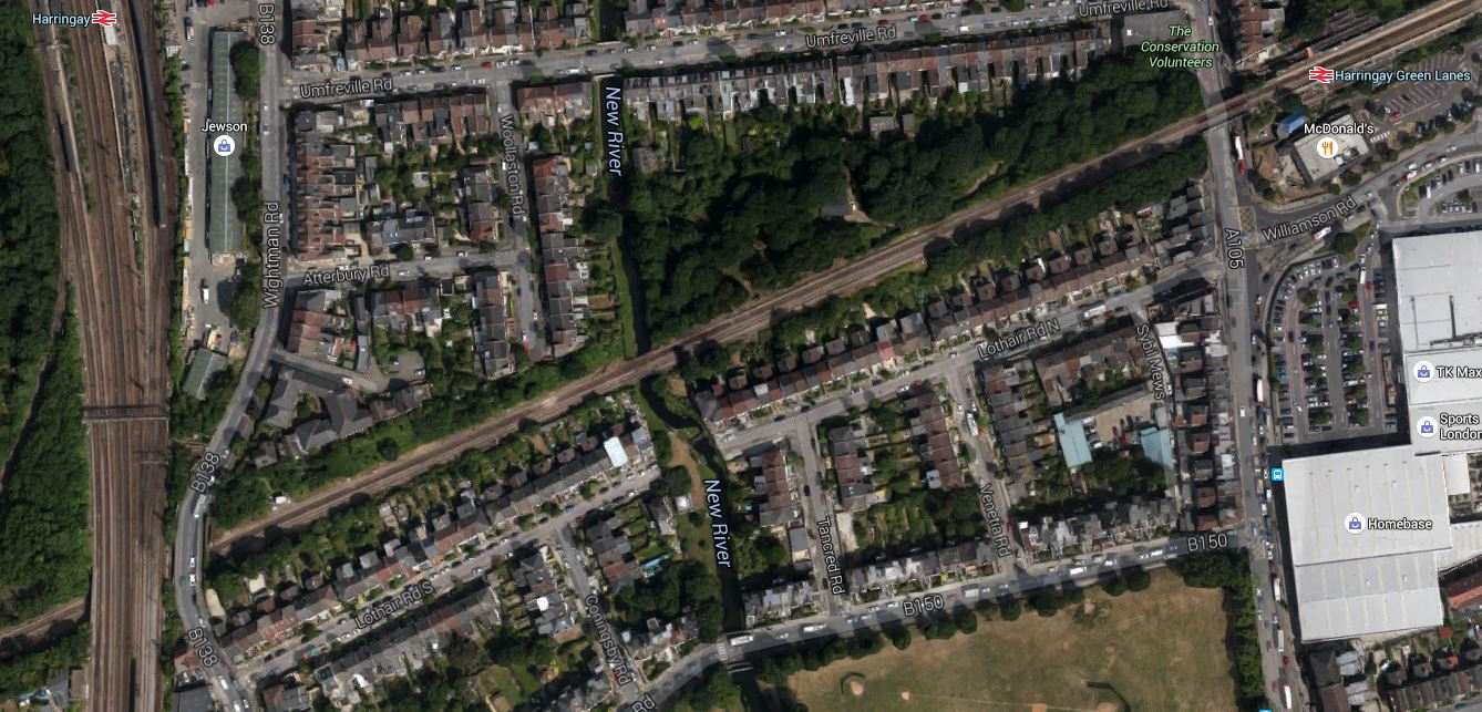
Wightman Road Bridge
If you follow the Gospel Oak to Barking Line (GOBlin) westward from Harringay Green Lanes station, you come to the important bridge where the East Coast Main Line goes over the GOBlin. To the East of this bridge is a road bridge that takes Wightman Road, which is a major route numbered B138 over the railway.
This would appear to be the bridge that is causing the trouble.
I can only find one authorative document on the web and that is this page on the Haringey Council web site, which is entitled Bridge Reconstruction Work in Wightman Road. This is said.
Work is under way to replace the defective bridge over the railway lines on Wightman Road. The bridge is showing signs of severe deterioration. Network Rail are carrying out the work to coincide with the closure of the Gospel Oak-Barking line, which is undergoing electrification. Both projects are being carried out at the same time to help minimise transport disruption.
The main construction work will run from March to September 2016. While every effort will be made to minimize disruption to traffic, there will be a period when complete road closure will be unavoidable. A temporary footbridge will be put in place to provide access for pedestrians and cyclists while the work is in progress.
Incidentally,. I’ve not heard anything on the news or seen anything in the papers. When I checked a few minutes ago, there was nothing I could find on the Transport for London or Network Rail web sites.
So is this another case of Network Rail not giving the truth about bad problems in the hope they’ll not be spotted?
Or do they think that informing the general public is not important?
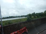
These are some pictures, I took at a visit to the bridge on a quiet Sunday morning.


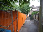


There’s certainly more useful infrormation at the bridge site, than on the web.
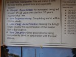
One notice labelled Wightman Road Overbridge says this.
- What: The existing Wightman Road Overbridge is to be demolished to bridge abutments to enable a complete bridge reconstruction.
- When: The construction phase is due to start in March 2016 and run until September 2016.
- Installation of scaffold walkway and access platform planned for March 2016.
- Diversion of services and removal of road surface are planned for April 2016 & May 2016.
- Removal of existing highway and bridge is planned for June & July 2016.
- Installation of new bridge deck planned for July 2016.
- Reinstatement of the highway, VRS and services is planned for July & August 2016.
- Why: The Wightman Road Overbridge is now at the end of its design life.In 2005 the structure was assessed and it was decided to renew the life-expired structure to modern-day standards.
A second notice says this.
- Improved Road Profile: This will make it safer for road traffic, pedestrians and especially cyclists.
- Lifespan of New Bridge: An increased design lifespan of 125 years with the first 25 years maintenance free.
- Save Taxpayer Money: Completing works within GOB blockade.
- Less Energy Use And Pollution: Raising the bridge height to allow for electrification of the Gospel Oak to Barking Line.
- Save Disruption: Other groundworks being completed by LBHC in conjunction with the road closure.
The pictures show that good progress appears to be being made. It would appear that services are being diverted, but that the original road surface is still in place. There were also notices prominently displayed saying that on the weekends of the 25th June and 2nd July the pedestrian walkway would be closed, as a crane would be working. Could this be when the old bridge is lifted out and the new one is lifted in?
Let’s face it, 125 year old bridges do get tired! The bridges at Upper Holloway, South Tottenham and Highbury and Islington stations have all been or are being replaced!
I do wonder, if the urgent need to replace this bridge might explain the progress on the GOBlin electrification. Network Rail and Murphys seemed to have had a simple plan, which was proceeding in the early months of 2016. Then they found they needed a six month closure of the railway to replace the Wightman Road bridge and that blew a big hole right through everything.
But that doesn’t explain, why TfL and Network Rail haven’t disclosed the detailed truth to the people of North London!
At least when they’ve replaced the bridge, they’ll have a strong structure that they could use to support the overhead wires.
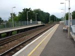
Could Tramlink Use The Heavy Rail Lines In South London?
Look at these pictures, I took at Birkbeck station, where one track is for heavy rail and the other is for London Tramlink.


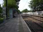

When I took these pictures, I wondered, if it would ease the expansion of the Tramlink network, if trains and trams could share lines.
I am not talking about tram-trains, but more a useful approach to benefit both types of transport.
So lets list the problems.
Rail And Wheel Profile
One of the problems in Sheffield with the introduction of tram-trains is that the rail profile needs to be changed to one that is compatible with the existing trams and the new Class 399 tram-trains.
But to be fair it is a trial and problems will be thrown up.
Platform Height
As someone, who has travelled all over Europe on trams, trains and tram-trains, one of the biggest problem is getting the platform height right, so that everybody including those in wheel-chairs can get on and off easily.
On a scale of five, we generally score about four, but we mustn’t be complacent and I think it will get better.
Some continental countries have problems as their trains have a low step and you step up into the train. This is because traditionally, they had low platforms, whereas for some time, we’ve been aiming for step across.
Karlsruhe has been running tram-trains on their Stadtbahn for over twenty years and are putting in a tunnel to take the tram-trains under the city.
This is said about platform height.
In addition, the platforms of the station’s tunnel will have pedestals that are about 15 metres long with a height of 55 cm above the rail so that the first two doors of Stadtbahn trains will have step-less entry. This will make possible stepless entrance on lines S 4 / S 41 and S 5 / S 51 / S 52 in Karlsruhe for the first time, reflecting a trend that has long been standard elsewhere. The platforms cannot consistently have a height of 55 cm, because the tunnel will be used by trams and DC services of the Stadtbahn, which have an entry level on the modern lines of 34 cm.
If the Germans have to go to that sort of solution, with all their experience, then platform height must be difficult to get right.
I have not heard anything about the platform design at Rotherham Central station, where the platforms must accept trains as different as Pacers and Class 399 tram-trains.
Power Supply
The current trams need overhead power, which with most tram systems is 750 VDC.
So if you want to run Tramlink trams on third-rail lines in South London, you’ll need to put up overhead wires or fit the trams with contact shoes.
It is my view, that for Health and Safety reasons and some design ones too, that running trams using third-rail power will not be practical.
Remember, passengers know they can walk across the tram lines and frequently do, so whatever happens, you don’t want live rails under the trams.
So any rail route, that will be running trams will have to have the 750 VDC overhead supply.
In the Sheffield trial, to extend the Sheffield Supertram, a freight route to Rotherham is being electrified at 750 VDC, rather than the main line standard of 25 KVAC.
Signalling Systems
Rail and tram signalling are different. But after a successful tram-trial in Sheffield, the problems of trams and train sharing the same track, should have risen to the surface.
Rules Of The Tracks
Trams and trains run under different rules.
One main difference is that trams have a maximum speed of 25 mph, whereas trains run at whatever speed the line permits.
So for safety and other reasons, if trams and trains were sharing a length of track, they would have to run under the same set of rules.
I suspect this would mean that the maximum speed would be 25 mph.
In some ways the problems are the equivalent of managing traffic at an airport like Southend, where light aircraft share the runways and airspace with Airbus-319s.
I don’t think it is an insurmountable problem, as two-car diesel multiple units have shared tracks with 125 mph expresses and hevy freight trains for years.
An Ideal Mix Of Trains
So is an ideal solution to use 750 VDC overhead wires for the trams and diesel trains?
Possibly!
But you could always use IPEMUs or EMUs with an on-board battery.
Supposing there is a chord or link line, that would be ideal to be used by trams and say the ubiquitous Electrostars that are popular in South London.
Wires would be put up and all Electrostars using the line, would have to have enough battery capacity to bridge the gap in the track with no electrification.
West Croydon Station
A possible application might be at somewhere like West Croydon station.
The map from carto.metro.free.fr, shows the heavy rail lines through the station and the tram lines around it.
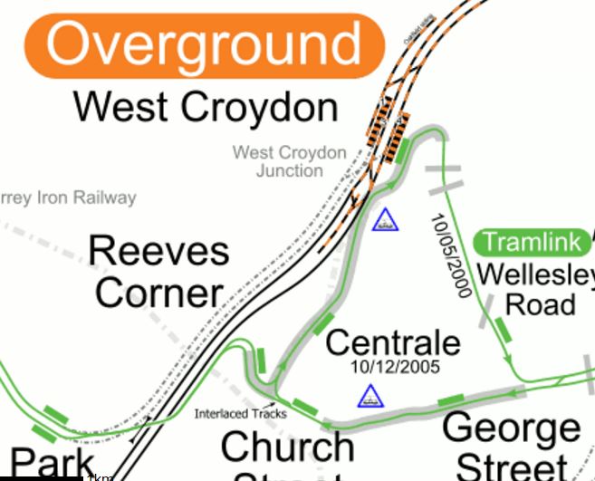
Lines Around West Croydon Station
I’m sure that the engineers in Karlsruhe would have had the trams going through the station to give same-platform interchange to and from trains.
Conclusion
Network Rail has a lot of tools in the box and I think that as technology develops, we’ll see some interesting ideas.
Farewell To The Old Gospel Oak To Barking Line
Today is the last day, that you can ride the Gospel Oak to Barking Line to the East of South Tottenham station, until after the wires are erected in a few months time.
So I took some pictures.


I must say I have not been impressed with progress so far.
- It looks like a large proportion of the piles are in the ground.
- If the piles are in the ground securely, why aren’t more masts erected?
- There would appear to be no start on clearing the platform extensions.
- Only in one place did I see a work-site.
- I didn’t see anyone actually working.
- There is masses of litter
- There’s no sign of how the stations will be electrified.
With my limited experience of looking at large projects that are in trouble, this project has the air of something not being up to scratch.
What has really puzzled me about this project, is that the information coming from Network Rail and especially TfL, has not been up to the usual standard.
The Longest Underwater Electrification In The UK Since The Channel Tunnel
It may only be a tunnel seven kilometres long and a lot shorter than the Channel Tunnel, but the Severn Tunnel has two tracks, which both have to be electrified, so that the Great Western Railway can run electric trains to and from South Wales.
But the Severn Tunnel was built between 1873 and 1886 and it posed various problems during its construction with water ingress and since with operation because of its length, profile and the pumping of constant water. There is a section in Wikipedia, which is called General, which gives more details.
The Severn Tunnel is probably one of those places, sane engineers wouldn’t want to electrify a railway.
So I was interested to read this article in Rail Engineer, which is entitled Preparing For Severn Tunnel Electrification. The article gives this overview of the project.
The electrification project now moves on to probably one of its biggest challenges: the electrification of the 7.012km long Severn Tunnel. The tunnel will be closed to trains between 12 September and 21 October for the work. It is referred to as the “Severn Tunnel Autumn Disruption” or STAD for short and, just to make it a bit more interesting, included in the STAD are the Patchway Tunnels –1.139km Old (Down); 0.057Km Short (Down); 1.609Km New (Up).
Some facts about the tunnel and the work already done.
- More than 76.4 million bricks were used in the construction.
- Between 10 and 20 million gallons of water have had to be extracted every day to prevent flooding.
- There is also a ventilation shaft through which 80,000 cubic feet of fresh air can be forced into the tunnel each minute by means of an eight- metre diameter fan at the top.
- The contractors first had to scarify 2,500 square metres of tunnel lining to remove more than 35 tonnes of soot.
It is not a small job. But at least the tunnel was in better condition than expected.
The article gives a deep insight into how the Severn Tunnel electrification is a collaboration between several major contractors, who are installing a Swiss system from Furrer + Frey called Rigid Overhead Conductor Rail System in the roof of the tunnel. The ROCS system uses a rigid aluminium rail supported on appropriately designed fittings fixed to the roof of the tunnel. There is more on the ROCS system in this article in Rail Technology Magazine.
To makes things more difficult, the engineers have only got thirty-nine days to do the work.
And if it all goes wrong, there are two sets of politicians who will get very angry!
Is The New Bay Platform At West Ealing Opening On August 1st?
I heard a rumour that the new bay platform at West Ealing station was going to open on the first of August, but I have just found a change in the timetable, that could mean that it is true.
If you look at the on-line timetables, you will find the following.
At present the first two trains after 07:00 from Greenford to West Ealing, are the 07:16 and the 07:46, which go on to Paddington in twenty-six minutes.
From the first of August, they are the 07:13 and 07:43 which are shown as only going as far as West Ealing, where you change for Paddington and do the journey in twenty-eight minutes.
The strange thing is that these two trains are the only ones before nine, that require a change for Paddington.
The times of trains from Hayes and Harlington to Paddington appear to change on the first too!
There is also an additional electric service leaving for Hayes and Harlington at 07:18.
Could it be that electric services are starting on the first of August too?
