Historic Church Tower Suspended On Stilts To Make Way For London Skyscraper
The title of this post, is the same as that of this article in The Times.
This is the sub-heading.
The remaining part of the 700-year-old All Hallows Staining, off Fenchurch Street, will be the centrepiece of the public square below Axa’s £1 billion office
These three paragraphs add more details.
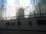
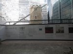
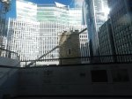
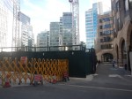
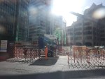
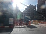
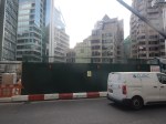
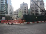
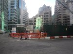
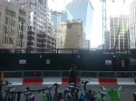
A700-year-old church tower is being suspended on 45ft stilts while developers clear the ground beneath to make way for the City of London’s newest skyscraper.
The tower, which is all that remains of All Hallows Staining close to Fenchurch Street station, is being preserved and will be the centrepiece of the public square at the base of 50 Fenchurch Street — the £1 billion office tower being built by the investment arm of Axa, the French insurer.
More than 125,000 tonnes of earth has been cleared from underneath and around the church — which survived the Great Fire of London in 1666 — into which the foundations will be laid and a basement level built.
The Wikipedia entry for All Hallows Staining, starts with this paragraph.
All Hallows Staining was a Church of England church located at the junction of Mark Lane and Dunster Court in the north-eastern corner of Langbourn ward in the City of London, England, close to Fenchurch Street railway station. All that remains of the church is the tower, built around AD 1320 as part of the second church on the site. Use of the grounds around the church is the subject of the Allhallows Staining Church Act 2010 (c. v).
Note.
- The Wikipedia entry gives a lot of history and other details about the tower.
- It was named “Staining”, which means stone, to distinguish it from the other churches of All Hallows in the City of London, which were wooden.
- The old church survived the Great Fire of London in 1666 but collapsed five years later in 1671.
- The church appears to have been cheaply rebuilt in 1674.
- In 1870 the parish of All Hallows Staining was combined with that of St Olave Hart Street and All Hallows was demolished, leaving only the tower.
- All Hallows Staining seems to have survived World War Two, but St Olave Hart Street suffered serious damage.
- Between 1948 and 1954, when the restored St Olave’s was reopened, a prefabricated church stood on the site of All Hallows Staining. The tower of All Hallows Staining was used as the chancel of the temporary church.
- The remains of All Hallows Staining were designated a Grade I listed building on 4 January 1950.
The tower of All Hallows Staining seems to have a very strong survival instinct.
This web page gives more details of Fifty Fenchurch Street,
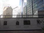
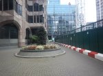
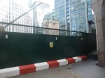
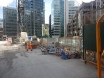
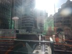
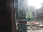
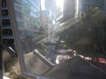
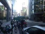
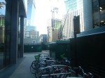
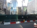
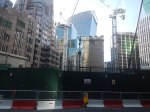
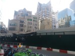
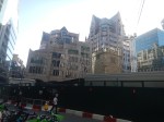
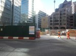
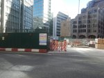
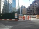
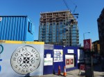
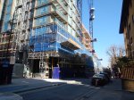
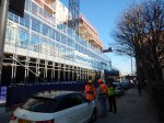
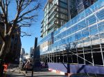
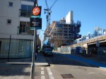
This morning, I went to take some pictures of the tower and the construction site.
Note.
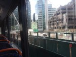
- I walked around the site from the forecourt of Fenchurch Street station.
- The last three pictures were taken from the top deck of a Westbound 25 bus.
- There appears to be no accessible bar or roof-top from which you can look down on the site.
So for the present time, the 25 bus seems to give the best views.
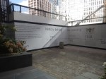
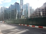
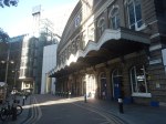
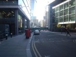
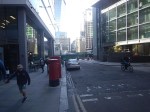
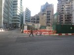
This afternoon, I took a train to Fenchurch Street station and looked at the Eastern and Northern sides of the site.

Note.
- The first picture was taken through the upper windows of the front of Fenchurch Street station.
- I think I might have got a better view out of the window of Fenchurch Street station, if Great Socialist Railways had cleaned the windows.
- In pictures three to nine, the “Walkie-Talkie” towers over All Hallows Staining.
- Some pictures were better than those I took in the morning, as the truck had moved.
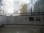
- The last picture shows the sign for the Garden at 120.
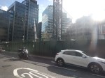
The area isn’t short of geometric shapes to photograph.
Could The Fenchurch Street And Grays Service Be Handed Over To The Elizabeth Line?
Before I discuss the suggestion in the title of this post, I will write down some thoughts.
The Capacity And Connection Problems At Fenchurch Street Station
If you read the Wikipedia entry for Fenchurch Street station, this paragraph sums up some of the problems of the station.
Fenchurch Street is one of the smallest railway terminals in London in terms of platforms, but one of the most intensively operated. It is the only London terminal with no direct interchange with the London Underground. Plans to connect it stalled in the early 1980s because of the lack of progress on the Jubilee line, but it is close to Tower Hill on the Underground and to Tower Gateway on the Docklands Light Railway.
I live in Dalston and if I want to use the services out of Fenchurch Street station to get anywhere it is a struggle.
As all services out of Fenchurch Street station stop at Limehouse, West Ham and Barking stations on the approach into London, I will usually go via either West Ham or Barking stations. As the three services out of Fenchurch Street are each two trains per hour (tph), this can mean a near-thirty minute wait at either West Ham or Barking stations, which at some times of the year are not the most customer-friendly of stations.
More services out of Fenchurch Street station would help to ease the problem, but the station is at capacity and nothing short of a complete rebuild of the station will solve the problems the capacity and connectivity..
There is a section called Future in the Wikipedia entry, where this is said.
There have been proposals to move the station 380 yards to the east to allow the station to expand to 6 platforms, (up from the current 4) and would be built partly on the site of Tower Gateway DLR station, which would likely be permanently closed.
The new station could be built with direct interchange with Tower Hill tube station, which could also have a replacement DLR station for Tower Gateway as Transport for London have looked into closing Tower Gateway and constructing a replacement on the Bank branch to increase capacity.
This project sounds like it would take a long time and cause a lot of disruption and inconvenience. But it would add capacity and connectivity.
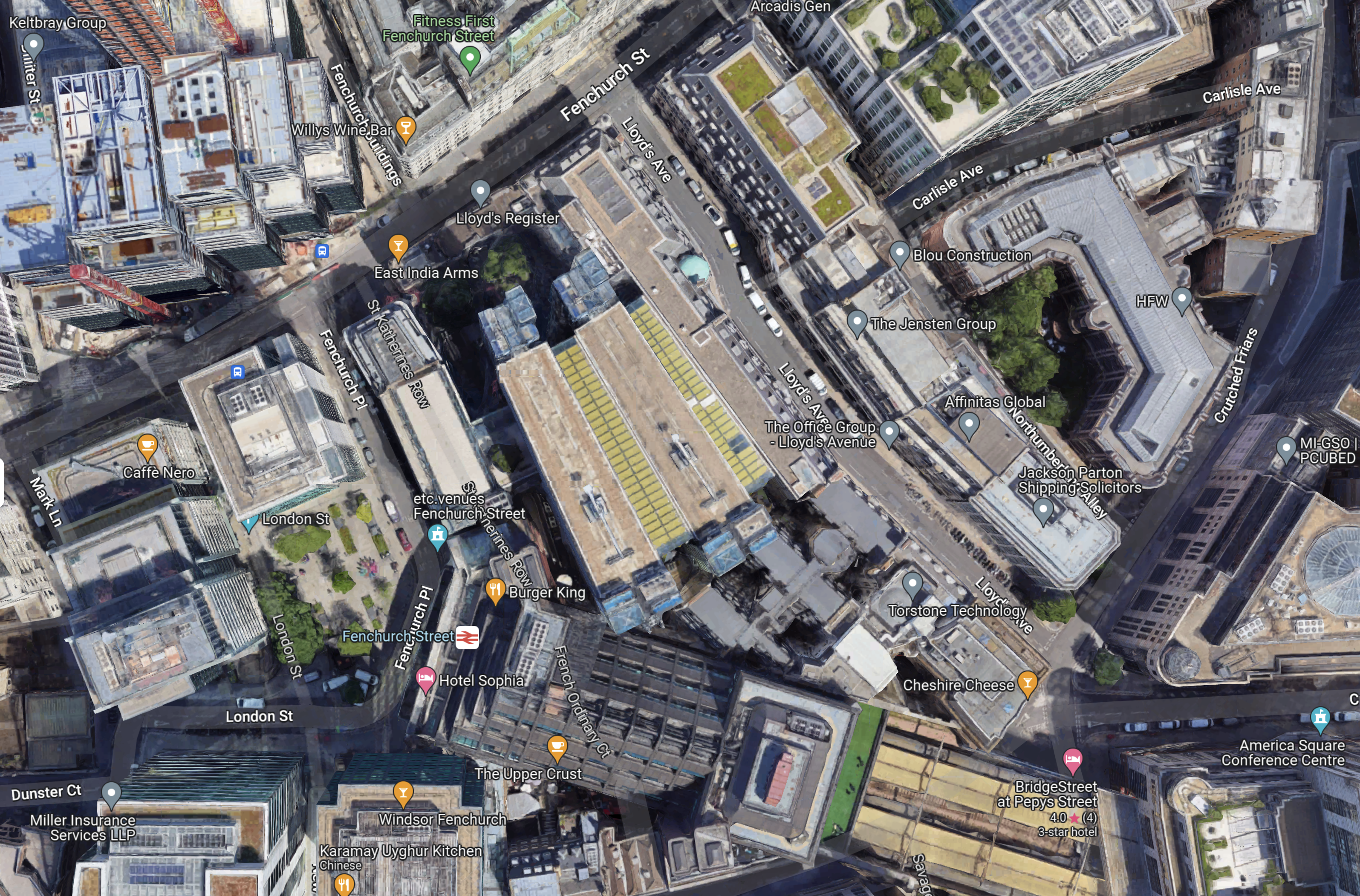
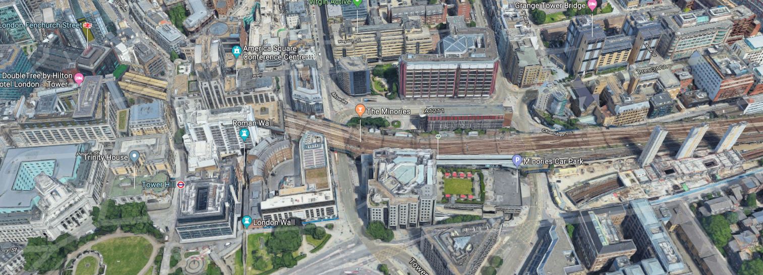
This Google Map shows the location of the station.
Note.
- Fenchurch Street station is towards the bottom of the map in the centre.
- It is completely hemmed in by buildings.
- There is just a small square in front.
I feel it would be very difficult to rebuild a larger station in the same place.
Services Into Fenchurch Street Station
Currently, there are three services into Fenchurch Street station.
- Fenchurch Street and Shoeburyness via Limehouse, West Ham, Barking, Upminster, West Horndon, Laindon, Basildon, Pitsea, Leigh-on-Sea, Chalkwell, Westcliff, Southend Central, Southend East and Thorpe Bay.
- Fenchurch Street and Southend Central via Limehouse, West Ham, Barking, Upminster, Ockendon, Chafford Hundred Lakeside, Grays, Tilbury Town, East Tilbury, Stanford-le-Hope, Pitsea, Leigh-on-Sea, Chalkwell and Westcliff
- Fenchurch Street and Grays via Limehouse, West Ham, Barking, Dagenham Dock, Rainham and Purfleet.
Note.
- All services are two tph.
- All services call at Limehouse, West Ham and Barking.
Each station gets the following frequency of trains.
- Barking – 6 tph
- Basildon – 2 tph
- Benfleet – 2 tph
- Chafford Hundred Lakeside – 2 tph
- Chalkwell – 4 tph
- Dagenham Dock – 2 tph
- East Tilbury – 2 tph
- Grays – 4 tph
- Laindon – 2 tph
- Leigh-in-Sea – 4 tph
- Limehouse – 6 tph
- Ockendon – 2 tph
- Pitsea – 4 tph
- Purfleet – 2 tph
- Rainham – 2 tph
- Southend Central – 4 tph
- Southend East – 2 tph
- Stanford-le-Hope – 2 tph
- Thorpe Bay – 2 tph
- Tilbury Town – 2 tph
- Upminster – 4 tph
- Westcliff – 4 tph
- West Ham – 6 tph
- West Horndon – 2 tph
c2c would appear to be offering a service, that is well-balanced about the stations it serves.
Can Elizabeth Line Trains Reach Barking?
This map from cartometro.com shows Woodgrange Park junction, where the Gospel Oak and Barking Line crosses over the Great Eastern Main Line.
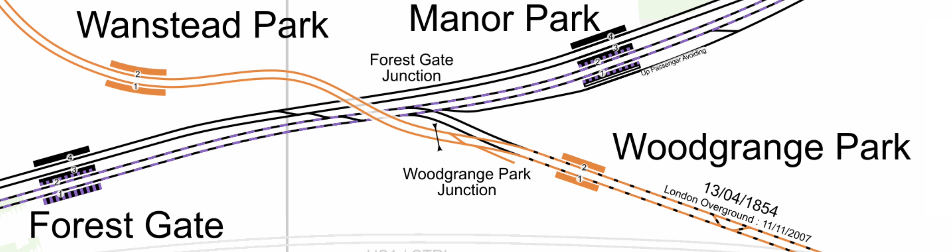
Note.
- The Gospel Oak and Barking Line is shown in orange.
- Gospel Oak station is to the North-West and Barking is to the South-East.
- The Elizabeth Line tracks are shown with a dash of purple.
- It looks to me, that a train on the Elizabeth Line going East could come through Platform 2 in Forest Gate station and then take the Gospel Oak and Barking Line through Platform 2 at Woodgrange Park station.
- It also looks as if trains could go through Platform 1 at both Woodgrange Park and Forest Gate stations to go West on the Elizabeth Line.
I don’t know whether they still do, but c2c trains used to use Woodgrange Park junction to access Liverpool Street station, when Fenchurch Street was closed or at weekends.
At Barking station, they would take the flyover over the station call in Platforms 7 and 8 in the station.
From the Eastern ends of Platforms 7 and 8, trains can use one of three routes.
- The London Overground route to Barking Riverside station.
- The c2c route to Grays via Purfleet.
- The c2c route to Upminster.
Note.
- The platforms at Barking Riverside station are probably too short for the Elizabeth Line trains.
- The Class 345 trains would fit into the bay platforms at Grays and Southend Central.
The simplest thing to do would probably be to divert the two tph between Fenchurch Street and Grays to either Liverpool Street or Paddington at the London end.
Each station would now get the following frequency of trains.
- Barking – 6 tph
- Basildon – 2 tph
- Benfleet – 2 tph
- Chafford Hundred Lakeside – 2 tph
- Chalkwell – 4 tph
- Dagenham Dock – 2 tph
- East Tilbury – 2 tph
- Grays – 4 tph
- Laindon – 2 tph
- Leigh-in-Sea – 4 tph
- Limehouse – 4 tph
- Ockendon – 2 tph
- Pitsea – 4 tph
- Purfleet – 2 tph
- Rainham – 2 tph
- Southend Central – 4 tph
- Southend East – 2 tph
- Stanford-le-Hope – 2 tph
- Thorpe Bay – 2 tph
- Tilbury Town – 2 tph
- Upminster – 4 tph
- Westcliff – 4 tph
- West Ham – 4 tph
- West Horndon – 2 tph
Only Limehouse and West Ham would get fewer trains.
But there would surely, be an extra pair of paths between Fenchurch Street and Barking.
I have also looked at trains through Pitsea, Upminster and Westcliff it appears that nearly all of the traffic is c2c’s passenger trains.
So would it be possible, with perhaps improved signalling to add an extra two trains between Fenchurch Street and Shoeburyness?
Each station would now get the following frequency of trains.
- Barking – 8 tph
- Basildon – 4 tph
- Benfleet – 4 tph
- Chafford Hundred Lakeside – 2 tph
- Chalkwell – 6 tph
- Dagenham Dock – 2 tph
- East Tilbury – 2 tph
- Grays – 4 tph
- Laindon – 4 tph
- Leigh-in-Sea – 6 tph
- Limehouse – 6 tph
- Ockendon – 2 tph
- Pitsea – 6 tph
- Purfleet – 2 tph
- Rainham – 2 tph
- Shoeburyness – 4 tph
- Southend Central – 6 tph
- Southend East – 4 tph
- Stanford-le-Hope – 2 tph
- Thorpe Bay – 2 tph
- Tilbury Town – 2 tph
- Upminster – 4 tph
- Westcliff – 6 tph
- West Ham – 6 tph
- West Horndon – 4 tph
More stations are getting four and six tph.
Conclusion
There are certainly possibilities to improve c2c by running services on the Elizabeth Line route.
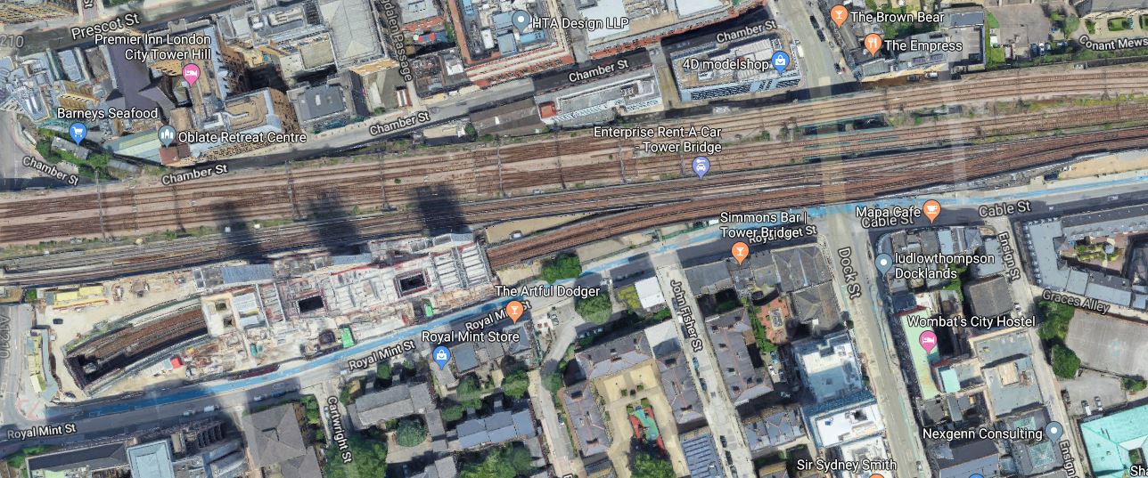
Royal Mint Gardens
Royal Mint Gardens is a housing development to the East of Fenchurch Street and Tower Gateway stations.
These are a few pictures of the development.


But this doesn’t tell the full story.
This Google Map shows the position of the development.
Note.
- Fenchurch Street station is towards the top-left corner of the map.
- The c2c tracks running to the East from Fencurch Street station.
- Tower Gateway DLR station is just to the right of the centre, just above the green space.
- The tracks of the Docklands Light Railway running to the East from Tower Gateway DLR station.
The three concrete towers at the right of the map, lying to the South of the railway tracks, are the three structural towers of Royal Mint Gardens.
This Google Map shows a close up of Royal Mint Gardens.
Note how the Docklands Light Railway splits into two to the East of the development.
- The Northern pair of tracks skirt the development to the North to go to Tower Gatewat DLR station.
- The Southern pair of tracks go underneath the development to go to Bank DLR station.
The new development has put the Bank branch in a concrete tunnel.
So in an area of the world, where land is a very expensive commodity, this area is being used twice at the same time.
Royal Mint Gardens On The BBC
BBC London television has been covering various aspects of the building of Royal Mint Gadens in local news for most of the day.
The developer, the architect, Network Rail and the reporter, all seemed very positive about what is being created.
The architect felt up to 250,000 houses could be created on similar sites across London.
How many houses could be built over rail lines in the rest of the UK?
Conclusion
Building over rail lines like this, will increasingly be seen as a way of adding new housing in densely populated cities.
Will Redevelopment Of Fenchurch Street Station Help To Pay For Crossrail 2?
I have just written Could Crossrail 2 Go To Grays?, after various articles suggested that a Hackney Branch of Crossrail 2 could take over c2c lines through Barking and have termini at Bssildon and Grays.
This map is provided.
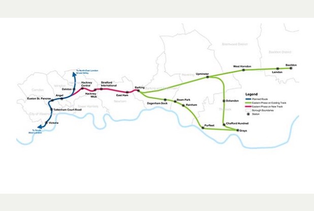
Possible Crossrail 2 Eastern Branch
The red section is new track, which would need to be in tunnel as far as East Ham.
Looking at this proposal, it became apparent, that the number of trains terminating at Fenchurch Street station could be severely reduced.
This Google Map shows Fenchurch Street station.
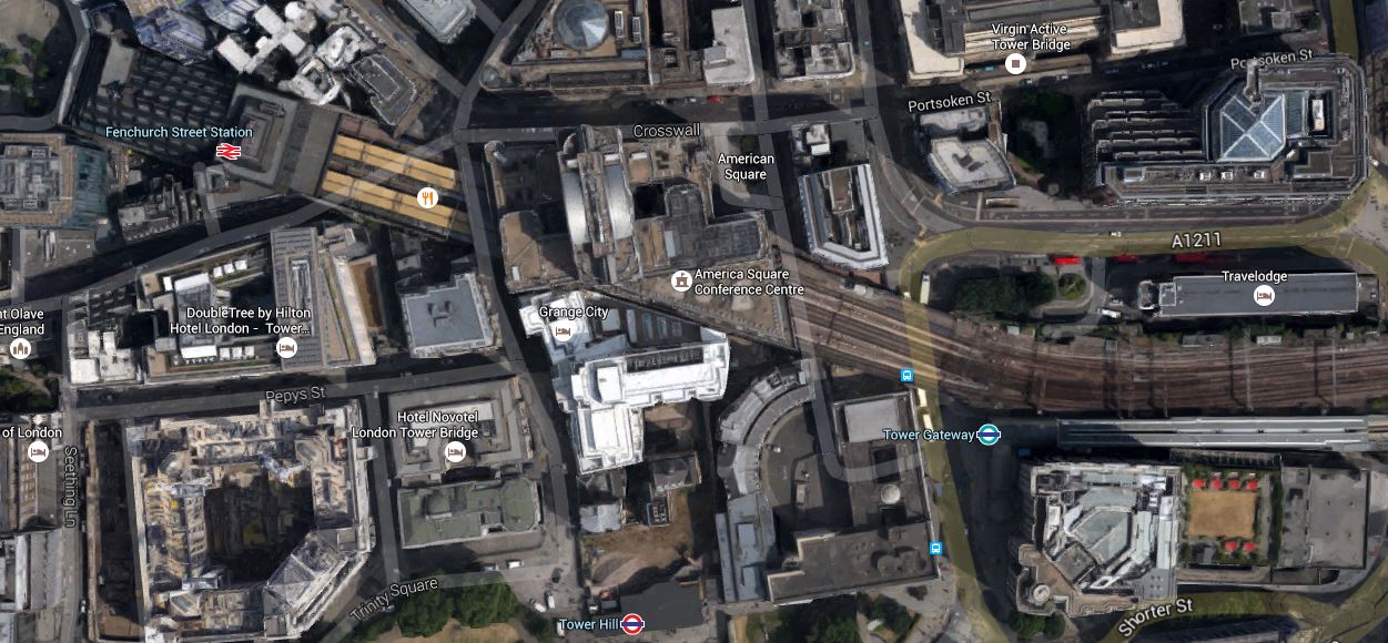
Fenchurch Street Station
Note Tower Gateway station on the DLR and Tower Hill station on the District and Circle Lines, to the South of the lines into Fenchurch Street.
The site must be worth a fortune in the City of London and could surely be redeveloped.
- It could have enough capacity to provide four trains per hour to Southend and/or Shoeburyness.
- The Docklands Light Railway terminus could be moved alongside the new station.
- It could have direct connectivity to Tower Hill station.
- There would obviously be a lot of offices on top.
There has been a proposal in the past to extend the DLR to Charing Cross and Victoria.
A rebuilding of Fenchurch Street station with the c2c and DLR stations underneath, might enable this extension from the Toewer Gateway branch.
This map from carto.metro.free.fr shows the rail lines from Tower Gateway to Charing Cross.
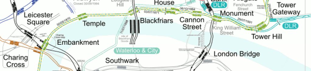
Tower Gateway To Charing Cross
This is said about the proposed route in Wikipedia.
Two reasons driving the proposal are capacity problems at Bank, having just one interchange between the DLR and the central portion of Underground, and the difficult journeys faced by passengers from Kent and South Coast between their rail termini and the DLR. Intermediate stations would be at City Thameslink/Ludgate Circus and Aldwych.
Could it be, that one of the drivers of linking Crossrail 2 to c2c services is to enable the Fenchurch Street station site to be redeveloped?
Could Crossrail 2 Go To Grays?
This article in Your Thurrock is entitled Is Crossrail about to stop at all stations in Thurrock?
It talks about a branch of Crossrail 2 going East from a junction between Angel and Dalston stations calling at Hackney Central, Stratford International, East Ham and Barking, before taking over the c2c routes to Basildon and Grays.
This map is provided.
Possible Crossrail 2 Eastern Branch
The red section is new track, which would need to be in tunnel as far as East Ham.
Connectivity Of The Route
The route would appear to tidy up a lot of the connectivity problems in East London.
- Stratford International station will be properly connected to London’s local rail network, instead of by a sizeable walk through Eastfield.
- The Western parts of Essex between Upminster and Grays, which will see a lot of much-needed new housing built in the next few years, get a much better rail connection to Central London.
- c2c services get a new excellent connection to Central London at Barking, which by-passes the inaccessible Fenchurch Street.
- Hackney gets its own direct connection to Central London.
And of course there will be a large increase in capacity with 200m. long trains to Basildon and Grays.
Stratford International Station
Stratford International station has never been properly connected to London’s local rail network.
At present, it is only really a domestic station for Southeastern’s HighSpeed services to Kent and some have branded it a white elephant.
With more and more international services likely to run into London, I think it is only a matter of time, before Stratford International gets some international services.
The Future Of c2c To Central London
If c2c services to Basildon and Grays are replaced with higher capacity Crossrail 2 services, does this have repercussions for c2c services.
- Basildon station currently has four trains an hour going between Fenchurch Street and Shoeburyness.
- Grays station has four trains per hour to Fenchurch Street and two to Southend Central.
This says to me that there might be scope to simplify the pattern of c2c services.
Fenchurch Street Station
This Google Map shows Fenchurch Street station.
Fenchurch Street Station
Note Tower Gateway station on the DLR and Tower Hill station on the District and Circle Lines, to the South of the lines into Fenchurch Street.
The site must be worth a fortune in the City of London and could surely be redeveloped.
- It could have enough capacity to provide four trains per hour to Southend and/or Shoeburyness.
- If the Docklands Light Railway terminus was moved alongside the new station, it might be possible to extend the DLR to Charring Cross station, as has been proposed
- It could have direct connectivity to Tower Hill station.
- There would obviously be a lot of offices on top.
Could it be, that one of the drivers of linking Crossrail 2 to c2c services is to enable the Fenchurch Street station site to be redeveloped?
Hackney Central to Stratford International
This Google Map shows the area between Hackney Central and Stratford International stations.
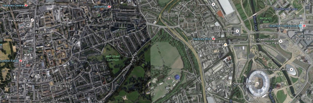
Crossrail 2 – Hackney Central to Stratford International
Hackney Central station is at the extreme left of the map and Stratford International station is north of the Olympic Stadium.
At least the engineers know it is good tunnelling country as there is already a large pair of tunnels between the two stations – High Speed One.
Stratford International to Barking
This Google Map shows the area between Stratford International and Barking.
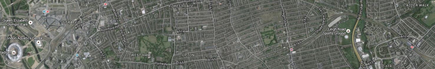
Crossrail 2 – Stratford International to Barking
Barking is at the extreme East of the map.
The Surface Route From East Ham to Barking
This Google Map shows the surface lines between East Ham and Barking stations.
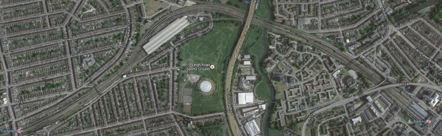
Crossrail 2 – East Ham to Barking
East Ham station is in the South West corner and Barking station is in the South East corner. The large structure on the railway by the park is c2c’s East Ham Depot.
This map from carto.metro.free.fr shows the lines through East Ham and Barking.
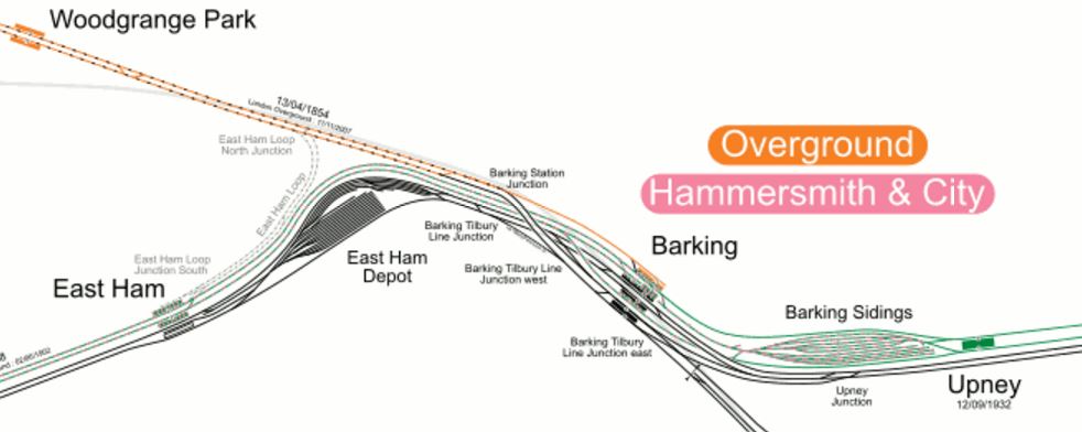
East Ham to Barking Lines
The engineers also have a lot of choice as to where Crossrail 2 can emerge to join the surface network.
Conclusions
It certainly seems to be a feasible route through East London, that effectively gives Crossrail 2, two eastern termini.
I also think, that it could release the Fenchurch Street site for redevelopment with perhaps a smaller station with four trains per hour to Southend Central, good connections to the Underground and the DLR and lots of offices on top.
That would help to pay for the extension.
