Could The Fenchurch Street And Grays Service Be Handed Over To The Elizabeth Line?
Before I discuss the suggestion in the title of this post, I will write down some thoughts.
The Capacity And Connection Problems At Fenchurch Street Station
If you read the Wikipedia entry for Fenchurch Street station, this paragraph sums up some of the problems of the station.
Fenchurch Street is one of the smallest railway terminals in London in terms of platforms, but one of the most intensively operated. It is the only London terminal with no direct interchange with the London Underground. Plans to connect it stalled in the early 1980s because of the lack of progress on the Jubilee line, but it is close to Tower Hill on the Underground and to Tower Gateway on the Docklands Light Railway.
I live in Dalston and if I want to use the services out of Fenchurch Street station to get anywhere it is a struggle.
As all services out of Fenchurch Street station stop at Limehouse, West Ham and Barking stations on the approach into London, I will usually go via either West Ham or Barking stations. As the three services out of Fenchurch Street are each two trains per hour (tph), this can mean a near-thirty minute wait at either West Ham or Barking stations, which at some times of the year are not the most customer-friendly of stations.
More services out of Fenchurch Street station would help to ease the problem, but the station is at capacity and nothing short of a complete rebuild of the station will solve the problems the capacity and connectivity..
There is a section called Future in the Wikipedia entry, where this is said.
There have been proposals to move the station 380 yards to the east to allow the station to expand to 6 platforms, (up from the current 4) and would be built partly on the site of Tower Gateway DLR station, which would likely be permanently closed.
The new station could be built with direct interchange with Tower Hill tube station, which could also have a replacement DLR station for Tower Gateway as Transport for London have looked into closing Tower Gateway and constructing a replacement on the Bank branch to increase capacity.
This project sounds like it would take a long time and cause a lot of disruption and inconvenience. But it would add capacity and connectivity.
This Google Map shows the location of the station.
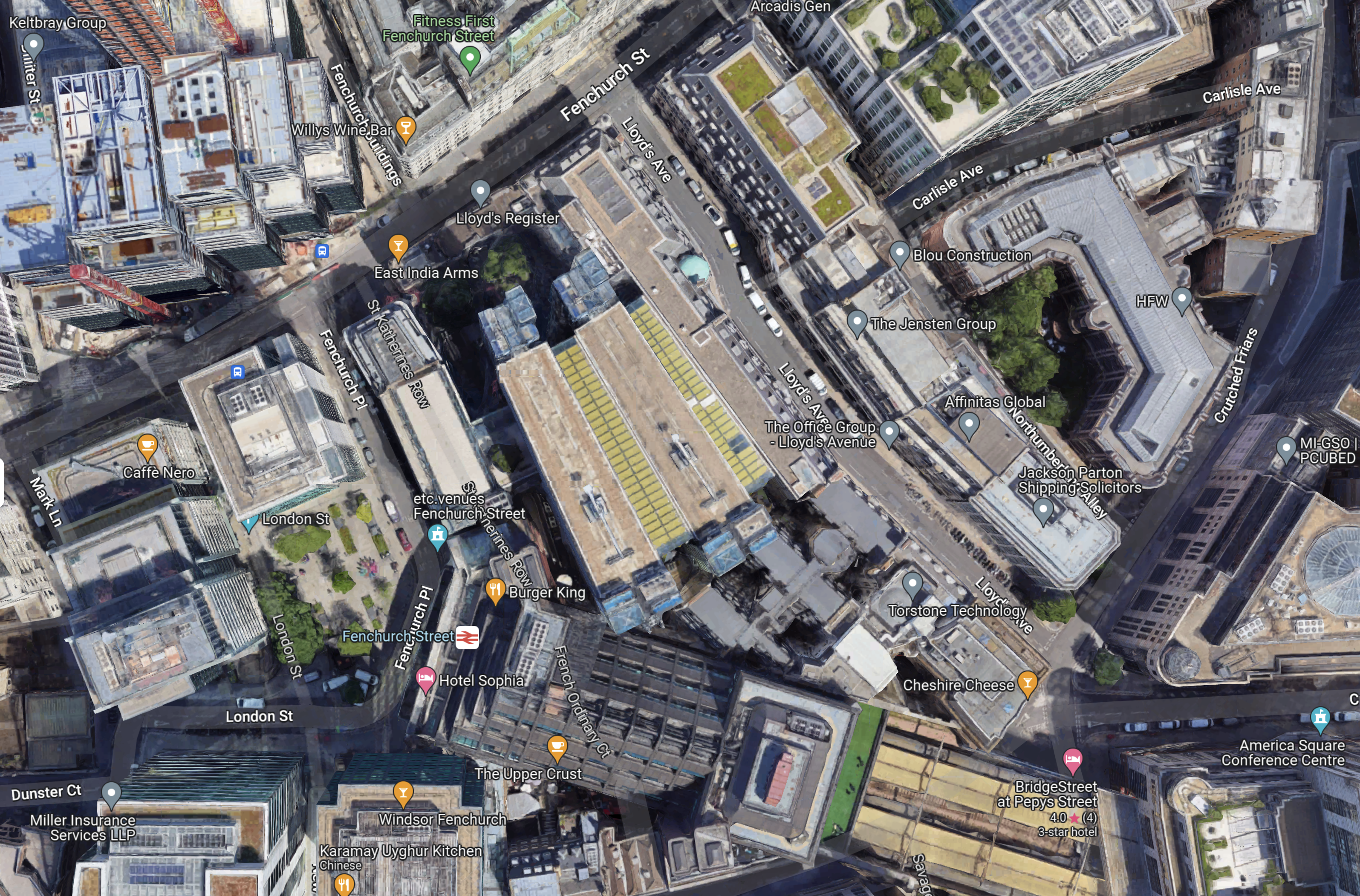
Note.
- Fenchurch Street station is towards the bottom of the map in the centre.
- It is completely hemmed in by buildings.
- There is just a small square in front.
I feel it would be very difficult to rebuild a larger station in the same place.
Services Into Fenchurch Street Station
Currently, there are three services into Fenchurch Street station.
- Fenchurch Street and Shoeburyness via Limehouse, West Ham, Barking, Upminster, West Horndon, Laindon, Basildon, Pitsea, Leigh-on-Sea, Chalkwell, Westcliff, Southend Central, Southend East and Thorpe Bay.
- Fenchurch Street and Southend Central via Limehouse, West Ham, Barking, Upminster, Ockendon, Chafford Hundred Lakeside, Grays, Tilbury Town, East Tilbury, Stanford-le-Hope, Pitsea, Leigh-on-Sea, Chalkwell and Westcliff
- Fenchurch Street and Grays via Limehouse, West Ham, Barking, Dagenham Dock, Rainham and Purfleet.
Note.
- All services are two tph.
- All services call at Limehouse, West Ham and Barking.
Each station gets the following frequency of trains.
- Barking – 6 tph
- Basildon – 2 tph
- Benfleet – 2 tph
- Chafford Hundred Lakeside – 2 tph
- Chalkwell – 4 tph
- Dagenham Dock – 2 tph
- East Tilbury – 2 tph
- Grays – 4 tph
- Laindon – 2 tph
- Leigh-in-Sea – 4 tph
- Limehouse – 6 tph
- Ockendon – 2 tph
- Pitsea – 4 tph
- Purfleet – 2 tph
- Rainham – 2 tph
- Southend Central – 4 tph
- Southend East – 2 tph
- Stanford-le-Hope – 2 tph
- Thorpe Bay – 2 tph
- Tilbury Town – 2 tph
- Upminster – 4 tph
- Westcliff – 4 tph
- West Ham – 6 tph
- West Horndon – 2 tph
c2c would appear to be offering a service, that is well-balanced about the stations it serves.
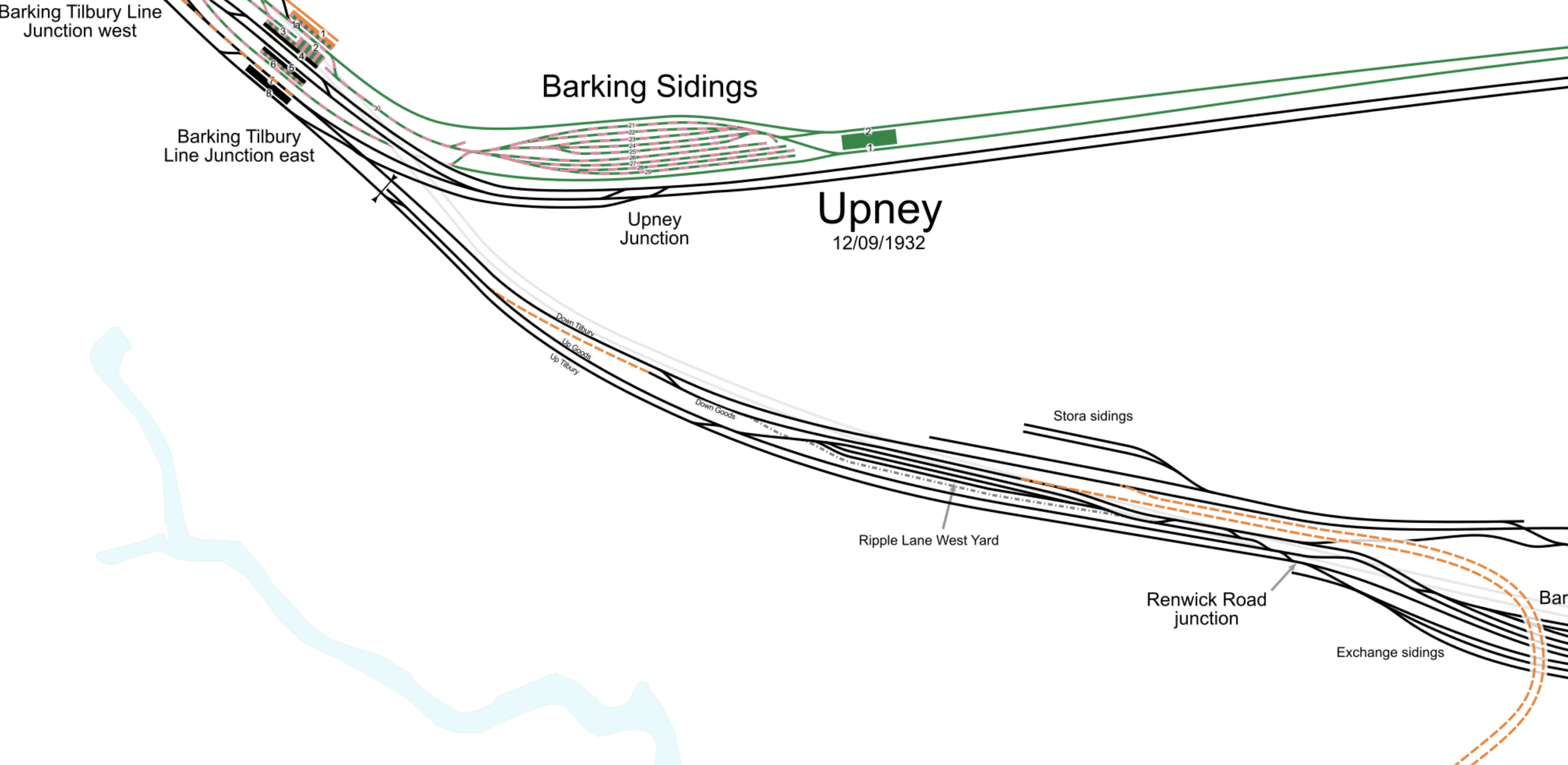
Can Elizabeth Line Trains Reach Barking?
This map from cartometro.com shows Woodgrange Park junction, where the Gospel Oak and Barking Line crosses over the Great Eastern Main Line.
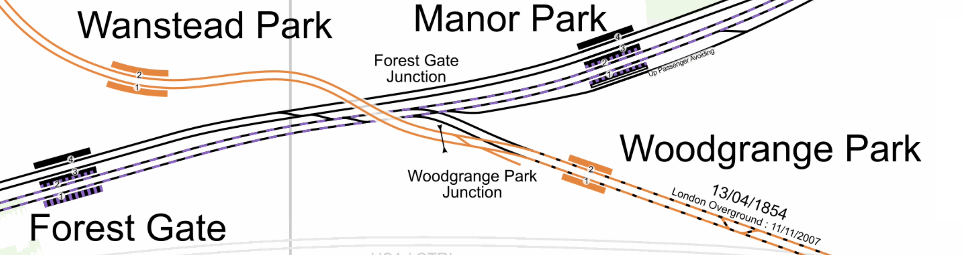
Note.
- The Gospel Oak and Barking Line is shown in orange.
- Gospel Oak station is to the North-West and Barking is to the South-East.
- The Elizabeth Line tracks are shown with a dash of purple.
- It looks to me, that a train on the Elizabeth Line going East could come through Platform 2 in Forest Gate station and then take the Gospel Oak and Barking Line through Platform 2 at Woodgrange Park station.
- It also looks as if trains could go through Platform 1 at both Woodgrange Park and Forest Gate stations to go West on the Elizabeth Line.
I don’t know whether they still do, but c2c trains used to use Woodgrange Park junction to access Liverpool Street station, when Fenchurch Street was closed or at weekends.
At Barking station, they would take the flyover over the station call in Platforms 7 and 8 in the station.
From the Eastern ends of Platforms 7 and 8, trains can use one of three routes.
- The London Overground route to Barking Riverside station.
- The c2c route to Grays via Purfleet.
- The c2c route to Upminster.
Note.
- The platforms at Barking Riverside station are probably too short for the Elizabeth Line trains.
- The Class 345 trains would fit into the bay platforms at Grays and Southend Central.
The simplest thing to do would probably be to divert the two tph between Fenchurch Street and Grays to either Liverpool Street or Paddington at the London end.
Each station would now get the following frequency of trains.
- Barking – 6 tph
- Basildon – 2 tph
- Benfleet – 2 tph
- Chafford Hundred Lakeside – 2 tph
- Chalkwell – 4 tph
- Dagenham Dock – 2 tph
- East Tilbury – 2 tph
- Grays – 4 tph
- Laindon – 2 tph
- Leigh-in-Sea – 4 tph
- Limehouse – 4 tph
- Ockendon – 2 tph
- Pitsea – 4 tph
- Purfleet – 2 tph
- Rainham – 2 tph
- Southend Central – 4 tph
- Southend East – 2 tph
- Stanford-le-Hope – 2 tph
- Thorpe Bay – 2 tph
- Tilbury Town – 2 tph
- Upminster – 4 tph
- Westcliff – 4 tph
- West Ham – 4 tph
- West Horndon – 2 tph
Only Limehouse and West Ham would get fewer trains.
But there would surely, be an extra pair of paths between Fenchurch Street and Barking.
I have also looked at trains through Pitsea, Upminster and Westcliff it appears that nearly all of the traffic is c2c’s passenger trains.
So would it be possible, with perhaps improved signalling to add an extra two trains between Fenchurch Street and Shoeburyness?
Each station would now get the following frequency of trains.
- Barking – 8 tph
- Basildon – 4 tph
- Benfleet – 4 tph
- Chafford Hundred Lakeside – 2 tph
- Chalkwell – 6 tph
- Dagenham Dock – 2 tph
- East Tilbury – 2 tph
- Grays – 4 tph
- Laindon – 4 tph
- Leigh-in-Sea – 6 tph
- Limehouse – 6 tph
- Ockendon – 2 tph
- Pitsea – 6 tph
- Purfleet – 2 tph
- Rainham – 2 tph
- Shoeburyness – 4 tph
- Southend Central – 6 tph
- Southend East – 4 tph
- Stanford-le-Hope – 2 tph
- Thorpe Bay – 2 tph
- Tilbury Town – 2 tph
- Upminster – 4 tph
- Westcliff – 6 tph
- West Ham – 6 tph
- West Horndon – 4 tph
More stations are getting four and six tph.
Conclusion
There are certainly possibilities to improve c2c by running services on the Elizabeth Line route.
Could There Be An Elizabeth Line Extension To Grays?
This article on My London is entitled London Underground Tube Map: The Towns That Could Be Added To The Elizabeth Line As New Giant Loop Through London, Essex And Kent Is Proposed.
This paragraph described the proposal.
The proposal, which is part of its Vision 2050 local transport plan, would see the current Elizabeth line service from Romford take over the Overground branch to Emerson Park and Upminster, then join c2c services continuing via Chafford Hundred Lakeside to Tilbury. It would then head under a new tunnel beneath the Thames to Gravesend, connecting with the reintroduced Eurostar at Ebbsfleet International/Northfleet.
It’s certainly a bold idea and you can view the report to Thurrock Council here.
These are my thoughts.
The Frequency Of Trains
Currently, these services have a frequency of two trains per hour (tph) in both directions.
- Romford and Upminster.
- Upminster and Tilbury Town.
It would seem sensible that this frequency is preserved, thus giving every station on the loop four tph to and from the Eastern End of the Central Tunnel at Whitechapel station. Two tph would go via Romford and Stratford and two tph would go via Ebbsfleet and Abbey Wood.
What Would Be The Western Terminal?
It would probably be the two busiest terminals in the West.
I suspect that these will be Heathrow Terminal 4 and Heathrow Terminal 5
- Two tph would go between Heathrow Terminal 4 and Heathrow Terminal 5 via the loop.
- Two tph would go between Heathrow Terminal 5 and Heathrow Terminal4 via the loop.
- Two tph would go clockwise.
- Two tph would go anticlockwise.
I suspect the digital signalling can sort it out, just as it does the loop in Thameslink.
The Connection At Romford To The Romford and Upminster Line
Consider.
- The Romford and Upminster Line is single-track.
- A well-signalled single-track railway can handle two tph in both directions in an hour.
- Trains take five minutes to go between Romford and Emerson Park stations.
- Trains between Romford and Upminster will use Platform 5 at Romford station.
- Trains between Upminster and Romford will use Platform 4 at Romford station.
This map from cartometro shows the track layout at Romford station.
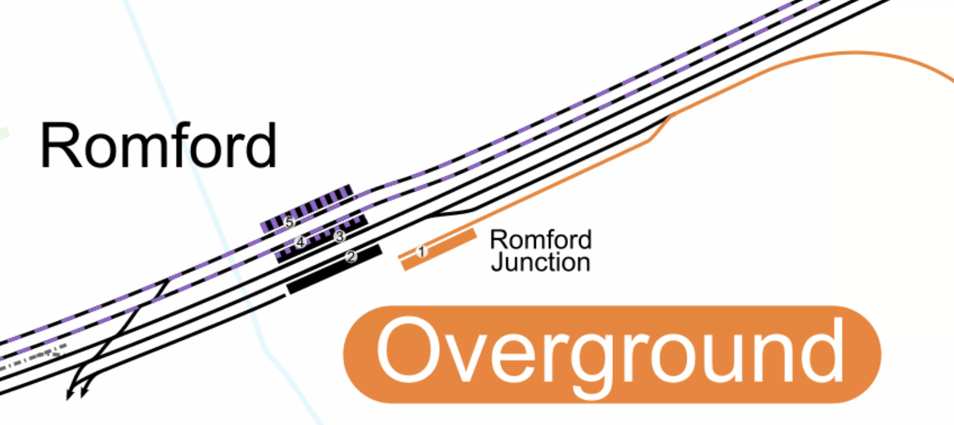
Note.
- The orange lines are the Overground tracks of the Romford and Upminster Line, which connects to Platform 1 in Romford station.
- The black and purple lines are the Elizabeth Line, which go through Platforms 4 and 5 at Romford station.
- The black lines are the fast lines of the Great Eastern Main Line, which go through Platforms 2 and 3 at Romford station.
- There is no connection between the Elizabeth Line and the Romford and Upminster Line.
I believe it is possible to build a single-track flyover or dive-under that connects both Platforms 4 and 5 at Romford station to the Romford and Upminster Line.
A similar double track flyover was built to connect the Barking Riverside branch to the main lines through Barking.
- But this track layout would only need to be single-track.
- I also suspect that there may not be enough space to put in a full double-track flyover.
- It would avoid the inconvenience and danger of using flat junctions to cross the fast lines of the Great Eastern Main Line.
As it only takes five minutes to go between Romford and Emerson Park stations, there is plenty of time to fit two tph in both directions in an hour.
Platform Extension In Platform 1 At Romford Station
Platforms 4 and 5 at Romford regularly take nine-car Class 345 trains, but I think that Platform 1 should be lengthened, to provide a bay platform on the route to help out when the service needs to recover.
Platform Extension At Emerson Park Station
The platform at Emerson Park station will need to be lengthened to take nine-car Class 345 trains.
Some commentators claim, that the passing loop at the station needs to be rebuilt. But I suspect, this isn’t needed as the expanded layout at Romford station effectively creates a passing loop.
The Connection At Upminster Between The Romford and Upminster Line And The Upminster And Tilbury Town Line
Consider.
- Both lines are single-track.
- But there is a passing loop at Ockenden station.
- There are three tracks between West Thurrock junction and Grays.
- Trains take five minutes to go between Emerson Park and Upminster stations.
- Trains take ten minutes to go between Upminster and Chafford Hundred stations.
- Trains take four minutes to go between Chafford Hundred and Grays stations.
- Trains take thirteen minutes to go between Upminster station and West Thurrock junction.
This map from cartometro shows the track layout at Upminster station.

Note.
- The orange lines are the Overground tracks of the Romford and Upminster Line, which connects to Platform 6 in Upminster station.
- The green lines are the District Line tracks that handle the services that terminate at Upminster station.
- The black lines are the c2c tracks between Fenchurch Street and Southend Central stations go through Platforms 1 and 2 at Upminster station.
- The Upminster and Tilbury Town Line leaves Upminster station in a South-Easterly direction.
- The Upminster and Tilbury Town Line connects to Platforms 1 and 2 at Upminster station.
I believe it is possible to build a single-track flyover or dive-under that connects both Platforms 1 and 2 at Upminster station to the Romford and Upminster Line.
This would connect the following.
- The Romford and Upminster Line to the the Upminster and Tilbury Town Line.
- The Romford and Upminster Line to the the Fenchurch Street and Southend Central Line.
Upminster station would be a much improved interchange.
Two tph Between Tilbury Town and Romford Stations
Consider.
- The route is fully electrified.
- The route is a mixture of single and double-track.
- There is a passing loop at Ockendon station.
- The platform at Emerson Park and possibly others may need to be extended to take nine-car Class 345 trains.
I believe single-track flyovers or dive-unders at Romford and Upminster stations would enable two tph on the route.
The only downside I can see, is that passengers going between Fenchurch Street and Chafford Hundred or Ockendon stations would need to change at Grays or Upminster stations.
Alternatively, they could take the Elizabeth Line, which would have a 4 tph direct service between the Central Tunnel of the line and Chafford Hundred and Ockendon stations.
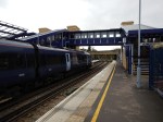
Under The Thames
This map from OpenRailwayMap shows the lines on the North bank of the Thames.
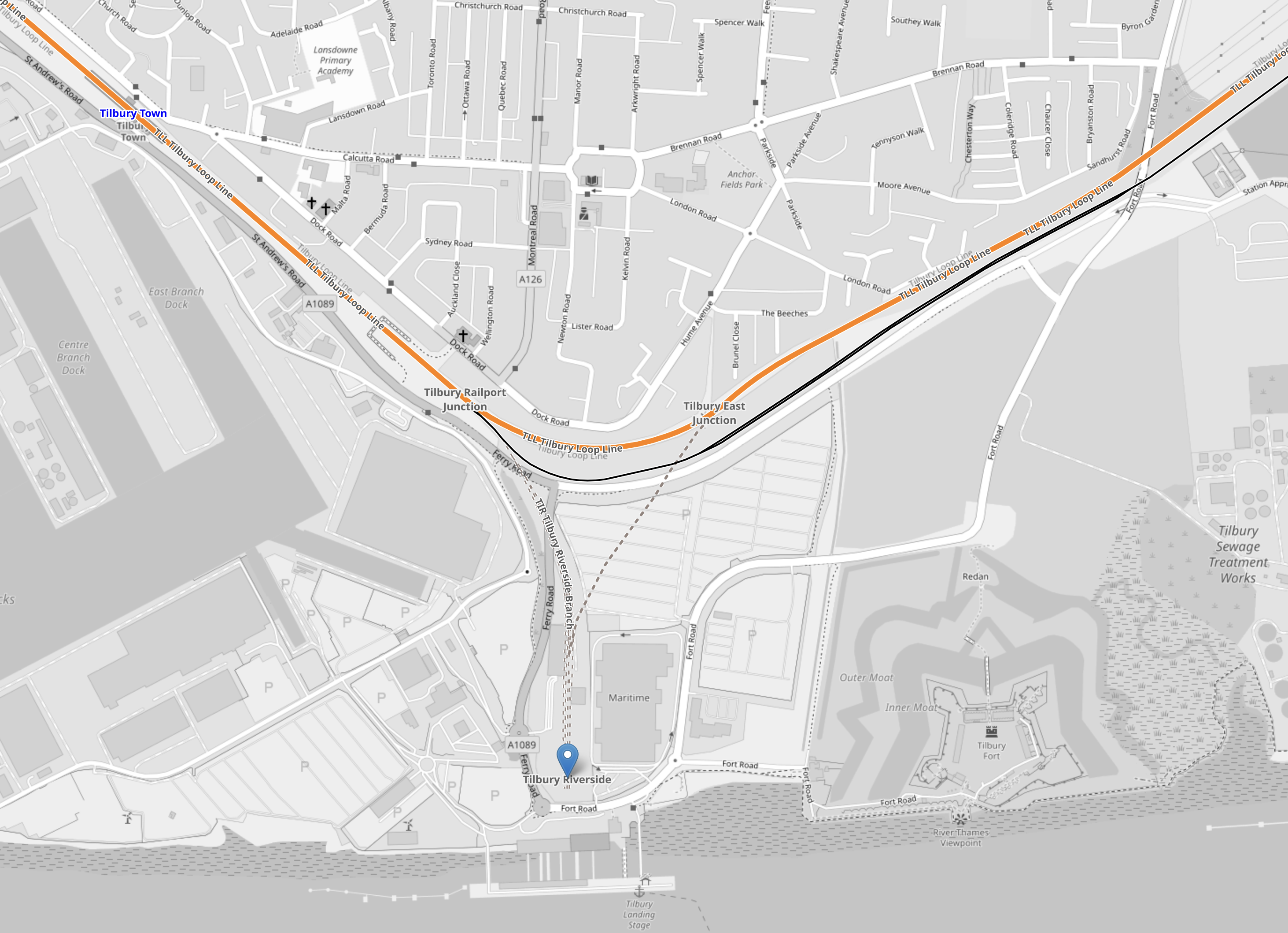
Note.
- The orange line is the double-track Tilbury Loop Line between Fenchurch Street and Southend Central stations.
- Tilbury Town station is in the North-West corner of the map.
- There is a proposal for a Tilbury Fort station in the North-East corner of the map.
- The blue arrow at the bottom of the map indicates the former Tilbury Riverside station, which is next to the London International Cruise Terminal.
I believe the North portal of the tunnel under the river could be at the site of the former Tilbury Riverside station.
Would it be an idea to rebuild the station and connect it to the cruise terminal, so that passengers on the cruise ships would have excellent access to Central London, Ebbsfleet International station for High Speed One and Heathrow Airport?
This map from OpenRailwayMap shows the lines on the South bank of the Thames.
Note.
- Tilbury Town station, the former Tilbury Riverside Riverside station and the Tilbury Loop Line are in the North-East corner of the map.
- Gravesend station is in the South-East corner of the map.
- The wide orange line going vaguely North-South at the Western side of the map is High Speed One going through Ebbsfleet International station.
- Connecting Gravesend and Ebbsfleet International stations is the North Kent Line.
I suspect it would be possible to bore a tunnel from Tilbury Riverside, that passed under Gravesend station and joined the North Kent Line to the West of the station.
How Would The River Crossing Connect To Gravesend Station?
The platform or platforms on the Elizabeth Line Loop would have to be underground, as there is not much space at Gravesend station as these pictures show.
Note.
- Gravesend has SouthEastern HighSpeed services to St. Pancras International station and North-East Kent.
- The route to Gravesend has been safeguarded for the Elizabeth Line.
- The railway under the Thames could replace the Tilbury and Gravesend Ferry.
There also could be operational advantages in not terminating Elizabeth Line services at Gravesend.
Abbey Wood And Gravesend
In Elizabeth Line To Ebbsfleet Extension Could Cost £3.2 Billion, I looked at the Transport for the South East proposal for extending the Elizabeth Line to Kent.
This image from the Abbeywood2Ebbsfleet consultation, shows the proposal.
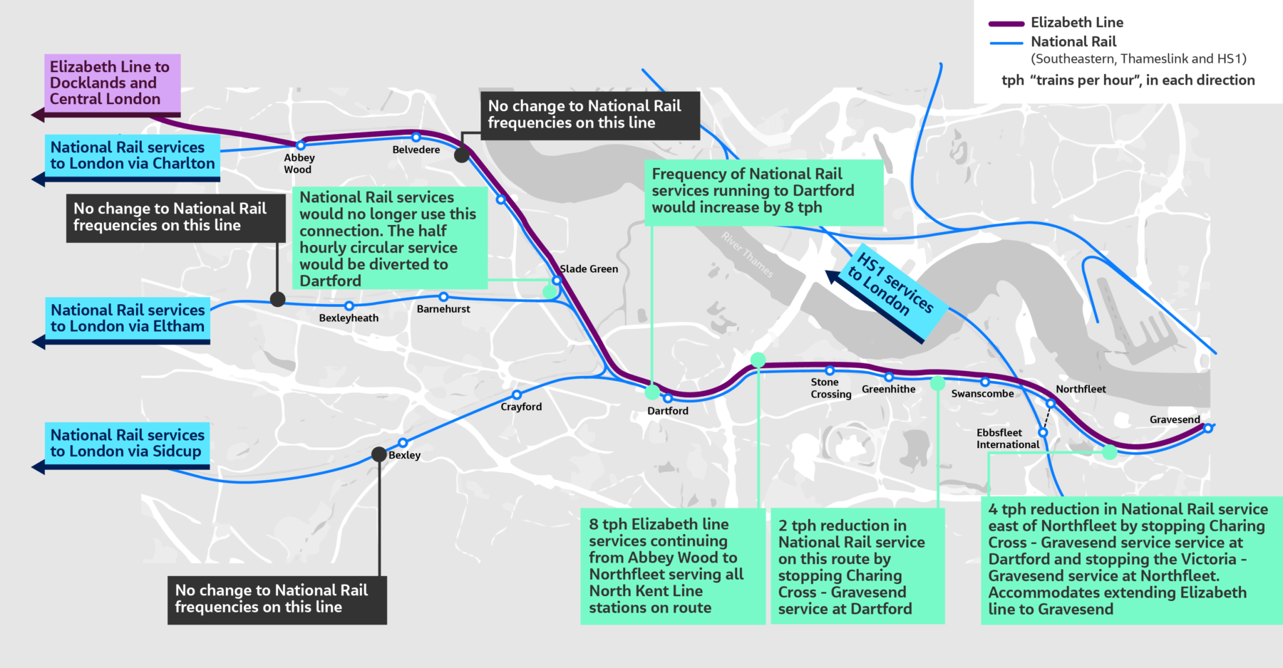
Note, that there doesn’t appear to be too much new infrastructure, except for a proper connection between Northfleet and Ebbsfleet stations. References on the Internet, say that the similar-sized Luton DART connection at Luton Airport, cost around £225 million, but we now know it was well upwards of that.
The TfSE proposal says that trains would terminate as follows.
- Abbey Wood – 4 tph
- Northfleet – 4 tph
- Gravesend – 4 tph
As space is limited at Gravesend and there is money for extending a railway service to a new Hoo station, I feel that proposing a two tph service to Hoo station would be a prudent action to take.
This would leave a handy two tph to take the loop back to Central London.
Could A Large Parkway Station Be Built Between Romford and Tilbury Riverside Stations?
Ebbsfleet International station, which is to the South-East of London, has 5,000 parking spaces and is the only large Park-and-Ride site around the capital.
Could another large Park-and-Ride site be opened on the Elizabeth Line North of the Thames?
One place could be at Chafford Hundred station and the nearby Lakeside Shopping Centre.
This Google Map shows the area.
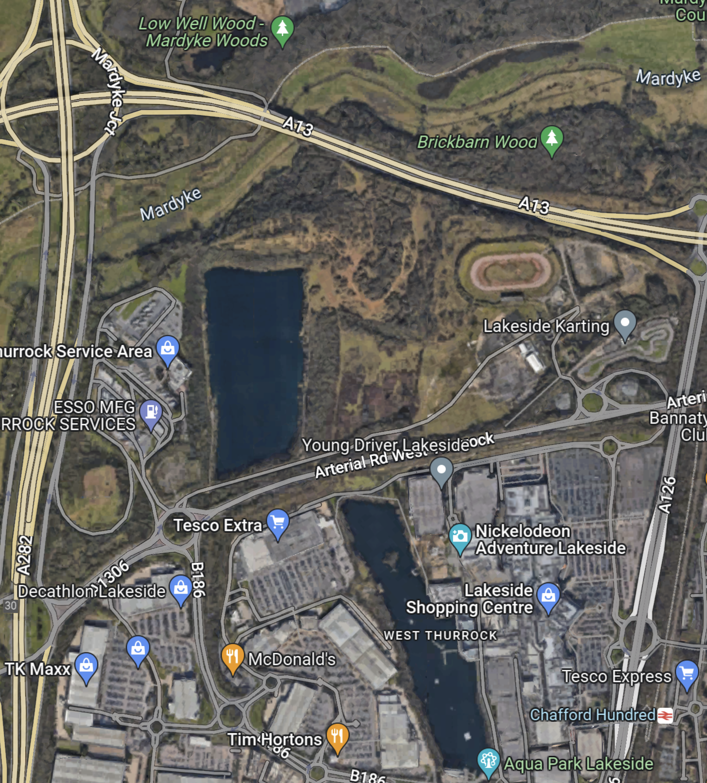
Note.
- The M25 runs North-South up the Western side of the map.
- Chafford Hundred station is in the South-East corner of the map.
- The shopping centre is next to the station.
Last time I went, Lakeside was looking tired.
Timings To And From Whitechapel
These are estimated timings to and from Whitechapel.
- Romford – 26 mins – 81 mins
- Emerson Park – 31 mins – 76 mins
- Upminster – 35 mins – 72 mins
- Ockendon – 41 mins – 66 mins
- Chafford Hundred – 45 mins – 62 mins
- Grays – 49 mins – 58 mins
- Tilbury Town – 52 mins – 55 mins
- Tilbury Riverside – 58 mins – 49 mins
- Gravesend – 62 mins – 45 mins
- Northfleet – 65 mins – 42 mins
- Swanscombe – 68 mins – 39 mins
- Greenhithe for Bluewater – 71 mins – 36 mins
- Stone Crossing – 73 mins – 34 mins
- Dartford – 81 mins – 26 mins
- Slade Green – 86 mins – 21 mins
- Erith – 88 mins – 19 mins
- Belvedere – 89 mins – 18 mins
- Abbey Wood – 92 mins – 15 mins
Note.
- The times between Tilbury Town and Gravesend are my best estimates.
- All other times are taken from current services.
- The first time is the time to Whitechapel via Romford.
- The second time is the time to Whitechapel via Abbey Wood.
It does appear that the best times from all stations are under an hour.
3,000 Homes To Be Built Next To Dagenham Dock Railway Station
The title of this post, is the same as that of this article on Ian Visits.
These are the first two paragraphs.
A sleepy railway station in East London is due to get a lot busier as a large housing development is to be built next to it.
The former Dagenham Stamping Plant car works site has been cleared, and has now been bought by Peabody housing association for development. The initial phase will see 1,550 affordable homes built, supported by an £80 million grant from the Mayor’s Affordable Housing Programme.
There is a lot of housing under construction the area and the c2c lines and the London Overground are being expanded to cope.
- The Gospel Oak and Barking Line is being extended to Barking Riverside station.
- Renwick Road station may be added to this route, where it joins the c2c lines.
- Dagenham Dock station is now fully step-free.
- A new station is to be built at Beam Park to provide a link to housing development.
But there is still only two trains per hour (tph) through Dagenham Dock and Beam Park, as opposed to the four tph, that will run to Barking Riverside.
The simple solution would be to improve the Fenchurch Street and Grays service.
- Currently it is two tph.
- The service calls at Limehouse, West Ham, Barking, Dagenham Dock, Rainham and Purfleet.
- Renwick Road and Beam Park will be added to this service, when and if, they are built.
It needs to have the same frequency as Gospel Oak to Barking which is four tph.
So how could this frequency increase be provided?
For a start, the bay platform at Grays could probably handle four tph with improvement and the route possibly with some signalling improvements could probably cope.

The bay platform at Grays station would probably need lengthening.
It’s just where do you terminate the trains at the Western end?
Fenchurch Street is probably at capacity, as it handles 8 tph in the Off Peak.
- 4 tph – Shoeburyness
- 2 tph – Southend Central
- 2 tph – Grays
But the station handles up to 20 tph in the Peak.
Could it be that with the installation of full digital ERTMS signalling on this route, that four tph between Fenchurch Street and Grays could run all day?
A Possible Crossrail Branch
Crossrail is a herd of testosterone-loaded elephants in the room, that have been locked up by some very poor decision making from the Mayor and Transport for London.
- If ERTMS signalling is one of the keys to unlocking capacity on the tunnels for Crossrail and Thameslink, could its application to c2c services open up possibilities for serious new services in East London.
- As I said, ERTMS signaling could open up the capacity into Fenchurch Street, but would it also allow Grays to be a terminal for Crossrail?
This map from cartometro.com shows Forest Gate Junction, where the Gospel Oak to Barking Line connects to the lines into Stratford and Liverpool Street.
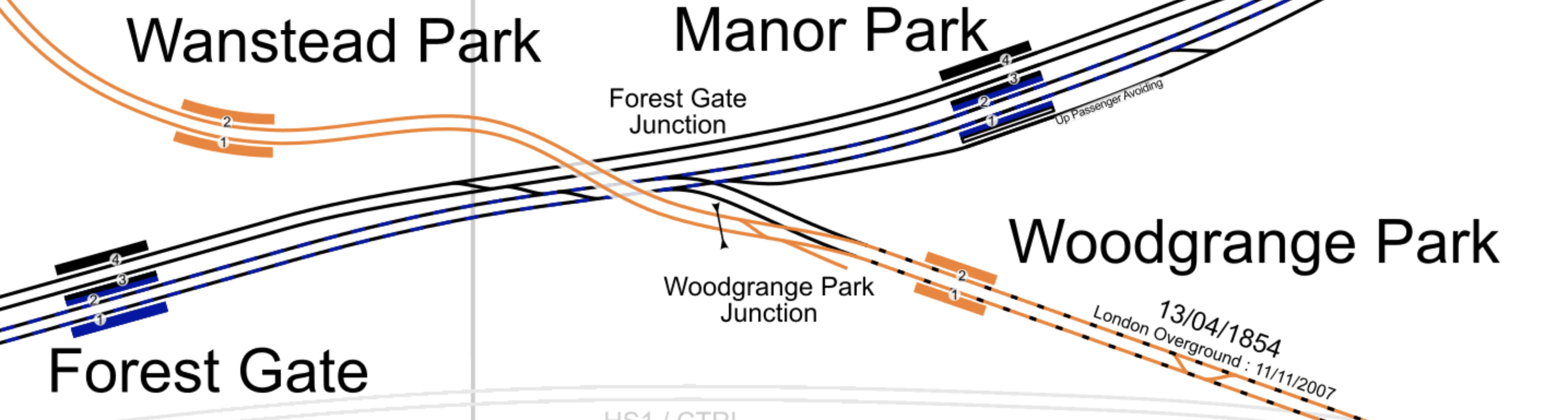
Note.
- The orange tracks are the Gospel Oak to Barking Line (GOBLin).
- Gospel Oak is to the North West and Barking is to the South East.
- The mauve-blue tracks are Crossrail, through Manor Park and Forest Gate stations.
- The black track are the fast lines into Liverpool Street station.
- Forest Gate Junction in the middle is regularly used by c2c trains accessing Liverpool Street, when there are engineering works.
I believe that with ERTMS signalling four or possibly six Crossrail tph could travel between Stratford and Barking stations via Maryland, Forest Gate and Woodgrange Park stations.
This second map from cartometro.com shows the lines through Barking station.
Note.
- Barking station is in the North-West corner of the map.
- The orange platform on the North side of Barking station is Platform 1, which is the current terminal of the GOBLin.
- After the Goblin is extended to Barking Riverside, the GOBLin services will share Platforms 7 and 8 with the Fenchurch Street to Grays services.
- Platforms 7 and 8 are on the South side of the station and they are connect to the GOBLin lines by a flyover.
- To the East of the station, the GOBLin route is shown in orange.
- The GOBLin turns South to Barking Riverside station, which is by the Thames.
I suspect that there is capacity for more trains.
- There will only be six tph through Platforms 7 and 8 at Barking station.
- There will be four tph over the flyover and through Woodgrange Park station.
I believe that terminating four Crossrail tph at Grays could be an interesting possibility.
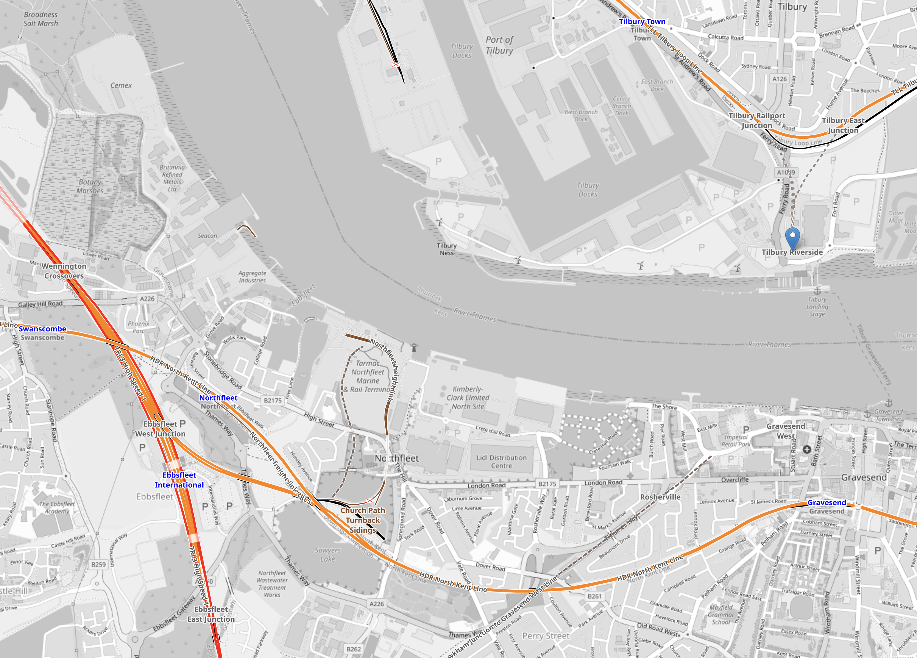
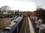
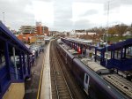
Grays Station To Go Step-Free
This document on the Government web site is entitled Access for All: 73 Stations Set To Benefit From Additional Funding.
Grays station is on the list.
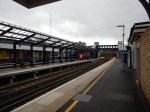
These pictures show the station.


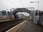
Note.
- The stopping trains from London arrive in a long bay platform 3.
- There are exits on both sides of the tracks.
- There is a subway under the tracks.
- There is a bridge over the tracks outside the station.
- The station only handles four trains per hour in both directions.
This Google Map shows the layout of the station.
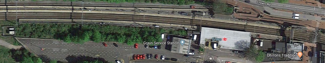
Note that the main platforms can take twelve-car trains.
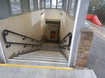
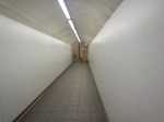
Installing Step-Free Access
According to a station guy, it will not be easy to add lifts to the subway and a step-free bridge will be installed.
- The subway is narrow and two wheelchairs probably couldn’t pass.
- There also appears to be enough space for a bridge.
- The bridge could probably be placed either side of the main station building.
In Winner Announced In The Network Rail Footbridge Design Ideas Competition, I wrote how the competition was won by this bridge.
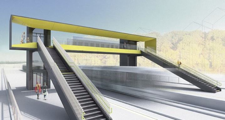
So could a factory-built bridge like this be installed at Grays station?
Installing such a bridge, would not need the subway to be closed, so overall the station could handle more passengers needing to cross the tracks.
This would not appear to be the most difficult of installations.
