One For London Overground To Correct
I was at Walthamstow Central station last night and wanted to return home the quickest way, for which I have a choice of routes.
1. Take an Abellio Greater Anglia train to Hackney Downs and then get a 56 bus.
2. Take a Victoria Line train to Highbury and Islington and then cross the road and get a 277 or 30 bus.
3. Take a Victoria Line train to Seven Sisters and then get a bus to Dalston.
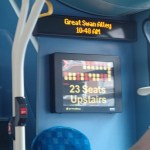
I prefer the first route, it has the least amount of walking and if it’s raining hard it’s mostly under cover. But the route has the disadvantage that you can wait fifteen minutes for a train. This is a bad picture of the information screen on the platform.
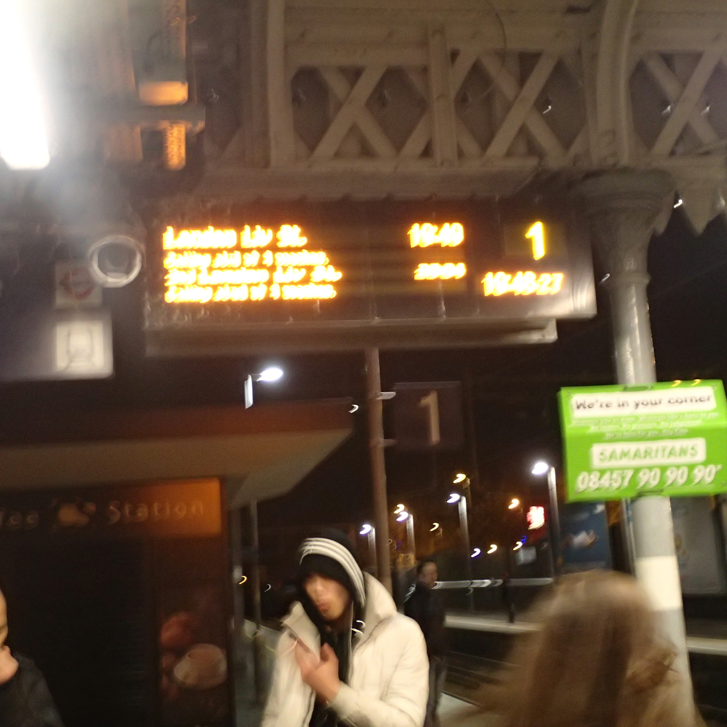
Information At Walthamstow Central
The trouble is that like all the other information screens at the station, it doesn’t give information for the Underground services in their station below.
Last night I waited about two minutes for a train, but if it had been six or so, I’d have probably dived into the Underground.
To make matters worse, if you arrive in the station using the underpass from the bus station, you do not pass any information screens at all and you have to climb the stairs to finds out the next train.
That’s not very customer friendly in my book.
Hopefully, when the Chingford services are taken over by London Overground in May, then as it will be an Overground/Underground station exclusively, then this lack-of-information problem will be resolved.
An Unnecessary Good Deed
I like to think that I can be a gentleman some of the time.
When I was going home this afternoon from London Bridge, I took the Northern Line to Old Street with the intention of getting a 141 bus from Provost Street opposite Moorfields Eye Hospital.
To get from the station to the stop I first had to cross East Road, walk past the stop for the southbound 43 bus and then cross Provost Street itself.
As I started to cross Provost Street, I noticed a classic little old lady with a white stick, who seemed rather feared to cross the other way. So I crossed over and asked if I could help. She told me that she needed to get a 21 bus south towards Lewisham. I should say that I did do a bit of training with Guide Dogs for the Blind on how to lead people, so after telling her that the stop was behind the building on our left, I guided her across the road, past the 43 bus stop and then across East Road to walk back to the step for the 21.
What was a bit frustrating was that as we crossed East Road, a 21 bus disappeared on its way south.
A few minutes later and with a bit of help from a fellow passenger, who told us a 21 was due in three minutes, I put the lady on the bus to New Cross and her home.
I used the word unnecessary in the title of this post. for two reasons.
I said the lady was a classic little old lady in the mould of Louisa Wilberforce in The Ladykillers or Mrs. Ross in The Whisperers, but she certainly was totally on the ball and without any eccentricities. She was also proud too, that she’d got the bus so easily northwards from New Cross. She also thought it a good idea to try my route next time, of a 43 to say Finsbury Square and then get the 21 from the same stop.
But the main reason, all of my guiding was unnecessary is that if there had been some clear large print signs, she would with her mental and physical faculties managed the walk without any passing assistance. Although, she thanked me profusely, she was a very independent soul, and she would probably have felt really satisfied to have been able to manage the walk unaided.
Surely outside an eye hospital, there will be quite a few people walking around, whose eyesight isn’t 20/20.
As I indicated in Is Silicon Roundabout Going To Become Silicon Peninsular, Transport for London are rethinking the Old Street Roundabout.
They have a unique opportunity to sort out the area for the visually impaired.
Blackpool’s New Maps And Signs
I’ve criticised Blackpool in the past, as lacking maps and information. But they have at least got started on a visitor-friendly information system.


I think it is true to say, that most of the locals and visitors I talked to, said that the town had been getting better in the last couple of years.
These maps and signs should lead to fewer people getting lost.
But there were no signs pointing you to the trams at the station and the tram stops didn’t have any maps or even information about how you use the tram.
Why Is London’s Transport So Well Mapped?
I’ve travelled all over the UK and a lot of Europe in recent years, and as I don’t drive, I have to use public transport.
What amazes me, is how poor mapping is in most cities and towns outside London.
There are exceptions like Munich, Glasgow and surprisingly, Ipswich, but most are pretty terrible. I’ve even had a letter in The Times complaining how bad the situation is in the UK.
So why is London so much more advanced with its maps, information and wayfinding?
In the 1920s and 1930s when the Underground was going through a major expansion, they probably had a problem with passengers not knowing where they could go!
So this led to Harry Beck‘s iconic Tube map, a version of which is still use today.
In the 1950s, when I started to explore London on my own, my mother told me that if I got lost to find a Tube station, as they had a tube map to me back to Oakwood and a local street map to find what I was looking for. It is still the same today, except that the tube map is more comprehensive and the local maps are generally larger and much better.
Over the last few years London has applied the pre-war principles to the buses, with bus route or spider maps that could have been designed by Harry himself and local walking maps at every bus stop with a shelter.
And then there’s Legible London and all its liths and fingerposts. Wikipedia sums it up like this.
Unlike other wayfinding projects, Legible London leaps over bureaucratic boundaries in order to provide one consistent visual language and wayfinding system across the city. This city–wide approach was implemented to help visitors and local residents to easily gain local geographic knowledge regardless of the area they are in.
In contrast if you go to the Manchester area, Manchester uses one design and Salford another.
London is different to other UK cities and most in Europe, in that it is so much larger.
Consequently, most Londoners are regularly a visitor in their own city, when they find themselves in a part of the city they don’t know.
And of course this applies to those who manage the city, so they appreciate the problem.
If you take a city like Nottingham or Liverpool, most of the locals probably have the city in their head, so they can’t see the point of providing consistent visitor information all over the area. And if it were to be installed, many locals would see it as a waste of money.
So I believe that London’s size is the main reason its information system is so good.
But you must add the tradition started by Harry Beck! He may not be lauded as a great artist, but surely the London Tube Map is one of the greatest examples of public art of all time.
Sheffield’s Information-Free Buses And Trams
I chose the Leopold Hotel, as it was in the centre by a tram stop, which made it easy to get to and from the match at Hillsborough. It also meant that to get to the hotel from the train, I just went to the tram stop and used my Freedom Pass to go a few stops up the hill.
But when I arrived at the stop, all it had was details on the tram route. But there was no sign of any local map. As I’d spotted the hotel from the tram before it stopped, I just walked a few metres down the hill and round the corner.
I had planned to have an early supper with an old friend, at the new Carluccio’s on Ecclesall Road. He’d said I’d needed to get an eighty-something. So I walked and found this bus stop.

The World’s Most Useless Bus Stop
Note that is says “Buses Do Not Stop Here on the sign. It didn’t have any information that a visitor might like to use to get to the Ecclesall Road. There was no information and nobody around to answer my question.
I eventually walked a couple of hundred metres the other way and found a guy, who told me that any bus from a particular stop went down the Ecclesall Road. The queues incidentally at the stop was manic, mainly because the ticketing system required many to give money to the driver. As usual I had to put my Freedom Pass down and pick up a printed ticket.
And when I did get on a bus, there was no way, I could tell where I was, as it was a silent bus. Luckily, I knew roughly, where I was going and I knew there was a Waitrose on the corner of Ecclesall Road. But I still ended up walking further than I wanted.
At least I could read the name on the bus stops, but how do the visually-impaired manage?
The bus wasn’t that full for the rush hour and that helped me look out. But I still had to fight my way to the front to get out.
If ever a city needed London’s bus spider maps and cash free buses it is Sheffield. How many more passengers would they get, if the buses and trams were organised with the same objectives as London in mind?
But the worst thing about the buses, was coming back from Ecclesall Road was that the buses seemed to have stopped running.
In the end I had to pay £6 for a taxi.
How visitor-friendly is that?
At least when I need to go to Sheffield in the future, I now know that unless I’m going to somewhere near a tram stop, the best course of action will be to stay at home.
Transport for London’s Latest Plot To Get Us To Climb Stairs
London’s buses are effectively computer terminals and displays, that just happen to carry passengers about the city.
These pictures that I took on route 141, show the latest software upgrade.

The clock has been shown on the Next Stop display for some time, but the display, showing how many spare seats are on the upper deck, is new.
Will it help to increase the loading of buses? The only problem, is that the system is not as attractive as a comely conductress calling politely for everybody to please move along the bus!
There’s more about the technology here on the IanVisits web site.
Match Six – Ipswich 2 – Millwall 0
Town got their second win of the season and the match was again lit up, by a sparkling display from the eighteen-year-old Teddy Bishop. He combined well with McGoldrick and their joint persistence made the first goal.
Walking to the ground from the station is easy at Ipswich, especially as you can see the ground virtually all the way and there are several maps. But surely those near the ground, should show the layout of the stadium to ease the walks of supporters and visitors.

History But No Stand Information
But at least Ipswich has got maps, which is more that can be said for most large cities and towns.
Millwall have a bad reputation for fan behaviour, but on the way home, I was sat with three fans and they were just phlegmatic about their teams performance.
The police told me, that they’d just had a nice trip to the country.
A Problem At Barking Station
Yesterday, I had a small problem at Barking station, about getting my train back to the centre.
This is what I wrote to London Underground.
I visited Barking and had arrived on an H&C. So when I went back, the signs directed me to the sane platform, but there was no information there and no trains. So in the end I gave up and walked to the Westbound District Line platform, where I found a distressed elderly lady looking for a train to Paddington. Eventually, I shepherded her on a District Line train and I found a H&C at West Ham. The lady went off to try her luck on the Jubilee Line.
Not only was there no signs to the H&C and no trains, but there were no staff on the platform directing people to the trains that were running.
It wasn’t the standard I usually get at Dalston Junction or Barbican say!
It is very unusual that this happens on the Underground.
Birmingham Has Now Got Liths
I was pleased to see that Birmingham has now got maps on liths all over the city centre.

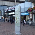
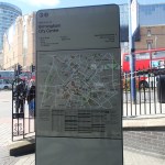
It certainly makes finding your way easier and I used a totally different and more interesting route to get to Carluccio’s from Moor Street station.
Now they need decent street and route maps on every bus stop in the city.
Typical Icelandic Tourist Information
Unlike many countries, Iceland believes in information.


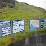
This display near Seljalandsfoss is typical.
