More Thoughts On Dalston Junction To Hayes
In February this year, I wrote Should Trains Run From Dalston Junction To Hayes?
I finished the post like this.
So is New Cross the least used direct southern destination on the East London Line? Also, was it only included in the East London Line for historic reasons, as it had been a Metropolitan Line destination?
If so, it might be an idea to see if extension of the four trains per hour services terminating at the station is possible. Perhaps two could go Hayes and two to Orpington, which would double the frequency to both places from New Cross.
I could also have said in the summing up, that this would give four trains per hour from Dalston Junction to Lewisham, with all its connections to South East London and Kent.
This morning, I was reading an article on London Reconnections about extending the Bakerloo Line, entitled Death, Taxes and Lewisham: Extending the Bakerloo.
So it got me thinking!
I returned to my original article and had the following blasphemous thought.
Is Transport for London, so obsessed with using the supposed spare capacity on the Bakerloo Line, that it doesn’t think straight about what to do with this line?
Consider the following points.
- Passengers like the Overground model and many rate it higher than the Underground.
- When Crossrail and Thameslink and the East London Lines are up to capacity of twenty-four trains per hour, the increase in capacity will change London’s transport system dramatically, as there will be an H-shaped network with interchanges at Farringdon, Whitechapel and possibly some other places.
- Most trains going to Kent and South East London start from Victoria, which is not well placed for some of the important parts of Central London. Would extra connections to a twenty-four trains per hour East London Line at Penge and Brockley be a better route for many passengers?
- I feel that there would be a backlash, if the Hayes Line became part of the Bakerloo Line, just like there was when Thameslink wanted to stop all Sutton Loop Line trains at Blackfriars! If you’ve been commuting for years in First Class from Hayes into Cannon Street for the City, I don’t think you’d be happy if your train was a smaller one-class, crowded Underground train. But you might accept an Overground train to Canada Water for the Jubilee Line or Whitechapel for Crossrail and the Metropolitan/Circle/District Lines.
- Thameslink together with the Bakerloo Line and an upgraded Jubilee Line will create a resilient North-West to East routing, that could withstand the occasional serious failure. The East London Line provides that resilient link in the East.
- Thameslink doesn’t connect with the Central Line, but the East London Line could at Shoreditch High Street.
I’m coming more to the conclusion that there is no way that a long extension to the Bakerloo Line would be needed. Perhaps it should be extended in a loop down the Old Kent Road to Camberwell, to get high-quality rail services into that area.
Should East London Line Services To New Cross Go Further?
Four services per hour on the East London Line have their Southern terminus at New Cross station and could these venture further into South London?
At the moment these services terminate in a bay Platform D, which is just a walk across from the trains going South. But when coming North, you have to go over the step-free bridge to get from Platform A to Platform D.
In the next few years, various developments will happen, that will affect travel in the area bordered by New Cross, Cannon Street and Whitechapel.
- London Bridge and Thameslink will be improved, so interchange between Cannon Street services and Thameslink will be much easier.
- Hopefully, access to the Underground at London Bridge will be eased by the redevelopment of the station.
- Will the Thameslink improvements increase the capacity into Cannon Street?
- Crossrail will open.
- The Metropolitan/District and Circle Lines will have been fully upgraded with bigger trains and new signalling.
- The Jubilee Line will have been upgraded.
- Bank station will have been upgraded.
- There will be large numbers of office developments around the City, increasing the numbers of needed final destinations.
I believe that the increasing flexibility will mean passengers will be less likely to use the same route.
I also believe that passengers will switch between London Bridge/CannonStreet and the East London Line destinations of Canada Water, Whitechapel and Shoreditch High Street.
Many more will want to change at New Cross!
If the East London Line services started South of New Cross and just called at Platform A on their way North, just as London Bridge/Cannon Street services do, this would this give a simple change for Northbound passengers.
If you were on a Tunbridge Wells to Cannon Street train and wanted to go to Whitechapel for Crossrail, you would get off at New Cross and wait for an East London Line train on the same Platform A.
This interchangeability of Northern destinations, is unlocked by sending East London Line trains past New Cross.
Can East London Line Services To New Cross Go Further?
After Crossrail and an upgraded Thameslink opens, it will take some time for passenger numbers to stabilise.
These figures will decide if it is worthwhile to extend the services past New Cross.
The other constraint will be whether paths are available to continue to Lewisham and beyond.
The simplest plan would be to run the four trains per hour to Lewisham and then run two trains to both of Orpington and Hayes.
Extra Interfaces On The East London Line
I would also build the following interchanges on the East London Line.
- Central Line at Shoreditch High Street. This can’t be done until Crossrail opens.
- A New Penge station to connect to the Chatham Main Line
- A high-level Brockley station to link to the Nunhead to Lewisham Line.
There may also be scope for linking the East London Line to Thameslink. It is probably a pity, that the East London Line serves West Croydon rather than East Croydon, as the latter station has so much better connectivity.
Today, I visited South East London and I can make these observations.
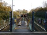
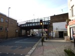
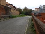
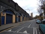
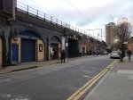
New Cross Station
I wrote Changing At New Cross, when I looked at New Cross station.
I can’t see any obvious reason, why East London Line trains have to terminate at New Cross. I suspect, that it’s only for historic reasons, as that’s what the Metropolitan Line did many years ago.
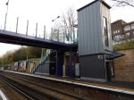
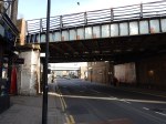
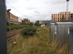
St. Johns Station
I wrote Investigating St. Johns Station, when I looked at St. Johns station.
My only feeling about this station is that if it were to be upgraded to the standard passengers expect, it could be a valuable step-free interchange station between an extended East London Line and the services into and out of Cannon Street.
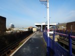
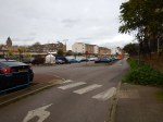
Lewisham Station
I wrote Changing At Lewisham, when I visited Lewisham station
If it were to be served by four trains per hour on the East London Line, with two trains per hour going to Hayes and the other two to Orpington, Lewisham would be an important interchange to increase the connectivity between South East and North East London.
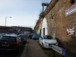
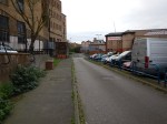
Catford and Catford Bridge Stations
I wrote An Opportunity At Catford, when I looked at the twin stations of Catford and Catford Bridge and can say this.
- Currently, all trains through Catford Bridge station are going to and from Hayes.
- All trains through Catford are Thameslink ones between Blackfriars and Sevenoaks.
- Track exists to send trains between Catford Bridge to and from Orpington.
If cross-platform interchange could somehow be provided between the two northbound and the two southbound lines at Catford/Catford Bridge, this would give passengers from Hayes and Orpington a big choice of Northern destinations.
Effect On Dalston Junction
If the four trains per hour shuttle service between Dalston Junction and New Cross was replaced by two trains per hour to each of Orpington or Hayes, it probably wouldn’t have much overall effect on the Dalston Junction to New Cross section of the line, but what would the timings look like?
Currently trains leave Dalston Junction in the Off Peak at 04, 19, 34 and 49 past the hour taking twenty-two minutes to get to New Cross. They then return at 07, 22, 37 and 52.
So the 04 train gets to New Cross at 26, returns at 37 and gets back to Dalston Junction at 59, which means it waits eleven minutes at New Cross and six at Dalston Junction.
New Cross to Hayes takes thirty minutes, so that would be fifty two minutes from Dalston Junction to Hayes.
Would that be fast enough for each train to do one trip each hour?
I suspect that one of Transport for London’s timetabling experts could devise a pattern.
More Trains Through The Thames Tunnel
At present there are sixteen trains per hour through the Thames Tunnel.
- 4 – Dalston Junction to New Cross
- 4 – Dalston Junction to West Croydon
- 4 – Highbury and Islington to Crystal Palace
- 4 – Highbury and Islington to Clapham Junction
Which means that as there is a theoretical limit of twenty-four trains per hour, there are another eight paths available.
In Increased Frequencies On The East London Line, I wrote that London Overground have plans to introduce the following extra services.
- From 2018, there will be an extra two trains per hour between Dalston Junction and Crystal Palace.
- From 2019, there will be two additional trains between Dalston Junction and Clapham Junction.
So that would mean that there are still possibly another four paths available.
I would assume that the extra trains would be accommodated at the Northern end by just tightening the turn-round times.
I can’t believe that it won’t be long before Transport for London come up with ways of using the remaining four paths.
If they are planning to turn back two extra trains from Crystal Palace and two from Clapham Junction at Highbury and Islington, I can’t believe that they couldn’t turn back another four services at Dalston Junction. Assuming the extra trains to Crystal Palace and Clapham Junction, this would give the following frequencies.
- 12 tph between Highbury and Islington and Dalston Junction.
- 24 tph between Dalston Junction and Surrey Quays.
The core section of the East London Line will interface in 2020 with the following lines.
- Crossrail at Whitechapel will be 24 tph
- The Jubilee Line at Canada Water will be 36 tph
- The Victoria Line at Highbury and Islington will be 36 tph by 2016.
Father and son, Marc and Isambard Brunel, will be spinning in their graves, to see what their Nineteenth Century engineering curiosity-turned-marvel has become.
The Emergence Of Overground Transport Hubs
More trains on the East London Line between Dalston and Clapham Junctions is to be welcomed.
I use the well-connected Clapham Junction, if say I’m going to Southampton, Portsmouth or many other places, as it means I can avoid the difficulty of getting to Waterloo or Victoria.
The one problem with Clapham Junction in my view is that Thameslink or the Gatwick Express doesn’t call at the station.
Even so, Clapham Junction, Dalston Junction and Stratord are evolving as the major hubs on the Overground Network.
In the next few years, the following stations will become major hubs.
- Whitechapel because of its important location on Crossrail
- Old Oak Common because of its connections to Crossrail and HS2
- Hackney Interchange (Central plus Downs) because it joins the North London Line to the West Anglia Lines.
Will Lewisham, Crystal Palace or other stations join this elite group?
Southeastern
Southeastern is the train operating company that operates most of the train services to South-East London. Kent and East Sussex.
The company has three sub brands.
- Highspeed operates high-speed service on the Channel Tunnel Rail Link using Class 395 trains.
- Mainline operates traditional long distance services to Kent and East Sussex.
- Metro runs services to South East and South London.
London Overground makes to secret of the fact that it would like to bring the Metro services under its control.
I would very much welcome this takeover for the following reasons.
- As a North Londoner, who grew up in the North, South London trains are very much a mystery to me and Southeastern’s information could be substantially improved.
- The East London Line and Southeastern services could be properly co-ordinated.
- When the Overground took over the West Anglia Lines, there was a definite improvement in stations and customer service.
- The whole of Southeastern’s Metro and Mainline network needs to be brought into Transport for London’s Oyster and contactless bank card ticketing.
Hopefully, the takeover will happen, when the franchise is up for renewal in 2018.
Crossrail Extension To Ebbsfleet International And Gravesend
I wrote Crossrail Extension to Gravesend after a visit to the area and I feel that it would be possible to extend Crossrail, so that it served both Ebbsfleet International and Gravesend stations.
This would enable a direct link between Heathrow Airport and Continental trains and you’d only need to change once if you were going to Gatwick, Luton or Stansted Airports.
Conclusions
On a brief look, there is a lot of potential to extend the New Cross branch of the East London Line to Lewisham, Hayes, Orpington and perhaps some more places.
Get it right and it might not be the best thing to have a long extension of the Bakerloo Line.
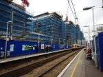
Denmark Hill Station Rises
I say rises, as the pub at Denmark Hill Station is called The Pheonix.
When I last took photos before the upgrade, it was rather a mass of scaffolding.
But look at it now!


I took these pictures as I came home today.
It’s certainly one of the better middle-sized stations in London.
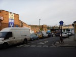
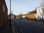
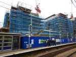
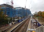
Loughborough Junction Station And Around
I took these pictures of Loughborough Junction station and its environs.


I do wonder if a four-poster station can be built here, to connect the South London Line that passes over the station to the current Loughborough Junction.
This Google Map shows the station and the surrounding area.
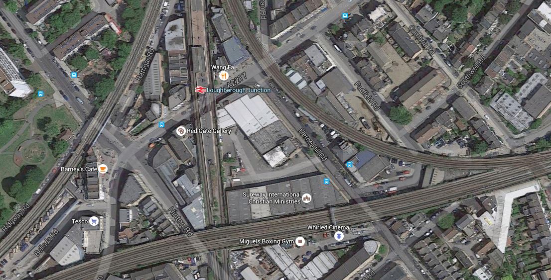
Loughborough Junction Station
Note the following about the railway lines and Loughborough Junction station.
- There are four lines going over the station, with the London Overground being the two lines on the southern side.
- The Thameslink lines are the ones going North-South through the area.
- The station only has two platforms on these lines.
- Platforms on the two spurs; Brixton and Cambria, were closed many years ago.
The height difference between the two sets of lines is probably no more than at Smethwick Galton Bridge station, where a four post station has been successfully built.
To say there are a mass of lines and the associated railway arches, filled with small businesses, would be an understatement.
This area should be able to be developed to provide what the people of the area need. A stylish and practical station linking both lines could be part of the development.
London Overground’s New Class 710 Trains
The Aventra trains on order for the London Overground have now been given a number and are now Class 710 trains.
Wikipedia says this about the trains.
The units will be delivered in two sub-classes; an AC only version with longitudinal and transverse seating (very similar to the S8 units on the Metropolitan Line of the London Underground) for use on the West Anglia and Romford-Upminster services, and a dual-voltage version with longitudinal seating for the Watford DC and GOBLIN services. The AC only version will be maintained at Ilford TMD and the dual-voltage units at Willesden TMD.
So it appears that the trains used on the Gospel Oak to Barking Line will be dual voltage, despite there being no existing or planned third-rail electrification on that line.
It did at first strike me as surprising, but then I suspect that it is nothing more sinister than prudent future-proofing, with perhaps some manufacturing and maintenance convenience.
It has to be noted that North London Line services between Stratford and Richmond, use dual-voltage trains.
There has been talk over the years about the extension of the GOBlin at both ends. Only the short extension to Barking Riverside is being taken forward.
For instance, in Transport for London’s London Infrastructure Plan for 2050, this map of lines around Old Oak Common station is shown.
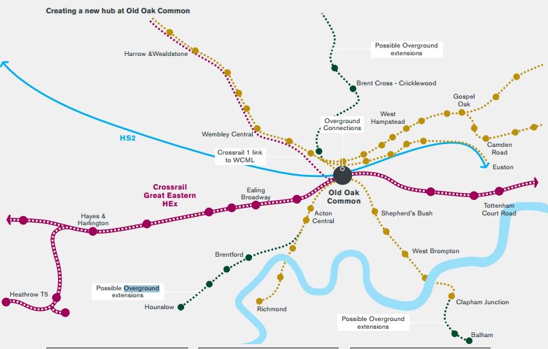
Lines Radiating From Old Oak Common Station
Note the various extensions all centred on the development area of Old Oak Common, that will be even more important if it has an HS2 station.
Could the future-proofing of specifying dual voltage trains, be in case they want to extend services through Gospel Oak onto the North London Line, to Balham, Hounslow and Richmond? All three destinations are deep in third-rail territory.
Dual voltage trains would also be needed, if GOBlin services went to Watford, but not for the extension to Brent Cross – Cricklewood.
In some ways, the interesting extension to the Overground is to Balham, which is a proposed Crossrail 2 station.
At the moment the service on the West London Line is crowded and probably doesn’t have enough capacity. The service is at present.
- Two London Overground serices per hour between Stratford and Clapham Junction
- Two London Overground services per hour between Willesden Junction and Clapham Junction
- One Southern service per hour between Milton Keynes and South Croydon.
Perhaps by running some of the Gospel Oak to Barking Line trains past Gospel Oak through to Clapham Junction or Balham stations, may help to sort out a few problems.
Richmond would probably be an unlikely destination, as the Class 710 trains have a car less than the Class 378 trains and getting there from any station on the GOBlin would anyway be a single change at Gospel Oak.
As Hounslow lacks the connectivity of Balham, if there is any extension of the GOBlin, Balham could be the most likely destination.
I think the only thing we can say with certainty, is that having dual-voltage trains on the GOBlin avoids the need to add the capability later, if it is decided to extend the line past Gospel Oak station.
Ten London Overground Stations For Upgrade
This article on Rail Magazine is entitled Murphy wins LO station contract. This is said.
J Murphy & Sons has won a £6.5 million contract from Transport for London to upgrade ten London Overground stations with new shelters and seating, upgraded lighting, better paving and new handrails.
It sounds like the work is not of too much of a major nature, but is more about some small important features.
On a personal note, the only station named, that I use regularly is Hackney Downs.
A First Glimpse Of The Planned Hackney Central Station
London Overground are planning an upgrade of Hackney Central station, as I reported in The Redevelopment Of Hackney Central Station.
I went to Hackney Central Library to get a first glimpse of the design.


It’s certainly a big improvement on what’s there now. Some points.
- The station is to a modular design, so we’ll be seeing other similar stations.
- There is more space in the station, with the gate line turned through ninety degrees.
- The guys I met from Transport for London (TfL) were referring to the combined station as Hackney Interchange.
- TfL and Hackney Council are working together to get things right in the area.
- There is no entrance on the far side onto Graham Road, which is something I’d like to see.
- There may even be toilets.
- TfL are welcoming comments.
But TfL haven’t created the web site yet. I’ll point to it, when they do.
Improving Bus Connectivity
Like many in London, I don’t live on top of a Underground or mainline rail station. The nearest is Dalston Junction station on the Overground, which gives me good connections to mist the capital with one or more changes.
So I rely heavily on buses to get to and from stations like Angel, Highbury and Islington, Manor House and Moorgate for onward connections.
It is the same with Hackney Central and Hackney Downs stations, which could be united as Hackney Interchange.
The buses are rather chaotic around the two stations and if Hackney Council achieve their laudable aim of creating a proper public space between Hackney Central station, St. Augustine’s Tower and the Narrow Way, using the buses in the area will get more difficult.
Transport for London needs to take a good hard look at buses passing through the area of Mare Street and the proposed Hackney Interchange.
The Dalston Eastern Curve
The lack of an Eastern Curve at Dalston means that westbound passengers on the North London Line needing to go South from Dalston, must change at Canonbury.
I sometimes do this to get to Dalston Junction station, but I also take the 38 bus from Amhurst Road, after crossing the North London Line on the Hackney Central station footbridge.
In The Dalston Eastern Curve, I talked about the curve, but I don’t think it will be rebuilt in the next few years.
A Southern Entrance To Hackney Central Station
Because of its connections to the attractions at Stratford and Crossrail, I suspect that we’ll be seeing more passengers taking the North London Line to and from its Eastern terminus at Stratford station. Especially, when West Ham moves into the Olympic Stadium.
The proposed increase in size and facilities at Hackney Central will be very much needed, for all these passengers.
Many passengers though will need to go South from Hackney Central or along Graham Road, but will be frustrated in having to climb the footbridge to get out of the station on the wrong side of the line.
It is my view that a southern entrance to Hackney Central station would make travel easier for a great many travellers.
In an ideal world, a southern entrance would lead to a light-controlled crossing over Graham Road, to give easier access to the buses.
The Dalston Eastern Curve
In several posts like Improving The East London Line, An Opportunity For Dalston, Platforms 11 And 12 At Stratford and Missing Links On The Overground, I mention the Dalston Eastern Curve. Currently, the land is occupied by a community garden called unsurprisingly the Dalston Eastern Curve Garden.
The Google Map shows the area.
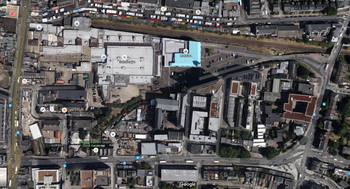
Dalston Eastern Curve
The line of the Dalston Eastern Curve is clearly shown, as it leaves the North London Line that goes across the map, and curves its way down to Dalston Junction station on Dalston Lane. The garden occupies the Southernmost section and has an entrance on the Lane.
These pictures show the area of the Curve.
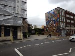
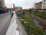


If it were to be reinstated the big losers would be the car park of the Shopping Centre and the Garden.
A new reinstated Dalston Eastern rail curve would probably be covered, as is much of the Western Curve. After all, railway lines in tunnels or covered over can be used as building land for houses, offices, shopping centres or gardens.
The rebuilding plans for Dalston Shopping Centre,shown many months ago, showed an open-aired concept, rather than the dated layout it has today. It also appears that the landlord of the Dalston Eastern Curve Garden is the owner of the Shopping Centre.
So I suppose that what Transport for London and the Shopping Centre agree is needed, will be implemented.
Other trends and facts must also be taken into account.
- The walking route between the two Dalston stations is terrible.
- Car parking is increasingly non-profitable for Shopping Centres to provide.
- More people will use bicycles and public transport to get to Dalston.
- Four extra trains an hour, are already planned on the East London Line.
- The East London Line has a capacity of twenty-four trains an hour. TfL has stated these could be six cars after some platform extensions.
- The East London Line will be given better connectivity to South East London, possibly by extending from New Cross or creating interchanges at Brockley and Penge.
- The North London Line could have more passenger trains. Especially, if freight trains on the line can be reduced.
- Waltham Forest Council has ambitions to have trains from Walthamstow Central and Chingford to Stratford by a reinstated Hall Farm Curve.
- Crossrail 2 or not, there will be massive developments up the Lea Valley, including housing and the Walthamstow Wetlands.
- Crossrail will connect to the East London Line at Whitechapel. What effects will this have on Dalston?
- Joining services back-to-back is always a good idea, as Thameslink showed years ago. It reduces the number of trains, staff and platforms needed to provide the service.
And then there is Crossrail 2, which once it is defined and started, will change everybody’s plans for Central Dalston.
I believe that the Dalston Eastern Curve will eventually be reinstated.
The main reason will be the need to have more Northern destinations for all of those trains going up and down the East London Line. A reinstated curve will allow services to go to and from Stratford and possibly if the Hall Farm curve was also to be reinstated as far as Walthamstow and Chingford.
So a series of short routes are converted into one long one, from Stratford or Chingford to say West Croydon, Orpington, Ebbsfleet or wherever!
It should be noted that at present Chingford/Walthamstow to South London is a difficult crowded journey on the Victoria Line to get a train going south from either St. Pancras or Victoria. A reinstated Hall Farm Curve would make things better by giving access at Stratford to the Jubilee Line and Crossrail in 2019.
Savvy passengers going from Stratford to South London destinations, change at Canonbury. But they would probably prefer a direct train via the Dalston Eastern Curve.
One thing that will happen, is that when the Shopping Centre is rebuilt, then space will be left to reinstate the Dalston Eastern Curve.
Beware The Tosser With A Digger!
This story from the Standard is entitled Digger cripples London Overground route after tearing down overhead wiring at level crossing.
This accident happened on a Sunday between Shepherd’s Bush and Willesden and it doesn’t appear anybody was hurt.
But it just illustrates how dangerous level crossing are.
Currently, several hours later,there is no service on the line.
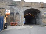
Underneath And Above The Arches
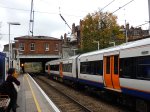
London Fields station has improved in some ways with Overgroundisation since I wrote Before Overground – London Fields in September 2014.


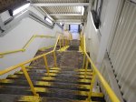


It just shows what you can do with an army of cleaners and painters. And a touch of Overground Orange!
But there is still the problem of step-free access to solve.
This Google Map shows how difficult this could be.
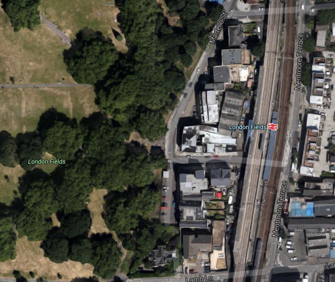
London Fields Station
The site is cramped, with the platform and stairs for the Liverpool Street platform squeezed between the slow and fast lines.
I wouldn’t be surprised if Transport for London, put the addition of step-free access to this station at the very back of the queue.
Unless of course, they could persuade a developer to do something very imaginative and expensive, which they can market as having its own station and a large park with an Olympic-sized swimming pool.
A Wall Of Flats At West Hampstead Station
I stopped off at West Hampstead station to see anything was happening on the new station.


Nothing much yet!
This article on West Hampstead Life gives details of the new station.
I will reserve judgement on the flats until they’re finished. Especially, on a windy day!
