Could Anglia Railways’ London Crosslink Be Recreated As Part Of The London Overground?
This is the first paragraph of the Wikipedia entry for the original London Crosslink.
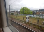
London Crosslink was a passenger train service operated by Anglia Railways between Norwich and Basingstoke, using the North London Line to bypass central London. Class 170 Turbostar diesel multiple units were used, and the service operated between 22 May 2000 and 28 September 2002, supported by funding from the Strategic Rail Authority through its Rail Passenger Partnership fund.
Note.
- The service called at Diss, Stowmarket, Ipswich, Colchester, Whitham, Chelmsford, Ingatestone, Romford, Stratford, Highbury & Islington, Camden Road, Willesden Junction, West Hampstead Thameslink, Brentford, Feltham, Staines, Woking, and Farnborough (Main)
- It ran six times on Monday to Friday and five times on Sunday.
- Feltham and Woking stations have a coach link to Heathrow.
- Journeys took around 3 hours and 44 minutes.
Over the years, attractions and other rail lines and stations served by the route have changed. improved and been added.
- In 2006, the Arsenal’s Emirates Stadium opened within walking distance of Highbury & Islington station.
- In 2012, the Olympic Stadium opened at Stratford and is now used by West Ham United.
- In 2020, Brentford Stadium opened within walking distance of Brentford station.
- There are long-term plans for a station at Brentford stadium.
- In 2022, Romford and Stratford stations were connected to the Elizabeth Line.
- In 2025, Beaulieu Park station was added to the Greater Anglia Main Line.
- In 2026, both ends of the route came under the control of Great British Railways.
At some point in the future, Old Oak Common Lane station will open to link the route to High Speed Two, the Great Western Main Line and the Elizabeth Line.
In Can The Signalling Of The London Overground Be Improved?, I looked in detail at the signalling of the London Overground and if it could handle more trains.
My conclusion was that on the East and North London Lines, another three trains per hour (tph) could probably be accommodated, which over an average day was probably around sixty trains.
As a restored London Crosslink would need just six paths per day, I would suspect the service could be restored, if it were thought to be a good idea.
I certainly feel that capacity would not be a problem.
These are a few other thoughts.
Will There Be Political Problems?
Providing the London Mayor approves, I can’s see any problem with Labour and I can’t see other parties objecting if passengers like it.
Would It Be Sensible To Use Lumo Branding And Trains?
Consider.
- Lumo is trusted branding.
- A five-car Lumo Class 803 train is 132 metres long and a pair of four-car London Overground Class 710 trains is 166 metres long, so I suspect platform length problems will be minimal.
- I doubt there will be problems on the Greater Anglia network.
- Stratford and Norwich is mainly a 100 mph network.
- Not all parts of the route have 25 KVAC overhead electrification, but batteries can be fitted to the Class 803 trains, that will cover any gaps.
- My calculations show that the modern trains will be twenty-two minutes quicker, than Anglia Railways Class 170 diesel trains.
- At one point Anglia Railways was owned by First Group, so FirstGroup may have knowledge of the problems of the route.
I believe it would be sensible to use Lumo branding and trains.
Could The Route Be Extended?
Consider.
- It could probably be extended to Winchester, Southampton and Bournemouth in the South.
- If offshore hydrogen takes off at Great Yarmouth, it might be worth extending with a reverse to Yarmouth in the North.
- Yarmouth has had a direct service from London in the past.
The service could also develop days out by the sea.
Thoughts On Splitting The Northern Line
In Battersea Power Station Station Opens, I talked about the scale of the new Battersea Power Station station.
- It looks like it could have three entrances.
- It’s got four escalators and two lifts to go to down to platform level.
- It has two terminal platforms.
I feel it has been designed to handle as many passengers and trains as Morden station.
- Morden station has five platforms.
- The station is step-free.
- The station handles ten million passengers per year.
The signalling can handle up to thirty trains per hour (tph) to Morden.
It looks to me that Battersea Power Station station has been designed to be big enough to take half the trains from North London with ease.
The Bank Station Upgrade
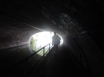
In the Bank Station Upgrade, nearly a mile of new train tunnel and several shorter pedestrian tunnels were built.
They were dug not with a tunnel boring machine, but by traditional methods, that would have been understood by Brunel and the ancient Egyptians; pick and shovel, but probably assisted by the best modern electrical diggers and trucks.
I would expect that any tunnelling needed to split the Northern Line will not use an expensive tunnel boring machine.
The Northern Line will be going back to the future.
The Proposed Split
There has been talk of splitting the Northern Line into two separate lines for some years.
- The Western Line (Charing Cross Line) would run between Edgware and Battersea Power Station via Camden Town, Euston, Charing Cross and Kennington.
- The Eastern Line (Bank Line) would run between High Barnet and Morden via Camden Town, Euston, Bank and Kennington.
Note.
- I will call the two lines the Bank and Charing Cross Lines.
- Both lines could have Victoria Line frequencies of at least thirty tph.
- It is generally felt that the split would need a rebuild at Camden Town station to handle the extra passengers.
- Camden Town station also needs better access between the trains and the street.
- There would need to be better connections at Kennington and Euston stations.
Surely, the main advantages of the split would be as follows.
- Trains on both lines would go end-to-end without crossing a junction, where signals and points were constantly switching trains. This is why the Victoria Line can handle more than thirty-three tph.
- Trains will run at Victoria Line frequencies on both lines.
- All trains at Camden Town and Kennington stations would use a route without points to go as fast as possible through the station.
- Eliminating the points, would make both lines more reliable.
- Euston station will have upwards at least sixty tph connecting it to Crossrail.
Effectively, the new Bank and Charing Cross Lines would be able to perform just like Dear Old Vicky.
I will now look at where work needs to or could be done to successfully split the two lines.
Kennington Station
In Could Access Between Platform And Train Be Improved At Kennington Station?, I outlined how passengers might use Kennington station to change between the Bank and Charing Cross Lines.
I developed this rule.
The rule would appear to be if you’re on one line and are going to a station on the other, you change at Kennington station.
Staff would need to be on the platform to help those, who were changing direction.
But I do think changing can be made to work well with step-free access between train and platform on all four platforms at Kennington station.
It will be interesting to see, what proportion of train changes at Kennington are simple cross-platform changes, where there is no use of the steep stairs. I think it could be quite high.
I believe Kennington station will grow into a very smooth interchange between the Bank and Charing Cross Lines.
Although, there’ll be a problem for some time, if you’re in a wheelchair and want to go between Morden and Battersea Power station.
This could be solved by lifts between each pair of platforms and the intermediate level passage, which connects to the lifts to the surface.
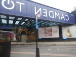
The Camden Town Problem
This map from cartometro.com shows the lines around and through Camden Town station.

Note.
- Camden Town station has four platforms.
- The Eastern pair are under Kentish Town Road and connect to High Barnet in the North.
- The Western pair are under Camden High Street and connect to Edgware in the North.
- In each pair of tracks the Northbound track is above the Southbound track.
- There is a level passage between the two Northbound tracks, so it is an easy interchange, if you’re on the wrong train going North.
- The passage between the two Southbound tracks has stairs at either end, if you want to change Southbound trains at the station.
But the real problem lies South of the station; the horrendously complicated Camden Town Junction.
The junction must be able to handle trains going between the following stations.
- Bank and Edgware
- Bank and High Barnet
- Charing Cross and Edgware
- Charing Cross and High Barnet
Note in the map, that the High Barnet tracks dive under the Edgware tracks so they can form two separate pairs of tracks to Euston, only one of which goes via Mornington Crescent.
If there was a similar junction on the motorways of the UK or the Interstate Highways of the US, it would have years ago been simplified.
The split will mean the following.
- The Eastern pair of platforms will still be connected to High Barnet as now, but will also be directly connected to the tracks that go directly to Euston and on to Bank.
- The Western pair of platforms will still be connected to Edgware as now, but will also be directly connected to the tracks that go to Euston via Mornington Crescent and on to Charing Cross.
- Camden Town Junction could be seriously simplified, with perhaps the ability to swap between routes only available for depot and engineering movements.
I do suspect, it would also mean all trains from High Barnet will go via Bank and all trains via Edgware will go via Charing Cross.
- A proportion of passengers would have to change at Camden Town.
- Both routes would connect to High Speed Two at Euston.
- Both routes connect to the Central, Jubilee, Piccadilly and Victoria Lines.
- Improvements promised for Euston will give better access to the Sub-Surface Lines.
I think it will be a case of winning some good routes and losing others. Disgusted from Finchley might complain.
But then there will be Crossrail, which as it connects to both lines at Tottenham Court Road and Moorgate could give serious advantages.
The split isn’t without passengers who will object to losing their preferred route.
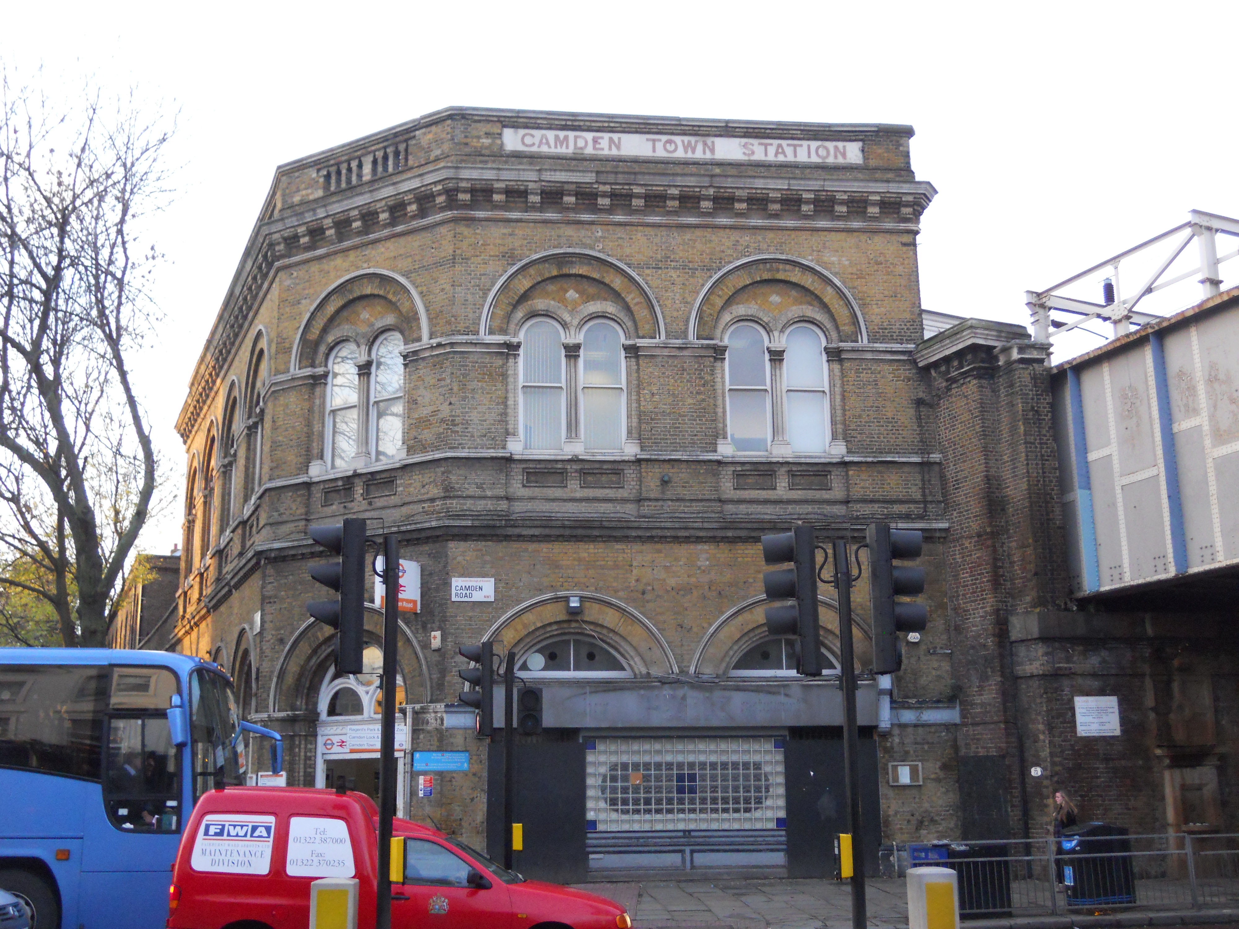
Camden Town Station
This document on TfL’s web site gives more details of the proposed capacity upgrade at Camden Town station. This schematic of the tunnels, platforms and walkways shows how the station could look in a few years time.

Note.
- New tunnels are shown in light grey.
- Existing tunnels are shown in dark grey.
- The Northbound platforms are above the Southbound ones.
- The tunnels in the foreground are those of the Charing Cross Line.
- The far tunnels are those of the Bank Line.
- The new Buck Street entrance is labelled 8.
- There is a new pedestrian tunnel between the two Northbound Lines.
- Below it is a new tunnel between the two Southbound Lines.
- There is an existing passage linking the four lines.
The full upgrade is very much on the back burner, but could Camden Town station be upgraded with the proposed extra cross passages.
- These would enable passengers to change lines easily on the level.
- Passengers changing between the Bank and Charing Cross Lines could be kept away from the existing escalators and the space at their bottom.
- The tunnels would increase the circulation area.
- The tunnels would be part of the new Buck Street entrance if it were to be built.
I feel with improved cross-platform interchange, Camden Town could function as an interchange station between the Bank and Charing Cross Lines.
A similar rule as I used for Kennington station would apply for passengers.
The rule would appear to be if you’re on one line and are going to a station on the other, you change at Camden Town station.
Staff would need to be on the platform to help those, who were changing direction.
But it would be a more comprehensive and easier interchange than Kennington, as all changes would be without steep stairs.
Once Camden Town station is working well with the new cross passages, I would then get a developer to put a large development on the proposed site of the Buck Street entrance, with a new entrance with lifts and escalators underneath, that reached down to the new cross tunnels.
After what the contractors did at Whitechapel, I suspect this could be achieved, whilst keeping the trains running and leaving the existing Camden Town station intact.
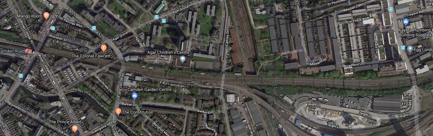
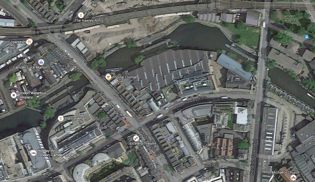
This Google Map shows the area between Camden Road and Camden Town stations.
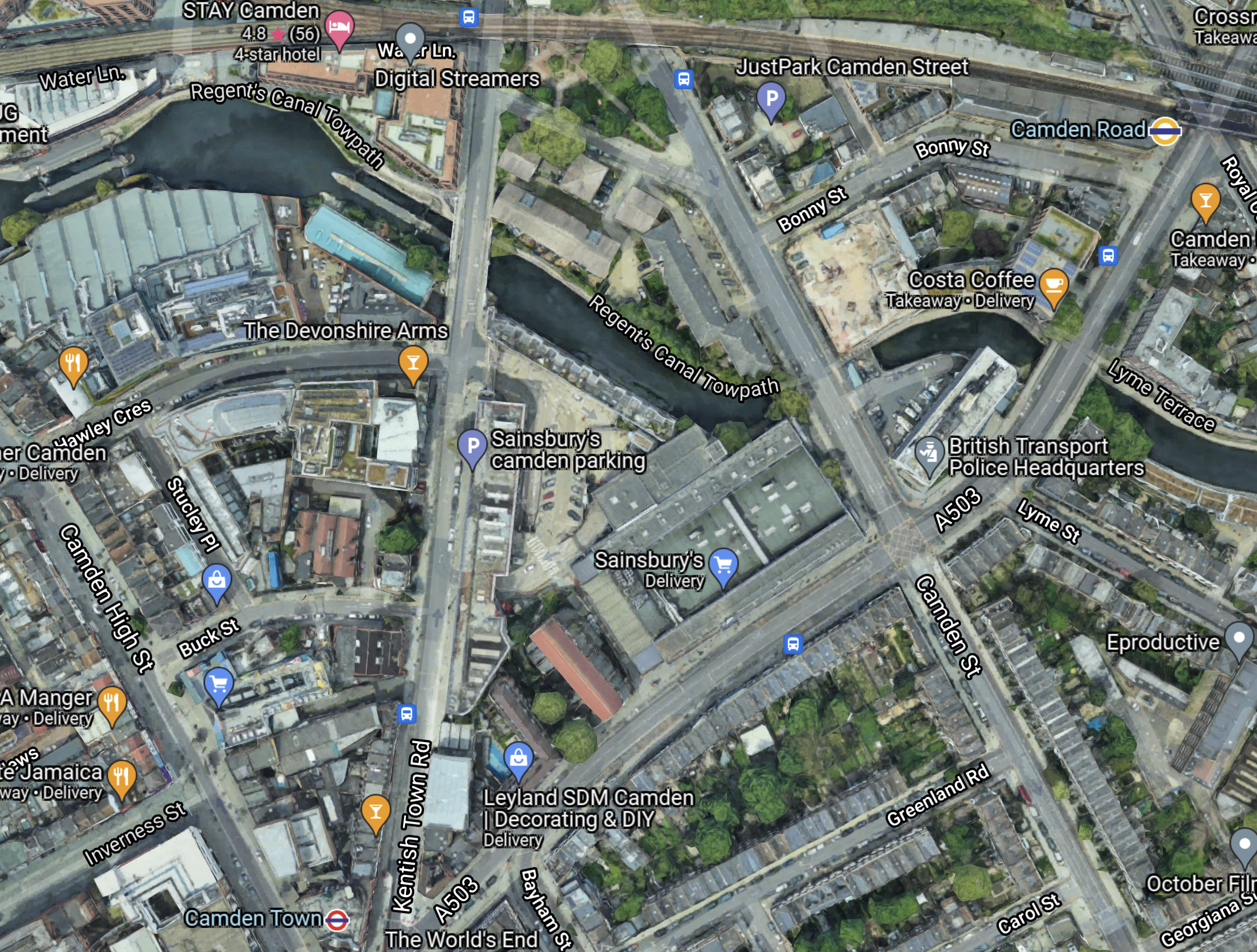
Note.
- Camden Road station on the North London Line is in the North-East corner of the map.
- Camden Town station is at the bottom of the map towards the West.
- The Charing Cross Line to Edgware is under Camden High Street.
- The Bank Line to High Barnet is under Kentish Town Road.
- Buck Street is to the North of Camden Town station connecting Camden High Street and Kentish Town Road.
- The red-roofed building in Buck Street is the former Hawley School, which is now owned by Transport for London and is earmarked for the new station entrance.
- The Regent’s Canal, which has a convenient towpath, runs East-West across the map.
- A lot of development is happening on the North bank of the canal.
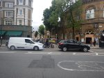
The map doesn’t show how difficult it is to walk between the two stations along the busy Camden Road.
In Between Camden Road And Camden Town Stations Along The Canal, I walked between the two stations along the canal and then up Kentish Town Road. It took me fourteen minutes in total with seven minutes between the canal and Camden Town station.
I believe the following will happen.
- People living and working in the new developments will need access to Camden Town station.
- The Regent’s Canal towpath will be updated into a safer walking route between Camden Lock and Camden Road station, that serves a lot of the developments.
- More tourists will need to get to Camden Lock and the markets.
These will increase the need for extra capacity at Camden Town station.
The only way it will get built is by a private developer, who puts a lot of housing on the Buck Street site and sells it as quality housing in an iconic location.
A lot of politicians won’t like it, but solving the problems at Camden Town station, which is an overcrowding accident waiting to happen, is more important than their egos.
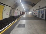
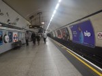
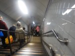
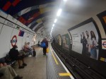
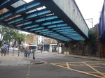
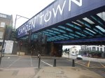
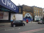
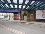
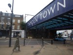
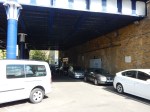
These pictures show some of the features of Camden Town station.
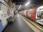
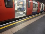
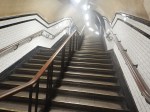

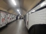


I believe Camden Town station could grow quickly into a very smooth interchange between the Bank and Charing Cross Lines.
In a few years time, when the Buck Street entrance is built, the capacity problems will be on their way to solution.
Finally, once the Buck Street entrance is complete, the original station can be refurbished.
Euston Station, Crossrail, Crossrail 2 and the Northern Line
Consider.
- Euston station is a very busy station and it will be even busier, when High Speed Two opens.
- Crossrail 2 will not be built before High Speed 2 opens.
- The Victoria Line doesn’t connect to Crossrail.
- The only connection between Euston station and Crossrail are the two branches of the Northern Line.
Splitting the Northern Line into the Bank and Charing Cross Lines will increase the number of Northern Line trains through Euston to at least sixty tph, if both lines can handle Victoria Line frequencies.
It looks to me, that making the Northern Line step-free at Euston is the best short-term alternative to building Crossrail 2.
Euston Station
Euston station is the third station, where the Bank and Charing Cross Lines connect.
This map from cartmetro.com shows the Northern Line through Euston station.
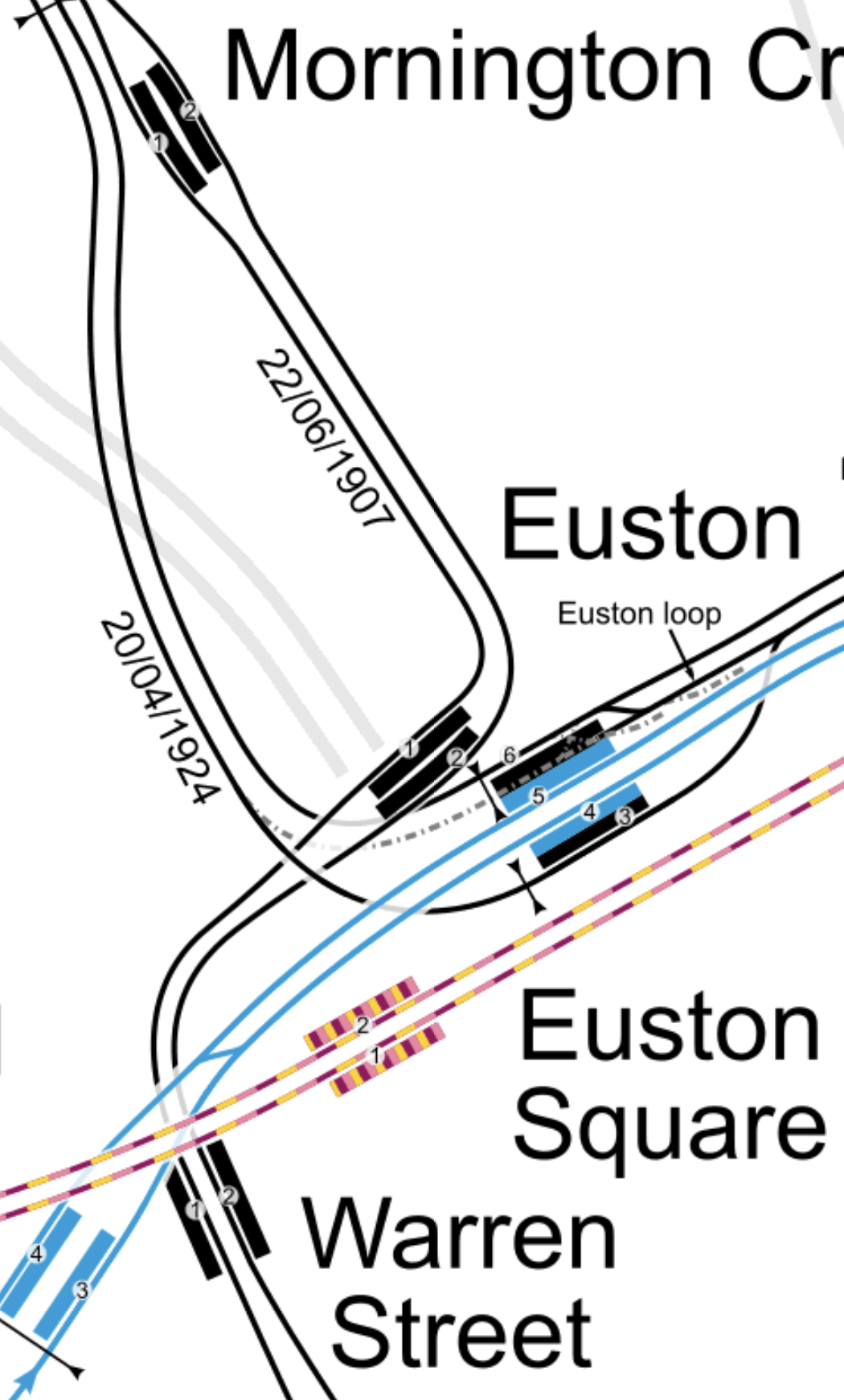
Note.
- The Northern Line is shown in black.
- The Victoria Line is shown in blue
- The Sub-Surface Lines are shown in purple and yellow.
In the map, the platforms are as follows going from top to bottom.
- Platform 1 – Northbound – Northern – Charing Cross to Camden Town
- Platform 2 – Southbound – Northern – Camden Town to Charing Cross
- Platform 6 – Southbound – Northern – Camden Town to Bank
- Platform 5 – Northbound – Victoria – Victoria to Walthamstow
- Platform 4 – Southbound – Victoria -Walthamstow to Victoria
- Platform 3 – Northbound – Northern – Bank to Camden Town
It is a bit unusual as the cross-platform interchange between Bank and Victoria Lines involves a change of direction.
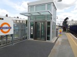
With the development of Euston station for High Speed Two, I am sure interchange between the two branches of the Northern Line and the other lines at Euston will be made step-free.
Plans have already been published that will connect Euston Square station and Euston station. I wrote about it in The New Step-Free Entrance At Euston Square Station.
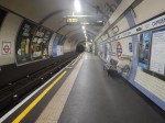
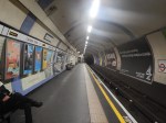
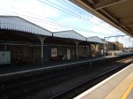
These pictures are of Euston station.
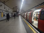
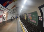
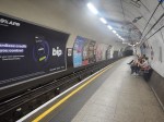
I feel the wide Platform 6 could give scope for innovation.
Level Access Between Train And Platform
I believe that many platforms on the Northern Line can be modified to give level access between train and platform.
In Could Access Between Platform And Train Be Improved At Kennington Station?. I outlined how it could be achieved at Kennington station.
At Kennington station, all platforms are straight and this is a prerequisite to making the access level.
I also feel that any straight platform with a Harrington Hump could effectively be given a full length hump.
I suspect that a lot of stations could be converted to level access between train and platform
Conclusion
I believe that splitting the Northern Line would be very worthwhile.
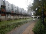
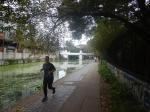
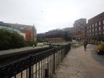
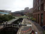
Between Camden Road And Camden Town Stations Along The Canal
This walk is preferable to walking along the busy Camden Road with its heavy traffic and narrow pavements.

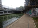
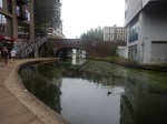
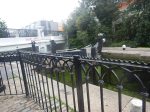
Note.
- The entrance is at the side of a Costa Coffee on the Camden Road.
- The canal seems to have more than its share of green algae.
- Hawley School in Buck Street will be the site of the new entrance to Camden Town station.
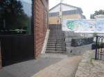
- Kentish Town Road could do with some decent buildings.
- It is not an area, that is short on graffiti.
- But is short on signage compared to some parts of the Regent’s Canal.
- It took me seven minutes walking along the canal and another seven minutes on Kentish Town Road. But I wasn’t walking fast.
The route is also an easy way to get to Camden Lock from Camden Road station, which avoids the chaos at Camden Town station.
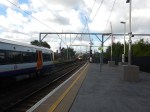
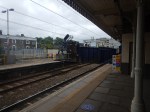
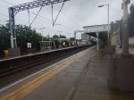
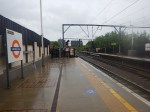
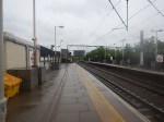
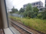
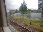
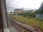
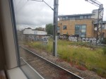
Could London Overground Services To Stratford Be Extended To Meridian Water?
My arrival In Platform 11 at Stratford station has got me thinking!
And others too! Judging by the comments I’ve received.
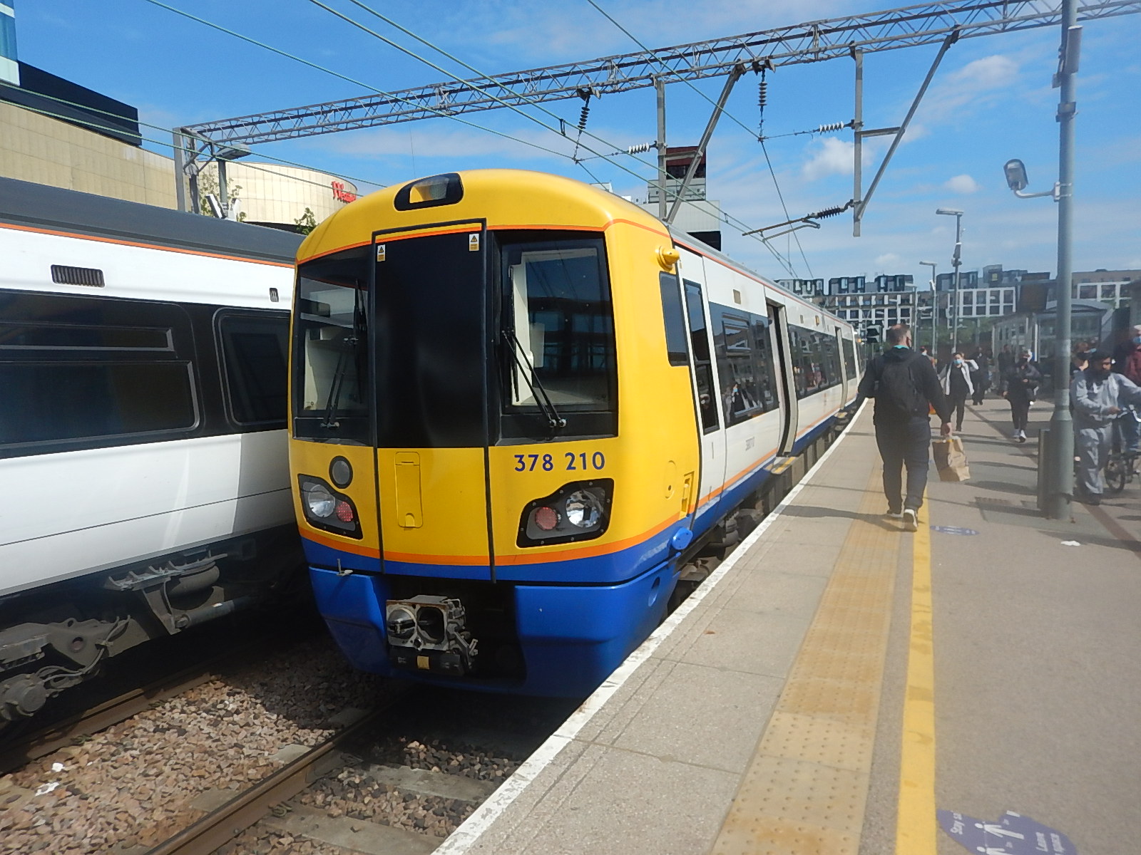
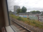
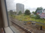
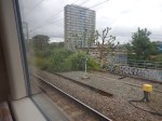
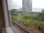
Yesterday, I took a train from Dalston Kingsland station to Stratford station.
- The train was the 0934 from Clapham Junction, which was timed to arrive in Stratford at 1038.
- It arrived in Platform 11 at 1036.
In A London Overground Class 378 Train In Platform 11 At Stratford Station, I show pictures of the train in Platform 11 at Stratford station.
I suspected this was just a one-off occurrence, caused by a malfunction in a train or the signalling, which prevented my train from using the normal Platforms 1 or 2, that services to Stratford would use.
Although, looking at Real Time Trains, the 0938 train this morning, terminated in Platform 11. As it did on Monday and Tuesday this week.
- This train was the only train from Clapham Junction station not to use Platform 2.
- Checking days last week, it appears that this train always terminated in Platform 2.
So why did the service terminate in Platform 11?
Driver training is one possibility, so they can use the Platform 11, if there is a malfunction that stops them using Platform 2.
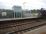
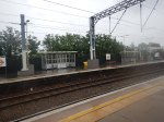
But is there a clue in the first picture, I took, when I arrived in Stratford?
The train in Platform 12 is the 1046 to Meridian Water, which arrived from Bishops Stortford at 1040.
Could it mean that there is to be a reorganisation of platforms at Stratford?
- Platform 12 will be exclusively used by Greater Anglia for their West Anglia Main Line services.
- Platform 11 will be used by London Overground.
In Using Platform 12 At Stratford Station, I described ending up on Platform 12, so I know it is possible, but when it happened information was bad for passengers, who didn’t know here they needed to go to continue on their way.
But why would London Overground need the extra platform?
These are my thoughts.
Do London Overground Need An Extra Platform At Stratford?
Currently London Overground services to Stratford are as follows.
- Four tph – Stratford and Richmond
- Four tph – Stratford and Clapham Junction
Note.
- tph is trains per hour.
- Both Class 378 and Class 710 trains can work the routes to Stratford.
- Eight tph can easily be handled by two platforms.
To handle more trains may need a third platform at Stratford for the London Overground.
Extra Trains Between Stratford And Canonbury
This report from Network Rail is entitled The London Rail Freight Strategy (LRFS).
It says this about creating a third platform at Camden Road station.
This proposal would reinstate a third track and platform on the northern side of Camden Road station, utilising part of the former 4-track formation through the station.
The additional capacity provided would facilitate much greater flexibility in pathing options for trains on this busy central section of the NLL, opening up new options for future service provision and bolstering performance resilience.
Reinstatement of a third platform would enable platform 2 to be used as a central turnback, with platform 3 becoming the eastbound line for through London Overground services and the majority of freight.
Transport for London modelling suggests that the eastern end of the NLL, from Canonbury to Stratford, will see some of the strongest long-term demand growth on the Overground network.
A turnback platform will allow this to be addressed with peak capacity boosting services between Stratford and Camden Road and there would also be the option to operate these through the off-peak, which could offer a means of providing additional passenger capacity where it is most needed.
The availability of an additional platform would also aid performance recovery during perturbation on
the orbital routes.
Note.
- The strongest passenger growth on the North London Line (NLL), will be between Canonbury and Stratford.
- Extra services are proposed between Stratford and Camden Road stations.
- If you travelled between Highbury & Islington and Stratford before the pandemic, the trains only had space for a few extra very small people in the Peak.
I use this section of the North London Line regularly and suspect the route needs at least twelve tph.
Twelve tph into Stratford would probably mean that the London Overground would need a third platform at Stratford.
More Trains Serving Meridian Water
In the Wikipedia entry for Meridian Water station, this is said.
In August 2019, it was announced that funding had been approved for construction of a fourth platform and a new section of track between Tottenham Hale and Meridian Water to enable up to 8 trains per hour to serve the station at peak times.
This must be the earliest upgrade in history, after a new station has opened.
I got the impression, when the station was announced that it would have four tph to Stratford. Currently, there are just two tph.
Two tph between Stratford and Bishops Stortford also pass through without stopping.
If these called at Meridian Water in the Peak, then there would still be four tph to find.
An easy way to create four tph between Stratford and Meridian Water would be to extend four London Overground services from Stratford.
- Services would call at Lea Bridge, Tottenham Hale and Northumberland Park stations.
- Trains would pass through Platform 11 at Stratford.
- Platform 11 at Stratford would be bi-directional.
- The service could be run all day, at a frequency of four tph.
- As these trains have their own track, they won’t delay the Cambridge and Stansted trains on the West Anglia Main Line.
- A cross-London service between Meridian Water and Clapham Junction or Richmond, would be possible.
Note.
- London Overground would be responsible for the bulk of the Meridian Water service.
- London Overground’s four- or five-car trains would probably have sufficient capacity for the service.
- The main new infrastructure needed would be the fourth platform and a new section of track at Meridian Water station.
- Some improvements as specified in the London Rail Freight Strategy will be useful, as they will increase capacity on the North and West London Lines.
- My only worry would be, that can modern signalling handle four tph in both directions through Platform 11 at Stratford station.
What Will Be The Track Layout And Method of Operation?
The current track layout is simple.
A bi-directional third track has been laid between Lea Bridge junction, just to the North of Lea Bridge station and Meridian Water station.
- It is to the East of the double-track West Anglia Main Line.
- There are bi-directional platforms at Tottenham Hale and Northumberland Park stations.
- There is a single terminating Platform 2 at Meridian Water station.
A train going between Stratford and Meridian Water stations does the following.
- Leaves from Platform 11 or 12 at Stratford station.
- Calls in Platform 2 at Lea Bridge station.
- Switches at Lea Bridge junction to the bi-directional third-track.
- Calls in Platform 2 at Tottenham Hale station.
- Calls in Platform 2 at Northumberland Park station.
- Terminates in Platform 2 at Meridian Water station.
A train going between Meridian Water and Stratford stations does the following.
- Leaves from Platform 2 at Meridian Water station
- Calls in Platform 2 at Northumberland Park station.
- Calls in Platform 2 at Tottenham Hale station.
- Switches at Lea Bridge junction to the Up line of the West Anglia Main Line.
- Calls in Platform 1 at Lea Bridge station.
- Terminates in Platform 11 or 12 at Stratford station.
The track layout can probably handle a maximum of two tph.
I suspect the upgrade will build on this layout to allow a frequency of at least four tph.
The following works will be done.
- A fourth track to the East of the bi-directional third track will be built.
- The fourth track will run between Tottenham Hale and Meridian Water stations.
- I suspect the fourth track will split from the third track at a junction to the North of Tottenham Hale station. Could this be called Tottenham Hale North Junction? I will use that name, to make things simple!
- A new Platform 1 will be built in Meridian Water station.
- Trains going North between Tottenham Hale and Meridian Water will use the current bi-directional third track and will be able to terminate in either Platform 1 or 2 at Meridian Water station.
- Trains going South between Meridian Water and Tottenham Hale will use the new fourth track and will be able to start from either Platform 1 or 2 at Meridian Water station.
- I suspect, Northumberland Park station will need a new Platform 1 for Southbound trains. But the station was designed with that in mind.
A train going between Stratford and Meridian Water stations will do the following.
- Leave from Platform 11 or 12 at Stratford station.
- Call in Platform 2 at Lea Bridge station.
- Switch at Lea Bridge junction to the bi-directional third-track.
- Call in Platform 2 at Tottenham Hale station.
- Call in Platform 2 at Northumberland Park station.
- Terminate in Platform 1 or 2 at Meridian Water station.
A train going between Meridian Water and Stratford stations will do the following.
- Leave from Platform 1 or 2 at Meridian Water station.
- Use the new fourth track to come South.
- Call in Platform 1 at Northumberland Park station.
- Continue on the bi-directional third-track at Tottenham Hale North Junction.
- Call in Platform 2 at Tottenham Hale station.
- Switch at Lea Bridge junction to the Up line of the West Anglia Main Line.
- Call in Platform 1 at Lea Bridge station.
- Terminate in Platform 11 or 12 at Stratford station.
The track layout is effectively two double-track sections linked by a bi-directional single track between Lea Bridge Junction and Tottenham Hale North Junction.
- On the double-track sections of the route trains can pass each other, as they are on different tracks.
- Lea Bridge and Tottenham Hale stations are 1.9 miles apart.
- Trains take three or four minutes between Lea Bridge and Tottenham Hale stations. Including the stop at Tottenham Hale on the single track section.
If trains could alternate through the single-track section, this would give a capacity of well over four tph in both directions.
- A train going North would wait in Platform 2 at Lea Bridge station until the previous Southbound train had cleared Lea Bridge junction, before proceeding North.
- A train going South would wait at Tottenham Hale North Junction until the previous Northbound had safely passed, before proceeded South.
I suspect that the trains need full digital signalling with a degree of Automatic Train Control.
But I suspect we could see six tph in both directions.
- This would fit nicely, with London Overground’s ambition of six tph on all routes.
- It could be increased to eight tph in the Peak, by arranging for an appropriate number of Greater Anglia services to and from Liverpool Street at Meridian Water.
I feel that a service that meets all objectives will be possible.
Proposals From The London Rail Freight Strategy That Might Help
These proposals from the London Rail Freight Strategy might help.
- NLL, GOB And WLL Headway Reductions – See Headway Reductions On The Gospel Oak To Barking, North London and West London Lines
- Kensal Green Junction Improvement
- Moving The West London Line AC/DC Switchover To Kensington Olympia
- Stratford Regulating Point Extension
- Camden Road Platform 3 – See Will Camden Road Station Get A Third Platform?
- Clapham Junction Platform 0 – See Will Clapham Junction Station Get A Platform 0?
It does look to me, that the London Rail Freight Strategy was designed with one eye on improving the passenger train service between North-East and South-West London.
Taking The Pressure Off The Victoria Line
Consider.
- If you’re going between Walthamstow and the West End or the major stations of Euston, Kings Cross, St. Pancras and Victoria, you will use the Victoria Line.
- If you live in the new housing, being built at Meridian Water, currently you will be likely to hop to Tottenham Hale station and take the Victoria Line.
Consequently, Northern end of the line can get busy! And not just in the Peak!
But a four tph service between Meridian Water and Stratford, will encourage passengers to go to Stratford to take advantage of the Central and Jubilee Lines and Crossrail.
Hence there will be less passengers, who need to use the Victoria Line.
A Better Interchange Between Camden Road And Camden Town Stations
The essential upgrade of Camden Town station has been put on indefinite hold due to TfL’s financial position.
This is a big mistake.
- Camden Town station gets dangerously full!
- It would allow the splitting of the Northern Line into two independent lines, which would increase capacity of the current system.
- Camden Town station is not step-free but Camden Road station has lifts.
Hopefully, it would result, in a better route between the two stations, rather than the polluted route on a narrow pavement.
I very much believe that the rebuilding of Camden Town station is the most important project to improve London’s Underground and Overground network.
But it won’t get built with the current Mayor, as he’s a South Londoner.
Could A Meridian Water and Clapham Junction Service Be An Affordable Crossrail 2?
Consider.
- Crossrail 2 will link Clapham Junction and Meridian Water via Central London and Dalston.
- A Meridian Water and Clapham Junction service would link the two stations via Shepherd’s Bush, Old Oak Common, West Hampstead, Camden Road, Dalston and Stratford.
Each route has their connectivity advantages.
- Both have good connections to Crossrail, Thameslink and the Bakerloo, Central and Jubilee Lines.
- The London Overground route has good connections to the Victoria Line and High Speed Two at Old Oak Common.
- Crossrail 2 serves important stations in Central London.
A Meridian Water and Clapham Junction service could be a valuable addition to London’s rail infrastructure without too much new expensive infrastructure.
Conclusion
An extension of some London Overground services from Stratford to Meridian Water would be worthwhile.
Implementation of this is made easier by the recommendations of the London Rail Freight Strategy.
I
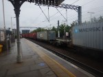
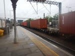
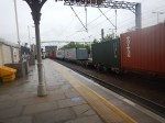
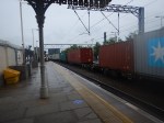
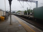
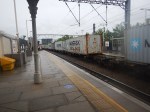
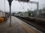
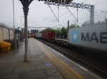
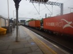
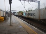
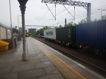
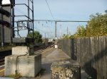
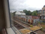
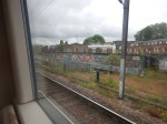
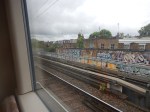
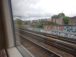
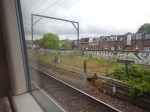
A Very Long Freight Train At Camden Road Station
I took these pictures as a very long freight train passed through Camden Road station.
Note.
- I estimate the train had 45 positions for containers.
- Fourteen or fifteen were not filled.
- I suspect the train started in Wentloog in South Wales and was going to the Port of Felixstowe.
- That route is fully electrified from Wentloog to Ipswich.
- The journey took over eight hours.
This could be a route, where an innovative Class 93 locomotive could be able to handle the freight train all the way across England and half of Wales.
- Most of the way, the locomotive would be using the electrification.
- The short distance at Wentloog and the fifteen miles at Felixstowe would be handled by the onboard diesel engine and the substantial battery.
These will be world-class zero-carbon freight trains, just by changing the motive power.
Will Camden Road Station Get A Third Platform?
London has a rail capacity problem, for both freight and passenger trains.
This report from Network Rail is entitled The London Rail Freight Strategy (LRFS).
One of the recommendations of the report is to build a third platform at Camden Road station. It says this about the third platform.
Reinstatement of a third track and platform on the northern side of Camden Road station, utilising part of
the former 4-track formation through the station.
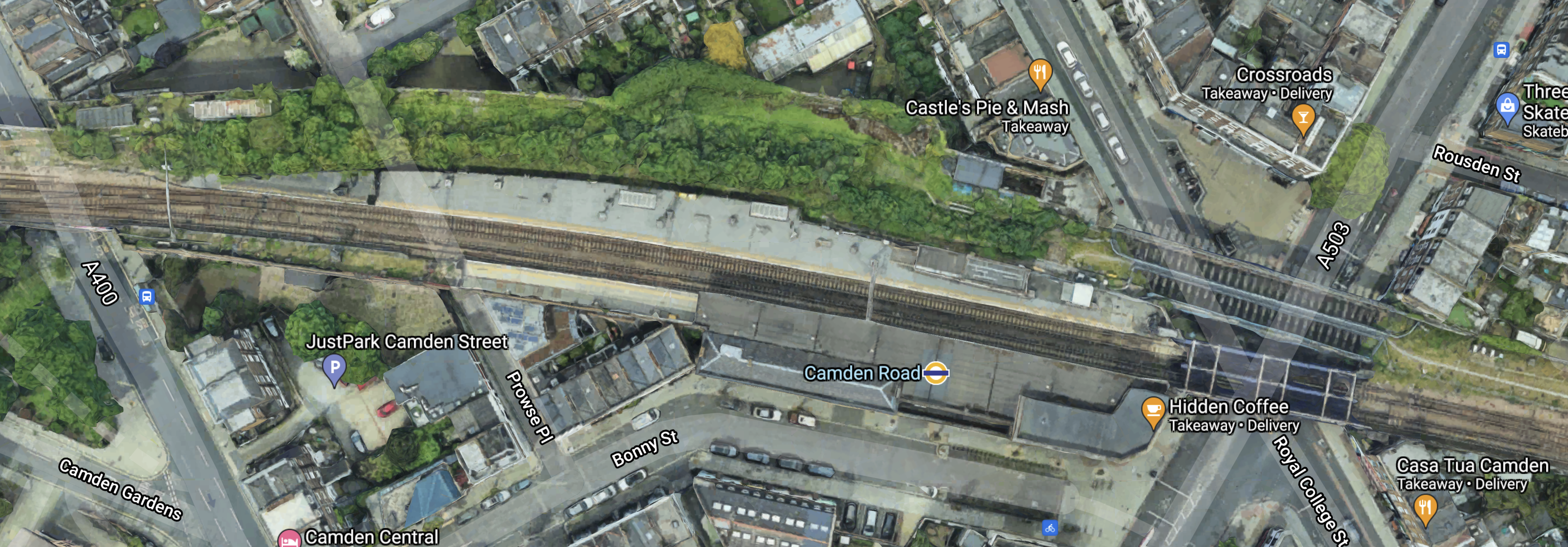
Camden Road station used to have four platforms, but now it just have two.
This Google Map shows the station as it is today.
Note.
- Platform 1 is on the South side of the tracks with the London Overground roundel conveniently shown on the roof.
- Platform 2 is on the North side of the tracks.
- Regular users of the station can probably pick out the lift at the Eastern end of Platform 2.
- There is a bridge to the East of the station which takes the tracks over the junction of Royal College Street and Camden Road.
To the North of this bridge, two further bridges can be seen, that used to take the former third and fourth tracks over the roads and into two additional platforms to the North of the current two.
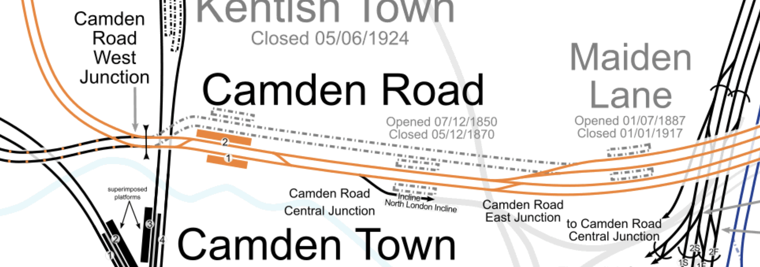
This map from cartometro.com shows the track layout through Camden Road station.
Note.
- The tracks shown in orange are the route of the North London Line of the London Overground.
- The two orange platforms labelled 1 and 2 at Camden Road station.
- The two former lines passing behind Platform 2, used to rejoin the North London Line to the West of the station.
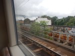
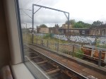
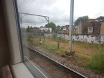
These pictures were taken on the current Platform 2.
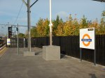
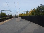
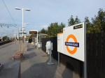
And these are some pictures of the bridge, what is behind the fence and other bridges.

Note.
- Most of the pictures of Platform 2, were taken from Platform 1.
- Behind the fence on Platform 2, there appears to be a substantial urban forest.
- Renewing the bridges and updating the railway arches could improve the area significantly.
- Camden Road station is a Grade II Listed building.
I don’t think, that any of the construction would be too challenging.
How Would The Third Platform Be Used?
This is said in the Network Rail document about the third platform at Camden Road station.
This proposal would reinstate a third track and platform on the northern side of Camden Road station, utilising part of the former 4-track formation through the station.
The additional capacity provided would facilitate much greater flexibility in pathing options for trains on this busy central section of the NLL, opening up new options for future service provision and bolstering performance resilience.
Reinstatement of a third platform would enable platform 2 to be used as a central turnback, with platform 3 becoming the eastbound line for through London Overground services and the majority of freight.
Transport for London modelling suggests that the eastern end of the NLL, from Canonbury to Stratford, will see some of the strongest long-term demand growth on the Overground network.
A turnback platform will allow this to be addressed with peak capacity boosting services between Stratford and Camden Road and there would also be the option to operate these through the off-peak, which could offer a means of providing additional passenger capacity where it is most needed.
The availability of an additional platform would also aid performance recovery during perturbation on
the orbital routes.
That all looks fairly sensible and wouldn’t require much work to the current station.
Note.
- Platform 2 is currently a fully-accessible platform with a lift and will become a spacious fully-accessible island platform with two faces 2 and 3, both serving London Overground services going East.
- There must surely be space on the island platform to build a substantial shelter, where passengers can sit, when long freight trains are passing through.
- There could even be space for a coffee kiosk.
The former Platform 3 appeared to be a Westbound platform, but the proposed new one appears to be an Eastbound one.
The Track Layout Immediately To The East Of Camden Road Station
These are my thoughts on the track layout to the East of Camden Road station.
This map from cartometro.com shows the track layout between Camden Road and Highbury & Islington stations.
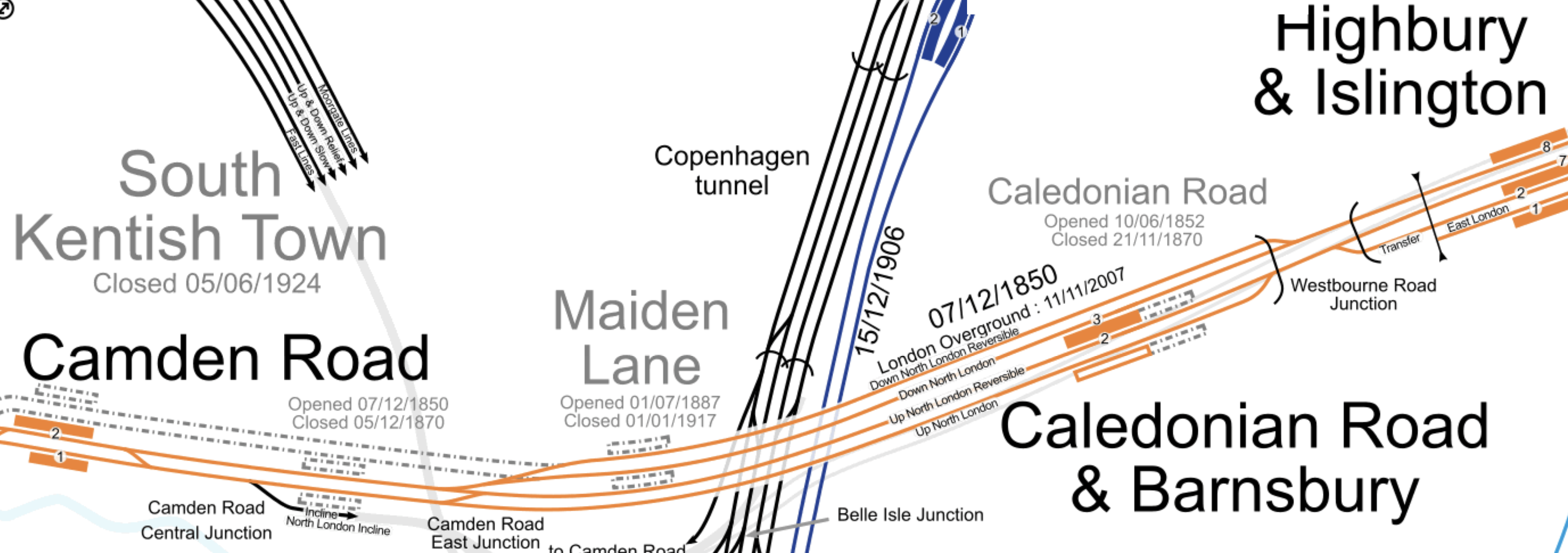
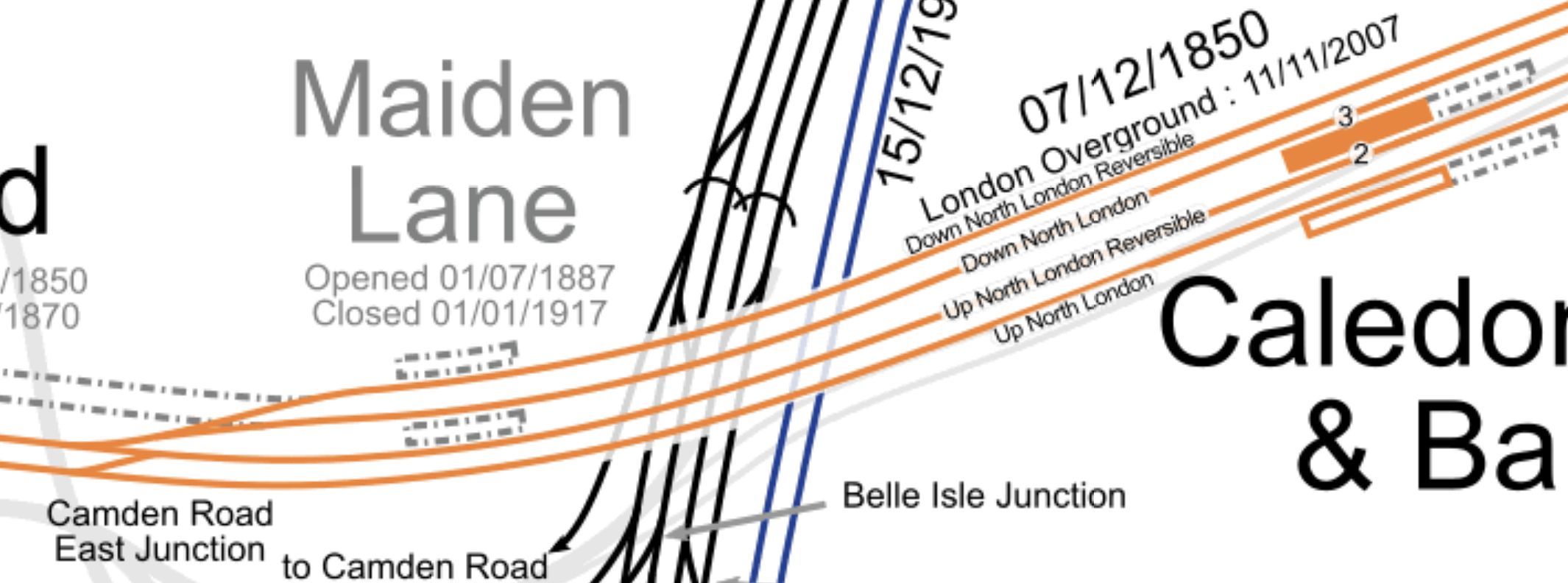
Much of the route through Caledonian Road and Barnsbury station is four tracks. These tracks are named from North to South as follows.
- Down North London Reversible
- Down North London
- Up North London Reversible
- Up North London
Note.
- Eastbound London Overground services use the Down North London track.
- Eastbound freight services use the Down North London Reversible track.
- Eastbound freight services are sometimes held by signallers on the Down North London Reversible track.
- Westbound London Overground services use the Up North London Reversible track, before crossing over to the Up North London track at Camden Road East Junction.
- London Overground services only use the central island platform at Caledonian Road and Barnsbury station.
- Westbound freight services use both of the Up North London tracks.
- The London Borough of Camden have stated that they would like to see the reopening of Maiden Lane station.
These pictures show the former trackbed between the former Maiden Lane station and Camden Road station.
Looking at these pictures, I can deduce the following.
- There is very little constructuction of the former trackbed.
- There would be some signalling equipment to move.
- Some of the steel bridges would have to be replaced.
I feel, that a single track could definitely be created between the new Platform 3 at Camden Road station to connect with both Down North London tracks before the site of the former Maiden Line station.
It may even be possible to squeeze in two tracks.
A new track or tracks would enable the following.
- Eastbound London Overground services to go from Platform 3 at Camden Road station to Platform 3 at Caledonian Road and Barnsbury station.
- Eastbound freight services to go from Platform 3 at Camden Road station to either the Down North London Reversible or the Down North London tracks through Caledonian Road and Barnsbury station.
Note.
- Westbound services going through Camden Road station would be unaffected.
- Westbound London Overground services terminating in Platform 2 at Camden Road station would cross over to the current Up North London Reversible at the current Camden Road Central junction.
- Eastbound London Overground services starting in Platform 2 at Camden Road station would cross over to the new track or tracks to proceed to the East.
These are my answers to a few questions.
Will There Be One Or Two Extra Tracks?
Consider.
- It could probably be organised that the extra track or tracks start perhaps fifty metres or so to the East of Camden Road station.
- The distance between this point and Westbourne Road Junction is around a mile.
- Network Rail allows freight trains up to a length of 775 metres.
I am drawn to the conclusion, that if two tracks were to be built, then signallers would be able to hold the longest freight trains on the extended Down North London Reversible track, without interrupting London Overground passenger services.
How Will The Extra Tracks Affect The Camden Highline?
If two new tracks are built, I would expect that it will be impossible to build the Camden Highline.
But if only one is built, I suspect that a narrower Camden Highline might be able to be squeezed in.
Could Provision Be Made So A New Maiden Lane Station Could Be Built?
This map from cartometro.com shows the track layout around the former Maiden Lane station.
Consider.
- Eastbound London Overground services use the Down North London track and call in Platform 3 at Caledonian Road and Barnsbury station.
- Westbound London Overground services use the Up North London Reversible track and call in Platform 2 at Caledonian Road and Barnsbury station.
- To connect Platform 3 at Camden Road station to the Down North London Reversible and Down North London tracks, I suspect that Camden Road East junction will have to be remodelled.
I wonder if by the application of Network Rail’s latest track layout software, space could found for an island platform between the Up North London Reversible and Down North London tracks.
In Is Caledonian Road And Barnsbury An Ideal Four-Track Station?, I discuss the design of Caledonian Road and Barnsbury station,
I think it is a distinct possibility, that provision could be made for a future Maiden Lane station.
Will There Be Changes At Camden Road West Junction?
This map from cartometro.com shows the track layout to the West of Camden Road station.
Note.
- Platforms 1 and 2 of Camden Road station at the Eastern end of the map.
- Camden Road West junction to the West of the platforms.
- The dotted lines of old tracks leading to the former Platform 3 and 4 at Camden Road station.
Two double tracks lead away to the West from Camden Road West junction.
- The orange tracks are the North London Line to Willesden Junction and Acton.
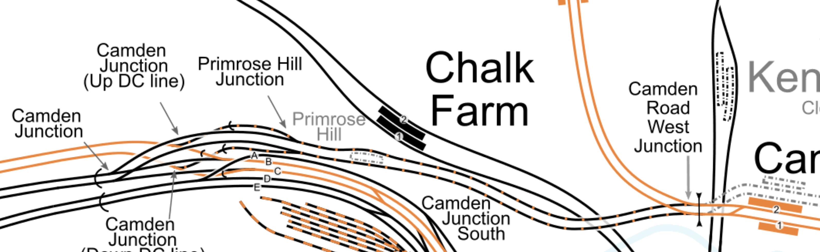
- The black and orange tracks are an extension of the Watford DC Line, that links Camden Road station to the West Coast Main Line via Primrose Hill station.
Will both pairs of tracks be connected to the North London Line at Camden Road West junction, as they are now?
- Currently, a few freight trains per day, use the Primrose Hill route.
- There have been plans in the past, for the London Overground to use this route.
- They have also been known to run a Rail Replacement Train between Willesden Junction and Camden Road stations during engineering works, as I wrote about in The Future Of The Watford DC Line.
So I suspect Network Rail will design a comprehensive junction, that is all things to all operators and trains.
Through Running Between The East London Line and Willesden Junction Station
This was originally talked about in the original plans for the London Overground.
If you travel on the Overground to Barking, Blackhorse Road, Canada Water, Highbury & Islington, West Brompton, Hampstead, Whitechapel or Willesden Junction in the Peak, the interchanges are very busy, as passengers are transferring to the Underground.
Was this why through running was originally proposed between the East and North London Lines at Highbury & Islington station, as it would allow direct connection to extra Underground lines?
But one of the aims of the Overground was to enable journeys around London without going via Central London.
Platform 3 at Camden Road station, seems to increase the capacity on the North London Line, so perhaps this upgrade would give extra paths to allow some services to terminate to the West of Highbury & Islington.
This map from cartometro.com shows the track layout to the West of Highbury & Islington station.
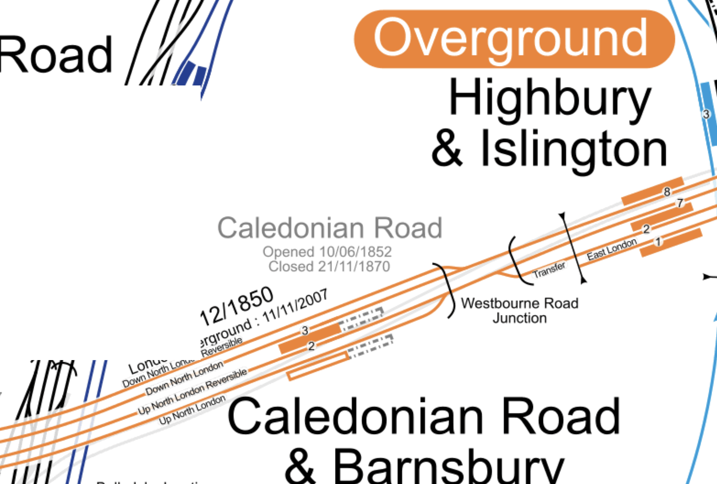
I’m sure if Network Rail’s engineers can sort out King’s Cross, then they can come up with a track and signalling system that can handle this,
Could Platform 2 At Camden Road Be Used As An Alternative Terminus For Watford DC Line Services?
Euston station is being rebuilt and Network Rail might like to kick Watford DC Line services out of the station either temporarily or even permanently.
There are two routes that the Watford DC Line could take to get between Harlesden and Camden Road stations.
- They can use the route, I took one Sunday, when the London Overground was running a Rail Replacement Train, via Willesden Junction Low Level, Kensal Green, Queens Park, Kilburn High Road and South Hampstead.
- They might also be able to join the North London Line an improved Kensal Green junction.
The first route works and the second may need some extra work at Harlesden junction.
I estimate that Platform 2 at Camden Road station is presently as long as 120 metres.
I also estimate that it could be lengthened at both ends, during the building of a new platform 3 alongside.
Could a platform be built long enough to be able to handle two trains simultaneously?
- A four-car Class 710 train at the Western end.
- A five-car Class 378 train at the Eastern end.
A 200 metre long platform would probably suffice!
I think the concept has possibilities.
- Willesden Junction station has connections to the Bakerloo Line.
- West Hampstead station has connections to Thameslink and the Jubilee and further connections could be developed,
- Camden Road station could be connected to Camden Town station, which is on both branches of the Northern Line.
- A reopened Primrose Hill station could be connected to Chalk Farm station on the Northern Line.
- The Northern Line connects to Crossrail at Moorgate and Tottenham Court Road stations.
I suspect, if Camden Town station were to be expanded and rebuilt, that the connection between the two Camden stations would be more likely.
Either route could be taken between Willesden Junction and Camden Road stations.
But I feel, it might be less costly to take the North London Line route, especially, as this connects to West Hampstead station.
Could The Track Layout Be Further Simplified?
I’m no track expert, but it strikes me that a four-track layout could be built between just East of Camden Road station and Westbourne Road junction. From North to South these tracks would be.
- Eastbound Freight line – Connecting at the Western end to Platform 3 at Camden Road station and following the existing Down North London Reversible track to Westbourne Road junction.
- Eastbound Overground line – Connecting at the Western end to Platforms 2 and 3 at Camden Road station and following the existing Down North London track through Caledonian Road and Barnsbury station to Westbourne Road junction.
- Westbound Overground line – Connecting at the Western end to Platforms 1 and 2 at Camden Road station and following the existing Up North London Reversible track through Caledonian Road and Barnsbury station to Westbourne Road junction.
- Westbound Freight line – Connecting at the Western end to Platform 1 at Camden Road station and following the existing Up North London track to Westbourne Road junction.
Note.
- Both freight lines would be long enough for signallers to hold freight trains, so that other services could overtake.
- East of Caledonian Road and Barnsbury station, Overground and freight service would share the two tracks, as they do now!
- West of Camden Road station, Overground and freight service would share the two tracks, as they do now!
It strikes me that by good design, the capacity and speed through this section of the busy North London Line can be increased.
Related Posts
These are related posts about the London Rail Freight Strategy (LRFS).
Decarbonisation Of London’s Freight Routes
East Coast Main Line South Bi-Directional Capability
Gauge Improvements Across London
Headway Reductions On The Gospel Oak To Barking, North London and West London Lines
Heavy Axle Weight Restrictions
Kensal Green Junction Improvement
Longhedge Junction Speed Increases
Moving The West London Line AC/DC Switchover To Kensington Olympia
Moving The West London Line AC/DC Switchover To Shepherd’s Bush
Stratford Regulating Point Extension
Will Clapham Junction Station Get A Platform 0?
Access To The Western End Of The Camden High Line
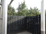
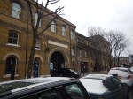
I took between Camden Road and Camden Town stations on Sunday.
I was investigating two questions.
- How would you provide access to the Western end of the Camden High Line?
- How would you improve interchange between the North London Line and Northern Line stations?
These are some of the pictures that I took.
I can see a few strengths and problems.
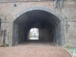
Architectural Quality
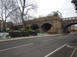
Camden Gardens has several Listed buildings, but the viaduct appears not to be Listed.
The brick viaduct is a substantial one and like most of this type of structure in the UK, Network Rail seem to keep it in good condition.
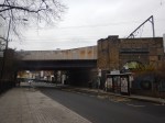
You have to remember that there was a derailment on the bridge, which I wrote about in Fall Out From A Train Crash. So I suspect, it has had a detailed check-up since.
The only eyesore is the steel bridge over Camden Street. But Network Rail have ways of making them look better. A good coat of paint would help.
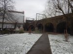
Camden Gardens
To my mind, Camden Gardens needs development. Not in any negative sense, but it is surrounded by pedestrian traffic generators.
- Camden Road station to the East
- The Regents Canal to the South
- Camden Town station to the South, which will have a new step-free Northern entrance, about a hundred metres from the Gardens.
- |A large mixed development on the other side of Kentish Town Road.
- It is on the direct route between Camden Road station and the tourist attractions around Camden Lock.
It could be developed into a convenient oasis for those walking in the area.
Perhaps there needs to be a cafe in one of the arches.
Camden Interchange
In Boris Johnson’s Transport Infrastructure Plan for 2050, the Appendix mentioned that there will be an interchange between Camden Town and Camden Road stations. Unfortunately, a copy of the report is not available on the Internet.
But it can’t be deleted from my memory.
I feel strongly, that as after the expansion of Camden Town station, the two stations will be physically closer, that a Western entrance to Camden Road station, should be built, if the sums added up.
Consider.
- It would create a convenient interchange between the two rail services.
- It would improve access from Camden Lock and the new developments on the North side of the Regent’s Canal.
But it could also create access to the Camden High Line.
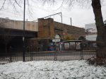
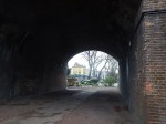
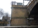
The Height Of The Viaduct
The viaduct is high, as the last-but-one picture in the gallery shows.
Because of the railway tracks, between the two platforms, which means the only way to cross is to walk to the other end of the platforms and go down and up again, design of affordable and practical access, will be challenging.
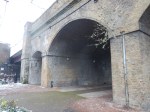
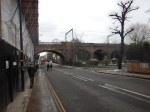
A Station Entrance On The Camden High Line
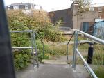
The first picture in the gallery, shows the shrubbery on the two disused tracks, that could become the Camden High Line, behind a fence.
It would surely be possible to create a ticket gate in a small building on the wide platform.
Conclusion
With clever design it would be possible to provide access to the Camden High Line and the station in a single development.
Thoughts On The Camden High Line
Last night, I was made aware of the Camden High Line proposal.
On their web site, they say this is their mission.
Our mission is to transform the disused railway into a sustainable green space and transport link that is open for and used by everyone.
Here are my thoughts.
The Railway Line In Question
This map from carto.metro.free.fr shows the disused railway tracks.
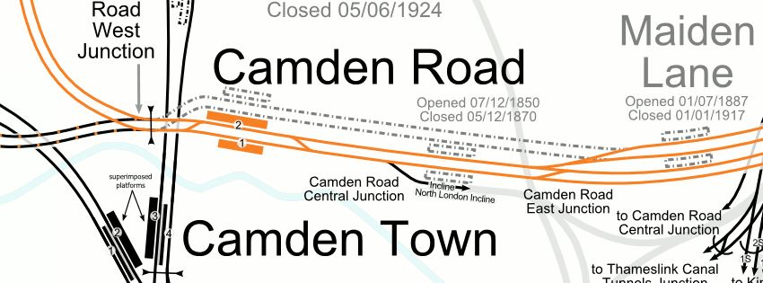
Note.
- The line shown in orange is the North London Line of the London Overground.
- Camden Road is a two-platform station, with full step-free access.
- Maiden Lane is a disused station, that closed a hundred years ago.
I would assume that the two dotted lines between the two stations, will be converted into the Camden High Line.
This Google Map shows the North London Line between Camden Road and Maiden Lane stations.
One of the most striking features visible from this map, is the large amount of development going on to the South of the North London Line.
The new residents and workers could probably do with a good walking and cycling route between Camden Town and Kings Cross.
Plans For The North London Line
The North London Line is a heavily-used passenger and freight route and it is unlikely, that traffic levels will drop.
Freight Traffic
There are now two electrified rail routes across North London; the North London Line and the Gospel Oak to Barking Line.
As two of the UK’s main container ports; Felixstowe and London Gateway, are not served by electrified railways, this still means that large numbers of diesel-hauled freight trains have to pass through North London to get to the Midlands, North and Scotland, despite the routes from Ipswich and Tilbury being fully-electrified.
These diesel-freight trains are boosted because the alternative route via Ipswich, Ely and Peterborough is not electrified.
The following needs to be done to seriously cut the number of diesel-hauled freight trains through North London.
- Electrify Ipswich to Felixstowe.
- Electrify to London Gateway.
- Electrify Ipswich to Peterborough.
- Replace a large fleet of polluting diesel Class 66 locomotives with modern electric units.
In some ways, the replacement of the locomotives by private freight companies is the largest stumbling block.
However, I think that the two shorter lengths of electrification will happen, which will mean that less diesel-hauled freight trains will pass through London, as they will go via Peterborough.
On the other hand, the need for freight trains will increase.
- More traffic to and from the ports.
- Freight to and from the Channel Tunnel, which must go through London.
- Trains carrying vehicles seem to be becoming more numerous.
I wouldn’t be surprised to see calls from the rail freight industry for improvements to the two freight routes through London.
One thing that will help freight trains, would be extra passing loops, where freight trains can wait for the passenger trains to overtake.
The double track of the Camden High Line is one of the few places, where another freight loop could possibly be installed.
Passenger Traffic
Sometime this year, two extra passenger trains per hour (tph) will run on the North London Line between Stratford and Clapham Junction stations.
This will bring the frequency to six tph.
On the past history of the London Underground, this will mean more full trains and pressure for longer trains and more services.
Old Oak Common Station
But the biggest changes will come in the next few years with a new Old Oak Common station, which will connect the North London Line to HS2, Crossrail, Chiltern, Great Western Railway and the West Coast Main Line.
Remember too, that the North London Line will be connected to Crossrail at Stratford.
Will these developments create a demand for extra trains on the North London Line?
Camden Town Station
Camden Town station on the Northern Line is being extended, with a new Northern entrance closer to the North London Line.
Will better routes be provided between Camden Road and Camden Town stations?
Interchange Between Camden Town And Camden Road Stations
Camden Town station’s new entrance will be to the North of the current entrance just off Kentish Town Road.
This Google Map, shows the Western end of Camden Road station.
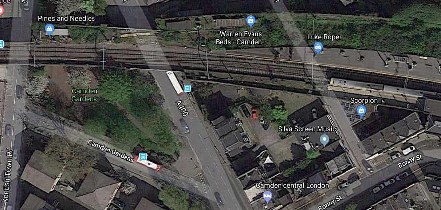
Note.
- There is a train in the Westbound platform.
- Kentish Town Road meets the station by Camden Gardens.
- The overgrown unused tracks to the North of the current station.
- The green space of Camden Gardens, with the 88 bus stand.
Could a second entrance to Camden Road station be built within the viaduct, perhaps with a ground-level entrance in Camden Gardens?
- It would be a short walk to the new entrance to Camden Town station.
- It would be convenient for walking to Camden Lock and the other attractions along the Regents Canal.
If the Camden High Line is created, access to the Eastbound platform could be directly to and from the High Line, which would be a garden to the North of the station.
Maiden Lane Station
Wikipedia says this about the re-opening of Maiden Lane station.
Camden Council has suggested this station could be rebuilt and reopened, in conjunction with the King’s Cross Central redevelopment project.
In June 2017, the Council were talking with Tfl on the possible reopening of Maiden Lane & York Road stations which it wished to reopen with Maiden Lane more likely to reopen then York Road.
I suspect, if the station is reopened, it will be on the Southern pair of lines, currently used by the London Overgr4ound.
One of the problems of reopening Maiden Lane station, is that a stop at the station would decrease capacity on the North London Line, through the area.
Plans For The East London Line
The East London Line is one of the UK’s rail successes of the last few years.
An outpost of the London Underground, through a tunnel, built by the Brunels, was turned into a modern railway with new trains and sixteen tph all day.
But this is only a start!
Plans exist for more new trains, an extra fout tph through the tunnel and a possible uprating of the signalling to handle a frequency to 24 tph.
If the latter should happen, I feel that another Northern terminal will be needed for the East London Line.
The obvious terminal is Willesden Junction station.
- Willesden Junction was certainly mentioned, when the London Overground was opened.
- There is a bay platform at the station.
- ,The station can be reached via Camden Road, Primrose Hill, South Hampstead, Kilburn High Road, Queen’s Park and Kensal Green stations.
- It will have good connections to an extended Bakerloo Line.
It would create another route across North London.
Would it mean extra platforms at Camden Road station?
Conclusion
I think that there will be a very large demand for using the two old tracks for rail purposes.
Is Hackney Downs Station A Suitable Case For Treatment?
Some of the stations on the London Overground, are architectural gems.
The picture shows some the internal detail of the refurbished Grade II Listed Crystal Palace station. The cafe was created in an area of the station, that few realised existed.
There is also work going on at Peckham Rye station, where an enormous Victorian waiting room has been discovered. An architect called Benedict O’Looney seems to be on a mission to restore the station to its former glory.
Peckham Rye station could be step-free as early as 2019, so I suspect that the station could become more important in the grand scheme of things.
What would Del Boy have thought?
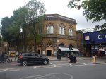
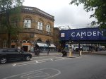
There is also Camden Road station, which is in pretty-good nick.
If Camden Road station has a problem, it is that the station possibly needs more passenger capacity and perhaps one of the closed platforms to be reopened.
I’d love to know what is behind those windows on the top floor.
Hackney Central station has a similar building to Camden Road station.
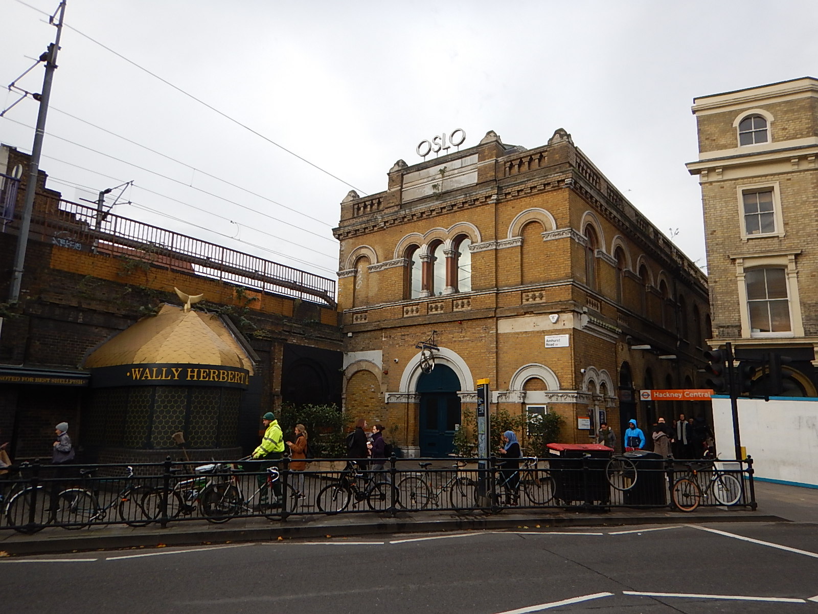
It looks like Hackney Central will get a modern station building to go with the step-free footbridge. But I suspect everything is on hold until the plan for Crossrail 2 is finally decided.
Yesterday, I was in Hackney Downs station and I was told that the bland station building abandoned by British Rail, might be worth restoring.

Who knows what lies behind the brick walls and lurks in the dark spaces under the tracks in the old station building?
Knowing the way, many of these railway stations were built, I wonder if London Overground could come up with an imaginative scheme to create a Victorian counterbalance to the more modern Hackney Central, in what will inevitably be Hackney Interchange.
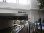
The Camden Town Station Upgrade Exhibition
This afternoon I went to the Camden Town Station Upgrade Exhibition at the Trinity United Reformed Church, Buck Street, Camden Town NW1 8NJ.
It will be on tomorrow and Saturday.
I did get a few questions answered and I have a few comments.
- This capacity upgrade is only concerned with the upgrade to Camden Town station and has nothing to do with improving the routes between this station and Camden Road station.
- I do think that provision should be made for a connection, even if it isn’t made until quite a few years.
- As in the current station, steps will still normally be used to access the two Southbound platforms from the main circulating space.
- For those needing step-free access to and from the surface, there will be a second lift lobby at Southbound platform height, below the main circulating space.
- Anybody crossing between the two Southbound or the two Northbound platforms will have a step-free route across.
I think that it is important that in addition to upgrading the capacity at Camden Town station, that the routes between the two Camden station; Town and Road should be improved for the following reasons.
- Camden Road is a station with full step-free access and if you lived or were staying within easy reach of the North London Line, you might find the route a much better alternative for going to the attractions of Camden Town and Camden Lock. I sometimes go for a coffee with my son, who works in Camden Town by that route from Dalston.
- Camden Lock is five hundred metres from Camden Road station and three-hundred and fifty metres from Camden Town stations and the longer route can be less busy.
- Walking between Camden Road station and Camden Lock has been improved recently, by creating a set of steps down from Camden Road to the Regent’s Canal. This may encourage many to walk to the Camden Lock area along the canal.
- Using Camden Road station or a bus for leaving the area avoids using the long spiral staircase to descend to the Northern Line at Camden Town station, which at times is the only route to the platforms.
- During the building of the capacity upgrade at Camden Town station, any alternative route that takes pressure off the station will be welcomed.
- The current walking route along Camden Road is very crowded and involves two crossings of roads on controlled crossings.
- Access to buses could be better thought out.
I would do the following.
- Improve the Regent’s Canal route between Camden Road station and Camden Lock. At present it is a bit difficult at the Camden Lock end, due to the development of Hawley Wharf.
- Improve the steps from the canal to Kentish Town Road, so that, when the Buck Street entrance to Camden Town station is opened, you have a shorter walk between the two stations.
- The Kentish Town Road steps could also provide a possibly quicker route to Camden Lock and the Roundhouse from the Buck Street entrance.
In addition lots of maps and signposting could point out some of the myriad routes and short-cuts in the area.
Eventually, a second entrance could be built at an expanded Camden Road station in the area of Camden Gardens.
Perhaps, by building much of the entrance in the three empty arches under the railway and using external lifts and escalators as has been done in buildings like the Pompidou Centre, the Lloyd Building or Deansgate-Castlefield tram stop in Manchester.
This Google Map shows the area.
Camden Gardens, Camden Lock And Buck Street
Camden Gardens is at the top right around the viaduct of the North London Line, which runs across the map to Camden Lock. Kentish Town Road goes almost North-South through the area, with Buck Street towards the bottom. The triple building is the school that currently occupies the proposed station site. I would estimate that the distance between Camden Gardens and Buck Street could be little more than two hundred metres.
Perhaps, the Buck Street entrance building, needs a back entrance on Kentish Town Road?
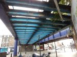
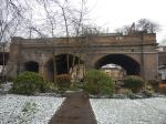
To finish this is a picture of the viaduct across Camden Gardens.
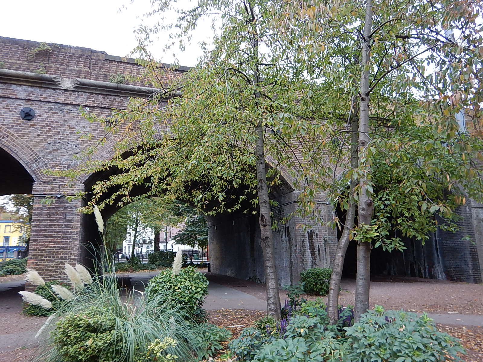
After being rebuilt since the freight train crash of a couple of years ago, I’m sure another good use can be found for it.
