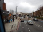
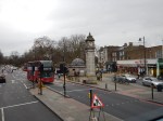
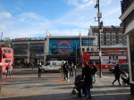
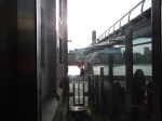
Is This Tube Advert Going To Upset Nicola?
I saw this advert on a Metropolitan Line tube train today.
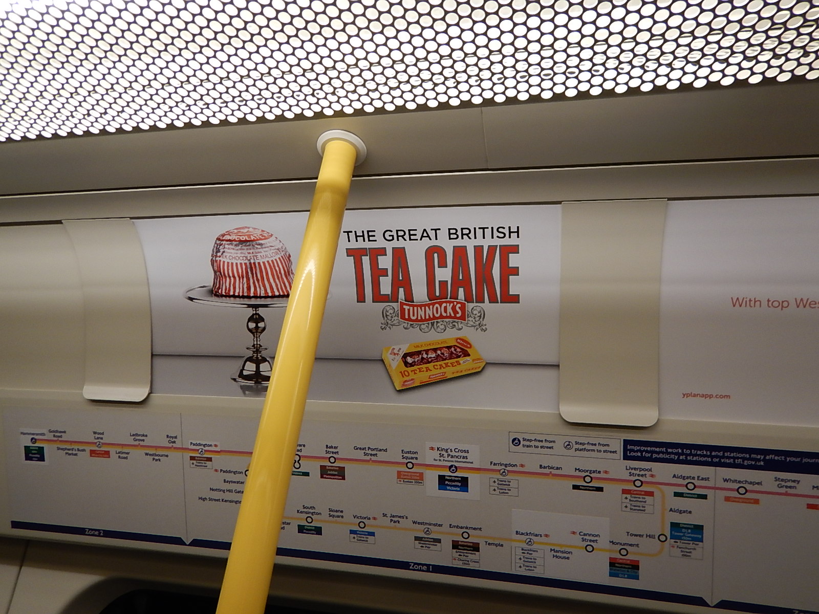
Is This Tube Advert Going To Upset Nicola?
Are some Scots, going to dislike the advert?
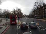
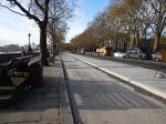
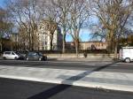
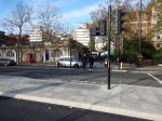
On A Bus From Kennington To Tooting Broadway
These are pictures I took from a 155 bus, as it trundled along the Northern Line between Kennington station and Tooting Broadway station.


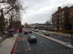

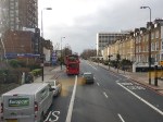

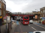
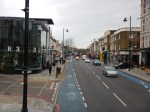
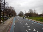

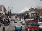
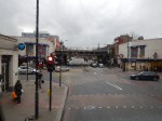
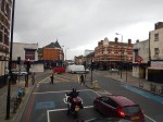
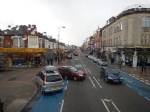
In some ways, it is a curious journey with several ventilation shafts for the Northern Line and the deep shelters under some of the stations.
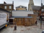
I was surprised at the number of deep level shelter entrances you can see. But at least according to this article in the Wandsworth Guardian entitled Clapham’s Second World War shelter to become cafe and exhibition, Transport for London are thinking about using these relics of World War II in a positive way.
Only from a bus do you notice the closeness of Clapham High Street station on the East London Line and Clapham North station on the Northern Line. This Google Map show the two stations.
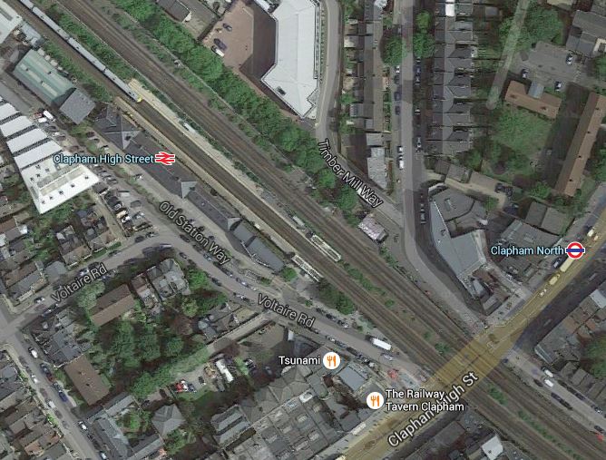
Clapham High Street And North Stations
Clapham North is one of those Northern Line stations with an island platform. This is a detailed line map from carto.metro.free.fr.
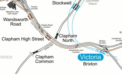
Lines Around Clapham High Street
It would appear that if Transport for London decided to sort out the dangerous (in my view!) platforms at Clapham Common and Clapham North stations, which both have escalators, then there could be some scope for an innovative step-free station linking the new platforms at Clapham North to Clapham High Street station.
It is a classic place where some extreme fag packet and used-envelop engineering washed down with several pints of real ale in the public bar of a local hostelry, could come up with an inspiring solution.
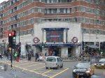
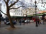
Fun At The Elephant And Castle
When I was driving, I used to find the Elephant and Castle roundabout confusing, especially as being a North Londoner, you don’t cross the Great Sewer unless you’re accompanied by a posse. (Make sure, they’re not Ipswich supporters, as they get lost at Liverpool Street!)
The Underground Station
In some ways Elephant and Castle tube station can be confusing and is almost two separate stations connected by long, dark tunnels under the roundabout.
- The Northern entrance is directly over the Bakerloo Line platforms
- The Southern entrance seems to give better access to the Northern Line platforms.
There are no escalators, but the Southern entrance is likely to be rebuilt. Wikipedia says this.
A major upgrade is being planned by Transport for London to bring improvements to the station; these include a new Northern line ticket hall, three new escalators and additional lifts to provide step-free access to the Northern line platforms. This will be done in conjunction with the major transformation in the Elephant & Castle area to create thousands of new homes and potential for new retail development to provide growth potential in the area.
That would be a great improvement.
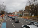
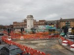
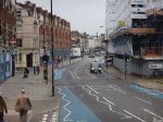
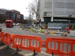
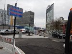
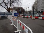
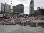
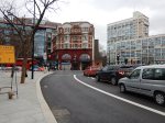
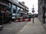
The New Road Layout
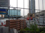
Things look like they’re going to get a lot more fun for drivers at the Elephant and Castle judging by this traffic scheme that will start on Sunday.
This Tfl web page shows the scheme and this TfL map shows the final layout.
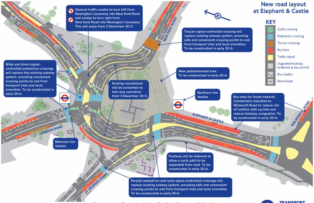
Elephant And Castle Roundabout
It’s even got its own web-site.
For comparison, this is a Google Map of the area before any roadworks.
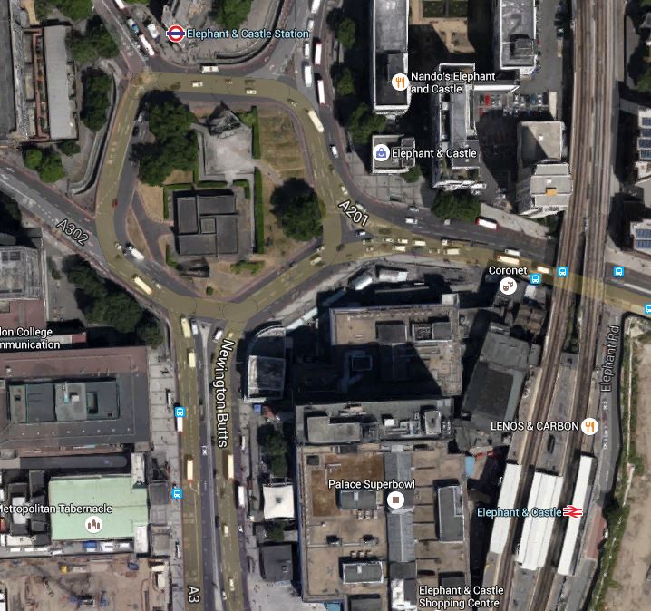
Elephant And Castle Northern Roundabout
Note.
- The drawing of the new scheme has North to the left.
- The Bakerloo Line entrance is on the North Side of the old roundabout, with the Northern Line entrance at the South
- A quick look could say that the road space will be wider, but shorter after reconstruction.
It could well be a lot easier for pedestrians like me!
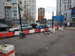
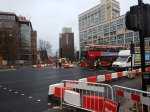
December 3rd, 2015
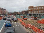
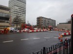
These are pictures taken on Thursday the third.


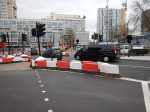


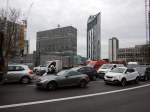
The traffic seemed pretty dense even at ten in the morning.
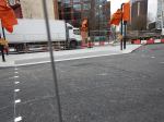
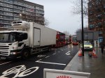
December 5th, 2015
These pictures were taken about the same time on Sunday the 5th.


Note that I walked a similar route on the third.
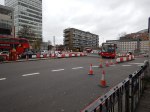
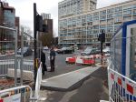
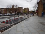
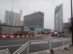
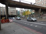
The Pedestrian Routes Are Emerging
The main difference between the two sets of pictures, is that on the North, West and East sides of the roundabout, traffic is now two-bay with a traffic island between the two carriageways.
The South side is no longer used for traffic and will be pedestrianised early in 2016.
It is now possible to see how when the scheme is complete, that the centre of the old roundabout will be joined to the South Side. This will mean that to walk from the Northern Line station to the Bakerloo line station, will require only one road crossing at the North Side of the old roundabout.
I have some questions.
- Will the middle be landscaped? Obviously!
- Will there be a cafe in the middle? Hopefully?
- Will the preferred route to the Bakerloo Line trains from the surface, always be to enter the Bakerloo Line entrance and then descend in the lifts there, which take you directly to the platforms? It might be a shorter and more pleasant walk, than a long one in a tunnel!
After my visit today, I think I can see a purpose to the new design.
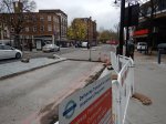
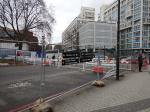
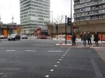
December 7th, 2015
This was the first working day at the same time as the previous sets of pictures.


I did see a picture, which showed a cafe and I think that if they can do the same at Old Street, which seems to be the next roundabout removal I’ll be pleased.
Although there is this article on the BBC, which is entitled Elephant and Castle: Two-way traffic redesign causes chaos. This is said.
The removal of the Elephant and Castle roundabout has been causing chaos for commuters, with motorists complaining of queues of more than an hour.
But then good news doesn’t draw viewers to the web site.
I’ll come back and watch this one in the future.
Signs Of The Northern Line Extension
I have been past Battersea Power Station twice in the last few days and have been able to take pictures of the conveyors linking the excavations of the now-started Northern Line Extension to the river.
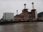
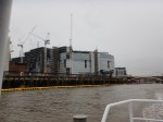
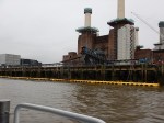
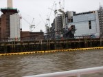
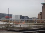
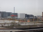
I do wish I could find a train from which it is possible to get a decent photograph of the conveyors and the barge, which is used to take the spoil away. Sadly, it wasn’t there when I took the Thames Clipper trip yesterday.
In this article in the Railway Gazette, the following is said.
Boring of twin tunnels is due to begin in early 2017 and is expected to take six months to complete. An expected 680 000 tonnes of material would be excavated. A 300 m long conveyor belt will carry 92% of this to the River Thames, from where barges will carry it to Goshems Farm in East Tilbury to the east of London.
This is only a small project compared to Crossrail or Crossrail 2, but you have to wonder, if we should be doing a few smaller rail projects like this, to squeeze more capacity out of our overcrowded railways, metros and trams.
In London some smaller projects come to mind.
- Extending the Victoria Line to Herne Hill station, which I wrote about in Could The Victoria Line Go To Herne Hill?
- Extending the Bakerloo Line, which according to this TfL press release has overwhelming support.
- Reinstating the Hall Farm Curve to allow direct services between the Chingford Branch Line and Stratford.
- Connecting the Central and East London Lines at Shoreditch High Street station.
The only certainty, is that the projects that get started will surprise us.
The Croxley Rail Link Is Now The Metropolitan Line Extension
This report in the Railway Gazette is entitled Metropolitan Line Extension Funding Agreed. This is said.
The funding package for the Metropolitan Line Extension project has been finalised, London Underground announced on November 23. Construction is now expected to start next year, with completion due in 2020.
The project has now also changed its name from Croxley Rail Link to Metropolitan Line Extension.
There is now also this page on Transport for London’s web site, which comes with this new map.
Metropolitan Line Extension
I have to ask, whether the timing of this is significant, as the Chancellor’s Autumn Statement is on Wednesday.
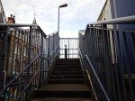
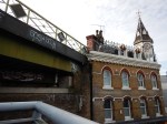
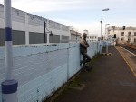
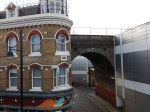
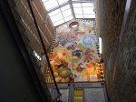
Changing Trains At Brixton
These pictures are a record of changing from Brixton tube station on the Victoria Line to Brixton station for a train to Herne Hill.


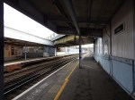

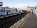


Note the following.
- The Underground station is step-free, but the rail station definitely isn’t!
- Platform 1 at Brixton station for Victoria is only accessible with difficulty.
- Platform 2 is by internal staircase with artwork.
- The platforms have two bronze figures on the platforms. I’d like to see more of the bronzes in store in our galleries exhibitied on stations. You certainly couldn’t nick them from Brixton station.
The Underground station is one of the best, but the rail station is best described as unusual.
This Google Map shows the two stations.

Brixton Station
Simple it isn’t!
How complicated and expensive a new station would be depends on how many connections, you want passengers to have.
Building an Overground station in the sky would be expensive, as height always costs money.
But putting decent stairs and lifts into the existing Brixton station would be routine compared to linking to the Overground.
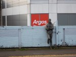
The only way to connect all three lines would be to rebuild the Argos building as a triple dcker station with lifts and escalators.
But it would be horrendously expensive, even if there were some shops and a lot of flats on the top of everything.
But the bulding would be well connected!
I think that the best that can be hoped for is lifts and decent stairs in the main line station.
Will The Victoria Line Go To Herne Hill?
The Wikipedia entry for the Victoria Line has a section entitled Possible Future Projects. This is said.
For many years there have been proposals to extend the line one stop southwards from Brixton to Herne Hill. Herne Hill station would be on a large reversing loop with one platform. This would remove a critical capacity restriction by eliminating the need for trains to reverse at Brixton. The Mayor of London’s 2020 Vision, published in 2013, proposed extending the Victoria line “out beyond Brixton” by 2030.
Now that the dodgy crossover on the approach to Walthamstow Central station has been replaced, this extension to Herne Hill station must be higher up Transport for London’s list of priorities, as they try to squeeze more capacity out of London’s railways.
This metro map from carto.metro.fr, shows the lines around Herne Hill.

Victoria Line And Herne Hill
Note the blue lines of the Victoria Line going a short distance past the terminal platforms at Brixton tube station.
The plan calls for these stubs to be extended in a wide loop under Herne Hill station, where there would be a single platform beneath the current platforms.
I think that this was a project that should have some years ago, as it would surely have taken some of the pressure off Victoria tube station, during the current rebuilding.
In the London Transport Infrastructure Plan for 2050, under New Links and/or stations for Strategic Interchange, there is a mention of Brixton High Level, which I wrote about in Could The Various Lines At Brixton Be Connected?. I finished with.
So it would appear that substantial improvement at Brixton could be achieved by creating a High Level station linking the various lines together and perhaps using an iconic lift tower to the ground.
Brixton needs an iconic creation to go with the vibrancy of the area, that doesn’t destroy everything. This could be the High Level station. Having seen the way that the walkway was threaded through at Hackney, I think there are at least one set of engineers and architects up to the challenge.
But building an iconic station at Brixton would cause a lot of disruption.
However, it could be argued and the passenger figures might show it, that another station at Herne Hill might help in giving passengers another way to get on the Victoria Line.
This section is taken from the Transport Infrastructure Plan.
Some examples of the types of schemes to address these issues are an upgrade of the London Overground network to provide 6 car trains and new stationson existing lines, eg at Camberwell, that can plug connectivity gaps and act as development nodes.
Look at the map of the Victoria Line and Herne Hill and you’ll see the orange line of the London Overground passing across and going over the top of Loughborough Junction station. Surely a four-poster station could be built to improve the connectivity. For a start, it would give Dalstonistas like me, good access to Thameslink.
South London often gets overlooked in the development of London’s railways, but done in the right sequence, I think these projects would be a welcome addition to London transport network.
- Victoria Line Extension to Herne Hill
- Brixton High Level Station, which would connect the Overground to lines out of Victoria.
- Loughborough Junction High Level Station, which would connect the Overground to Thameslink.
I would start with the Victoria Line extension to Herne Hill. After all it would be a nice follow-on job to the Northern Line Extension to Battersea.
From Monument To Westminster Along The East-West Cycle Superhighway
I walked the East-West Cycle Superhighway in two sections, as I crossed the bridges to have lunch on the South Bank by the Tate Modern.


It certainly is getting a move on, with some sections almost ready to open.
A few notes follow.
The Arthur Street Site
A new block is being created on this site, but before that happens, the site is being used to access the underground parts of Bank station.
This map from a TfL document show the site.
The Arthur Street Site
This fact sheet explains how the Arthur Street Site is to be used. This is said.
To deliver the proposed station improvements there is a need for a worksite in Arthur Street. This site is above the new tunnel alignment, and enables access via a shaft directly down to the new tunnel. This separates the underground tunnelling works from the extensive demolition and basement construction works on the Cannon Street site, facilitating an earlier completion of the tunnelling works and a reduction of the overall impact of the project on the City.
As with everything in the City of London, it all seems very crowded.
Along Upper Thames Street
As the pictures show the Cycle Superhighway is going on the North side of this road.
This road has always been jammed solid with cars, taxis and a lot of trucks.
The construction phase of the Cycle Superhighway isn’t exactly helping traffic flows.
The Millennium Inclinator
The Millennium Inclinator is by the Millennium Bridge and I used it to get up the steps to the bridge, before crossing to get some lunch on the South Bank.
Westward From Blackfriars
After lunch, I crossed back to the North over Blackfriars Bridge and followed the Cycle Superhighway to Westminster station.
Conclusions
As with Cycle Superhighway CS5 from Oval to Pimlico, from what I could see, it seems to be well-designed and built.
I’ll look forward to hiring a bike at one end and riding it to the other.
Squeezing Blood Out Of A Stone On The Northern Line
The Northern Line is not the most popular or glamorous line of the London Underground.
It is a line I try to avoid for various reasons.
- It’s often too crowded.
- I have buses, Victoria Line and the London Overground as alternatives. For example, I use Camden Road station instead of Camden Town station and walk.
- In recent months, stations I want to use have been renewing escalators.
- I also want to get to stations, that are on the Charing Cross branch of the line.
I also wonder, if I’m prejudiced against the Northern Line, as I spent so much of my formative years on the Piccadilly Line.
I have just read this article on London Reconnections, which is entitled Twin Peaks: Timetable Changes On The Northern Line.
I have extracted these points from the article.
- Until mid-2014, both central sections and both northern branches of the Northern Line in the peak hours were only able to handle twenty trains per hour (tph). This compares with 30 tph on the Jubilee Line, 33 tph for the Victoria Line and 34 tph for the Central Line.
- In June 2014, with the full introduction of automatic train operation (ATO), this was raised to 22 tph.
- Engineers were working hard to improve the track to allow better speeds and from December 2014, the train frequency in the peak was raised to 24 tph.
- The line is now running at 30 tph between Kennington and Morden.
- The Off Peak service at the start of 2014 was 15-16 tph and it is now 20 tph.
All of this frequency improvement has been attained because they have got ATO working well and they’ve done a good job to allow trains to run faster on much better track.
You could say it’s all down to quality engineering. With probably the input from someone, who understands scheduling.
The article has a section entitled As Good As It Can Get For The Moment?, where this is said.
No doubt the ATO system will continue to be refined but the dramatic time reductions already achieved are unlikely to be improved on much more. Unless more available trains or speed can be coaxed of the existing fleet it is hard to see how the peak timetable can be improved until new trains arrive.
So have we got to the limit of the current lines and the 1995 Stock trains?
If you read the article, you’ll see that Transport for London are talking about peak hour services of 30 tph with new trains after the reworking of track in Summer 2020.
But given the skilful way, the frequency of this line has been ramped up over the last couple of years, I suspect, there’s more blood to come from this particular stone!
The Camden Town Station Upgrade Exhibition
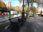
This afternoon I went to the Camden Town Station Upgrade Exhibition at the Trinity United Reformed Church, Buck Street, Camden Town NW1 8NJ.
It will be on tomorrow and Saturday.
I did get a few questions answered and I have a few comments.
- This capacity upgrade is only concerned with the upgrade to Camden Town station and has nothing to do with improving the routes between this station and Camden Road station.
- I do think that provision should be made for a connection, even if it isn’t made until quite a few years.
- As in the current station, steps will still normally be used to access the two Southbound platforms from the main circulating space.
- For those needing step-free access to and from the surface, there will be a second lift lobby at Southbound platform height, below the main circulating space.
- Anybody crossing between the two Southbound or the two Northbound platforms will have a step-free route across.
I think that it is important that in addition to upgrading the capacity at Camden Town station, that the routes between the two Camden station; Town and Road should be improved for the following reasons.
- Camden Road is a station with full step-free access and if you lived or were staying within easy reach of the North London Line, you might find the route a much better alternative for going to the attractions of Camden Town and Camden Lock. I sometimes go for a coffee with my son, who works in Camden Town by that route from Dalston.
- Camden Lock is five hundred metres from Camden Road station and three-hundred and fifty metres from Camden Town stations and the longer route can be less busy.
- Walking between Camden Road station and Camden Lock has been improved recently, by creating a set of steps down from Camden Road to the Regent’s Canal. This may encourage many to walk to the Camden Lock area along the canal.
- Using Camden Road station or a bus for leaving the area avoids using the long spiral staircase to descend to the Northern Line at Camden Town station, which at times is the only route to the platforms.
- During the building of the capacity upgrade at Camden Town station, any alternative route that takes pressure off the station will be welcomed.
- The current walking route along Camden Road is very crowded and involves two crossings of roads on controlled crossings.
- Access to buses could be better thought out.
I would do the following.
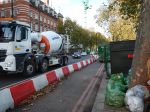
- Improve the Regent’s Canal route between Camden Road station and Camden Lock. At present it is a bit difficult at the Camden Lock end, due to the development of Hawley Wharf.
- Improve the steps from the canal to Kentish Town Road, so that, when the Buck Street entrance to Camden Town station is opened, you have a shorter walk between the two stations.
- The Kentish Town Road steps could also provide a possibly quicker route to Camden Lock and the Roundhouse from the Buck Street entrance.
In addition lots of maps and signposting could point out some of the myriad routes and short-cuts in the area.
Eventually, a second entrance could be built at an expanded Camden Road station in the area of Camden Gardens.
Perhaps, by building much of the entrance in the three empty arches under the railway and using external lifts and escalators as has been done in buildings like the Pompidou Centre, the Lloyd Building or Deansgate-Castlefield tram stop in Manchester.
This Google Map shows the area.
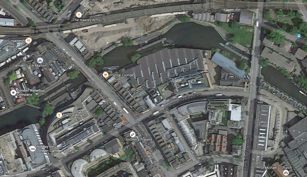
Camden Gardens, Camden Lock And Buck Street
Camden Gardens is at the top right around the viaduct of the North London Line, which runs across the map to Camden Lock. Kentish Town Road goes almost North-South through the area, with Buck Street towards the bottom. The triple building is the school that currently occupies the proposed station site. I would estimate that the distance between Camden Gardens and Buck Street could be little more than two hundred metres.
Perhaps, the Buck Street entrance building, needs a back entrance on Kentish Town Road?
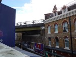
To finish this is a picture of the viaduct across Camden Gardens.
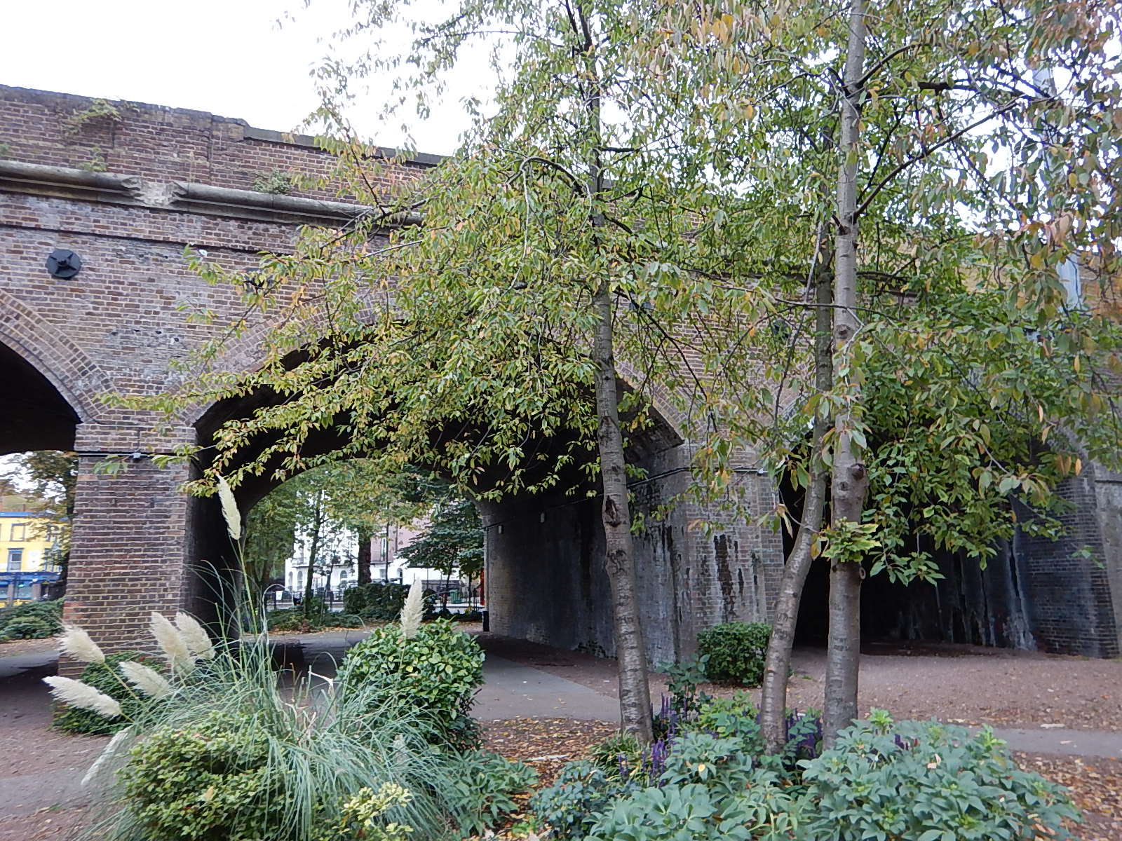
After being rebuilt since the freight train crash of a couple of years ago, I’m sure another good use can be found for it.
