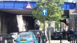
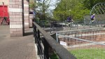
Walking To The Eynsham Drive Bridge At Abbey Wood
My walk yesterday to take the pictures of Crossrail at Eynsham Drive and Abbey Wood station started at Plumstead station, where I crossed the High Street and then found the end of the Ridgeway, which is on top of the Southern Outfall Sewer. I took these pictures as I walked to Harrow Manor Way, that led into Abbey Wood, where I turned off into Eynsham Drive..
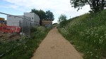

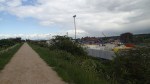
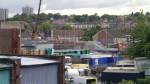
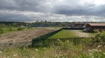


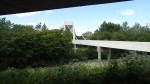

It is mostly, a typical estuarial industrial landscape with a quantity of uninspiring housing, although the space between the Ridgeway and the rail lines is going to be transformed, as Crossrail sidings are being built here.
You can understand why Stanley Kubrick shot Clockwork Orange in the area.
Thames Tideway Tunnel Site – Albert Embankment Foreshore
Index Thames Tideway Tunnel Sites Albert Embankment Foreshore
The Albert Embankment Foreshore site must have given the Secret Intelligence Service kittens, as it is going to be located across the front of their famous building. I also went to a lecture at University College London, which said that in the river at this point, there are prehistoric structures.
Thames Water say this on the Thames Tideway Tunnel web site.
Work will comprise construction of a new area of reclaimed land in the foreshore, in front of Camelford House for a shaft approximately 48 metres deep with an internal diameter of approximately 16 metres. Connection to the existing sewers will be made within a second new area of reclaimed land underneath Vauxhall Bridge and in front of the Vauxhall Cross building. These two areas will be connected under the foreshore. The shaft is required to transfer sewage flows from the combined sewer overflows to the main tunnel.
Once construction is complete there will be new public space extending into the foreshore providing a viewing platform to Central London, benches and intertidal terraces. The Thames Path will be widened to allow pedestrians to be diverted in front of (rather than underneath) Camelford House.
It is certainly a large set of works in the area, which they also say will link the Clapham Storm Relief and Brixton Storm Relief sewers to the new Thames Tideway Tunnel. This is a visualisation of how the completed site will look

Albert Embankment Foreshore
Joseph Bazalgette would be pleased at the expansion of his Albert Embankment. These are a few pictures I took around Vauxhall Bridge.
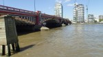

There is certainly scope to improve the river in this area.
Thames Tideway Tunnel – Greenwich Interconnection Tunnel
Index Thames Tideway Tunnel Sites
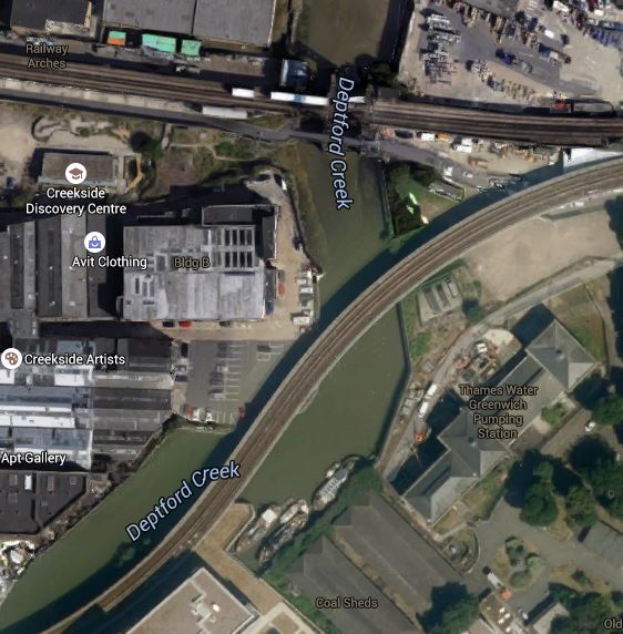
The Greenwich Interconnection Tunnel is a branch tunnel that splits from the Main Thames Tideway Tunnel at Chambers Wharf and goes by way of Earl Pumping Station and Deptford Church Street to Greenwich Pumping Station, from where it will be bored. This map shows the route of the tunnel.
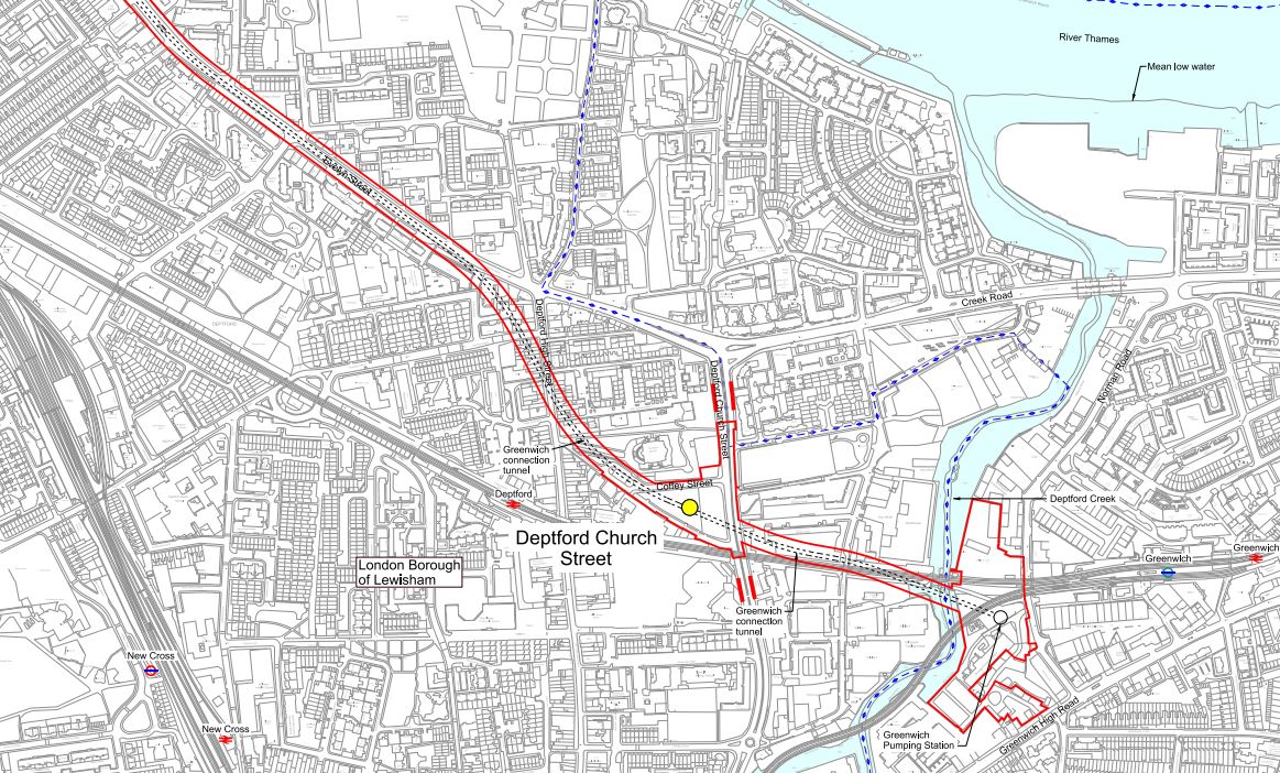
Greenwich Interconnection Tunnel
It would appear that the tunnel is being dug in a single go from Greenwich to the Thames, with most of the route deep under the Greenwich Rail Line.
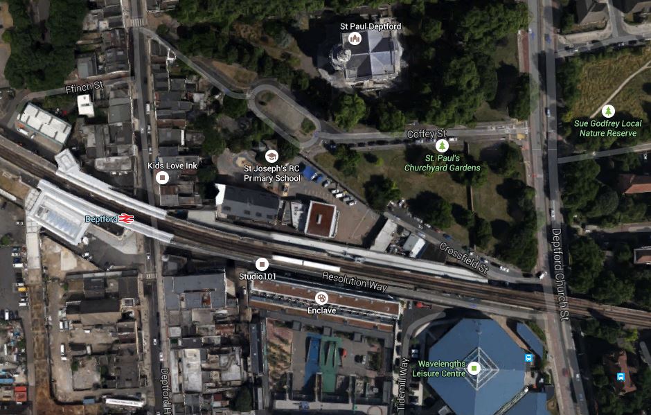
This Google Earth image shows the rail line between Greenwich and Deptford station.

Deptford To Greenwich Station
The works on Deptford Church Street are just to the north side of the rail line in part of the green space and those at the Greenwich Pumping Station are to the south of the junction, where the DLR branches south from the rail line.
The next site at Earl Pumping Station is just off the main map at the left.
On the page for the Greenwich Pumping Sration, Thames Water say this.
In our application for development consent this site is used to drive the Greenwich connection tunnel, a long connection tunnel which connects the combined sewer overflows (CSOs) at Greenwich Pumping Station, Deptford Church Street and Earl Pumping Station to the main tunnel at Chambers Wharf.
So it looks like Thames Water are sneaking the tunnel into Chambers Wharf.
I doubt they’ll be much disruption from the actual boring of the Greenwich Interconnection Tunnel, as it’ll all be dug from Greenwich from a site with water access. As the tunnel is being bored towards Chambers Wharf, it would seem likely that the large amount of tunnel spoil created will be loaded on barges at Greenwich and taken away for disposal, with little disruption to anybody. It would appear to be a smaller version of the system Crossrail used on the Limmo Peninsular in East London.
Thames Tideway Tunnel Site – Deptford Church Street
Index Thames Tideway Tunnel Sites Deptford Church Street
Deptford Church Street is a site that is being used to help construct the Greenwich Interconnection Tunnel between Greenwich Pumping House and Chambers Wharf. Specifically, it’s purpose is defined on the Thames Tideway Tunnel web site as follows.
It will be used to intercept the Deptford Storm Relief Sewer combined sewer overflow, divert flows into the Greenwich connection tunnel and to the main tunnel.
This Google Earth image shows the area.
Deptford Church Street
The work site at Deptford Church Street are to the north side of the Greenwich Rail Line in part of the green space and this is a visualisation of the area from the Thames Tideway web site.
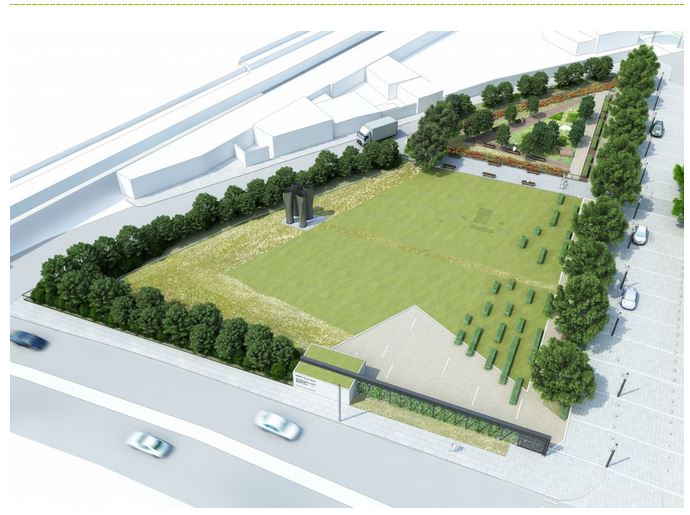
Deptford Church Street
The corner at the bottom left of the green space is tucked between the Greenwich Rail Line and Church Street, which runs across the front of the image.
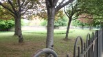
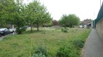
I also took a few pictures of the area.


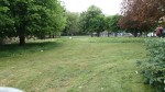
I think it is true to say that we’re good at landscape gardening in this country and I can envisage a garden design being produced here, that could enhance the whole area. As the image shows, there will be a few smallish structures in the garden.
Thames Tideway Tunnel Site – Greenwich Pumping Station
Index Thames Tideway Tunnel Sites Greenwich Pumping Station
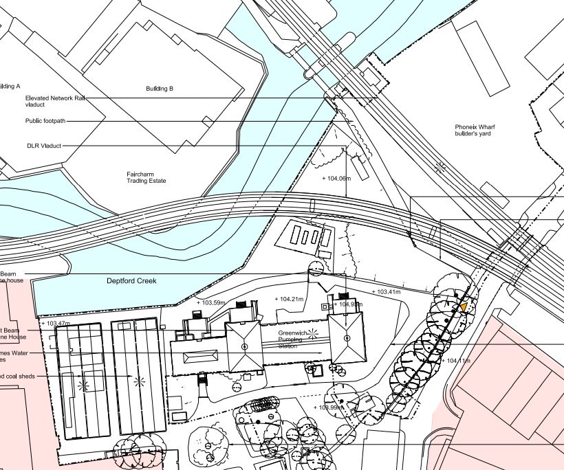
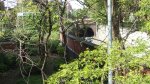
Greenwich Pumping Station is an existing Grade II Listed works and is being used to drive the Greenwich Interconnection Tunnel to Chambers Wharf. The Pumping Station lies alongside Deptford Creek, underneath the DLR and the Greenwich Rail Line. This Google Earth image shows the area.
Greenwich Pumping Station
The DLR is the rail line that bends along the Creek and the Pumping Station is to the right. These are some pictures I took of the Pumping Station.
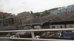
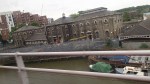
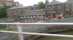
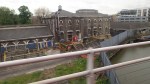
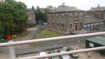
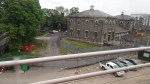
Some were taken from the DLR and they give a good view of the site.
This is another picture that was clipped from the Thames Tideway Tunnel website, which shows how it will look when complete.
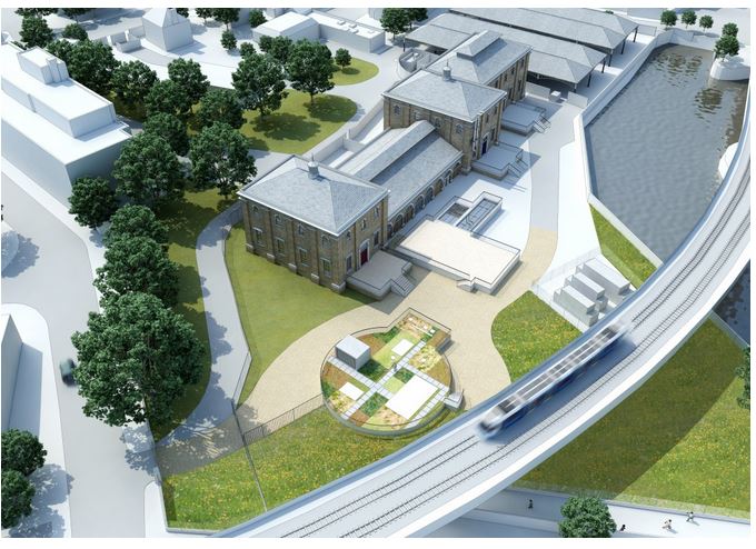
Greenwich Pumping Station
The DLR is shown in the foreground and the picture is looking south.
Thames Water say this about the Greenwich Pumping station on the Thames Tideway web site.
Work includes construction of underground structures to connect the CSO to a shaft approximately 46 metres deep with an internal diameter of approximately 17 metres. This shaft will be built within the existing Greenwich Pumping Station compound to the north of the existing pumping station building. The existing Grade II listed East Beam Engine House will be refurbished to house ventilation equipment and electrical and control panels.
Hopefully, this is one of the few sites on the Thames Tideway Tunnel, where some quality visual architecture can be employed. The area between the the Pumping Station, the railways and Deptford Creek could be turned into a leisure area bookended by the Grade II Listed Pumping Station and the Deptford Creek Lift Bridge.
This architectural drawing was clipped from the Thames Tideway Tunnel website.
GreenwichPumping Station Plan
To my untrained eye, it looks like the only new construction between the Pumping Station and the railway lines is the shaft that reaches down to the Greenwich Interconnection Tunnel. Will this be flat in the concrete or an odd shape that can’t be used for anything else? But even so there is a lot of space there to create something worthwhile for residents and visitors.
I also can’t believe that the locals will be too inconvenienced during construction. The builders may have problems because of the DLR viaduct, but in London cramped sites are something to which you get used. The builders have also got good water access for difficult supplies and taking out the tunnel spoil.
I also feel, that there might be some excellent views of the construction from the DLR, as most of the heavy work will take place, like the insertion of the tunnel boring machine, in full view of Lewisham-bound trains.
Thames Tideway Tunnel Site – Earl Pumping Station
Index Thames Tideway Tunnel Sites Earl Pumping Station
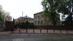
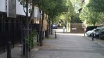
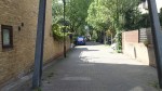
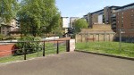
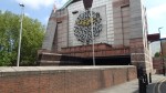
Earl Pumping Statiuon is going to be upgraded for the Thames Tideway Tunnel. it is currently in use and is tucked away in residential streets to the south of Surrey Docks. This Google Earth image shows the area.
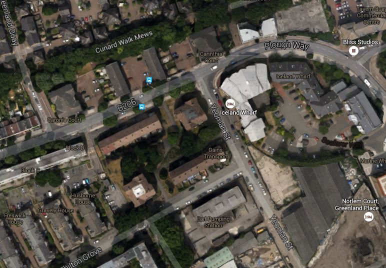
Earl Pumping Station
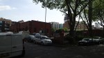
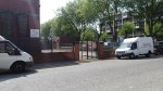
The Pumping Station is on Yeoman Street and is the rectangular building pointing to the north-east. There are labels and they may help. These are pictures I took of the outside of the pumping station.
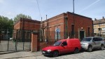
It is a building of simple practicality rather than architectural merit. Hopefully the new building works will improve it.
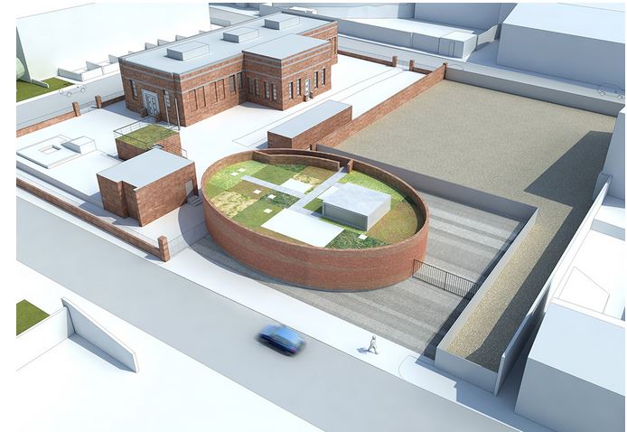
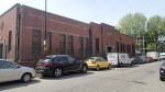
Earl Pumping Station
This image was one I clipped from the Tideway Tunnel site.
This is one of those sites, which if they used some good project planning and got a keen architect to skin and landscape everything properly, they could create a building that fitted in to the area well.
Thames Tideway Tunnel Site – Abbey Mills Pumping Station
Index Thames Tideway Tunnel Sites Abbey Mills Pumping Station
Abbey Mills Pumping Station is one of Joseph Bazalgette‘s cathedrals of sewage and as it lies at the junction of the Northern Outfall Sewer and the Lee Tunnel to the massive sewage works at Beckton, it has been chosen as a junction, where the Thames Tideway Tunnel meets the existing system.
The official site says this about the works.
Abbey Mills Pumping Station is an existing Thames Water pumping station site.
In our application for development consent this site receives the tunnel from Chambers Wharf and connects the main tunnel to the Lee Tunnel, which will transfer sewage flows to Beckton Sewage Treatment Works.
This Google Earth image shows the area.
Abbey Mills Pumping Station
The Abbey Mills Pumping Station is clearly marked and the white line running across the image beside it is the Greenway, underneath which is the Northern Outfall Sewer.
I can’t expect that the construction work at this site will cause much disruption, especially as since 2010, they have been building the Lee Tunnel and there doesn’t appear to have been too many protests.
Thames Tideway Tunnel Site – Bekesbourne Street
Index Thames Tideway Tunnel Sites Bekesbourne Street
Bekesbourne Street is not a particularly big site. The official site says this about the works in the area in the planning agreement.
In an average year the Holloway Storm Relief combined sewer overflow
(CSO) discharges 7,900m3 of untreated sewage into the tidal Thames at
London Wharf, Limehouse. On the basis that litter tonnages are
proportional to discharge volumes, approximately two tonnes of sewage
derived litter is also discharged from this CSO in an average year.A worksite is required to control the Holloway Storm Relief CSO and divert
flows into the northern Low Level Sewer No.1. These works would avoid
the need to connect the CSO to the main tunnel. The proposed
development site is known as Bekesbourne Street, which is located in the
London Borough of Tower Hamlets.
So this site will be used to stop untreated sewage going into the Thames.
If you look on the Index Page, you’ll see that this site is marked as 22 on the map and the sewer will seem go from here to Abbey Mills via the Limehouse Cut Tunnel.
They also have a map, which shows two work sites, outlined in red and the line of the Holloway Storm Relief Sewer shown in green
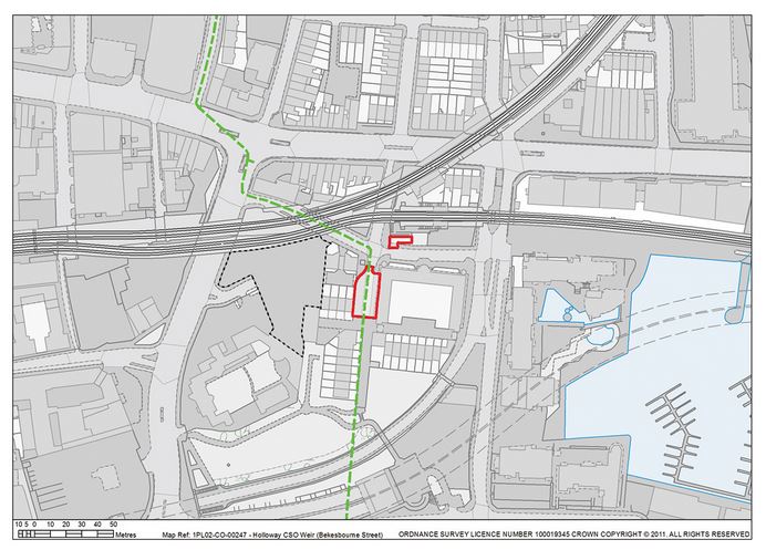
Bekesbourne Street
This is a Google Earth image of the local area to a large scale.
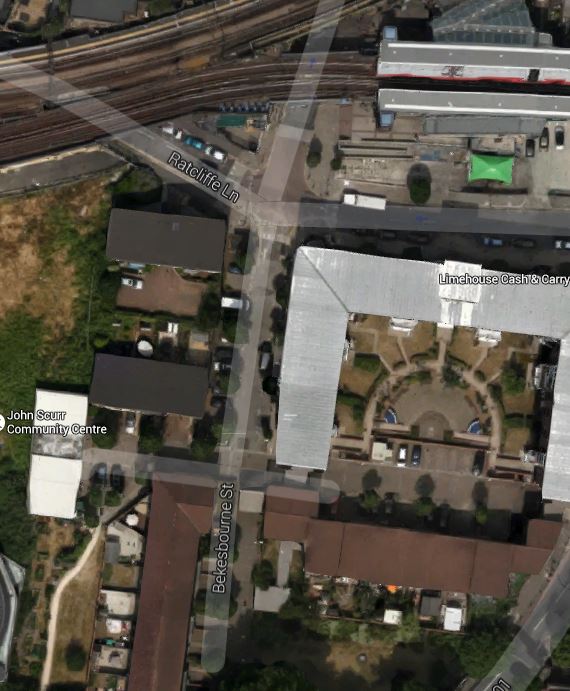
The Holloway Sorm Relief Sewer follows the line of Bekesbourne Street, which is the north-south route down the map from Limeshouse station at the top.
The second Google Earth image shows the wider area from the station to the Thames.
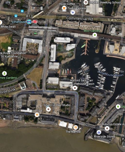
Limehouse Station To The Thames
Notice that the Rotherhithe Tunnel goes through the area. These are pictures I took locally.


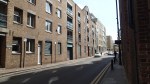
It strikes me, that quite a bit of time and effort could have been saved, if when they built the Limehouse Link Tunnel in the late 1980s, they had sorted out the Holloway Storm Relief Sewer at the same time. I could see no trace of the sewer, so it must go deep under the road straight under all the new housing into the Thames.
The new scheme, where all the water and sewage goes to Abbey Mills and Beckton must be much better.
Thames Tideway Tunnel – Index
To many the Thames Tideway Tunnel is contentious. But how will it effect London and where will the construction sites be?
This map from the official site shows the route.
Thames Tunnel Route
Obviously, living in Dalston, the main construction is well away from where I live.
I should say that I have heard convincing arguments, as to why the sewer should be built, from both Thames Water and users of the river, who want it cleaned up.
As a non-resident of effected areas, I probably have no right to directly comment, but with my project manager’s hat on I do have a right to comment on the quality of both the whole project and all the smaller ones related to it.
The following lists the names al the construction sites for the Thames Tideway Tunnel.
23 – Abbey Mlls Pumping Station – My Comments
1 – Acton Storm Tanks (Ealing) – My Comments
13 – Albert Embankment Foreshore (Lambeth) – My Comments
3 – Barn Elms (Richmond) – My Comments
24 – Beckton Sewage Treatment Works (Newham) – My Comments
22 – Bekesbourne Street (Limehouse) – My Comments
15 – Blackfriars Bridge Foreshore (City of London) – My Comments
7 – Carnwath Road (Hammersmith and Fulham) – My Comments
17 – Chambers Wharf (Bermondsey) – My Comments
10 – Chelsea Embankment Foreshore (Kensimgton and Chelsea) – My Comments
9 – Cremorne Wharf Depot (Kensingon and Chelsea) – My Comments
19 – Deptford Church Street (Deptford) – My Comments
5 – Dormay Street (Wandsworth) – My Comments
18 – Earl Pumping Station (Deptford) – My Comments
8 – Falconbrook Pumping Station (Wandsworth) – My Comments
20 – Greenwich Pumping Station – My Comments
2 – Hammersmith Pumping Station (Hammersmith and Fulham) – My Comments
12 – Heathwall Pumping Station (Wandsworth) – My Comments
21 – King Edward Memorial Park (Wapping) – My Comments
6 – King George’s Park (Wandsworth) – My Comments
11 – Kirtling Street (Wandsworth) – My Comments
4 – Putney Embankment Foreshore (Wandsworth) – My Comments
16 – Shad Thames Pumping Station (Bermondsey) – My Comments
14 – Victoria Embankment Foreshore (Westminster) – My Comments
The numbers are those of the map of the route.
The following sites also make up the Greenwich Interconnection Tunnel, that is effectively a branch tunnel to bring sewage from Deptford and Greenwich into the main system, through a junction at Chambers Wharf
17 – Chambers Wharf (Bermondsey) – My Comments
18 – Earl Pumping Station (Deptford) – My Comments
19 – Deptford Church Street (Deptford) – My Comments
20 – Greenwich Pumping Station – My Comments
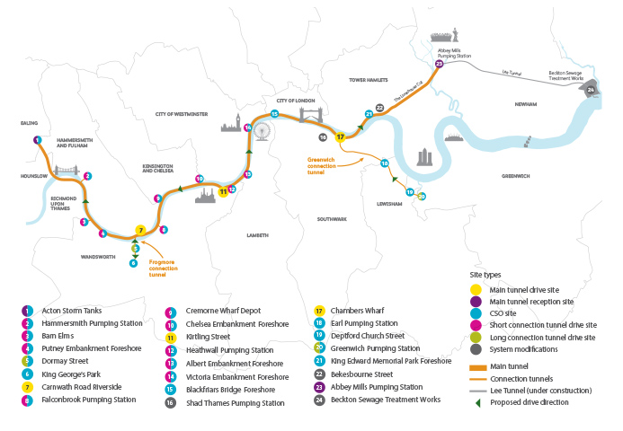
Thames Tideway Tunnel – Preparatory Works At Blackfriars Bridge
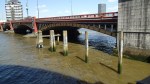
As I walked along the river from Cannon Street, I noticed what looked like a small oil rig in the middle of the Thames.
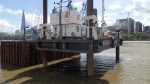

t is actually a secondary site that is being used to develop a new Millenium Pier as the old one is in the way of construction works for the new Thames Tideway Tunnel at Blackfriars.
It was good to see that they are putting up pictures of what they are doing.
This picture clipped from this page on the tunnel website, shows an impression of what the completed works will look like.

Tideway Tunnel At Blackfriars
Blackfiars Bridge leads off over the river at the top right of this image.
When completed there will be a public space with shops and a cafe.
The web site for the Thames Tideway Tunnel is impressive.
