Gates Open On Thames Tideway Tunnel Super Sewer
The title of this post, is the same as that of this article on the BBC.
This is the sub heading.
The first four sites along London’s new “super sewer” – officially known as the Thames Tideway Tunnel – have been brought into operation.
These are the first two paragraphs.
The valves, which operate like giant gates, are being used at four of the 21 locations that make up the system.
The rest are due to come online in the coming months, with the sewer operating at full capacity by 2025.
Note.
- The BBC article contains a video.
- The Thames Tideway has a web site.
Finally, more of London’s sewage is on its way to Beckton.

This map shows there’s even a lighthouse on the River Thames.
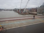
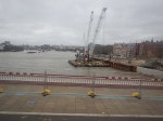
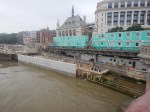
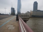
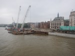
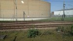
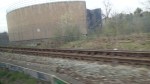
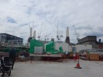
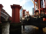
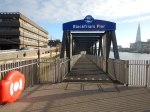
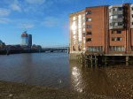
Tideway – Blackfriars Bridge Foreshore – 12th February 2024
It is two years since I took the last set of pictures here.
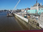
The tunnelling is now complete.
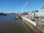
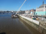
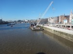
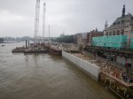
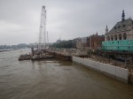
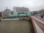
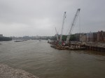
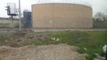
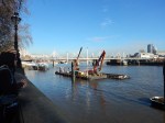
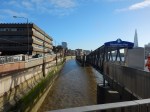
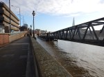
Tideway – Blackfriars Bridge Foreshore – 13th February 2022
I took these pictures of the Tideway’s Blackfriars Bridge Foreshore site from the top of a 63 bus on Blackfriars Bridge.
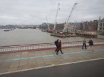
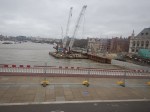
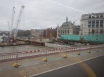

Compare the pictures with those I took on the 4th September 2021.
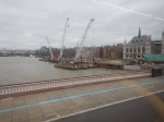
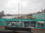
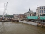
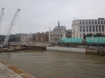
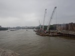
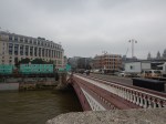
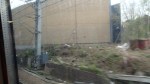
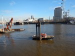
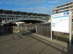
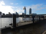
Tideway – Blackfriars Bridge Foreshore – 4th September 2021
I passed Tideway’s Blackfriars Bridge Foreshore site on the way home and took these pictures.
This page on the Tideway web site, gives a visualisation of the project.
Would A Mutant Many-Parent Child Help To Solve London’s Transport Problems?
London needs to increase the capacity of its public transport system, as the City continues to get larger and larger.
Current Major Projects
There are only three major rail projects ongoing in London at the present time.
The Bank Station Upgrade
The Bank Station Upgrade appears to be progressing well, albeit perhaps it’s a bit late due to the pandemic.
It is a complex project and from what I have heard and observed, it has been well designed and planned.
The Barking Riverside Extension
As with the Bank Station Upgrade the Overground extension to the new Barking Riverside station, appears to be going reasonably well.
But compared to that project, it is a relatively simple project, built mainly in the open air, with no tunneling.
Crossrail
Crossrail is in trouble, after what many believe was a very good tunnelling phase of the project.
But then tunnels under London usually seem to go well. I can remember the Victoria Line tunnelling and many other under London since the 1960s and all of these tunnels seem to have been dug without trouble. As I write, there don’t seem to be any tunneling problems with the Thames Tideway Tunnel.
Crossrail now has been reduced to a series of station builds and rebuilds, some of which are as large as the Bank Station Upgrade, with other ongoing projects like the testing of trains and systems.
So why are some of these stations running late in their delivery?
If you walk along the route of Crossrail in the City of London and through Clerkenwell and the West End, it is one massive building side as developers raise massive clusters of new developments around and above the Crossrail stations.
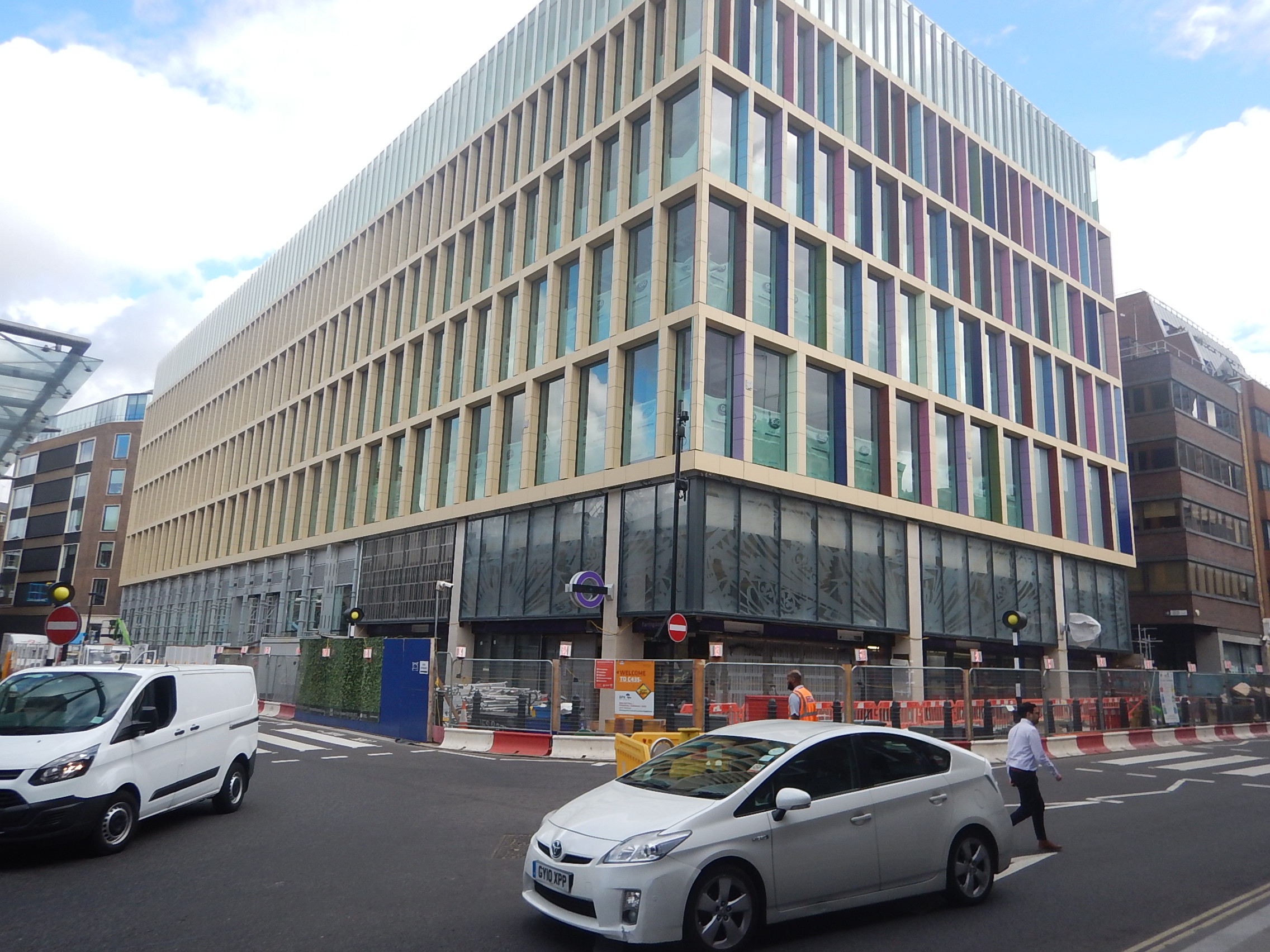
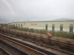
The picture shows Farrington station’s Eastern entrance, with a new development on top.
This one wasn’t a big one, but it went up in record time.
These buildings are often funded by Sovereign Wealth Funds, who want their buildings finished ASAP and as they have bottomless pockets, they are prepared to pay more to get the builders and tradesmen they need.
And where did they get the workers from? Other projects, including Crossrail.
This problem happened in Aberdeen at the height of the oil boom in the last century.
I also think that Brexit worsened the problem, as workers from mainland EU moved to large projects closer to home, like Stuttgart 21 and the new Berlin Brandenburg airport, that were both very much in trouble and could have been offering premium salaries as well!
The solution would have been to phase developments so that the limited pool of workers was not exhausted.
But that probably wouldn’t have suited the developers and politicians for all sorts of reasons.
- An uncompleted building doesn’t bring in money and jobs.
- Early completion must improve chances of letting the building.
- Delaying the building would probably have meant fewer holidays for politicians in exotic locations.
Hopefully, a comprehensive enquiry into the lateness of Crossrail will provide answers.
High Speed Two
High Speed Two is to my mind a London local project. But only in a secondary way!
- Rebuilding Euston station will improve Underground connections and interchange at Euston and Euston Square stations.
- It is claimed by High Speed Two, that the rebuilt Euston station will create 16000 jobs and 2200 homes.
- High Speed Two will enable massive development at Old Oak Common, with tens of thousands of homes and jobs.
- Old Oak Common station will be a very important rail hub in North-West London.
With seventeen trains per hour (tph) between Euston and Old Oak Common will High Speed Two attract local traffic?
- I suspect High Speed Two between Manchester Airport and Manchester Piccadilly and between Birmingham Interchange and Birmingham Curzon Street will also attract local traffic.
- I’ve used TGVs between Nice and Antibes.
- Tourists might visit, just like they did and still do at the Olympic Park.
- Many Londoners will join High Speed Two at Old Oak Common.
Some wag will suggest putting it on the Tube Map. But is it such a stupid idea?
Where Does London Need More Rail Services?
Having lived in London on and off for over seventy years, I feel the worst areas for rail links are probably.
- North West London
- South East London
- South Central London between Wimbledon and Croydon.
- South West London
Note.
- Over the years, there is no doubt that East and North London have improved considerably, with the development of the East London, North London and Gospel Oak to Barking Lines.
- Thameslink has been improved in North London and now it is being supported with improvements to the Northern City Line. Both routes now have new Siemens trains, which give a whole new dimension to using ironing-boards as seats.
- Crossrail will produce major improvements in West, East and South East London.
- Building of a new Penge Interchange station, which I wrote about in Penge Interchange could improve routes to and from South East London.
- Hopefully the work in recent years at Waterloo will improve suburban services out of Waterloo. In An Analysis Of Waterloo Suburban Services Proposed To Move To Crossrail 2, I showed that four tph could be run to Chessington South, Epsom, Hampton Court and Shepperton stations.
It looks like North West and South Central London are missing out.
How Can Services Be Improved In North West London?
There are radial routes from the centre of London to the suburbs.
Starting from the North and going to the West, there are the following lines.
- The High Barnet branch of the Northern Line
- The Mill Hill East branch of the Northern Line
- The Midland Main Line to St. Albans, Luton, Bedford and the East Midlands.
- The Edgware branch of the Northern Line
- The Jubilee Line to Stanmore
- The West Coast Main Line to Watford, Milton Keynes, the West Midlands, the North West of England and West Scotland.
- The Bakerloo Line to Harrow & Wealdstone.
- The Watford DC Line of the London Overground
- The Amersham, Chesham and Watford branches of the Metropolitan Line
- The Chiltern Route to Aylesbury.
- The Chiltern Main Line to High Wycombe, Banbury, Bicester, Birmingham and Oxford.
- The West Ruislip branch of the Central Line.
- The Uxbridge branch of the Metropolitan and Piccadilly Lines
When I used to live at Cockfosters as a child, to visit my many cousins in North West London, there was no alternative but to use a bus and take well over an hour each way.
There are now some circular rail routes in London but nothing in the North West of the capital.
The Dudding Hill Line And The West London Orbital Railway
But there is the little-used freight route called Dudding Hill Line.
- It runs between Cricklewood on the Midland Main Line and Acton Central on the North London Line.
- It is four miles of double-track railway.
This YouTube video shows a cab ride from Acton to Cricklewood.
Plans exist to turn it into the West London Orbital Railway, which will run two services.
- West Hampstead and Hounslow via Cricklewood, Neasden, Harlesden, Old Oak Common Lane, Acton Central, South Acton, Lionel Road, Brentford, Syon Lane and Isleworth
- Hendon and Kew Bridge via Brent Cross West, Neasden, Harlesden, Old Oak Common Lane, Acton Central, South Acton
Note.
- The proposed frequency of both services is four tph.
- There would be some stations to be built, but the track exists.
- There would be no new tunnels.
- The route is technically feasible.
- The route would connect West London to High Speed Two.
- There would be little disruption whilst it was built.
- The services could be run by dual-voltage battery-electric trains charged on the electrification at both ends of the route.
- The scheme represents a high value for money, with a benefit-cost ratio (BCR) of 2.2.
On the other hand, the scheme has two serious problems, as far as the current London Mayor is concerned.
- Transport for London has no money, partly because of London’s Fare Freeze.
- The project is not in South London.
This important and value-for-money project will not be built, whilst Sadiq Khan is still Mayor of London.
Harlesden Interchange
I believe that if we get the interchanges right on the West London Orbital Railway correct we can do things like.
- Increase the benefit cost ratio.
- Link the route to South London to make the Mayor a bit happier about the North London Scheme.
This Google Map shows Harlesden station.
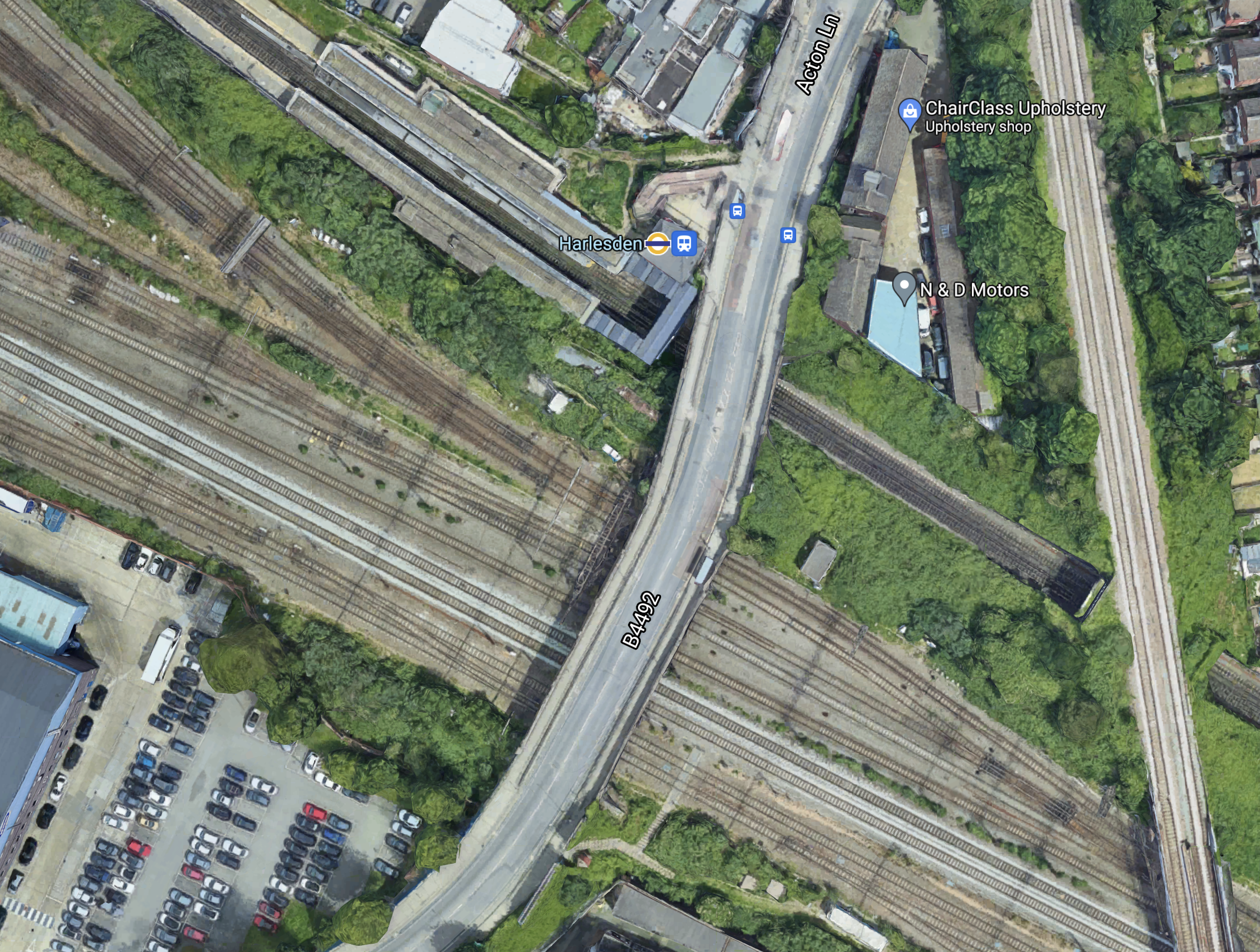
Note.
- The Bakerloo Line/Watford DC Line running North-West/South-East through Harlesden station.
- The West Coast Main Line in the Southern section of the map.
- The Dudding Hill Line running North-South across the map.
Platforms will be built on the Dudding Hill Line to connect that would probably be new or extended platforms in the current Harlesden station to enable interchange between the West London Orbital and the Watford DC Lines.
I also think there is a possibility that platforms could be added to the slow tracks of the West Coast Main Line, so that suburban services into London Euston can also connect to the West London Orbital Line.
It would also enable a connection between Southern’s Clapham Junction and Milton Keynes service and the West London Orbital Railway.
Looking at this from various angles, I think that an architect good at designing three-dimensional structures could develop a quality Harlesden Interchange station.
Neasden Interchange
Like Harlesden, Neasden is another possibility for a comprehensive interchange.
This Google Map shows Neasden station.
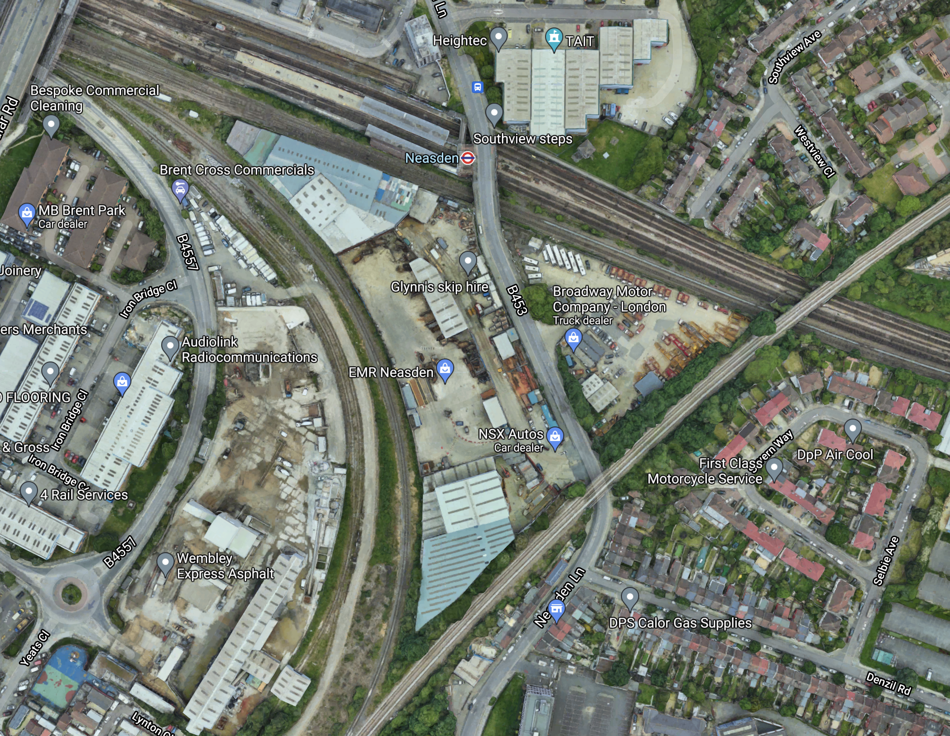
Note.
- There are a lot of lines going through Neasden station.
- The Dudding Hill Line goes across the South-East corner of the map.
- There is plenty of space in the area.
This map from cartometro.com shows the lines in the area.
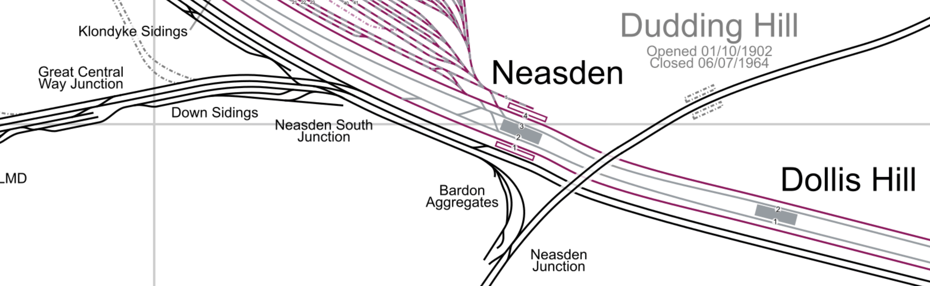
Note.
- The Dudding Hill Line is indicated by the former Dudding Hill station.
- The red tracks are Metropolitan Line tracks.
- The silver tracks are Jubilee Line tracks.
- The Southerly pair of lines through Neasden and Dollis Hill stations are Chiltern’s lines into Marylebone.
- The Chiltern tracks divide to the West of Neasden station, with the Aylesbury line following the other tracks and the Chiltern Main Line diverging to the West.
- London’s largest Underground Depot at Neasden, lies to the North-West in an area of London noted for few merits with the North Circular Road passing through.
I wonder, if the station and the depot offers a unique opportunity to offer large scale additions to London’s housing stock over the top of a rebuilt station and depot.
This Google Map shows the wider area.
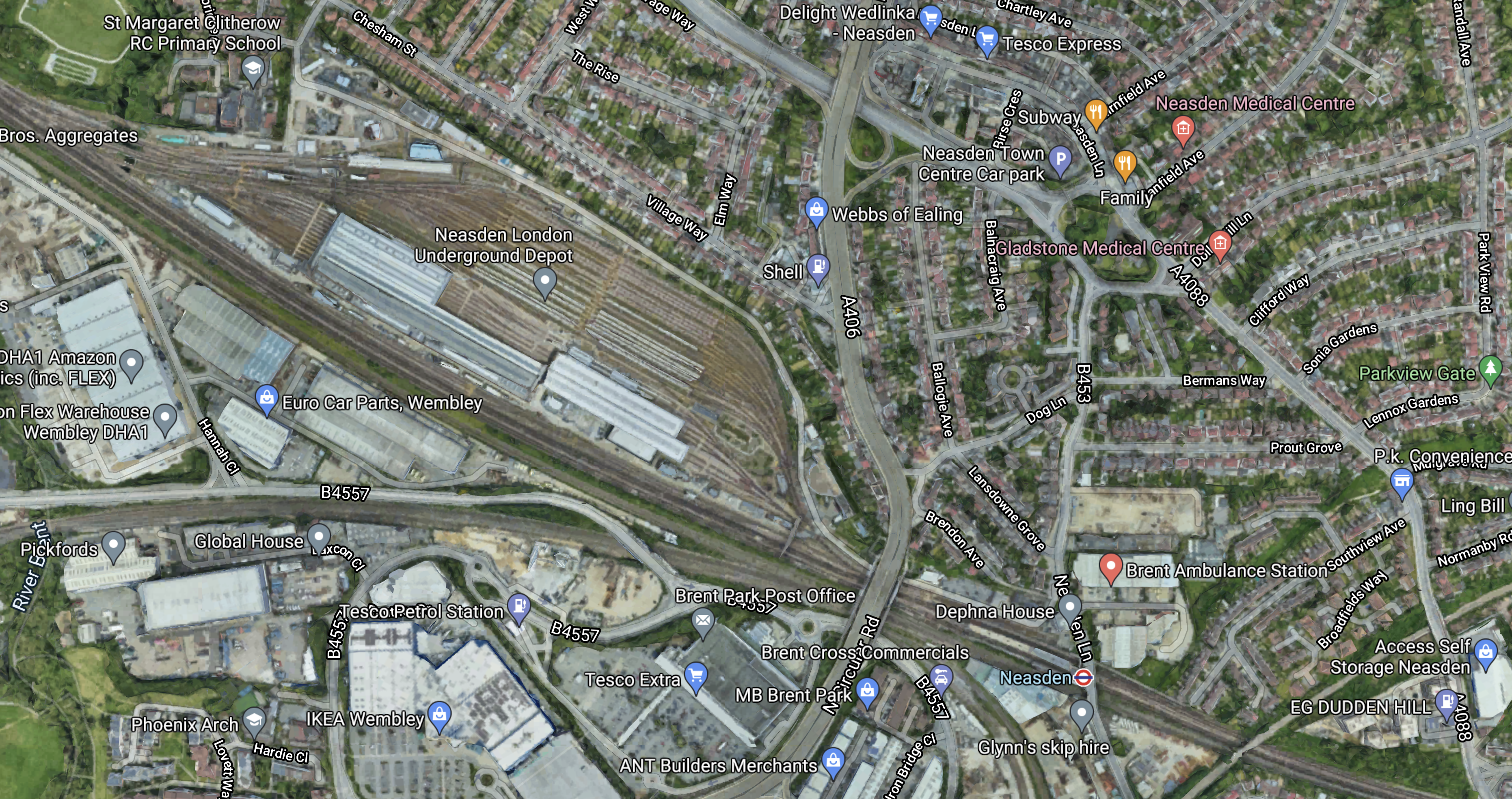
Note.
- Much of the depot appears to be open-air stabling for trains.
- The North Circular Road passes North-South between the depot and Neasden station.
- The Dudding Hill Line cuts across the South-East corner of the map.
- This corner of the map is labelled as Dudden Hill.
- According to Wikipedia, Dudding Hill is considered a more genteel spelling of Dudden Hill and could be as old as 1544.
It looks as if it would be relatively easy to develop over the top of the depot to create housing, industrial or commercial properties.
But why stop there and cover both the North Circular Road and the six tracks through Neasden station?
Neasden station could be rebuilt into a station with platforms on the following lines.
- Metropolitan Line
- Jubilee Line
- Chiltern Lines
- Dudding Hill Lines
Note.
- I estimate that Chiltern has a train about every six minutes, so some could stop.
- There might be space for a bay platform for Chiltern.
Neasden could be a major housing and transport hub.
- There could be large amounts of parking.
- Road access would be good.
- It would have good rail connections.
- It could have a bus interchange.
- London needs housing.
It might even be an alternative to Chiltern’s plan for a West Hampstead Interchange.
The Mayor of London, Transport for London and the Borough of Brent need to be bold!
Improvements To Chiltern’s Routes
Chiltern Railways have some plans that could improve services in North West London.
Using The Acton-Northolt Line
Wikipedia says this about using the Acton-Northolt Line to access new platforms at Old Oak Common station.
Upgrading the Acton–Northolt line (formerly the “New North Main Line”) to new platforms at Old Oak Common. This upgrade will also extend to London Paddington to increase capacity on the Chiltern Main Line as there is no room to expand the station at Marylebone.
This scheme has merit.
- The platforms would be connected to the Chiltern Main Line along the route of a partly-disused railway.
- The route could be double-tracked.
- There must be space for at least two new platforms.
- The new platforms could easily handle four tph.
- There may be a case for some new stations.
The scheme could add valuable extra capacity for Chiltern.
A Chiltern Metro
Wikipedia says this about a proposed metro service between Marylebone and West Ruislip stations.
- The Metro would have a frequency of four tph.
- It would call at Wembley Stadium, Sudbury & Harrow Road, Sudbury Hill Harrow, Northolt Park and South Ruislip.
- The service would require a reversing facility at West Ruislip.
- There would need to be passing loops at Sudbury Hill Harrow, and Wembley Stadium.
Given that the Chiltern Metro was first proposed over a decade ago, perhaps the concept could be increased in scope.
- Housing and other developments along the route may suggest that a station further out like High Wycombe might be a better terminal.
- ERTMS in-cab digital signalling is likely to be installed at some time, which would decrease headways between trains and allow more services.
- Electrification is likely in some form before 2040 and this will improve train performance.
- If Neasden station were to be rebuilt, as a comprehensive transport and residential development, I believe that this Metro service should also call at Neasden, as it would complement the West London Orbital Railway.
I believe that a review of the Chiltern Metro may mean, that an improved version is worth building.
Improvements To The Milton Keynes And Clapham Junction Service
I feel that this service could be key in improving services between North London and South London via the West London Line and High Speed Two’s station at Old Oak Common.
Currently, this service is as follows.
- It runs between Milton Keynes and Clapham Junction stations.
- It has a frequency of one tph.
- It calls at Bletchley, Leighton Buzzard, Tring, Berkhamsted, Hemel Hempstead, Watford Junction, Harrow & Wealdstone, Wembley Central, Shepherd’s Bush, Kensington (Olympia), West Brompton and Imperial Wharf stations.
- The service used to extend to South Croydon via Wandsworth Common, Balham, Streatham Common, Norbury, Thornton Heath, Selhurst and East Croydon.
- It uses Class 377 trains.
- It shares parts of the route with the London Overground.
I also think it has various issues and questions with respect to the future.
- The Class 377 trains are only 100 mph units, whereas the outer suburban trains on the West Coast Main Line are 110 mph Class 350 trains, which will soon be replaced by 110 mph Class 730 trains. Do the slower trains cause timetabling problems?
- Is one tph enough?
- The route doesn’t serve High Speed Two at Old Oak Common station.
- Is the service run by the right operator?
- What is the ideal Southern terminal?
These are my thoughts on the various issues.
The Service As A North-South Link
A friend, who lives in South London has told me, that if you go to an event at Wembley stadium the route is busy.
On the other hand, I’ve used it at midday on a Tuesday and found the trains empty.
But developed properly it could connect the following.
- Milton Keynes Central
- Bletchley for the East West Rail Link
- Watford for the West Coast Main Line to the North
- Wembley Central for Wembley Stadium and other entertainments
- Willesden Junction for the North London Line
- Hythe Road for High Speed Two, Crossrail and the Great Western Railway
- Shepherd’s Bush for the shopping.
- Clapham Junction for most of South London and the South of England
It would be a very useful cross-London route to complement Thameslink and the East London Line.
The Frequency
The current Milton Keynes and Clapham Junction has a frequency of one tph.
This may be enough for some parts of the route, as other services also provide services.
But many would argue, that perhaps South of Watford Junction, the service needs to be increased to connect the area to Old Oak Common and Clapham Junction.
I feel that High Speed Two, Crossrail and the Great Western Railway give so much connectivity, that between Clapham Junction and Willesden Junction needs a frequency of at least eight tph.
As the North London Line and the Watford DC Line are working at a frequency of four tph, this could indicate that a four tph direct service Watford Junction and Clapham Junction be ideal. Perhaps, it could continue North to Milton Keynes with a frequency of two tph.
The Trains
I am absolutely certain, that the full service needs to be operated by dual voltage trains, that are capable of running at 110 mph.
The Class 350/1 trains of West Midlands Trains would probably be ideal for the full service.
- They are dual voltage trains.
- They are 110 mph trains.
- They have a long distance interior.
They are being replaced with new Class 730 trains, so would be available.
If some services were running only as far North as Watford Junction, these could be either Class 378 or Class 710 trains of the London Overground.
The Connection To The West London Line And High Speed Two
This map from Wikipedia by Cnbrb shows the latest iteration of the lines at Old Oak Common station.
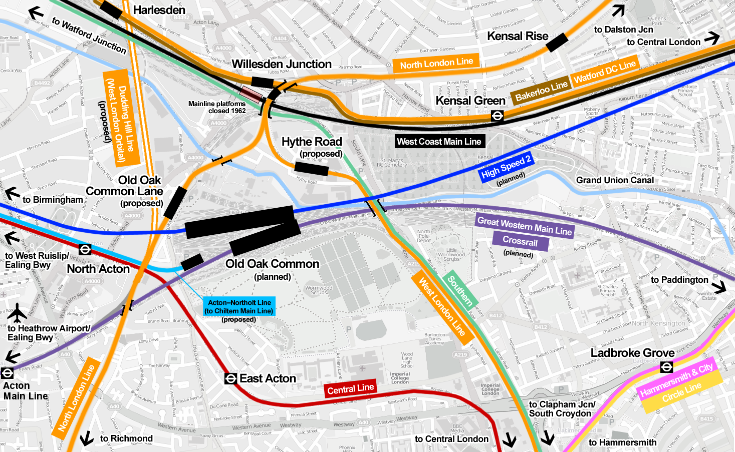
Note.
- The green route is taken by the Milton Keynes and Clapham Junction trains.
- The bright blue is High Speed Two.
- The purple is Crossrail.
- The orange is the Overground
- Hythe Road station is proposed for the West London Line to connect to Old Oak Common station for High Speed Two.
- Hythe Road station will have a bay platform to turn trains from the South.
- Old Oak Common Lane station is proposed for the North London Line to connect to Old Oak Common station for High Speed Two.
But where is the connection between the Milton Keynes and Clapham Junction service and Old Oak Common station for High Speed Two?
- Access from the South is not a problem as the Overground can be used to Hythe Road station.
- Extra services from the South can be run to and from the bay platform at Hythe Road station.
- Access from the East is not a problem as the Overground can be used to Hythe Road station.
- How do passengers go between say Wembley Central and Heathrow?
In addition for access from the West is the Overground can be used to Old Oak Common Lane station.
But as things stand at the moment the Milton Keynes and Clapham Junction service bypasses Hythe Road station and the only ways to go from Milton Keynes to Old Oak Common station for either High Speed Two, Crossrail or the Great Western is to do one of the following.
- Change to the Watford DC Line at Watford Junction, Harrow & Wealdstone or Wembley Central and then change to the Overground at Willesden Junction for either Old Oak Common Lane or Hythe Road station.
- Continue South to Shepherd’s Bush station, cross over to the other platform and then come back to Hythe Road station.
- Go via Euston station. OK for High Speed Two, but not for Crossrail or the Great Western.
They cannot be serious!
I hope that there is a cunning plan to enable the Milton Keynes and Clapham Junction service to connect.
Whilst on the subject of connections at Old Oak Common, where is the promised connection of Crossrail to the West Coast Main Line?
Were all these connections just kicked into the long grass and quietly forgotten, as they were deemed too difficult and/or expensive?
I think serious questions need to be asked about the design of Crossrail and High Speed Two at Old Oak Common.
Why weren’t Crossrail and High Speed Two designed to connect directly to the London Overground at Willesden Junction station perhaps by the use of a North South people mover serving the following lines?
- Bakerloo, Watford DC, West Coast Main and West London Orbital Lines at a rebuilt Harlesden station.
- London Overground at the high-level Willesden Junction station.
- High Speed Two
- Crossrail and the Great Western Railway
- The new Chiltern platforms.
- Central Line at East Acton station.
Note.
- Hythe Road and Old Oak Common stations would not be needed.
- The Milton Keynes and Clapham Junction service would call additionally at the rebuilt Harlesden station.
The current design of Old Oak Common stinks like a horse designed by a committee!
The Northern Terminal
I suggested earlier that some trains use Watford Junction and others use Milton Keynes Central.
Both stations have the capacity and the connectivity.
The Southern Terminal
In the last ten years, South Croydon, East Croydon and Clapham Junction have been used as the Southern terminal.
Thameslink seems to have chosen its various terminals to satisfaction of the travelling public, so perhaps the same method or personnel should be used.
The Operator
The Gibb Report said that this service should be transferred to the London Overground and I wrote about this proposal in Gibb Report – East Croydon – Milton Keynes Route Should Be Transferred To London Overground.
This is one suggestion, but I do wonder, if it should be transferred to West Midlands Trains and run in conjunction with their West Coast Main Line services.
- The service needs 110 mph trains.
- Timetabling and operation should be easier.
- London Overground trains don’t have a long-distance interior.
On the other hand, trains running between Watford Junction and Clapham Junction would probably be better if they were London Overground trains.
Conclusion
I believe that by using the current network and some modern trains and signalling, the passenger services to the West of the capital can be substantially improved.
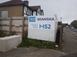
London’s First Two HS2 Tunnelling Machines Ordered
The title of this post, is the same as that of this article on Ian Visits.
The title gives a description of the story, but the article reveals a lot of details about the tunnels for High Speed Two.
- There will be ten tunnel boring machines (TBMs) in total for High Speed Two.
- The main tunnels are 42 % larger than those for Crossrail.
- There will be three pairs of tunnels under London; West Ruislip and Greenford (5 miles), Greenford and Old Oak Common (3.4 miles) and Old Oak Common and Euston (4.5 miles).
- It looks like these first two machines will bore the two outer tunnels and that two extra TBMs will be ordered for Greenford and Old Oak Common.
There are also two excellent infographics.
- The first shows the route of the tunnels.
- The second shows the three pairs of tunnels and the directions, they will be bored.
- The third also discloses that the tunnels will be up to fifty metres deep.
There will also be a vent shaft at Greenford in Green Park Way, when the tunnel opens.
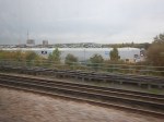
This Google Map shows the area.
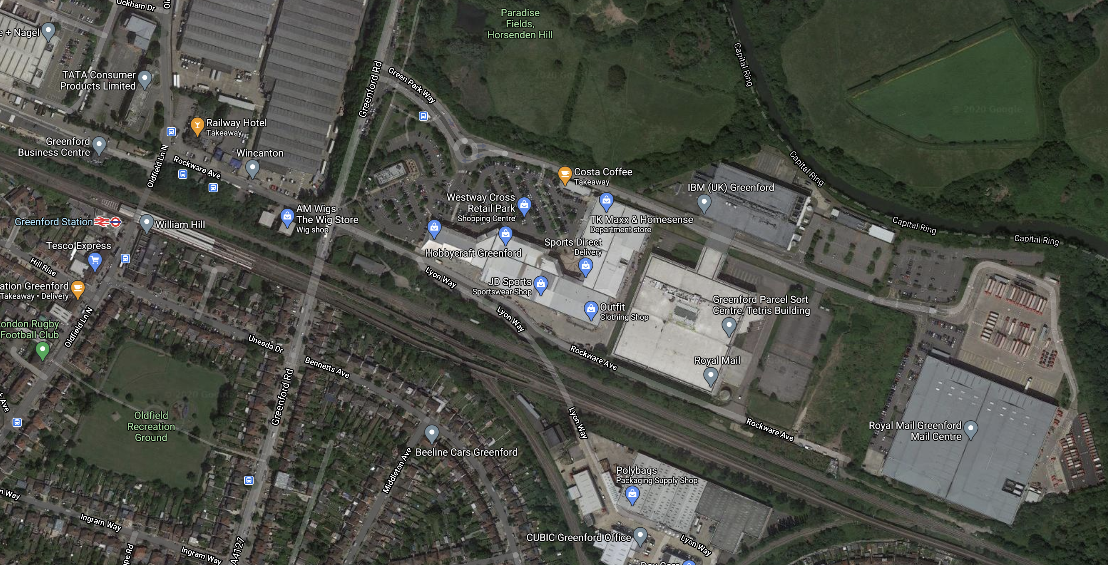
Note.
- The A 4127 runs North-South across the map.
- The railways running across the map are Acton and Northolt Line and the Central Line, which serves Greenford station.
- The Greenford Branch Line goes South from a triangular junction.
The green site squeezed in between the industrial buildings and just to the North of the railways could be the site for the vent shaft.
This second map is a clip of High Speed Two’s map of the area.
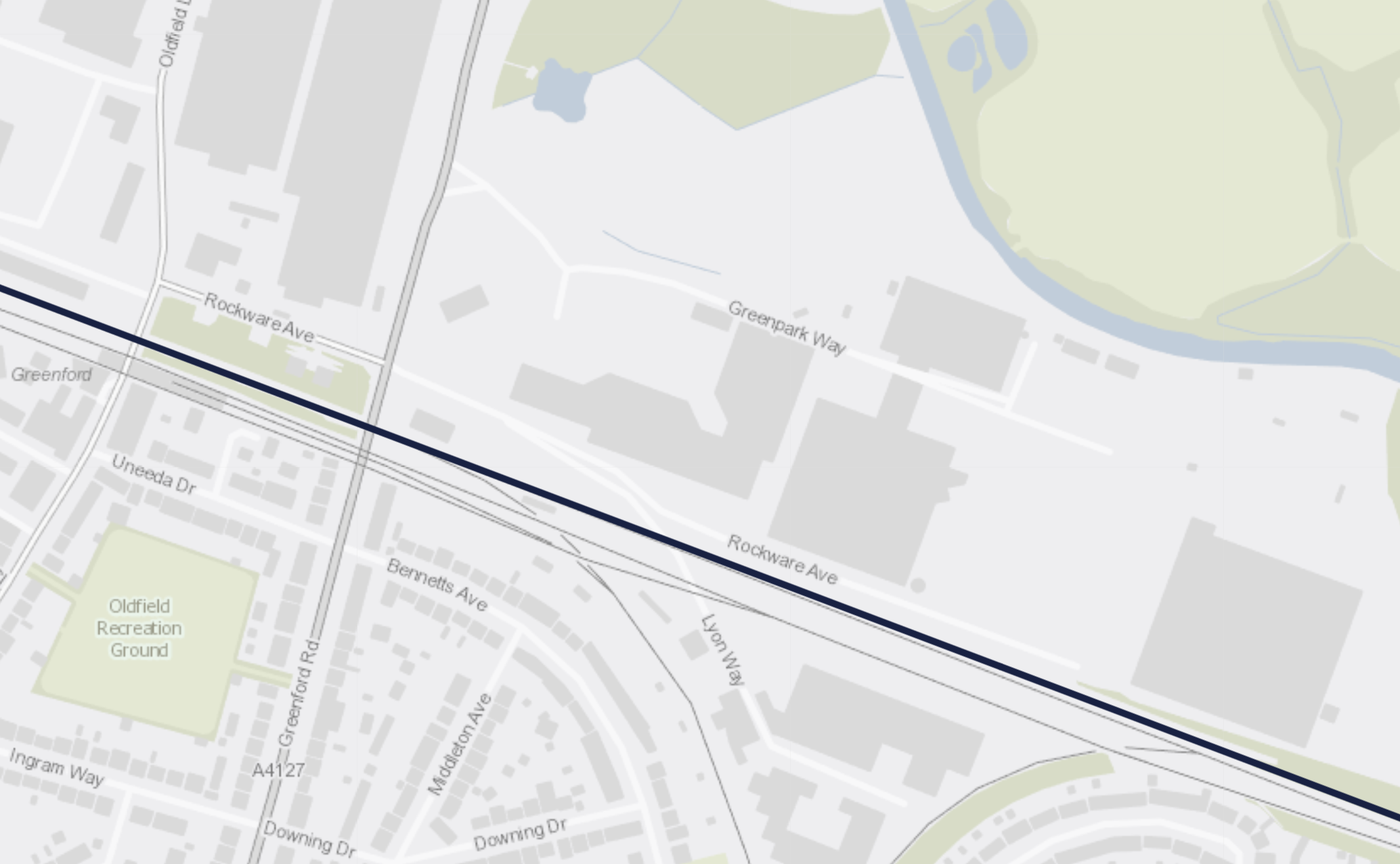
The black line is the route of the High Speed Two tunnel.
- It is to the North of the Central Line.
- It looks to be close to the vacant site.
When High Speed One was built through Hackney, they bored the tunnels under the North London Line, so High Speed Two only seem to be repeating, what worked successfully.
These pictures show some of the ventilation shafts for High Speed One in East London.
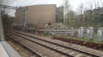
Crossrail’s vent shafts are smaller in number and less obtrusive. There is one disguised in this building; Moor House.
I would hope that High Speed Two could improve further and create a useful building on top, that adds value to the area and doesn’t follow the utilitarian constructions of High Speed One.
Boring the Tunnels
According to the infographics, the three tunnels will be built in the following directions.
- West Ruislip and Green Park Way – Towards Green Park Way
- Green Park Way and Old Oak Common – Towards Green Park Way
- Old Oak Way and Euston – Towards Euston.
These High Speed Two tunnels will be the fourth set of large tunnels to be bored under London in recent years after High Speed One, Crossrail and the Thames Tideway Scheme and I suspect there will be those , who will have worked on all four, at every level.
- I wouldn’t be surprised to see some innovative use of the TBMs, so that they are reused if possible.
- As four TBMs start at Old Oak Common and four finish at Green Park Way, I wonder if the planners have sequenced the insertion and extraction of the TBMs to make best use of the very expensive cranes needed.
- Two TBMs will be inserted at West Ruislip, where there is a public golf course that must give plenty of space.
- Two TBMs will be extracted a short distance to the North of Euston station. Again, there appears to be space.
I suspect experience from previous projects and good project planning has contributed to the design.
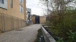
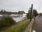
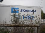
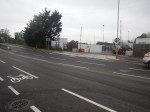
The Work Has Started At Green Park Way
These pictures show the Greenford site on the 12th of October 2020.
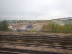
These pictures were taken from a Central Line train.
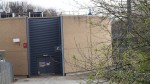
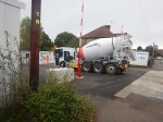
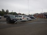
The Tunnel Portal Works At West Ruislip Station
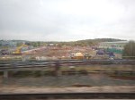
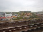
These pictures show the West Ruislip site on the 12th of October 2020.
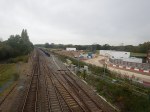
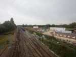
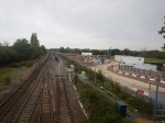
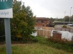
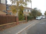

Note.
- This is where High Speed Two will emerge from the tunnels from Euston.
- The first three pictures were taken from the bridge over the railway and show the Chiltern Main Line, Chiltern’s turnback siding and the High Speed Two site.
- There is no sign of works around the car park and the L-shaped care home on the station side of the road, so I would assume, that they will be unaffected by the tunnel.
This Google Map shows West Ruislip station.
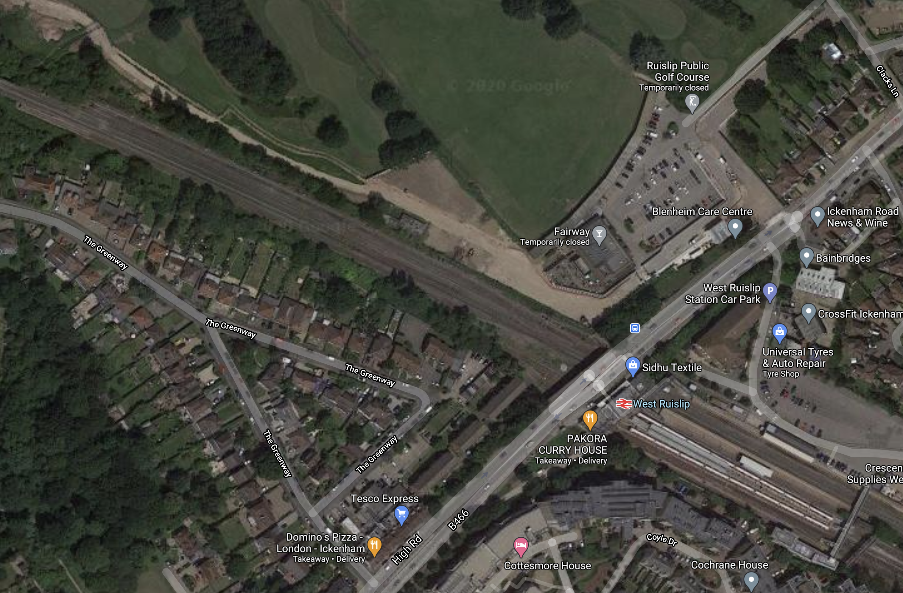
Note.
- The Central Line terminating in West Ruislip station.
- The Chiltern Main Line passing through the station.
- The scar of the construction of High Speed Two alongside the Chiltern Main Line.
If you follow the Chiltern Main Line on Google Maps for a couple of miles, you can see the route of High Speed Two.
This second map is a clip of High Speed Two’s map of the area.
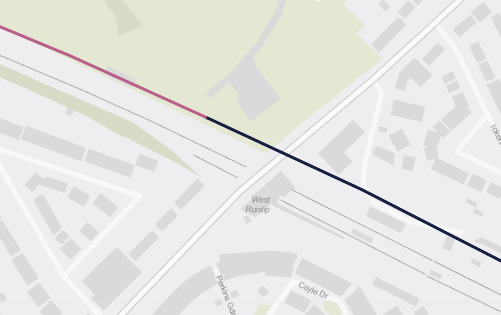
Note.
- The black line is the High Speed Two tunnel, that surfaces, where it changes colour.
- The L-shaped care home is still on the map, so it does appear the tunnel goes underneath.
It looks to me, that the bridge and Chiltern Trains going towards London, will offer good views of the tunnel works.
In the late 1950s, British Rail were increasing the number of tracks through Hadley Wood station, from two to four, by digging two extra tunnels.
I can remember my father taking me to see the works from Waggon Road or Wagon Road, which had and still had a few years ago, different names at either end.
Could We Bore A Double-Track Railway With A Tunnel Boring Machine?
There is one inevitability about construction projects.
As buildings get taller, foundations get deeper, structures get heavier, machines like cranes get bigger and more able to lift heavy loads.
I remember how in the 1970s, a project manager was eulogising about how the latest floating cranes that could lift 4,000 tonnes wee revolutionising the construction of oil platforms in the North Sea.
Crossrail may be a railway under London, where people think the tunnels are massive.
This page on the Crossrail web site describes the tunnels.
A network of new rail tunnels have been built by eight giant tunnel boring machines, to carry Crossrail’s trains eastbound and westbound. Each tunnel is 21 kilometres/13 miles long, 6.2 metres in diameter and up to 40 metres below ground.
But they are not the largest tunnels under London.
The Thames Tunnel, built by the Brunels, opened in 1843.
- It is eleven metres wide.
- It is six metres high.
- It carries the double track railway of the East London Line, which runs Class 378 trains, which are very much a typical British loading gauge.
There is also the Thames Tideway Tunnel, which is being dug to be a 7.2 wide circular tunnel.
And then there’s Bertha!
This description is from Wikipedia.
Bertha was a 57.5-foot-diameter (17.5 m) tunnel boring machine built specifically for the Washington State Department of Transportation’s (WSDOT) Alaskan Way Viaduct replacement tunnel project in Seattle.[1] It was made by Hitachi Zosen Sakai Works in Osaka, Japan, and the machine’s assembly was completed in Seattle in June 2013. Tunnel boring began on July 30, 2013, with the machine originally scheduled to complete the tunnel in December 2015.
It looks like London’s tunnels should be considered small.
Cross section areas of various tunnels are.
- Thames Tuideway Tunnel – 40.7 square metres.
- Thames Tunnel – 66 square metres
- Seattle Tunnel – 240 square metres.
- 8 metre circular tunnel – 50.3 square metres
- 10 metre circular tunnel – 78.6 square metres
- 12 metre circular tunnel – 113 square metres
The Seattle Tunnel shows what is possible today.
I am led to the obvious conclusion.
It would be possible to build a tunnel to take a full-size double-track UK railway using a tunnel boring machine.
Whether you would want to is another matter, as two single tunnels may be more affordable and better operationally.
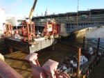
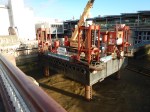
Millicent And Ursula Prepare To Go Tunnelling
I went to the Tideway Open Day today to see Millicent and Ursula before they go tunnelling.
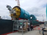
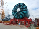
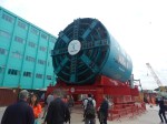
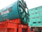
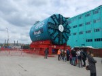
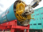

Other than the names on the sides, you will notice that Millicent has less teeth on the business end, than her friend.
This is because Millicent will be going West from the site near Battersea Power station and Ursula will be going East.
As the geology is more challenging to the East, Ursula has more teeth.
Some points to note!
- Millicent was named after Dame Millicent Fawcett.
- Ursula was named after Audrey ‘Ursula’ Smith.
- Both machines will have a statue of Saint Barbara, who is the patron saint of miners and tunnellers.
- These machines are larger than those of Crossrail.
- A documentary is being made for television about the tunnel.
There’s more on Millicent and Ursula on the Tideway web site.
The Victoria Embankment Work-Site Of The Thames Tideway Tunnel
As I walked along the Thames, signs of works for the Thames Tideway Tunnel are appearing.
These pictures were taken at the Victoria Embankment Work-Site.
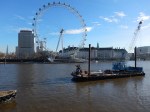
There is not much to see at present, but most of it is so the Tattersall Castle can be moved.
When the tunnel is finished, the site will look like this.
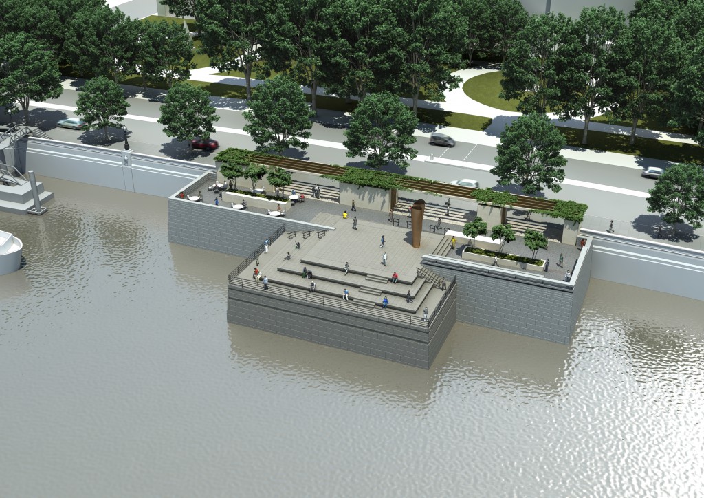
The main purpose of the site, is to connect the Regent Street combined sewer overflow to the main tunnel.
Anybody fancy a coffee, a drink or a meal in the sun by the Thames on top of the sewer outfall in 2021?
A Walk Along The River
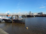
It was very sunny so I walked along the Thames from Blackfriars station to the Tower.
Note.
- The works for the Tideway Tunnel.
- The impressive new Blackfriars Pier for the Thames Clippers.
- Queenhithe.
- You walk underneath the City’s waste transfer station at one point.
I couldn’t believe that the weather was that good for December.
At Queenhithe, you have to walk inland as the Thames Path is blocked by development, that was done a couple of decades ago.
I do hope that the new development at Queenhithe will include a bridge across the ancient dock to continue the path.
