The Platform For The Future
The June 2016 Edition of Modern Railways has a section about The Railway Industry Innovation Awards 2016.
One is labelled the Platform for the Future.
That probably sounds rather boring, but I’m a great believer in disruptive technology and using new and innovative methods to replace something that is rather dull, with something that is better, quicker to be installed and get working and more affordable.
This is said.
Abellio Greater Anglia and Dura have pioneered the use of a composite platform at Needham Market station in Suffolk, which was installed in just 36 hours.
This installation might be considered surprising as Needham Market station is a Grade II Listed building. So it can’t look like.
A monstrous carbuncle on the face of a much-loved and elegant friend.
But the product comes with these advantages.
- The design life is sixty years.
- A financial saving of 25% is reported.
- As the platforms are built in a factory, the quality should be tip-top.
- Other features like Harrington Humps could be built-in.
Hopefully, this would dissuade even the most determined member of the Heritage Taliban from objecting.
There’s more here on the Dura website. There’s also this video, of the platform being installed at Needham Market station.
This is a picture I took from a p[passing train.
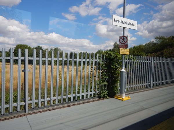
It looks good and who would think it was long-life hard-wearing plastic.
Only members of the Taliban tendency of the Green and Heritage lobbies would probably object!
I think that this product could find lots of applications, in traditional heavy rail, light rail and tramways. Certainly, it could be used to create some of the needed extensions to platforms on the Gospel Oak to Barking Line.
Look at these pictures taken at Harringay Green Lanes station.
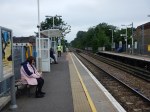
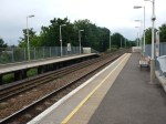

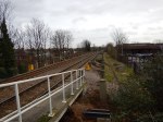
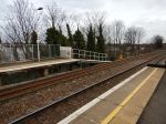
Would composite platforms make extending these platforms an easier process?
The company might also have the solution to the dual-height platforms, that some people feel are needed for tram-trains. The Germans certainly use stepped platforms so that different types of tram-trains have step-free access.
In fact, why restrict it to rail applications?
It could be used to provide a disabled viewing platform at somewhere like a horse racecourse or other sporting venue.
Or how about helping to create step-free bus stops, that I wrote about in One Of London’s Step-Free Bus Stops?
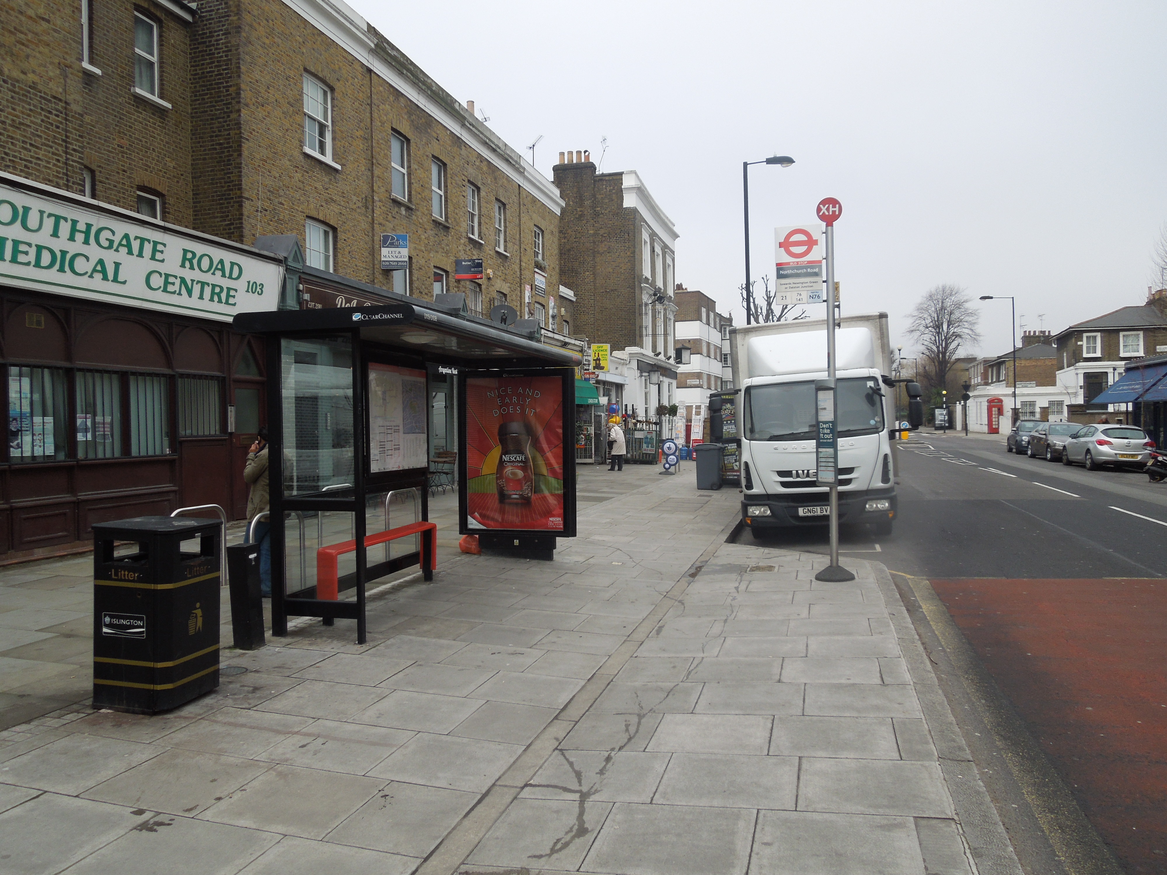
One Of London’s Step-Free Bus Stops
It’s certainly a very good innovation.
Never On Sunday
There have always been things that were banned on Sundays or because of personal reasons, you never did on that day.
- A Welsh friend at Liverpool University called David Roberts didn’t use to drink on Sundays when I first met him. But we soon cured him of that!
- My late wife, who had been a Sunday school teacher in her time, wouldn’t go to the cinema on Sunday, as her mother thought it ungodly.
- For myself, I don’t think I went to a football match on a Sunday until I was about forty, as they were never staged on Sundays.
I also remember the first day, that C and myself went to the first 1000 Guineas at Newmarket on a Sunday. Now horse racing and most other sport on a Sunday is considered normal, just as it is in the rest of the world.
It also used to be that the Northern City Line didn’t run at weekends, despite having three stations that served The Emirates Stadium.
This morning before it rained, I took a trip to Harringay station to view the Wightman Road Bridge, by taking a 38 bus to Essex Road station and then going three stops to the North.




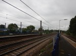
The line is getting new Class 717 trains, but I do feel that some work to improve the stations might not be a bad idea.
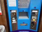
I actually wanted to buy a ticket on that dreadful machine from the Zone 6 boundary to Guildford, but unlike London Overground and some other companies ticket machines, it doesn’t sell such a useful ticket, which I wrote about in The Price Of Freedom.
More details of the Class 717 trains are given in this article in Rail Magazine, which is entitled New Govia Thameslink Railway trains to be Class 717s. This is said.
They are similar to the Class 700s being built by Siemens for GTR (of which 16 are in the UK), but they must have end doors as per safety regulations due to their operation in the Moorgate Tunnels. The design of this is at an advanced stage, with construction due to start this year.
I have felt that the Northern City Line, would be a classic application for an IPEMU for some time, as this would enable the Moorgate tunnels to be electrically-dead, as the trains would use batteries between Drayton Park and Moorgate stations. This would have the following effects.
- The third-rail electrification could be deactivated or even removed.
- The trains could also be 25 VAC only, if they wouldn’t be going into any other third-rail territory.
How would this impact tunnel safety regulations?
Whatever happens to this line, running a seven day a week service, will make the Northern City Line a valuable rail line in my part of London.
On a personal note, the line and Essex Road station in particular, will help me cut-out the dreaded Highbury and Islington station, with its long passageways and lack of lifts.
Cheam Station
Cheam Station is one of the stations on the route a proposed South London Outer Orbital, although I doubt the limited-stop service would call.
I took these pictures as we passed through.
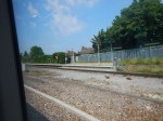
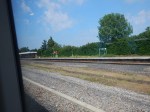
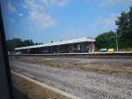
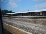
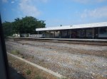
It is a curious station, quite unlike any others you see on the electrified lines South of the Thames. The layout is explained in the History section in the Wikipedia entry.
The station is almost 16 miles (26 km) from London Bridge station. Over the years Cheam station expanded, and was rebuilt and the rail bed widened in preparation for the installation of AC overhead electric services, which would have included the building of an additional central platform island. Due to the outbreak of the First World War, the full planned expansion was cancelled and was never completed. Nevertheless, the through lines were still in place until the late 1970s when the Bognor Regis and Portsmouth express services were withdrawn from the Sutton and Dorking route to serve an expanding Gatwick Airport. The wide space between the tracks still remains and shows where the fast lines had been laid prior their removal. The brick main buildings are on the down side of the station.
How different would trains be South from London, if the electrification was overhead?
Improvements To Clapham High Street And Wandsworth Road Stations
In the June 2016 Edition of Modern Railways, there was an article entitled Turning South London Orange.
The report suggests putting platforms at Clapham High Street and Wandsworth Road stations on the Southeastern tracks to enable a direct service to Victoria to be reinstated.
This map from carto.metro.free.fr shows the lines through the two stations.
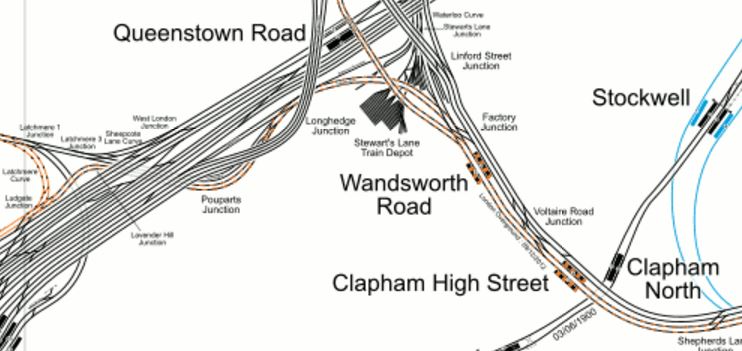
Lines Through Wandsworth Road And Clapham High Street Stations
If the proposed Brixton Tunnel were to be built, that would mean that only local stopping services and the London Overground trains would call at these two stations.
So would only two platforms be needed to handle all the trains? The frequency would probably be something in the region of twelve trains per hour, with possibly six on the Overground and six going to and from Victoria.
I know of many places in London and the rest of the UK, where a train every five minutes would be considered easy to handle. Crossrail and Thameslink will be handling a train at twice this frequency.
The great advantage of all trains in one direction being handled on a single platform face, is that if say you wanted to go from Dalston Junction to Victoria, you could get off one train at either of these stations and then get the next to your appropriate destination.
You could even use a wide island platform, which would allow changes where direction is reversed without leaving the platform. It would also only require one lift, so could the money be used for an escalator?
Because of the problems of providing platforms and a step-free connection at Brixton, undoubtedly, the platforms there would be built on the Northern pair of tracks. So I suspect that they would on these two stations.
This would have various knock-on effects.
- Freight, empty stock movements and other non-stopping services would use the Southern pair of tracks.
- There would probably need to be some reorganising of the junctions to the West of Wandsworth Road station, as part of the tunnel works.
- There would need to be some sorting out of the junctions East of Brixton to make sure all of the trains got to and from the correct places.
- Clapham High Street station could be properly integrated into Clapham North station with an escalator connection.
In some ways, it all shows how a tunnel under Brixton could be a masterstroke.
A New Station For Battersea
In the June 2016 Edition of Modern Railways in an article entitled Turning South London Orange.
One of the proposals is to create a new station at Battersea.
The station is proposed to have platforms on the Southeastern lines into Victoria, close to the Dogs’ Home, that will adjoin the new Battersea Power Station station on the Northern Line extension.
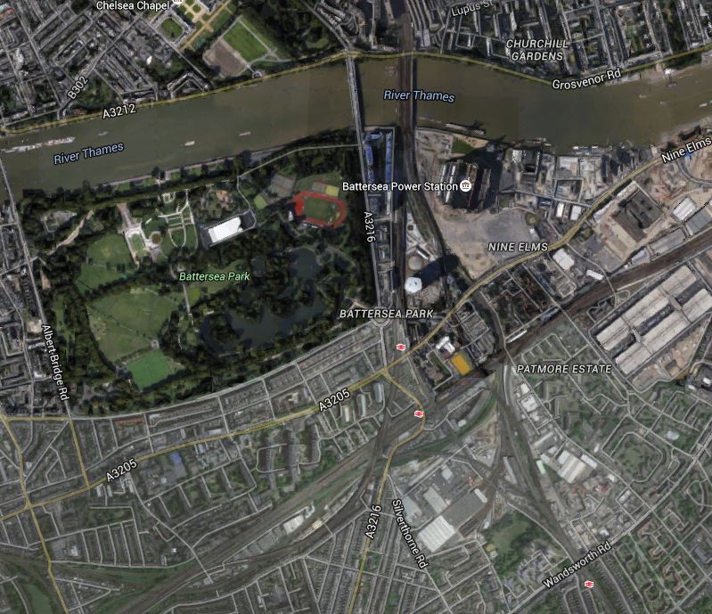
This Google Map shows the Battersea area |South of the Thames.
Battersea
Note the position of Battersea Power station to the East of the railway lines crossing the Thames into Victoria station.
The three stations shown are from North to South.
- Battersea Park, which is on the Brighton Main Line between Victoria and Clapham Junction stations.
- Queenstown Road is on the lines into Waterloo.
- Wandsworth Road is a London Overground station on the South London Line.
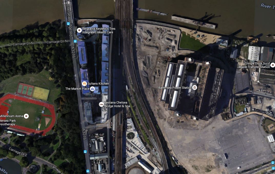
Battersea station will sit somewhere to the South West of the Power Station.
This Google Map shows the area in more detail.
The Location Of Battersea Station
Given that there is a redesign at Battersea, that I wrote about in Is A Big Row Developing Over The Northern Line Extension?, I have this feeling that a new Battersea station might be part of the solution. If Transport for London are having to foot the bill for a stronger station box, then connecting it to a new station on the Southeastern lines might generate traffic, that would create some income.
If the Improved South London Line proposed by Centre for London is built, then the new Battersea station will be conveniently between Victoria and Wandsworth Road stations.
- It would link the Northern Line to the Southeastern lines.
- It would improve journeys between South and South East London to Central London.
According to several theories, you can’t have too many stations.
Proposed New Stations And Interchanges In South London
In the June 2016 Edition of Modern Railways in an article entitled Turning South London Orange.
In the article, there is a table of Station and Interchange Proposals. I will list them in order.
Battersea
Battersea station is proposed to have platforms on the Southeastern lines into Victoria, close to the Dogs’ Home, that will adjoin the new Battersea Power Station station on the Northern Line extension.
As this station appears to be crucial to a lot of the Centre for London reports proposals, I have given the new station its own post called A New Station For Battersea.
Beddington
Beddington station is proposed between Wallington and Waddon stations on the line between West Croydon and Sutton stations.
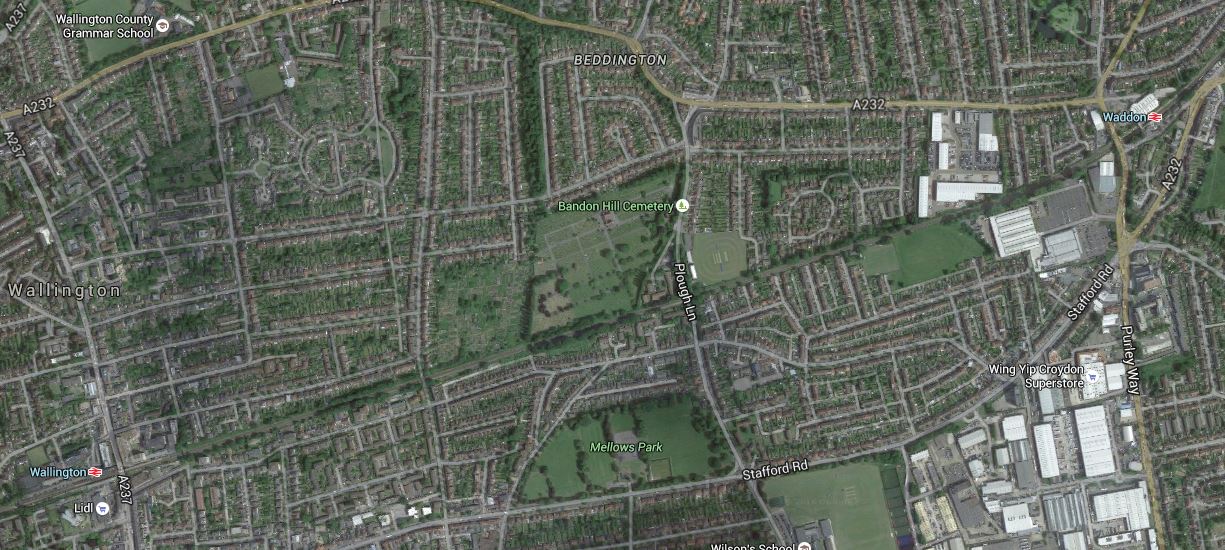
I don’t this area well, but here’s a Google Map between Wallington and Waddon stations.
Proposed Beddington Station
According to the Centre for London report, there is a long gap between stations and there has been a loot of development in the area.
The rail line runs across the middle of the map and the station is proposed for Plough Lane, South of Bandon Hill Cemetery.
Brixton
One of the proposals in the article is to create an improved station at Brixton, by reopening disused platforms on the Northernmost tracks at the station.
I have written this a separate post at An Improved Station For Brixton
Brockley
The article proposes a new pair of platforms on the South London Line between Nunhead and Lewisham stations, providing interchange with the existing Brockley station.
I gave my views on Brockley station in A Report On The Bakerloo Line Extension, which I now repeat.
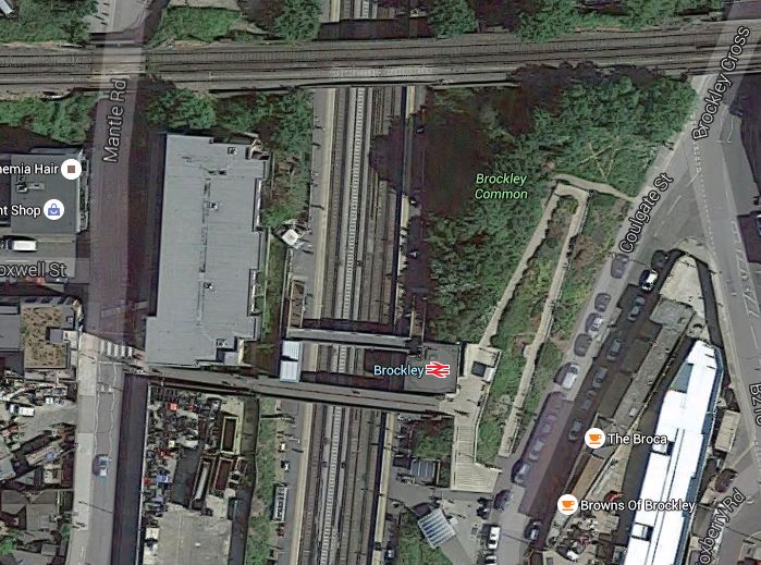
This Google Map shows Brockley station.
Brockley Station
The Bexleyheath Line between Nunhead and Lewisham stations crosses the East London Line and Brockley station at a high level.
I wrote A Four-Poster Station about connecting these two lines.
It would appear that Transport for London have advanced this project from one word in their 2050 Infrastructure Plan to a proposal.
This is the sort of connectivity, that us plebs in Dalston will like a lot. From 2018, as I wrote in Increased Frequencies on the East London Line, there will be ten services per hour between Dalston Junction and Brockley stations and one change at Brockley, will open up many transport opportunities.
Camberwell
Camberwell station is a new station on the Thameslink Line between Elephant and Castle and Loughborough Junction stations.
This Google Map shows the area around the disused Camberwell station.

Camberwell Station
Camberwell station used to be where Camberwell New Road crosses under the railway.
Wikipedia has a section about the re-opening of the station. This is said.
In March 2016 it was reported by Transport for London that proposals to re-open the station are being considered with other stakeholders, including the London Borough of Southwark. Initial feasibility indicates it would be possible to construct a modern station on the site if timetables could be modified to accommodate Camberwell as an additional stop. TfL will be working with Network Rail and the boroughs of Southwark and Lambeth to further develop the feasibility of this proposal.
I would also suspect that being able to open a new Camberwell station, at the same time as Thameslink, would be very easy to justify on a costs basis.
Clapham East
Clapham East station is proposed to be half a mile North-East of Clapham Junction station on the East London Line.
As this station is a new proposal and hasn’t come to my notice before, I have given the new station its own post called A New Station For Clapham East.
Clapham High Street And Wandsworth Road
The report suggests putting platforms at Clapham High Street and Wandsworth Road stations on the Southeastern tracks to enable a direct service to Victoria to be reinstated.
I have dealt with these two stations in Improvements To Clapham High Street And Wandsworth Road Stations.
Imperial Wharf
There is an interesting proposal to put a footpath over the Thames to give access to Imperial Wharf station from the South Bank.
This Google Map shows the station and the Thames.
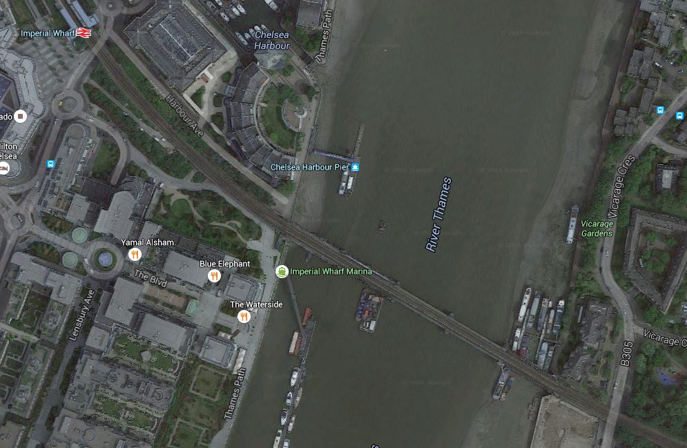
Why not build the footpath?
New Cross
New Cross station is just over five hundred metres from New Cross Gate station. This Google Map shows both stations.
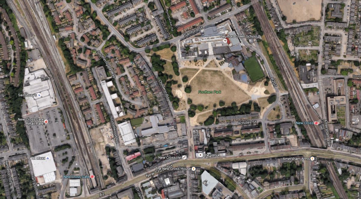
New Cross Gate And New Cross Stations
The Centre for London is proposing stopping East London Line services to New Cross, increasing service to New Cross Gate and building a travolator between the two stations. They say this in the report.
The proposal is to build an underground travolator between New Cross, Goldsmiths College and New Cross Gate interchange. At New Cross Gate a more frequent train service would be available on the ELL and existing Southern route. This would be a practical alternative linking the Southeastern and South Central networks, and it would also create Southeastern lines access via New Cross to the proposed Bakerloo station at New Cross Gate, for those trains which avoided Lewisham.
It is an interesting solution, that possibly could be used in many places.
Leaving Ljubljana
I took an early start as my train left at 09:23 for Munich. But at least the breakfast in the hotel was not bad at all.






The pictures show the station, where at least I was able to get some weak sun after the last couple of days in Croatia.
I must admit, I’ve never seen so many trains with added graffiti. I suppose, if it’s always raining, it passes the time.
Two Beautiful Seats At West Acton Station
This seat forms the waiting area at West Acton station on the Central Line.
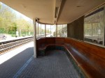

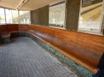

With the rounded window, it must be one of the most beautiful platform shelters on any rail station.
Note the picture of the second one on the other track.
Wikipedia says this about the design of the station.
The current station, replacing the original building, was designed by the Great Western Railway, on behalf of London Transport as part of the LPTB’s 1935-40 New Works Programme improvements and extensions to the Central line, by the GWR’s architect Brian Lewis and was completed by November 1940.
So it was actually designed by the Great Western Railway.
Simple Art At Blackfriars Station
I’ve been through Blackfriars station many times and have never noticed this art before.
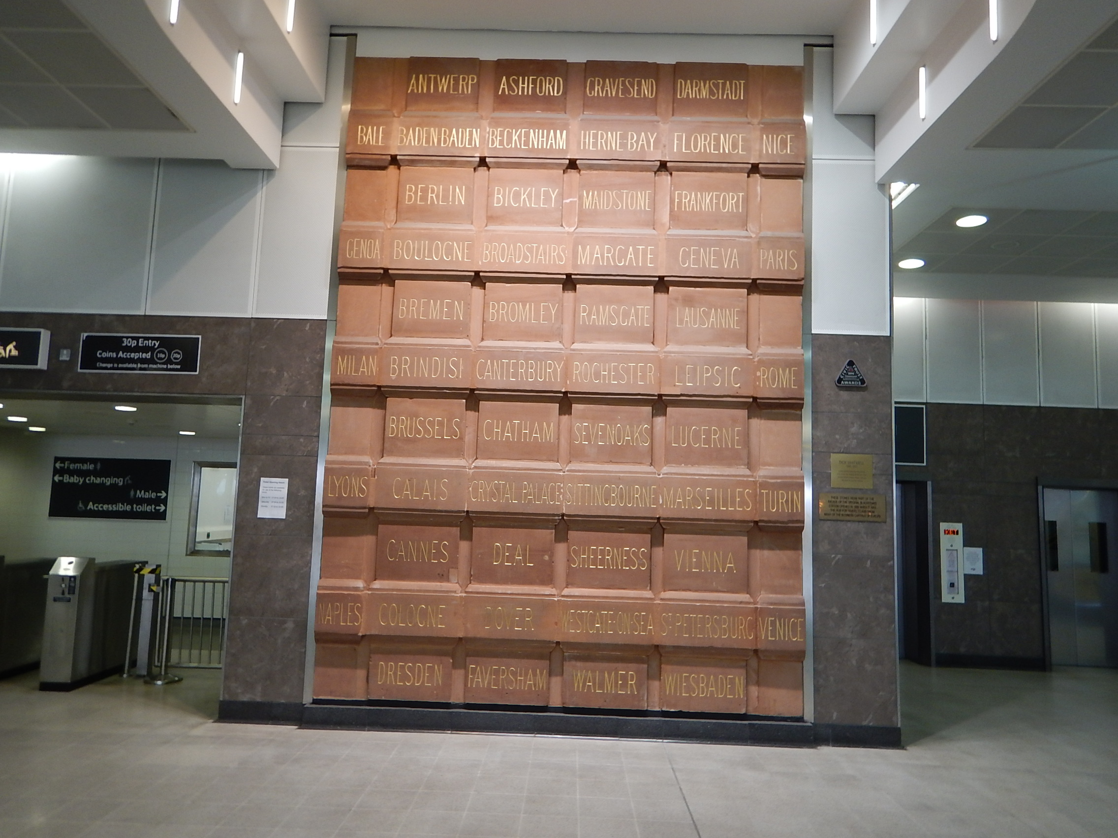
Simple Art At Blackfriars Station
All of the bricks have the names of stations served by trains from the old Blackfriars station.
It must be the only place where Baden-Baden is next to Beckenham.
Reversal Stations
In Crossrail In East Docklands, I said this about Whitechapel station.
Whitechapel station will be Crossrail’s Jewel In The East and the most important interchange for the line in East London.
- It links both eastern branches of Crossrail to the Metropolitan and District Lines.
- It provides an interchange to London’s important but sometimes forgotten East London Line.
- An extended Whitechapel station would provide much better access to the East of the City of London.
But perhaps more importantly, Whitechapel is the reversal station for passengers travelling between one Eastern branch of Crossrail and the other.
A reader has asked me what I mean by a reversal station.
Look at this map from carto.metro.free.fr, which shows the lines around and through Whitechapel.
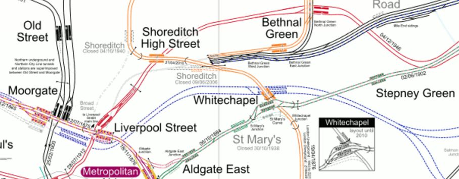
Lines Through Whitechapel
The Crossrail tracks, which are shown in blue, come from the West and go through the two platforms at both Liverpool Street/Moorgate and Whitechapel, before dividing into the two branches to Abbey Wood and Shenfield, a mile or so South of Stepney Green.
Note.
- Liverpool Street and Moorgate will share a massive doubled-ended Crossrail station with an island platform, that connects to all the lines at the two stations it connects.
- Whitechapel has a massive underground station with another island platform, where all Eastbound trains use the North side of the platform and the Westbound trains use the South.
I call Whitechapel a reversal station, as it means that any passenger arriving from the East wanting to go West on the other branch, just walks across the platform and gets an appropriate train.
As a dozen trains an hour will be using each branch, that means the maximum wait will be five minutes, but if say the trains were timed to pair up at Whitechapel, so that an Eastbound Shenfield train was always in the station with or just after a Westbound train Abbey Wood and vice-versa, the interchange time would be determined by how long it took passengers to walk across.
The interchange is totally step-free for transferring passengers and can be paired with a very wide platform to make the interchange easy for everyone.
It is a simple but absolutely brilliant concept!
The designer of the station obviously liked it so much, he did it again at Whitechapel.
Arrive at Whitechapel on an Eastbound Metropolitan or District Line train and if you need to go back West on the other line, you just walk across for the train you want. These trains don’t pair up, but then the signalling wasn’t designed to be this sophisticated in the middle of the last century.
This interchange on the Sub Surface Lines has only started recently and I wonder how often it is used by passengers.
Are there any other stations, where this passenger reversal is or could be used?
Hayes And Harlington
A similar technique could have been used at Hayes and Harlington station to link the two Western branches of Crossrail, which have the following services.
- Four trains per hour serve the Heathrow Branch.
- Two trains per hour serve both Reading and Maidenhead.
But using a similar layout to Whitechapel with a spacious island platform and scheduling the trains appropriately, might effectively give Reading four services an hour to Heathrow, which would involve nothing more than a step-free interchange at Hayes and Harlington.
It would certainly have been more affordable than tunneling into Heathrow from the West.
This map from carto.metro.free.fr shows the lines through Hayes and Harlington and the Junction for Heathrow.
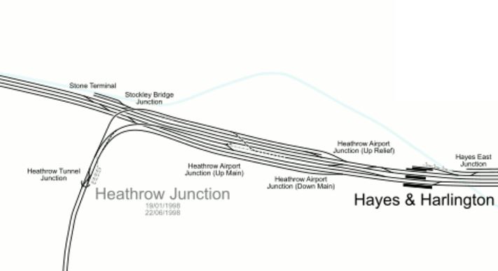
Lines Through Hayes And Harlington And Heathrow Junction
It’s probably too late now to adjust all the tracks and platforms at Hayes and Harlington station and the Stocley Viaduct, but I do believe that something could be setup at the station to improve access to Heathrow from the West until the full tunnelled link is built.
I believe that good design here, could have enabled a much more affordable Western Link for Heathrow, without any need to tunnel into the Airport.
An ideal solution would incorporate.
- Two tracks into Heathrow.
- Step-free and preferably step-across interchange at Hayes and Harlington station for passengers from Reading.
- Connection to Great Western Railway’s local trains in the Thames Valley.
- Contactless ticketing using bank cards between London, Heathrow and London.
- All Crossrail trains from London to serve all terminals.
Point five must be possible, as I’m sure the tunnels under Heathrow have a larger capacity than is being used.
But Heathrow are holding Crossrail, London and Londoners to ransom!
But then we hold all the cards, as no Mayor and few Londoners, would ever support the expansion of Heathrow!
This Google Map shows the current Hayes and Harlington station.

Hayes And Harlington Station
This description of platform use is from Wikipedia.
The station has five platforms, four being through platforms and one being a terminus bay platform. Platforms 1-2 are used only during engineering works; platforms 3 & 4 are for stopping services to and from Heathrow Airport, Reading and Oxford; platform 5 is a bay terminus platform, which is sometimes used during peak times, amended services and during engineering works. Platform 5 is capable of holding an eight-car train; platforms 2, 3 and 4 can hold seven-car trains and platform 1 can hold a five-car trains. All lines at Hayes & Harlington are electrified. On platform 5 there is an alternative entrance leading to High Point Hayes, the entrance has Oyster Pay & Go readers, platforms 3 & 4 are connected by a bridge towards the end of the platforms.
Stations are numbered from the South.
What would need to be done is create an island platform between the two relief lines that will be used by Crossrail.
This would mean that a passenger between Heathrow and Reading, would just walk across the platform and wait for their train. As at Whitechapel, the first train would arrive a few minutes before the second left. It would be easy to arrange with Crossrail’s modern signalling and train control.
Under Crossrail in the Wikipedia entry for the station, these modifications are listed.
- New station building
- 4 new lifts to provide step-free access
- Platforms 1-4 extended
- New 200m bay platform 5 constructed (replacing existing bay)
- New platform canopies to platform 4 and 5
- Track work to widen the island platform 2/3 and to provide access to the new bay platform
Does point six mean that Platform 2 is Crossrail for Reading and Heathrow and Platform 3 is Crossrail for London?
I hope so, as that would give a step-across interchange between Reading and Heathrow.
But there is no mention of the layout of the two fast lines, which are currently served by platforms 1 and 2.
In Hayes And Harlington Station – 28th March 2016, there are several pictures of the station and the lines don’t appear to have been slewed to the South to enable the Crossrail Lines to be either side of an enlarged island platform 2/3.
It was probably just too difficult.
Old Oak Common
There are proposals to add a branch of Crossrail that would go up the West Coast Main Line to perhaps Milton Keynes. The logical place for Crossrail to join the West Coast Mail Line (WCML) is near Old Oak Common station.
I believe this could be another reversal station like Whitechapel, where the Western and WCML branches split to the West of the station.
This map shows some of the proposed track and station layout at Old Oak Common.
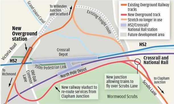
Rail Lines At Old Oak Common
The WCML is off the North of this map.
Get this connection right and there would be step-across access between the WCML to Milton Keynes and all stations to Heathrow on Crossrail.
Willesden Junction On The North And West London Lines
The North London and West London Lines divide to the west of Willesden Junction station.
Passengers between say Richmond and Imperial Wharf stations can use Willesden Junction station as a step-across to reverse direction. The timetable gives five or six minutes for the change, which is acceptable, but not as quick as I believe Whitechapel will be.
St. Pancras Thameslink
When the Thameslink Programme is completed, the Thameslink platforms at St. Pancras International will become a reversal station for passengers wanting to change between the Great Northern and Midland Main Line branches.
But it will not be a simple walk across a platform, but a hike over a footbridge, albeit one with step-free access.
The only Central London station on Thameslink, which will be an island platform will be London Bridge, where platforms 4 and 5 will serve Thameslink.
East Croydon
In an ideal world all Northbound Thameslink services at East Croydon station would call at the same island platform and all Southbound services would call at the opposite face of the island. I think that sixteen trains per hour will use the various Thameslink routes through East Croydon. On a dedicated platform, that is only one train every four minutes and the East London Line handles that with ease!
I think that the number of Thameslink trains through East Croydon is not very ambitious, in contrast to the number through the core of twenty-four trains per hour, which is ambitious, but not unduly so!
But I can’t find any information as to whether this will happen.
Where will passengers wanting to travel between Caterham and Tattenham Corner stations change trains?
It does strike me, that the care applied to the design of Crossrail, is lacking in the Thameslink Programme.
They obviously used ordinary envelopes, rather than special engineering ones!
Just compare the mess that is East Croydon station to the much larger, more complicated and impressive Reading station.
If Croydon is serious about being important, it needs a gateway station like Ealing Broadway, Huddersfield, Leeds, Liverpool, Manchester Victoria, Northampton, Nottingham, Stratford or Reading, rather than an overcrowded badly-designed stop on the Brighton Main Line, that just makes visitors say, they’ll never return.
East Croydon also needs a proper connection to the East London Line. The current terminus of West Croydon is one of the worst designed pieces of railway infrastructure in the world. It’s equivalent to putting a main station for Liverpool in Birkenhead or one for Newcastle in Sunderland.
West Croydon station should be shut as soon as possible and East London Line services transferred to East Croydon.
Manchester Piccadilly
Whilst I’m in attack-dog mode, the two worst platforms in the country are platforms 13 and 14 at Manchester Piccadilly station.
- These platforms were designed to get passengers as fit as possible, by locating them some distance from the main station facilities.
- They are too small and always crowded.
The plans to remedy the overcrowding, include building two new platforms further out at great expense.
This may solve the problem, but I’d like to see answers to these questions first.
- How many trains per hour stop at each platform? A platform like this should be able to handle sixteen trains per hour both ways, as does Canada Water on the Overground.
- How many passengers use this island platform to reverse direction?
- How many passengers get off one train here and get on another in a few minutes? I’ve done that myself on those platforms, a few times.
- How would platform utilisation change with two and three-car trains changed for larger ones?
- Could a reorganisation of services and the Ordsall Curve, increase seats on various routes, but reduce the number of trains through these platforms?
- What difference would contactless ticketing using bank cards make to passenger throughput?
- Is it necessary that every train stopping at Piccadilly always seems to stop at Oxford Road?
As an aside here, I could rightly claim that I’ve written more successful resource scheduling programs, than anybody else ever has!
I know it was designed in the 1960s, but I believe that by applying some modern data analysis and desjgn, that platforms 13 and 14, with more space, escalators and lifts everywhere, better facilities and perhaps a direct entry to the Metrolink station underneath, could go a long way to handling more traffic.

