A Hauptbahnhof But Not As The Germans Know It!
Hauptbahnhof, which is often abbreviated to Hbf, is the German equivalent of Central.
But Kassel Hauptbahnhof is a station that the high speed line from Hanover to Wurzburg, ignored to call at a new station of Kassel-Wilhelmshohe. So as it now gets only a few trains, and has been transformed into a culture station, with a tram-train station underneath.

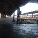


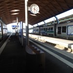


It struck me that the people of Kassel could find a better use for it, although the tram-train station appeared to work well.
According to Wikipedia it is the only Hauptbahnhof, that is not the main station for the town or city. So when you book a hotel in Kassel and you’re coming by train, make sure the hotel is by Kassel-Wilhemshohe station
What Is Happening To The Sheffield-Rotherham Tram-Train?
The Sheffield-Rotherham Tram-Train is a pilot project to prove whether the technology can work on UK railways.
It’s a laudable aim, but I don’t like pilot projects as if they work, then you usually end up with an inadequately funded permanent one, that is lacking in certain areas and has to be upgraded. On the other hand, if they don’t work you have all the expense of ripping them out.
It is much better to take proven technology and phase the introduction of the system, funding and building every phase adequately.
This Google Earth map shows the area where the tram-train will run.
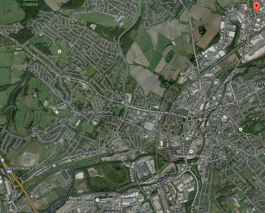
Sheffield Rotherham Tram Train
In the top right or north east corner of the image is the Rotherham Parkgate Retail Park, which will be the terminus of the route. In the bottom left hand corner is Meadowhall Shopping Centre, with the associated Interchange station, where the tram-train will join the Sheffield Supertram network. Tram-trains are proposed to run three times in an hour, which would be in saddition to the two or three trains per hour on the route.
This Google Map shows the layout of train tracks around Rotherham Central station.
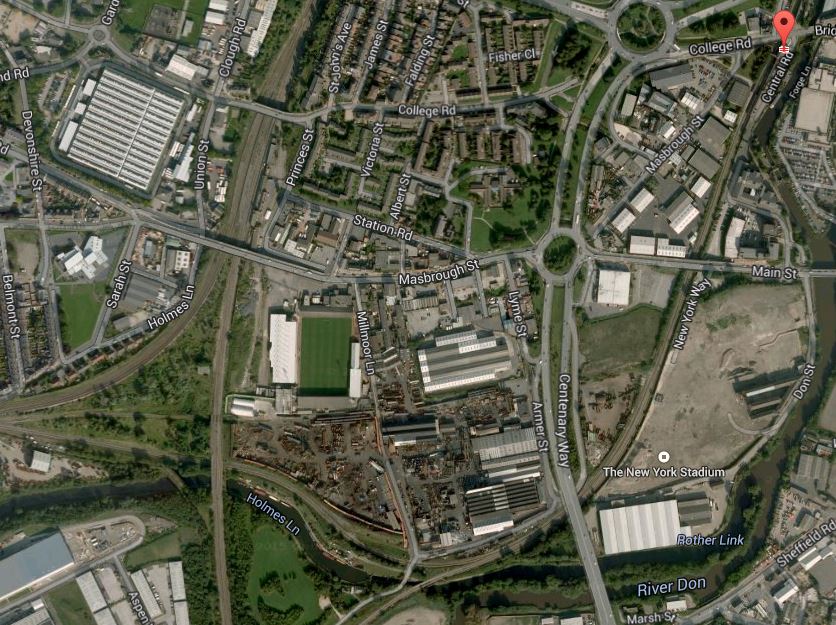
Lines Through Rotherham
Note the New York stadium marked on the map, but not shown, as the image was taken before the stadium was built. Just after the stadium, the lines split with one going west to join other lines and go direct to the Meadowhall Interchange and the other, which is now a freight route, going more south-west over the river towards Sheffield.
This Google Map shows the layout of the railway lines and the tram tracks around Meadowhall Interchange.
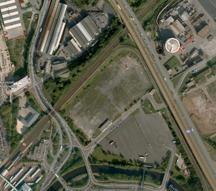
Meadowhall Tram-Train Connection
Meadowhall Shopping Centre itself, is just off the bottom of this map and is connected to the station by a bridge over bus, tram and train stations, which can just be seen in the bottom-left corner.
Note how the railway to the east from Sheffield goes under the M1 motorway, with the Sheffield Supertram coming up parallel to the motorway and then turning into the interchange.
It will be difficult to get this connection right, as a direct tram-train from Rotherham will come under the motorway and then stop in the Meadowhall Interchange station. I would assume that it would stop in the Sheffield Supertram platforms and then reverse direction to go on to Sheffield.
This must be wrong, as it would be a difficult scheme to run efficiently with three tram-trains an hour in each direction reversing in the tram platforms and then Rotherham-bound trams sometimes waiting there to cross the westbound rail line to get on the right track for Rotherham.
So I would assume the second route that breaks off to the south-west from Rotherham would be used. This Google Earth map shows where the line meets the Sheffield Supertram around Meadowhall South station.
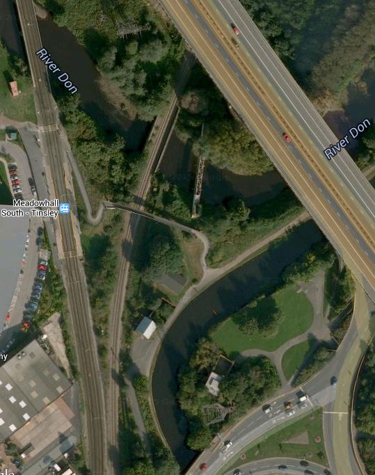
Medowhall South
This would be a much easier connection and I think this is the way the tram-trains will go to and from Rotherham.
The Sheffield-Rotherham tram-train has been a long time coming since the decision to start. I wonder if the reason is that the engineering of both track and signalling has been much more difficult than first thought. The first direct route is difficult if not impossible operationally, but sorting out the tracks for the second route may not be too easy, as looking at the image there is a lot of water about, that might need to be bridged, by the tight turn.
I think too, that as it’s only a trial, we might see a single track curve, as the tram-trains will be reversing at Meadowhall Interchange. That would at least cut costs and men less disruption to the Supertram, whilst the connection is being made.
One issue that has to be thrown into the pudding, is the electrification for the trams, which is 750 volts DC overhead. If at some future date the planned electrification of the Midland Main Line and trans-Pennine routes at Sheffield is extended to Meadowhall and Doncaster, then the new station at Rotherham Central would possibly be electrified at 25kV AC.
So it could be that extending the tram-train pilot scheme between Sheffield and Rotherham into the future, might be scuppered by electrification plans for the North.
It does strike me that the £60million or so being spent on the tram-train pilot, might be better spent on providing extra trams for the Sheffield Supertram and trains for more services through Rotherham.
Could it be that just as the great and good in the Department for Transport, forced Cambridge to have a guided busway, they are persuading Sheffield and Rotherham to have a tram-train?
Will Dudley Get A National Very Light Rail Innovation Centre?
In London, there are several types of railway.
1. The main lines coming into London like the East Coast Main Line and the London Overground would typically be classified as heavy rail.
2. The London Underground is a metro, underground of rapid transit system. Take your pick on the name, but in London’s case it’s complicated by some Underground trains sharing tracks with heavy rail services.
3. The Docklands Light Railway is probably best described as what it says in the name; a light railway.
4. There is also the Tramlink, which in London is a tram that runs both on-street and on dedicated tracks.
Looking around the world, there are a multiplicity of types of railway and every country seems to have their own versions.
So I was interested to see this article on the BBC web site, which talked about a proposed Very Light Rail Innovation Centre and a new transport link in Dudley in the West Midlands.
So what is very light rail?
I suppose the only truly very light rail system in the UK, is the Parry People Mover in Strourbridge, which is a lightweight vehicle powered by an innovative electric drive train using a flywheel for energy storage.
It is my belief, that as you make vehicles lighter, they become more efficient and this improves the economics. This applies to both road and rail vehicles.
As the Dudley project is backed by the well-respected Warwick Manufacturing Group, I suspect that quite a few influential organisations, will think the Innovation Centre could be a worthwhile project.
This is a project that needs to be watched.
But consider.
1. The Docklands Railway is successful and liked by passengers and operators. So why is it, that there is no similar driverless system using the same technology?
2. How many proposals for trams and light rail systems in the ?UK, have never come to fruition?
3. Every tram system I’ve ever ridden seems to be a one off design from the stations and track to the vehicles and the ticketing system.
We must be able to do better!
And surely a properly-funded Innovation Centre, backed with the right technical resources wiill help us create better urban transport systems in the UK and the wider world.
Manchester Trams To Get Wi-Fi
Modern Railways is reporting that all trams in Manchester are to get wi-fi.
Now that wi-fi is becoming more universal on trains in the UK, with some operators like Chiltern and Virgin offering it free to all passengers, it would seem logical to apply the technology to trams and light rail systems. I believe Edinburgh is going along the wi-fi route with its new trams.
Naively, as trams go slower and tend to operate on the surface in cities, the technical problems of wi-fi on Manchester trams must be less than those on say a Scottish rail line.
It’s All Go On The Manchester Metrolink
According to this article in Global Rail News, work has now started on the Second City Crossing or 2CC. But it is the last paragraph that shows how the Manchester Metrolink is developing.
November has seen several significant milestones ticked achieved for the Metrolink system, with funding confirmed for the Trafford Centre extension and the opening of the system’s new airport line.
More projects like this should be promoted if we are going to create a powerhouse across the North.
Incidentally, with my project management hat on, I don’t think the upgrading of Manchester Victoria station and the Metrolink has been planned as the partially joint project they so obviously are.
On my travels around Manchester in the last couple of years, I have sometimes found it extremely difficult to get between the two main stations; Victoria and Piccadilly. That would have been eased by making sure there was always one reliable easy-access properly-signposted link at all times.
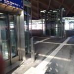
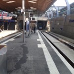
A New Tram Loop At East Croydon
I don’t go to Croydon very often, but I always have problems with getting between the two stations; East Croydon and West Croydon. The reason is that I live near Dalston Junction and therefore end up at West Croydon, but I have onward travel from East Croydon. I also sometimes want to travel to IKEA via West Croydon.

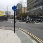
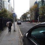
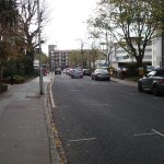
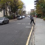

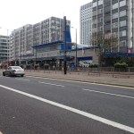
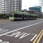
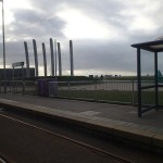
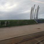
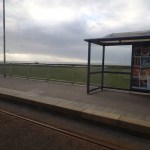
The Tramlink is being updated with a new turnback loop at East Croydon station, which is described here. I took these pictures in the area, where it will go.
It doesn’t seem to me that any of the options suit me better than any other, but I hope the cars I saw rushing about in the area between the offices calm down, when they share the roads with the trams.
One thing the new loop won’t do, is help me get to IKEA from West Croydon station. Either I walk through to the Church Street stop or go to East Croydon and get on a tram to Wimbledon.
Extending The Blackpool Trams
My ride on the Blackpool trams yesterday, got me thinking.
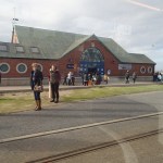
In the first place, I think that concerning the link to Blackpool North station, a trick has been missed. Opposite the station, Sainsburys have built an impressive store.

Sainsburys Opposite Blackpool North Station
Surely, the whole area should be part of one development with the trams coming up Talbot Road from the North Pier to a covered interchange giving level access to both the station and the superstore. With electric trains arriving direct from Liverpool, London and Manchester, and places farther afield, this would make Blackpool North a true destination station.
When I go to see Ipswich play Blackpool at Bloomfield Road, I sometimes go on the single track railway from Preston via Lytham to Blackpool South station, as it is an easy walk through the car-parks to the ground.
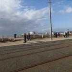
But this means, I have to endure one of Northern Rail’s scrapyard specials and there is nowhere along the walk, to even get a cup of tea. I also walk through masses of car parking for visitors, which like the football ground, are a walk of a couple of hundred yards from the promenade and the tram. This map shows the area.

The football ground is clearly at the top and the red arrow at the bottom indicates Blackpool South station, with the car parks between. The tramway at this point runs between the beach and the road along the front. The two blue dots are the tram stops at Waterloo Road and South Pier.
If you look further south, the rail-line and tramway get closer together.

Near Blackpool airport, Squires Gate station (red rail arrows) is perhaps just a couple of hundred metres from the Starr Gate terminus of the tram (blue dot in top left).
It strikes me that the whole of this could be pulled together.
Applying my naive logic, it strikes me that to extend the Blackpool tramway to Lytham, as is a stated as an aim in Wikipedia, one way to do this would be to convert the Blackpool South line to a tramway as far as Lytham. At the Northern end, it would branch off the existing tramway somewhere slightly North of the football ground and then pass through the car parks to take over the rail line at Blackpool South station.
From what I have read in the latest edition of Modern Railways more electrification centred on Liverpool, Manchester and Preston area, is on the cards after the current schemes are completed.
In some ways making the Blackpool South branch, an extension to the Blackpool tramway takes part of this line out of one expensive large project and into a simple stand-alone project, that extends the tramway.
You might even extend the tramway through Lytham to Kirkham and Wesham station, where the branch diverts from the Blackpool North branch, which is being electrified.
Kirkham and Wesham is a larger station, that could probably easily accommodate a simple turnback platform for the tram. It will also be on an electrified railway to Preston, Liverpool and Manchester, and possibly even London.
I would doubt, that whilst the tramway extension was being built, it would have any effect on the operation of the Blackpool North branch.
One extra saving might be, that sense would probably dictate doing both extensions around the same time, the extra trams needed could probably be ordered together.
Incidentally, I’ve found a report, which says that the Blackpool South branch could be converted to tram-trains.
Tram-trains might be an option, but I’m a great believer in extending what you’ve got, rather than bringing in too many different systems, as this means you have the convenience of a uniform fleet and you don’t confuse the passengers.
Tram-trains and other new systems appeal to governments, as politicians and civil servants get nice paid-for trips to see the systems at work.
My only worry about my analysis is, am I being bold enough.
I believe that an urban transport system should link the railway stations to the main visitor and sporting attractions, shopping centres and public services like the Council Offices and hospital.
Could for example the spur to Blackpool North station profitably serve anywhere else?
Is Blackpool On The Way Up?
In previous visits to Blackpool, I’ve found the place rather depressing and dirty. Generally, I’ve arrived by train, to give myself time to get to the match and then got the first train out afterwards. I have also called Blackpool the most pedestrian-unfriendly resort in the UK.
Also, when I mention I’ve been to Blackpool, like I did once to a lady on a bus in Leeds, I have often got a comment saying no-one goes there now!
But was it the fact that the sun was shining yesterday, that made the place seem so much better. But visitors and residents were adamant that the town had improved in the last few years.
The promenade is so much better and must rate architecturally with some of the best in Europe. Although, I would think that the obvious food offerings, are a bit too gluten-rich for me. If I go again, I might do a bit of searching, to see if anybody can cope.
But living in Dalston, an area of Hackney, that has been transformed by a refreshed North London Line, I would think that Blackpool’s refreshed tramway has done the same for the resort. After all, many of Blackpool’s visitors are like me and not in the best state they could be. Surely, a step-free low-floor tram is one of the best prescriptions, that isn’t available on the NHS.
I think to be fair, we haven’t seen the end of the rise of Blackpool. Just as Liverpool took more than a few years to rise from its nadir, Blackpool won’t get back to the top overnight.
The biggest thing that will happen is connecting the town to the electrified rail network as part of the North West Electrification. Network Rail’s report says this about progress in linking Blackpool to Preston by 2016.
A fully electrified route between Preston and Blackpool will connect the area to the west coast main line, the key rail artery linking the North West with London and Scotland.
We’ve upgraded all 15 bridges whilst carrying out safety improvement work to parapets. Overhead line equipment will be installed in 2015/16.
This electrification should improve the perception of the resort, as refurbished Class 319 trains are so much better and bigger than most of the trains working the line now.
It will also further improve the direct services to Liverpool, Manchester and London.
The tramway should also be linked to Blackpool North station in the next few years, as it should have been years ago. Nothing annoys me more, when I arrive by train in a town or city and find that the buses and/or trams are not connected to the station. Blackpool will rectify this omission, but I hope they get the tram capacity right, as many arriving by train will want to get straight on a tram to perhaps have a sightseeing run up and down the promenade.
One factor affecting the extension of the tramway to Lytham is the Open. Golf has staged its championship four times at Royal Lytham Golf Club in the last twenty-five years. As it last staged an Open in 2012, it should probably be due another. Ansdell and Fairhaven station is close to the course, so if another Open was to be staged at Lytham, then this station would probably play a large part in getting spectators to the event in a carbon-free manner.
I would suspect that Lytham are pushing hard for another Open and they are stressing the 2016-electrification to Preston in their bid. They can probably link an improved train or tram service to the course into the mix as well!
One interesting asset well connected to the trains and the tram is the old Blackpool International Airport, which recently closed. I’m sure that the town will use it to their advantage and I suspect various stakeholders have ideas in mind.
Blackpool has certainly had problems, but I would hope it is now on the rise!
Riding The Blackpool Trams
I’d never ridden the Blackpool trams until this visit, as often these visits seemed to coincide with their rebuilding.

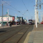


The trams I rode are modern Flexity 2 units, that are essential for providing a complete service in the 21st Century. Supposedly some of the older trams still run at weekends, but I didn’t see any.
The trams have three problems in my mind.
They should link up with the trains at Blackpool North station. Wikipedia says this.
The tramway is to be extended to Blackpool North railway station after Blackpool Council agreed to provide the remaining funding for the project. [11] A study is currently being undertaken by the council about a further extension to Lytham St Annes.
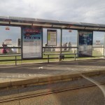
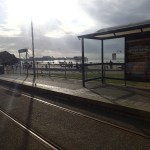
They need information and maps at the tram stops. As the trams have helpful and chatty conductors, this isn’t as pressing as it could be, but why isn’t there an illustrated map showing the route at each stop?
The tram I rode from the North Pier to the South Pier was crowded to say the least. It strikes me that some serious thinking needs to be done about augmenting the fleet, either by adding more new trams or running the heritage trams more. In an ideal world, where money was no object you’d probably build some innovative new double-deck trams. Come to Blackpool Thomas Heatherwick, Blackpool needs you!
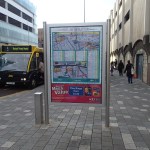
Blackpool’s New Maps And Signs
I’ve criticised Blackpool in the past, as lacking maps and information. But they have at least got started on a visitor-friendly information system.
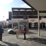


I think it is true to say, that most of the locals and visitors I talked to, said that the town had been getting better in the last couple of years.
These maps and signs should lead to fewer people getting lost.
But there were no signs pointing you to the trams at the station and the tram stops didn’t have any maps or even information about how you use the tram.
