What Is Happening To The Sheffield-Rotherham Tram-Train?
The Sheffield-Rotherham Tram-Train is a pilot project to prove whether the technology can work on UK railways.
It’s a laudable aim, but I don’t like pilot projects as if they work, then you usually end up with an inadequately funded permanent one, that is lacking in certain areas and has to be upgraded. On the other hand, if they don’t work you have all the expense of ripping them out.
It is much better to take proven technology and phase the introduction of the system, funding and building every phase adequately.
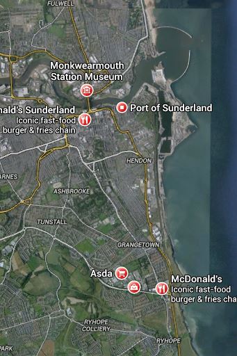
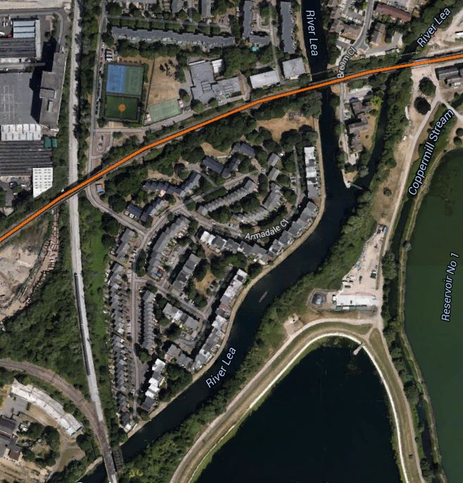
This Google Earth map shows the area where the tram-train will run.
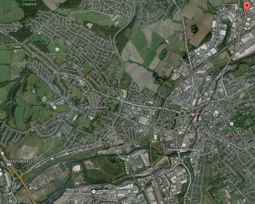
Sheffield Rotherham Tram Train
In the top right or north east corner of the image is the Rotherham Parkgate Retail Park, which will be the terminus of the route. In the bottom left hand corner is Meadowhall Shopping Centre, with the associated Interchange station, where the tram-train will join the Sheffield Supertram network. Tram-trains are proposed to run three times in an hour, which would be in saddition to the two or three trains per hour on the route.
This Google Map shows the layout of train tracks around Rotherham Central station.
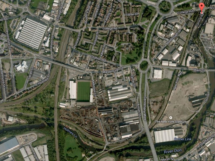
Lines Through Rotherham
Note the New York stadium marked on the map, but not shown, as the image was taken before the stadium was built. Just after the stadium, the lines split with one going west to join other lines and go direct to the Meadowhall Interchange and the other, which is now a freight route, going more south-west over the river towards Sheffield.
This Google Map shows the layout of the railway lines and the tram tracks around Meadowhall Interchange.
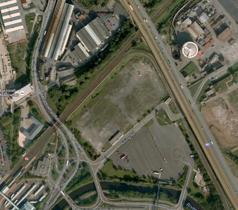
Meadowhall Tram-Train Connection
Meadowhall Shopping Centre itself, is just off the bottom of this map and is connected to the station by a bridge over bus, tram and train stations, which can just be seen in the bottom-left corner.
Note how the railway to the east from Sheffield goes under the M1 motorway, with the Sheffield Supertram coming up parallel to the motorway and then turning into the interchange.
It will be difficult to get this connection right, as a direct tram-train from Rotherham will come under the motorway and then stop in the Meadowhall Interchange station. I would assume that it would stop in the Sheffield Supertram platforms and then reverse direction to go on to Sheffield.
This must be wrong, as it would be a difficult scheme to run efficiently with three tram-trains an hour in each direction reversing in the tram platforms and then Rotherham-bound trams sometimes waiting there to cross the westbound rail line to get on the right track for Rotherham.
So I would assume the second route that breaks off to the south-west from Rotherham would be used. This Google Earth map shows where the line meets the Sheffield Supertram around Meadowhall South station.
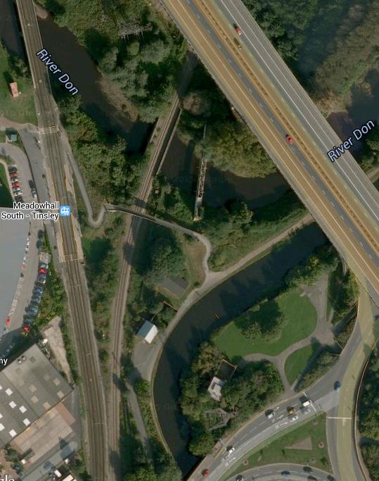
Medowhall South
This would be a much easier connection and I think this is the way the tram-trains will go to and from Rotherham.
The Sheffield-Rotherham tram-train has been a long time coming since the decision to start. I wonder if the reason is that the engineering of both track and signalling has been much more difficult than first thought. The first direct route is difficult if not impossible operationally, but sorting out the tracks for the second route may not be too easy, as looking at the image there is a lot of water about, that might need to be bridged, by the tight turn.
I think too, that as it’s only a trial, we might see a single track curve, as the tram-trains will be reversing at Meadowhall Interchange. That would at least cut costs and men less disruption to the Supertram, whilst the connection is being made.
One issue that has to be thrown into the pudding, is the electrification for the trams, which is 750 volts DC overhead. If at some future date the planned electrification of the Midland Main Line and trans-Pennine routes at Sheffield is extended to Meadowhall and Doncaster, then the new station at Rotherham Central would possibly be electrified at 25kV AC.
So it could be that extending the tram-train pilot scheme between Sheffield and Rotherham into the future, might be scuppered by electrification plans for the North.
It does strike me that the £60million or so being spent on the tram-train pilot, might be better spent on providing extra trams for the Sheffield Supertram and trains for more services through Rotherham.
Could it be that just as the great and good in the Department for Transport, forced Cambridge to have a guided busway, they are persuading Sheffield and Rotherham to have a tram-train?
Birmingham Gets A Big Snow Job
It is said by many in the regions of the UK, that London gets and eats all the pies.
At present there are four main rail projects on the go in London; Thameslink, Crossrail, the Northern Line Extension and the London Overground.
Thameslink is a government funded project, whereas Crossrail and the NLE are paid for wholly or in part by property developers and business.
The smaller Overgroundisation of London surface railways is more a methodology that is starting to be copied and expanded in places like Merseyside, the Cardiff Valleys and the West Midlands. Although you could argue that other railways in the UK have had the same idea of frequent clean and sometimes new trains, smart stations and good staffing levels, working for some time. Some of the stations on the Overground, have been or will be expanded, in conjunction with property development.
But other projects where co-operation between Network Rail, rail companies.local government and property developers are starting to be proposed and implemented, Often these projects are led by a major redevelopment of a station.
1. Leeds Station
Leeds station was rebuilt and extended a few years ago, but little use was made of the space above the station.
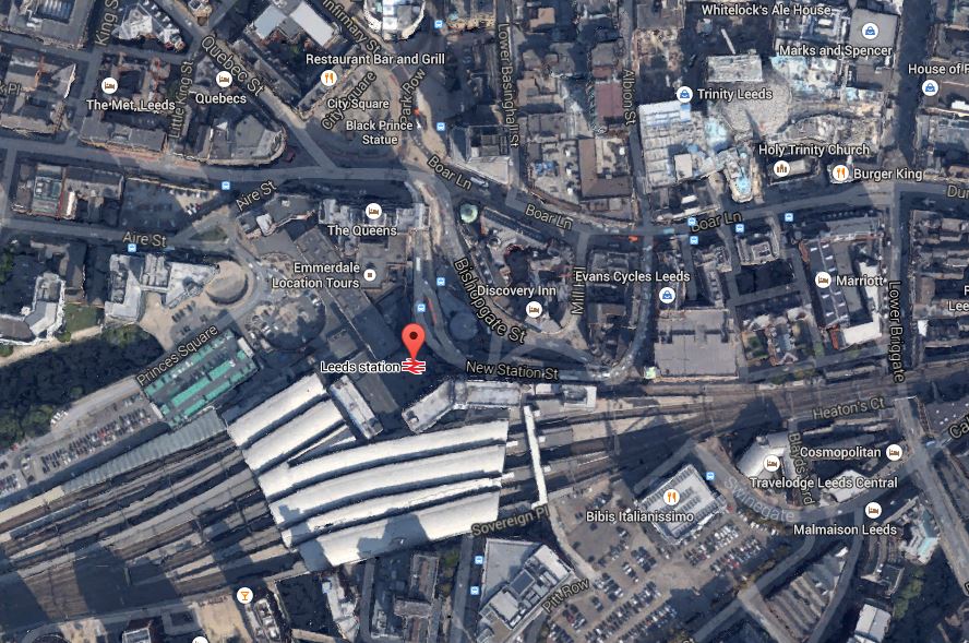
Leeds Station And City Centre
This Google Earth map shows the central location of the station and also its closeness to the main Trinity Shopping Centre at the top right of the map. Walking routes between the two are not good and the station should have been improved with development on the northern side to link it to the city centre. According to Wikipedia. future plans are in place to add much needed extra platforms and develop the south side of the station.
I believe, that you should walk out of a station into an open space, from where you can get your bearings of the city. This has been done well at London Kings Cross, Liverpool Lime Street, Huddersfield and Cardiff Central and some station rebuilding and expanding, is embracing such a concept.
I hope that Leeds develop the concept to a new level, when they create a new southern entrance. Perhaps on a personal level, they could create an easy way to get a bus to Elland Road.
2. Reading Station
Reading station has also been rebuilt and is surrounded by development, as this Google Earth map shows.
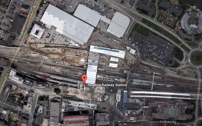
Around Reading Station
In the future it will be getting Crossrail,the new western link to Heathrow and probably more offices around the station. Network Rail, who now manage the station, have already created entrances on both sides of the station and I hope that development in the next few years, will make what is a spectacular station, a true gateway to the City.
3. Birmingham New Street
Birmingham New Street station is approaching the end of its rebuilding, which is now Gateway Plus. It includes a lot of retail including a new John Lewis. The station will also be connected to the Midland Metro. This Google Earth map shows the station and it’s surroundings.
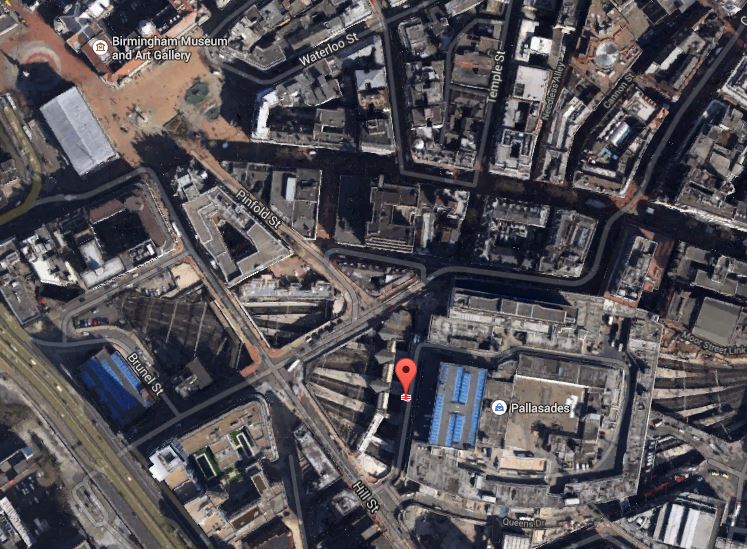
Birmingham New Street
It shows the problem that the station suffers, when compared to many. It is in a deep dark hole surrounded by busy roads, with the buses some way away. I don’t think you would design a station like that these days, as they did in the 1960s.
The station has a problem, as does Leeds, that there is not enough lines and platforms, but whereas at Leeds space is available, it would appear that at Birmingham New Street, it will be difficult to find.
The design of the station means that natural light on the platforms is difficult to provide. Hopefully, though by providing that light on the concourse and lots of lifts and escalators to get to the trains, the architects may have improved things. At present, it’s a bit like a bad Underground station experience arriving and departing at the station. One of the reasons, I generally travel between London and Birmingham by Chiltern Railways, is that Moor Street is a light and airy station, that has been tastefully updated for the modern age.
One of the biggest problems at New Street, is getting onward connections around the City Centre. On my visits to Birmingham, I often walk to Brindley Place to have a drink or lunch with friends. It’s not a difficult walk, but in a few years time, I’ll be able to do this sort of journey on the Midland Metro from the stop in Stephenson Street. When HS2 opens, this tram will be used as the connection between all four Birmingham city centre stations.
4. Manchester Victoria Station
The updating of Manchester Victoria station is the centrepiece of two big projects in Manchester; the Northern Hub and the extensions to the Manchester Metrolink like the Second City Crossing. This Google Earth map shows The station and the surrounding area.

Manchester Victoria
This image is quite old and doesn’t show the new roof, but it does show the roof of Manchester Arena next door, how the tram lines call at the station, the nearby green space and the river. All the station needs now is completing, the Metrolink extensions and new electric train services to Liverpool, Preston, Blackpool, Bolton, Leeds, Huddersfield, Sheffield, Newcastle and Hull.
I would also personally, like to see an hourly service to the South and Euston, so that I can avoid, the mostly dreadful Piccadilly. This will be possible once the Ordsall Chord is opened, although some might say that it is a real pity, the Picc-Vic tunnel was never built. Perhaps Virgin will get permission to run a service to Huddersfield via both main Manchester stations.
5. Newcastle Station
Newcastle station is a station that I don’t remember as anything special from my last visit some yeas ago, although it is a Grade I Listed Building. But since then, several millions have been spent according to Wikipedia, mainly on internal and retail facilities and on opening up the area round the station. So perhaps I should pay the city a visit. This Google Earth image shows the unique position of the station.
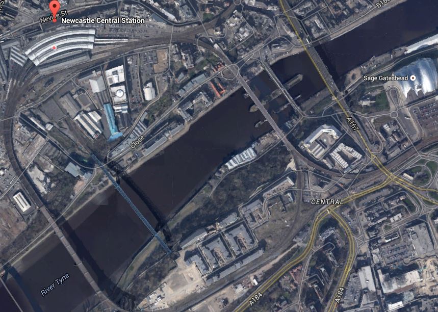
Newcastle Station
It is high above the Tyne on the edge of the city centre and uniquely the station is on a curve. It must be a very difficult to add extra tracks and platforms, which seem to be needed, as both through and local services are going to increase significantly.
I have only given five major examples, but they show how stations are becoming the focus of development.
One of my manual searches on the Internet picked up this article on Modern Railways entitled Snow Hill ‘transformation’ plan. This is the first paragraph.
Birmingham City Council has released its Snow Hill Masterplan, which outlines plans to grow the business district surrounding the station and includes proposals for the ‘transformation’ of the station into a transport hub.
Snow Hill is Birmingham’s station that is ignored by visitors from around the country, although it is important for commuters and others brought into the city on the Snow Hill Lines.
The Snow Hill Masterplan is here on the Birmingham Post website. Some of those who have commented don’t like it and they could be right. But the principles behind the plan of creating high quality offices, retail and apartments over a well-connected station is one that has been proven to work at Canary Wharf. After all it does actually make double use of the same piece of land. This is a Google Earth image of the Birmingham Snow station and its location.

Birmingham Snow Hill
You don’t see much of the actual station, as it is covered by a multi-story car park. As someone who can’t drive and manages well without a car, I can’t see why cities don’t do what London, Cambridge and Oxford have done and discourage people from driving in by providing top quality public transport.
The Snow Hill Masterplan would need an updated Midland Metro and also extra trains and routes through Snow Hill station.
I think that if I could get trains direct from Marylebone to Snow Hill, then that would be my preferred way of going. Snow Hill is in a much friendlier and welcoming part of the City than New Street.
I think on balance it is a good plan.
George Osborne Sets Out His Vision Of Yorkshire
This article in the Huddersfield Examiner is entitled Chancellor George Osborne to set out long term economic plan for Yorkshire during visit to West Yorkshire.
Read it and there are some interesting snippets, that he believes will be part of a long term plan for Yorkshire.
One of them is this.
We will also increase speeds on the East Coast Mainline to 140 mph
It is already planned and if and when it happens it will significantly reduce journey times all the way up the line between London and Edinburgh.
George is not actually promising anything for which funds have not been allocated, but his words show he understands the value of infrastructure, something that can’t be said for all Chancellors of the Exchequer since the Second World War.
The one thing that George or any future Chancellor can ensure, is that by not cutting funds they will get this valuable project carried out!
Network Rail Plans Another Tunnel Into Heathrow
We may not build the tunnel boring machines any more, but we certainly know how to dig holes better than most, as Crossrail is showing.
We also seem blessed with a geology that in many places, has the consistency of Emmental cheese.
So it is not a surprise that a news item in Modern Railways has reported that Network Rail are planning on creating the access into Heathrow from the West using a 5 km tunnel from between Iver and Langley to the airport.
This Google Earth map shows the area.

Langley To Heathrow
The blue line is the Piccadilly Line at the airport and the red arrow indicates Langley station. Iver station is towards London just before the M25. I would assume that the new tunnel will vaguely follow the M25 and link up to the airport at Terminal 5. It would probably be dug from Langley with a lot of the route directly under the motorway, so the work would not affect any sensitive sites.
I doubt it’s a plan, that will stir up much opposition, except in the area, where it leaves the Great Western Main Line. This Google Earth image shows the area in detail.

Langley And Iver
A quick look at this image, would appear to show that it’s mainly farmland with no housing, for quite a bit of the way between Langley and Iver stations.
Another plus point of this plan, is that the Class 345 trains being developed for Crossrail could probably be used on the new line to connect it to Reading and/or Oxford, if the Heathrow station was built to Crossrail dimensions and standards.
It is in some ways a pity, that Crossrail wasn’t designed to go to Terminal 5 at the airport and then on to Reading in the first place. But then some of the design of the western end of Crossrail had more to do with making sure that British Airways and Heathrow Airport didn’t get upset. It doesn’t matter if they do, as they are secondary to all the passengers and staff who use the airport. After all if the passengers aren’t happy with Heathrow, after Crossrail/Thameslink opens, they can easily get to Gatwick and Luton.
I think that this is a very sound plan and if it could be routed to serve all terminals at Heathrow by perhaps going back-to-back with the current Crossrail line being built to the airport, we’d get a much better service to London’s main airport.
So if we end up with effectively a new Crossrail loop line, that leaves the Great Western at Airport Junction, goes round all the Heathrow terminals and then after Terminal 5 connects to the Great Western between Langley and Iver, what are the consequences.
1. The plan rectifies the big fault of Crossrail not serving Terminal 5.
2. It gives passengers what they want. Going to any terminal at Heathrow from either the West or London, you just get on a Crossrail train that is using the Heathrow loop line and get off at Terminal 1/2/3, Terminal 4 or Terminal 5. Some journeys to Heathrow now sometimes need a change of train at the airport.
3. Crossrail will be used to transfer between terminals.
4. A plan like this, is the last nail in the coffin of Heathrow Express, which will probably be on permanent life support after Crossrail opens anyway. Another nail will be driven, when Old Oak Common station opens as a major transport interchange.
5. When Heathrow Express is dropped, Network Rail will be pleased, as it will free up two platforms at Paddington, for long distance services to Wales and the West Country.
6. There will also be new platform space at Heathrow Terminal 4 and 5, as if all Crossrail trains to Heathrow are going straight through, there will be no need for terminal platforms under the airport. These platforms could be used for the new Crossrail loop line.
7. All rail traffic to and from the Airport will be controlled by Transport for London. This can only be a good thing for reasons that are too numerous to list.
8. British Airways will be livid at the loss of Heathrow Express and the handing of all rail transport to TfL. So be it! There are lots of other airlines!
9. Heathrow Airport may or may not be expanded. But surely a rail line passing under most of the airport would be much easier to fit into new terminals.
10. If you are going to Heathrow 123 today from Tottenham Court Road station, it takes 55 minutes by tube all the way. The Crossrail journey should take 30 minutes and it will be fully accessible. I doubt that Transport for London would close the Piccadilly Line to Heathrow, but I can see it becoming a very quiet way of getting to and from Heathrow.
So I think it is true to say that creating a direct tunnelled link into Heathrow from the West should please everybody, except those who feel that the dinosaur that is Heathrow Express should be preserved.
Sunderland Port Gets A Rail Connection
I’m all for freight traffic to be on the railways, even if it sometimes means that noisy and smelly freight trains pass through residential areas. But on the plus side, I’ve seen how rail improvements connecting the Port of Ferlixstowe to the wider rail network, has taken so much traffic off the busy A14. It is my belief, that one of the best ways to increase motorway capacity, is to remove as much long distance freight as possible.
DB Schenker obviously want to promote rail freight for commercial reasons and they seem to be backing a lot of new rail developments like the Northern Hub.
So I was not surprised to see the company very much behind the re-opening of a rail link into the Port of Sunderland, as reported in this piece in Modern Railways. DB Schenker’s spokesman says this.
‘Ports play a crucial part in DB Schenker Rail’s growth strategy and we are delighted to bring rail back to Port of Sunderland.
It will be interesting to see how busy this rail link becomes in the next few years.
Increasingly, these last mile rail links are being created or renewed. The only losers are probably the drivers of heavy good vehicles.
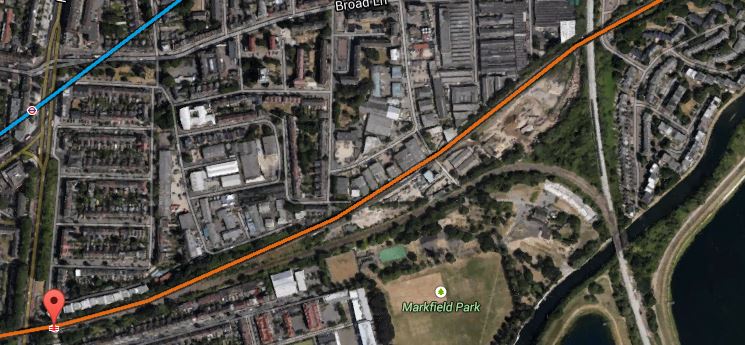
This small rail link has been renewed in an area that could see a lot of development in the next few years. This Google Earth map shows the rough route of the rail link along the coast.
The Durham Coast South Of Sunderland
Sunderland Port is marked by the two curved breakwaters at the top and the link joins the Durham Coast Line that runs from Newcastle via Sunderland and Hartlepool to Middlesbrough, at Ryhope Grange junction, which is near to the marked McDonalds.
The Durham Coast Line has an hourly service between Newcastle and Middlesbrough and also connects various ports and sites to the rail freight network. It is also used by Grand Central services between Sunderland and London and as a diversionary route for the East Coast Main Line. Local groups are also keen that the line be upgraded with a better passenger service between the Tyne, Wear and Tees areas.
In a sane world, this line would be a prime candidate for electrification linked to the East Coast Main Line at Newcastle and Darlington. A few points.
1. It would be an important electrified diversion for the increasingly crowded East Coast Main Line.
2. I suspect Grand Central and other East Coast Main Line operators are pushing for this electrification, as it would enable direct high speed services between Newcastle and London via Sunderland, Hartlepool and Middlesbrough.
3. After the completed electrification of the Trans-Pennine routes, it would also improve services from towns and cities not on the East Coast Main Line to the western side of the Pennines.
However full electrification is probably not possible as the northern part of the line has been electrified for the Newcastle Metro to a different standard. But the new passenger trains like the Class 800 and new freight locomotives like the Class 88, would just switch to their on-board diesel power,
As an aside here, Tees Valley Metro, is being developed around Middlesbrough, in rather a stop-go fashion. Surely if the Durham Coast Line is electrified and that electrification is extended to Darlington and then perhaps on the Tees Valley Line to Bishops Auckland to serve both the National Railway Museum at Shildon and the Hitachi train factory at Newton Aycliffe. It would seem a bit mad to build a large factory to make electric trains and then have to haul them in-and-out with a diesel locomotive.
If nothing else, all of these options prove to me, that the North East should have a similar sort of autonomy as Greater Manchester is getting. That would enable the area to bring together all of the ideas about extending the transport system.
Looking at Wikipedia’s list of proposed rail infrastructure projects, these are in the North East.
Newcastle Station Redevelopment
Tyne And Wear Metro Developments
It’s not a long list. Other areas south of Hadrian’s Wall, like Bristol, Birmingham, Cardiff, Leeds, London, Merseyside and Manchester have much better developed plans on the drawing board, even if they know some will be a long time coming.
I wonder if Department of Transport officials when talking to representatives from the North East, say to them, you’ve got an electrified railway to London, the Tyne and Wear Metro, rebuilding of Newcastle station and a brand new train factory, so what more do you want?
Surely, local elected representatives should decide what is best value to the communities they serve. No-one based outside an area, can ever know all of the subtle local reasons, why things should or should not be done. As an example, Greater Anglia’s stations in East London are managed from Norwich. I don’t think they manage them very well and not for good reason are most being put under the care of Transport for London.
Most transport in the North East should be under the control of a single body, so that the limited finances available will be better allocated.
Could This Be From Where Crossrail 2 Is Dug?
As I trundled along the Gospel Oak to Barking Line (GPBlin) between Blackhorse Road and South Tottenham stations, I took these pictures.


As the reservoirs to the east of all this dereliction are going to be turned into the new Walthamstow Wetlands, could this be used as the site from where Crossrail 2 is dug?
This image from Google Earth shows the area.
East Of SouthTottenham Station
The orange line is the GOBlin and the light blue is the Victoria line. The red arrow indicates South Tottenham station.
The area I photographed lies south of the GOBlin. Note how it is bordered by railways, with the West Anglia Main Line in the east and the double-track curve that connects the two lines in the south. Slightly to the south of where the two lines join at South Tottenham Junction, the River Lee runs close to the site in a south-westerly direction.
So the spoil from the tunnelling could either be used to help create the new wetlands or barged down London’s other navigable river to the Thames. When I worked for Enfield Rolling Mills at Brimsdown in the early 1960s. their supplies of copper wirebars were delivered by barge from London Docks using this route. In those days, the river wasn’t as clean as it is now, and there was quite a lot of commercial traffic.
Britain From Above has some wonderful pictures of the area from the 1930s here. This image shows the River Lee as it goes under the railway.

This modern picture from Google Earth gives a good comparison.
Note how the tracks on the West Anglia Main Line have been reduced from four to two by the closure of the easterly pair of tracks. Proposals for the line include four-tracking from just south of here to Broxbourne.
The large East Warwick Reservoir is just off the picture to the right and the timber yard is now housing.
The GOBlin is shown in orange on the second image and you can just pick it out on the 1933 aerial photo.
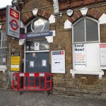
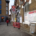
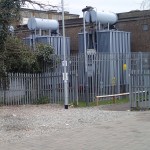
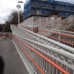
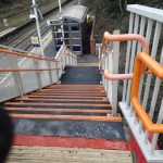
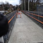
Orange Army Sighted At Lea Bridge Station
I was on the top deck of a 56 bus today and took these pictures at Lea Bridge station.

Could this mean that work is about to start on the rebuilding of the station?
Walking Between Walthamstow Central And Queens Road Stations
Walthamstow Central and Walthamstow Queens Road stations are not far apart and are considered to be an out-of-station interchange. This means that if you touch out in one station and then walk to the other to continue your journey, you only get charged for one journey.
It used to be tortuous to walk between the two stations, but in recent months a link called Ray Dudley Way has opened.

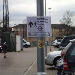
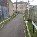
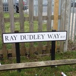

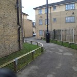
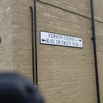


It does make the walk easier, but it is still not properly signed.
Note too, that it would appear that the eastern entrance to Walthamstow Central has been closed.
It’s Not Just British Trains And Buses That Are Run By Foreign Companies
Some people, especially politicians, who’ve never run anything more difficult than an office with perhaps one employee, despair that a lot of our trains and buses are run by foreign companies. They think they should all be nationalised.
But then there’s this article from the Guardian entitled National Express To Run Nuremberg’s Overground Urban Trains.
This is the second such contract, National Express has obtained and the article talks about further contracts.
As an aside here, German trains have a lot of characteristics that we have long banished from our trains and buses, like bad customer service, as I experienced at Osnabruck.
Hopefully National Express will impose some of the excellent principles they use on c2c between London and South Essex.
Ashford To Get A Signalling Update
This story from Global Rail News about the updating of the signalling at Ashford to allow Eurostar’s new e320 trains to stop at the station, is about a project that is one of whole host of small projects that probably should be done to keep our railways up to scratch.
Big projects like Thameslink, Crossrail and the Northern Hub, may seem to get all the headlines and money, but often smaller projects are very important to the smooth running of trains and trhe maintenance of existing services.
