An Opportunity For Dalston?
Look at this map of the rail and Underground lines in East London going north around Dalston Junction.
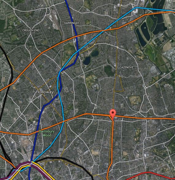
Map 1. Rail Lines Around Dalston
The light blue,dark blue, black and orange lines are the Victoria, Northern and Piccadilly lines and Overground respectively. Stations to note are.
1. Dalston Junction which is marked by the red arrow.
2. Tottenham Hale at the top right and is shown in more detail on this larger scale map.
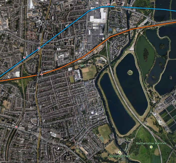
Map 2. Tottenham, Seven Sisters Area
3. Seven Sisters is the next station as you come south-westerly from Tottenham Hale and is marked by both tube and national rail symbols on the second map.
4. Below and slightly to the right of Seven Sisters is South Tottenham on the Gospel Oak to Barking Line.
5. On the original map, Angel is towards the left at bottom, approximately south west from Dalston Junction. This is a larger scale map of the area.
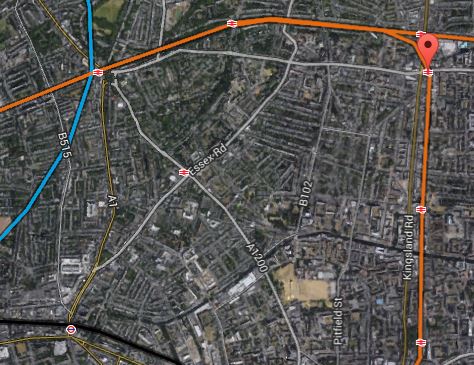
Map 3. Angel To Dalston Junction
In this map, Angel is close to the bottom left. Note how you can see Highbury and Islington, Essex Road and Canonbury stations north of the Angel and Haggerston and Hoxton stations south from Dalston Junction on the East London Line.
Roads, like Essex Road, Balls Pond Road and New North Road are visible, as is the Regent’s Canal.
From the limited information that has been published about Crossrail 2, I believe that the New Southgate branch will pass under Seven Sisters and very close to South Tottenham before meeting the other branch from Tottenham Hale somewhere near Walthamstow Marshes shown on Map 2 and in detail below.
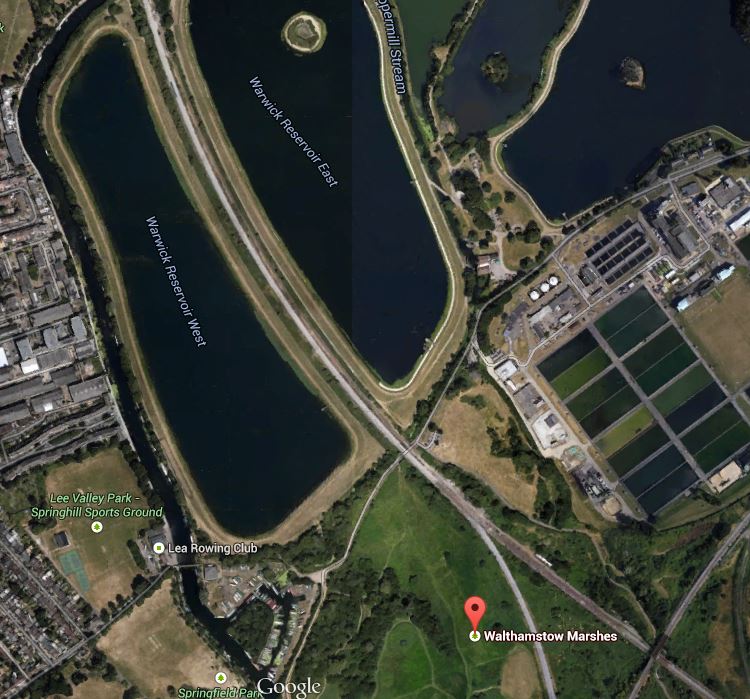
Walthamstow Marshes
The map shows how Walthamstow Marshes could also make an ideal site from where to build the tunnels.
1. It is a spacious site with good road access, where the running tunnels to New Southgate, Tottenham Hale and Central London may all meet.So if a big deep shaft could be dug here, as Crossrail 1 did on the Limmo Peninsular, it could be used to launch and retrieve the tunnel boring machines (TBM). Looking at how far the TBMs went from Limmo to Farringdon on Crossrail 1, which is a distance of 8.3 km, I suspect that their successors on Crossrail 2 could go a long way under London and given the right ground conditions, perhaps even all the way to Wimbledon.
2. The site is close to the West Anglia Main Line and surely this could be used to bring in heavy equipment and materials.
3. Around the west of the Marshes, the map shows the River Lea, which could be another transport artery into the site.
4. As there are several reservoirs there is plenty of raw material for the drink that builds the railways; tea.
5. The one problem is that the Marshes are a Site of Special Scientific Interest. But having seen how Crossrail 1 handled the potentially tricky situation at Stepney City Farm, I suspect that if they follow similar rules, then an amicable solution can be found.
From the junction near Walthamstow Marshes, Crossrail 2 has said that the line will go to the next two stations; Dalston Junction and the Angel.
This would mean that the line would run roughly north east to south west from the junction of the two branches of the line to the Angel. Whether it is aligned under a road, a railway or even the Regent’s Canal, would obviously be a matter for the engineers.
On this map, I have drawn the possible route in pink.

Map 4. Possible Crossrail 2 Route At Dalston
Not shown on Map 4 is the line of the Channel Tunnel Rail Link, which runs in a tunnel underneath the North London Line.
I believe that it might be possible to dig the tunnel so that it passes underneath both Dalston stations, despite the presence of the Channel Tunnel Rail Link. In this respect, I have great faith in the ability of London’s finest hole diggers to navigate correctly and not connect New Southgate and Tottenham Hale to France.
One of my Google Alerts today, picked up this article from the Hackney Gazette, entitled Crossrail 2 threatens another Georgian terrace in Dalston.
As someone who lives close to Dalston Junction and whose roots are very much in the area, I want what is best for the local area. I also have my own list of buildings that should be saved.
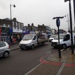
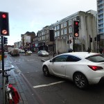
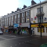
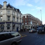
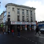
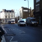
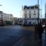
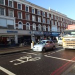
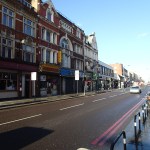
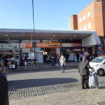
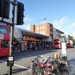
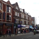
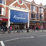
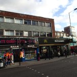
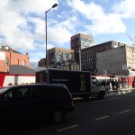
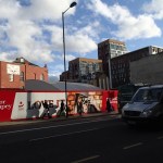
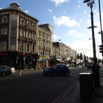
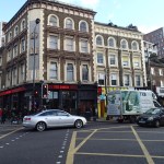
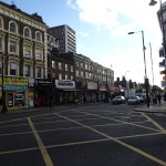
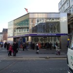
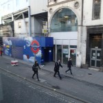
So I went down to Dalston Junction and took pictures of the area between and around the two stations, starting just south of Dalston Junction and then walking north, picking up some shopping in Sainsburys and having a coffee in fed on the way.
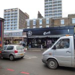

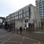
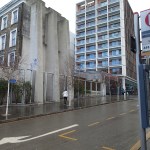

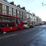
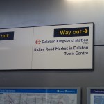
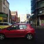

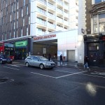
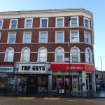
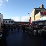
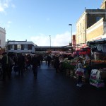

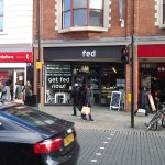

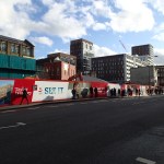
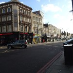
Quite frankly, I think that for most of the buildings, only some of the frontages and some interiors like that of the former eel and pie shop, are worth saving.
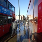
But as my pictures show the two main problems in the area are the movement of large volumes of both vehicular traffic and pedestrians.
As I don’t drive, I have no personal interest in the former, if the buses still get through.
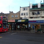
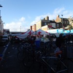
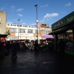
But I regularly walk up and down the Kingsland Road to Sainsburys, Boots and the Market. The pavements are a nightmare, as they are narrow and very busy.
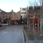
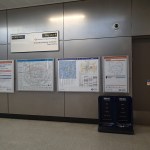
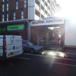
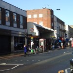
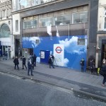
The new Dalston Junction part of the solution to the walking problem has been built, with a draughty but rain-free passage between the two station entrances.
So wouldn’t it be nice, if this passage could extend up to at least Dalston Kingsland station? If it did it might be a traffic generator for the underused bus station, which could do with more routes. A passage would of course make the interchange between the two stations easier.
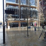
At least the Kingsland Shopping Centre is proposed to be redeveloped to a more modern layout. Pictures in the link, give hope that there could be a traffic-free route from at least Kingsland station to Dalston Lane, which somehow has to be crossed. The current arrangements of a light-controlled crossing works, but could be improved upon.
The walking link between the two stations will hopefully be improved when the new Dalston Kingsland station is rebuilt, as someone from London Overground indicated to me it will be, a few months ago.
Could something bigger be rolling through Dalston?
Something is and it’s called Crossrail 2.
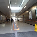
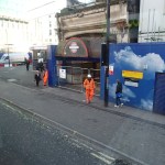
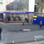
In one of the pictures it shows a sign at Dalston Junction station, showing that it is 250 metres between the two stations.
I will make an assumption here, that Crossrail 2 will use the same Class 345 trains and platforms matched to their size as Crossrail 1. I think it would be a reasonable assumption to make, as this would mean a common fleet and a lot of repeated platform design.
And how long are the platforms on Crossrail 1?
They are 260 metres long.
So would it be possible to fit a double-ended station for Dalston, that avoided the Channel Tunnel Rail Link and was connected to the platforms at the two Dalston stations at each end?
I don’t know as I haven’t got the detailed dimensions, but the last time London Overground threaded a rail line under Kingsland High Street, they managed it without mishap. If the station followed the traditional hump-backed design, then it would rise up to the platforms, which would be deep under the area and could be connected to the two stations by escalators and lifts. If the Crossrail 2 station had a wide centre platform between the tracks, then it could also be used by passengers transferring between the two stations. The platforms would have platform edge doors, so there would be no safety or draught issues. It might even be possible to make the central Crossrail 2 platform wide enough for a cafe, kiosks and an information office.
The design would have advantages for passengers.
1. It would give full interchange between the North London Line, East London Line and Crossrail 2, which would make so many more journeys possible, like for example Turnpike Lane to Homerton or Shoreditch High Street to Ware, with just a single step-free change.
2. Dalston Junction is the first station on Crossrail 2, after the two northern branches have joined, so just as at Whitechapel on Crossrail, you could come down one branch walk across the platform, perhaps picking up a coffee on the way, and get on a train up the other branch.
3. In the case of an interchange between either the North or East London lines and Crossrail 2 it would be up or down on an escalator or in a lift, but between the East and North London Lines, you would have a nearly 250 metre walk as well. But the walk would be easier and more pleasant than the current one on the surface.
4. Would the ability to transfer at Dalston between the North London Line and Crossrail 2 serve Hackney sufficiently well, so that the need for the possible Hackney branch of Crossrail 2 could be delayed?
There could possibly be some advantages to Dalston
1. As the interchange between the East and North London Lines is now a safe walk out of the weather and traffic, would this be a good enough connection to make it unnecessary to reopen the Dalston Eastern Curve, thus releasing this land for something better in perpetuity.
2. But the great advantage of this plan to Dalston, is that it doesn’t require any demolition of buildings on the surface, except for the unloved Dalston Kingsland station.
3. Dalston Junction station already has a building that is big enough, but could you do away completely with buildings at Dalston Kingsland station? You might just have escalators ending level with the street and a simple glass front like the new Tottenham Court Road tube station. The money saved on the building could be used to add extra escalators and lifts. Perhaps on both sides of Kingsland High Street.
I probably have all this totally wrong, but I believe that Crossrail 2 could be a bigger opportunity for Dalston, if a double-ended station is built to serve both Junction and Kingsland.
It is only possible because the Victorians had the foresight to build the two Dalston stations the same distance apart as the length of a Crossrail station.
FA Cup Match Two – Ipswich 0 – Southampton 1
Every year these days, Ipswich never seem to get past the Third Round.
And this year was no exception!
I agree with Mick McCarthy’s comments.
I’m always disappointed when I lose but I thought the game was a damp squib. We were OK until they scored and then they killed the game.
At least because there was no extra time, I did get home easily, if very slowly.
Transport for London Get The Cleaners, Painters And Engineers Ready For The Shenfield Metro
There is an article in the Brentwood Gazette, entitled Shenfield to London slow trains to get refresh before end of year, which illustrates how Transport for London aim to hit the ground running, when they take over the Shenfield Metro services in May this year.
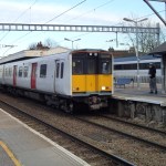
1. The Class 315 trains will be refreshed. I took these pictures.

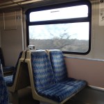


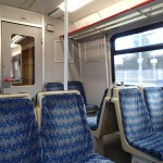
I think that TfL could spend billions on these trains and they wouldn’t be that much better, as in their current state, they do the job they were built for of moving people in and out of London, reliably and with enough comfort for those with seats. So fixing the seat covers, perhaps getting rid of the awful pink colour and asking Aggie and her ilk to give them a good clean, and they’ll last until the Class 345 trains arrive.
2. Staff will be on duty when trains are running.
3. The stations will be fully integrated into TfL’s information and brought up to their standards.
I wonder if their other big acquisition in May;the Lea Valley Line services will get the same treatment.
The Shape Of Things To Come
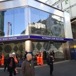
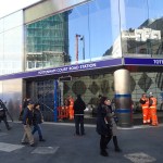
I visited the newly-reopened Tottenham Court Road station and took these pictures.


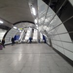

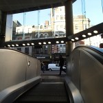


The pictures were taken in sequence. I arrived on a Northern Line train from Embankment, took the steps and long escalators to the enormous ticket hall, where I got sanother escalator to the station entrance, where you are delivered at pavement level. I then left on a 10 bus, from where I took the last pictures.
Obviously, there is still work to do, but you have to remember that this is perhaps a third of the station that will have been created by when Crossrail opens. The Central Line will be connected again, an entrance will be positioned by Centre Point and a new large entrance to the west in Dean Street is being built.
This Google Earth image shows the area around Soho Square.
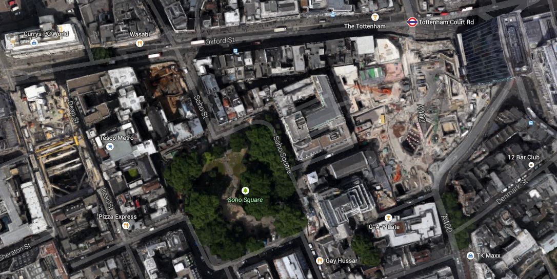
The Soho Square Area
Tottenham Court Road station and the iconic Centre Point at the top right corner and Dean Street to the left or west.
Note the distance between the two entrances, which emphasises how long the platforms are to accommodate two hundred metre long trains, that call at two hundred and sixty metre long platforms. Crossrail describes their new station with these points.
- 24 trains per hour service at peak times in each direction
- 260m – length of platform tunnels
- 25m – platform depth
- 102,000 passengers are estimated to use Crossrail station each day
- 40 utilities diverted in and around Charing Cross Road and Oxford Street
- 500,000 square feet of premium retail, office and residential accommodation created at eastern end of Oxford Street and Tottenham Court Road
- £1bn – total investment to build Crossrail station and upgrade capacity of existing Tube station
It is a massive project in its own right and will totally reform the area.
This new tube station is just the first manifestation. The first benefit other than better exit and exit to the Underground, will probably be lots of walking short cuts on the area, when it is busy or raining hard.
The Overground And Its Class 378 Trains Turn Up In A Computer Game
My Google Alert picked up this article onPCGames, entitled Train Simulator 2015: hands on with the London Overground train.
It’a well-written article and worth reading.
But I won’t be investing in the game, as I’ve never played a computer game and probably never will.
I certainly wouldn’t play this game, as it seems to be South London-based and doesn’t simulate the iconic East London Line, with the historic Thames Tunnel.
If I want to experience a Class 378 train and the East London Line, all I need to do is walk to Dalston Junction station and take any southbound train.
And with my Freedom Pass, it’s all free! Although the excellent cafes in Dalston aren’t!
My Second Paris Transport Day Ticket
This is the second ticket that I used to get a day’s travel in Paris.
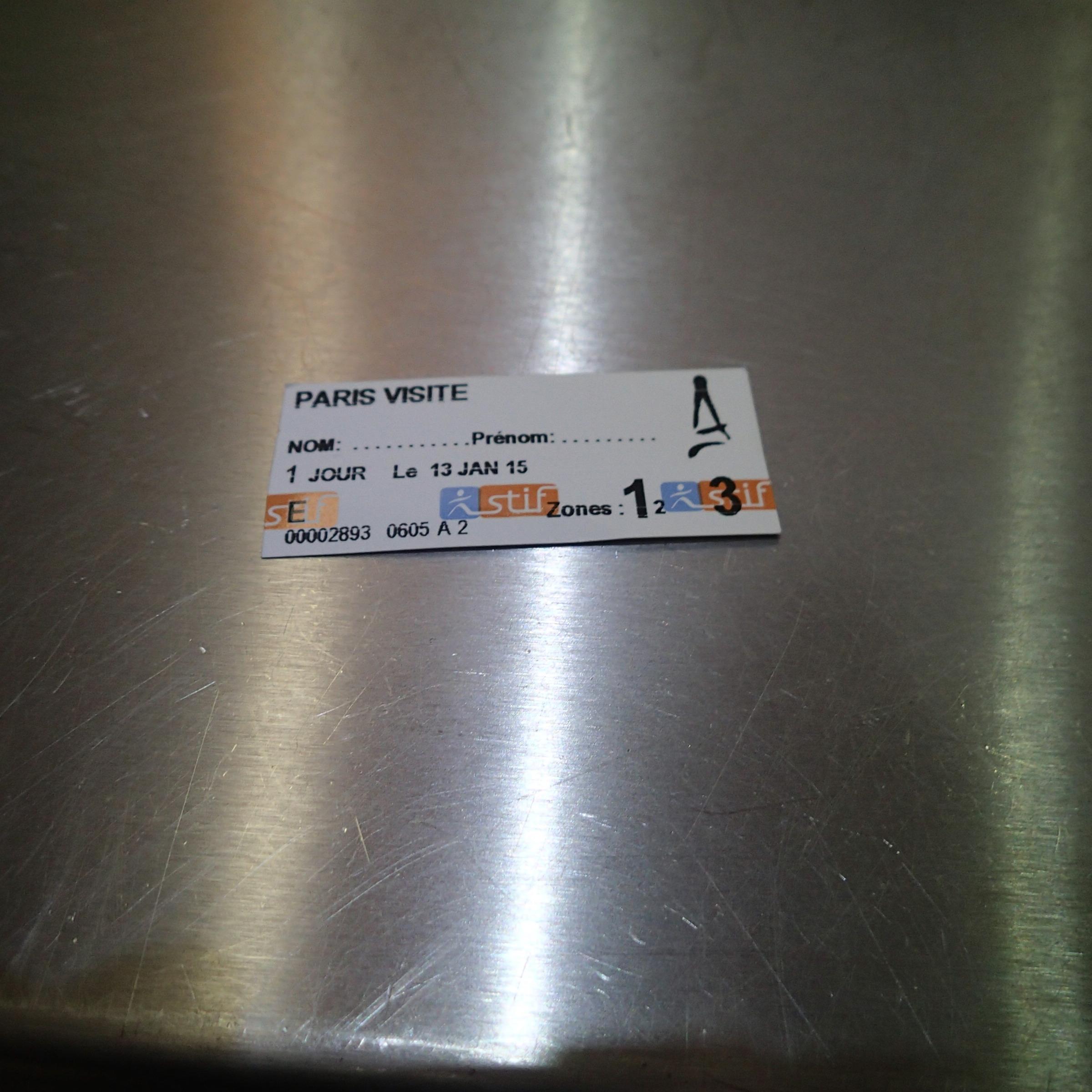
My Second Paris Transport Day Ticket
The first one fell apart when it rained, so I had to exchange it for another.
Paris has a system called Navigo, which is very much the same as London’s Oyster. But Paris doesn’t seem to offer contactless payment with a bank debit or credit card and I can’t find any plans for them to do so.
Surely, every public transport system in the world should be moving towards contactless bank card ticketing.
Paper ticketing for transport is so nineteenth century.
I know I like the UK’s orange credit-sized rail tickets, but then they fit everybody’s wallet and are understandable by everyone and the newest ones are computer readable, by your standard scanner.
I suspect that Londoners planning a weekend away, will look at the ticketing in their possible destinations and might choose one where contactless bank cards can be use as tickets.
If I was a world dictator, one of the things I’d do is make all buses, trams and trains accept contactless bank cards as tickets. It must surely create lots of jobs in tourism, as people would travel more, if they knew that when they ended up in say Tokyo, Helsinki or Belgrade, all they needed was work out the map of the trains and not bother with the ticketing.
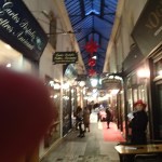
Searching For Food In Paris
I know quite a few good places to eat in Paris, but partly because it was Tuesday and my favourite creperie was closed for January, I ended up not finding anywhere to eat.
Searching the Internet I found this bakery and restaurant called NoGlu. But you’ve guessed it! It was closed, but I was able to take pictures.


Next time I go, I’ll give it a try. It’s certainly got good rcviews on Trip Advisor.
In the end I had a very nice steak and chips at a cafe near the Gare du Nord, called Paris Nord Cafe. They weren’t specifically gluten-free, but they knew how to make sure my meal was safe.
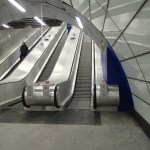
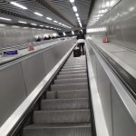
A Design Crime – How Not To Design Platform Edge Doors
I took these pictures on Metro Line 1, which has some stations with platform edge doors.

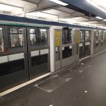
Unlike all others I’ve seen, they are only half height and the thick pillars partially obscure the view of the station from inside the train. As there is no station display inside the train, which can be seen from most seats, these doors meant that I missed my stop.
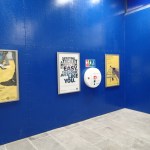
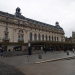
A Gallery I Wish I’d Missed
I regretted going to the Musee D’Orsay, as I was tired after my walk and it wasn’t a gallery that was easy to visit, if you were in your sixties and showing the odd sign of wear and tear.
Compared to the Louvre, it was very second rate, with no working lifts and no escalators, and steps everywhere, which would make it probably a no-go for many.
In some ways if your compare it to the Louvre, the four Tates, the Royal Academy and the Louvre, the layout is very 1980s and the Musee D’Orsay desperately needs an update to bring it up to modern standards.
It also annoyed me that photography is not allowed, so I was unable to take pictures of the building, which was one of my reasons for going.
I also felt that the Sade exhibition was rather pretentious, long winded, cramped into a too small exhibition space and badly presented.
It certainly wasn’t good value at I think eleven euros with no senior discount.
Walking Along The Seine
After Republique, I took the Metro to the Bir Hakeim, with the aim of having a river cruise. I didn’t see a boat running or anybody to ask, but a notice said there had been floods, so I just walked along the Seine to the Musee D’Orsay.

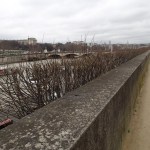

It was a pleasant walk for much of the route, but it was rather devoid of any information on nearby Metro stations, so I probably walked further than I intended.
