The Future Of The Watford DC Line
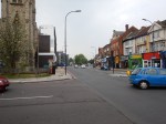
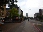
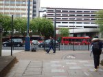
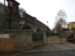
Primrose Hill Station
I was looking at the tracks through Camden on carto.metro.free.fr, as I wanted to see how the former Primrose Hill station fitted into the knitting.

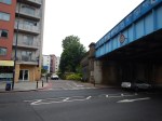
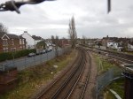
Lines Through Camden
Note the two orange tracks of the Watford DC Line from Euston curving to the West around the carriage sidings.
The line through Primrose Hill station from Camden Road is a connection that allows freight trains to go between the North London Line and the West Coast Main Line.
One of the plans for the area, is to reopen the station. This is said in the station’s Wikipedia entry under Plans.
It has been proposed to re-open Primrose Hill station by bringing the short stretch of line between South Hampstead and Camden Road stations back into the regular passenger service by incorporating it into the London Overground network.
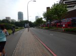
South Hampstead station is just off the map to the West on the Watford DC Line.
No Infrastructure Required To Open Primrose Hill Station
Obviously, the station will have to be rebuilt, but look at this page from the Journey Planner for Sunday, the 2nd of October, when I enquired how you would get between Willesden Junction and Highbury and Islington stations.
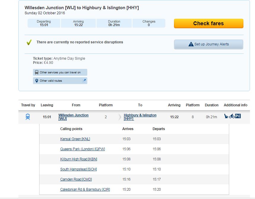
Willesden To Highbury and Islington
As the Class 378 trains can’t fly, the route via South Hampstead station must be open and available to the trains.
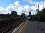
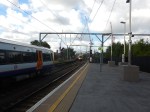
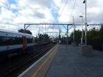
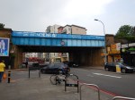
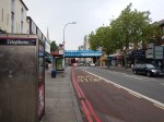
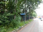
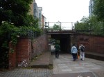
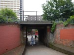
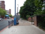
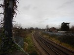
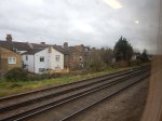
This sequence of pictures shows a train entering Camden Road station after coming through the site of the former Primrose Hill station.

Benefits And Disadvantages Of The Route
The current setup seems to be rather a waste of resources, with two tracks into Euston for the Watford DC Line and the need for platforms with third-rail electrification to handle the short four- and five-car trains.
Euston station is a very busy station and it would probably be glad to lose the Overground services.
So it might be a good idea to divert the three trains per hour (tph) between Watford Junction and Euston, through Primrose Hill and onto perhaps Highbury and Islington or even Stratford stations.
Others might not think so, as all those passengers along the Watford DC Line, would lose their direct connection to Euston.
But in a few years time, the following projects should have been completed or will be in progress.
- Crossrail will have opened.
- Plans for Old Oak Common station will be well advanced.
- El;ectrification of the Gospel Oak to Barking Line (GOBlin) will be complete.
- Rebuilding of Euston station for HS2 will have started.
- Capacity and station improvements at Highbury and Islington station will be known, which should give better access to the Victoria Line and the Great Northern Metro.
- The Metropolitan Line will have reached Watford Junction, by way of the Croxley Rail Link.
- The future of the Bakerloo Line will have been decided.
- West Hampstead Interchange might have been progressed.
These projects will mean that the Watford DC Line could and will have to be reorganised. If only to make sure there was enough capacity for commuters in the Peak and electric freight trains.
In my view the service on the Watford DC Line to London, should be as close to a high-capacity link running perhaps six to eight tph as is possible.
It is not as easy to achieve as many might think.
- London Midland services stop at stations on the Watford DC Line.
- The Bakerloo Line runs 6 tph on the line.
- The train size limit on the Watford DC Line is probably about six cars and might be possible to raise to say eight or ten.
- The train size limit along the North London Line is currently five-cars and all the Class 378 trains are this length.
- Six-car trains on the North London Line is probably an upper limit, although I wouldn’t be surprised to see longer platforms in my lifetime.
- There will be pressure to increase the number of freight trains on the North London Line.
- A Northern terminal for the Bakerloo Line must be provided.
- Third-rail electrification must be provided on all track shared with the Bakerloo Line.
- If possible, the route should avoid Euston, so that the HS2 rebuilding can proceed at a faster pace.
But I suspect an innovative solution will be found to provide a high capacity link between the stations on the Watford DC Line and Central London.
Crossrail
Crossrail will have a massive influence on how passengers use London’s rail network.
Plans have been talked about for extending Crossrail to the West Coast Main Line. Wikipedia says this.
Network Rail’s July 2011 London & South East Route Utilisation Strategy (RUS) recommended diverting West Coast Main Line (WCML) services from stations between London and Milton Keynes Central away from Euston, to Crossrail via Old Oak Common, to free up capacity at Euston for High Speed 2.
The previous Government rejected it as having a bad economic case
But Crossrail with its massive trains carrying fifteen hundred people a time, will strongly influence stations and routes it connects to Central London.
- At Abbey Wood, it is forcing an update to services on the North Kent Line, which could bring 6-10 tph through the Medway Towns.
- At Moorgate, it will bring passengers to an updated Great Northern Metro sending 8-10 tph to North London and South Hertfordshire.
- At Reading, it will bring passengers to updated Thames Valley and West Country services.
- At Shenfield, improvements are in progress to link Crossrail to Essex and East Anglia.
Where Crossrail will lead is an unanswerable question.
North-West from Old Oak Common, there are several stations that could be possible Crossrail termini.
- High Wycombe for Chiltern.
- Milton Keynes with its link to the East West Rail Link
- Tring, which was the original idea
- Watford Junction has been suggested before.
In the end, passenger numbers will decide where the trains go.
This map from carto.metro.free.fr shows the lines at Watford Junction station.
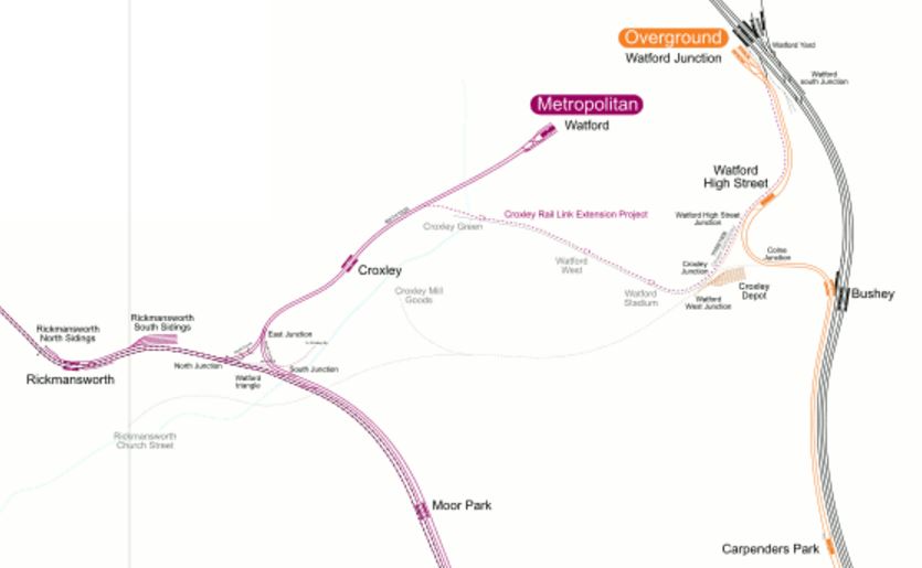
Rail Lines Around Watford
The North-South orange line is the Watford DC Line, which goes starts from Watford Junction station and goes through Watford High Street, Bushey and Carpenters Park stations.
Note the Croxley Rail Link going between Croxley and Watford Junction stations.
This short length of new line would also make possible direct services between Amersham and Watford Junction stations.
I’m not going to speculate on where trains on Crossrail and the Watford DC Line will go, but there are lots of possibilities.
I suspect that new housing developments will also be a driver of the routes of services.
The New Class 710 Trains
The Watford DC Line is going to see some some extra trains from the new fleet of Class 710 trains. If we see eight trains of the new dual-voltage fleet going to the GOBlin on a one-for-one replacement basis, that would mean a doubling of capacity on the line, that means that only six trains are left for the Watford DC Line.
But as the Watford DC line runs three tph currently in the Off Peak and the trip takes about fifty-five minutes, then perhaps those six four-car trains might be enough.
When I first read the specification for the Class 710 trains for the GOBlin, I was surprised to see that they were dual voltage. After all between Gospel Oak and Barking stations, there is precisely no third-rail lines.
But if you think about extending GOBlin services, the ability to run on third-rail lines would be needed on the following routes.
- Willesden Junction to Clapham Junction
- Willesden Junction to Richmond
- Willesden Junction to Watford Junction
- The Barking Riverside Extension to Abbey Wood.
Abbey Wood, Clapham Junction, Richmond and Watford Junction stations all have third-rail platforms.
I doubt all of these routes will be delivered, but at least by making the GOBlin trains with a dual-voltage capability, they are future-proofed for any possible services.
The Future Of The Bakerloo Line
The Bakerloo Line is a line, with spare capacity across Central London, according to many reports I’ve read.
Wikipedia has a section on the Future of the Bakerloo Line in its entry for the Watford DC Line.
This is said.
Various proposals have been made to alter services involving both extending or truncating Bakerloo Line services but there has been no basic change until 2015 other than to rolling stock and service patterns. As of 2015, plans and suggestions (from official bodies and others) connected to development of Crossrail and the Old Oak Common area have current potential consequences.
If the Bakerloo Line is extended into South London, this must have an effect.
Rumours are circulating as I write this, that this is being brought forward to 2029.
This article in New Civil Engineer is entitled £775M Paddington Cube gets green light. It says that the development by Paddington station, will be designed to enhance the area and will upgrade the Bakerloo Line station.
What Will Upgrades And Extensions To the Bakerloo Line Do To The Watford DC Line?
I suspect there’s both scope for rationalisation, increased capacity and faster services, along both lines, with the correct design.
There are other factors, that might create something special from an integrated Watford DC/Bakerloo Line.
- The Milton Keynes to East Croydon service might be increased in frequency and it might share the route.
- London Midland trains to Birmingham, Northampton and the Midlands could join the party.
- Train control and signalling is improving fast and might allow all these dissimilar services to share safely and give passengers better routes.
- Better train and station design could improve the terrible step-down and step-up access to Bakerloo Line trains at some stations.
The Watford DC/Bakerloo Line could end up as another important North South route.
- 27 tph on the Bakerloo Line.
- Same platform interchange with trains for Birmingham, Euston, Milton Keynes, Northampton and many other places.
- Quality step-free interchange to Crossrail and main line services at Paddington.
- Improved step-free access to main line services at Charing Cross, Marylebone and Waterloo stations.
- An improved interchange with the Victoria and Central Lines at Oxford Circus station.
- Interchange with Thameslink at Elephant and Castle station.
- Interchange with the East London Line at New Cross Gate station.
If all this happens by 2029, it won’t be soon enough!
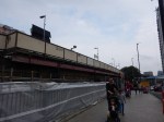
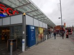
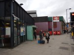
The Bay Platform 2 At Willesden Junction Station
In posts like this one, entitled More Platform Action At Willesden Junction, I showed work to create a new bay platform 2 at Willesden Junction station.
On Sunday, the 2nd Of October 2016, I took these pictures of the station in use.
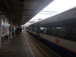


What are Transport for London’s plans for this platform, other than stock transfers and Rail Replacement Trains?
As they were doing on that Sunday, they could run a Willesden Junction to Stratford service via a rebuilt Primrose Hill station.
Platform Height Issues
At some stationS to get in to and out of the Bakerloo Line 1972 Stock trains, is quite a step and it would be difficult in a wheel-chair.
I have covered this in Platform Height Issues On The Watford DC Line and feel that dual-height platforms could be used.
Highbury And Islington Station
In some ways, Highbury and Islington station is the worst station in North London, as after war damage and then the addition of the Victoria, North London and East London Lines, it shows major evidence of Topsy at work.
With better connections between the deep-level Victoria Line and Great Northern Metro and the London Overground, it could be a very useful interchange. At the moment, there’s just too much walking in long underground passageways.
But as the Great Northern Metro will have new Class 717 trains giving a 10-12 tph link to Crossrail and the City at Moorgate, surely improvements at Highbury and Islington station would be worthwhile.
These services will be going through the station in a few years.
- 6 tph between Highbury and Islington and Crystal Palace – East London Line
- 4 tph between Highbury and Islington and West Croydon – East London Line
- 3+ tph between Stratford and Richmond – North London Line
- 3+ tph between Stratford and Clapham Junction – North London Line
- 10+ tph between Moorgate and Hertfordshire – Great Northern Metro
- 36 tph between Brixton and Walthamstow Central – Victoria Line
Admittedly, Crossrail will take some pressure off the station, by providing alternative routes via Moorgate and Stratford, but I can’t believe that Transport for London, aren’t looking to improve the interchange between the various lines. Especially, as with a few tweaks, Dear Old Vicky could possibly deliver forty tph or a train every ninety seconds, as opposed to the current hundred. These could include.
- A second entrance at Walthamstow Central station to provide step-free access and cope with the sheer numbers of passengers.
- A loop at Brixton, with a possible new station at Herne Hill to turn the trains at the Southern end.
- New trains with a higher performance.
- Improvements at certain busy stations like Oxford Circus, Euston and Kings Cross St. Pancras.
Other improvements like air-conditioned trains would attract passengers to the line and make greater capacity necessary.
This article on the authorative London Reconnections, which is entitled A Look At The World Class Capacity Upgrades, concludes its thoughts on the Victoria Line with this.
With the Victoria line pushing towards what must be the theoretical limit for a line with that amount of rolling stock and – more importantly – two-platform termini, there are no plans to further improve the service. Indeed the challenge of procuring more trains and finding the depot space for them would probably discourage any such plans on its own. This does not mean that the line will be forgotten, as both Oxford Circus and Walthamstow Central are on TfL’s top ten hit list of stations in need of a major capacity upgrade. Simply that the days of pushing more trains through the same stations more quickly have passed. In the case of Walthamstow Central it is highly likely that the next step will be making the station double-ended, with an entrance near or in the shopping centre.
I have a feeling that forty trains per hour will come sooner rather than later.
Oxford Circus Station
In two sections of my ramblings, Oxford Circus station has had a small mention.
An improved Oxford Circus station could benefit both the Bakerloo and Victoria Lines.
As the station is high on TfL’s list of stations for improvement, I would expect to see something planned to start here before the mid 2020s.
- Step-free access.
- Better interchange between Victoria and Bakerloo Lines in different directions.
- More space around the Central Line.
- An underground pedestrian link to Crossrail at Bond Street station.
- Extra entrance and exits to serve pedestrianised Oxford and Regent Streets.
I believe, that adding new passages, entrances, exits, lifts and escalators into the current complex can be organised in a similar way to how Bond Street station has been successfully upgraded over the last few years. Hopefully, Bank and Camden Town stations, will also be upgraded in the same way.
But Oxford Circus is the big one!
Conclusion
As I write this, the BBC is announcing that plans will be announced by Sadiq Khan today to bring the Bakerloo Line Upgrade forward to 2029.
I think that this will bring forward a lot of related work to improve the Watford DC Line and the related lines across North London.
The future is brown, with large splashes of orange!
Improving Lewisham Station
In the June 2016 Edition of Modern Railways, there was an article entitled Turning South London Orange.
One of the proposals is to try to sort out Lewisham station.
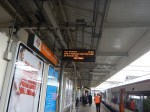
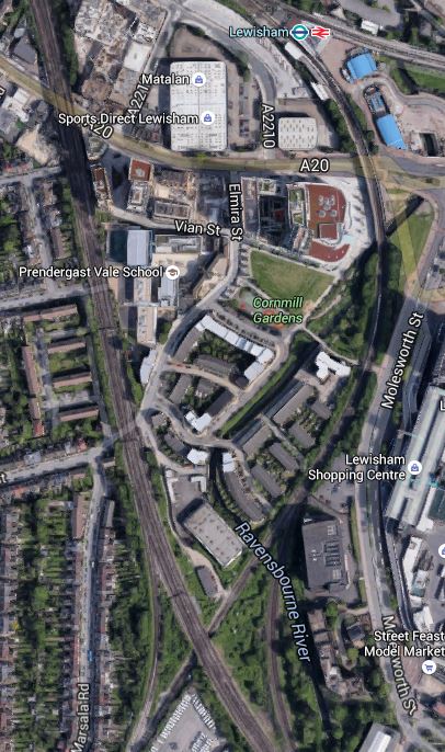
My mother used to tell me never to go South of the Thames as you’ll get lost. Perhaps she had Lewisham in mind, as just look at this Google Map of the lines through the station.
Lines Through Lewisham
The rail lines in the Lewisham area are.
- The lines to the West of the map is the South Eastern Main Line from Charing Cross to Dover and Folkestone.
- The line curving down from the station to the South Eastern Main Line is the Hayes Line, which meets it in a complicated junction.
- Going off to the East from the station is the North Kent Line.
Was the designer of the lines in this area having a laugh, as it must make running trains through Lewisham in an efficient manner extremely difficult.
I also assume that anybody going to and from Dover, can’t change trains at Lewisham, unless they an force a window and jump out.
In order to try to improve matters, the Centre for London report is proposing Lewisham South interchange platforms on the South Eastern Main Line, which are connected to the main station using a travelator running alongside the Hayes Line.
The thinking behind all this is detailed in this document from JRC consultants.
Some major points and recommendation from the document include.
- There are too many flat junctions and other track problems.
- The service levels from the area into London is erratic and nowhere near TfL’s oreferred level of four trains per hour.
- Getting to and from anywhere other than the City or Central London in the peak can be difficult.
- Connectivity to Lewisham to get the DLR to Canary Wharf could be improved.
- Southeastern’s commuter services should be taken over by TfL.
- Extending the East London Line to Lewisham wll be difficult and expensive, if not impossible.
The document also includes a map of the proposed travelator on Page 14.
It shows the travelator curving along the Eastern side of the Hayes Line to an island platform on the South Eastern Main Lines.
It also says this.
However a southern location closer to Lewisham High Street, placed over the Hayes branch line, in low value or empty land on the slow lines alongside Parks Bridge Junction and north of the Courthill loop, would permit a 12-car island platform connected into the Lewisham Interchange and making that much more of a hub station. A direct entrance to the southern part of Lewisham High Street could also be opened up. A travelator alongside the Hayes line, in several segments, would link to the interchange in 540 metres and also provide fast access to Lewisham shopping centre at an intermediate point.
This Google Map shows the area from the current Lewisham Interchange to the proposed Lewisham South.
Note the blue roofs of the DLR station at the top of the map and the crossing by the South Eastern Main Line of the Hayes Line at the bottom, where it is surrounded by green space.
To get a better feel for the area. I took these pictures ass I walked from where the South Eastern Main Line crosses the High Street back to the station.
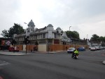
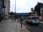
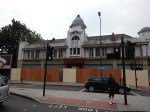

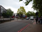
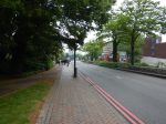

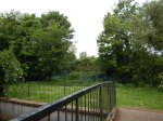
After this walk along the dual-carriageway from the Western end of Lewisham High Street to the station, I certainly think that a better walk could be created.
Let’s hope that when the current construction and road works are complete, that the current walking route between the station, the Shopping Centre and Lewisham High Street is improved.
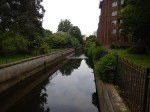
What disappointed me was that surely better use of the Ravensbourne River, which I called a Hidden Waterway in the pictures. This Google Map shows how it twists and turns through the area.
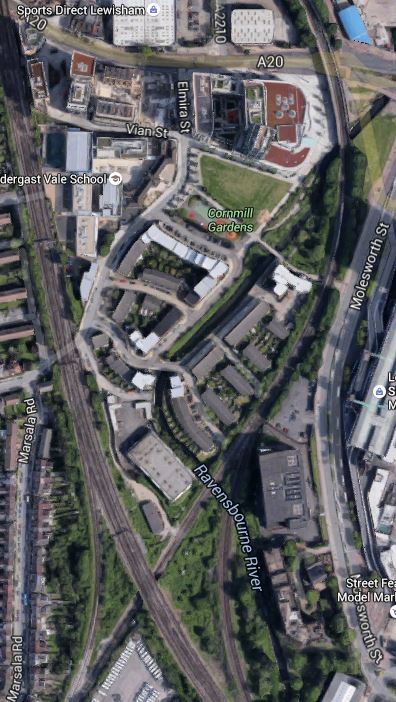
The Ravensbourne River Through Lewisham
I certainly think something better can be done.
For those who think a travelator is a bit naff, the JRC report also suggests that the DLR could be extended.
Consider.
- If it’s worth extending the DLR to Lewisham South, perhaps it should go further.
- One of the themes of the JRC report is prudence and affordability, which I think pushes the author to the travelator solution.
- The travelator route may make it easier to serve the Shopping Centre.
- A travelator might make it easier to catch the buses on the other side of the Shopping Centre, which every time I go to Lewsiham, I seem to have to do.
I also think that to extend the DLR would probably involve some impressive engineering to get over the roads by the station, whereas a walking route/travelator might even start from or beside the Hayes Line platform (2) on the bridge over the road. The latter option would mean that at the station end, all of the lifts are there for step free access to the other platforms.
I also think that not many passengers would want to transfer between Platform 1 at Lewisham station and the Lewisham South platforms, so starting the walkway from Platform 2, which has a level connection to Platform 3 and good connections to the DLR, would not be a bad idea.
Overall, I don’t think we make enough use of travelators and outside escalators.
But I do like the idea of the new platforms at Lewisham South and a travelator.
Something will have to be done at Lewisham, before the Bakerloo Line is extended to the area.
Puzzled Over Streatham Common Station
Transport for London’s proposal for the Bakerloo Line Extension comes with a very nice map of the various projects that will be carried out to improve rail services in South London.
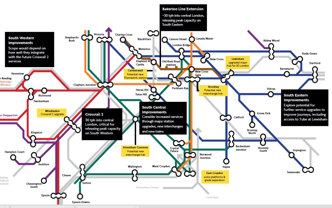
Rail Improvements South Of The Thames
It is all good stuff and most is easily explained.
The black boxes are about more general and larger projects, whereas the yellow boxes are comments about specific stations.
The projects; large and small, fit together like a jigsaw. And not a particularly difficult one to understand!
Of the larger projects, the simple extension of the Bakerloo Line to Lewisham station via two new stations and New Cross Gate station is a masterstroke.
- It provides a thirty trains per hour rail link through the Old Kent Road Opportunity Area.
- It gives all those living on the East London Line, as I do, a much needed connection to the Bakerloo Line.
- Coupled with an upgraded Lewisham station, it gives South East London access to the Underground.
- The project can be opened without an expensive set of new trains.
- New Cross Gate and Lewisham stations have space for construction.
- The extension can be built with minimal closure of the Bakerloo Line.
- The project is almost a repeat of the Northern Line Extension.
- No-one’s current train service will be discontinued.
- There is no replacing heavy rail with smaller Underground trains.
- If in the future, the line needs to be extended, this will be no problem, if Lewisham station is designed correctely.
The only negative, is that the plan doesn’t provide a much-needed rail link in Camberwell.
But Transport for London have done there research and have concluded that reopening the disused Camberwell station on Thameslink could be a worthwhile alternative.
The TfL report gives this concise summary.
A new station at Camberwell would be a significantly lower cost option to a Tube extension, whilst serving the same catchment area. Investigations show significant journey time improvements could accrue to Camberwell passengers and that operationally there may be scope to integrate re-opening of the station into the launch of the completed Thameslink programme.
We will therefore undertake further planning work with Network Rail and the London Borough of Southwark to assess the proposal.
It is a second masterstroke.
Camberwell station will probably get a similar service to Loughborough Junction station. I’m not sure what it will be, but something like four eight-car trains an hour both ways. In around fifteen minutes, passengers could be at.
- Balham for the Northern Line and Crossrail 2
- Elephant and Castle for the Bakerloo and Northern Lines
- Blackfriars for the Circle and District Lines
- Farringdon for Crossrail and the Metropolitan Line.
- Kings Cross St Pancras for main line services and the Victoria Line.
Camberwell station could easily be double-ended, with entrances on both sides of Camberwell New Road.
Camberwell would get at least a high-capacity four trains per hour service to virtually everywhere, with just a single change.
And this could be delivered by 2020, if they get the turbo-charged engineering skates out.
On the South London map, there are some other stations mentioned.
- Brockley – Potential new interchange hub
- East Croydon – Extra platforms & grade separation
- Lewisham – Upgraded major hub for SE London
- Streatham Common – Potential new interchange hub
- Wimbledon – Crossrail 2 upgrade
All of these station upgrades are understandable, with the exception of Streatham Common station.
I can only believe that Transport for London have a cunning plan for this station and the tangle of lines to its North.
Streatham Common Station And The Tangle Of Lines
So what would an interchange hub be like?
In the simplest design, two platforms would be built across the lines through Streatham Common station alongside the Sutton Loop Line. They would be connected to extended platforms from the existing station, by stairs and lifts.
I think there would be space to build some bay platforms into the station, so that Streatham Common station could be used as a terminus.
This schematic of the rail lines is from carto.metro.free.fr
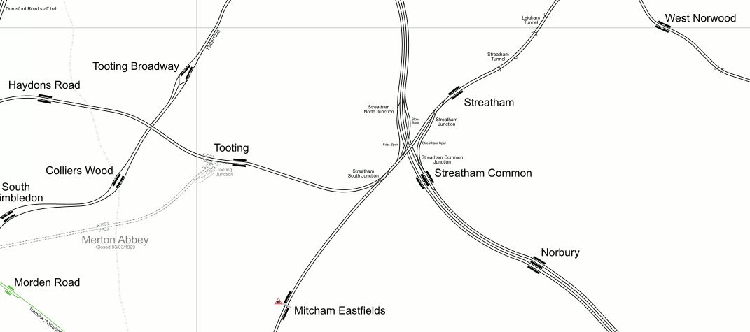
Lines At Streatham
Note how there are very few rail lines, south of Streatham towards Mitcham Eastfields station. Wikpedia says this about the station.
The station is located at Eastfields Road level crossing, in an area previously poorly served by public transport. The nearest station was Mitcham Junction, which along with Mitcham tram stop, was over 1 mile (1.6 km) from the district.
I wrote about the station in Mitcham Eastfields Station.
The lines that currently go or could go through the Dtreatham stations are set out in the following sections.
The Sutton Loop Line Of Thameslink
Streatham station is the last station on Thameslink before the Sutton Loop starts and finishes. Stations on the Sutton Loop include.
- Tooting
- Haydons Road
- Wimbledon
- Wimbledon Chase
- South Merton
- Morden South
- St. Helier
- Sutton Common
- West Sutton
- Sutton
- Carshalton
- Hackbridge
- Mitcham Junction
- Mitcham Eastfields
The fourteen stations have the following service.
- Currently, there are two trains per hour in each direction on the loop.
- Only Mitchan Junction and Wimbledon have connecions to Tramlink.
- I think Streatham to Streatham takes about forty-five minutes of travelling time.
- These trains eventually terminate and come back at St. Albans or Luton in the Peak.
- When the ongoing Thameslink Programme is finished, there will be two eight-car Class 700 trains in each direction every hour.
When the Thameslink Programme was planned, Network Rail intended to terminate these services at Blackfriars.
Residents and their politicians objected! Wikipedia says this.
Network Rail had planned to terminate Sutton Loop Thameslink trains at Blackfriars station, rather than have them continue through central London as at present. This upset many residents in South London and their local politicians, who saw it as a reduction in services rather than an improvement. In response to pressure, government has ordered Network Rail to reverse the decision.
I think this illustrates a certain sensitivity about train services in the area. Do they think that other places like Balham, Croydon and Wimbledon, get all the goodies?
So we have four trains an hour through the core section of Thameslink going on the Sutton Loop.
Although, this shouldn’t affect the services on the loop, could this cause problems for passengers on the trains through Wimbledon and Sutton, as long-distance trains are being used for short local journeys.
For example, you might have mothers with buggies taking babies and children to nurseries and schools, mixed up with commuters, who want to go north of the Thames.
A simple solution would be to have more trains going round the loop, so that instead of just two trains per hour each way, there were perhaps four or even more.
But where would they come from?
They could come a long way from somewhere like Orpington or Cannon Street, which would mean finding paths all over South East London and perhaps beyond.
Or perhaps they could just do the loop and start and finish at either Streatham or an expanded Streatham Common.
As Streatham is just a two platform station, with little space to expand, a bay platform in Streatham Common might be one solution.
Possible Reason for an expanded Streatham Common station – The station could be the terminus of a two train per hour local service around the Sutton Loop.
The Brighton Main Line
The Brighton Main Line goes from Victoria to East Croydon with fast trains generally only stopping at Clapham Junction station en route. However services pass through several important stations like Balham and Streatham Common without stopping.
Could there be advantages in stopping some of these services at an upgraded Streatham Common?
I don’t know under normal circumstances, but there may be good operational reasons for services to be able to call at Streatham Common station.
Possible Reason for an expanded Streatham Common station – The station could be a valuable interchange between Brighton Main Line and other services.
Tramlink
Although Tramlink doesn’t go anywhere near Streatham at present, it does have a main route, south of the area.
There is also a distinct lack of rail services in the area between Streatham and Mitcham, which led to the building of Micham Eastfields station.
In Wikipedia, it says that extensions to the Tramlink have been proposed North and South of Croydon. This is said about North of Croydon.
To the north of Croydon, it is proposed to use a highway alignment based on London Road. To the south of Thornton Heath Pond, the use of a shared carriageway is a possibility. North of this point the road becomes the A23 again, but there are likely to be some opportunities for trambaan type segregation to Norbury and between Norbury and Streatham, although Norbury is a pinch point. The proposal is to terminate the line at Streatham railway station, providing an interchange to the extended East London Line
Possible Reason for an expanded Streatham Common station – The station could be a destination for Tramlink.
Tram-Trains
In areas of Germany, where there are both trains and trams, the Germans are getting very enthusiastic about tram-trains which can run on both networks.
If tram-trains, were to be used on a possible Tramlink Extension to Streatham, they could join the railway at a convenient station, like Norbury or Streatham Common and become trains to go round the Sutton Loop.
Possible Reason for an expanded Streatham Common station – Tram-trains on Tramlink.
The East London Line
I use the East London Line a lot and it has the problem of success.
Trains have grown from three to five cars and some recent trips from Denmark Hill to Dalston Junction have shown, that at times standing is common.
Increased frequencies in 2018/2019, will ease the problems, but would another terminus in South London be a good idea for the East London Line?
The capacity of the core section of the East London Line is twenty-four trains per hour, so even from 2018/2019, there are four more paths available.
So could we see some services going to Streatham Common station perhaps via Peckham Rye, Tulse Hill and Streatham?
A factor that might apply here, is can Platform 1 at Clapham Junction cope with enough trains from Dalston Junction?
Possible Reason for an expanded Streatham Common station – A terminus for a branch of the East London Line.
The West London Line
Southern’s hourly service between South Croydon and Milton Keynes calls at Streatham Common station.
London Overground has a service of around four trains per hour on the West London Line between Clapham Junction and Willesden Junction, which Southern’s service augments for part of the route.
But there are problems with the West London Line.
- There are some extended service intervals at times.
- The Southern service doesn’t call at Willesden Junction.
- West London Line services call at different platforms at Clapham Junction.
- As with the East London Line, could platform space at Clapham Junction be a problem for the West London Line of the Overground
Unlike the East London Line, the West London Line is not a turn-up-and-go service.
So could there be advantages to use Streatham Common station, as a southern terminus for services through the West London Line?
Possible Reason for an expanded Streatham Common station – A terminus for the West London Line.
HS2
When HS2 opens in 2026, getting to Euston station will not be easy, as it is unlikely that Crossrail 2 will have been started, let alone up and running.
Passengers will need to get to a Northern or Victoria Line station and have a deep and possibly tedious journey across Central London.
Thameslink will be of use to some, but there will be a walk or a short-but-difficult tube journey between St. Pancras and Euston.
But HS2 will stop at Old Oak Common station on the North London Line. If the West London and East London Lines were to be extended to Streatham Common station, either could be a good alternative route to HS2 and the West Coast Main Line.
I estimate that Streatham Common to Old Oak Common will take thirty three minutes, compared to Morden to Euston on the Northern Line, which can take forty-one minutes.
Possible Reason for an expanded Streatham Common station – The station could be an important hub, collecting passengers for HS2 and the West Coast Main Line
Crossrail 2
Crossrail 2 is not planned to call at Streatham Common station, although it might go underneath in its route from Balham to Wimbledon.
Even so, I suspect that an expanded Streatham Common station will be to the advantage of Crossrail 2.
As I said earlier the station can help improve services on the Sutton Loop, which would have effects.
- Bring more passengers to Wimbledon for Crossrail 2.
- If extra stations were added to the Sutton Loop, these could help solve the Tooting Broadway/Balham wars.
- Could a new station be built at St. George’s Hospital, between Tooting and Haydons Road stations?
But the biggest benefit would be that Streatham Common station, would be an alternative hub, for those wanting to avoid Wimbledon during the building of Crossrail 2.
Possible Reason for an expanded Streatham Common station – Crossrail 2
East Croydon
When East Croydon station is being extended or the grade separation at Windmill Bridge Junction is being built, surely a well-connected interchange at Streatham Common, could be an asset towards helping to maintain a service.
Even under normal circumstances with a decent tram and train connection to Croydon, Streatham Common station may take the pressure off public transport in Croydon.
Possible Reason for an expanded Streatham Common station – Alternative routes for Croydon
Conclusions
Build a Streatham Common interchange hub!
It is just a pity that Crossrail 2 can’t have a station at Streatham Common.
Is the Streatham Common interchange hub, a third masterstroke?
A Report On The Bakerloo Line Extension
Transport for London, have released a report on the Bakerloo Line Extension that they call the Option Selection Summary Report.
It is one of those worthy documents, you get from analysing the data from consultations.
But it is full of several nuggets, which although not directly associated with the Bakerloo Line could be very important for passengers coming from or venturing to South London.
They have also provided this helpful map, which lays out possible actions and improvements.
Rail Improvements South Of The Thames
I hope that the boxes can be read.
I shall deal with the various boxes in separate sections, going in a vaguely East to West direction. I will leave out the Crosrail 2 related topics for the moment.
Bakerloo Line Extension
The summary on the map says thirty trains per hour (tph) into Central London, releasing peak capacity on South Eastern. They describe the extension like this in the Executive Summary of the report.
Following the 2014 consultation, we have conducted a comprehensive assessment of the consulted route options alongside alternatives suggested by respondents and stakeholders. The work has concluded that an extension to Lewisham via the Old Kent Road is currently the best option as a first phase, as the route would serve the Old Kent Road Opportunity Area and support significant numbers of new homes and jobs for London. This would include a major new interchange at Lewisham. It is estimated that the selected corridor could enable over 25,000 new homes by serving Opportunity Areas and regeneration areas along its length.
From the map, the route of the extended Bakerloo Line, would be a simple one from the current terminus at Elephant and Castle station to Lewisham station, via two new stations in the Old Kent Road and an interchange at New Cross Gate station with the London Overground and main line services from London Bridge.
These are various highlighted points from the report.
- Assessment of the alternative route options suggested during the 2014 public consultation has demonstrated that the options towards Lewisham remain the most effective for addressing the challenges in south east London.
- An extension should serve Lewisham station due to the new homes that could be unlocked in growth areas along its route, and the wider transport connectivity and access improvements it would provide. 4.2.1. Our assessment work has found that although shor
- We currently recommend a route to Lewisham via Old Kent Road for further development as part of an initial phase for an extension. We have found that this option has the greatest potential to unlock new homes to support London’s growth and significantly improve transport provision in south east London.
- An extension via Old Kent Road would provide a step-change in the capacity, connectivity, accessibility and speed of travel for residents.
- By improving transport and unlocking new homes and jobs growth, the economic benefits of the Old Kent Road option are higher than the route via Camberwell and Peckham Rye. The latter option is estimated to be more expensive to deliver and has a lower potential of obtaining funding.
- Delivering a major transport infrastructure project is a challenging and often risky process. By integrating planning with the Opportunity Area development, the proposed route via the Old Kent Road offers the best prospect of successful delivery.
- An initial extension to Lewisham could form part of a wider package of complementary rail improvements across south and south east London, providing improved journeys via Tube and rail connections.
The report doesn’t rule out extensions beyond Lewisham. This is said.
The assessment shows there could be significant additional benefits from an extension beyond Lewisham and therefore it has not been ruled out at this stage, with further work required to develop the deliverability and case further.
Under Next Steps, this is said.
We will focus developing plans for the first phase of an extension to Lewisham via the Old Kent Road, with further public consultation anticipated in 2016.
TfL’s proposals for the Bakerloo Line Extension would appear to be simple and deliverable at an acceptable cost to give the greatest benefit to South East London.
It should also not be the most difficult line to build, as it is only three stations, with it would appear plenty of green space and cleared sites on the surface for access.
It would almost be a repeat of the Northern Line Extension, except that it is shorter.
For people like me living on the East London Line, the interchange to the Bakerloo Line at New Cross Gate will be very much welcomed, as it improves connectivity to that difficult-to-access area between Piccadilly Circus and Elephant and Castle. Try getting from Dalston to Charing Cross in the rush hour!
I think the biggest problem of this short extension, is going to be that even at an increased frequency of 30 tph, it will quickly get close to capacity.
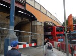
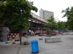
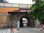
Lewisham Station
The map also labels Lewisham station with a box saying upgraded major hub for SE London.
This Google Map shows Lewisham station.
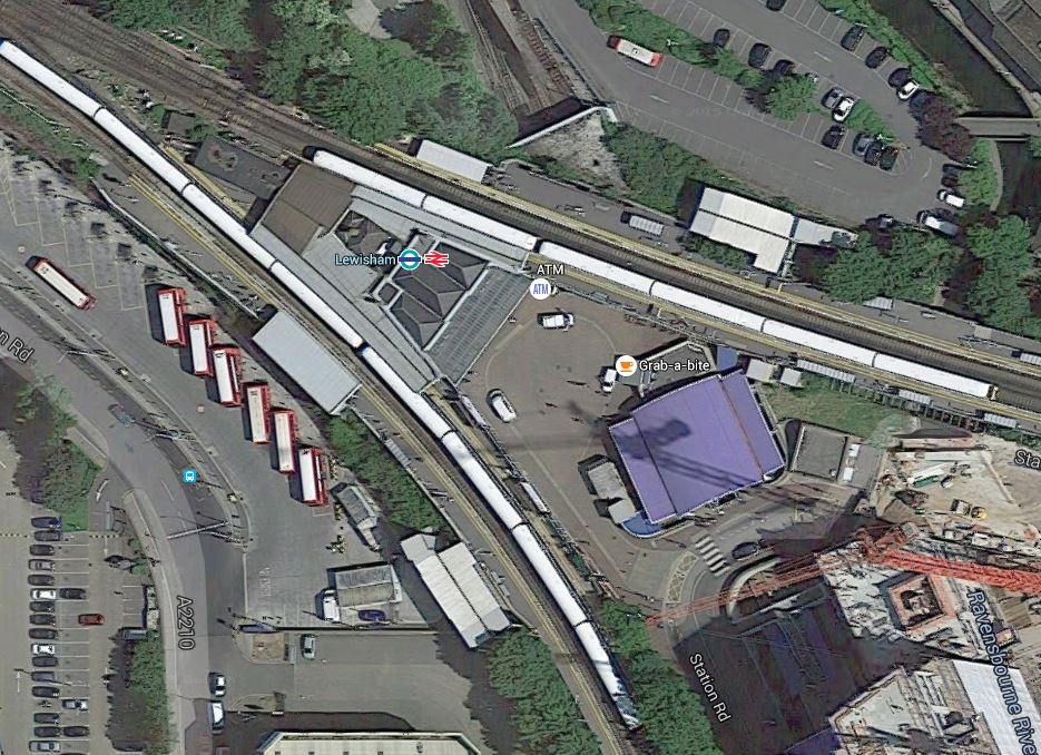
Lewisham Station
I think that there would appear space for improvements and digging the shafts for the creation of the Bakerloo Line Extension.
South Eastern Improvements
The summary on the map says explore potential for further service upgrades to further improve journeys, including access to Tube at Lewisham.
Some stations have been upgraded to a modern standard, but many still don’t have the fscilities that passengers expect these days.
Nothing is said about TfL’s long term ambition to take over the Metro services of Southeastern.
South Central Improvements
The summary on the map says consider increased services through major station upgrades, new interchanges and new trains.
I could repeat what I said in the previous section for South Eastern Improvements.
New Trains
This is very much a general point about new trains.
London’s latest train fleets are increasingly becoming walk-through from one end to the other.
Passengers are also getting very savvy in their train usage and often board a train in a coach, that will be close to their exit at the destination.
And if they get on at the wrong point, they will often walk to their desired exit position, before the train stops.
So could this be used to advantage in the design of stations, with more perhaps having multiple exit points, as do some Crossrail stations?
Brockley Station
The map also labels Brockley station with a box saying potential new interchange hub.
This Google Map shows Brockley station.
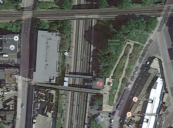
Brockley Station
The Bexleyheath Line between Nunhead and Lewisham stations crosses the East London Line and Brockley station at a high level.
I wrote A Four-Poster Station about connecting these two lines.
It would appear that Transport for London have advanced this project from one word in their 2050 Infrastructure Plan to a proposal.
This is the sort of connectivity, that us plebs in Dalston will like a lot. From 2018, as I wrote in Increased Frequencies on the East London Line, there will be ten services per hour between Dalston Junction and Brockley stations and one change at Brockley, will open up many transport opportunities.
East Croydon Station
The map also labels East Croydon station with a box saying extra platforms & grade separation.
This Google Map shows East Croydon station.
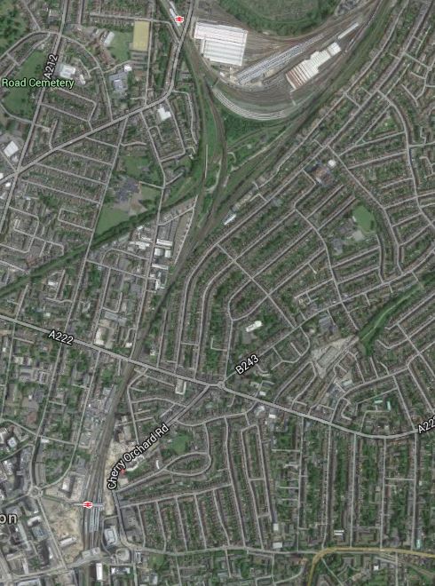
East Croydon Station
The station is towards the bottom of the map and the semi-circular shape at the top is Selhurst Depot.
There is a large section labelled Future in the station’s Wikipedia entry and given the legendary congestion and the large expansion plans for Croydon, I think it is highly likely that expansion of the station and grade separation will go ahead even if the Bakerloo Line Extension doesn’t!
Camberwell Station
The map also labels the now-disused Camberwell station with a box saying potential new Thameslink station. The TfL report says this.
Similarly, we are working with Southwark Council to look into the re-opening Camberwell station on the Thameslink line to improve access into Central London and support local development.
This Google Map shows the area around the disused station.

Camberwell Station
Camberwell station used to be where Camberwell New Road crosses under the railway.
The TfL report makes these points.
- Camberwell has no direct rail connection.
- A two-branch extension of the Bakerloo Line; Old Kent Road and Camberwell, will be very costly.
- A Thameslink station at Camberwell, would serve the same area as an Underground station and is a much more affordable option.
The TfL report gives this concise summary.
A new station at Camberwell would be a significantly lower cost option to a Tube extension, whilst serving the same catchment area. Investigations show significant journey time improvements could accrue to Camberwell passengers and that operationally there may be scope to integrate re-opening of the station into the launch of the completed Thameslink programme.
We will therefore undertake further planning work with Network Rail and the London Borough of Southwark to assess the proposal.
I would be very surprised if the Bakerloo Line Extension calls at Camberwell.
I would also suspect that being able to open a new Ca,berwell station, at the same time as Thameslink, would be very easy to justify on a costs basis.
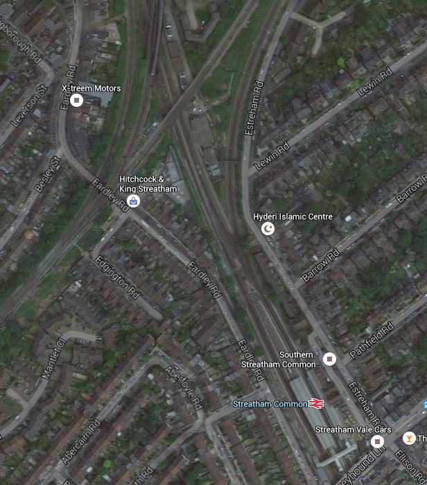
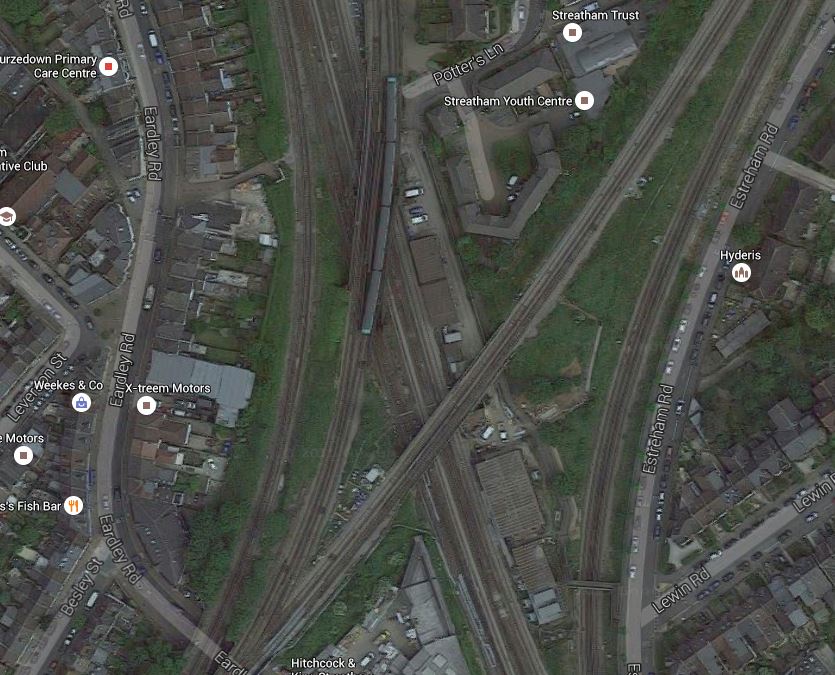
Streathham Common Station
The map also labels Streatham Common station with a box saying potential new interchange hub.
This Google Map shows Streatham Common station.
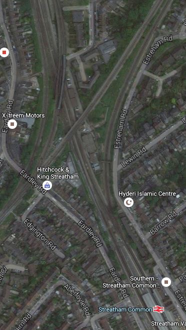
Streatham Common Station
Wikipedia introduces Streatham Common station with these words.
The station is managed by Southern who also operate trains from the station. Direct trains from the station run to Victoria, London Bridge, East Croydon, Shepherds Bush, and Milton Keynes Central. Southern consider the station to be the 6th busiest station on their 158 station network as it receives 12,932 passenger journeys a day, totalling 4,655,520 per year. The Office of Rail and Road figures are lower at 3,827,296.
The station has four platforms, but only platforms 1 and 2 are in daily use; platforms 3 and 4 are normally for passing Express trains, but they are occasionally used during engineering work or major disruption. Step free access to both platforms and both station entrances is available.
Just to the North of the station, is the Sutton Loop Line of Thameslink and I suspect that Streatham Common is mentioned in TfL’s report, is that they have a cunning plan to link the various lines in the area together.
To try to get a better feel of the area, I took a train to Streatham Common station, walked to Streatham station and then took a train to Micham Junction, which travelled across Streatham Common station. I took these pictures.


My walk showed me how complicated the lines are in the area and that is emplasised by this Google Map of the junction.
A Tangle Of Lines
I do wonder if there are operational problems in Streatham, that perhaps necessitate a bit of a sort out.
It’s also not an easy walk between Streatham and Streatham Common stations because there is a massive Tesco Extra blocking the walking routes. It certainly follows Tesco’s tradition of trying to create some of the ugliest buildings in the UK.
My other thought, is that the space around the railway lines is quite generous and are Network Rail looking to create some more housing around the junction.
I think that any plans that Network Rail have for Streatham will be revealed in due course.
Conclusion
I think Network Rail, Transport for London and others have decided to bundle a lot of smaller projects under the umbrella of the Bakerloo Line Extension, with the intention of getting value-for-money, that delivers a lot of improvement in an ordered manner in a short timescale, all over South London.
It could be described as the following.
- One large billion pound project to create the actual Bakerloo Line Extension.
- One large project, possibly with a property developer, to sort out East Croydon station.
- Three mid-sized projects to create the Brockley and Streatham Common interchanges and Camberwell station.
- A lot of small projects to create quality stations all over South London.
- Some new trains as required.
So there would be something for everybody. Even the man on the Clapham omnibus!
But who knows?
A Radical Idea For The Bakerloo Line Extension
I have spent forty years involved in project management, writing software for project managers and generally listening to some of the thoughts and experiences of some of the best engineers from all over the world.
One common thread, which is best illustrated by how the size of lift possible increased in the North Sea in the 1970s, is that as time has progressed machines have got bigger and more capable, and the techniques of using them has improved immeasurably.
The Crossrail tunnel boring machines (TBM) make those used on the Jubilee Line extension or the Channel Tunnel look like toys. But not only are the TBMs bigger and faster, they have all the precision and control to go through the eye of the smallest needle.
If we look at the proposals for the Bakerloo Line Extension, there have been several differing ideas. Some envisage going under Camberwell and in others the trains terminate on the Hayes line.
Transport for London (TfL), obviously know the traffic patterns, but do we really want to take the chance of say connecting the Hayes line to the Bakerloo and then finding that it’s not the best solution?
What we should do is augment the services in the area, by providing a good alternative transport mode, that links to some of the traditional rail lines to give even more flexibility. We certainly shouldn’t repeat the grave mistake that was made at Brixton in the 1960s by not connecting the Victoria line to the surface rail lines.
This is Transport for London’s indicative map of the extension.

Bakerloo Line Extension Map
I have reason to believe that the Northern Line Extension may be being built as an extension to the Kennington Loop.
So could we design the Bakerloo Line Extension as a loop starting and finishing at Elephant and Castle calling at important stations?
A possible route could be.
- Elephant and Castle – Interchange with Northern Line and National Rail including Thameslink
- Old Kent Road 1 – Proposed on Map
- Old Kent Road 2 – Proposed on Map
- New Cross Gate – Interchange with London Overground and National Rail
- Lewisham – Interchange with Docklands Light Railway and National Rail including Hayes Line
- Catford Bridge – Interchange with Catford station and National Rail including Hayes Line and Thameslink
- Peckham Rye – Interchange with London Overground and National Rail
- Camberwell – Interchange with National Rail including Thameslink
- Elephant and Castle
The advantages of this simple design are.
- The tunnel would be excavated in one pass by a single TBM.
- The line could be deep under any existing infrastructure.
- Most stations would be simple one-platform affairs, with perhaps only large lifts and emergency stairs, to give unrivalled step-free access for all from the street to the train. Surely lifts exist, that are large and fast enough to dispense with escalators.
- For safety, passenger convenience and flows, and other reasons, the stations could have two entrances, at opposite ends of the platform.
- The simple station entrances would be much easier to position on the surface, as they wouldn’t need to be much bigger than the area demanded by the lifts.
- A single loop would only need half the number of platform edge doors.
- At stations like New Cross Gate, Lewisham, Catford and Peckham Rye the lifts would surface within the confines of the existing surface stations.
- The route has interchanges with the Brighton Main Line, East London Line, Hayes Link, Thameslink and other services, so this would give lots of travel possibilities.
- Trains do not need a terminal platform, as they just keep going on back to Elephant and Castle.
- The loop would be operationally very simple, with no points to go wrong. TfL have aspirations to run twenty-seven trains per hour on the Bakerloo and a simple reversing loop , which would mean the driver didn’t have to change ends, must certainly help this. It would probably be a lot more difficult to get this capacity at the northern end of the line,where Harrow and Wealdstone doesn’t have the required capacity and the only possibility for a reversing loop would be north of Stonebridge Park.
- Elephant and Castle would need little or no modification. Although it would be nice to have lifts to the Bakerloo Line.
- Somewhere over two billion pounds has been quoted for the extension. A single loop with simple stations must be more affordable.
The main disadvantage is that the loop is only one-way.
But making even part of the loop two-way would create all the operational difficulties of scheduling the trains. It would probably be better, less costly and easier to make the trains go round the loop faster and more frequently.
But if a passenger went round the loop the wrong way and changed direction at Elephant and Castle that would probably only take a dozen minutes or so.
Alternatively, I’m sure some New Routemasters would step up to the plate and provide service in the other direction between the stations.
Are Transport for London Doing Bit Of Route Proving?
I noticed this evening that London bus route 453 is to be Routemasterised next month.
I obviously don’t have the figures that TfL do, but is it a choice with a lot of implications for future public transport in the capital.
Route 453 has its Northern terminus at Marylebone, which is on the Bakerloo line. The route then calls at the following stations, which are also on that line.
- Baker Street
- Oxford Circus
- Piccadilly Circus
- Charing Cross
- Lambeth North
- Elephant and Castle
It then continues to New Cross, New Cross Gate and a couple of places mentioned as possible stops on the Bakerloo Line Extension.
As buses these days have extensive data collecting capabilities through Oyster, are TfL hoping to get specific traffic information, that might help in deciding where and when to extend the Bakerloo line? They might also be hoping that a quality bus route might flush out a few more passengers. The numbers using route 38, since the full Routemasterisation in May, certainly hasn’t decreased markedly, although in the summer there have been a few half-empty buses.
TfL obviously knows what to expect, as they have now converted several routes to New Routemasters.
But the only fact we know about traffic changes when New Routemasters take over a route, is that no statistics have been published.
I’d have loved to write a software system to analyse bus route performance.
It’ll be interesting to see how it all works through in the future.
If I take the route I know best, the 38, what would happen if the buses got to be very full?
I am drawn to the conclusion, that all TfL would do, would be to draft a few more buses on the route, which will be very easy, if there is only one type working the route.
Try doing that in a hurry with a tram route!
Consultation Starts On The Bakerloo Line Extension
The Standard is reporting that consultation is going to start on the route of the Bakerloo Line Extension.
I’m always surprised that this project which was first proposed seriously in 1931, has taken so long to this point, given that the line is the most lightly used of all the main Underground lines.
Is The Bakerloo Line Extension To Be Built?
The Bakerloo Line Extension was originally planned to be built in the 1940s and it seems to come up every now and again.
In this supporting document to the London Infrastructure Plan for 2050, the following is said.
Potential extensions to the existing network to unlock major potential for housing development range from major rail schemes such as the extension of the Bakerloo line, to extensions to the Overground. In unlocking development they also provide opportunities to secure funding towards the cost of delivery.
In some ways the second quoted sentence is the more important statement, as it might mean that developers, who want to contribute to infrastructure will be listened to. This happened in part with Canary Wharf at the Jubilee Line, so if done properly, it might mean an accelerated rate of construction of new infrastructure.
Obviously before any decision is made detailed costings and consultations must take place. According to this report though, it has a benefit cost ratio of 3:1
One factor that will be important, is how the project to create the Northern Line Extension to Battersea performs.
If it is on budget and on time, will that team be rolled over onto the Bakerloo?
