The Luvvies Don’t Like Crossrail 2
Kings Road is one of the worst roads for traffic in London, as Traffic in the New Kings Road shows.
So you’d think that a new Crossrail 2 station would be welcomed. But according to thus article in the Standard which is entitled Felicity Kendal and Trevor Eve join fight to stop Crossrail station on King’s Road, there is a campaign against the line. The article says this.
The campaign group No Crossrail in Chelsea warns that it will lead to years of disruption and ruin the character of one of London’s best loved “villages”
I have always thought that there would be such a campaign in Chelsea, as let’s face it, these people probably don’t go anywhere unless they’re in a large gas-guzzler or taxi.
The joke is that if a station is built in the Kings Road, I believe it will be built by uphill excavation from the tunnels deep below and the amount of surface disruption will be about the same as that of building a couple of new shops with flats on the top.
These people don’t know what they are missing, being so detached from London’s transport system. After all Crossrail 2 would allow them to come and enjoy the sights of Dalston, Tottenham and Walthamstow. But they probably go no further than John Lewis at Sloane Square. (I know it’s called Peter Jones, but John Lewis know that to change the name would create a battle that would make Stalingrad look like a childrens tea party!)
These campaign groups are a disgrace and if any of the members have Freedom Passes, they should be publicly cancelled.
Incidentally, Patrick Stewart and other so-called important people staged a campaign against the Super Sewer. That was extremely successful and they are now looking forward to a sewage system of which London could be proud.
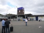
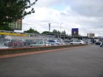
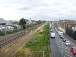
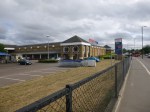
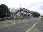
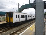
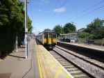
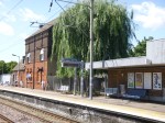
Before Crossrail 2 – Tottenham Hale
In the near five years since, I moved back to London, Tottenham Hale station has changed for the better, with the addition of a lift to the Victoria Line platforms and the reorganisation of buses, taxis and other traffic around the station.


But over the next few years, we should be seeing a lot more changes as this Future section in the Wikipedia entry for the station. The significant section is about Crossrail 2.
In February 2013, the Crossrail task force of business group London First, chaired by former Secretary of State for Transport Andrew Adonis, published its recommendations on Crossrail 2, favouring a route almost identical to the regional option proposed by TfL in 2011. The report was endorsed by Network Rail.
This proposal will see four tracks restored through Tottenham Hale and direct links to South-West London.
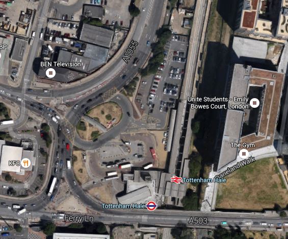
This Google Map shows the station and the surrounding area.
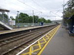
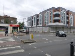
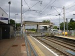
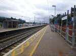
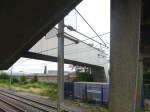
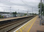
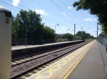
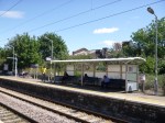
Tottenham Hale Station
This image appears to have been taken before the new Tottenham Hale Bus Station was created and the traffic system was changed.
With all the development going on, putting four tracks through the station will need a very narrow track and platform layout.
On this page of the Haringey web site are more details and an artist’s impression of the proposed station. This picture is shown in an article in the Tottenham Journal.

Proposed Tottenham Hale Station
I would suspect that a wide bridge would extend eastwards from this building over the tracks with lifts and escalators to the platforms. Looking at this image, it does strike me that the the architect has taken some of Charles Holden‘s stations as their inspiration.
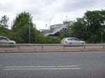
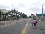
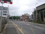
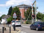
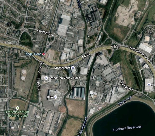
Before Crossrail 2 – Angel Road
Angel Road station is one for which there are big plans.
However, it will be on Crossrail 2 and will be one of the main features of the development at Meridian Water, which may give the station a new name.
This Google Map shows the station and the surrounding area as I walked to the Tesco superstore to get a bus to Tottenham Hale.

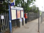
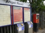
Angel Road Station
It is not the most beautiful of stations and the walking route is pretty dreadful.
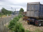
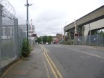
After I arrived, I walked Northwards along the line and then climbed up onto the flyover on a set of rusty steps, before walking alongside the road and under the North Circular Road, taking these pictures as I walked.


Angel Road must surely, be one of the most inaccessible stations for the able-bodied not just in London, but the whole of Europe. No wonder it is the second least-used station in London. I shall have to visit Sudbury and Harrow Road station, which sees fewer passengers. The station is also so lacking in facilities, that there isn’t even a convenient place to drop or pick-up a passenger with a vehicle.
The one good thing about this truly dreadful station is that there is more than adequate space to put the two extra tracks for stopping trains and Crossrail 2 between the current West Anglia Main Line and the busy Meridian Way.
Short term plans for this station include an hourly service pattern. So when there is limited development at the station, which must include decent pedestrian access direct across Meridian Way from IKEA and Tesco with perhaps a footbridge with lifts, the prognosis for passenger numbers at the station can only be upwards.
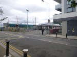
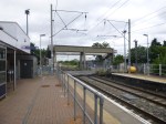
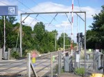
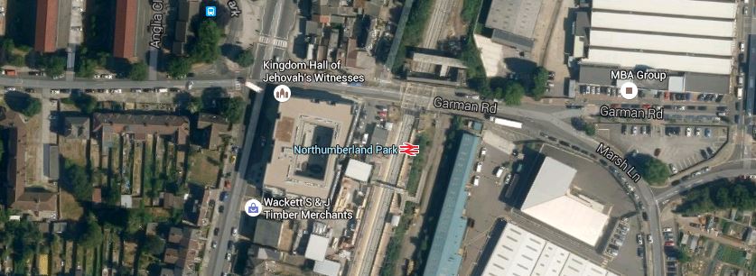
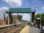
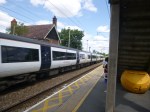
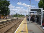
Before Crossrail 2 – Northumberland Park
Northumberland Park station is another one with a level crossing, as this Google Map of the station and the area shows.

Northumberland Park Station
I went to the station on a 476 bus and took these pictures.


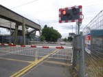


You get the impression, that despite the problems caused by the level crossing, no-one has ever had a decent holistic plan for this station.
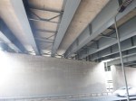
Before Crossrail 2 – A Narrow Four Track Station
As I said in my post on Brimsdown station, squeezing a four track railway through the station could be challenging.
But space can be saved, by not having any platforms on the fast lines, as in normal operation they will not be needed.
So would this be acceptable to the Health and Safety Authorities?
There is one station I use regularly, where two fast tacks run within ten metres or so of the slow platforms that I use.
That station is Shadwell station on the Docklands Light Railway, where the c2c lines into Fenchurch Street are on the other side of the viaduct. This Google Map shows the layout of tracks through the station.

Shadwell Station
I would also borrow the idea from the DLR of putting a single platform between the two slow lines.
At Shadwell too, there is no bridge, but a series of steps lead up and down to the single platform. To make the station step-free there is a single lift at the end of the platform.
Surprisingly, in 2010-11, Shadwell had ten times the passengers of Brimsdom.
So perhaps you’d put a wide subway under the tracks, with perhaps a height of two metres or whatever is normal and then connect it to the single platform using steps, escalators and just a single lift. A similar layout to this is also used at Burnham station on Crossrail.
This station design has several advantages
1. The subway could be used by those not using the train, as they went about their business.
2. Passenger gates, waiting rooms,toilets, kiosks and staff could be stationed where they are needed – On the platform!
3. No fast trains would pass platforms with people on them.
4. Only a few trains not stopping in the station would come alongside the platforms.
5. Width can be designed in where it is important for safety and operational needs. So the single platform would not be narrow and an adequate gap could be left to the fast lines.
6. A safety barrier could be used to separate the fast lines from the slow lines and the platform to cut the opportunities for suicide.
At Burnham they do get problems with the layout, when the relief (slow) lines are not working. Wikipedia says this.
Unusually for a station on the Great Western Main Line, Burnham was built with platforms that serve only the relief lines, which makes it vulnerable to losing services when engineering work closes the relief lines and leaves trains only on the main lines. Consequently the station is frequently served by a replacement bus service at night.
I suspect though that this wouldn’t be so much of a problem along the Lea Valley as there are alternative lines, which seem are connected by buses.
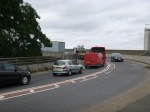
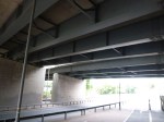
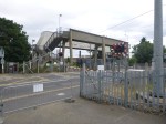
Before Crossrail 2 – Brimsdown
I have a bit of a love hate relationship with Brimsdown station, despite having rarely used it as a start or end point of a train journey. It’s just that I’ve spent many minutes waiting for trains to cross the level crossing, in a car or with my bike. When I worked at Enfield Rolling Mills, I seemed that every other day, I had to wait perhaps ten minutes for a train to pass.


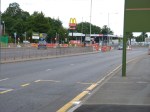
As you can see on a relatively quiet Sunday morning, the level crossing inconvenienced quite a few.
This Google Map shows the layout of the station and the roads around it.
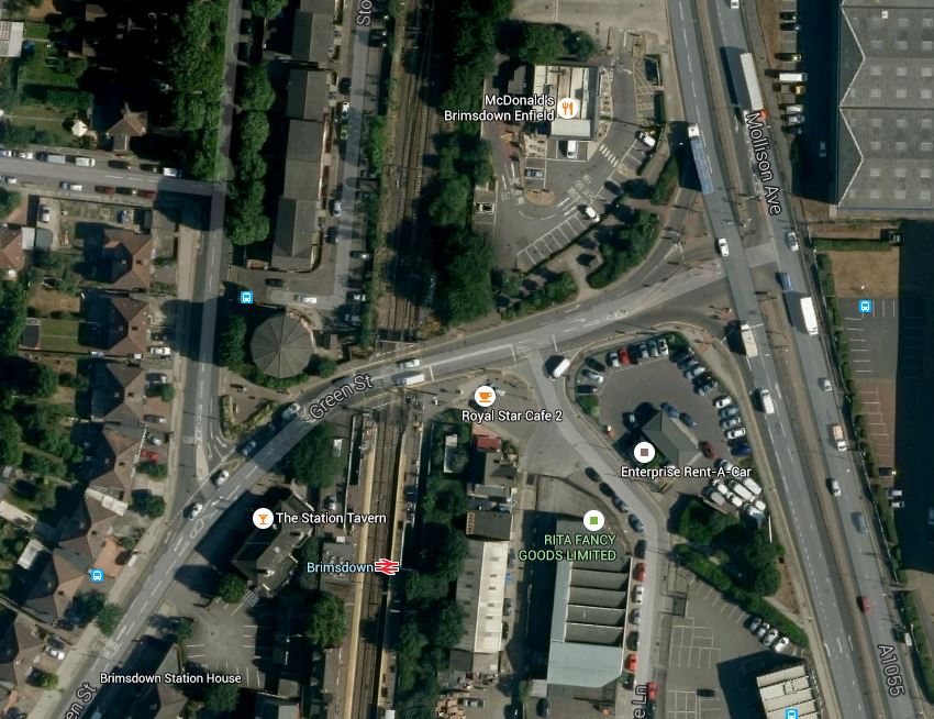
Brimsdown Station
This is going to be one station, where four-tracking and removal of the level crossing will not be easy.
I think that the four tracks could be squeezed through as there is green space on each side of the tracks, but there is so little space around the station that a bridge or an underpass for traffic would be impossible.
So I suspect the only thing to do is create alternative pedestrian and bicycle routes from one side to the other and close the level crossing.
It will not be popular!
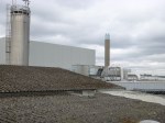
Before Crossrail 2 – Meridian Water
Meridian Water is a large property development in North London which sits in the curve of the North Circular Road between Edmonton and Walthamstow, with the large Tesco and IKEA stores on its Southern boundary and the Edmonton incinerator to the North. Wikipedia describes the current site like this.
The Meridian Water development site is centred 1.2 km south east of the town centre of Edmonton Green. It comprises an area of approximately 0.82 km², 0.72 km² of which is land capable of development.
In economic geography the site consists largely of vacant or ailing industrial/transport use, and in natural geography is characterised by the waterways of the mid-Lea which pass through or beside it to the east: theRiver Lee Navigation, the Lee Diversion, the River Lee Flood Relief Channel, and Pymmes and Salmons Brook.
It is very much a part of North London, that is not doing its best to boost the prosperity of the city. The developers have a £1.5billion plan for the development of the site. This Google Map shows the area.
Meridian Water
Most of the site is between the North Circular Road and the various rivers and canals, although a portion is on the north side of the A406. This aerial photograph with the development marked in red comes from this page on the Enfield Council web site.
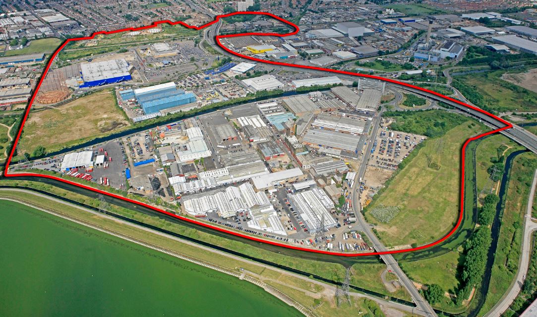
Aerial View Of Meridian Water
What has this massive development got to do with Crossrail 2?
Note the loop in the red boundary to the top of the picture. That encloses Angel Road station, which is clearly shown on the Google Map.
Meridian Water needs good transport links and this report in the Enfield Independent describes what Enfield Council and the developers are doing about it.
Enfield Borough Council has named the firm it has chosen to turn Angel Road Rail Station into a ‘thriving’ new hub.
Atkins, a global design and engineering firm, has been chosen to design the new rail and bus terminal, which will see an increased service of four trains per hour.
It is also stated in some place that the station will be renamed Meridian Water.
As Angel Road is on the list of probable Crossrail 2 stations in the Lea Valley, only a stupid developer would not want to have their development directly linked to Crossrail 2 and all the cornucopia of destinations it brings.
I also wonder how much the developers would pay to have the upgraded Meridian Water station, as a terminus, from where trains could turn back under London.
Before Crossrail 2 – Capacity And Level Crossings From Tottenham Hale To Hertford East
It is being proposed that Crossrail 2 goes up the West Anglia Main Line just after it surfaces from the central tunnel and then it would take the Hertford East Branch to the terminus at Hertford East station.
There are some issues and problems on the West Anglia Main Line that have to be solved before Crossrail 2 can be fully developed.
1. Services At Lea Bridge Station
The service level at the new Lea Bridge Station must be settled before the full plans for Crossrail 2 can be drawn up.
Wikipedia says that it is intended to have three trains per hour stopping at the station in both directions. All Southbound trains would go to Stratford and two Northbound would go to Bishops Stortford and one to Angel Road.
I don’t think that this level of service will be provided, as Transport for London like to set a minimum of four trains per hour, which exists on many places on the Overground. Surely, if the large development at Meridian Water is to realise it’s full potential, Angel Road will need a frequent service to Stratford and Liverpool Street, in addition to the full Crossrail 2 service.
There is also the complication of possible services between the Chingford Branch and Stratford using the Hall Farm Curve.
Between the Hall Farm Curve and Stratford, there is probably enough capacity on the two track line to accommodate the extra services, but what about north of where Crossrail 2 emerges from its central tunnel probably in the area of Coppermill Junction?
2. The Service Level On Crossrail 2
The service level from Liverpool Street to Hertford East is currently two trains per hour, which would probably be doubled to four trains per hour, as this is Transport for London’s preferred minimum.
The question has to be asked if there will still be a service between Hertford East and Liverpool Street via Hackney Downs?
Train commuters tend to be a conservative bunch and they may not take kindly to being told that instead of going into Liverpool Street they’re going to Angel and Kings Cross.
So I suspect that just as when Thameslink is completed there will still be services on the Sutton Loop Line, I suspect they’ll still be two trains per hour between Hertford East and Liverpool Street.
3. Extra Termini
The South Western end of Crossrail 2 has quite a few branch lines that can be used to extend the system, but in the North East, there aren’t the obvious termini.
With a railway like Crossrail 2, it is important that the line is balanced as this makes it easier to operate. The East London Line has four terminal platforms at both ends and each platform operates a four trains per hour service to its paired platform, thus giving sixteen trains per hour through the core. I think Thaneslink and Crossrail will both use a similar operating principle.
To accomplish this, Crossrail has the ability to turnback trains short of the terminus of the line at stations like West Drayton and Chadwell Heath,
I suspect that to make it easier to balance the service through the core tunnel, there will be one or more stations on Crossrail 2 that can turn trains back. The three most important stations; Tottenham Hale, Cheshunt and Broxbourne might be provided with such a facility. These stations could also act as interchanges between Cambridge and Stansted services to Crossrail 2.
I do wonder if the planners of Crossrail 2 are looking at putting a facility at Angel Road, which will become an important station because of the Meridian Water development.
There is certainly more opportunities to create extra termini on the line, than would there would appear from a cursory look.
4. Capacity From Tottenham Hale To Broxbourne
There are a lot of possibilities for making more and better use of Crossrail 2 services up the Lea Valley, but all of them will add to the number of trains running between Tottenham Hale and Broxbourne.
In addition if the services through Lea Bridge are increased then we’ll see the following trains running up the line.
- Stansted Expresses – Liverpool Street-Stansted Airport – 4 tph
- Cambridge Expreses – Liverpool Street-Cambridge – 2 tph
- Liverpool Street-Bishops Stortford – 2 tph
- Stratford-Bishops Stortford – 4 tph
- Liverpool Street-Hertford East – 2 tph
- Crossrail 2-Hertford East – 4 tph
The frequencies are speculation, but when you add them up, they do illustrate how more capacity is needed on the line, especially when you take into account the fact that the Cambridge and Stansted services will want to travel much faster than the local stopping services.
The planners for the West Anglia Main Line are already planning an increase in the number of lines from two to four as this Future Developments section in Wikipedia says.
If Stansted Airport’s expansion is authorised it is planned that the line will see many further changes. Long term proposals include four-tracking between Coppermill Junction and Broxbourne junction; an additional tunnel and platform edge on the Stansted Airport branch; one additional train per hour serving Stansted and up to six further trains per hour at peak times, including four into Stratford as a terminus. More stations, such as Broxbourne, will also have platform extensions to accommodate 12-car trains.
It seems likely that two tracks will be built alongside the line to Cheshunt as part of Crossrail 2. Intermediate stations from Tottenham Hale will transfer to Crossrail 2 releasing capacity on the main line for additional trains
I think that the last paragraph could be saying that stations like Northumberland Park, Angel Road, Ponders End, Brimsdown, Enfield Lock and Waltham Cross will have two fast tracks without platforms and two slow Crossrail 2/local tracks with platforms.
Whatever it means, the four-tracking is one of those projects that is needed whether Crossrail 2 is built or not.
I would hope that Network Rail’s surveyors have shown that four-tracking is possible. It will certainly need a design of narrow station.
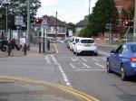
5. Level Crossings
Levels crossings are numerous on the West Anglia Main Line, with examples at Northumberland Park, Brimsdown and Enfield Lock, south of Waltham Cross. The post on Enfield Lock shows queues at the crossing. This Google Map shows queues at Northumberland Park.
Northumberland Park Station
Removing this level crossing would look to be particularly difficult, but surely with the development of Meridian Water just to the North East, the time is now right to sort it once and for all.
Incidentally, when I worked at Enfield Rolling Mills in the 1960s, driving across the railway was a slow and tedious business, because of jams at the Brimsdown and Enfield Lock crossings.
In the 1980s the A1055 Meridian Way was built, which must have taken some pressure from these two level crossings.
I have found this page from Hansard in 1958, which mentions the Brimsdown level crossing and another which must have now been closed at Ponders End.
It’s now nearly sixty years!
I think any plan to four-track the West Anglia Main Line must include removal of these crossings.
6. Conclusion
I think it is essential that the West Anglia Main Line is four-tracked and the level crossings south of Broxbourne are removed before any other work on Crossrail 2 starts. I would also rebuild the Hall Farm Curve at the same time.
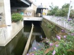
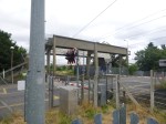
Before Crossrail 2 – Enfield Lock
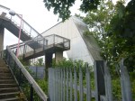
After visiting the house where my mother was born, I took a bus to Enfield Lock station.


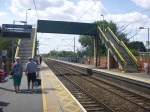
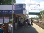
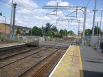
The footbridge must be one of the steepest I’ve seen. At least you can cross the line at the level crossing by the station.
This Google Map shows the station.
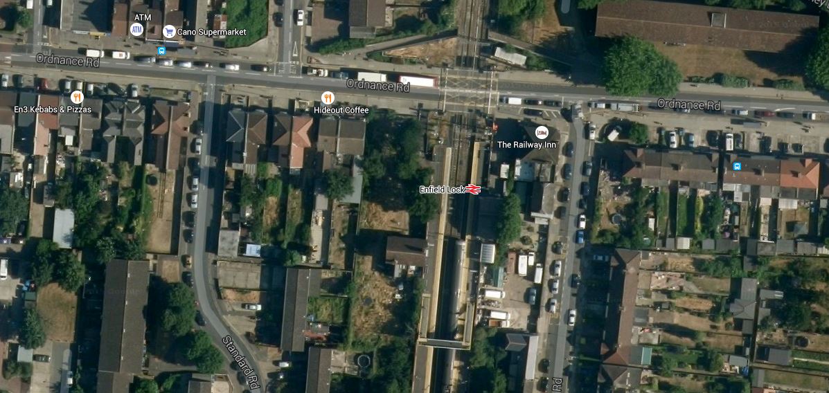
Enfield Lock Station
Note that there appears to be a pedestrian subway on the North side of the level crossing, which also seems to be holding up lots of traffic.
As there is another level crossing at Brimsdown station, when I worked at Enfield Rolling Mills in the 1960s, driving across the railway was a slow and tedious business.
In the 1980s the A1055 Meridian Way was built, which must take some pressure from these two level crossings and a third at Northumberland Park station.
T
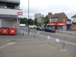
Before Crossrail 2 – Ponders End
Just as I have tag Before Crossrail that documents Crossrail before construction started, I have now started one for Crossrail 2.
This is the first post and it shows Ponders End station.


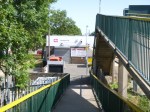

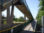


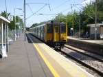
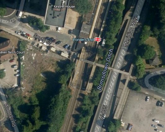
It is not the worst station I have seen, but although entry to the Northbound platform is step free, it is rather a climb to get across the tracks to the other platform and the bridge over the Meridian Way that runs alongside the railway. This Google Map shows the station.
Pomders End Station
It is definitely not a station with an abundance of facilities, although it is claimed to be step-free.
The station certainly needs at least a couple of lifts and perhaps another on the other side of Median Way.
