Why I’m In Favour Of Cycling Superhighways
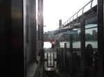
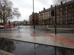
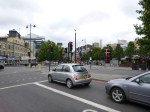
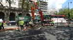
Near me there is a junction, which drivers access, like Lewis Hamilton going into the pits at Silverstone.
It means they can get through to the City quicker.
But over the last few weeks, the number of drivers taking the bend quickly and putting pedestrians in danger has dropped significantly. I’ve also seen drivers go hurtling off doiwn the road only to come back a couple of minutes later, with faces like thunder.
I just give them a knowing look!
So why has a dangerous junction become a lot safer?
Cycling Superhighway 1, goes across the rat-run and it has been used to choke off the rats, as the pictures show.
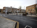
I’m now very much in favour of the Cycling Superhughways despite being told by every taxi-driver I use, that they are a complete pain!
But then I don’t drive!
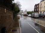
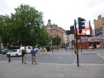
From Monument To Westminster Along The East-West Cycle Superhighway
I walked the East-West Cycle Superhighway in two sections, as I crossed the bridges to have lunch on the South Bank by the Tate Modern.


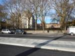


It certainly is getting a move on, with some sections almost ready to open.
A few notes follow.
The Arthur Street Site
A new block is being created on this site, but before that happens, the site is being used to access the underground parts of Bank station.
This map from a TfL document show the site.
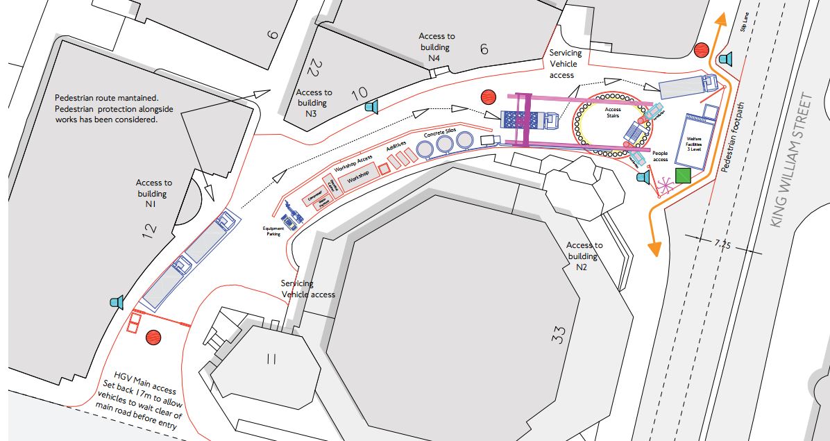
The Arthur Street Site
This fact sheet explains how the Arthur Street Site is to be used. This is said.
To deliver the proposed station improvements there is a need for a worksite in Arthur Street. This site is above the new tunnel alignment, and enables access via a shaft directly down to the new tunnel. This separates the underground tunnelling works from the extensive demolition and basement construction works on the Cannon Street site, facilitating an earlier completion of the tunnelling works and a reduction of the overall impact of the project on the City.
As with everything in the City of London, it all seems very crowded.
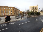
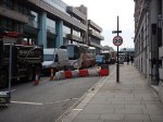
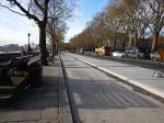
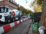
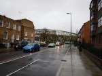
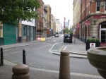
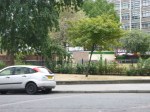
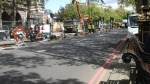
Along Upper Thames Street
As the pictures show the Cycle Superhighway is going on the North side of this road.
This road has always been jammed solid with cars, taxis and a lot of trucks.
The construction phase of the Cycle Superhighway isn’t exactly helping traffic flows.
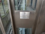
The Millennium Inclinator
The Millennium Inclinator is by the Millennium Bridge and I used it to get up the steps to the bridge, before crossing to get some lunch on the South Bank.
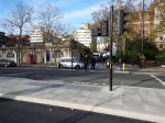
Westward From Blackfriars
After lunch, I crossed back to the North over Blackfriars Bridge and followed the Cycle Superhighway to Westminster station.
Conclusions
As with Cycle Superhighway CS5 from Oval to Pimlico, from what I could see, it seems to be well-designed and built.
I’ll look forward to hiring a bike at one end and riding it to the other.
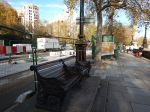
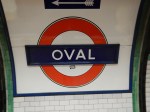
Walking The Cycle Superhighway CS5 From Oval Station To Pimlico
The pictures tell the story, as I walked from Oval tube station to Pimlico along Cycle Superhighway CS5


This is the official Transport for London map for CS5.
Cycle Superhighway CS5
This is a Google Map from Oval Station To Pimlico

From Oval Station To Pimlico
Some of my thoughts.
- The route is an easy one to cycle, as it is virtually flat.
- I was impressed with the way that the designers of the Cycle Superhighway had threaded it through the area, with good attention to bus stops, traffic signals and signage.
- Before I walked towards Pimlico, I had a quick walk in the direction of Kennington and checked out the other cycle routes being constructed. The walking routes were good.
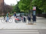
- I particularly liked the bike rental station in the dry in a railway arch. How many people like getting on a wet saddle? The Brownlees perhaps!
- The route was also an easy one to walk, as the designers had catered for walkers in the design.
- The builders had done an excellent job in making all the surfaces good for cyclists and walking.
- I was a bit surprised on how fast I was walking.
- I did feel though, that at times, there was a very crowded line of traffic alongside an almost empty cycle lane. The Jeremy Clarksons of this world might say something.
If all the Superhighways are designed and built to this standard, they will be a big asset to London.
I think in areas, where people are objecting to their imposition, they may actually win a few friends.
It’s a long time, since I was the parent of a young child and even longer since I used to cycle about four miles to school in the midst of the traffic.
But I would have no worries about my thirteen-year-old granddaughter cycling on a track like I saw today.
Walthamstow Doesn’t Like Going Dutch!
This article from the Waltham Forest Guardian is entitled Grand opening of mini Holland scheme dominated by angry protestors.
I have posted it, as we are getting the Cycle Superhighway through where I live in the northern part of D Beauvoir Town in the near future and there are various opposing groups wanting or not wanting road closures and different parking restrictions.
As a Control Engineer, who has quite a bit of experience of dealing with complex liquid flow systems in chemical plants, I think that Councils tend to take a too definitive approach to the problem.
So my experience of chemical plants was in the late 1960s and we used an amazing PACE 231R. But that machine was the state-of-the-art computer of its day for solving differential equations. The computer was also the unrecognised star of the amazing rescue of the astronauts on Apollo 13.
The aim of the modelling in the chemical plant was to get different chemical streams flowing at the right rate into various reaction vessels, where they could be safely reacted and handled. The reaction products would then flow off in a controlled manner in other directions.
On a chemical plant the flows are controlled by various measures, but typically by valves, of which a domestic example is your mains water stop cock.
Often after modelling the flow system, it was found that the various valves were set almost to a fixed position for normal running of the plant.
If you look at traffic flows in say Walthamstow Village, as in the article, or De Beauvoir Town, you have an area bounded by main routes, which is crossed in a random manner by buses, cars, cyclists, pedestrians and trucks.
So what is different between modelling fluid and traffic flows?
Mathematically, it is the same process, but there is no variable method for regulating traffic flows.
The only regulation in De Beauvoir Town and other traffic systems is the brain of cyclists, pedestrians and regular drivers, who adapt their route according to their knowledge.
What the Mini Holland system in Walthamstow and other systems try to do is modify the thought processes of regular uses. The problem is that it may do that with the regular uses, but it doesn’t influence say your casual driver, who ventures into the area.
So in Walthamstow the local businesses and others see the drop in traffic and protest.
We need to apply more subtle ways of regulating the traffic, through areas like Walthamstow Village, that are understood by everybody.
- Speed limits should be set to twenty and they should be enforced. The Police need all the money they can get, so I would be happy to see mobile enforcement cameras on the top of Police vehicles parked at the side of the road.
- Computer-controlled traffic lights can be used as restrictors, so for instance at a notorious place where rat-runners enter an area, a pedestrian-crossing with lights could be placed. Timings could be adjusted automatically to the day of the week and time of the day.
- Speed humps aren’t as affective as they used to be. Perhaps car suspensions are better and Councils have softened them, so they don’t get sued?
- Cambridge has used rising bollards, that are automatically opened by certain vehicles, like buses, taxis, fire engines and ambulances.
- Even physical gates can even be opened and closed at various times. Suppose to calm an area, there was a need to shut off a road past a church. Why couldn’t it be opened on Sundays?
We are not being innovative enough.
Solutions like mini Hollands and just shutting routes are just too simplistic for a complex city like London.
As an aside, I’m old enough to remember London’s first experiment in traffic managment.
Green Lanes through Harringay in the 1960s was even more crowded with traffic than it is today. So traffic lights were put every fifty metres or so between Harringay Green Lanes and Turnpike Lane stations. There are quite a lot less lights today.
It cut the traffic through the area, but we all diverted through the side streets and made the lives of residents hell!
Walking Cycle Superhighway Route 1 From My House To Liverpool University
As I did this in an hour, it wasn’t the University in Liverpool, but their London Campus in Finsbury Square to which I walked along Cycle Superhighway Route 1.


I joined the Sperhighway at the junction of Culford and Tottenham Roads about a hundred metres from my house.
Note that the pictures are generally in order going North to South, with some pictures taken looking back.
I think it is true to say that it is a pretty good cycling route, which from Dalston to the City is pretty flat, with very little cross traffic. I think that the major junctions will be light-controlled.
I do hope they put bike hire stations all along the route.
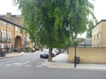
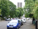
A Tree-Lined Section Of Cycle Superhighway Route 1
I took this picture, as I walked along Culford Road to go to my house.
A Tree-Lined Section Of Cycle Superhighway Route 1
Like most of the roads round here, it is lined by numerous mature trees. I haven’t looked at the species in detail, but if it’s anything like my road, they’ll be a mixture, with generally two of each randomly planted to no particular pattern.
Do cyclists bother about leaves on the road?
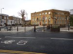
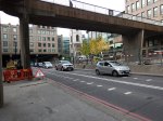
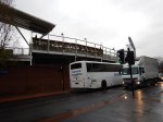
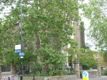
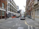
Cycle Superhighway Construction At Temple
This site seems to feature in a lot of BBC Radio 5 Live’s traffic reports.
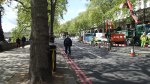

You can understand, why various factions are against the Cycle Superhighways.
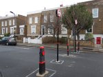
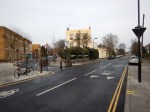
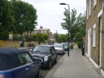
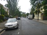
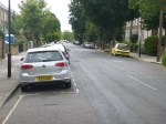
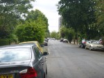
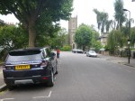
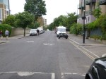
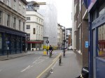
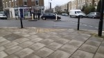
A Rat Run Is Going To Be Cut
The Ardleigh Road junction off Southgate Road, near to me is a dangerous place for pedestrians. Cars, trucks, vans and cyclists like to peel off Southgate Road and see how fast they can turn down Ardleigh Road.

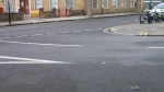
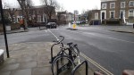

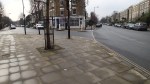
I took these pictures this morning, as I walked across De Beauvoir Town to my doctor’s surgery. Later on, two visitors to my house, who know the area well, told me that they are always very careful near that junction.
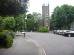
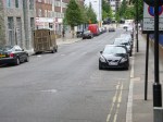
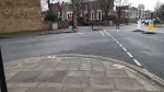
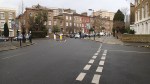
But the other end of Ardleigh Road, where it meets Culford and Engelfield Roads near the Scolt Head pub, is going to become a dead end for vehicles because Cycle Superhighway Route 1 goes up Culford Road, which will go straight across Engelfield Road towards the City.
This Google Earth image shows the area.
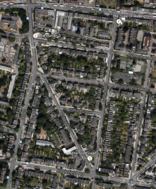
Ardleigh Road
On the map note how the Scolt Head sits between Ardleigh Road and Culford Road. Culford Road is going to be straightened and will take the cycling route on a north-south axis through De Beauvoir Town crossing the Balls Pond Road by the Duke of Wellington pub.
You can clearly see from the map how tempting it is to drive fast off Southgate Road into Ardleigh Road just south of the Hunter S pub. Someone told me, that the wide junction of Southgate and Ardleigh Roads was to allow trams and trolley buses to turn. This photostream on Flickr shows, trams, trolley-buses and buses in the area. The first picture in the photostream was taken on the western side of Southgate Road opposite the Hunter S looking towards the Balls Pond Road.
There are going to be a lot of very angry rats. And at least one very happy pedestrian!
How Will Cycle Superhighway Route 1 Affect De Beauvoir Town?
And me in particular?
Transport for London have published their plans for Cycle Superhighway Route 1, The good news is that I’m only a hundred metres away from where it runs between Liverpool Street and White Hart Lane. So at least it won’t have a negative effect on the value of my house.
It will affect my walking routes significantly.
1. My doctor’s Surgery is on the Superhighway and as he is a keen cyclist I think he’ll be pleased too. I might actually get a replacement bike to avoid the walk. Or I could lobby for a Boris Bike station close to my house? I’d actually prefer the latter, as then if the bike got nicked, it’s not my problem.
2. One of the problems walking round here, is that drivers treat the turn out of Southgate Road into Ardleigh Road as a chicane that should be taken at speed. As many don’t bother to signal someone is going to get flattened on that junction in the future. Hopefully, as Ardleigh Road is being blocked at the southern end, fewer drivers will use it as a rat run. So it looks the Superhighway will have a collateral benefit for pedestrians here.
3. The arrangements where the Superhighway crosses the Balls Pond Road will make walking to Dalston High Street easier as a new pedestrian crossing will be in a better place than the current one. At least for me!
4. Some of the other changes to cycle and pedestrian routes just to the north of the Balls Pond Road will also make it easier to walk to and from Dalston Kingsland station, the Rio Cinema and the northern part of the High Street. The route is quieter and you avoid the narow pavements round Dalston Junction.
Other residents of the area, may have different views on how it will affect pedestrians. But hopefully, the large number of cyclists on Southgate Road will swap to the Superhighway, easing the traffic on that road and making it easier to coss.
So you can understand, why I’m pretty much in favour of the scheme.
A few Boris Bike stations along the Superhighway would probably get me cycling again!
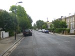
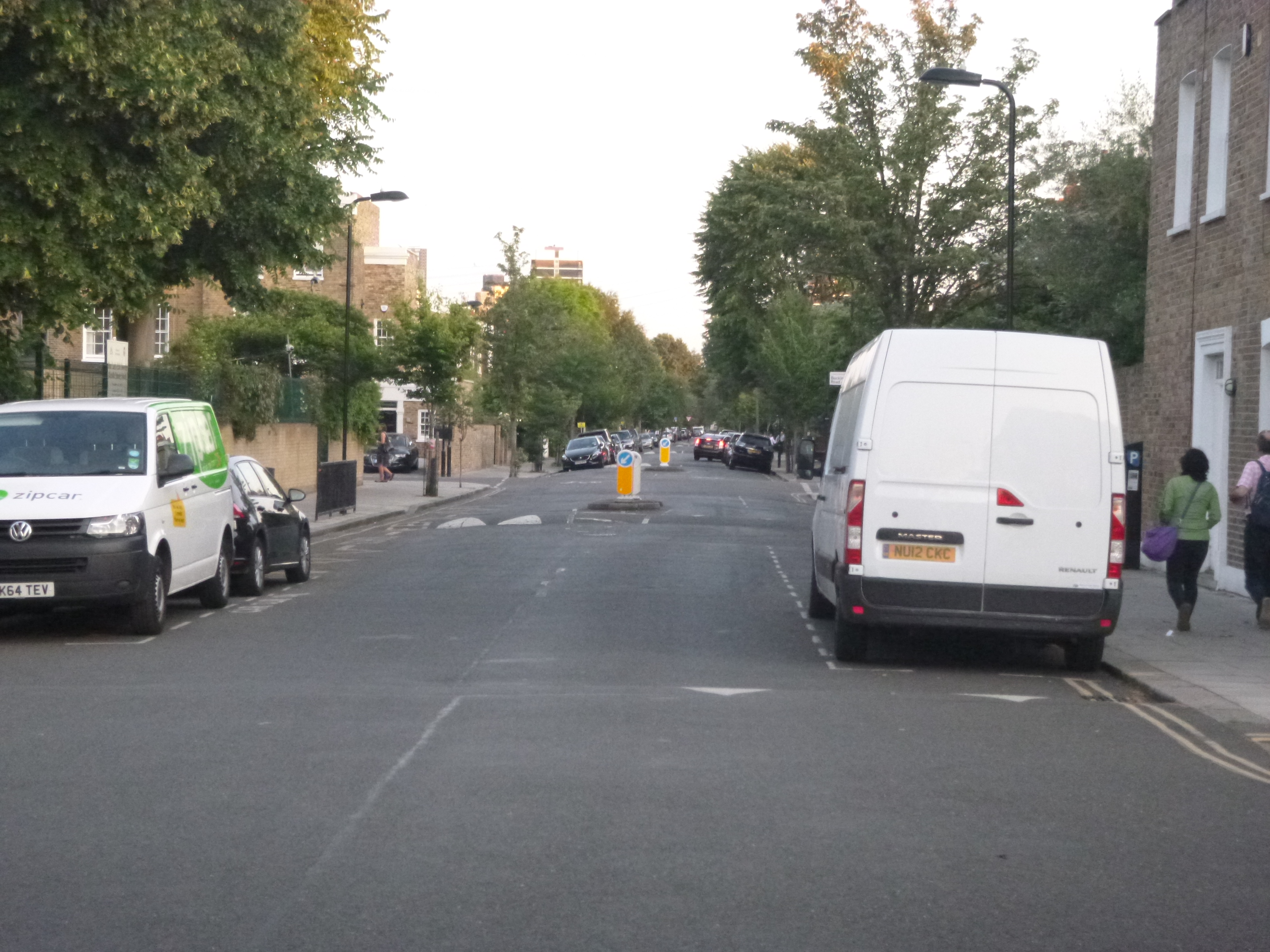
De Beauvoir Town’s Cycle Superhighway
De Beauvoir Town is flat and good cycling terrain. I took these pictures this morning in Lawford Road.


I must get back on my bike, as it’s an easy way to get around and we have a couple of roads like this with little vehicular traffic, as they are blocked by iron posts, which are just visible in some of the pictures.
In some ways because the roads are wide and parked cars aren’t a problem, they can use this approach of putting the cyclists down the middle of the road.
Wouldn’t it have been nice if all of London had been built with wide streets like this part of Hackney.
