Ducking And Diving Between Crossrail And The Central Line
There are stations that Crossrail and the Central Line have in common.
Ealing Broadway
Ealing Broadway station is one of the Western termini of the Central Line.
But is isn’t particularly well arranged to allow a fast interchange.
The change between an Eastbound Crossrail train and the Central Line is easy and is just a walk across of a few metres.
However, changing between a Westbound train and the Central Line involves a trip over a bridge.
Bond Street
Bond Street station links both lines to the Jubilee Line.
The change between Crossrail and the Jubilee Line looks to be easy, provided you are at the Western end of a Crossrail train.
The change between Crossrail and the Central Line, also has the Western end advice and also needs a lengththy walk underground.
A Look At Bond Street Station gives more details, of the various connections.
I do think that regular users of the new Bond Street station, with its three lines and multiple entrances spread over a wide area, will quickly learn that they will need to get off at the right end of a train and use the correct entrance.
This map from Westminster Council shows the station entrances.

Bond Street Station Entrances
The station entrances are as follows.
- A – Northern Underground entrance.
- B – Davies Street Crossrail entrance
- C – Hanover Square Crossrail entrance.
A few thoughts.
- As it looks like Hanover Square will be returned to its original state, it would appear that the Hanover Square entrance to Bond Street station, will be an entrance with a garden.
- Fenwicks, Hamleys, John Lewis and Libertys, which are in a ring around Hanover Square will probably be best reached using the Hanover Square entrance.
- Walking between Oxford Street station and the Hanover Square entrance isn’t too taxing, but it could be improved by wider pavements and more pedestrianisation.
The biggest change at the Eastern end will occur, when and if TfL decide to make Oxford Street station step-free.
This map from carto.metro.free.fr shows the various lines from Bond Street to Tottenham Court Road.
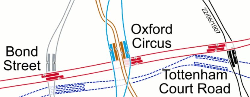
Bond Street, Oxford Street And Tottenham Court Road Stations
It would appear that the Bakerloo Line goes under Regent Street with the Central Line under Oxford Street.
Consider.
- Could it be possible to dig a new entrance, with lifts and escalators down to the deep level lines from the South West corner of Oxford Circus?
- It it was feasible, it might even be possible to build the entrance, without disturbing the current station.
- The entrance would be a short walk to Hanover Square.
- Crossrail would gain the missing link to the Victoria Line.
The solution will depend heavily on the development in the area.
Tottenham Court Road
A lot of what is said for Bond Street, can also be said for Tottenham Court Road station..
- It is a double-ended station, with lots of entrances.
- It connects Crossrail and the Central Line to an important North-South line; the Charing Cross Branch of the Northern Line.
- It will bring hoards of shoppers to a hopefully pedestrianised Oxford Street.
I said more in The Double-Ended Tottenham Court Road Crossrail Station.
I’m not sure how difficult the interchange will be between the Crossrail and the Central Line will be at Tottenham Court Road, but I suspect that the unknowledgeable traveller, at the wrong end of a Crossrail train, might have a long walk.
Certainly, travellers changing to the Northern Line at Tottenham Court Road, will probably find they need to be at the Eastern end of the Crossrail train.
Liverpool Street
Liverpool Street and Moorgate stations share a massive Crossrail station, that I wrote about in Liverpool Street Station Disentagled.
When travelling on Crossrail and changing at this station, you’ll need the Western end of the train for.
- Moorgate Main Line Trains, which will become the Great Northern Metro.
- Northern Line
And the Eastern end for.
- Central Line
- Liverpool Street Main Line Trains
It would appear, that Circle, District and Metropolitan Lines will be easily accessible from both ends of the Crossrail train.
Get it wrong and you could have an unexpected two hundred metre walk.
This map from carto.metro.free.fr shows the layout of lines at Liverpool Street and Moorgate stations.
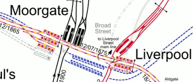
Lines At Moorgate And Liverpool Street Stations
So many journeys from the complex will now be a lot easier.
- Liverpool Street to Canary Wharf
- Liverpool Street to Heathrow
- Liverpool Street to North London and South Hertfordshire
- Liverpool Street to South and South-East ~London.
Liverpool Street is going to be a very busy Crossrail station.
Stratford
Stratford station is a cross-plstform interchange of the highest quality between the Central Line and Crossrail.
I’m certain that passengers travelling from the East to stations like Holborn, Oxford Circus, Marble Arch and Shepherds Bush, will think about changing at Stratford from Crossrail, rather than at later stations.
The journey might be more convenient and you might get a seat.
Journey Times
But the factor that will decide, where a Crossrail passenger will get the Central Line or vice-versa will probably be decided by journey time.
Looking at a journeys, the following times are predicted by the various planning tools.
- Ealing Broadway to Stratford – Central Line – 46 minutes – Crossrail – 26 minutes
- Bond Street to Stratford – Central Line – 20 minutes – Crossrail – 15 minutes
- Ealing Broadway to Bond Street – Central Line – 23 minutes – Crossrail – 11 minutes
So it looks like Crossrail will be significantly quicker.
Conclusions
I think that Londoners will do what always do and duck and dive across London, finding the best route for their particular journey.
The ones who will have problems will be the irregular passengers, who don’t know the station layouts.
For this reason, TfL need to get the information on Crossrail to a much higher standard than today.
One thing on their side will be that Crossrail trains will be wi-fi and 4G enabled.
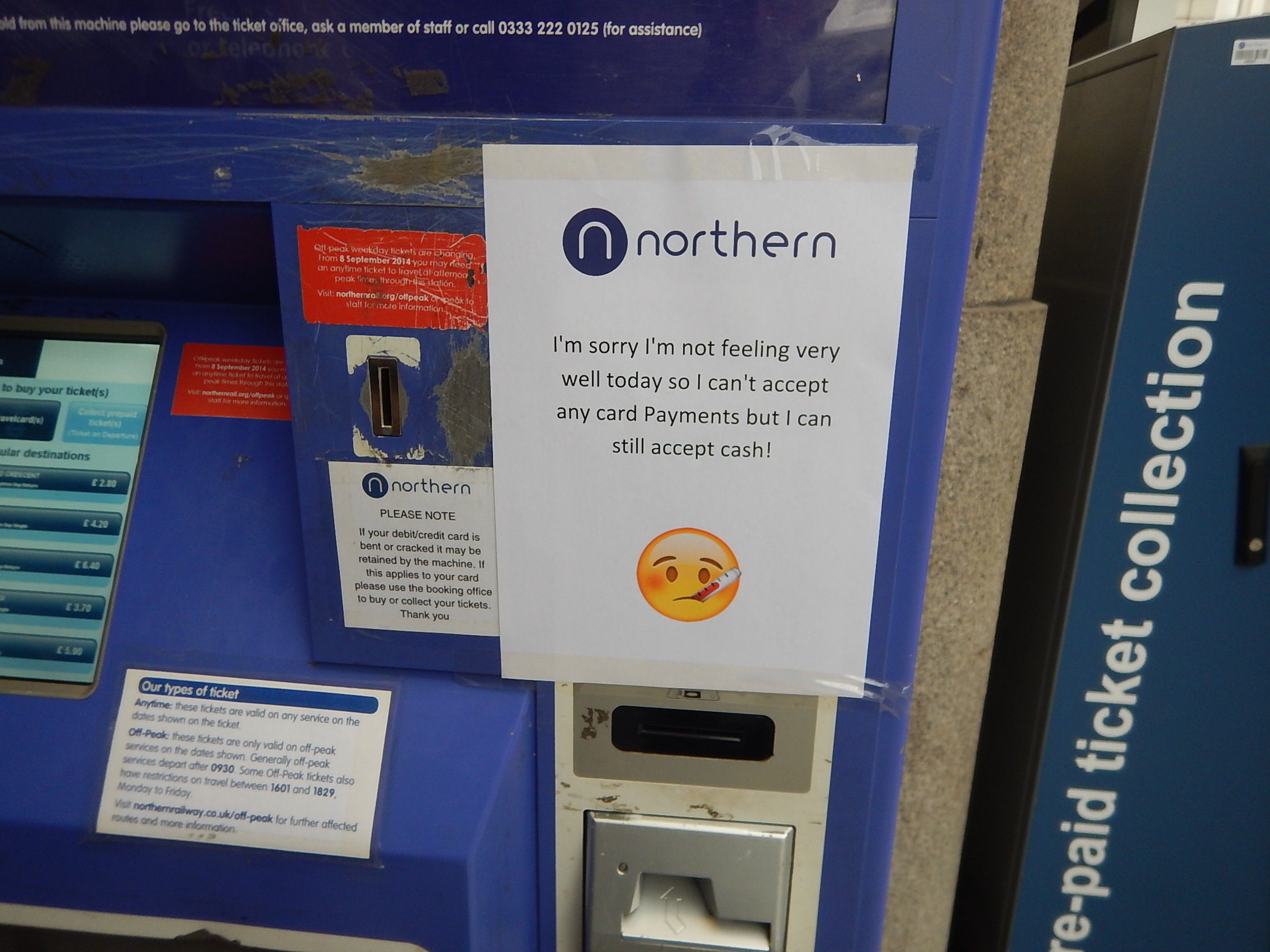
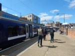
Northern Rail’s Ticket Machines
This picture sums up Northern Rail’s ticketing machines; lonely, unreliable and crap.
A Niortern Rail Ticket Machine At Manchester Victoria Station
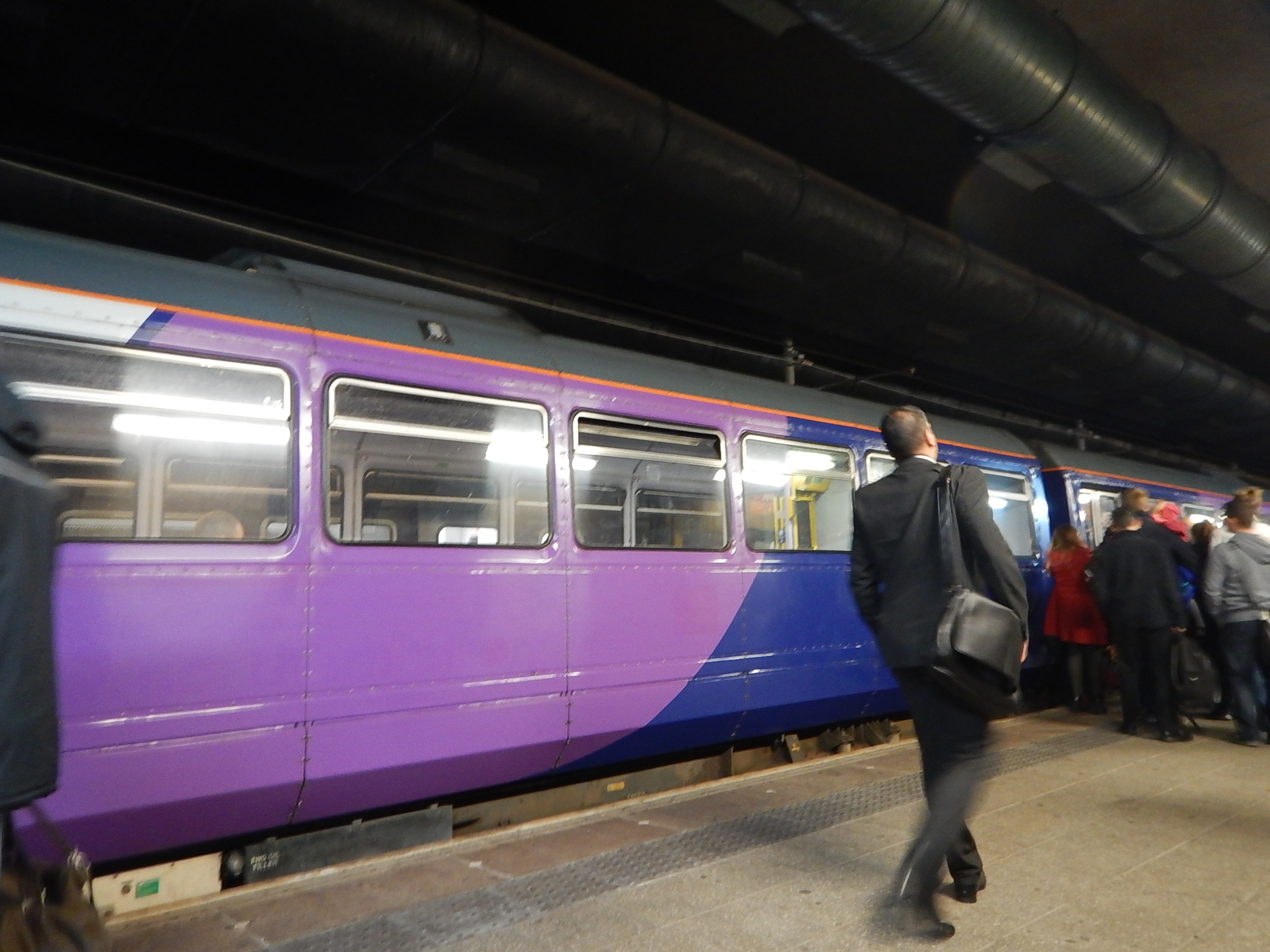
This machine at Manchester Victoria station did work though and after scratching around for a few coins, I was able to get to Blackburn.
A few other comments on my trip to Blackburn on Saturday.
- On my arrival at Liverpool Lime Street station, the queue for the ticket machine was at least fifteen people. So by the time, I’d bought a ticket, my train had left.
- At Manchester Victoria station, there were only two machines for a very busy station.
- At Blackburn station, the machine was hidden in the subway.
- I never saw a machine at the two small stations; Clitheroe and Whalley.
- The last two stations have independent platforms, so if you’re travelling from one without a ticket machine, you’ll have to have a long walk first.
- When I passed through Manchester Piccasdilly on Saturday evening, neither of the Northern Rail ticket machines were fully operational.
The company needs a lot more machines, hopefully with better functionality and reliability. They should also make sure they’re better placed.
Whilst, I’m giving Northern Rail a good kicking, here’s some more annoyances
A couple of stations I visited had a truly dreadful mobile phone signal. I think the law should be that all stations and bus stops should have a top class signal, so that those, who need to text or call their partner, friend or parents can do so.
The two-coach Class 156 train, I rode from Blackburn to Preston was the most overcrowded train I’ve ever ridden. The staff must have known it was so bad as Blackpool had just been beaten at Accrington. So why weren’t we told by the station staff?
Probably because they were keeping well away!
At least we had a nun on board and she probably prayed for our safe deliverance to Preston.
Surely, Northern could have rustled up another or bigger train from somewhere. A four-car Pacer would have been manna from heaven!
What’s missing from this picture?
Getting My Train To Blackburn
Although, it was the Peak, there was no prominent staff on the platform to help unload and load this four-car Pacer.
I had to look it up on the Internet, whether our train stopped at Rochdale for a fellow traveller.
Incidentally, Manchester Victoria is starting to look tired and dirty. Is it all the diesel exhaust?
Northern also seem to specialise in bad information on stations. The bus information at Blackburn was abysmal and pointed you to a non-existent bus stop to get to Ewood Park.
I do wonder that Northern are worried if they improve things, then too many passengers might want to use the service and they’d have to buy more trains.
Walking Routes Around London Bridge Station
The walking routes around London Bridge station have been revealed.
They are shown in this plan.

London Bridge Concourse
It would appear that the new concourse is all at street level and that lifts, stairs and escalators take you to the fifteen platforms that run across the top.
It all sounds very simple and passenger friendly.
In some ways the key will be information, in that say you want to go to Purley, you will need to be directed there without fuss.
I have a feeling that the best way to work the station, is as you approach to call up http://www.nationalrail.co.uk on your mobile phone, choose Live Departure Boards and then type in London Bridge and your destination. As this information is generally available fifteen minutes before the train leaves, this should give you enough time to walk to the platform.
I’ve done it so many times on my phone, I just type “nat” to get started.
I would hope that the visual information system is just as quick.
A Walk Between Colchester’s Two Stations
I’ve not been to Colchester many times.
Once I remember, I had to go to Celia’s Chambers on North Hill and for some reason I took the train and walked. I think, it could have been that we were going out with friends from the Chambers and she must have driven me home. But it was probably around twenty years ago.
So as I’d certainly never been to Colchester Town station and wanted to get some photos for Making Sense Of The New East Anglia Franchise, I thought it might be a please to go and have a walk to Colchester station to get the train home.
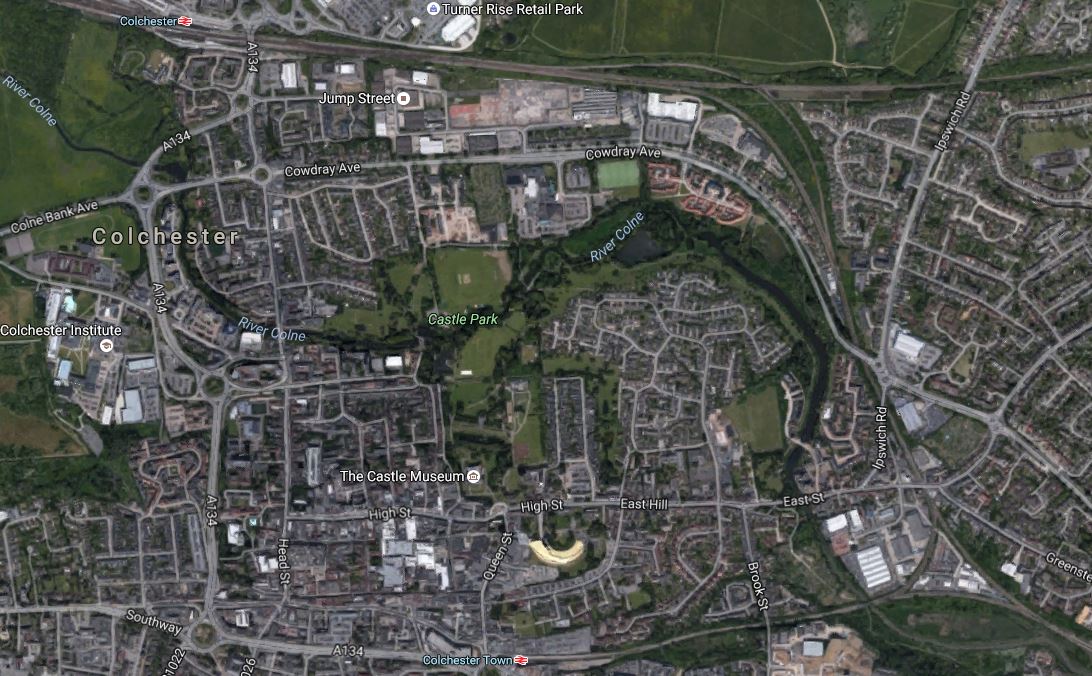
This Google Map shows the two stations and the town.
Colchester Stations
Colchester station is at the top, with the Great Eastern Main Line going through in a West-East direction, from Chelmsford to Ipswich.
The Sunshine Coast Line breaks off the main line, turns South and goes out of the South-East corner of the map.
There is a branch from this line, that goes from a triangular junction to Colchester Town station, which is in the midde at the bottom of the map.
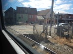
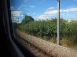
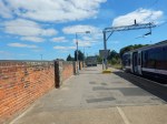
These are pictures, I took on my walk.


Note.
- It is not a very well-signposted route.
- There is plenty of space at Colchester Town station and it would be possible to walk across between the two platforms.
- It is quite a steep walk up from both stations.
- What didn’t help, was that the Town Centre was being landscaped and there was builders rubbish everywhere.
If you look at the Google Map, I’m certain there must be a better walking route, than the one I used. But then if Councils put up decent walking maps and routes, the natives complain, as they say they know their town and city well.
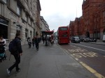
Who Nicked The Display?
There used to be a Next Bus Display on this stop at the Angel.
Who Nicked The Display?
Why was it removed?
It is such a pain, as like many others, I’m often returning from shopping to Dalston without a spare hand to text the stop on my mobile phone.
I assume it will be replaced.
A Tram Map In Munich
When it comes to local transport and walking maps, it’s a case of the bigger the better.

A Large Munich Tram Map
This was in the tram information centre in Munich Hauptbahnhof.
Every main station should have a local transport information centre and the largest map possible.
At the station, I also took this picture.

Tram Sign In Munich
I was going for supper and I needed to get a tram 16 to St. Emmeram, which would drop me in the area of one of the best gluten-free pizzadromes in Europe; Pizzesco.
So what could go wrong?
There was a demonstration in the area and the trams stopped running, leaving me in a part of MunichI didn’t know!
Although, Pizzesco was very crowded and I had to wait, I eventually got my delicious pizza and a bottle of gluten-free beer.
Coming back to my hotel, I eventually found a tram outside the Deutsche Museum.
A Good Information Board
I saw this information board at Kings Cross station.


I think the seat on the right, should be by the Tube Map.
But it’s a good attempt!
Is This The Worst-Placed Bus Map In London?
These pictures show the bus map at Kidbrooke station.

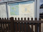
I was checking if I could get a bus to Abbey Wood station.
To read anything, you had to stand in the flower bed, but then the fence was in the way of the entries under A.
You can’t! But how could I find out?
It’s Less Than Twenty Days Until The Rail Timetable Change
The new rail timetable for the UK comes into affect on the 15th May 2016.
The Oracle (the National Railweb site) has a page that lists all the timetable changes. This page gives all the changes for December 2015.
But where is the page for May 2016?
Some of the changes are reflected in the timetables, like the start of services from Lea Bridge station, which I wrote about in The Full Service From Lea Bridge Station Starts On The 16th May 2016.
But other services are not in the on-line timetable!
Some companies also seem to have decided that not to publicise their plans for May 2016.
It is just not good enough!
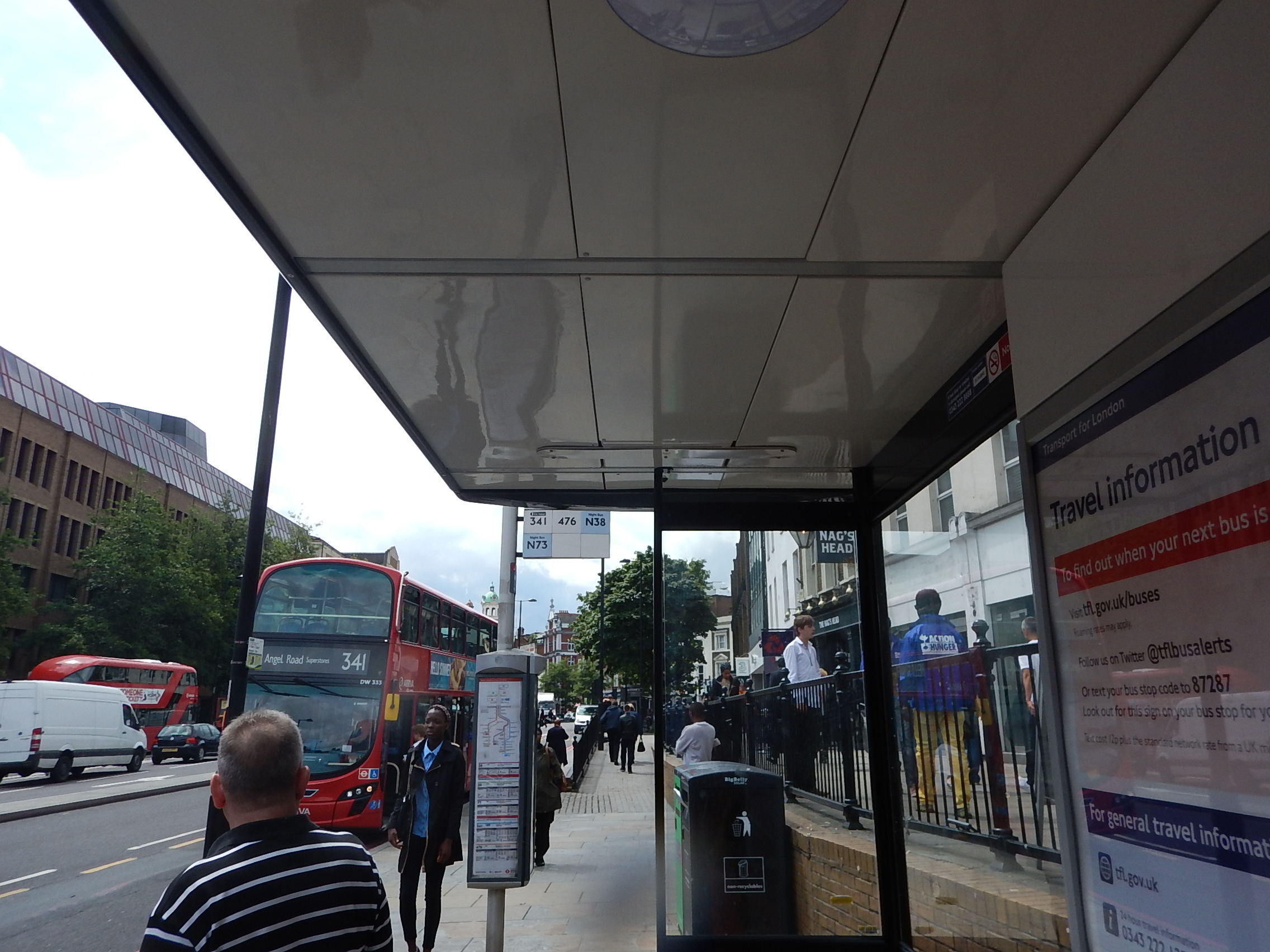
Two Bus Stops On High Holborn
I went to visit one of my investments on Fetter Lane and I knew that if I could find the stop I could get a 341 bus from the area to Islington or my home.
There were two bus-stops and I knew I was on the right side of the road.

But which one do I go to? I had to walk to both of them to find the answer.
I don’t show it in the pictures, but there was a street sign between the two stops.
Wouldn’t it be nice to have a finger post to tell you where the stops are for various buses?
High Holborn is also one of those places, where there aren’t enough crossings.
Does London need a reporting system for poor street layouts or an army of elderly/disabled/teenage street walkers to collect possible simple improvements to the walking realm in the city?
