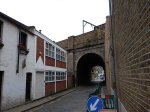
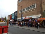
Underneath And Above The Arches
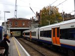
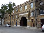
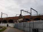
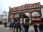
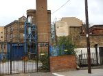
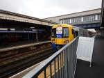
London Fields station has improved in some ways with Overgroundisation since I wrote Before Overground – London Fields in September 2014.
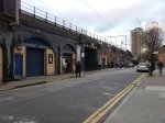


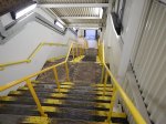


It just shows what you can do with an army of cleaners and painters. And a touch of Overground Orange!
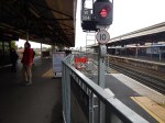
But there is still the problem of step-free access to solve.
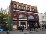
This Google Map shows how difficult this could be.
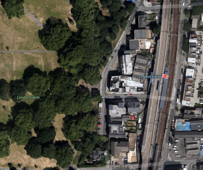
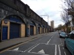
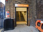
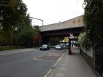
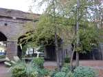
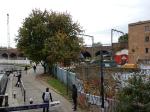
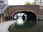
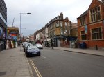
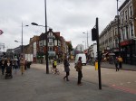
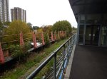
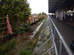
London Fields Station
The site is cramped, with the platform and stairs for the Liverpool Street platform squeezed between the slow and fast lines.
I wouldn’t be surprised if Transport for London, put the addition of step-free access to this station at the very back of the queue.
Unless of course, they could persuade a developer to do something very imaginative and expensive, which they can market as having its own station and a large park with an Olympic-sized swimming pool.
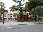
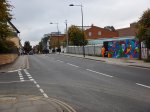
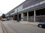
A Wall Of Flats At West Hampstead Station
I stopped off at West Hampstead station to see anything was happening on the new station.

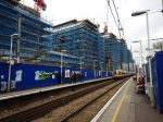
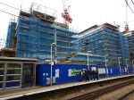
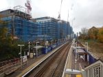

Nothing much yet!
This article on West Hampstead Life gives details of the new station.
I will reserve judgement on the flats until they’re finished. Especially, on a windy day!
Toronto Looks At The Overground
My Google Alert for Overground found this article from the Toronto Star entitled London’s other railway holds many lessons for Toronto, Mayor John Tory.
The Mayor had come to London to look at Crossrail and it seems that the Overground had impressed him.
But then the Overground, is only one of a family of local City networks in the UK, like those in Birmingham, Cardiff, Leeds and Liverpool, that have done the same as London and taken a run-down network, cleaned it up with bright stations, improved the trains, provided a frequent service and visible customer service, often linked with smart ticketing.
Living as I do on the Overground by Dalston Junction station, I know the concept works and it has only one serious problem – As more capacity is provided it quickly fills up. For example, I did one stop yesterday at eleven in the morning and all the seats were taken.
There is no doubt that quality sells!
Camden Town Station Capacity Upgrade
Camden Town station on the Northern Line of the London Underground is one of the most congested stations on the network.
It finally looks like something is happening to ease the problems as this consultation is now on the TfL website.
TfL’s first rebuilding plans are described in Wikipedia and they needed a lot of demolition. Wikipedia says this.
Apart from complaints about destruction of one of the ox-blood tiled station buildings, there is a significant controversy over the demolition of the buildings to the north. Complaints particularly centred on London Underground’s desire to replace the buildings with modern construction said to be out of place and out of scale with the remainder of Camden Town, together with complaints about the loss of the buildings and market themselves. This led to a public inquiry being held. In January 2004, consultants Arup published plans commissioned by Save Camden, a group of local market traders, for a remodelling that would preserve the majority of the threatened buildings, including the market. In 2005 Transport for London lost its appeal to the office of the Deputy Prime Minister and the scheme has been cancelled.
So this has led to the current plan, where TfL are proposing a second entrance on Buck Street. They say this in the consultation.
A possible site for a new station entrance would be on Buck Street, between Camden High Street and Kentish Town Road. It would lead to three new escalators and two lifts. Below ground there would be more space to change between trains. This would in turn enable future capacity benefits on the Northern line.
The most significant point is the capacity upgrade on the line, which involves splitting the Northern Line into two.
- The Edgware Branch would take the Charing Cross route to Kennington before continuing to Battersea and eventually Clapham Junction.
- The High Barnet Branch would take the Bank route to Kennington and then go to Morden.
The only thing stopping this is the current mess that is Camden Town.
I would assume that this upgrade would include an easy walk-across for passengers changing between the two new lines at Camden Town.
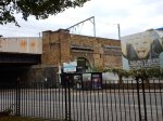
On the surface, it would appear that little will be done, except to build the new station entrance on the site of a closed school. This map shows the position of the new entrance.
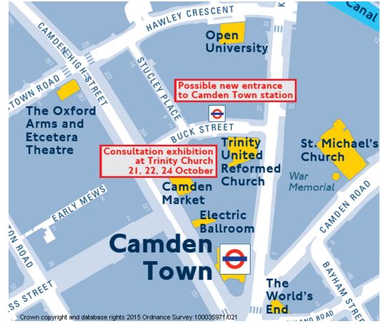
New Entrance To Camden Town Station
It would be ideally placed for the hoards of visitors going to and from Camden Lock and the various markets.
It is also worth looking at the layout of lines in the area.
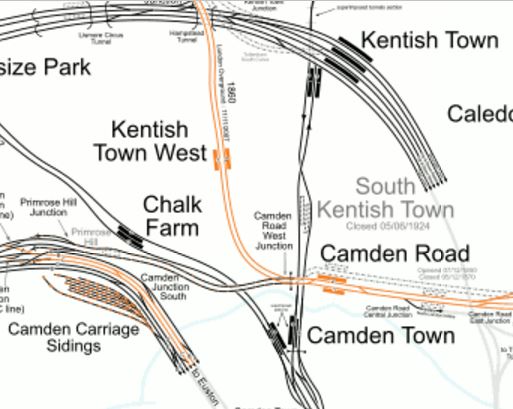
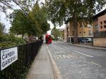
Camden Town And Camden Road Stations
Note how Camden Road station is actually quite close to the northern end of the platforms at Camden Town station.
So would it be possible to create a better link between the two stations?
I would certainly feel that when the Northern Line is split and extended to Battersea, many people would use the interchange. I certainly would, as getting to places like Charing Cross or Waterloo is one of those journeys you don’t start from Hackney.
future.
In Transport for London’s London Infrastructure Plan for 2050, this is said.
This will allow, for example, higher frequency services out of terminals such as Victoria to South London centres such as Croydon and the development of major interchange hubs that act in a similar way to Clapham Junction in the South West. e.g. Camden Interchange between Camden Road and Camden Town stations.
So obviously, TfL are thinking along these lines.
The two stations are an official out-of-station interchange.
A Google Map also shows Buck Street and the North London Line.
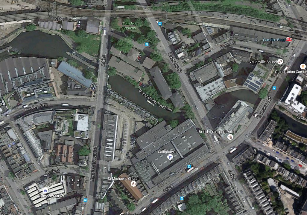
Buck Street To Camden Road
Buck Street is the curved road in the bottom left corner of the map, just above the white building which is Camden Market. On the North side of the street is Hawley Infant and Nursery School, which will become the site of the second entrance to Camden Town station.
The North London Line runs across the top of the map with Camden Road station at the right. It is worthwhile noting the fork in the line.
- The southern arm is a freight-only line, that leads to the disused Primrose Hill station and the Watford DC Line.
- The northern arm is the North London Line to Willesden Junction.
At one time it was proposed that changes be made here, as detailed in Wikipedia, but nothing seems to be planned at the moment.
The only thing the proposal shows is that TfL have been thinking hard about this area.
But I do think that London’s universe-class tunnellers could create an escalator connection between the two stations, if that was decided how the interchange was to be created.
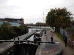
There could also be other simpler ways to create better walking routes between Camden Road station and Buck Street. I will have to check, but I don’t think it is possible to walk along the tow-path of the Regent’s Canal.
Later I took a train to Camden Road station and then walked by a roundabout route to Camden Town station.


Do I have any conclusions and questions?
- The current walking route between the two stations is crowded and possibly dangerous. It also involves crossing two roads at lights.
- Because there is now steps down from Camden Road to the Regent’s Canal Tow Path, there is already a walking route between Camden Road station and Camden Lock, which does not mean any roads have to be crossed. Some improvements to the surface and perhaps guard and hand rails would need to be made to bring it up to a safe standard.
- It might be possible to install lifts, at Camden Road, Kentish Town Road and Camden Lock to make the tow path fully-accessible to all.
- Until Camden Town station is extended and improved, it could be sign-posted as an alternative route to Camden Lock.
- As you approach Camden Lock, where the railway runs along the Regent’s Canal, what plans are there for development in the area?
- The Regent’s Canal Tow Path, would also enable a walking route between Camden Road station and the new Buck Street Entrance to Camden Town station.
- It would appear that the Hawley Infant and Nursery School is not a bad place for a second entrance to Camden Town station, as it is well placed for the attractions between Camden Town and Camden Lock.
- The Buck Street site is probably big enough to create a second entrance, which has a capacity substantially greater than the current station. The consultation talks of three new escalators and two lifts, but capacity is often determined by the space at the bottom of the lifts/escalators, which I’m sure would be more than adequate.
- The area round Camden Town station is more than incredibly busy.
- There are bus stops everywhere and they could do with being reorganised. As an example, getting a bus to London Zoo is not very easy.
- There are quite a few low-grade buildings in the area, that few would miss.
- How was planning permission for the Sainsbury’s supermarket obtained?
- Incidentally, the store was built in 1988, so it must be coming up for refurbishment soon.
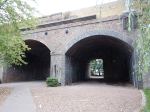
But looking at the North London Line as it passes over Camden Gardens and along the canal, it struck me that something dramatic and modern, but that still fitted in with the surroundings could be created that connected the high viaduct of the North London Line to the ground below and then by escalators and/or lifts to the Northern Line tunnels. I then looked at the Google Map of the area from Camden Road station to Camden Gardens.
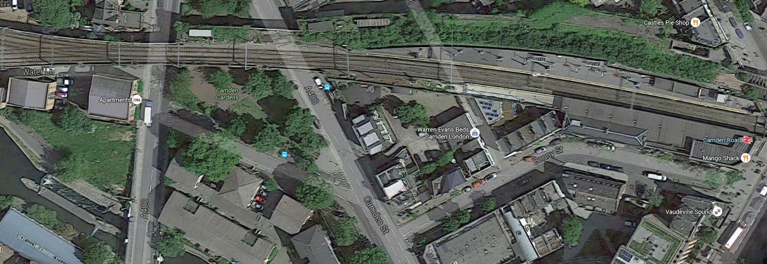
To The West Of Camden Road Station
Note the disused twin-track rail loop around Camden Road station to the north side of the station. There is also a smaller space on the south side that leads almost to Camden Gardens.
Surely, an imaginative architect could use these resources to extend the station to the area of the gardens, from where some means of descending and ascending would be provided. Large lifts or escalators fully enclosed in glass would be something I’ve seen elsewhere and they would contrast well with the bricks of the viaduct.
With my project management hat on, I also believe that TfL have chosen a design, that will be easy to build.
- Phase 1 – Build the second entrance with its lifts and escalators as almost a second station connected to the existing platforms. There is another station on the Underground that is effectively two stations – Knightsbridge, because of Harrods.
- Phase 2 – Open the second entrance and prove that it can handle all the passengers who want to use the station.
- Phase 3 – Close and refurbish the existing station.
The link to Camden Road station would probably be incorporated into Phase 1.
I don’t know anything about the safety arrangements of stations, but surely a twin station’s duplication must make it simpler.
There is a chance to create an iconic Camden Interchange station, that truly reflects the unconventional nature of Camden Town.
Increased Frequencies On The East London Line
This article from the South London Press is entitled More Trains For The London Overground. The article says Transport for London (TfL) wants to make two service improvements are on the East London Line.
- From 2018, there will be an extra two trains per hour (tph) between Dalston Junction and Crystal Palace.
- From 2019, there will be four additional trains between Dalston Junction and Clapham Junction, making the frequency 8 tph.
I found the source of the report on TfL’s web site. This is a handy summary from the Appendix.
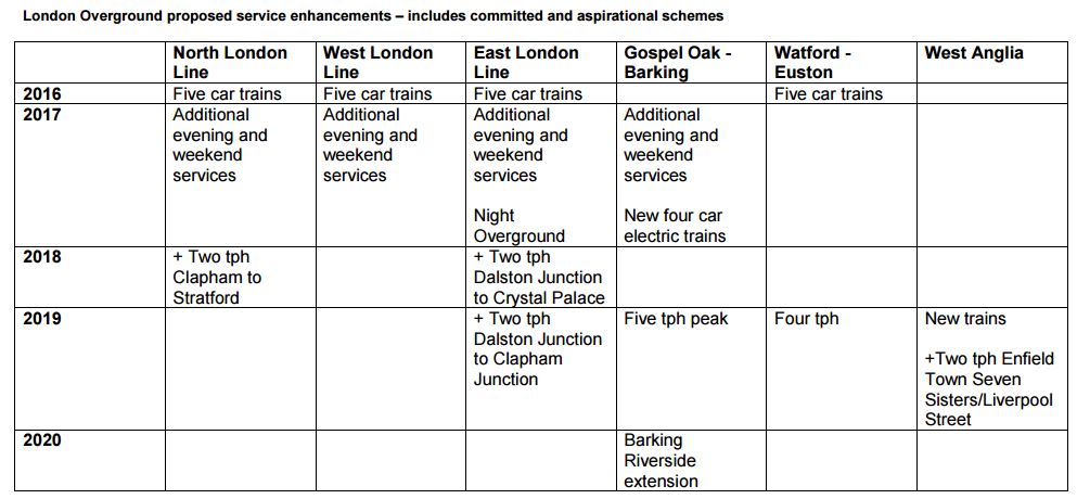
LO Improvements
It looks like the pattern of extra trains is as follows.
- From 2018, there will be an extra two trains per hour (tph) between Dalston Junction and Crystal Palace.
- From 2019, there will be an extra 2 tph between Dalston Junction and Clapham Junction, making the frequency 6 tph.
Currently both these services go to Highbury and Islington.
It’s interesting that these increased services are starting in 2018-2019! This times them to start just as Crossrail and Thameslink are opening, which probably means that TfL are expecting that a lot of Crossrail passengers will change to and from the East London Line at Whitechapel. As I will, no doubt!
Buried in TfL’s Transport Plan for 2050 says are possible plans on improving the service on the East London Line.
- Better late night and overnight services on the Overground.
- Automatic Train Operation on the core of the line from Dalston Junction to Surrey Quays to increase service frequency from 16 tph to possibly as high as 24 tph.
- Six car trains on the Overground.
At the moment the East London Line has 16 four-car trains an hour in the core route, so 24 six-car trains will mean an increase of capacity of 2.25.
The announced service improvements will mean that 20 tph will be passing Whitechapel and Canada Water.
So will we see other services started to bring the line up to the 24 tph capacity?
This would give London three almost-new 24 tph lines crossing the city; Crossrail, Thameslink and the East London Line, in an H-shape.
TfL don’t sem to be planning it yet!
The increase in frequency from Dalston Junction to Clapham Junction station is very welcome to me, as I often take a train to Clapham Junction to go south to Brighton, Gatwick or other places.
Increasing the frequency to Clapham Junction may also be needed, as extra stations and other changes are added to this branch of the East London Line.
- New Bermondsey station will be opened to take advantage of the six services per hour between Dalston Junction and Clapham Junction.
- Clapham Junction might be served by the Northern Line Extension some time in the early 2020s.
- Clapham Junction may well be served with other services to take the pressure off Victoria and Waterloo. It always strikes me as a station, that since its latest improvements could handle more services.
- Camberwell station, which has been promised for some time, could finally be under way, to connect the East London Line to Thameslink at Loughborough Junction station. A design based on the split-level principles of Smethwick Galton Bridge station may solve the connection problem.
The only difficulty of this frequency could be that there might need to be upgrades at Clapham Junction to turnback more trains.
Increasing the frequency to Crystal Palace station will be of less use to me, as I’ve rarely used that service.
If it linked to Tramlink, I might use it more, but that extension to Tramlink was dropped by Boris and there seems to be no enthusiasm on anybody’s part to build it.
I do wonder if Transport for London have other plans for Crystal Palace in their mind.
Look at this Google Map showing Crystal Palace, Penge West and Penge East stations.
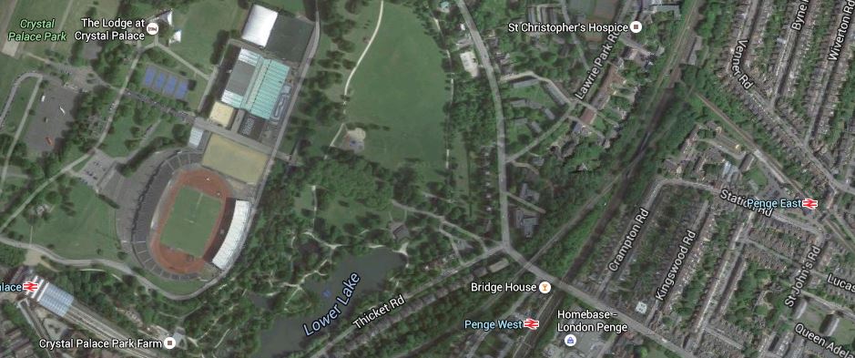
Crystal Palace And Penge
Crystal Palace is a fully modernised and accessible station with lifts, a cafe and lots of platforms, so it makes an ideal terminus for trains on the East London Line.
Penge West is not the best appointed of stations and I suspect if a much better alternative was provided nearby, no-one would miss the station.
Penge East is on the Victoria to Orpington Line and needs upgrading for step-free access. But it has the problem of a Listed footbridge, that should be burnt. I wrote about it in An Exploration At Penge.
Buried in TfL’s Plan for 2050, is the one-word; Penge, as a possible new station. The line through Penge East passes under both the Brighton Main Line and the branch to Crystal Palace, in an area of railway land.
After looking at Smethwick Galton Bridge station or as I called it, Birmingham’s Four-Poster station, I do feel that a good architect could design a station, that solved the challenging problem of the difference in height and created a fully-accessible interchange. This station could have a lot going for it, as services passing through the station would include.
- 4 tph between Victoria and Orpington on the Victoria to Orpington Line
- 6 tph between Dalston Junction and Crystal Palace and 4 tph between Dalston Junction and West Croydon on the East London Line.
- A selection of the East London Line services would go to Highbury and Islington.
- 2 tph between London Bridge and Caterham on the Brighton Main Line.
- Services between Bedford/St. Albans/St. Pancras and Beckenham Junction on the Victoria to Orpington Line
It would increase connectivity greatly all over East London, both North and South of the river.
I suspect too, that the station would open up the brownfield land around the railway for property development.
I think there is a strong case to watch that area of Penge!
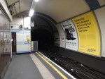
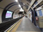
Could Another Overground Platform Be Squeezed In At Clapham Junction Station?
Clapham Junction station has two Overground platforms, 1 and 2, at the Northern side of the station.
This Google Map shows the platforms at the station.
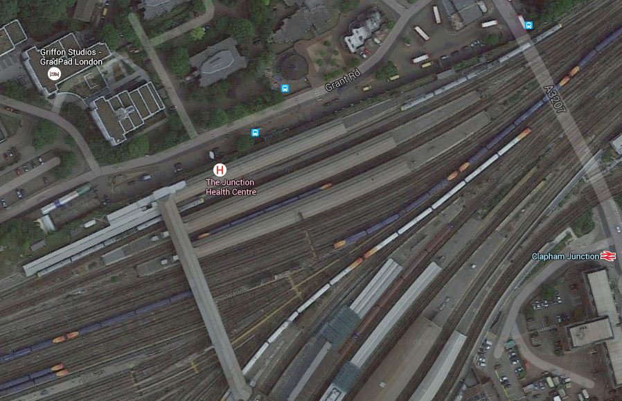
Clapham Junction Platforms 1 and 2
Platforms 1 and 2 are continuous at the top, with one on the left. Note that Class 378 trains are in both platforms.
These pictures show Platforms 1 and 2 and the space behind.
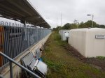
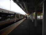
I don’t know whether another platform could be fitted in, but I suspect, if London Overground needed another one, then with some reconstruction and movement of the various cabins and boxes, then one could be built.
Will The London Overground Aventras Have Energy Storage?
When I wrote Is Liverpool Planning To Invade Manchester By Train?, I enclosed a clip from the October 2015 Edition of Modern Railways about energy storage on the proposed new Liverpool trains.
Merseytravel has indicated that it will be seeking ‘innovative proposals’ from manufacturers, with considerable emphasis being placed on the overall cost of operating the fleet rather than just the basic cost of the trains themselves. Options such as regenerative braking and onboard systems to store energy under braking to be used for acceleration will attract particular interest. The independently-powered EMU (IPEMU or battery train) concept evaluated earlier this year on a modified Class 379 in East Anglia ,might see an application here.
So if energy storage is good for Scousers, surely it would be good for Cockneys! I could add Brummies, Geordies, Mancunians, Bristolians, Glaswegians, Hullensians and lots of others too!
I feel that using the new trains in IPEMU-mode would be a better way to run electric passenger trains on the Gospel Oak to Barking and Dudding Hill Lines, as all the inept disruption of putting up the catenary could be performed in a more relaxed manner.
But are there any other advantages, other than the energy saving and flexibility, if the trains have energy storage or an IPEMU capability?
- This morning, the wires are down on the London Overground at Hampstead, so trains are stopped. An IPEMU could possibly get through to provide a limited service.
- At times, lines are closed for work on the electrification and Rail Replacement Buses have to be used. Would an IPEMU be able to provide a service in some cases, by perhaps using another track? Obviously, safety for the workforce would have to be ensured, but Network Rail is improving its working methods all the time.
- London has two different electrification systems; overhead and third rail. Would an IPEMU allow extra services to be developed, which bridge the two systems?
- Would an IPEMU give advantages in the design, construction and operation of depots, by needing less electrification, as trains could move under their own own power.
- Suppose a terminal station like Chingford needs to be rebuilt or a new station needs to be built, would it cost less to design and build a station, if the station had no electrification?
Even if the current order for Aventra trains for the London Overground isn’t delivered with energy storage and an IPEMU capability, I believe it will become the standard for it to be installed on trains in the near future.
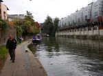
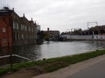
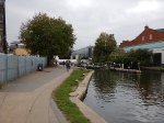
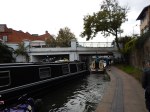
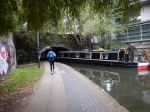
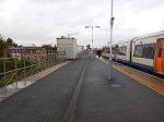
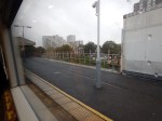
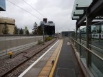
The Canonbury Interchange In The Wet
Passengers going from Stratford to stations on the East London Line, often change at Canonbury, where it is a walk across from North London Line trains going West to East London Line trains going South, which are pften timed to be in the station together. I often do the change, as after one stop to Dalston Junction station, I can get any number of buses to just around the corner from where I live and can get home without crossing any roads.
A few days ago, I did the change in the wet.
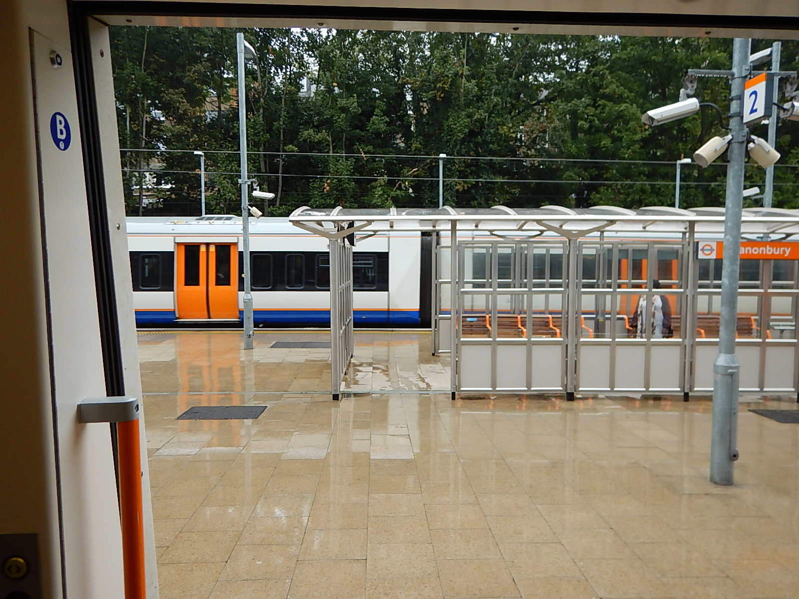
The Canonbury Interchange In The Wet
Recently, Transport for London have placed a shelter in the middle of the platform, so it was a run from the Westbound train into the shelter and after a few minutes, another run straight from the shelter into the open door of the Southbound train, from where I took the picture, just as another Westbound train was arriving.
Canonbury station is an excellent example of how good design can improve the daily lives of everybody.
So often modern designs look good, but just annoy a lot of the population, who aren’t in the designer’s age, sexual and ethnic group.
Platforms 11 and 12 At Stratford
In December this year, an service hourly service called STAR will be started between Stratford and Angel Road along the Temple Mills Branch of the Lea Valley Lines via Lea Bridge, Tottenham Hale and Northumberland Park stations. Wikipedia says this about services to and from the Angel Road station.
Angel Road is only served by a number of trains every weekday to and from Stratford. No services operate at the station on weekends or public holidays. However, from December 2015 Angel Road will receive an hourly service to Stratford that will start here and vice versa, the service will be known as (STAR).
STAR services will obviously call at the new Lea Bridge station, when it opens next year.
I shall probably use the service occasionally, when I need to get home from Stratford, as Lea Bridge station is on the 56 bus route that passes by my house.
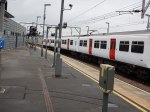
At Stratford, there are two platforms that have been positioned to give easy access to the Temple Mills Branch through Lea Bridge and Tottenham Hale and onwards to Stansted Airport. I took these pictures of the platforms.

They sit at the end of the two London Overground platforms, which are the Eastern terminus of the North London Line. You can see two Class 378 trains peeking out from underneath the rusty bridge. (Not my name, but an East London nickname, I’ve heard from locals and station staff!) This Google Map shows the layout of the platforms.
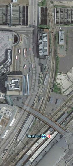
Stratford Platforms 11 And 12
In the map, platforms 11 and 12 curve away to the North from underneath the rusty bridge, which connects Eastfield to Stratford town centre.
Platform 11 is the Easternmost platform and is used as the terminus of the Stratford to Bishops Stortford service, which has been rumoured many would like extended to Stansted.
Platforms 1 and 2 for the North London Line are connected to the unused Platform 12, by a simple walkway, so in the future if Platform 12 is used for the STAR services, passengers going from anywhere on the North London Line to Tottenham Hale or Angel Road would just have an easy interchange.
As the STAR service will initially be an hourly service and the Bishops Stortford service is half-hourly and they run from platforms connected by a subway, I can’t help feeling that this will be an arrangement that won’t last long, before it is improved.
Suppose you arrive at Stratford wanting to get home to your house near Lea Bridge station and just miss the hourly train. Do you wait an hour for another train or catch the Bishops Stortford train, that will probably stop at Lea Bridge, after the new station opens?
It would be so much easier, if the two local services started from an shared island platform or at lest two platforms with a level walk between them.
This is going to get very complicated, if some of the plans for Stratford services up the Lea Valley are implemented.
- I’ve read several times, that reinstatement of the link to Stansted Airport is an aspiration of many, especially as Stratford is close to the Olympic Park and it is an important rail interchange and a terminus for two branches of the DLR and the Jubilee and North London Lines.
- There are also aspirations to start a direct service between the Chingford branch and Stratford using the reinstated Hall Farm Curve.
- With all of the housing, business and leisure developments along the lower Lea Valley, it will not be long before an hourly STAR service is inadequate.
- If the Hall Farm Curve is reinstated, would there be a need to run services between the Chingford branch and the North London Line?
- There is also the Crossrail effect, which in the Lea Valley’s case could not be just Crossrail, but Crossrail 2 if that ever gets built.
- Perhaps unlikely now, but I feel that at some point the Dalston Eastern Curve will be reopened, so enabling services between say Walthamstow to South London.
- Is there a need to better connect Stratford International station to the main regional complex?
I can’t help feeling that the layout of Platforms 11 and 12 will at some time not be able to handle all the Lea Valley services.
I suspect though there may be an innovative solution.
Look at the Google Map and you see that the Temple Mills Branch passes over the deep hole of the International station. I wrote Is This The Most Unwelcoming Station In The UK? about that dreadful station.
So could two or three bay platforms to serve the Lea Valley and Stansted Airport, be built alongside the Temple Mills Branch, as it passes over the International station?
This Google Map shows Stratford International station.
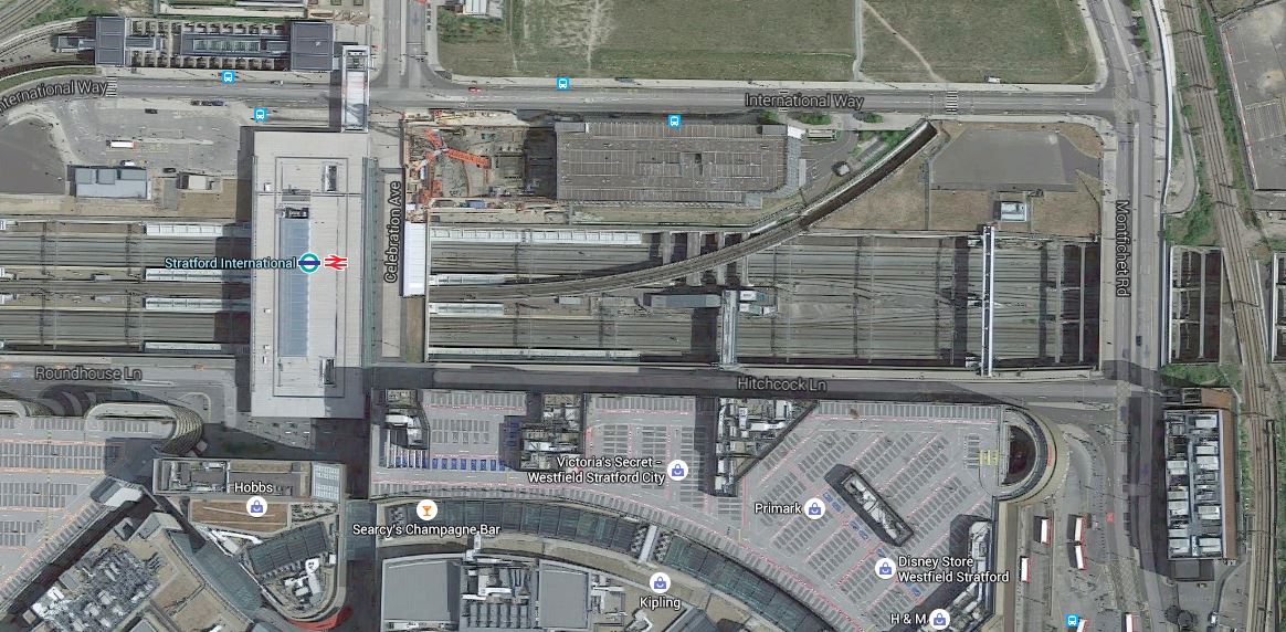
Stratford International Station
The building at the bottom right is also shown on the previous map that shows Platforms 11 and 12.
If the extra platforms were built over the Eastern end of the International station, it would enable the following.
- A new Eastern entrance to the International station could be created to give better connections between International and High Speed services from Stratford International and all the other services at Stratford Regional station.
- Crossrail would have a step-free interchange to Eurostar and other International services, if those services stopped at the International station.
- Interchange between Lea Valley and North London Line services, would be via a double Clapham Kiss, where passengers would just walk on the level to the other set of platforms.
- There might be opportunities to extend or improve the connectivity of the DLR. The current DLR station is at the top left of the map.
- Any direct services between the Temple Mills Branch and the North London Line would use the existing Platforms 11 and 12.
To get the connection right, the pedestrian links would have to be well-designed, but surely there is space to put a travelator effectively between the Regional and International stations.
Stratford International station would end up as what it should be, the International section of Stratford station.
Jeremy Corbyn Sugests Women-Only Carriages On Trains
According to this article on the BBC, Jeremy Corbyn is suggesting that women-only carriages should be introduced in the UK. This is the start of the article.
Labour leadership contender Jeremy Corbyn has said he would consider women-only rail carriages to help stem a rise in assaults on public transport.
Mr Corbyn told the Independent he would consult women on the suggestion.
But the idea was attacked as outdated and unhelpful by his Labour leadership rivals Yvette Cooper and Andy Burnham.
I have no view one way or another on the actual proposal, but practically there are problems.
Most new urban trains, like those on the London Overground, Underground, Thameslink and Crossrail are effectively built as one long articulated carriage. This picture shows the inside of a Class 378 train on the Overground.
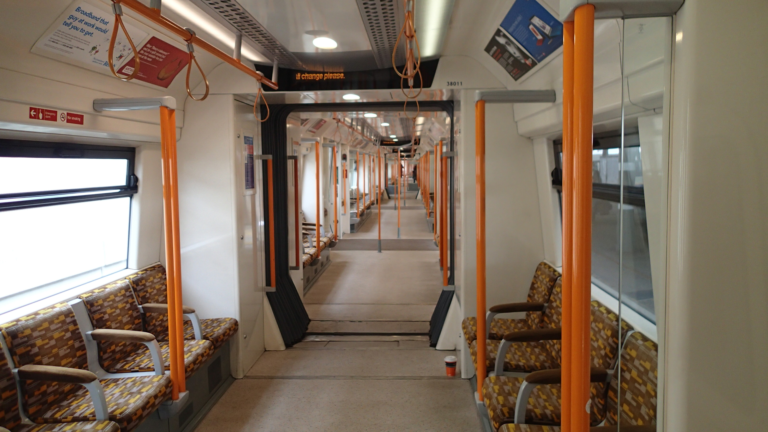
This layout increases capacity, enables passengers to spread themselves to less-crowded parts of the train and get to the appropriate carriage for disembarking.
I am not sure whether it is a safer layout, but on a couple of occasions, I’ve had a drunk or a noisy baby sit by me, whilst I’m trying to read, so I’ve quietly moved to another part of the train. It must also be an easier train to monitor for security purposes.
The layout also makes evacuation of the train easier in the case of an incident, like a complete power failure in a tunnel, as you’d just walk to one end of the train to be taken down steps by the emergency services.
If there was a segregated area for women, this would be extremely difficult to incorporate into a train designed in this way. It might even compromise the tunnel evacuation procedures.
So to create some women-only trains would mean an expensive rebuild, new trains, or a lot of work to make tunnels fit the new circumstances.
An alternate would be to make one train in six say, women only!
And surely, if you have women-only trains, you should also have women-only buses, taxis and minicabs. I think the latter are one of the worst places for attacks on women. This article in the Daily Mail has the headline of No woman is safe in a minicab, says rape judge. It may be an exaggeration as it’s the Daily Mail, but it does say there are 100,000 private hire drivers in the country and questions the checking procedures.
It would be far better, if instead of making public transport safer for a particular group, we made it safe for everybody who wants to use it.
I was travelling on the Overground recently, when on arrival at Dalston Junction station, a blind, black lady in her forties was met by a uniformed Overground stationman, who led her professionally up the stairs and through the barriers.
Every station in the UK should be mandated to follow the Overground rule of station staff being present from the first train of the day until the last. Also if you need special assistance on the Overground, you don’t need to give prior warning. This page on the Transport for London web site, details their policy.
