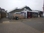
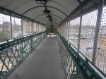
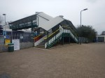
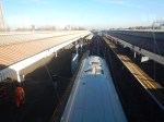
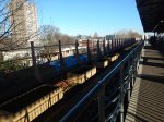
London Underground Gets Approval For Walthamstow Central Tube Station Upgrade
The title of this post, is the same as that of this article on Ian Visits.
It is from over a year ago and I’m only including it, as it includes a cutaway of the upgrade.
I go regularly to Walthamstow Central station and hopefully, this will make my journeys easier in busy times.
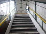
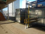
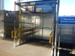
This paragraph from Wikipedia describes some of cost-cutting design features of the current station.
The underground station, like many stations on the Victoria line, was built to a low budget. White ceiling panels were never fixed to the ceilings above the platforms; instead the steel tunnel segments were painted black and used to support the fixtures and fittings, cutting lighting levels. A concrete stairway sits between two escalators instead of a third; this economy caused a disruptive station closure for several weeks in 2004 when both escalators went out of service.
Hopefully, these short comings will be addressed in the upgrade.
But it doesn’t appear there will be step-free interchange between Underground and Overground.
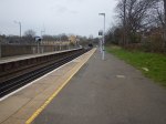
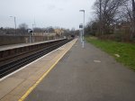
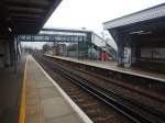
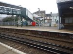
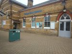
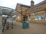
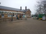
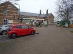
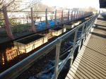
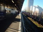
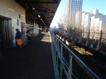
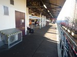
Penge East Station – 11th March 2022
When I wrote Advance Warning Of Brixton To Beckenham Junction Rail Closure In July, I realised I’d never been to Sydenham Hill station.
So when I visited Sydenham Hill station this morning, I decided to take the train through Penge Tunnel to take some pictures of Penge East station.
Note.
- The station is a Grade II Listed Building.
- It has been well-painted since I last visited.
- It would be very difficult to make the existing bridge step-free.
I think this station could be difficult to incorporate into a Penge Interchange station.
But it would be a shorter walk along the platforms to a lift and stairs to the high level platforms, than the current one to Penge West station.
Advance Warning Of Brixton To Beckenham Junction Rail Closure In July
The title of this post, is the same as that of this article on Ian Visits.
These are the first two paragraphs.
In late July, the railway between Brixton and Beckenham Junction will be closed for 9-days as Network Rail carry out a major upgrade of the tracks in the Penge railway tunnel.
Over the 9-day closure Network Rail says that it will be delivering a £4.5 million investment to replace the tracks through the Penge tunnel to help improve train service reliability. During the works, they will be replacing 3,970 metres of track in total, using engineering trains, road-rail vehicles and other heavy machinery to complete the work.
The railway will be closed between Herne Hill and Beckenham Junction stations for the week of Saturday 23rd to Sunday 31st July 2022.
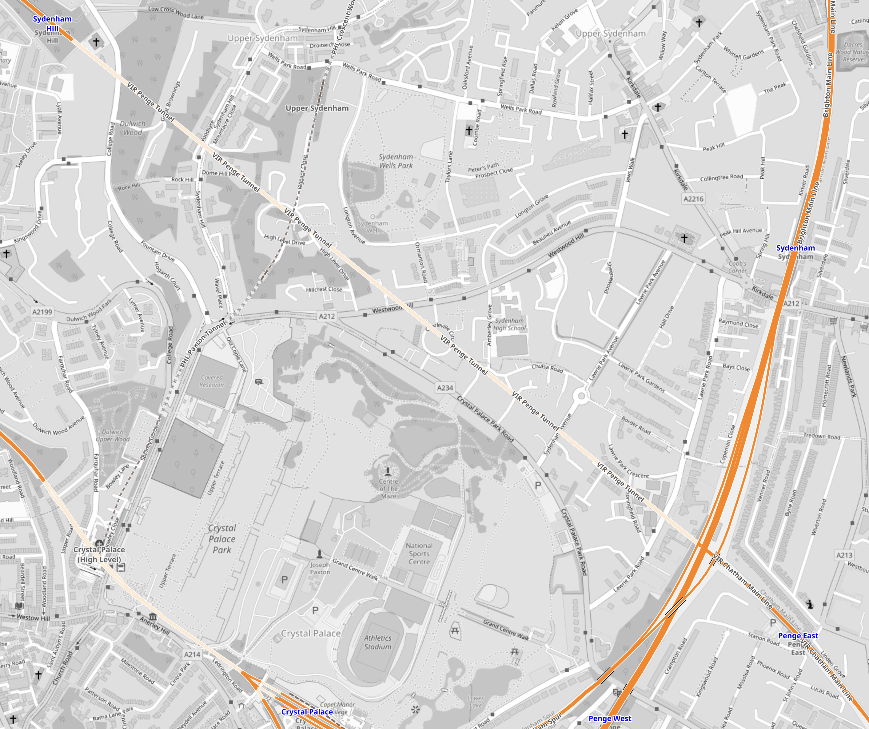
This map from OpenRailwayMap shows the tunnel.
Note.
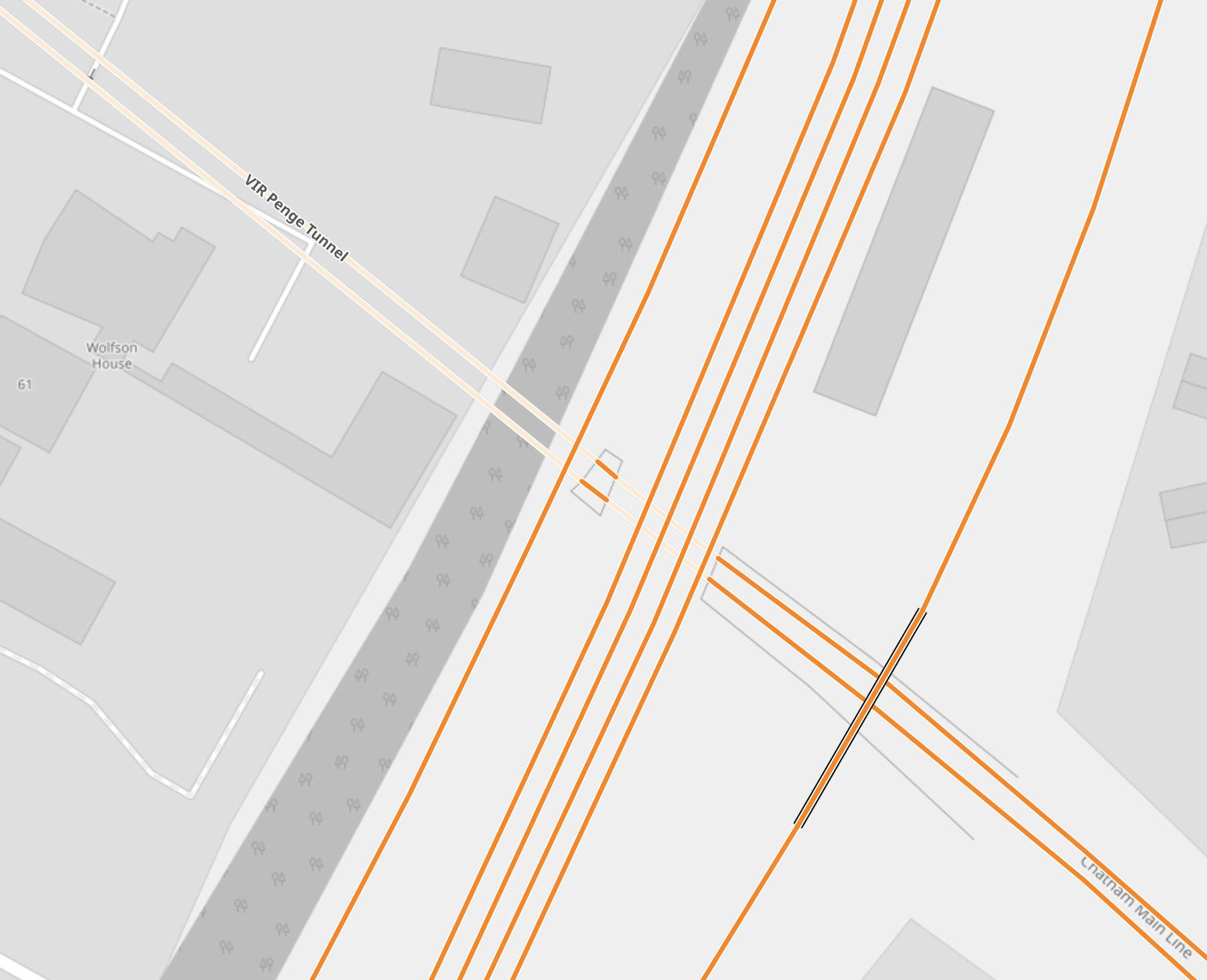
- The North-South railway is the Brighton Main Line, that passes through Sydenham and Penge West stations.
- The NW-SE railway is the Chatham Main Line, with Sydenham Hill station in the North-West and Penge East station in the South-East.
- Penge East Station – 11th March 2022 shows the station and the distance to Penge Tunnel.
- Sydenham Hill Station – 11th March 2022 shows the station and Penge Tunnel.
- Penge Tunnel is between the two stations and is shown in cream.
This second map, shows where the two lines cross.
In Penge Interchange, I described how Transport for London would like to build a new Penge Interchange station to possibly replace both Penge East and Penge West stations.
- It could be fully step-free.
- The station would be built on railway land.
- It would have four tph between Victoria and Bromley South stations.
- It would have four tph between Highbury & Islington and West Croydon stations.
- It would have two tph between London Bridge and Caterham stations
- It might also be possible to have platforms on the Crystal Palace branch, thus adding six tph between Highbury & Islington and Crystal Palace stations.
- The station could have Thameslink platforms.
I feel it would offer the following benefits.
- Better connection between South East and North London, without going through Central London.
- Better connection between South East London and Crossrail, with all its connections.
- Closure of the two older Penge stations.
I hope that whilst the railway is closed for the relaying of track, that Network Rail will do a full survey to at least find out whether a Penge Interchange station is feasible.
Final Tunnelling Gets Underway On Bank Station Blockade
The title of this post, is the same as that of this article on Ground Engineering.
This is the introductory paragraph.
Four weeks into the closure of Bank Station for its capacity upgrade, main contractor Dragados is making good progress on all key activities, including final tunnelling works.
This has been traditional tunneling, that would have been familiar to those like the Victorians, where a lot of the digging has been done by hand, with the addition of smaller diggers and power tools.
The project seems to be on schedule for a mid-May opening.
A Thought On The Prospects For Crossrail
Someone asked the question, in a discussion group, that I visit, if Crossrail will be a success.
I believe that you only have to look at the success of the London Overground to realise that Crossrail will be a success.
When the North London Line reopened as the first route of the London Overground with new Class 378 trains, it used to run four-car trains at a frequency of six trains per hour (tph) between Stratford and Willesden Junction stations.
Now the line runs eight tph on that route and the trains are five cars.
That is a capacity increase of 66% in terms of cars per hour.
And still at times, the trains are full and Transport for London are looking at ways of adding extra trains and/or cars.
Crossrail will have the factors going for it, which helped to make the Overground that success. It is new and has a novelty value, but above all like the Overground, it is built for full-sized people, who could be pushing bikes and buggies and trailing baggage.
Crossrail, also increases options for alternative routes for Londoners , who are World Champions at ducking-and-diving.
Crossrail has also been designed so that the trains can be extended.
If Crossrail has a problem, other than the lateness and budget overrun, it is that it doesn’t connect to the Victoria or Piccadilly Lines.
Housing Development Next To Planned Overground Station Gets Approved
The title of this post, is the same as that of this article on IanVisits.
This paragraph describes the development.
The development, New Bermondsey, will see a cluster of residential towers built around the Millwall football ground on former light industrial sites, and will provide some 3,500 homes, a new sports facility, auditorium with 800 seats, and it’s said some 1,250 jobs. The towers vary in height across the site from 13 – 44 storeys; most towers are around 29/30 storeys.
The Overground station is New Bermondsey station, which was originally to be called Surrey Canal Road station.
This Google Map shows the area.
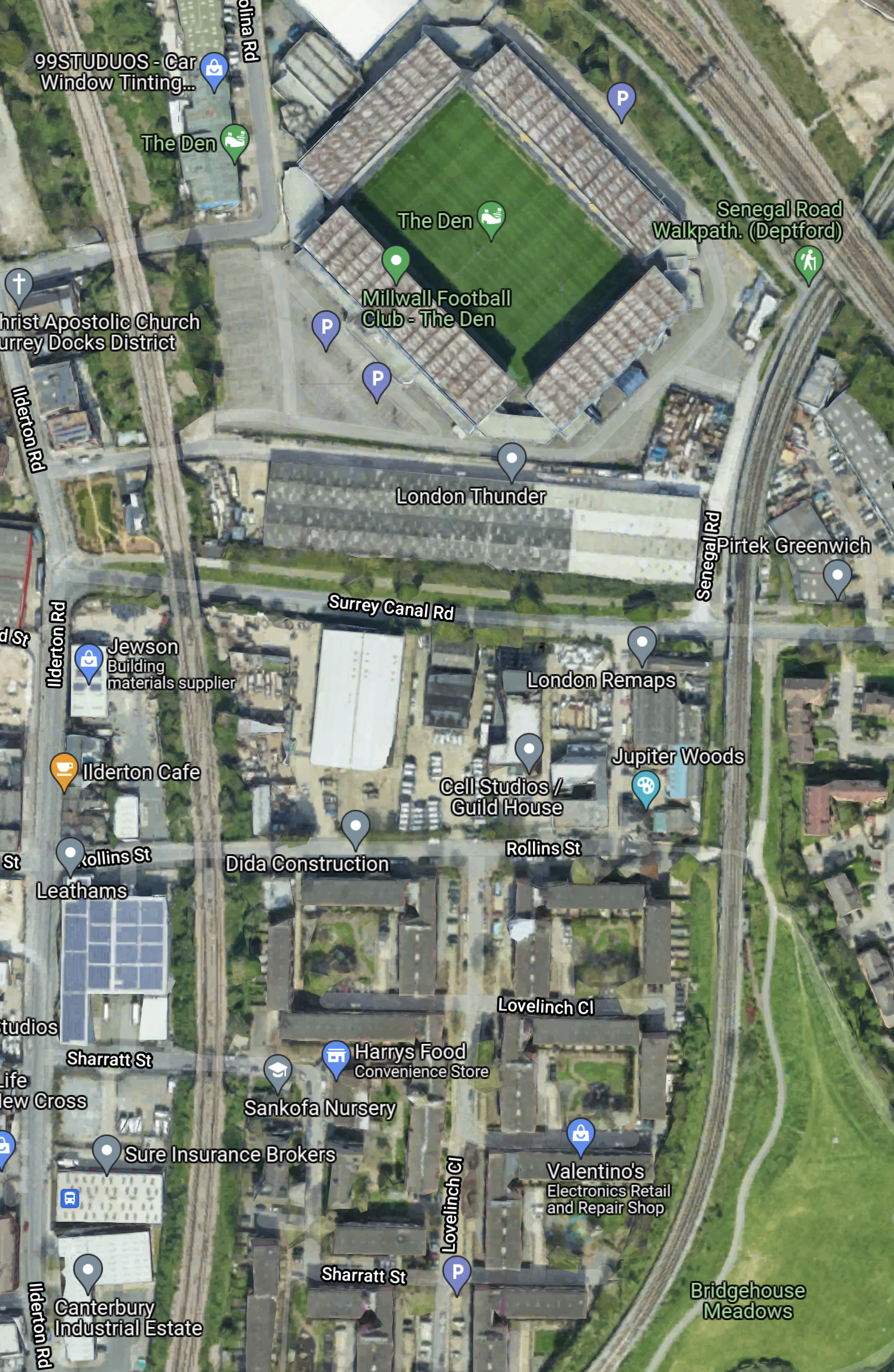
Note.
- The railway going down the East side of the map in the South London Line of the London Overground.
- The railway going round the West side of the map is the National Rail line going through South Bermondsey station to London Bridge.
- The two lines meet at Queens Road Peckham station to the South.
- Surrey Canal Road runs East-West across the map to the South of The Den.
- New Bermondsey station will be where Surrey Canal Road crosses under the London Overground.
- Most of the new housing will be clustered along this road and around the football ground.
The development will be convenient for Millwall supporters.
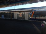
Apology After Woman Dragged On Platform By London Overground Train
The title of this post, is the same as that as this article on the BBC.
These first three paragraphs describe the incident.
An investigation has been launched after a woman attempting to board a London Overground train was dragged along a platform.
The passenger tried to board the train at Wood Street Station in Walthamstow, north-east London, on 14 January when her hand got trapped in the door.
The Rail Accident Investigation Branch (RAIB) said she was then forced to run alongside the train for about 20m (66ft), before the train stopped. The woman was uninjured.
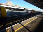
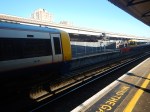
I don’t know Wood Street station or the size, shape and agility of the lady, who had the near accident.
I shall be going to have a look.
I took these pictures at Wood Street station, this afternoon.


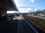


These are my observations.
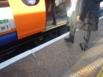
- The platforms have a very pronounced curve, which makes the gap between train and platform wider.
- There is a significant difference in the height of the train floor and the station platform, which makes the gap effectively wider.
- All the passengers getting into the train were men and wearing sensible shoes. I was too!
- There is a warning message about doors closing thirty seconds before the train leaves. I’ve never seen one before on the Overground.
I will not speculate on what caused the accident, except to say, that as the passenger wasn’t badly injured, I suspect we’ll get to the truth of what happened.
London Bus Crash: Children Injured As Double-Decker Hits Shop
The title of this post, is the same as that of this article on the BBC.
These are the first three paragraphs.
Three children and two adults have been taken to hospital after a double-decker bus hit a shop in north-east London.
The crash happened on Selwyn Avenue, Highams Park, at about 08:20 GMT, the Metropolitan Police said.
London Ambulance Service (LAS) said 14 other people were treated at the scene, near Highams Park Overground station, but did not need hospital treatment.
The driver is quoted as saying, that his brakes failed.
This Google Map shows the route of the 212 bus route through Highams Park.
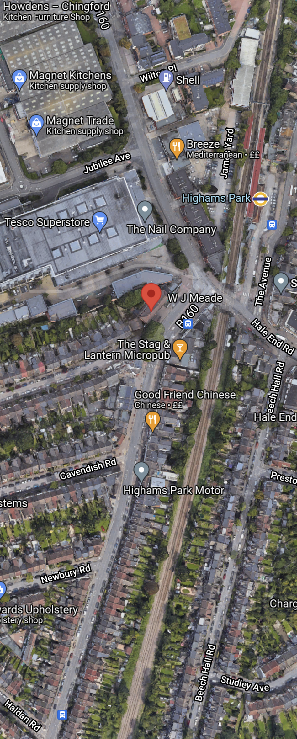
Note.
- The red arrow in the middle of the map shows the location of the crash.
- The bus route runs North-South on the map to the West of the railway line.
The pictures in the article show that the bus was going to Chingford, which is in the North.
In May las year, I took a ride on a 212 bus,which I described in A Trip On An Electric Double Deck Bus On Route 212 Between Chingford And St. James Street Stations.
This is an extract from that post.
I know someone, who used to manage this route and they called it a basket case.
I can certainly understand that.
- The route is narrow in places with cars parked on both sides of the road. This must delay services.
- I was lucky with the level crossing at Highams Park station, but at busy times it could be a nightmare.
Will the new Class 710 trains on the parallel Chingford Branch Line improve matters, by attracting passengers away from their cars in the area and the buses?
There has also been talk of a new station at Chingford Hatch, which could also be served by the 212 bus.
I can’t help feeling that the level crossing was something to do with the crash. Especially as a train went through just before the crash.
Interestingly, a few months ago, I used a black cab driven by a guy, who lives near Highams Park station. He felt the level crossing could be closed and drivers could use other routes. He also said, that since the new trains had started running, more were using the trains.
Perhaps improving the railway, with a couple of new stations, would also take the pressure of the buses.
Carry On Ducking And Diving
I have a Google Alert running on “bank station northern line closure” and it is only picking up factual reports generally based on the fact that the Northern Line will be closed for seventeen weeks between Moorgate and Kennington, like this report in The Sun.
I have been to Moorgate station a couple of times, and it actually seems rather quiet.
It would appear that Londoners are doing, what they do in times of trouble with public transport and go ducking and diving.
The weather hasn’t been too bad, so that probably explains why the likes of Disgusted from Tunbridge Wells have been silent.
Conclusion
Londoners will carry on ducking and diving!
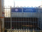
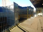
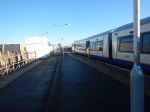
Barriers And Planters On The London Overground Platforms At Clapham Junction Station
To get home from Feltham station, after my visit this morning to see the new bridge, which I wrote about in The Completed Bridge At Feltham Station, I changed trains at Clapham Junction station.
I noticed that a barrier has been put up between the current two Overground platforms; 1 and 2.
.I suspect it is for safety reasons, as it will certainly stop passengers falling off the platform.
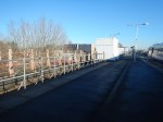
I also noticed that planters had been placed where I suspect that the new Platform 0 will be built.
Note.
- If the track is to placed between the planters and the platform, the space could be a bit small.
- Or is the platform going to be rebuilt a bit narrower?
- It also looks like the platform won’t be long enough for the planned eight-car train.
I also took these pictures of what looks to be a Fire Exit.
Could it be a temporary entrance, that will be used if there is a lot of work going on about the Grant Road entrance to create the new platform?
I also took these pictures of the Eastern end of the platform.
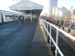
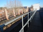
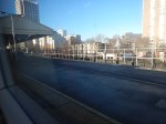
Considering, that the Class 378 train is five cars and an eight-car train would be sixty percent longer, it looks to me, that they will have to extend the platform, behind the temporary entrance or perhaps further towards the East.
Or could Network Rail have called up Baldrick, and asked him for one of his cunning plans?
Consider.
- Currently, there is a one train per hour (tph) between Milton Keynes and Clapham Junction stations, run by Southern.
- The service used to run between Milton Keynes and South Croydon stations.
- There surely is a need for a high-frequency service between the High Speed Two station at Old Oak Common and Clapham Junction station.
- Currently, there is no planned link between Crossrail and the West London Line.
Hythe Road station is planned to be on the West London Line and will serve the High Speed Two station at Old Oak Common.
This Transport for London map, shows the position of the proposed Hythe Road station with respect to High Speed Two and Crossrail.
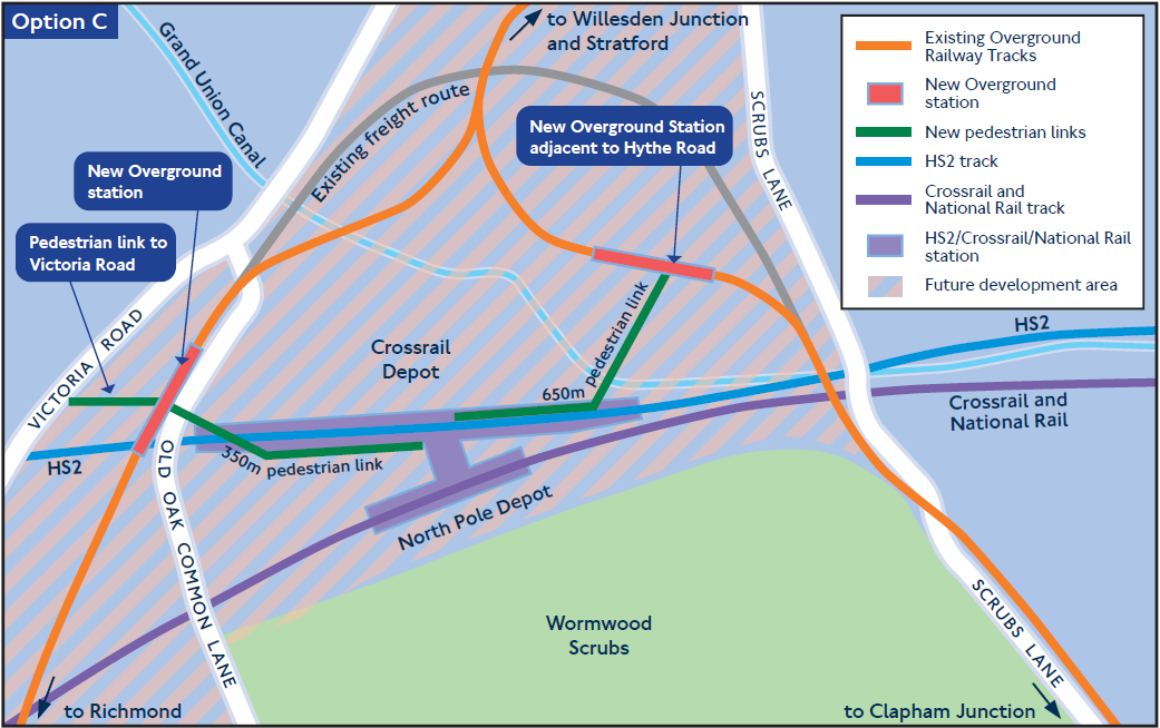
Note.
- The West London Line to and from Clapham Junction goes down the East of the map.
- The North London Line to and from Richmond goes down the West of the map.
- The current Milton Keynes and Clapham Junction service doesn’t go through the site of Hythe Road station, but somehow sneaks round on the freight line in the map.
Wikipedia describes the proposal for Hythe Road station like this.
Hythe Road railway station would be situated about 700 metres (770 yards) from the mainline Old Oak Common station. Construction work would involve re-aligning the track along a new railway embankment (built slightly to the north of the existing line) and demolishing industrial units along Salter Street, on land currently owned by a vehicle sales company (‘Car Giant’). The station structure will sit on a viaduct, with a bus interchange underneath. The station will incorporate 3 platforms, allowing through services between Stratford and Clapham Junction with an additional bay platform to accommodate terminating services from Clapham Junction.
I can envisage an eight tph service between Clapham Junction and Hythe Road stations, made up something like this.
- Four tph between Stratford and Clapham Junction stations
- One tph between Milton Keynes and Clapham Junction stations
- Three tph between Hythe Road and Clapham Junction stations
Note.
- Services would stop at Shepherd’s Bush, Kensington (Olympia), West Brompton and Imperial Wharf.
- Two platforms at Clapham Junction station could easily handle eight tph.
- The London Overground’s five car Class 378 trains would probably be long enough for the shuttle.
- There is even the possibility of running the Milton Keynes and Clapham Junction service with five car trains, to void the expense of creating an eight-car platform at Clapham Junction station.
It would be better if the Milton Keynes and Clapham Junction service could go through Hythe Road station. But this might be difficult to arrange.
Conclusion
An eight tph service through Old Oak Common could be a nice little add-on for both High Speed Two and Crossrail.
