FirstGroup Adds Leeds-based J&B Travel To Growing Coach Portfolio
The title of this post, is the same as that of this article on Route One.
These two paragraphs add more detail.
J&B Travel of Leeds is the latest coach business to be acquired by FirstGroup.
The operator, which has been established for more than 40 years, has a fleet of 15 vehicles, with work including home-to-school, private hire and FlixBus contracts.
But in some ways, the most significant thing not mentioned is that FirstGroup have now acquired seven coach firms.
- AndersonTravel in London
- EnsignBus in London
- J & B Travel in Leeds
- Matthews Coaches in County Monaghan, Ireland
- Tetley’s Coaches in Leeds
- York Pullman in Harrogate, Hull, Leeds and York
Note.
- MatthewsCoaches are about halfway between Dublin and Belfast.
- Three of the English acquisitions are in Yorkshire and two are in London.
- Leeds isn’t far off being halfway between London and Central Scotland.
This looks like the first part of a master plan.
- Leeds and County Monaghan could be ideal refuelling points for zero-carbon coaches.
- Ferrybridge, just South of Leeds is getting a hydrogen-fired power station.
- Ferrybridge is a big site with a motorway service station on the M1.
- Wrightbus are building an electrolyser at Ballymena, which is 81 miles from Matthews Coaches.
- Wrightbus have said that Dublin and Cork would be an ideal route for a hydrogen coach.
- Wrightbus have said that Heathrow and Gatwick would be an ideal route for a hydrogen coach.
This plan could be built-on with routes to various cities and attractions.
I have some further sorts and questions.
Could The First Obvious Routes Be Run By Hydrogen Coaches?
From what Wrightbus have indicated, I would rate the obvious routes as.
- Dublin and Belfast – 103 miles or 206 miles round trip
- Dublin and Cork – 107 miles or 340 miles round trip
- Leeds and Glasgow – 224 miles or 448 miles round trip
- Leeds and Edinburgh – 222 miles or 444 miles round trip
- Leeds and London – 197 miles or 396 miles round trip
- Heathrow and Gatwick – 40 miles or 80 miles round trip
Note.
The longest route is 714.5 km.
It would appear that, if the hydrogen-powered coach had a range of 1,000 km. all routes would be possible.
How Far Would A Hydrogen Coach Get On A Tankful From London?
A thousand kilometres is 621.4 miles.
These are the distances from Scottish cities to London.
- Aberdeen – 537 miles
- Dundee – 472 miles
- Dunfermline – 430 miles
- Edinburgh – 410 miles
- Glasgow – 404 miles
- Inverness – 561 miles
- John O ‘Groats – 678 miles
- Perth – 451 miles
- Stirling – 418 miles
I’ve added John O’Groats for completeness, but all cities would be reached.
How Far Would A Hydrogen Coach Get On A Tankful Going West From London?
These are the distances from Western towns and cities to London.
- Aberystwyth – 236 miles
- Fishguard – 255 miles
- Holyhead – 289 miles
- Lands End – 310 miles
- Penzance – 307 miles
I’ve added Lands End for completeness, but all towns and cities would be reached.
John O’Groats And Lands End In A Hydrogen Coach
I asked Google AI how far the journey was and received this answer.
The distance from Land’s End to John o’ Groats varies by transport: about 837-874 miles (1347-1407 km) by road, roughly 600 miles (970 km) as the crow flies, and around 1,200 miles (1900 km) for an off-road walking route, with cyclists typically taking 10-14 days and walkers 2-3 months.
So it looks, like there will be a need for a refuel, but that would give 2,000 kilometres, which is more than the 1,347-1,407 kilometres needed.
Ferrybridge Could Be An Ideal Refuelling Point
I suspect, even in fifty years you could name the places in the UK, where you will be certain of refuelling any hydrogen vehicle on the fingers of one hand.
The list would include.
- Ferrybridge in Yorkshire, where SSE are building a hydrogen-fired power station.
- Felixstowe Docks in Suffolk, where there will be a need to fuel hydrogen trucks.
- Keadby in Lincolnshire, where SSE are building a hydrogen-fired power station.
- Kintore in Aberdeenshire, where an electrolyser is being built.
- Runcorn in Cheshire, where there was an electrolyser in 1968, when I worked there.
This web site lists all the UK hydrogen projects.
This Google Map shows the location of the Ferrybridge hydrogen-powered power station site in relation to Barnsley, Doncaster, Leeds and other towns and cities of Yorkshire.

Note.
- The red arrow indicates the former coal-fired power station site.
- Leeds is in the North-West corner of the map.
- Barnsley and Stocksbridge are in the South-West corner of the map.
- The city of Sheffield is to the South-West of Stocksbridge.
- Doncaster is in the South-East corner of the map.
Last September I wrote Visiting The Consultation For Ferrybridge Next Generation Power Station At Knottingley.
In that post, I wrote about supplying both the power station and the motorway services with hydrogen and felt that it could use one of two methods.
- A pipeline from the hydrogen storage in East Yorkshire.
- Some form of train from a hydrogen production site.
Recently, Network Rail have been conducting tests on the movement of hydrogen by train, which I wrote about in Network Rail’s Test Track Take Centre Stage As Hydrogen Is Delivered By Rail For The First Time.
The Ferrybridge Site Has most things needed.
This map shows the site.
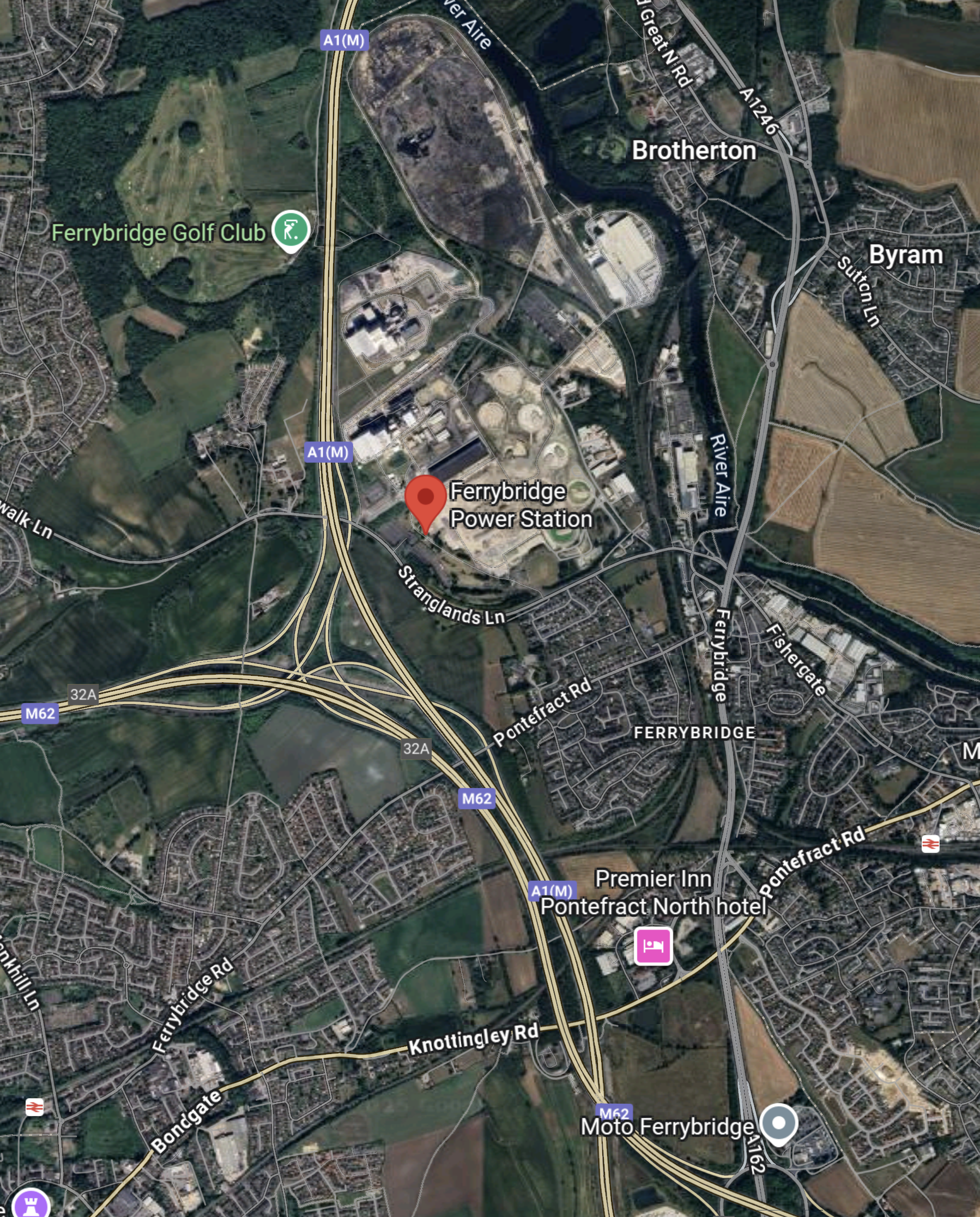
Note.
- The impressive motorway junction, where the North-South M1 crosses the East-West M62.
- Liverpool and Manchester are to the West.
- Leeds, Newcastle and Scotland is to the North.
- Hull is to the East.
- London is to the South.
- There is a Moto Services.
- There is a Premier Inn.
There is even two railway stations on the map.
This reply from Google AI gives the details of the distance between Ferrybridge and the South-West.
The driving distance from Ferrybridge, Yorkshire, to Land’s End is roughly 470 to 500 miles, taking about 8-9 hours, primarily via motorways like the M1, M5, and A30, though exact times and routes vary by real-time traffic and specific starting/ending points.
I am absolutely certain, that if you have a vehicle like a hydrogen coach and you want to go anywhere between A to B on the UK mainland, then if there is hydrogen-refuelling at Ferrybridge, you will be able too do the journey with a refuel at Ferrybridge.
Mega Airport Costing £24billion In Europe To Rival Heathrow And Dubai
The title of this post is the same as that of this article in the Daily Express.
A new mega airport is being built in Europe, and it is set to rival the likes of Dubai and London Heathrow in terms of size and capacity for passengers and planes alike
These three paragraphs add more details.
A plush new airport could be touching down in Europe, set to rival London’s Heathrow and even the esteemed Dubai International, as it aims to link the entire continent in unprecedented ways.
The Centralny Port Komunikacyjny, a proposed $32.5 billion project, is a fresh aviation gateway in Warsaw that carries the burden of Poland’s ambitious mega airport aspirations. However, the concept is swiftly progressing, with the official approval and handover of the passenger terminal design marking a significant leap forward.
This suggests the colossal airport is officially moving into its next phase of development. The question remains, will this new progression challenge the supremacy of the Middle East, home to both the world’s largest airport, King Fahd International Airport in Saudi Arabia, and the busiest, Dubai International Airport?
Note.
- In English, Centralny Port Komunikacyjny means Central Communications Port.
- CPK’s forecasted passenger capacity makes it a formidable contender as the new hub for Europe.
- Dubai is on course to handle 100 million passengers by the end of next year, thanks to its strategic geographical position with other continents, while the Polish project will eventually accommodate up to 44 million.
- n 2024, Heathrow Airport welcomed a record 83.9 million passengers, a 6% increase from the previous year.
Even the busiest airports in Europe handle far fewer passengers than Dubai.
Central Communications Port has a Wikipedia entry, which has this first paragraph.
The Central Transport Hub is a planned major infrastructure project in Poland aimed at the construction of a new international airport and the development of a nationwide integrated transport network. The airport is planned to be located approximately 40 kilometres (25 mi) southwest of Warsaw, connected to a new high-speed rail network and controlled-access highway system linking it with much of the rest of the country.
Note.
- The airport will be designed by Foster + Partners in collaboration with Buro Happold.
- Initially the airport is planned to have two runways, but will eventually be expanded to four.
- The combined airport and railway station is planned to serve 40 million passengers per year, double the size of Berlin Brandenburg Airport.
- The long-term goal is about 100 million passengers per year.
These are my thoughts.
The Airport’s Location
The Wikipedia entry for the airport has a section called Location, which has this first paragraph.
The airport’s planned site is about 40 km west of Warsaw, next to the village Stanisławów which is part of Gmina Baranów in Grodzisk Mazowiecki County. The Baranow commune occupies a significant part of the Grodzisk County and, despite its rural character, has an extensive road infrastructure. The A2 autostrada and railway lines run in the immediate vicinity of the potential construction site, and Wrocław (Expressway S8) and Poznań (National road 92) is nearby.
It sounds to me, that a British equivalent airport, would be a four-runway airport at Birmingham Airport with connections to the M1, M6, HS2 and the West Coast Main Line.
Rail Connections
The Wikipedia entry says this about rail connections.
Planned train connections from the CPK will take 15 minutes to Warsaw Central railway station, 25 minutes to Łódź Fabryczna railway station, and 2 hours to most other major Polish cities, such as Kraków, Wrocław, Poznań and Gdańsk. The construction of a high-speed train to Frankfurt (Oder) is also planned, which is to shorten the travel time on the Berlin-CPK route to under 3.5 hours
I suspect that Rail Baltica’s trains between Berlin and Helsinki via Warsaw, Kaunus, Riga, Bialystok and Tallinn will also stop at the airport.
The Airport Will Become A Gateway To North-East Europe
I wouldn’t be surprised to see Central Communications Port become a low-cost gateway to the surrounding countries., like Belarus, Estonia, Finland, Latvia, Lithuania and hopefully Ukraine.
Polish Hospitality
Consider.
- Most Poles speak English better, than what I does!
- There are several large Polish cities that are worth a visit.
- The food is excellent, as the local basic ingredients are of high quality.
- I have spent about a month in Poland and I’ve stayed in all levels of accommodation from the lowest to the highest and have never felt need to complain.
- They handle my gluten-free diet with no problem.
My experience of Belarus was also similar.
Footage Released Of East West Rail’s First Commercial Freight Train
The title of this post, is the same as that of this news item from Network Rail.
These four paragraphs give detail to the story.
The inaugural journey was part of a dual first, as it also saw the entry into service of Maritime Transport’s Northampton Gateway Terminal.
This Easter Network Rail completed its work there to join the 35-acre freight facility directly to the West Coast Main Line via the Northampton Loop.
The modern junction design allows freight trains to enter and exit the site at speeds of up to 40mph, which is eight times faster than conventional freight connections.
Clearing the railway junction much faster will significantly improve both passenger and freight journeys – as it reduces the impact on other services running on the main line.
This OpenRailwayMap shows the location of Maritime Transport’s Northampton Gateway Terminal.
Note.
- The red track running diagonally across the bottom half of the map is the West Coast Main Line.
- The orange track running North-South is the Northampton Loop of the West Coast Main Line.
- The blue arrow indicates Northampton station.
- The grey line running diagonally across the map, vaguely parallel to the West Coast Main Line is the M1 Motorway.
- The SEGRO Logistics Park Northampton Gateway is indicated between the Northampton Loop and the M1 Motorway.
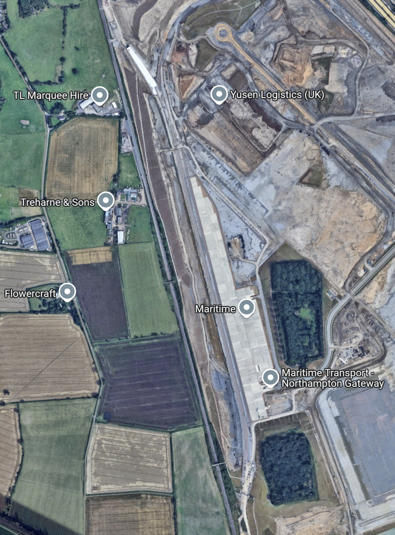
This Google Map shows the layout of the logistics park to a larger scale.

Note.
- The Northampton Loop of the West Coast Main Line running North-South across the map.
- The M1 Motorway running between the North-West and South-East corners of the map.
- Junction 15 is the M1 junction in the South-East corner of the map which connects the logistics park and the A45 to the M1.
- Junction 15A is the M1 junction in the North-West corner of the map which connects the A43 and Northampton services to the M1.
- There is probably space to add more warehouses and other facilities.
The logistics park is well connected to both rail and road.
This second Google Map shows the rail connection to the logistics park in more detail.
From this map, it appears that Network Rail have met their objective outlined in this paragraph of the news item.
The modern junction design allows freight trains to enter and exit the site at speeds of up to 40mph, which is eight times faster than conventional freight connections.
As only freight trains and slower passenger trains use the Northampton Loop, I would expect that freight trains should be able to enter and leave the logistics park with the minimum of disruption to traffic on the Northampton Loop.
The Route Of Yesterday’s Train
These three paragraphs from the Network Rail news item describe the route.
The first commercial freight train has travelled along the East West Rail line as part of its journey into a new strategic rail freight interchange in Northampton.
Shortly after 13:00 yesterday (Monday 16 June) the service* from Didcot came onto the new infrastructure at Oxford, travelling the 35 miles to Milton Keynes to connect with the West Coast Main Line.
It marked the first time East West Rail infrastructure has been used for commercial freight, after many months of signaller training and train driver learning since the £1.2bn railway was completed in October 2024.
This OpenRailwayMap shows the route from Didcot to Milton Keynes.
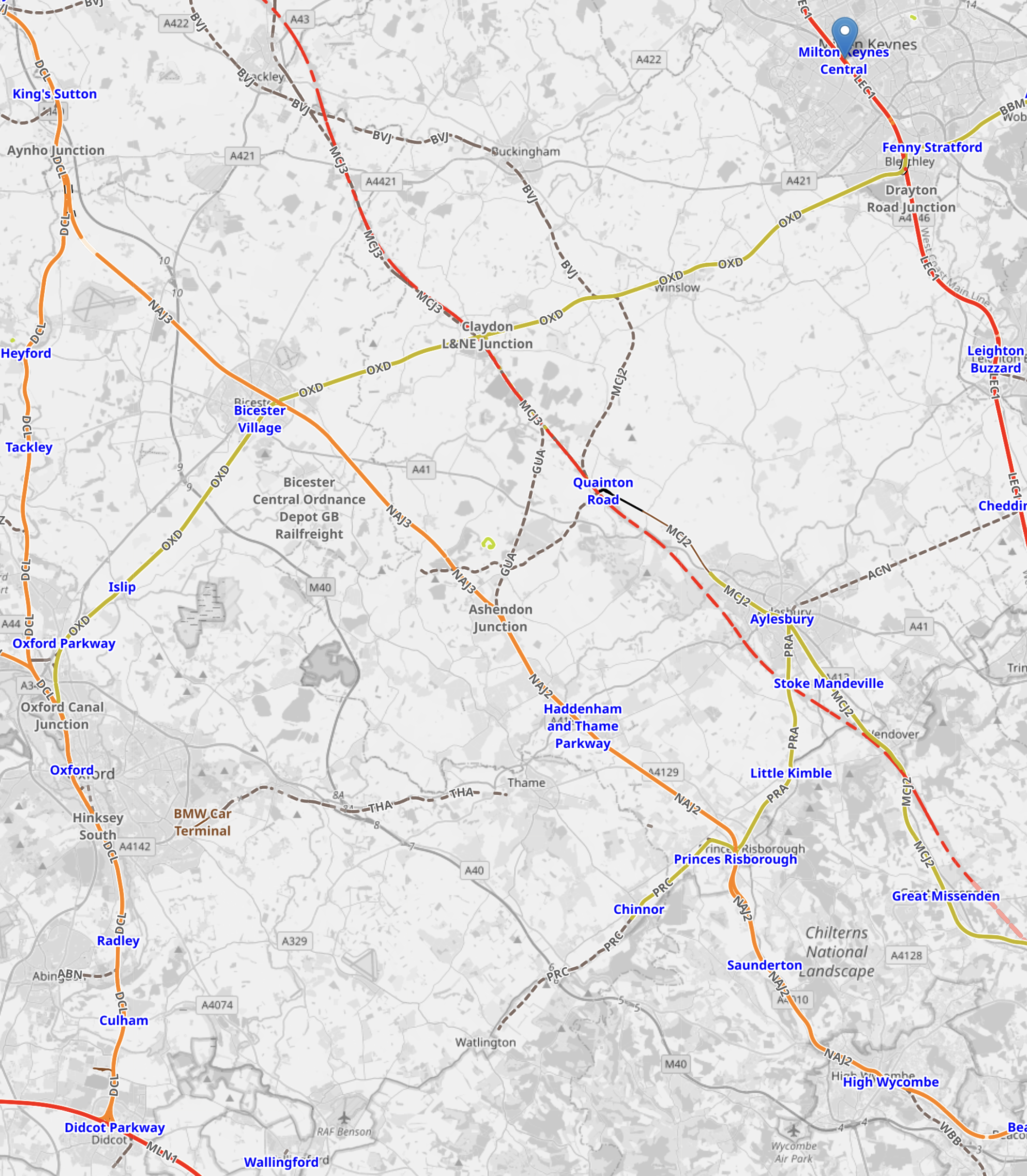
Note.
Didcot Parkway station is in the South-West corner of the map.
Milton Keynes Central is in the North-East corner of the map and marked with a blue error.
The route is via Oxford, Oxford Parkway, Bicester Village, Winslow and Bletchley.
This video shows the train passing Winslow.
Could Wrightbus’s New Hydrogen Coach Do A London Scotland Round Trip On A Full Load Of Hydrogen?
Victoria Coach Station And Edinburgh
I have just looked up on the National Express web site and found that I can leave Victoria Coach Station at 22:00 and arrive in Edinburgh at 07:40 the following morning for a ticket price of £29.90.
The road distance would appear to be 638.1 km, which would be a 1276 km round trip. So I would expect that, there would need to be refueling in the round trip.
Victoria Coach Station And Glasgow
I have just looked up on the National Express web site and found that I can leave Victoria Coach Station at 23:00 and arrive in Glasgow at 07:40 the following morning for a ticket price of £23.90.
The road distance would appear to be 652.1 km, which would be a 1300 km round trip. So as with Edinburgh, I would expect that, there would need to be refueling in the round trip.
A Refuelling Strategy
Consider.
- I would expect that a refuelling strategy would minimise, the carrying of large amounts of hydrogen, through the centre of London or any other conurbation.
- The Southern Uplands of Scotland already host a lot of wind farms, including the UK’s largest onshore wind farm at Whitelee, which has a capacity of 539 MW.
- An electrolyser to produce hydrogen is being developed at Whitelee, which is 32.8 km South of Glasgow.
- Newport Pagnell services is 86.5 km. from the Southern end of the M1.
- Toddington services is 62 km. from the Southern end of the M1.
I wonder if two refuelling points, say 50-100 km. from each end of the route, would be a safe an efficient way to fuel the coaches?
Some Services Between London And Scotland
They are in South to North order.
Toddington Services
Toddington Services is 62 km. from the Southern end of the M1.
This map shows the services.
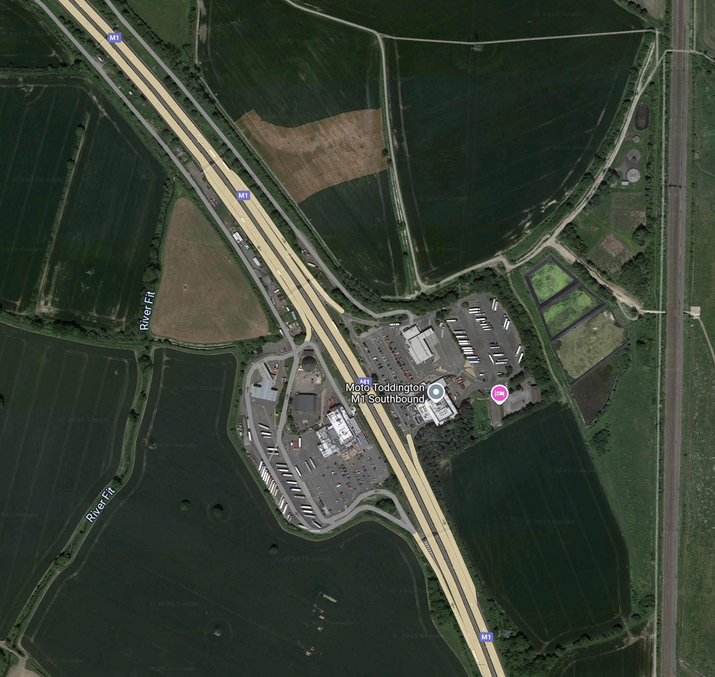
Note.
- There is land around the services that could be used to create more parking for hydrogen coaches.
- There doesn’t appear to be much space for a large wind farm to provide electricity to generate hydrogen.
- The Midland Main Line runs up the Eastern side of the map.
I wonder, if hydrogen could be brought to a refuelling site at Toddington services by the use of rail wagons.
Newport Pagnell Services
Newport PagnellServices is 86.5 km. from the Southern end of the M1.
This map shows the services.
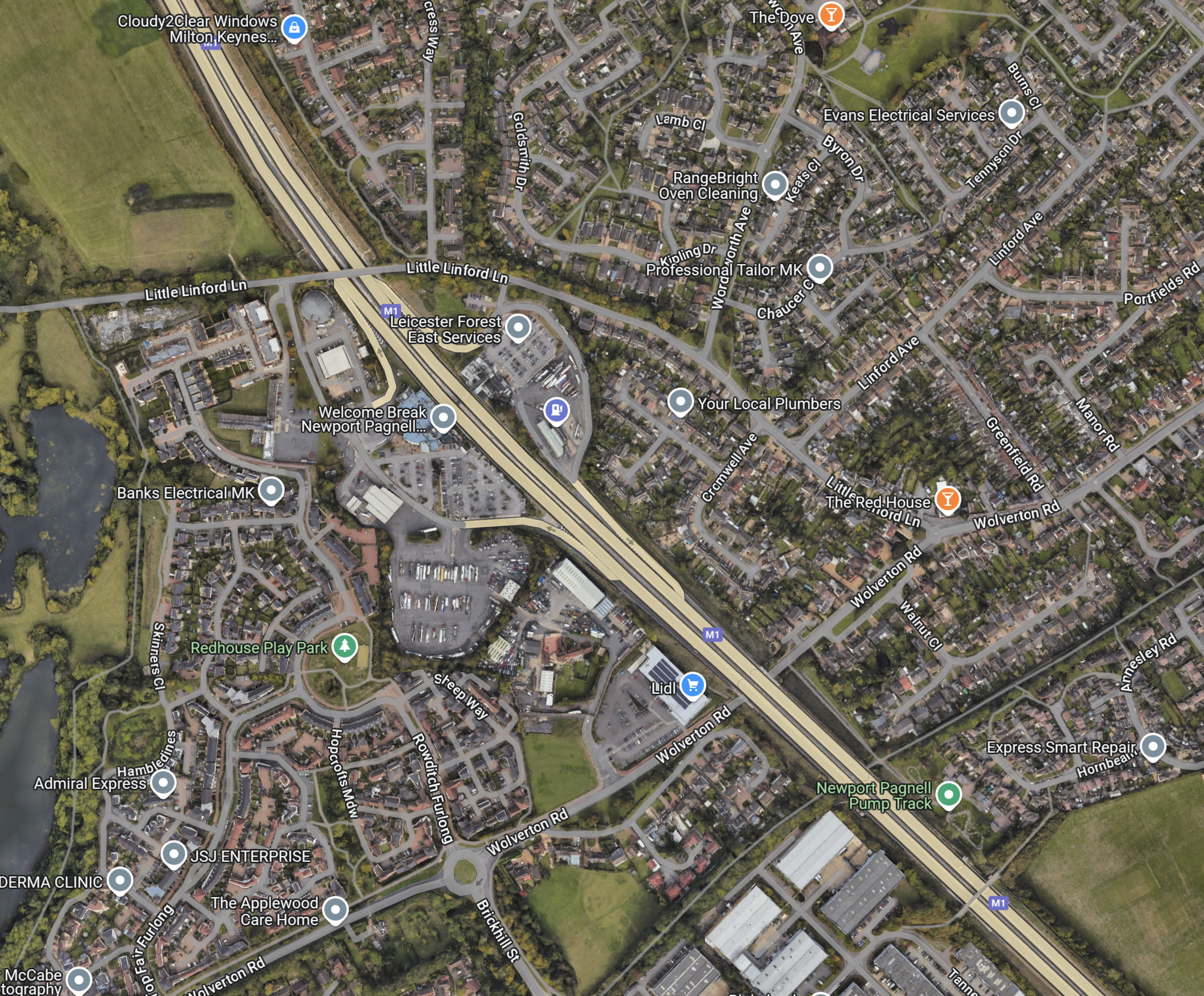
Note.
- The services are labelled as Leicester Forest East.
- The services are tightly surrounded by houses.
I’m not sure the residents would like to have a hydrogen refuelling station in their midst.
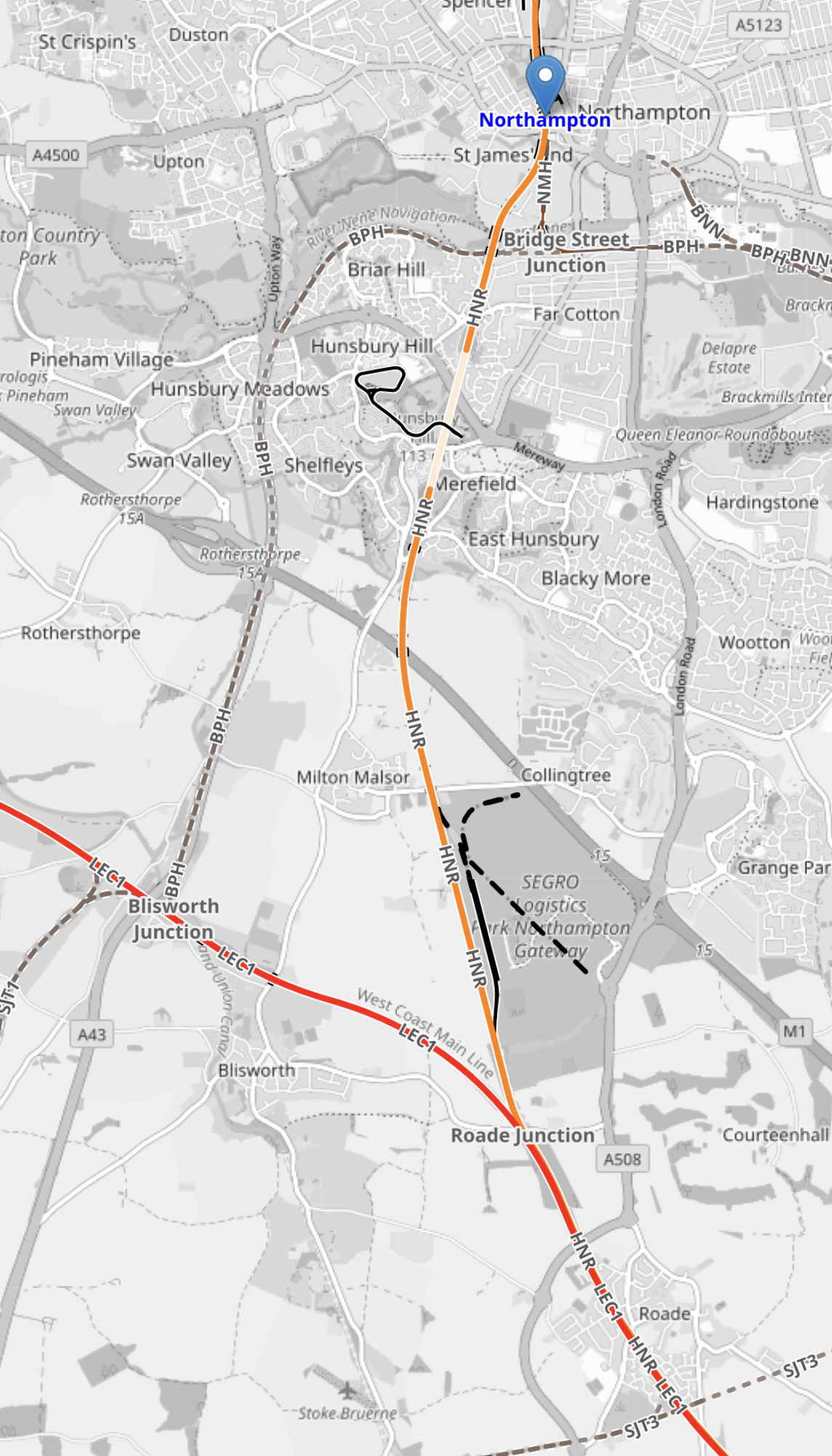
Northampton Services
Northampton Services is 104.5 km. from the Southern end of the M1.
This map shows the services.
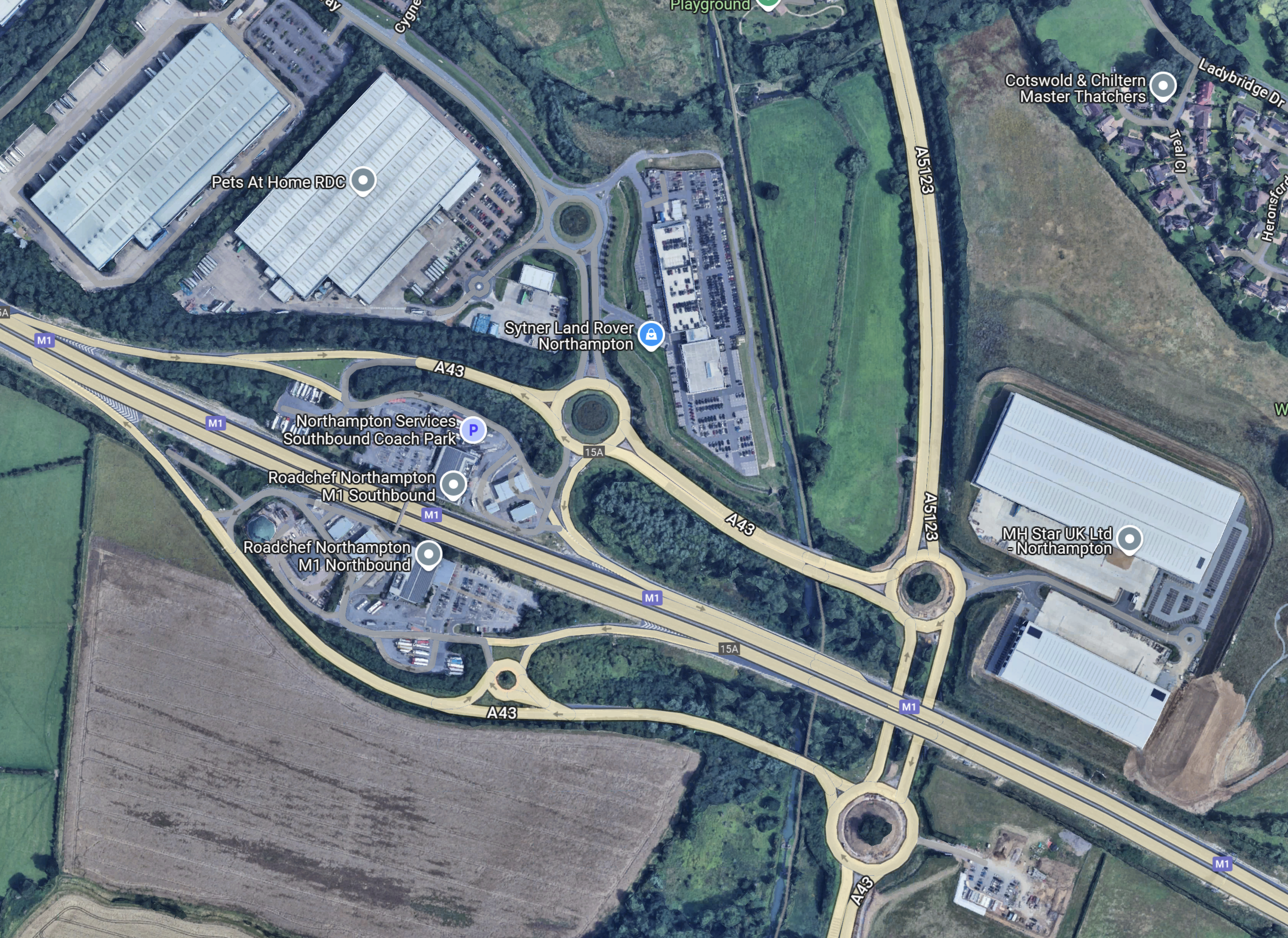
Note.
- It looks a rather complicated services.
- It might be too far from London.
- Provision of hydrogen might be difficult.
I think that this is another services that we can discount.
Watford Gap Services
Watford Gap Services is 120.8 km. from the Southern end of the M1.
This map shows the services.
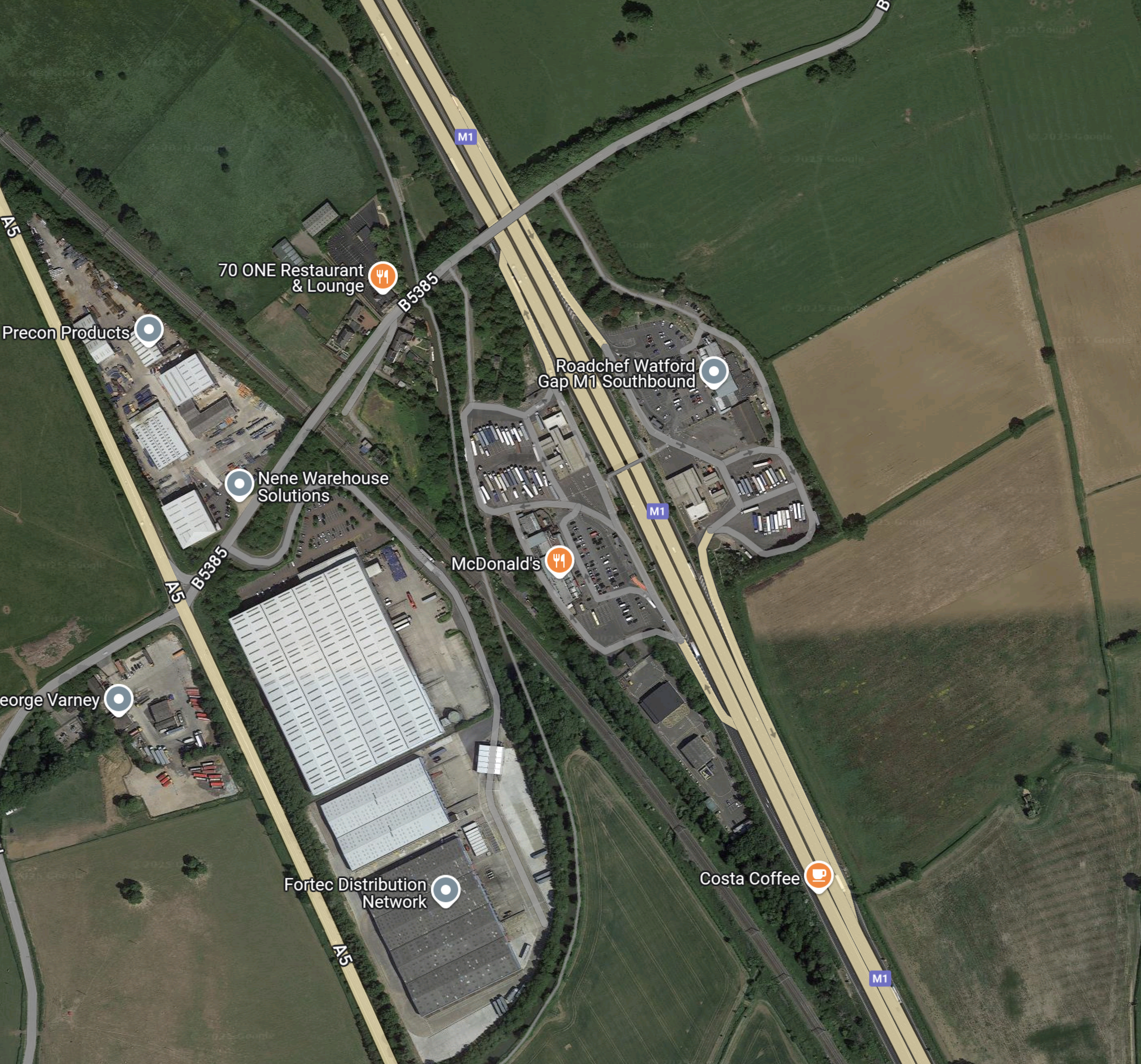
Note.
- There is land around the services that could be used to create more parking for hydrogen coaches.
- There doesn’t appear to be much space for a large wind farm to provide electricity to generate hydrogen.
- The West Coast Main Line runs through the centre of the services.
I wonder, if hydrogen could be brought to a refuelling site at Watford Gap services by the use of rail wagons.
Rugby Services
Rugby Services is 137.8 km. from the Southern end of the M1.
This map shows the services.
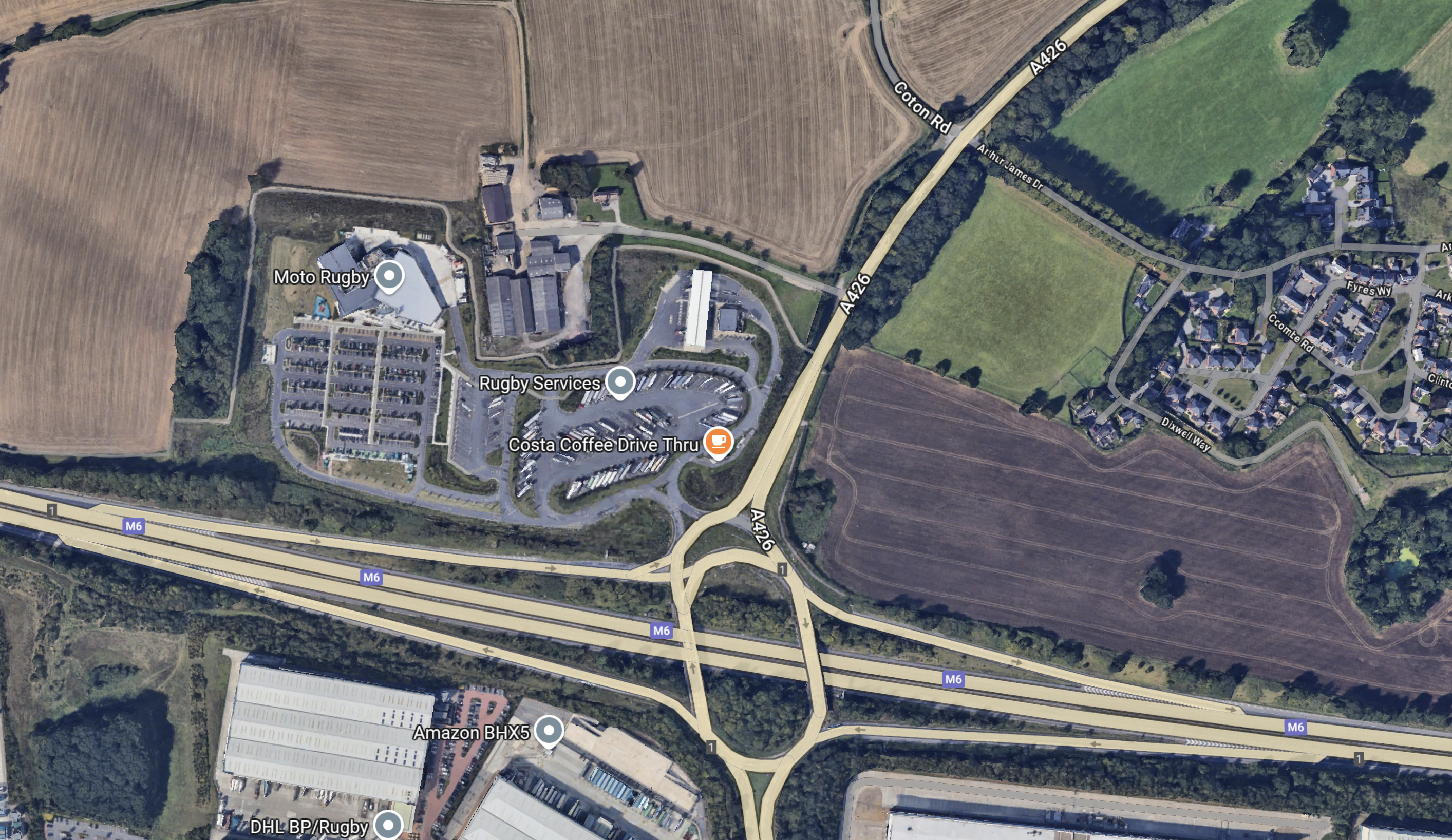
Note.
- There is land around the services that could be used to create more parking for hydrogen coaches.
- It is at Junction 1 of the M6.
There is also a gas compressor station nearby, so I wonder, if a HiiROC system could be located here to extract hydrogen from the natural gas.
This map shows the location of the Churchover compressor station, with relation to Rugby services.
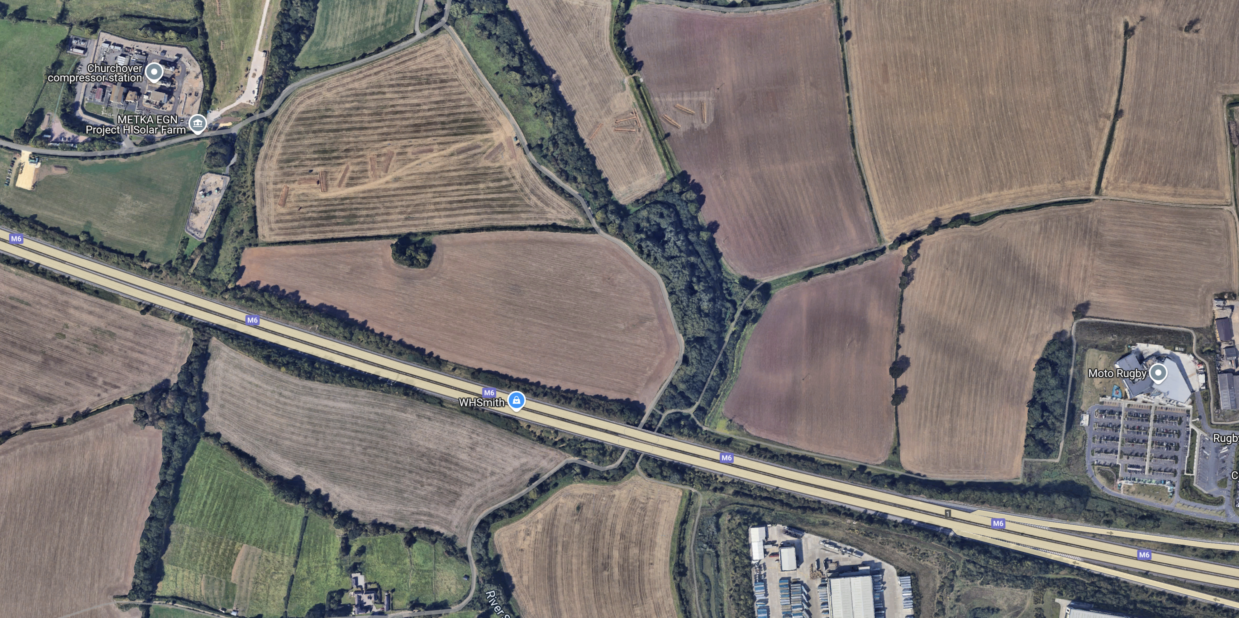
Note.
- The compressor station is in the North-West corner of the map.
- Rugby services are in the South-East corner of the map.
- From labels on the map it appears, a solar farm might be planned by the compressor station.
With a system like HiiROC creating turquoise hydrogen from natural gas, this could be a major filling station for hydrogen-powered trucks, coaches and cars.
Conclusion
It looks to me, that Toddington services would be best, but there would need to be a large increase in capacity, if a large number of hydrogen coaches, were going to fill up at Toddington for their trip into London.
The alternative would be to give the coach a large enough hydrogen tank for a complete round trip.
