Would It Be Possible For The Bakerloo And Watford DC Lines To Use The Same Trains? – 6th March 2023 Update
These two lines are very different.
- The Bakerloo Line is a classic London Underground Line with 25 stations and services run by 1972 Stock trains.
- The Watford DC Line is part of the London Overground with 19 stations and services run by Class 710 trains.
Ten stations are shared between the lines, of which only one; Queen’s Park offers level boarding.
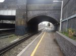
The Shared Stations
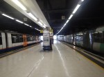
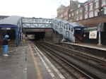
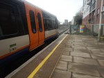
The nine shared stations often have considerable steps up and down, as at Willesden Junction station, which is shown in Train-Platform Interface On Platform 1 At Willesden Junction.
I am rather pleased and pleasantly surprised, that there are not more accidents at the shared stations, but using the line must be a nightmare for wheelchair users, buggy pushes and large case draggers.
If Transport for London proposed building a line like this, they would have to launch it at the Hammersmith Apollo, where comedians perform.
The One Train Type Solution
To my mind, there is only one solution. The two services must use the same type of trains.
These are a few thoughts on the trains.
Trains Would Be Underground-Sized
As the trains will have to work through the existing tunnels to Elephant & Castle station, the trains would have to be compatible with the tunnels and therefore sized for the Underground.
I suspect they would be a version of the New Tube for London, that are currently being built by Siemens for the Piccadilly Line.
New Tube For London And Class 710 Train Compared
This Siemens infographic summarises the New Tube For London.
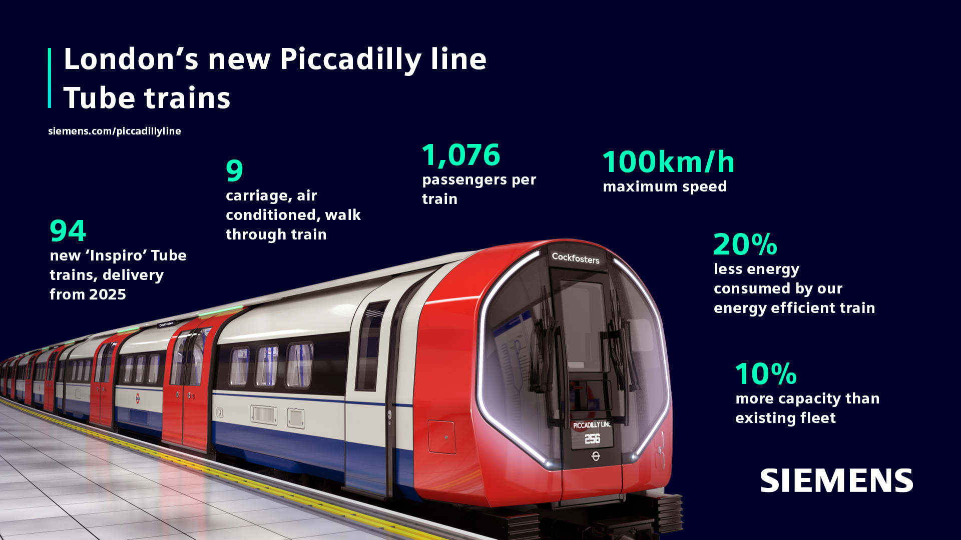
These figures are from Wikipedia.
- Cars – NTFL – 9 – 710 – 4
- Car Length – NTFL – 12.6 metres – 710 – 20 metres
- Train Length – NTFL – 113.4 metres – 710 – 80 metres
- Seated Passengers – NTFL – 268 – 710 – 189
- Total Passengers – NTFL – 1076 – 710 – 678
- Passenger Density – NTFL – 9.5 per metre – 710 – 8.2 per metre
- Speed – NTFL – 62 mph – 710 – 75 mph
Note.
- The figures for the Class 710 train are for a four-car train.
- The passenger density and speed are closer than I thought they’d be.
- I’m sure Siemens can design a longer and/or faster train if required for the Euston service.
I feel that the New Tube for London design could be adjusted , so that it could work the Watford DC service.
Platform Modifications
I suspect that the New Tube for London will be lower than the Class 710 train and all platforms would need to be lowered to fit the new trains.
I would also suspect that it would be easier to lower platforms, than modify them, so that they had dual-height sections to satisfy two classes of train.
It should be noted that the New Tube for London has shorter cars than the sixteen metre 1972 Stock trains currently used on the line, so there will be smaller gaps at stations with curved platforms like Waterloo.
I believe that with one class of train, all of the stations on the Bakerloo and Watford DC Lines could be made step-free between train and platform.
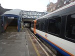
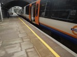
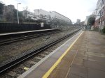
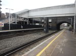
Platform Height On Platform 9 At Euston
I took these pictures on Platform 9 at Euston station.
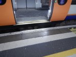
Note that it is rather a high step into the train and there is a large gap.
But if say, a modern London Underground train from say the Victoria Line pulled into the platform would it be a better fit?
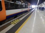
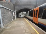
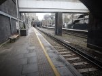
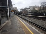
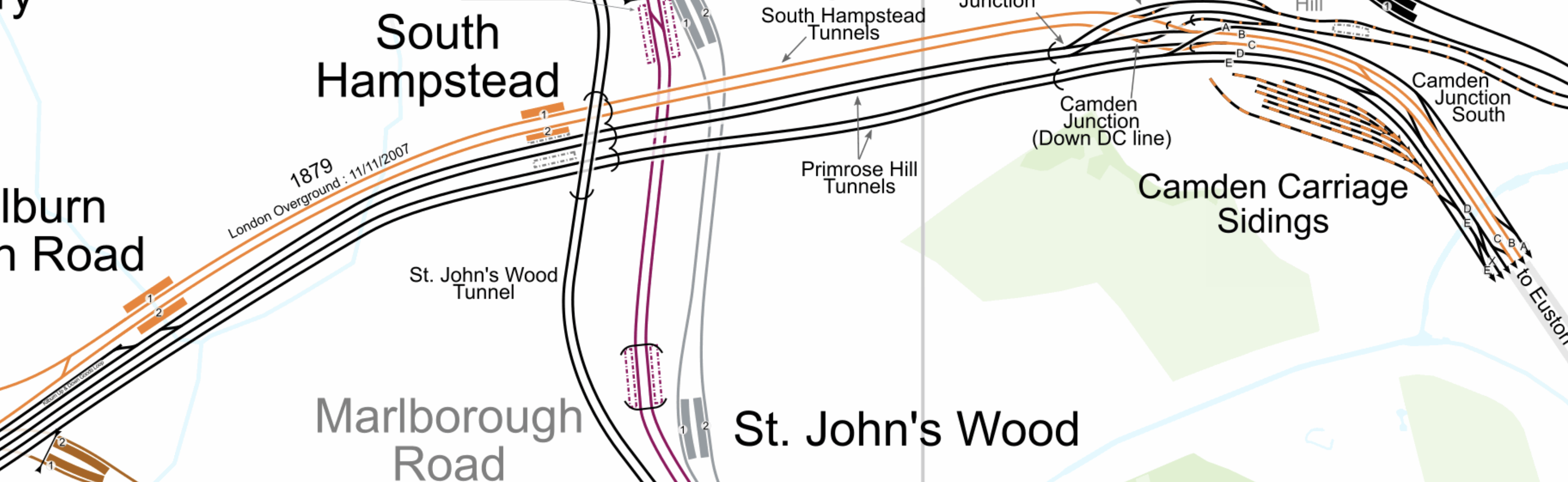
Platform Height At Kilburn High Road Station
These pictures show Kilburn High Road station.
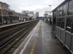
I should have taken more pictures, but the step between the platform and train is similar to Platform 9 at Euston.
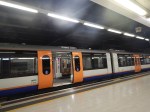
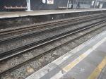
Platform Height At South Hampstead Station
These pictures show South Hampstead station.
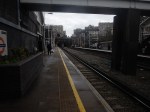
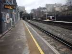
I should have taken more pictures, but again the step between the platform and train is similar to Platform 9 at Euston.
Were The Platforms At Euston, South Hampstead And Kilburn High Road Built For Another Class Of Train?
This Wikipedia entry is for the London Underground Watford Joint Stock train, where this is said.
The Watford Joint Tube Stock was built for the service to Watford along both the Bakerloo tube and the London North Western Railway. As a result, the cars were owned by both the Underground and the London North Western Railway. To be able to operate on both lines, the car floors were 4+1⁄2 inches (110 mm) higher than other tube cars. This was a compromise height between the platform heights on the two lines.
The cars were ordered in 1914, but construction was delayed by The First World War. As a result, the first cars were not delivered until early 1920.
Note.
- The Wikipedia entry has links to some images of which this is one.
- They must have been rather cramped trains if they were built for deep tunnels and had a floor that was 110 mm higher, than other tube trains.
It certainly appears to be possible to design a train, that would fit both lines.
But would it fit modern regulations and give full step-free access?
Queen’s Park And Euston
This map from cartometro.com, shows the route between Queen’s Park and Euston stations.
Note.
- The Watford DC Line is shown in orange.
- Queen’s Park station is to the West of Kilburn High Road station.
- It appears that Watford DC Line trains always use Platform 9 at Euston station.
The route seems to be a self-contained third-rail electrified line into Euston station.
On the subject of electrification between Queen’s Park and Euston stations, there would appear to be a choice between the third-rail system and London Underground’s four-rail system.
But it is rumoured that the New Tube for London will have a battery capability.
As Euston and Queen’s Park stations are only 3.7 miles apart, perhaps the choice would be to use battery power into Euston station, which would remove electrified rails from Euston?
How Many Trains Could Run Into Euston?
Currently, four trains per hour (tph) run into Euston.
It is generally accepted that six tph can use a single platform. But would this be enough?
I suppose there is the possibility of tunnelling under Euston station to a pair of terminal platforms.
In that case the current platform could be used by other services.
Southern’s Milton Keynes And Clapham Junction Service
This service wouldn’t be affected as it uses the fast lines between Willesden and Watford Junction.
Advantages Of One Train Type On The Bakerloo And Watford DC Lines
I can think of these advantages.
- Step-free access between train and platform, should be achieved.
- A unified fleet.
- A higher frequency between Euston and Willesden Junction stations.
- Higher frequency where needed.
- If trains had a battery capability, Euston could be free of third-rail electrification.
As only one type of train will be using the Watford DC line between Euston and Watford Junction, this could result in operational efficiencies.
Linking Of The Bakerloo And Abbey Lines
This could be the biggest advantage of all.
This map from cartometro shows the lines at Watford Junction station.
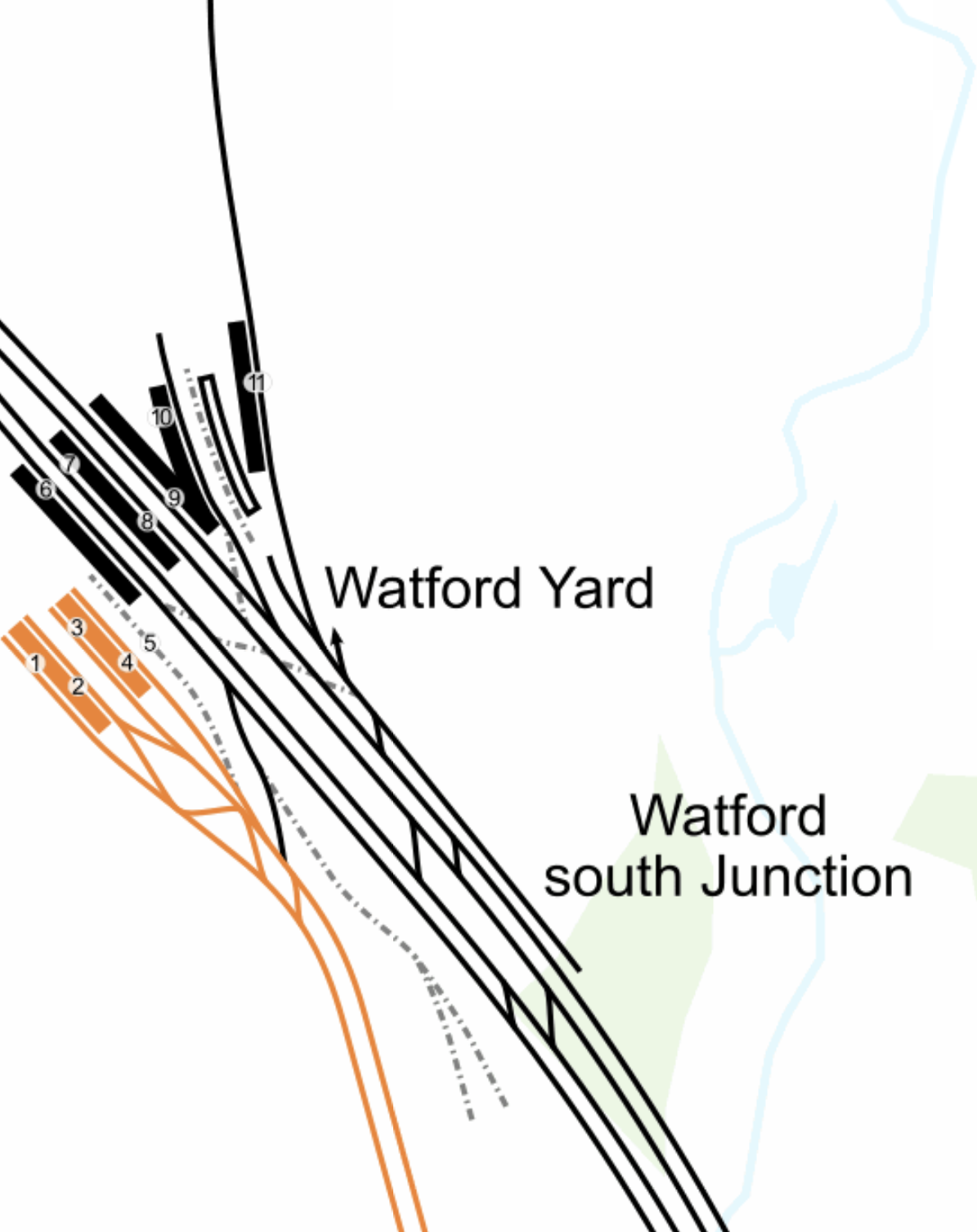
Note.
- The orange lines are the current Watford DC Line services of the London Overground, terminating in platforms 1 to 4 of Watford Junction station.
- These lines would be taken over by the unified Bakerloo/Watford DC Line services, running nine-car New Tubes For London.
- The next station to the South is Watford High Street.
- The West Coast Main Line goes through the station and uses platforms 5 to 10.
- At the North of the station is Platform 11 on the Abbey Line which leads roughly North East to St. Albans.
Look at how the Abbey Line is more or less in line with the twin-tracks of the Watford DC Line.
Recently, during the Bank Station Upgrade, a 488 metre long single track tunnel was built to divert the Southbound Northern Line.
This tunnel was not dug with a tunnel boring machine, but traditionally by hand, using men, picks, shovels and I suspect a few small machines.
I believe, that a similar technique could be used to dig a tunnel, to connect the Abbey Line and the Watford DC Line.
- It would only be single-track
- It would probably be less than 500 metres long.
- It would connect to the Abbey Line to the South of Platform 11.
- It would be deep-level tube-sized.
- It might be dug by hyperTunnel.
- Geography wouldn’t allow the tunnel to terminate in the Watford DC Line platforms at Watford Junction station.
But where would the terminal be on the Southern side of the West Coast Main Line?
This map from OpenRailwayMap, shows the two routes between Watford Junction and Bushey stations.

Note.
- Watford Junction station is at the top of the map.
- The orange line is the West Coast Main Line.
- The yellow line looping to the West of the West Coast Main Line is the double-track Watford DC Line.
- Bushey station is at the bottom of the map, where the two rail lines meet.
- Watford High Street station is in the middle of the map on the Watford DC Line.
The new service could certainly take the Watford DC Line as far as Watford High Street station.
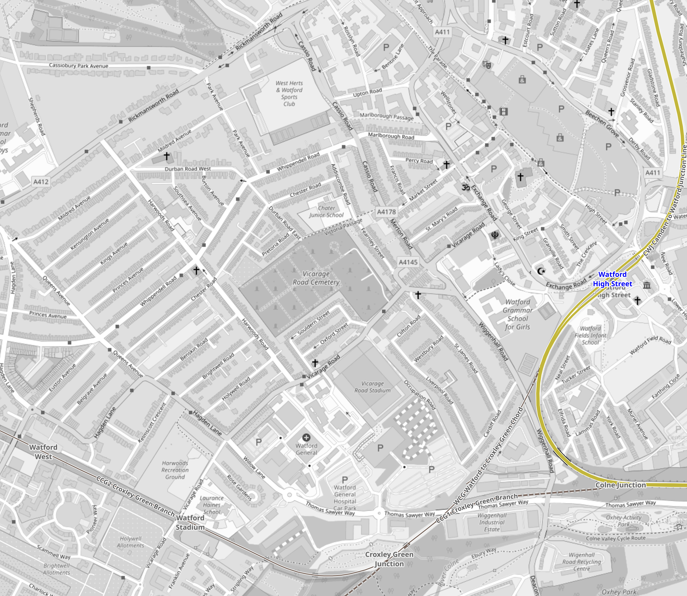
- The station is close to the centre of Watford, the hospital and Vicarage Road stadium.
- But there is no space for a terminal platform.
This second OpenRailwayMap shows the disused railways to the West of Watford High Street station.
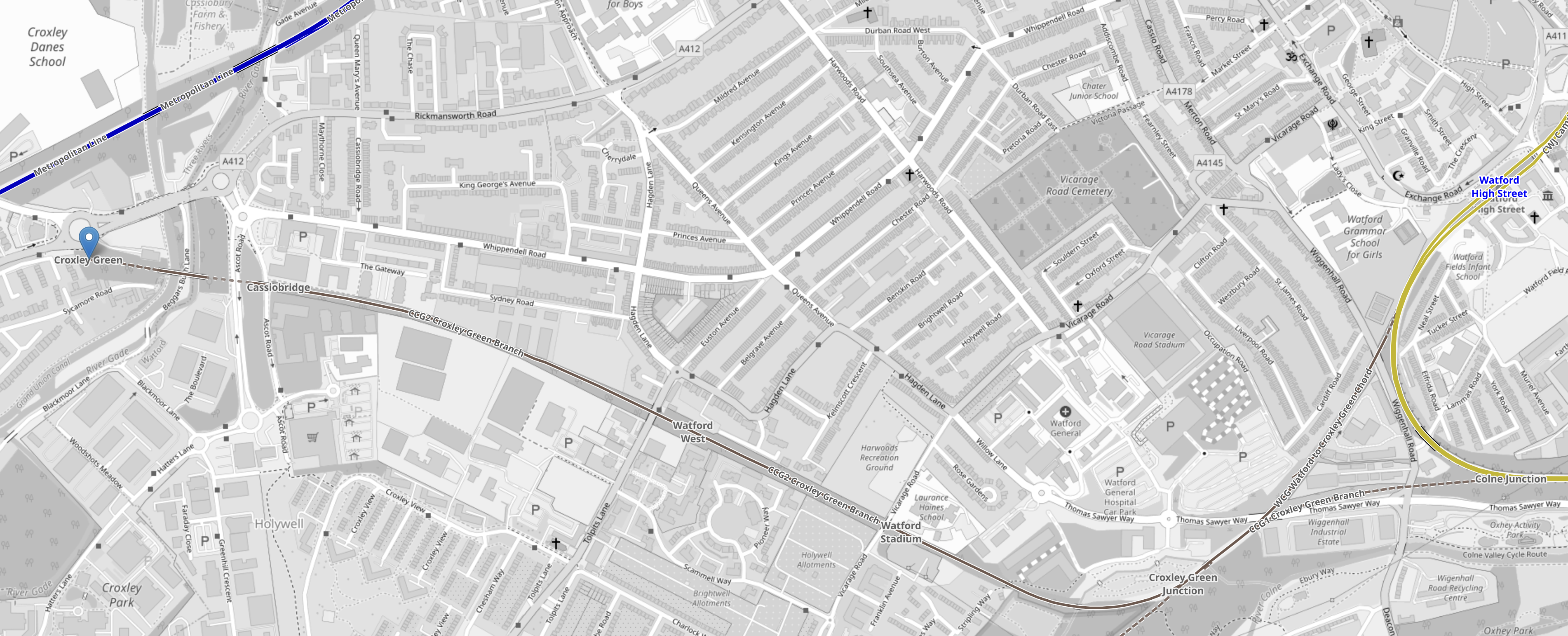
Note.
- The yellow loop at the East of the map is the Watford DC Line.
- Watford High Street station is on this loop.
- There is a triangular junction, that connects the former Croxley Green branch to the Watford DC Line.
- The terminus at Croxley Green station is marked by a blue arrow.
- There used to be intermediate stations at Cassiobridge, Watford West and Watford Stadium.
- This route was used for the failed attempt to build the Croxley Rail Link.
But could a Western extension of the Abbey Line be built?
- It would terminate at either Croxley Green or Cassiobridge.
- There would be intermediate stations at Watford West, Watford Stadium and Watford High Street.
- There would be two tph.
- Trains would be nine-car New Tubes For London.
- The current Abbey Line is 6.4 miles and would be run using battery power, with possible charging at St. Albans Abbey station.
- The tunnel under the West Coast Main Line would be run on battery power.
- The Western extension from Watford High Street station would be run using battery power, with possible charging at the Western end.
I believe, an extended Abbey Line could be a viable alternative to the ill-fated Croxley Rail Link.
- I have used battery power, as I doubt Health and Safety would allow any new third-rail electrification.
- I have used nine-car New Tubes For London for the extended Abbey Line, as their small cross-section would allow a smaller tunnel and they would be certified for running in tunnels.
- Some platforms on the Abbey Line would need to be lengthened, but these would be the only modifications, other than the possible installation of the charging system.
- The extended Abbey Line would serve Watford Hospital and Vicarage Road.
The capacity of the extended Abbey Line would be substantially more than the current line.
Conclusion
A common fleet used by the Bakerloo and Watford DC Line would appear to give advantages and it has been done successfully before.
But what the Bakerloo Line, the Watford DC Line, the Abbey Line and the Bakerloo Line Extension need is a good dose of holistic design.
Leading Transport Experts To Explore Innovative Options For The Watford To Croxley Link
The title of this post, is the same as that of this news item on the Watford Borough Council web site.
The news item starts with this sub-title.
A wide range of proposals to bring a long disused stretch of railway back to life as a key transport link between Watford and Croxley Green are to be explored…
These four paragraphs then outline what is to be done.
A wide range of proposals to bring a long disused stretch of railway back to life as a key transport link between Watford and Croxley Green are to be explored by three leading travel and transport consultancies.
Atkins, SYSTRA UK and Wood Group will work in partnership with Hertfordshire County Council, Watford Borough Council, Three Rivers District Council and Network Rail to provide innovative solutions to improve connectivity within the area.
The transport link will connect important areas of Watford like the town centre, hospital, Watford FC and Croxley Park with Croxley Green and Watford Junction and the travel network beyond.
Securing the right solution is an important part of the overall plans of the partnership and Network Rail for future cleaner, healthier and greener travel in the area for the benefit of residents, visitors and commuters.
Note.
SYSTRA UK and the Wood Group are respected consultancies.
The main railway station, town centre, football ground and the hospital should be connected together by decent public transport. In Watford, as in many towns, they currently are a long walk or a taxi.
Watford Junction and Croxley stations will be connected together.
These are my thoughts.
The Abbey Line
I believe that the Abbey Line, which links Watford Junction and St. Albans Abbey stations should be included in any proposals.
- It has a rather unusual timetable with trains running every forty-five minutes.
- Proposals exist for a passing loop, which would allow two trains per hour (tph)
- All stations only have a single platform.
If it were updated to a modern railway, it would be a valuable asset with charm.
Connecting St. Albans Abbey And St. Albans City Stations
This map from OpenRailwayMap shows the two stations.
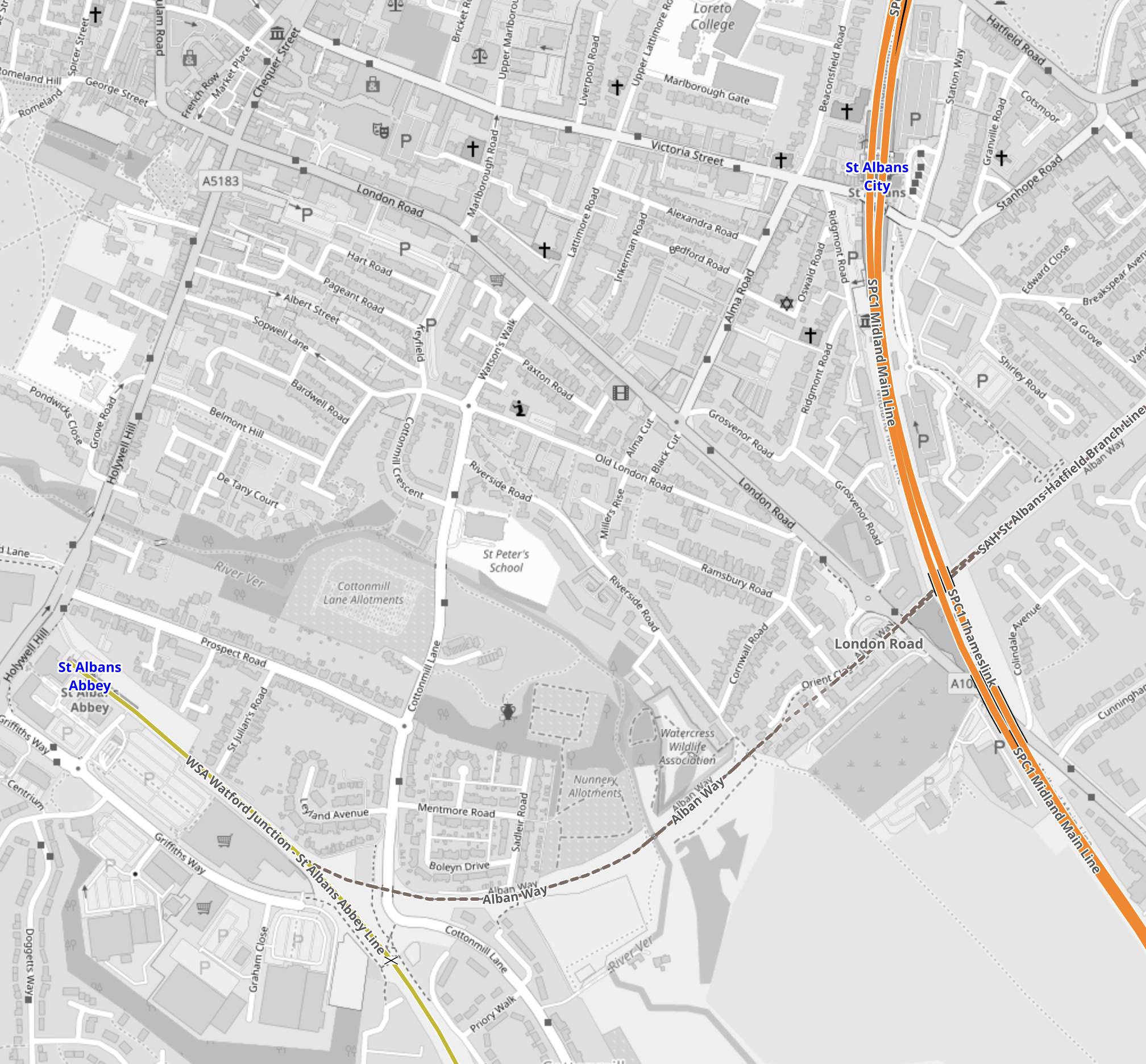
Note.
- The yellow line in the South-West corner is the Abbey Line that terminates in St. Albans Abbey station.
- The orange line is the Midland Main Line passes through St. Albans City station.
- The dotted line crossing the Midland Main Line and linking to the Abbey Line is a disused railway that has been converted into the St, Albans Way.
Tram-trains with a tight turning circle might be able to use the Abbey Line and with selected use of street running be able visit the City Centre and terminate at St. Albans City station.
Connecting The Abbey Line And The London Overground
This map from OpenRailwayMap, shows the track layout at Watford Junction station.
Note.
- The orange tracks are the West Coast Main Line.
- The yellow track to the North of the West Coast Main Line is the Abbey Line.
- The yellow track to the South of the West Coast Main Line is the Watford DC Line of the London Overground.
If you were using tram-trains, like the Class 399 tram-trains on the Abbey Line, I suspect a single-track dive-under could connect the Abbey Line with the Overground tracks to Watford High Street station.
Why Tram-Trains?
Tram-Trains have advantages in a scheme like this.
- They can run as trams on the streets.
- They can run as trains on railway tracks.
- They can use lightweight catenary, which is quicker and more affordable to erect.
- They are narrower and lighter than trains.
- They have a tighter turning circle than trains.
But most importantly, tram-trains have been running successfully in Sheffield for several years.
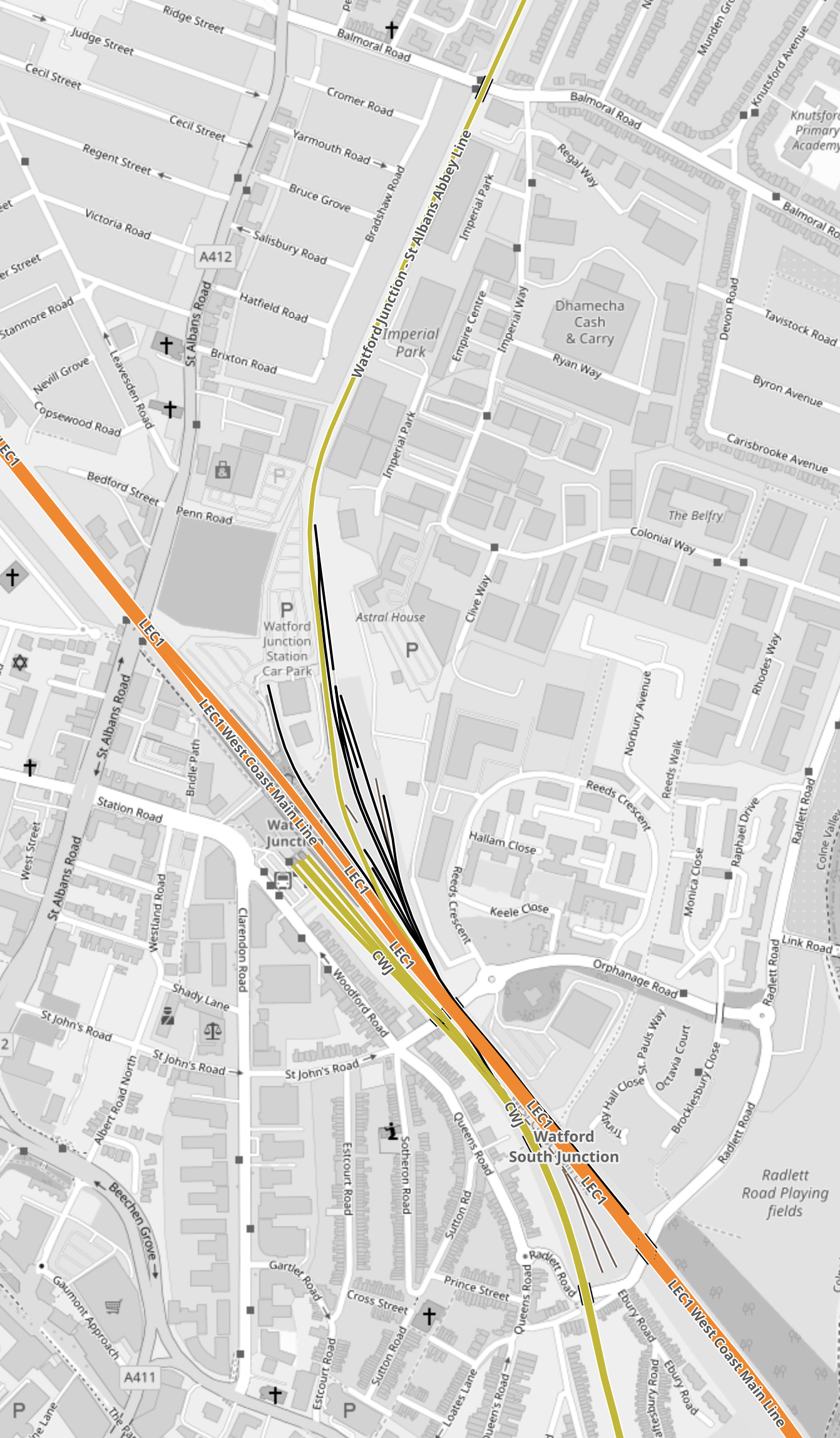
The Eastern Section Of The Croxley Rail Link
This map from OpenRailwayMap shows the Eastern section of the Croxley Rail Link.
Note.
- The yellow track is the Watford DC Line, which goes through Watford High Street station.
- A disused line runs via the Croxley Green Chord to the disused stations of Croxley Green, Watford Stadium and Watford West.
- Vicarage Road and Watford General Hospital are to the North of the disused line.
The original plan for the Croxley Rail Link would have seen a double-track along the line of the old railway with stations at Vicarage Road and Watford General Hospital.
I don’t see why tram-trains could join the Watford DC Line to the South of Watford Junction station, go through Watford High Street station and then continue along the reinstated track.
The Western Section Of The Croxley Rail Link
This map from OpenRailwayMap shows the Western section of the Croxley Rail Link.
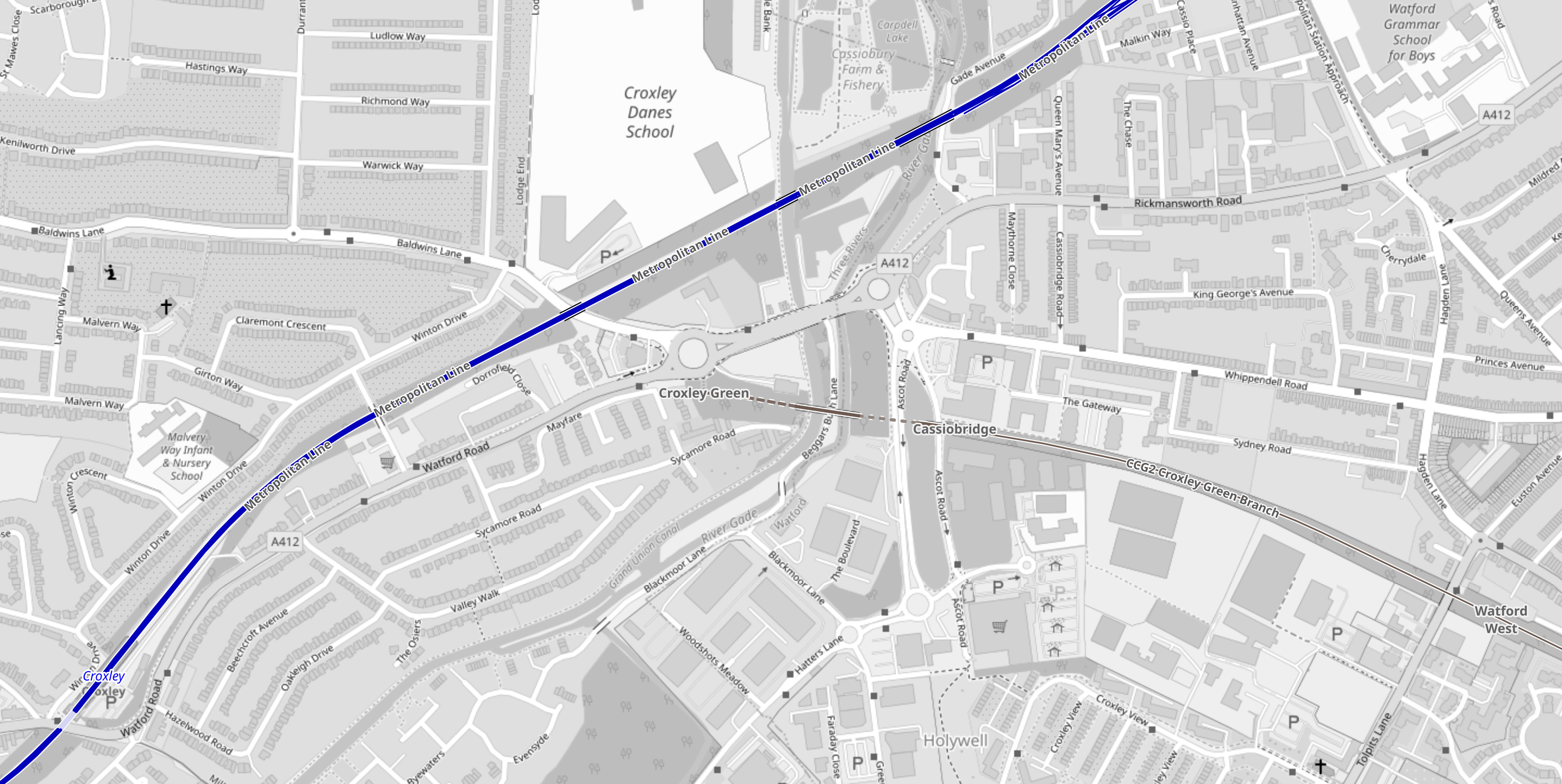
Note.
- The blue track is the Metropolitan Line, which runs to Watford station.
- The disused line runs West from the former Watford West station to the roundabout at Croxley Green on the A 412.
The original plan involved a large double-track viaduct, which is shown in this visualisation from the Watford Observer.
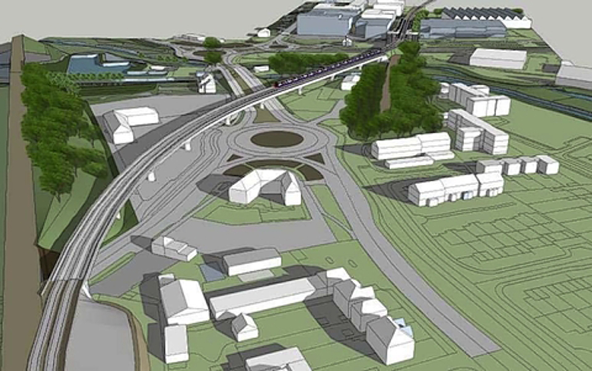
Note that the roundabout is the Croxley Green roundabout.
This Google Map shows the Croxley Green roundabout.
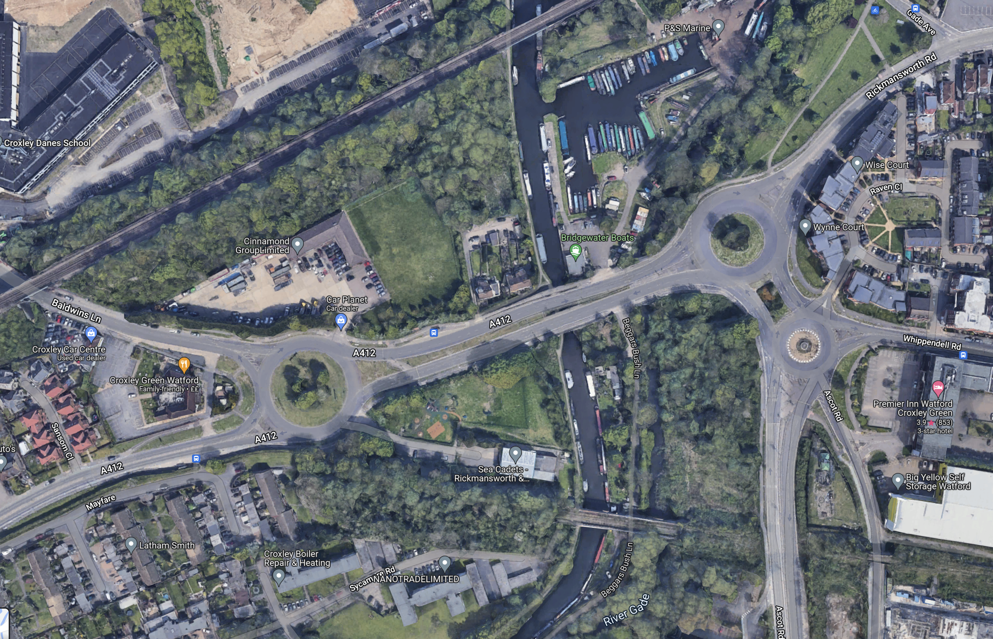
Note.
- The Metropolitan Line to Watford station runs across the North-West corner of the map.
- The Croxley Green roundabout is the roundabout in the West of the map.
- The disused railway runs from South of the roundabout to the South-East corner of the map.
- The proposed Cassiobridge station would be in the South-East corner of the map.
I wonder, if it would be possible to build a Croxley Green station to the South of the roundabout.
This would be an interim solution until it is worked out how to connect the Croxley Link to the Metropolitan Line.
Solutions could be.
- The original solution of a massive flyover, which would be very expensive and disruptive to build.
- Street-run the tram-train, which I feel are needed on the Croxley Link to Croxley station.
- Build a Croxley Green station on the Metropolitan Line to the North of the roundabout.
I think that experienced transport planners can find an acceptable solution.
