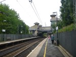
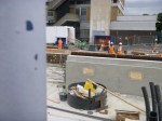
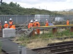
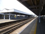
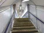
The New Northampton Station
Surely, a town trying to sell itself as a town to both develop and build cutting-edge products, needs a modrn gateway to the world.
Over the last couple of years, Northampton station has been rebuilt and it is now a superb gateway to the town.
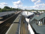


When the platforms and stairs have been finished, it’ll be one of the best medium-sized stations in the country.
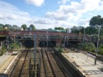
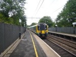
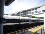
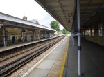
Redditch Station
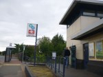
Redditch station is a small station, at the end of the mainly single-track Redditch Branch of the Cross-City Line in Birmingham.

I had hoped to find a cafe close, but there was nothing obvious, so I got back on the Class 323 Train and returned to Birmingham.
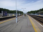
Redditch doesn’t quite get the service of say West Croydon on the Overground of four five-car trains an hour, but it does get three three-car trains every hour, which is better than many places in the UK and the wider world.
I would think that service levels greater than this would need another platform and complete doubling of the branch to Barnt Green. This Google Map shows that there is little space for another platform.

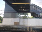
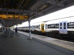
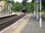
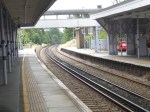
Redditch Station
As the post about Bromsgrove station showed, the Cross-City Line is adding four much-needed platforms at Bromsrove, just a few miles away.
So could we be seeing three trains an hour to each destination?
But I just get the feeling that some four-car trains might be needed after one trip in the peak.
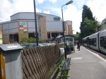
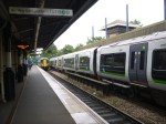
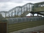
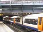
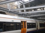
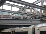
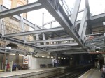
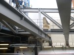
Birmingham’s Four-Poster Station
When I put forward the concept of a Four Poster Station, I was kite flying and didn’t know one had already been built.
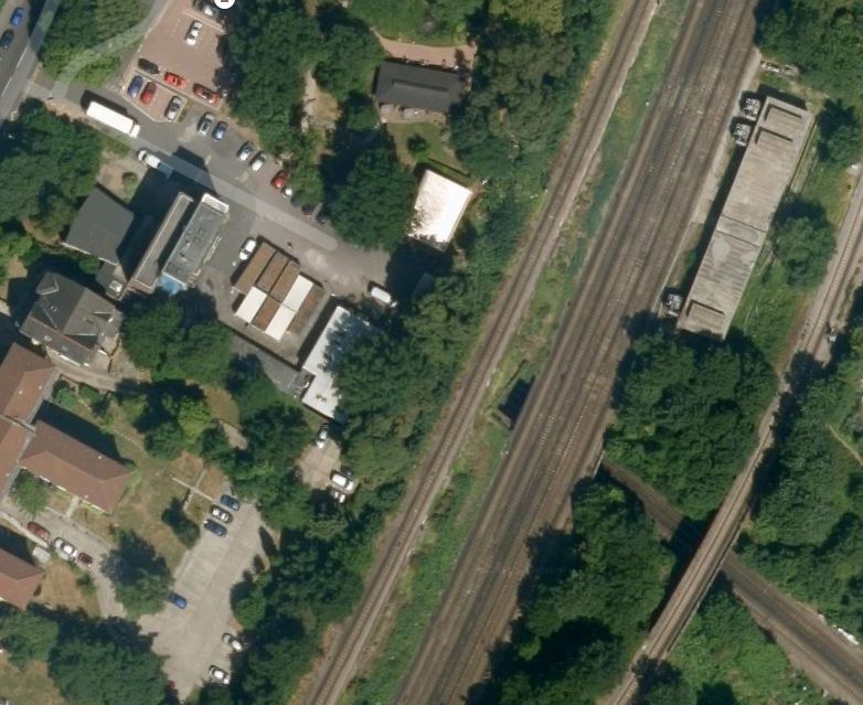
Smethwick Galton Bridge station has been built where the electrified New Street to Wolverhampton Line crosses the Snow Hill to Worcester Line. This is a Google Map of the station.
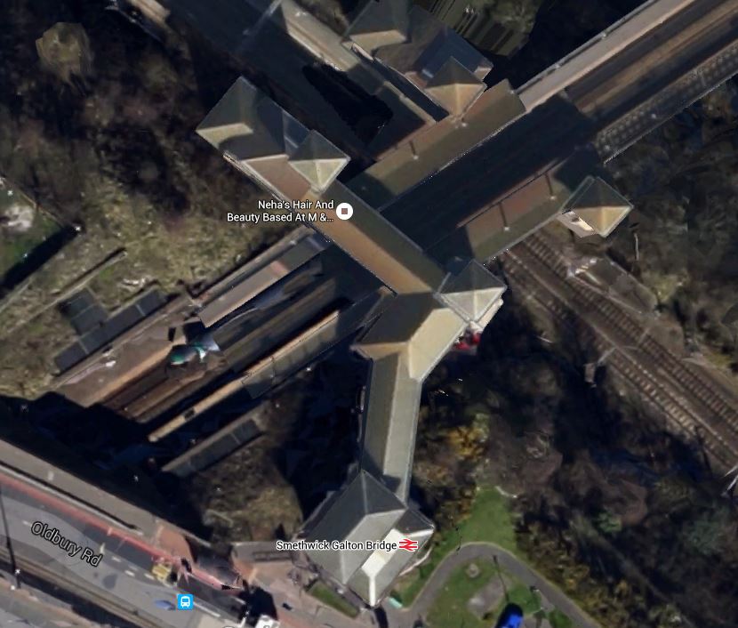
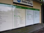
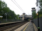
Smethwick Galton Bridge Station
Note the pyramids on top of each of the four lifts.
New Street is towards the South East, with Wolverhampton to the North West.
Worcester is to the South West with Snow Hill to the North East
I just had to go and see the station and took these pictures.


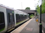

Considering it was opened in 1995, it was pretty radical for the time.
But it seemed to be working well, when I saw the station in the middle of the rush hour.
I do think, if they were building a station like this today, the various platforms and walkways would be made wider and if one was on the London Overground, they would leave spaces to put coffee stalls, passenger shelters and staff refuges. It probably illustrates how much more people friendly new stations are compared with twenty years ago.
I have a feeling that the design principles used here might be used at Brockley, Brixton and Penge.
But how many other places in the UK and perhaps the wider world could copy the basically simple design principles used here in Smethwick.
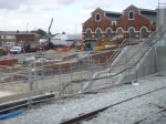
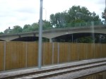
New Tracks And Platforms At Abbey Wood Station
These pictures show construction work going on, mainly on the Southern side of the North Kent Line at Abbey Wood station.
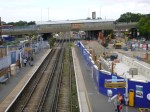


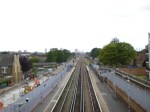
The current southern platform, which is numbered 1, will become an island platform for the North Kent Line between the two tracks., The current Up line will become the Down line , with the new Up line being created to the South side of the platform. As the pictures show work is progressing well on creating a concrete channel for the track.
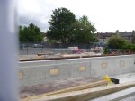
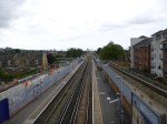
Crossrail Works Between Plumstead And Abbey Wood Stations
Work seemed to be in full flow between Plumstead and Abbey Road stations, as I went to Abbey Wood.


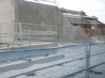


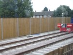
There will be depot at Plumstead for Crossrail, but most of the work shown is for the two new tracks that will be on the northern side of the North Kent Line
They’re Just A Load Of Snobs In Chelsea
That should be the headline on this report from the Evening Standard about the posh people not wanting the plebs to go to Chelsea.
It’s the last time, I buy any of Grossman’s sauces!
Seriously though, look at this Google Map of the area from Fulham Broadway station to the possible proposed site of the station.

Chelsea Station And Stamford Bridge
If the new Chelsea station is where the red arrow is, it will be very convenient for going to the football. Especially for one of my mates who supports Chelsea and lives in Dalston.
But where I live, I’m close to Highbury and could walk there to see a match. The only trouble you get is a lot of traffic on match days, which is getting better year on year as the public transport improves.
I suspect that if the new Chelsea station opens, that on match days, it will actually improve the traffic in Chelsea, as more supporters will use public transport.
Those who are protesting are just a load of snobs, who would prefer to live in a gated community, where others are only let in under permit and after CRB checks!
I took a few photographs from the top of a virtually empty number 11 bus, as it progressed up the King’s Road from Fulham Broadway to Sloane Square.


It was surprisingly quiet.
Having seen the site, I suspect if they do put a station at the Chelsea Fire Station site, they’ll use the same technique as at Moor House for Crossrail.
At some point in the next few years, a developer will put up a stylish building in place of the fire station, which will have a core that will have provision for Crossrail 2 to pass through and connect up later. This later connection will be done without any action from the surface, but totally from the tunnels.
I suspect the probably bland high-rise residential property, they will get on the fire station site, will cause more degradation than Crossrail 2 ever will. Look at the monstrosity that has replaced the much-loved Middlesex Hospital.
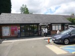
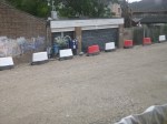
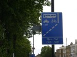
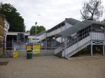
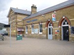
Orpington Station – 3rd August 2015
After An Exploration At Penge, took a train from Penge East station to Orpington station.
These pictures I took, show a well-appointed station with full step-free access and a selection of long through and bay platforms.


Could Orpington be one of the extra destinations that are needed by the East London Line?
It takes thirty four minutes of travelling time to get to Whitechapel changing at New Cross at the moment, so it is actually closer than West Croydon, which takes forty minutes.
The route passes through a series of important and busy stations like New Cross, Lewisham and Petts Wood. It could either be via Beckenham Junction and Bromley South or via Hither Green and Chislehurst.
Using Opington as a destination for the East London Line would appear to connect a lot of South East London to Crossrail at Whitechapel and the Jubilee Line at Canada Water.
It would also fit in well with Transport for London’s desire to take over services in South East London. The Wikipedia entry says this.
However, since taking over the West Anglia services, TfL have once again proposed to take over the suburban routes, currently operated by Southeastern after their franchise ends. The opposition to TfL taking over routes from Kent County Council have softened after a London Assembly meeting, which Kent County Council attended. Kent have set out “red lines” to its support, stating no Southeastern Mainline service should be negatively affected by a take over by TfL.
So bringing an uprated East London Line to Orpington might appear on the surface to fit in well with TfL’s ambitions.
It certainly seems that they have big ambitions in South East London.
Could it be Borough Jealousy?
Councils like Bromley have seen the improvements in transport and the related benefits in Northern boroughs like Hackney, Islington and Brent and want a piece of Orange action themselves.
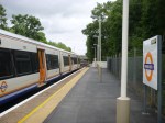
An Exploration At Penge
I took the Overground to Penge West station and then walked to Penge East station. The walk is about 15 minutes.
The objective was to investigate the Penge Interchange proposed in the Transport Infrastructure Plan for 2050, After all, I can’t find any other reference to this on the Internet. Even if you search the whole of the Infrastructure Plan, Penge is only mentioned once.
This is a Google Map showing both stations.
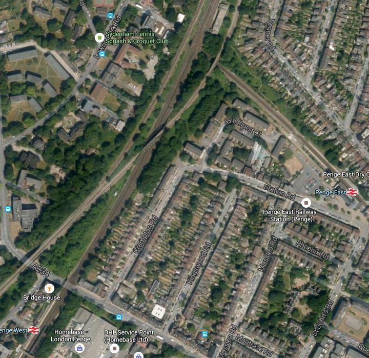
I took these pictures at Penge West station

Penge West is a typical South London station, but it is not step-free and it has an uncovered bridge. There is also only one entrance and exit on the Northbound platform. It will have to be rebuilt with a new footbridge and a possible entrance/exit on the Southbound side. This Google Map shows the station and the surrounding area.
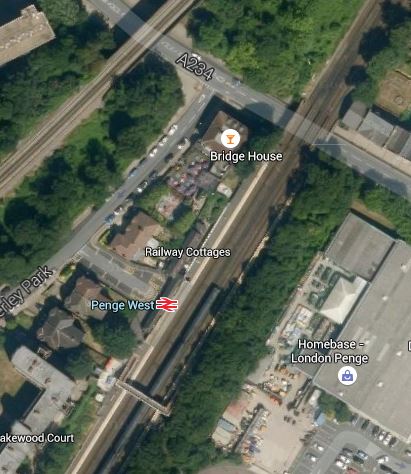
Penge West Station
It would appear that there is enough space to rebuild the station with a second entrance/exit on the Sounthbound side of the lines. The other line crossing the top left corner of the map, is the line that takes the East London Line to Crystal Palace.
Whilst I walked to Penge East station, I took these pictures.

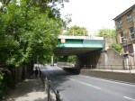
The bridges at Penge West station, probably rule out any connection of the two lines in a rebuilt station.
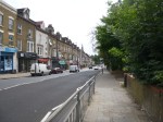
Incidentally, the walk is well-signposted except for the unfortunate sign directing you to Penge East station off the High Street, which is only visible when you’ve passed by.
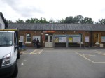
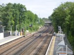
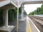
These are pictures of Penge East station.


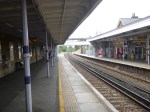
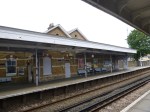
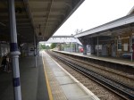

The station has the worst footbridge, I’ve seen for a long time and surely only the grace and favour of the woodworms holding hands, stops it from falling onto the railway. It is of course not step-free.
Believe it or not this dreadful footbridge is Listed. It also is a regular walking route across the railway for people not using the trains.
So making Penge East station comply with the disability Regulations would mean putting a second footbridge somewhere else.
The irresistible force of the Disability regulations has met the immoveable object of the Heritage Lobby. Wth which group would Network Rail least prefer to have a big fight?
This Google Map shows the area from Penge East station to where the lines go under the Brighton Main Line
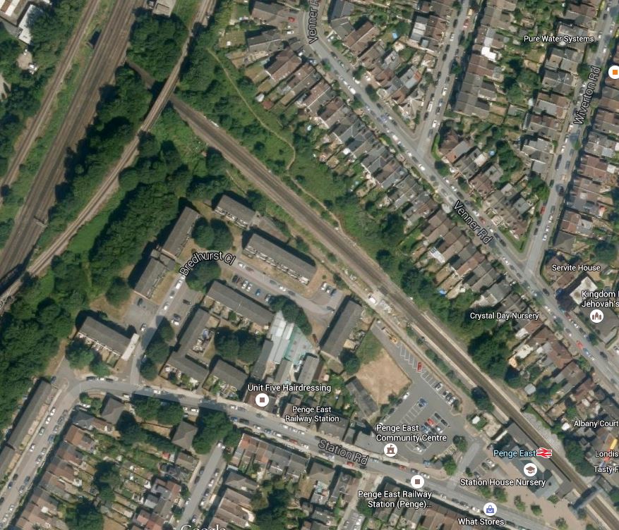
Penge East Station
I think that having looked at both Penge East and Penge West to improve services in the area, TfL and Network Rail have taken the decision to perhaps build a new Penge Interchange station, where the lines cross.
This has led to the inclusion of the single word, Penge, under a list of possible interchange stations in Transport for London’s future predictions. This Google Map shows the area where the lines cross.
A Possible Site For A Penge Interchange Station
There are actually three groups of lines that cross the lines through Penge East.
- The single-track northbound Sydenham Spur linking Crystal Palace to the Brighton Main Line.
- The four-track Brighton Main Line with the slow lines on the outside.
- The single-track southbound Sydenham Spur linking the Brighton Main Line to Crystal Palace.
Depending on how much you would want to spend, you could build new platforms on the Brighton Main Line and the Sydenham Spur and link them by lifts to platforms on the line through Penge East.
A few points.
1. I think that the platforms would be extended from Penge East towards the new interchange.
2. The Listed footbridge at Penge East would be saved and the woodworm can be given help from craftsmen to hold the bridge up.
3. There would appear to be a service tunnel under the railway, that gives access to the building on the eastern side of the Brighton Main Line. Could this help in the design and construction of the station?
4. From the Google Map, there would appear to be space for an access to the station from Lawrie Park Road.
5. The area around Penge West station could probably be connected to the new complex by a footpath running along the railway lines. There could also be some rerouting of buses.
6. The station could probably be designed to create an East- West walking and cycling route under the railway.
7. Network Rail would get improved access to their building on the eastern side of the tracks.
It is also interesting to look at the passenger statistics for the stations in the area for 2013-14.
- Penge West – 0.5 million
- Penge East – 1.5 million
- Anerley – 0.7 million – South of Penge West
- Sydenham – 2.3 million- North of Penge West
These statistics provoke me to say, that if a Penge Interchange station was developed where the lines cross, would it be sensible to close the current Penge West station?
After my visit to Penge and my cursory investigation, I am led to the conclusion, that building a new Penge Interchange station, which possibly incorporates elements of the current Penge East station, and closing the lightly-used Penge West station, is not an impossible dream.
Whitechapel Station – 3rd August 2015
There has been another busy weekend at Whitechapel station.


There has been no news of problems, that will delay the opening of the temporary entrance in the Autumn.
Should We Increase Rail Freight To Avoid Calais And The Migrants?
The BBC has quoted the French Police Chief at Calais as saying that the number of trucks trying to use the ferries and Eurotunnel has dropped.
Is this because it’s now the Summer holidays and the drivers have flown to their holidays or could it be that at last the needs of freight transport between the UK and Europe are being increasingly fulfilled by the obvious alternative, that hopefully would be totally useless to the migrants? – Direct freight trains between UK and Europe.
I wrote on this in December 2014 calling the post, Would Reorganising Cross-Channel Freight Cut Illegal Migration?
I stand by what I said then.
You have to remember, that a lot of freight flows between the UK and Europe are large and predicable. This is a few freight categories that I know go by rail over the channel.
- Car components including complete engines for Ford and BMW.
- Complete vehicles. Four years ago, you didn’t see car trains on the Gospel Oak to Barking and North London Lines, but now they are quite common.
- Fresh fruit from Spain to the UK.
- Steel products for Tata Group between Wales and The Netherlands
Are cargoes like Scottish fish and meat from all parts of the UK something that will be going on that list? These would only need refrigerated containers, that you see all over the railways. With meat too, there are no welfare issues and as a beef farmer once told me, dead carcasses pack three times better in a refrigerated truck, than livestock.
I have also found this informative article on the DB Schenker web site. It isn’t dated unfortunately, but it makes a lot of general points. This is the first two paragraphs.
When the Channel Tunnel between Calais in northern France and Folkstone on the southeastern coast of England opened in 1995, many forecasted a bright future for rail freight transport between Great Britain and continental Europe. An enormous amount of effort and money went into the construction of the two-track rail tunnel. The high hopes for the groundbreaking project have not yet been met, however. In fact, only 1.1 million metric tons of freight was transported by rail via the tunnel under the English Channel in 2010, less than before the 50-km tunnel opened.
High prices in particular have prevented rail freight transport from making greater use of the tunnel. Competition between freight forwarders that use the truck shuttle has kept prices in check. Eurotunnel charges a higher, constant price for block trains, however, and as a result, only a few providers can afford the transfer.
The last part in particular blames the high charges and the charging method of Eurotunnel. Governments should apply pressure here.
The article does talk about problems with the UK loading gauge, which hopefully are being fully addressed now.
At least thought freight trains between the UK and Europe can now get from Barking in East London to virtually anywhere in Europe.
Perhaps, the UK Government should use taxation and tax relief to encourage more freight flows across the Channel to go on freight trains.
The losers would be UK haulage firms and drivers, but they can’t find Cross-Channel trade very profitable and stress-free at the moment.
