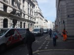
Protecting Pedestrians From Vehicles Driven By Imbeciles
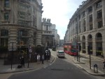
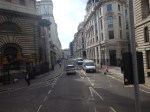
Look at these Google Maps of part of various bridges across the Thames.
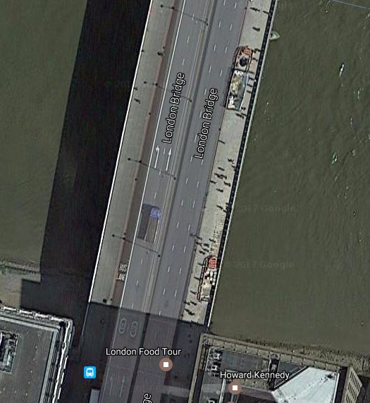
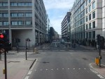
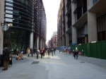
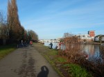
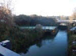
London Bridge
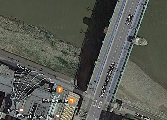
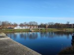
Southwark Bridge
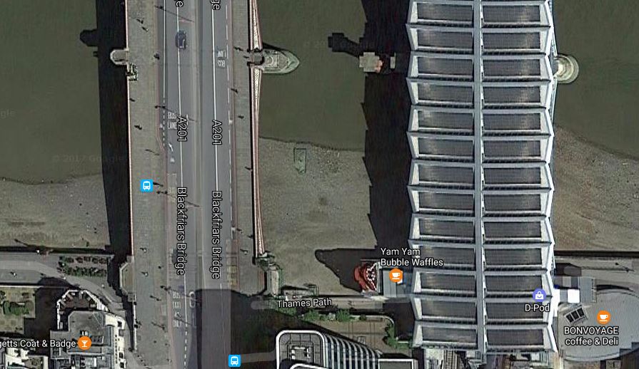
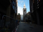
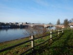
Blackfriars Bridge
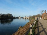
Waterloo Bridge

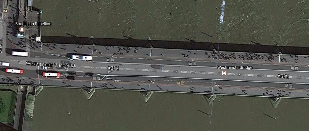
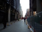
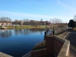
Westminster Bridge
Note.
- How the pedestrians can are easily seen in the images.
- All the bridges have wide pavements, which are designed for easy walking.
- All images were probably taken at the same time and are to the same scale.
- Westminster Bridge is much busier than the others.
There is no protection to stop a bin lorry with a driver who has a high risk of collapse, wandering off into the crowd. Given that that has happened in recent years, surely we should develop a protective system, that stopped vehicles getting on the pavement.
You wouldn’t need it on every road, as very few are likely to suffer an attack from imbeciles. But there have been a couple of pedestrians killed by drunks or drivers who should have given up because of health or advanced age.
Many roads too already have massive protection for pedestrians, as rows of vehicles are parked nose to tail alongside. I’ve never heard of an out of control vehicle going through a line of parked vehicles to kill someone. It must have happened surely!
Perhaps on London’s bridges and the wide pavements of streets like Regent Street and the Embankment, bollards or something physical will help.
But we should think creatively!
Something that could be done in London would be to follow on from the action at Bank Junction, where between seven and seven, the junction is for buses and cyclists only.
As there seems to have been little protest about this action, perhaps it could be done elsewhere and for twenty-four hours.
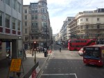
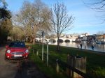
Look at the image of Southwark Bridge and the bridge is showing its reputation as London’s least used bridge.
So why not make the bridge pedestrians and cyclists only?
That could be done tomorrow and it would take some pressure from London Bridge, especially in the rush hour.
Also, at Blackfriars Bridge, it should be that pedestrians could use Blackfriars station, by just touching in and out and not being charged.
Pedestrian-only routes must be much safer.
Bank Junction Goes Buses And Cyclists Only
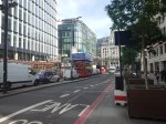
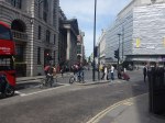
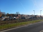
On Monday, the 22nd of June 2017, the City of London brought in an order making the busy Bank Junction buses and cyclists only between seven in the morning and seven in the evening from Monday to Friday.
I took these pictures soon after ten in the morning.


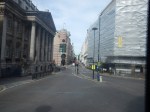


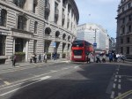


The first few pictures were taken from the top of a Routemaster bus on Route 21, as it travelled from where I live across the city to London Bridge station.
Note.
- Most drivers seemed to be avoiding the area.
- The City of London Police were telling drivers, but didn’t appear to be ticketing anybody.
- Much of the congestion seemed to be caused by half-empty polluting Tour Buses.
- One pedestrian was moaning that he couldn’t use his car to get around the City.
Overall, it appeared to be a calm start.
The Upgrade Of Bank Station
I have only shown the area on the surface, but under the ground around Bank Junction, a massive construction project is starting in the City of London’s twin goals of more and better office accomodation and transport links.
Bank station is getting a major upgrade, which will include.
- In The New Tunnel Under Bank Station, I wrote about an upgraded pedestrian tunnel that crosses the area.
- In Between Bank And Cannon Street Station, I wrote about how Bloomberg are helping develop a new step-free entrance to the Waterloo and City Line and Bank station, which will open by early 2018.
- A new Northern Line tunnel to create more space on the platforms and increase frequency on the line.
- The station weill receive a forty percent increase in capacity.
- Full step-free access with thirteen new escalators and three new lifts.
- A new entrance to Bank station opposite Cannon Street station.
- Two North-South moving walkways.
- Some of the £600million project cost will be funded by oversite office development.
- Hopefully, much of the work will be finished by 2021.
There’s more in this article in the Guardian, which is entitled Bank station upgrades point to London’s bigger, busier future.
Bank Station And Crossrail
You may wonder, why if Bank station is so important, that Crossrail doesn’t call and Crossrail 2 won’t either.
It may not, but the Central Line will have good connections to Crossrail at Stratford, Liverpool Street, Tottenham Court Road and Bond Street stations.
So passengers for Bethnal Green, Bank, St. Paul’s, Chancery Lane and Holborn will change from Crossrail to the Cwntral Line at a convenient station.
In addition, Crossrail will feed passengers into loops in the District, Hammersmith and City and Jubilee Lines.
Travellers will pay their money and take their choice.
Other Developments At Bank
I wouldn’t be surprised to see more pedestrian routes linking the City stations of Bank, Cannon Street, Fenchurch Street, Liverpool Street and Moorgate; both on the surface and possibly underground.
I would also make sure that all buses in the centre of London are low-emission vehicles. That certainly doesn’t apply to those polluting and jam-creating Tour Buses and tourist coaches.
Derby To Manchester The Midland Way
I was trying to find out about two stations; Miler’s Dale and Monsal Dale, which are both on the Manchester, Buxton, Matlock and Midland Junction Railway.
I found this article in the Derby Telegraph, which is entitled 50 years on, as passengers return to railways, in a few quiet corners, Beeching’s cuts are being reversed.
It says a lot about the Midland’s spectacular route from Derby to Manchester.
As a result, some of the lines and stations axed in the Beeching Report are being brought back to life. One of these is the Midland Railway, a route which once linked Derby and Manchester.
It is regarded as one of the most spectacular lines ever built. Cutting through the Peak District, numerous tunnels and other impressive civil engineering features, including magnificent viaducts at Millers Dale and Monsal Dale, had to be constructed because of the terrain.
In 1967, the Beeching Report brought about the end of passenger services on the line with the closure of stations at Millers Dale, Bakewell, Rowsley, Darley Dale and Matlock Bath. Now a three-and-a-half-mile section of the line has since been reopened and brought back into use by Peak Rail.
Today, the company operates both a steam and heritage diesel service for tourists and visitors to both the Peak District and the Derbyshire Dales. The preserved railway line operates trains from Matlock station via Matlock Riverside and Darley Dale to Rowsley South.
Peak Rail has ambitions to reopen more of the line in the future. The first stage would be to relay track to the site of Rowsley station, extending to a total of 4.25 miles. There are also plans to extend the line all the way to Bakewell, which would involve the restoration of both the Haddon tunnel and Coombs Road viaduct as well as the reinstatement of numerous bridges along the way.
It certainly seems to be worth a visit.
It sounds to me though to get trains running all the way will need a friendly billionaire.
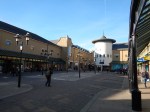
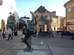
A Visit To The Design Museum
I visited the Design Museum yesterday.


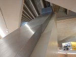

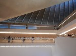

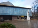
It is an interesting concept and I think as it settles down it will be worth visiting again.
One problem, I had with the Museum is getting to and from the site in Holland Park.
I went by the Underground to High Street Kensington station and took about ten minutes to walk along to the museum.
Coming back, I thought I’d go a different way after a walk.
But after emerging from the Museum, there were none of London’s excellent Legible London maps and signs to be seen.
Eventually, I walked through Holland Park, but it was the same story on the other side of the Park; no maps or signs to the Underground. There were several fingerposts in the Park, but none pointed to the Underground.
I suppose if you’re in a Chelsea Tractor, many of which were rushing around the area, you’re not interested in walking maps and are against your Council spending monry on them, as it might attract more visitors.
Between Bank And Cannon Street Station
The City of London is creating a new walking route between Bank and Cannon Street stations, along Walbrook.
It doesn’t reach to the Thames yet, as there is some 1980s development and the dual-carriageway of Upper Thames Street in the way, but I suspect it will, at some point in the future.
On the Western side of the walk is Walbrook Square being developed by Bloomberg, which underneath which are both the London Mithraeum and the new step-free entrance to the Waterloo and City Line and Bank station.
On the Eastern side is the historic church of |St. Stephen Walbrook, where I once met Chad Varah; the founder of The Samaritans, who for personal and wider reasons, I nominated at Man of the Noughties.
This Google Map shows the area.
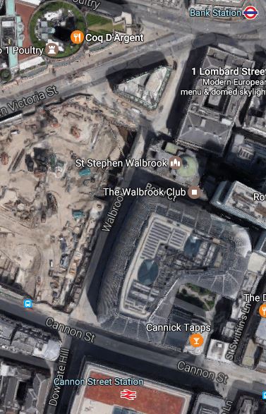
It looks like this walking and cycling route will come with a prestigious office development, an important Roman site and a transport interchange.
I have a feeling there’s a deep agenda in pedestrianising Walbrook in this way.
Commuters arriving in the City at Cannon Street station or the Waterloo and City Line will be able to come out of the stations onto the spacious thoroughfare of Walbrook , from where they could walk to their place of work. A pedestrianised Bank Junction would give a traffic free route for commuters to the East side of the junction.
Could we see other routes around Bank Junction also given over to pedestrians and cyclists? Roads like.
- Cannon |Street
- Cornhill
- Dowgate Hill
- King William Street
- Lombard Street
- Lothbury
- Old Jewry
- Prince’s Street
- St. Swithin’s Lane
and a few others, must all be being considered for full or partial pedestrianisation.
In addition, there will be beloe-ground routes through Bank station.
From St. Leonard’s To Hastings
I walked along the sea-front in the sun to Hastings.
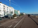


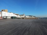
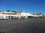


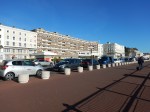

It was colder than it looked and I was pleased, I had got a lot of layers on.
I finished my walk, in the cafe at the surprisingly large Marks and Spencer, which was just a short walk from the station.
About fifteen years ago, I went to Hastings and was distinctly unimpressed. It has certainly improved and it was a good walk along the front.
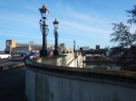
Bollards To Illegal Parkers
The City of London has its own distinctive way with street furniture.
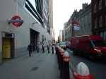
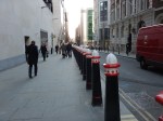
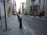
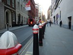

But it’s not just bollards.


A walk through the City of London is always rewarding.
Walking From Hampton Court To Kingston
I hadn’t intended to walk, but when I saw the distance was 3.5 miles and it was sunny, I thought why not!


It took me twenty minutes over the hour and I had lunch in Bill’s by the river before taking the train home.
A Walk From Oxford Station – 1st December 2016
This walk was a repeat of A Walk From Oxford Station, that I took in March 2015.
.

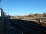
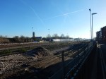
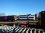
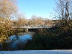
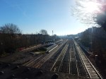
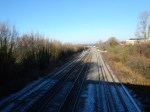
You wouldn’t notice much from the pictures, but being there I noticed changes.
It was all so much better organised, with a new bridge and extra tracks for Chiltern services.
The Mayor’s Plans For East London River Crossings
This article on the BBC is entitled Mayor accused of ‘betrayal’ over Silvertown river tunnel.
I made my feeling clear about the tunnel in No To Silvertown Tunnel . I started by saying this.
My personal feelings about the Silvertown Tunnel are that it is irrelevant to me, except that it might help some trucks bring goods that I buy online or at a local shop. Although as a sixty-eight year-old-widower living alone, I don’t think my transport needs through the tunnel will be high.
I don’t drive after my stroke and I like that lifestyle, except when last night it takes me three trains, a coach and a taxi to get back from watching football at Ipswich. But that tortuous late night journey was caused because NuLabor spent my tax money on pointless wars that will haunt us for generations, rather than in extending and renewing our rail system, that will nurture and enrich our future.
I don’t think, that I’ve changed my views much.
The Mayor is actually proposing five river crossings.

Five New Thames Crossings
Here my thoughts on each
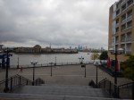
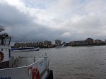
Rotherhithe – Canary Wharf Bridge
This is detailed in Wkipedia as the Rotherhithe Crossing or Brunel Bridge.
Wikipedia says this about the location.
The preferred location for the bridge identified in the feasibility study would be between the Impound Lock close to Cascades Tower on the northern (Canary Wharf) bank, and at Durand’s Wharf park on the southern (Rotherhithe) bank.[2]
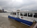
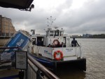
There is currently a Thames Clippers ferry shuttle between these two points. The Jubilee line parallels the route of the proposed bridge, with the nearest stations at Canada Water and Canary Wharf.
I took these pictures of the current ferry from Canary Wharf pier.
The bridge has its own web site, with a dramatic picture on the home page.
The visualisations show a bridge, that I think few would dislike. I certainly don’t!
- It’s dramatic.
- It would be open to pedestrians and cyclists.
- It would be the longest bascule opening bridge in the world.
- It would allow tall ships to pass through.
But above all I suspect that Marc and Isambard would have approved.
Canary Wharf – North Greenwich Ferry
If Canary Wharf to Rotherhithe can sustain a ferry, then surely a ferry at the other side of Canary Wharf connecting to North Greenwich with the O2, must be viable.
This Google Map shows the Thames between Canary Wharf and North Greenwich.

Canary Wharf And North Greenwich
It is not the longest ferry link, but there are questions to be answered.
- Does the ferry go right into the heart of Canary Wharf or only as far as the bank of the Thames?
- Does the ferry go all round the O2 to North Greenwich Pier or call at a new pier on the west side of the Greenwich Peninsular?
- Will the ferry be fully accessible?
- Will the ferry accommodate bicycles?
- Will the ferry be free, as is the current Woolwich Ferries?
- How many boats will be used?
I think that there could be an opportunity to design an integrated ferry and pier, that would be all things to all users.
It certainly shouldn’t be boring and if possible it should call at the heart of Canary Wharf.
Silvertown Tunnel
In my view the Silvertown Tunnel is just another route for some travellers and possibly their goods to take between the two banks of the Thames.
Categories of traffic across the river through a new Silvertown Tunnel would include.
- Individuals, groups and families, who don’t necessarily need a vehicle. But sometimes choose to take one.
- Individuals, groups and families, who absolutely need to take a vehicle.
- Vans and trucks collecting or delivering goods.
- Buses and coaches
- Taxis, mini-cabs and private hire vehicles.
One thing that has been said about the Silvertown Tunnel is that it will be funded by a toll and some reports have said that the Blackwall and Rotherhithe Tunnels will be tolled as well.
London already has a congestion charging system for areas in the centre and I suspect that this could be updated to charge for the cross-river tunnels.
We’ve never had a toll to get across the Thames in London, with even the Woolwich Ferry being free, so I suspect that a toll would reduce cross-river vehicular traffic.
Remember that, when tunnels were built under the Thames in Central London, there was few quality alternatives with the exception of the Northern and Victoria Lines and the original undeveloped Thameslink.
But over the last few years, cross-river and other public transport has been getting better. And it still is!
Consider.
- In the last year, a lot has been disclosed about Crossrail and its enormous Class 345 trains.
- We’ve also seen the opening of the new London Bridge station and can see the improvements taking place in South London.
- We’ve also seen the arrival of the Night Tube.
- Capacity is being increased on the cross-river East London Line and the Jubilee, Northern and Victoria Lines.
- We have Night Thameslink, so will we see a Night Crossrail?
Other developments will follow.
The only certainty is that we will be seeing a large increase in quality public transport, over, under and on the Thames.
I think for the first time in my life, there could be two competing ways of getting across the Thames; driving through a tunnel or using public transport.
Cost, convenience, needs and possibly an all-singing-and-dancing computer or phone app will tell you where to go.
As I said earlier, if the Silvertown Tunnel is built, it will be just another route for travellers, with perhaps a higher, but fixed cost.
If it is built, I think there should be conditions.
- The Blackwall, Rotherhithe and Silvertown Tunnels should all have tolls.
- Crossrail and Thameslink should have a great deal more Park-and-Ride capacity.
- All buses, coaches, mini-cabs, taxis and trucks in Central London should be low emission.
I also think that large areas of Central London, like the City and Oxford Street should be pedestrianised and some are on track for this to happen.
Much of the decision about the Silvertown Tunnel revolves around politics.
Sadiq Khan, has said he’s in favour of the tunnel with conditions, but he is up against a formidable movement that don’t want the tunnel built at any price.
I also find it interesting, that Ken Livingstone was in favour of the Silvertown Tunnel. But Ken brought in congestion charging.
I wouldn’t be surprised, if there’s some researchhanging aroiund in TfL, that says that a tolled road crossing will cut traffic. But it’s the sort of research no-one would believe.
So perhaps a tolled Silvertown Tunnel with conditions will be a good idea.
But only because there are now alternatives!
Gallions Reach DLR
The BBC article says this about this proposal.
A DLR crossing at Gallions Reach, helping support the development of around 17,000 new homes across Newham and the Royal Borough of Greenwich
It is different to the original proposal of a Docklands Light Railway extension to Dagenham Dock, which stayed on the North bank of the Thames.
This map shows the area of London from Gallions Reach to Abbey Wood.
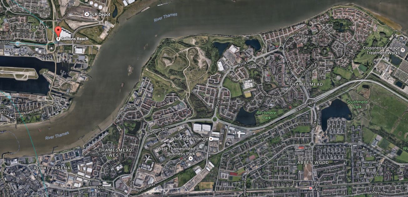
Gallions Reach To Abbey Wood
Note.
- Gallions Reach DLR station is marked with the red arrow.
- Just to the North of Gallions Reach station is the main DLR depot, which would probably be an excellent site to start a tunnel.
- The tunnel would probably emerge on the South bank of the Thames to the West of Thamesmead.
- It could then weave its way along the side of the main road.
- The North Kent Line with Abbey Wood and Belvedere stations runs along the bottom of the map.
- Crossrail could be extended to Gravesend.
- Crossrail should also be extended Ebbsfleet International for European rail services.
If the DLR extension went from Gallions Reach DLR station to Abbey Wood station it will be a loop on Crossrail serving a lot of areas ripe for quality housing and commercial development.
It certainly looks a feasible area to think about taking the DLR.
Barking Riverside Overground Extension
When I first heard about the Thamesmead Extension of the Gospel Oak to Barking Line, I thought it was a good idea.
As it is mentioned in the Mayor’s plans, I suspect that building the extension is getting nearer to reality.
Certainly provision has been made in the design of the Barking Riverside Overground Extension to extend the line under the river if required.
Joined Up Connections
If you take out the Silvertown Tunnel, which is the only one of the five crossings for which you need a vehicle, you get a route along the Thames from Canada Water To Barking.
- Walk from Canada Water to the Rotherhithe – Canary Wharf Bridge
- Cross the Rotherhithe – Canary Wharf Bridge
- Walk to the Canary Wharf – North Greenwich Ferry
- Take the Canary Wharf – North Greenwich Ferry to North Greenwich
- Take the Emirates Air-Line to Royal Victoria
- Take the DLR to Gallions Reach and on to Thamesmead
- Take the Gospel Oak to Barking Line to Barking
It’s an interesting route using various means of transport.
