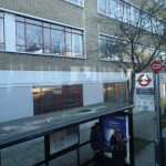
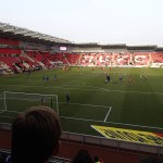
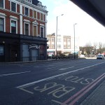
Match Thirty – Ipswich 2 – Sheffield Wednesday 1
Ipswich finally got their campaign back on track.
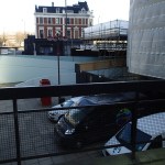
One thing that could be improved in evening matches like this, is a proper train home after the match. I don’t want to wait an hour or so in the cold for a rake of Mark 3 coaches hauled by a Class 90 locomotive. Instead we got a cattle class 321, which stopped everywhere on its way to Liverpool Street.
The train was really shown up by the Class 379 I rode on earlier in the day.
Is The Battery Electric Multiple Unit (BEMU) A Big Innovation In Train Design?
By training I am an Electrical Engineer who specialised at Liverpool University and for a few years afterwards in the mathematics of the control of mechanical, electrical and other systems.
Over the last fifty years, I’ve liked to think of myself as scientifically green and in transport, I’ve come to the belief that we need to be as electric as possible, as this can produce a minimum of carbon dioxide and less noxious fumes and noise.
We may have produced a series of battery-electric vehicles for special purposes such as golf buggies, the electric milk floats of my childhood and light taxis and buses for historic city centres.
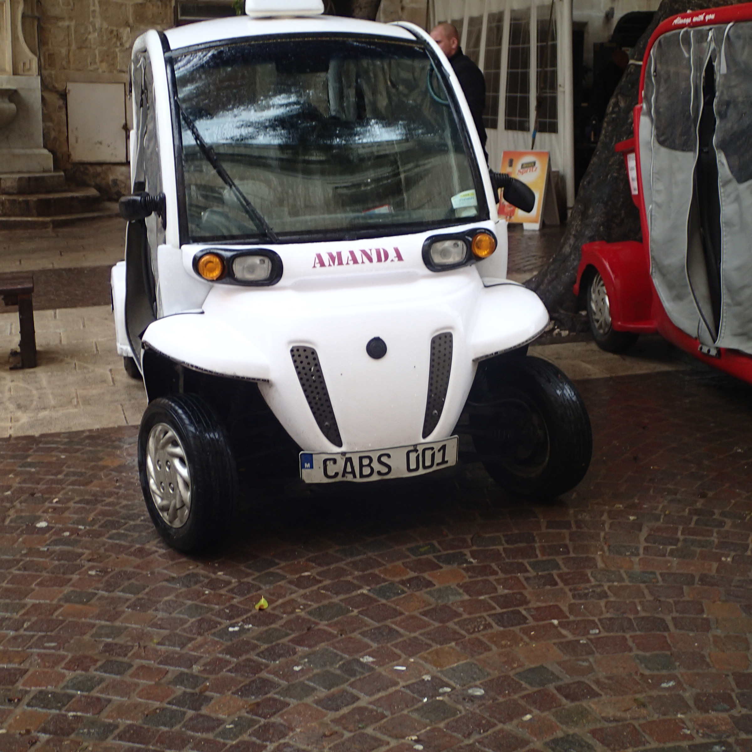
Electric Taxi In Malta
But where are the queues of stylish electric cars waiting for the charging points in my local car park in Dalston?
In my view, electric road vehicles with one or two rare exceptions, don’t really appeal to drivers, owners and users. You read reports that the economics are suspect without large subsidies. That’s as maybe, but having once owned a golf buggy, I can testify that battery life and performance wasn’t acceptable to the special needs on my farm.
So when Bombardier, Network Rail, Greater Anglia and others announced they were going to test a Class 379 4-carriage train as a battery-electric multiple unit (BEMU), I either thought they had more money than sense or there was something I’d missed.
Riding The BEMU
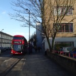
A desire to investigate found me on a cold morning in February boarding what looked to be a outwardly normal Class 379 train at Manningtree.

An Outwardly Normal Class 379 Train
The only visible difference was the Batteries Included sign on the side. Inside nothing appeared to have been changed
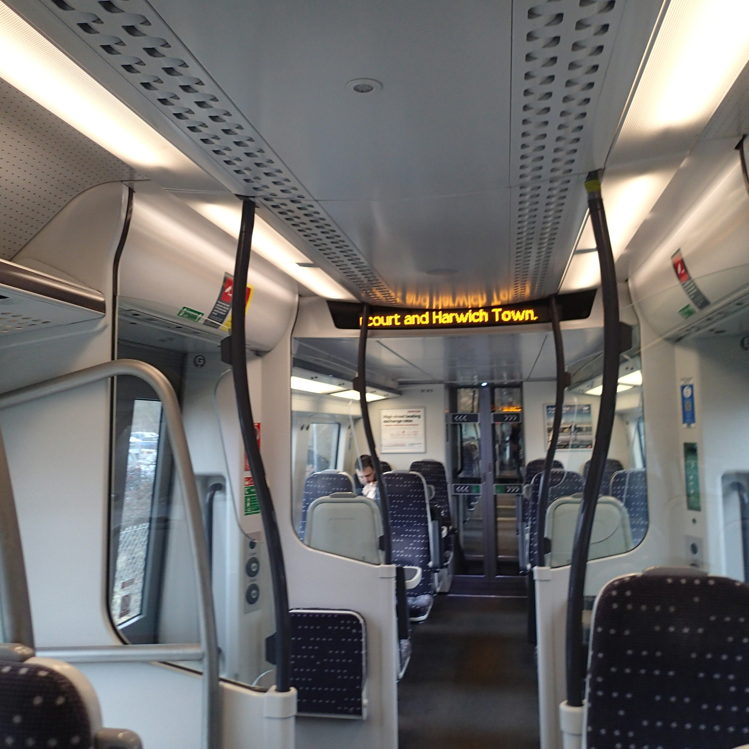
A Very Familiar Interior
Except for the destination display showing we were going the dozen miles to Harwich Town.
As we trundled away and breezed down and back up the Stour Estuary, I could detect no difference between the two runs and between train 379013 and its unmodified siblings, which I use regularly to Cambridge. The conductor assured me that they generally went one way under AC power from the catenary and the other on the batteries.
Returning from Harwich, I travelled with the train’s on-board test engineer, who was monitoring the train performance in battery mode on a laptop. He told me that acceleration in this mode was the same as a standard train, that the range was up to sixty miles and that only minimal instruction was needed to convert a driver familiar to the Class 379 to this battery variant.
It was an impressive demonstration, of how a full-size train could be run in normal service without connection to a power supply. I also suspect that the partners in the project must be very confident about the train and its technology to allow paying passengers to travel on their only test train.
It’s All About The Rolling Resistance
The physics of rolling resistance, explain why I was wrong to be sceptical and had now been so surprised and delighted by the Class 379 BEMU.
Most of us have driven a car with soft tyres and know that you need more power to maintain speed, as soft tyres have a higher rolling resistance.
Generally the rolling resistance of a steel wheel on a steel rail is lower, which helps trains move heavier loads for less power than road vehicles with rubber tyres.
But also if you read about the mathematics of rolling resistance, you will find that if you increase the load on a steel wheel running on a steel rail you lower the rolling resistance, so you can move the train for less power. This helps explain the impressive performance of the BEMU.
You have the paradox, that optimally-located heavy batteries, in a steel-wheel-on-rail vehicle, reduce the rolling resistance and mean it needs less power.
One of the most important rules of life is that you can’t disobey the laws of physics.
A Hybrid Train
In some ways to consider this train a battery electric multiple unit is wrong, as its nearest cousin is probably the hybrid bus, such as the New Routemaster in London. In the bus the battery is charged by a small diesel engine and final drive is all-electric.
In the rest of this article, I will continue to use BEMU, but hybrid electric multiple unit or HEMU might be better. It could be argued that the general public associate hybrid with something good, so there may be sensible public relations reasons for calling the trains HEMUs.
Using a BEMU
One of the main uses of a BEMU would be on a cross-country route that connects two electrified lines. The overcrowded Cambridge to Ipswich route would certainly be possible, as the gap between Haughley Junction and Cambridge is short of thirty miles and well within the capability of a BEMU.
Another use of a BEMU would be to extend an electrified route to an important town that needed a rail link bigger than can be provided by a two-coach diesel train of a certain age. London to Great Yarmouth via Norwich would be a typical route.
Branch lines off an electrified main line, such as the Felixstowe branch would be ideal for a BEMU.
The three East Anglian examples I have given could probably be served without spending a penny on infrastructure.
The Greater Anglia Involvement
Greater Anglia’s involvement in the project is significant as East Anglia has several routes suitable for a BEMU, in addition to those mentioned earlier.
The trains would also give the company the ability to extend some of the Liverpool Street to Cambridge services to perhaps Norwich, Newmarket and Bury St. Edmunds.
Some gaps like Ely to Norwich, might be stretching the range, but the trains could give the soon-to-be-two Cambridge stations much better access to a wider East Anglia from Peterborough and Wisbech in the West, Norwich and Cromer in the North and Yarmouth and Ipswich in the East.
East Anglia seems to suffer more than most from track and overhead wire problems and rebuilding. A BEMU would make a superb blockade buster and could even have been used to get passengers to Peterborough, when all the problems happened on the East Coast Main Line at Christmas, by jumping the gap from Ely.
The rail network in East Anglia also suffers from periodic overcrowding, especially in the summer, so extra carriages on many services would be welcome to Greater Anglia and users alike.
East Anglia for so long a rail backwater would love these trains.
Advantages To Network Rail
Network Rail is an infrastructure company so why is it getting involved in the design of trains?
Network Rail has some problems with electrification due to well-publicised issues and in some cases the large quantity, they are being tasked to install, which puts pressure on manpower and resources.
In some sensitive areas, there may be planning issues with putting up the overhead wires. A simple example in Suffolk illustrates the value of a BEMU. It is unlikely the Gainsborough Line will ever be electrified, as it runs through the Stour Valley and the Nimbys would have a field day if Network Rail decided to put overhead line gantries on the iconic listed Chappel Viaduct, which is the second largest brick structure in England. But as the line is only a dozen miles long, running a BEMU on the line would be a sensible idea.
There are probably a lot of places where using a BEMU, rather than electrifying saves Network Rail a lot of installation costs and lawyers fees. Passengers would get a brand new and probably larger electric train, from the day they can be delivered and after the train crew has been trained.
Electrification of passenger services is a proven revenue generator, but predicting how much electrification will increase traffic, is one of the blackest of black arts. The difficulty is illustrated by the North and East London Lines, which were built to run the three-car trains that were thought to be required for the level of traffic. London Overground is now going through the second train lengthening process to cope, which is also requiring various infrastructure changes. If London can’t get this right with their massive journey databases, how can you predict traffic on a branch line in say Dorset or Norfolk? A shiny modern BEMU could be a valuable tool for assessing the increase in traffic, by trialling one for a period to ascertain what needs to be done to improve a service. The solution could be anything from bringing back the terrible diesel multiple unit, through using a BEMU on the line to full electrification.
I think it is true to say, that Network Rail could probably cut the cost of electrification and line improvements, by better planning of the work.
There are also innumerable lines in the United Kingdom, where the distance is less than sixty or seventy miles and both ends of the line are electrified, which are possibilities for running BEMUs.
- Hurst Green to Lewes via Uckfield and the Marshlink Line in Sussex
- The Tyne Valley Line between Newcastle and Carlisle
- Many lines that link to electrified hubs like Liverpool, Manchester, Birmingham and Leeds.
- Lines in Scotland that link to the current electrification. This could include the new Borders Railway which is only thirty miles long.
- Any branch from an electrified main line.
Unfortunately for everybody concerned, the hundred miles between Salisbury and Exeter is probably just too far to run on batteries at present. But this could be possible in a few years, as the technology develops.
Many routes with minimal partial electrification could accept a BEMU tomorrow, which could be a more affordable alternative to full electrification.
- Full electrification often needs a lot of bridge and tunnel reconstruction to give sufficient clearance to the wires. With a BEMU, this is unnecessary.
- Deployment of BEMUs, could also release much-needed modern diesel trains for use on lines away from electrification.
I would argue it’s better to spend the money on rolling stock, rather than use it to enlarge bridges and tunnels.
The Biggest Advantage To Rail Companies And Users
The biggest advantage of the technology is a truly unusual one, which is akin to putting the cart before the horse.
It’s that the new BEMUs start to run as soon as they are delivered and even before the electrification is complete.
Suppose you are possibly going to electrify a line like Carlisle to Newcastle, where both ends are already wired.
Traditionally, you can’t run any electric trains, until the electrification is complete.
But if you used BEMUs to operate the line, you can actually deliver the trains and bring in the new service pattern before you electrify using the power at both ends to charge the batteries.
After electrification, you might replace the BEMUs with a non-battery sibling and move the BEMUs to another line to repeat the process.
So the passengers benefit earlier from new trains. The train company should also benefit, as hopefully all the publicity of better and possibly longer trains generates extra journeys.
Instead of the speed of the electrification works governing the pace of line modernisation, the limiting factor is how fast trains can be built and any necessary much smaller infrastructure improvements like platform extensions are completed.
A Possible Production BEMU
The partners in this project seem to have come up with some fairly tight performance objectives for the train.
- A sixty plus mile range. This seems to bridge a lot of network electrification gaps and the length of out and return on the average branch line – Achieved
- Performance similar to the standard Class 379 and enough to work the average secondary or branch line – Achieved.
- No change of passenger experience to a standard Class 379 – Achieved
- Identical Driving Characteristics to a standard Class 379 – Achieved
- An overall experience better than a Pacer or a Sprinter – Achieved by a wide margin. I’ve also ridden modern Class 171 and Class 172 diesel multiple units lately and the Class 379 BEMU was certainly better in terms of ambient noise.
Bombardier could just create a Class 379 BEMU, but I suspect that the upcoming Aventra train chosen for Crossrail would be used. After all, why would you use a boring old train, when you could have a sexy new one? Especially one that is lighter and more energy efficient. You could even borrow the use of a small on-board engine to charge the battery from the bus industry.
Probably the most difficult decision in the design is the train length, but why not make them all identical go-anywhere four carriage dual-voltage trains?
Incidentally, that go-anywhere capability will be enhanced when ERTMS becomes standard for all trains.
How Would BEMUs Affect Various Schemes?
The next few sections will look at various proposed schemes and how BEMUs might affect them.
The Felixstowe Branch
I’ve used the Felixstowe branch for over fifty years and the individual train capacity is now smaller than it was in the 1960s. But the frequency has improved and the service has got better since the Bacon Factory Chord was created.
It carries upwards of thirty freight trains each way every day and has long been mooted for electrification. Unless the complete route from
Felixstowe to Nuneaton and inside Felixstowe Port were also electrified, electrification of the branch line is probably a waste of time, as there would need to be a change of locomotive at some point.
I sometimes wonder if you want to have overhead wiring in a port or goods yard, with cranes lifting containers all the time.
I believe that the Class 88 locomotive is a better solution, as this would give electric haulage on electrified lines like the Great Eastern Main Line and diesel haulage on the branch and in the port.
Passengers on the line would like better and larger trains and this could be solved by a BEMU charging every time it returned to the Ipswich end of the branch.
Ipswich To Cambridge And Lowestoft
If you are going to run a BEMU from Ipswich to Felixstowe, then surely it would be a good idea to run the trains on the services from Ipswich to Cambridge and Lowestoft.
The gap between the overhead wires at Cambridge and Haughley Junction is less than thirty miles and would easily be jumped by a BEMU, charging itself at the two ends of the line.
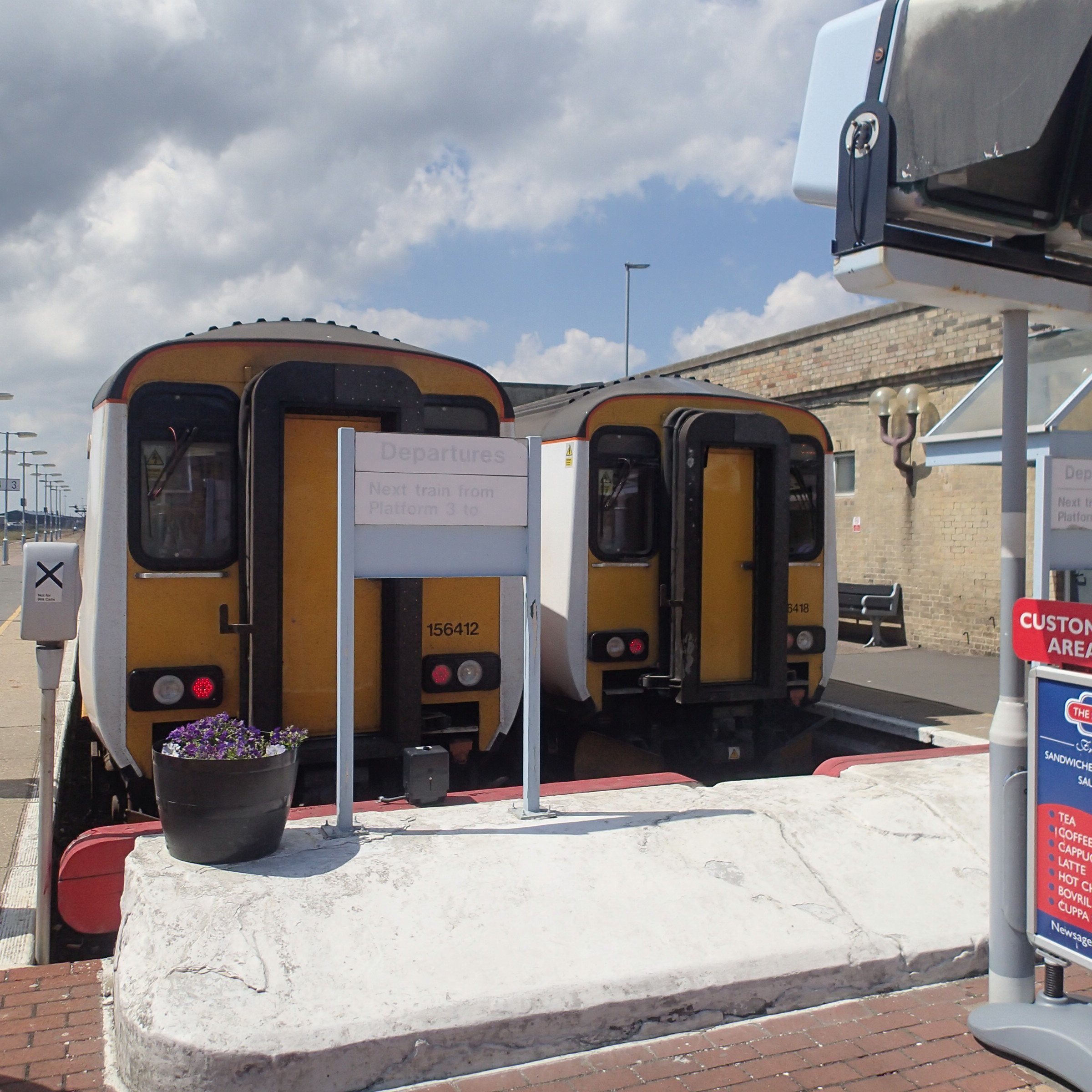
Ipswich to Lowestoft is fifty miles which would certainly be too far for a BEMU going out and back on one filling of electricity at Ipswich. But as I believe a BEMU should be dual voltage, why not put in a shielded length of third-rail away from the platform side of the train in Lowestoft station. This picture shows the platform layout at Lowestoft with the current Norwich and Ipswich Class 156 trains in the platforms.
Surely, Network Rail’s engineers can come up with a third-rail system in the station for charging BEMUs, that meets the most draconian Health and Safety regulations.
If BEMUs were to also run the Norwich to Lowestoft services, then you’d have electrified the passenger services to the United Kingdom’s most easterly town.
What would a picture of two Aventra BEMU profiles in Lowestoft station, do for the town?
Completing The East Anglian Electrification Of Passenger Services
If some means of range extending like a third-rail-based charger in some terminal stations, then there is no reason that all unelectrified lines in East Anglia could be run successfully by BEMUs. These would include.
- Cambridge and Ely to Norwich on the Breckland Line
- Norwich to Yarmouth on the Wherry Lines
- Norwich to Cromer and Sheringham on the Bittern Line
- Marks Tey to Sudbury on the Gainsborough Line
The BEMUs would also be an ideal train for the proposed re-opening of Bramley Line between Wisbech and March and the possible creation of the Norfolk Orbital Railway from Sheringham to Wymondham.
Completing The Electrification In East Sussex
East Sussex Council has produced a document called Shaping Rail In East Sussex, and also proposes the electrification of the Marshlink Line and improving and fully electrifying the Wealden Line and Oxted Line.
I believe that BEMUs could be the key to completing the electrification of this important commuter area and releasing sixteen Class 171 diesel multiple units for areas with no electrification at all.
As BEMUs would effectively be a one-for-one replacement for the Class 171 and no infrastructure work would be needed except for the track work at Lewes, as the new trains were delivered, a Class 171 could be released to go and replace a Pacer or Sprinter.
The Borders Railway
I suspect that various Scots and their politicians will be a bit miffed, that a beautiful new railway will be running second-hand trains. I suspect that something like Class 171 or Class 172 will be used, but wouldn’t it be nice if four-coach electric trains were to be used on the route.
As the route is not being electrified, but power is available at the Edinburgh end and the line is only sixty miles out and back, the line would be an ideal candidate for equipping with sexy new BEMUs.
The only problem is that the Scots have just signed a deal with Hitachi to deliver a whole stable of new AT200 electric trains.
However, it should be noted that Abellio Greater Anglia is one of the partners in the testing of the experimental Class 379 BEMU and that Abellio ScotRail is the new Scottish franchise holder.
Incidentally, Abellio’s parent; Nederlandse Spoorwegen still have sa few diesel multiple units, so perhaps they have other motives in being involved with the BEMU.
Glasgow Crossrail And The Airport Rail Link
Glasgow Crossrail is a proposal to improve rail services in Glasgow described like this in Wikipedia.
The proposed Crossrail initiative involves electrifying and reopening the City Union Line for regular passenger use in conjunction with new filler sections of track which will connect the North Clyde, Ayrshire, and Kilmarnock and East Kilbride suburban routes together, therefore allowing through running of services through the centre of Glasgow in a North-South axis.
It has been an on-and-off project over the years, as has the closely-related Glasgow Airport Rail Link.
Perhaps by selectively using BEMUs on the City Union Line, some of the major problems of rail transport in Scotland’s largest city can be alleviated, until the budget allows full electrification across the city.
Replacing Pacers Out Of Electrified Hubs
I asked in the title of this post if a new battery electric multiple unit (BEMU) could be a replacement for the truly-dreadful Pacers.
On some routes out of Liverpool, Manchester, Leeds and other electrified hubs, Pacers perform out and back services, which could probably be replaced by a BEMU.
As electrification progresses more and more, Pacers will find that they operate more of their routes partially under the wires. All of these routes will become candidates for BEMUs.
As the new trains will elsewhere displace some modern diesel multiple units, these could also probably chase a few Pacers to the scrapyard.
So in my view, new BEMUs may not always directly replace the Pacers, but they will certainly hasten their demise.
Should The Gospel Oak To Barking Line Be Electrified?
I know that freight is an important driver of electrification of the Gospel Oak to Barking Line, but how would the availability of a number of BEMUs affect how the work will proceed?
The Gospel Oak to Barking Line is being electrified at a cost of £115million. In addition eight new four carriage trains are being ordered for the line.
Electrification of the line is said to be difficult, as there are numerous bridges and viaducts.
But the line is also desperately short of capacity for passengers and desperately needs the new electric trains.
As the line is partly electrified, why not drop the full electrification for a few years and buy eight new BEMUs?
They would pick up power east of Woodgrange Park station and around South Tottenham, leaving only about twenty miles to run on the batteries.
If the batteries need a top up at Gospel Oak, why not put in a short length of overhead wire at the western end of the line. Or heresy of heresies, a short length of third rail!
As circumstances and funds allowed the rest of the line would be electrified.
All of the flexibility in the schedule would be down to the unique characteristics of the BEMU.
Some residents along the line might be annoyed by the continuing noise and smell of the diesel freight locomotives passing through if the line remains without full electrification, but passengers will get twice as many carriages as at present, in brand new electric trains. Passengers won’t care that they’re powered by batteries, so long as they are reliable, comfortable and punctual
Conclusion
Who’d have thought that such a rather unusual concept of a battery electric multiple unit would have so many possibilities?
I think I’ve seen the future and it just might work!
What Is Happening To The Sheffield-Rotherham Tram-Train?
The Sheffield-Rotherham Tram-Train is a pilot project to prove whether the technology can work on UK railways.
It’s a laudable aim, but I don’t like pilot projects as if they work, then you usually end up with an inadequately funded permanent one, that is lacking in certain areas and has to be upgraded. On the other hand, if they don’t work you have all the expense of ripping them out.
It is much better to take proven technology and phase the introduction of the system, funding and building every phase adequately.
This Google Earth map shows the area where the tram-train will run.
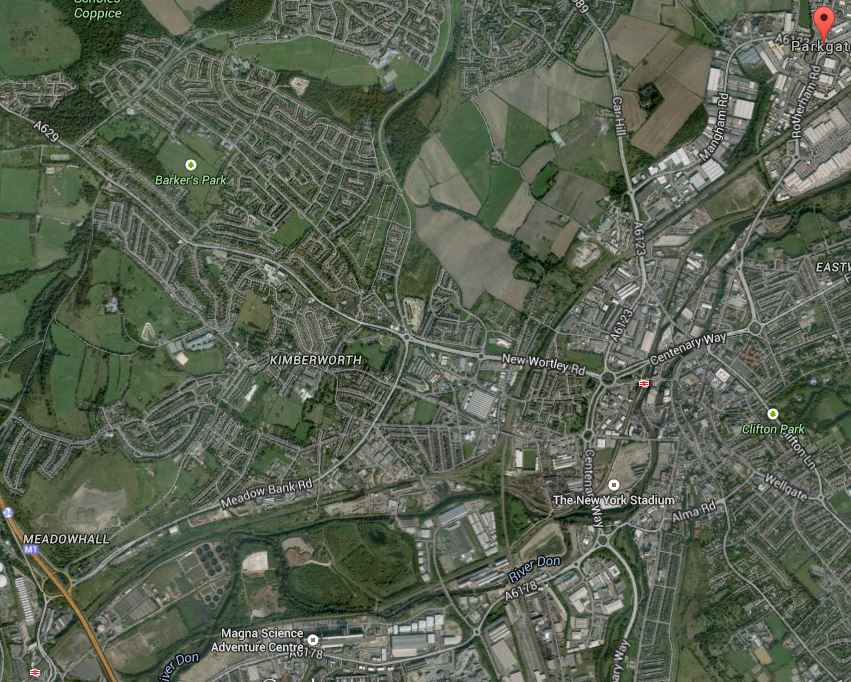
Sheffield Rotherham Tram Train
In the top right or north east corner of the image is the Rotherham Parkgate Retail Park, which will be the terminus of the route. In the bottom left hand corner is Meadowhall Shopping Centre, with the associated Interchange station, where the tram-train will join the Sheffield Supertram network. Tram-trains are proposed to run three times in an hour, which would be in saddition to the two or three trains per hour on the route.
This Google Map shows the layout of train tracks around Rotherham Central station.
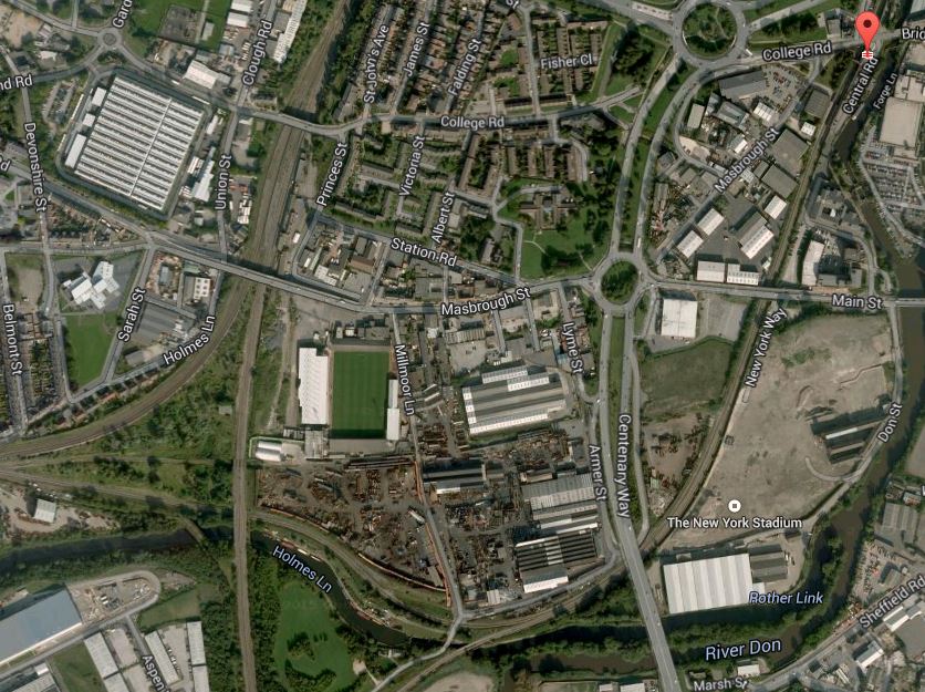
Lines Through Rotherham
Note the New York stadium marked on the map, but not shown, as the image was taken before the stadium was built. Just after the stadium, the lines split with one going west to join other lines and go direct to the Meadowhall Interchange and the other, which is now a freight route, going more south-west over the river towards Sheffield.
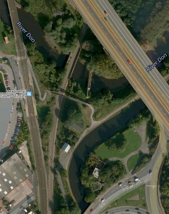
This Google Map shows the layout of the railway lines and the tram tracks around Meadowhall Interchange.
Meadowhall Tram-Train Connection
Meadowhall Shopping Centre itself, is just off the bottom of this map and is connected to the station by a bridge over bus, tram and train stations, which can just be seen in the bottom-left corner.
Note how the railway to the east from Sheffield goes under the M1 motorway, with the Sheffield Supertram coming up parallel to the motorway and then turning into the interchange.
It will be difficult to get this connection right, as a direct tram-train from Rotherham will come under the motorway and then stop in the Meadowhall Interchange station. I would assume that it would stop in the Sheffield Supertram platforms and then reverse direction to go on to Sheffield.
This must be wrong, as it would be a difficult scheme to run efficiently with three tram-trains an hour in each direction reversing in the tram platforms and then Rotherham-bound trams sometimes waiting there to cross the westbound rail line to get on the right track for Rotherham.
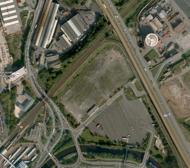
So I would assume the second route that breaks off to the south-west from Rotherham would be used. This Google Earth map shows where the line meets the Sheffield Supertram around Meadowhall South station.
Medowhall South
This would be a much easier connection and I think this is the way the tram-trains will go to and from Rotherham.
The Sheffield-Rotherham tram-train has been a long time coming since the decision to start. I wonder if the reason is that the engineering of both track and signalling has been much more difficult than first thought. The first direct route is difficult if not impossible operationally, but sorting out the tracks for the second route may not be too easy, as looking at the image there is a lot of water about, that might need to be bridged, by the tight turn.
I think too, that as it’s only a trial, we might see a single track curve, as the tram-trains will be reversing at Meadowhall Interchange. That would at least cut costs and men less disruption to the Supertram, whilst the connection is being made.
One issue that has to be thrown into the pudding, is the electrification for the trams, which is 750 volts DC overhead. If at some future date the planned electrification of the Midland Main Line and trans-Pennine routes at Sheffield is extended to Meadowhall and Doncaster, then the new station at Rotherham Central would possibly be electrified at 25kV AC.
So it could be that extending the tram-train pilot scheme between Sheffield and Rotherham into the future, might be scuppered by electrification plans for the North.
It does strike me that the £60million or so being spent on the tram-train pilot, might be better spent on providing extra trams for the Sheffield Supertram and trains for more services through Rotherham.
Could it be that just as the great and good in the Department for Transport, forced Cambridge to have a guided busway, they are persuading Sheffield and Rotherham to have a tram-train?
Will The Real Leroy House Please Stand Up
Leroy House is a rather drab 1970s office block near me.


They are updating the building for the twenty-first century, so I went to look.
It’s actually a business centre with lots of serviced offices, but you wouldn’t know that from the outside. It is extremely anonymous and could contain something that doesn’t want to be noticed like the Islington Parking Revenue Collectors.
If it was my building, I’d do the following.
1. Whilst the building is being updated, I’d put up some information on the wall, about what is happening and why you would want to use offices and services in Leroy House, when the updating is finished.
2. I’d give the building a web site like businesscentre.islington or leroyhouse.london and put that in clear signs on the building.
3. If the domain name extension of .islington does not exist, then I’d either get the council to create it or if they thought it wasn’t a good idea, then I’d get it for the building. It might become a nice little earner for every butcher, baker and candle-stick maker in the Borough.
4. Once the building is updated, I’d think carefully about what was plastered all over the building to entice punters to come inside.
5. A lot of the pictures I took, were taken from the top of a passing bus. The 38 actually load up the tail-gunner outside the building. So why not give all those bored passengers something witty to read? You never know, they might know someone who needs an office.
6. I would develop the cafe, they are planning to put inside, as a local business meeting point.
Updating the building as they are planning, seems to be a good idea and I can’t see it will cause local residents any problems unless offices are rented to someone with totally unacceptable political beliefs and this provokes massive demonstrations outside.
Would Anybody Like This Pre-Loved Expedit Storage Unit?
Because IKEA has changed from Expedit to a new form called Kallax.
I use a lot in my house, as it means I can use the same inserts everywhere.
This 4 x 2 in brown-black is a bit tatty, but with a bit of glue and perhaps some other work, it would be ideal for a lot of places.

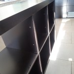
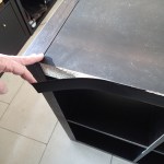
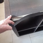

I live in the Dalston area close to the Islington border, so if anybody would like it, let me know. I may have some others in the future, as some will have to be replaced to fit with the new style.
Doesn’t it get annoying that IKEA have discontinued the old design. Hence the reason for the Bad Design tag.
Birmingham Gets A Big Snow Job
It is said by many in the regions of the UK, that London gets and eats all the pies.
At present there are four main rail projects on the go in London; Thameslink, Crossrail, the Northern Line Extension and the London Overground.
Thameslink is a government funded project, whereas Crossrail and the NLE are paid for wholly or in part by property developers and business.
The smaller Overgroundisation of London surface railways is more a methodology that is starting to be copied and expanded in places like Merseyside, the Cardiff Valleys and the West Midlands. Although you could argue that other railways in the UK have had the same idea of frequent clean and sometimes new trains, smart stations and good staffing levels, working for some time. Some of the stations on the Overground, have been or will be expanded, in conjunction with property development.
But other projects where co-operation between Network Rail, rail companies.local government and property developers are starting to be proposed and implemented, Often these projects are led by a major redevelopment of a station.
1. Leeds Station
Leeds station was rebuilt and extended a few years ago, but little use was made of the space above the station.
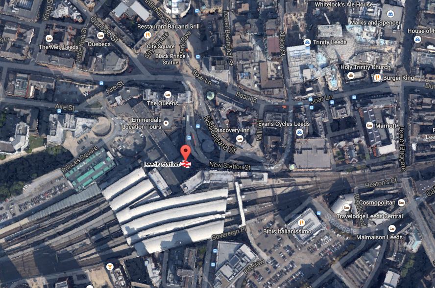
Leeds Station And City Centre
This Google Earth map shows the central location of the station and also its closeness to the main Trinity Shopping Centre at the top right of the map. Walking routes between the two are not good and the station should have been improved with development on the northern side to link it to the city centre. According to Wikipedia. future plans are in place to add much needed extra platforms and develop the south side of the station.
I believe, that you should walk out of a station into an open space, from where you can get your bearings of the city. This has been done well at London Kings Cross, Liverpool Lime Street, Huddersfield and Cardiff Central and some station rebuilding and expanding, is embracing such a concept.
I hope that Leeds develop the concept to a new level, when they create a new southern entrance. Perhaps on a personal level, they could create an easy way to get a bus to Elland Road.
2. Reading Station
Reading station has also been rebuilt and is surrounded by development, as this Google Earth map shows.
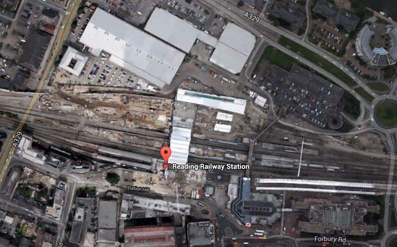
Around Reading Station
In the future it will be getting Crossrail,the new western link to Heathrow and probably more offices around the station. Network Rail, who now manage the station, have already created entrances on both sides of the station and I hope that development in the next few years, will make what is a spectacular station, a true gateway to the City.
3. Birmingham New Street
Birmingham New Street station is approaching the end of its rebuilding, which is now Gateway Plus. It includes a lot of retail including a new John Lewis. The station will also be connected to the Midland Metro. This Google Earth map shows the station and it’s surroundings.
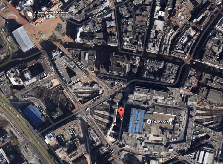
Birmingham New Street
It shows the problem that the station suffers, when compared to many. It is in a deep dark hole surrounded by busy roads, with the buses some way away. I don’t think you would design a station like that these days, as they did in the 1960s.
The station has a problem, as does Leeds, that there is not enough lines and platforms, but whereas at Leeds space is available, it would appear that at Birmingham New Street, it will be difficult to find.
The design of the station means that natural light on the platforms is difficult to provide. Hopefully, though by providing that light on the concourse and lots of lifts and escalators to get to the trains, the architects may have improved things. At present, it’s a bit like a bad Underground station experience arriving and departing at the station. One of the reasons, I generally travel between London and Birmingham by Chiltern Railways, is that Moor Street is a light and airy station, that has been tastefully updated for the modern age.
One of the biggest problems at New Street, is getting onward connections around the City Centre. On my visits to Birmingham, I often walk to Brindley Place to have a drink or lunch with friends. It’s not a difficult walk, but in a few years time, I’ll be able to do this sort of journey on the Midland Metro from the stop in Stephenson Street. When HS2 opens, this tram will be used as the connection between all four Birmingham city centre stations.
4. Manchester Victoria Station
The updating of Manchester Victoria station is the centrepiece of two big projects in Manchester; the Northern Hub and the extensions to the Manchester Metrolink like the Second City Crossing. This Google Earth map shows The station and the surrounding area.

Manchester Victoria
This image is quite old and doesn’t show the new roof, but it does show the roof of Manchester Arena next door, how the tram lines call at the station, the nearby green space and the river. All the station needs now is completing, the Metrolink extensions and new electric train services to Liverpool, Preston, Blackpool, Bolton, Leeds, Huddersfield, Sheffield, Newcastle and Hull.
I would also personally, like to see an hourly service to the South and Euston, so that I can avoid, the mostly dreadful Piccadilly. This will be possible once the Ordsall Chord is opened, although some might say that it is a real pity, the Picc-Vic tunnel was never built. Perhaps Virgin will get permission to run a service to Huddersfield via both main Manchester stations.
5. Newcastle Station
Newcastle station is a station that I don’t remember as anything special from my last visit some yeas ago, although it is a Grade I Listed Building. But since then, several millions have been spent according to Wikipedia, mainly on internal and retail facilities and on opening up the area round the station. So perhaps I should pay the city a visit. This Google Earth image shows the unique position of the station.
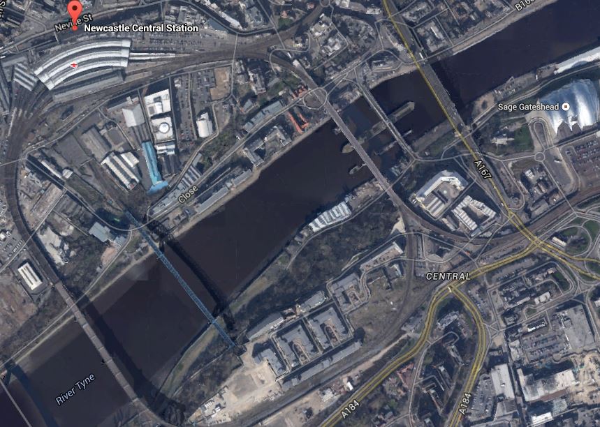
Newcastle Station
It is high above the Tyne on the edge of the city centre and uniquely the station is on a curve. It must be a very difficult to add extra tracks and platforms, which seem to be needed, as both through and local services are going to increase significantly.
I have only given five major examples, but they show how stations are becoming the focus of development.
One of my manual searches on the Internet picked up this article on Modern Railways entitled Snow Hill ‘transformation’ plan. This is the first paragraph.
Birmingham City Council has released its Snow Hill Masterplan, which outlines plans to grow the business district surrounding the station and includes proposals for the ‘transformation’ of the station into a transport hub.
Snow Hill is Birmingham’s station that is ignored by visitors from around the country, although it is important for commuters and others brought into the city on the Snow Hill Lines.
The Snow Hill Masterplan is here on the Birmingham Post website. Some of those who have commented don’t like it and they could be right. But the principles behind the plan of creating high quality offices, retail and apartments over a well-connected station is one that has been proven to work at Canary Wharf. After all it does actually make double use of the same piece of land. This is a Google Earth image of the Birmingham Snow station and its location.

Birmingham Snow Hill
You don’t see much of the actual station, as it is covered by a multi-story car park. As someone who can’t drive and manages well without a car, I can’t see why cities don’t do what London, Cambridge and Oxford have done and discourage people from driving in by providing top quality public transport.
The Snow Hill Masterplan would need an updated Midland Metro and also extra trains and routes through Snow Hill station.
I think that if I could get trains direct from Marylebone to Snow Hill, then that would be my preferred way of going. Snow Hill is in a much friendlier and welcoming part of the City than New Street.
I think on balance it is a good plan.
George Osborne Sets Out His Vision Of Yorkshire
This article in the Huddersfield Examiner is entitled Chancellor George Osborne to set out long term economic plan for Yorkshire during visit to West Yorkshire.
Read it and there are some interesting snippets, that he believes will be part of a long term plan for Yorkshire.
One of them is this.
We will also increase speeds on the East Coast Mainline to 140 mph
It is already planned and if and when it happens it will significantly reduce journey times all the way up the line between London and Edinburgh.
George is not actually promising anything for which funds have not been allocated, but his words show he understands the value of infrastructure, something that can’t be said for all Chancellors of the Exchequer since the Second World War.
The one thing that George or any future Chancellor can ensure, is that by not cutting funds they will get this valuable project carried out!
Match Twenty-Nine – Rotherham 2 – Ipswich 0
This was the most disappointing match of the year so far in what was the best smaller stadium we’ve visited.


Town are going through a bad spell, but they have had a tough sequence of matches since before Christmas and it just doesn’t seem to go right.
At lest coming home on the train from Sheffield, we got a lot of best wishes from Palace fans after their win at Leicester.
Network Rail Plans Another Tunnel Into Heathrow
We may not build the tunnel boring machines any more, but we certainly know how to dig holes better than most, as Crossrail is showing.
We also seem blessed with a geology that in many places, has the consistency of Emmental cheese.
So it is not a surprise that a news item in Modern Railways has reported that Network Rail are planning on creating the access into Heathrow from the West using a 5 km tunnel from between Iver and Langley to the airport.
This Google Earth map shows the area.

Langley To Heathrow
The blue line is the Piccadilly Line at the airport and the red arrow indicates Langley station. Iver station is towards London just before the M25. I would assume that the new tunnel will vaguely follow the M25 and link up to the airport at Terminal 5. It would probably be dug from Langley with a lot of the route directly under the motorway, so the work would not affect any sensitive sites.
I doubt it’s a plan, that will stir up much opposition, except in the area, where it leaves the Great Western Main Line. This Google Earth image shows the area in detail.

Langley And Iver
A quick look at this image, would appear to show that it’s mainly farmland with no housing, for quite a bit of the way between Langley and Iver stations.
Another plus point of this plan, is that the Class 345 trains being developed for Crossrail could probably be used on the new line to connect it to Reading and/or Oxford, if the Heathrow station was built to Crossrail dimensions and standards.
It is in some ways a pity, that Crossrail wasn’t designed to go to Terminal 5 at the airport and then on to Reading in the first place. But then some of the design of the western end of Crossrail had more to do with making sure that British Airways and Heathrow Airport didn’t get upset. It doesn’t matter if they do, as they are secondary to all the passengers and staff who use the airport. After all if the passengers aren’t happy with Heathrow, after Crossrail/Thameslink opens, they can easily get to Gatwick and Luton.
I think that this is a very sound plan and if it could be routed to serve all terminals at Heathrow by perhaps going back-to-back with the current Crossrail line being built to the airport, we’d get a much better service to London’s main airport.
So if we end up with effectively a new Crossrail loop line, that leaves the Great Western at Airport Junction, goes round all the Heathrow terminals and then after Terminal 5 connects to the Great Western between Langley and Iver, what are the consequences.
1. The plan rectifies the big fault of Crossrail not serving Terminal 5.
2. It gives passengers what they want. Going to any terminal at Heathrow from either the West or London, you just get on a Crossrail train that is using the Heathrow loop line and get off at Terminal 1/2/3, Terminal 4 or Terminal 5. Some journeys to Heathrow now sometimes need a change of train at the airport.
3. Crossrail will be used to transfer between terminals.
4. A plan like this, is the last nail in the coffin of Heathrow Express, which will probably be on permanent life support after Crossrail opens anyway. Another nail will be driven, when Old Oak Common station opens as a major transport interchange.
5. When Heathrow Express is dropped, Network Rail will be pleased, as it will free up two platforms at Paddington, for long distance services to Wales and the West Country.
6. There will also be new platform space at Heathrow Terminal 4 and 5, as if all Crossrail trains to Heathrow are going straight through, there will be no need for terminal platforms under the airport. These platforms could be used for the new Crossrail loop line.
7. All rail traffic to and from the Airport will be controlled by Transport for London. This can only be a good thing for reasons that are too numerous to list.
8. British Airways will be livid at the loss of Heathrow Express and the handing of all rail transport to TfL. So be it! There are lots of other airlines!
9. Heathrow Airport may or may not be expanded. But surely a rail line passing under most of the airport would be much easier to fit into new terminals.
10. If you are going to Heathrow 123 today from Tottenham Court Road station, it takes 55 minutes by tube all the way. The Crossrail journey should take 30 minutes and it will be fully accessible. I doubt that Transport for London would close the Piccadilly Line to Heathrow, but I can see it becoming a very quiet way of getting to and from Heathrow.
So I think it is true to say that creating a direct tunnelled link into Heathrow from the West should please everybody, except those who feel that the dinosaur that is Heathrow Express should be preserved.
Islington’s Eyesore
Archway is once of those places on the London tube map, which unless you know someone who lives there or has unfortunately found themselves in the local hospital, has nothing iconic to be worth visiting.
I went to have a drink with a friend, who lives within five hundred metres of the Underground station and took these pictures.
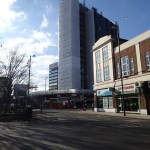


I should say that Archway suffers from the same problem that afflicts the bus station at London Bridge station because of the station’s proximity to The Shard. Lots of wind and today, that was cold wind, that makes walking around the area challenging.
I met my friend in the Gate cafe in the middle of the roundabout and that was a pleasant oasis in one of the bleakest areas of London. Archway even makes the old Elephant and Castle and Vauxhall Cross roundabouts, look to be award-winning architecture.
If ever a traffic intersection, was designed by a team of sadists with all the design flair of one of the North Korean dictators, it is this one.
I would like to see the following happen.
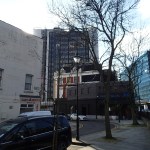
1. Archway Tower should be taken down, as it creates too much wind. Incidentally, the Wikipedia entry for the building doesn’t name an architect for the 1963 building. I can’t find one anywhere on the Internet.Perhaps, he was too ashamed of his creation and wanted to save his reputation, by not having it on his record.
Sadly, if it can’t be taken down, then clever engineers at somewhere like Farnborough or a top class university, should be given a brief to sort out the dodgy aerodynamics of the tower.
2. I crossed from the tube station, after arriving by bus, to the middle island where the Archway Tavern sits and it was a long walk round over three separate sets of pedestrian lights. There should be a subway, but my friend told me that was closed some time ago.
3. The traffic patterns must be sorted out, as it was always a bad area for driving.
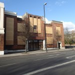
4. The disused cinema that my friend says has graced the area for forty-four years, should be used as rubble elsewhere!
It will be impossible that when the improvement scheme is completed, that a vast improvement will not have been achieved.
