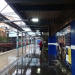
Walking Between Rochester And Strood Stations
I took the South Eastern Class 395 and explored Rochester.
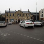


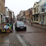
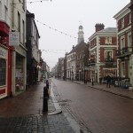
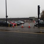
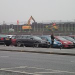
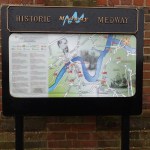


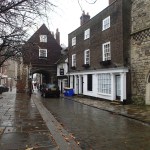
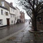
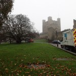
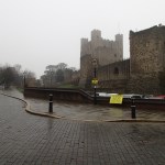


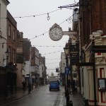
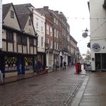
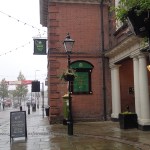
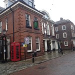
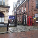
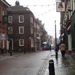
I walked along the High Street, visited the cathedral, castle and the museum before crossing the Rochester Bridge to get the train home from Strood.
Stratford And Its Two Stations
I couldn’t resist looking at the map of Stratford upon Avon and its two stations.

Stratford And Its Stations
Parkway is in the top left and the town centre station is marked by the arrow. The centre of the town is in the bottom right.
All this map does is ask a lot of questions!
I think some will be solved, when the main station is complete and hopefully is getting more trains from London and Birmingham.
But this will need some more Class 172 trains to be rustled up for Chiltern Trains and London Midland.
So the question gets more complex!
Return From Stratford Parkway Station
Because I thought time was short, I decided to take a taxi to Stratford upon Avon Parkway station to come home.
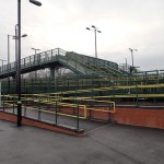
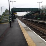
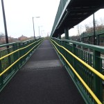
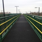

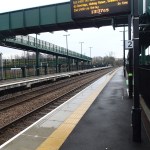
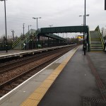
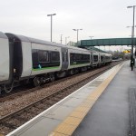
But somewhere I’d got the time wrong and had to wait an hour for my train, in a cold, unwelcoming station without a toilet. And then when I did get on the train, the main toilet was broken!
It is certainly a station that was built down to a cost, that would be unlikely to win any architectural awards.
There should be a rethink about how this station operates.
Stratford Upon Avon Station Is Getting A Facelift
Stratford upon Avon station was very much in a state of flux as I passed through.


But as it is a busy station with lots of tourists, I would suspect that Network Rail have got their priorities right.
If you look at the services to Stratford, they are a bit thin, as giving the importance of the town and the nearby parkway station, you might think that more services could be supported.
Perhaps the station improvements are part of a plan to increase the number of trains.
Wikipedia talks about possible future development, which would link the line to the Cotswold Line, thus giving Stratford direct links to lots of other places.
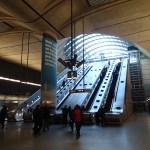
Solihull Station
To get to Stratford, I changed at Solihull station.

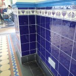
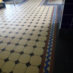

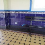
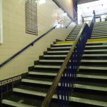
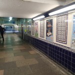
The pictures show what an excellent job has been done in creating a modern station, with nice details and what looked like a proper buffet.
The Bicester Chord Takes Shape
I took the Chiltern Line to Stratford upon Avon today and I was able to get these pictures of the building of the Bicester chord.
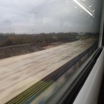
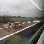
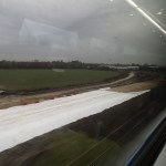
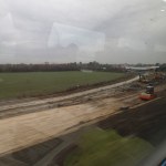
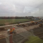

This will allow Chiltern Trains to start services between Oxford and Marylebone sometime in 2015.
The Bicester Chord is the first idea of several to come to fruition and transform railways in the area between Oxford, Banbury and Milton Keynes.
The East West Rail Link will be built and electrified, to link Oxford, Bicester, Milton Keynes, Bedford, Cambridge, Ipswich and Norwich.
The Cowley Branch at Oxford will be opened to passenger traffic.
Marylebone to Birmingham will drop to ninety minutes.
Chiltern Trains will probably want to expand. This is probably just as well, as if HS2 is to be built and Euston rebuilt, someone will have to get the passengers between London and Birmingham.
Gatwick Makes A Pitch For The Third Runway
Canary Wharf tube station is all decked out in adverts for expanding Gatwick.
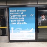
It’s certainly a tough fight between the two airports about which one gets developed.
On the ninth of October, I had a letter published in The Times, under the title, Plane or Train?
Sir, The closure of Richard Branson’s Little Red airline (News, Oct 7) comes at a time when people in their millions are rediscovering trains, raising a question over the attraction and viability of short-haul air services. Together with the introduction of aircraft that can carry up to a third more passengers, this leads me to wonder whether we need new runway capacity.
Effectively, it is a shorter reworking of some of the arguments in Hot Air Over London’s Airports.
To also stoke up the fire, Heathrow Hub were also advertising heavily in the papers at the weekend.
As I said in Hot Air Over London’s Airports, I quite like this proposal. This liking gets bigger every time I read about it.
One thing their reports and all the other proposals don’t talk about for obvious reasons, is the unpredictability of some of the world’s worst air accidents. Just read up on the circumstances that led to the Tenerife Airport Disaster.
For this and other reasons, I would leave the decisions to the professionals. And they will probably say that some proposals have a bigger safety margin than others!
But I still feel my last statement in the Hot Air post might be correct.
But I have this sneaking suspicion that no new runways will be built or extended and in twenty years time or so, we’ll wonder what all the fuss was about.
Passengers will just choose their airports with more care and airports will be competing with us with better and better facilities and more point-to-point flights.
But then some politician might want to add his name to a new London airport.
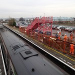
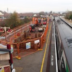
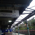
Squeezing A Bridge Between Working Railways
Crossrail has shown some impressive pieces of engineering to the media. But I’ve seen little about the work that is going on at Whitechapel station where Crossrail goes underneath the Overground, which contrary to what you might think, goes underneath the Underground. These pictures show how one of London’s most delapidated stations is being transformed.
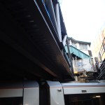
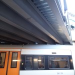
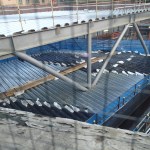
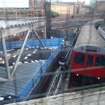

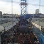
I’m not sure, if the impressive steel bridge is for the Underground lines or passengers. But inserting it isn’t camel-going-through-the-eye-of-a-needle stuff, but something a lot more challenging. Especially, if you’re doing it in the space between two busy rail lines. Luckily for Crossrail, when the East London Line was rebuilt a few years ago, the decision was made not to convert it to overhead electrification.
Look at this section on the Crossrail web site, which shows some images, which help you to make sense of what I photographed. Helpfully, the architect has drawn the trains in the right colours.
Waxing Lyrical About The Overground
My Internet trawler found this article on a web site called The Quietus. It’s an interview with veteran writer and filmmaker; Iain Sinclair.
He says this about the London Overgroiund, when asked about the effect of the lines on his life.
It’s changed mine enormously, in a sense. It’s so convenient that I tend to make journeys that reflect on the railway rather than journeys that I need to make. I wouldn’t have thought of going to Clapham Junction if I couldn’t just jump on this train and get to Clapham Junction. I wouldn’t have gone to Willesden Junction, which proved to be very useful, because I got a better sense of Leon Kossoff as a painter. He’d done some fantastic paintings of Willesden Junction but I didn’t really know Willesden Junction.
I think the Overground railway is a bit like the cinema project in that it curates. It curates a London of disparate elements. What relates Denmark Hill to Finchley and Frognal or Camden Town to Shadwell? They are now an organic identity. And sitting on this train is like sitting in a cinema. You’ve got this screen, and the landscape changes. Patrick Keiller writes that as being the view from the train; that is, really, a form of cinema. I really believe that walking is a form of cinema, and being on a train is a form of cinema, and having the excuse to stop and go to these venues and see some wonderful movie enhances that experience.
Read the full article.
I can see my own behaviour in what he says.
Every city deserves its own Overground network, designed and run to the same principles.
In the UK, Birmingham, Bristol, Cardiff, Glasgow, Leeds and Liverpool seem to be going or starting to go in this direction. Manchester is going a slightly different direction by integrating its trams and trains in the Northern Hub.
As somebody once said in the past – “The Future’s Bright – The Future’s Orange!”
Improving Walking Routes To Football Stadia
I’m using football stadia as an example, but it could equally be any other important building, like a hospital or a museum, or any number of sporting venues.
The problem was brilliantly illustrated yesterday at Bournemouth, where I walked the obvious route to Dean Court, that I’d used twice before. But after seeing Bournemouth fans at Pokesdown station turning the other way, I thought there must be a better route. Stewards gave me directions to one, that was the other two sides of a quadrilateral, that was five minutes shorter.
A few signs are all that are needed, with perhaps a few metres of asphalt to make the walking easier.
At Ipswich, you come out of the station and you can see the ground. But there are also maps everywhere for the lost, although for visiting fans there isn’t any indication of where they should go. In this map, away fans go to the bottom right corner of the ground, which is the area of the ground you get to first as you walk up Portman Road.

Ipswich Station And Portman Road
Since this map was produced, the biggest improvement has been putting the Sir Bobby Robson Bridge across the river. This provides an important walking route between the south western parts of the town and the centre and the football ground.
Note that in this map, the station is indicated by the red arrow symbol, as they are in all the other maps.
There are a few groups in the Premier League and Championship that have their own stops or are less than fifteen minutes from a rail, tube, tram or metro stop.
Arsenal – This has three stations at Arsenal, Finsbury Park and Highbury and Islington.
Aston Villa – The stations are Aston and Witton
Chelsea – Take your pick from Fulham Broadway, Imperial Wharf and West Brompton
Crystal Palace – Norwood Junction is five minutes away.
Everton – Sandhills station and then the Soccerbus.
Hull City – There is a walking route from Hull station.
Liverpool – Sandhills station and then the Soccerbus.
Manchester City – Take the Metrolink to Etihad Campus.
So could the walking routes to other grounds in the top two divisions, particularly from the nearest rail station, be improved?
Birmingham City
The walking route from Bordesley station isn’t very long or difficult, as this map shows.

Bordesley Station And Birmingham City
But it’s just downright dangerous, as there is no pedestrian route around Bordesley Circus. I wrote about it in this post; A Pedestrian Crossing From Hell.
I have heard from Birmingham City Council, who say that something is being done.
If you look at the map, you’ll see the Camp Hill Line passing at the side of the ground. If Birmingham City are ever successful and need to rebuild the ground, if feasible planning permission should include a station at the new stadium.
It is a long term aspiration of Birmingham City Council to open this line to passenger traffic. The way the tide is turning in favour of rail, I wouldn’t bet against this happening.
Blackburn
Ewood Park is a tricky ground to get to, as you have two stations in the town; Blackburn and Mill Hill.
I usually go to the ground by Blackburn, as I usually change trains for the area in Manchester, so that I can get a meal if I need one.
To get between the station and the ground, I normally use a bus, which isn’t as easy as it could be, as the information is rudimentary.
Mill Hill is nearer to the ground and walk-able, as this map shows.

Mill Hill Station And Ewood Park
But I think there are two problems with using Mill Hill.
To return to the station would be a walk up the hill.
But the main reason, I would not go to Mill Hill, is that I can’t get a direct train to that station from Manchester. As you have to change trains in Blackburn, I might. just as well get out there and catch a bus.
Cardiff
The preferred route to get to the ground is to take a train to Grangetown station, but Ninian Park station is nearer, but the trains aren’t so good.

Grangetown And Ninian Park Stations, And Cardiff City Stadium
All this might change when the local lines around Cardiff are electrified, as they seem to be improving stations.
Derby
Derby is an easy walk between Derby station and Pride Park, as the map shows.

Derby Station And Pride Park
I did get lost though, so I think a few more signposts would help, as would another light-controlled crossing on Derwent Parade.
Leicester
I wasn’t sorry when Leicester City got promoted, as the walk to get to the stadium is not a short one.

Leicester Station And Stadia
I think it would be helped with some better signs. I generally take the road opposite the station and aim for Welford Road, I pass the rugby ground and you can see the King Power stadium.
Nottingham
This map shows Nottingham station and the two Nottingham football grounds; Meadow Lane and the City Ground.

Nottingham Station And The Football Grounds
I have walked between the station and the City Ground probably a dozen times and it’s flat and not a route that has many opportunities to get lost. But as the map shows, you walk alongside a waterway and surely access to this would make the walk more pleasant. It would also help if some improvements could be implemented at both ends of the route.
One thing that I’ve never had explained to me, is why are there no plans to serve the two football grounds and the cricket ground using the Nottingham tram.
Wigan
I’ve always thought that getting from Wigan North Western station to the DW Stadium was very difficult, so I generally take a taxi. I’ve just looked at the map.

Wigan North Western And The DW Stadium
The distance isn’t great but it doesn’t appear to be signposted at all. Note that there is a canal and Wigan Pier, that could be on the route,so it could bring visitors to an area that the council is developing, into the Wigan Pier Quarter.
