From Hebden Bridge To Leeds
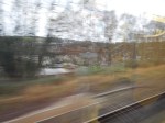
The weather was bad and on the last leg from Hebden Bridge to Leeds, I didn’t see much.
According to the Bradford-Halifax section in the Wikipedia entry for the Calder Valley Line, there are five tunnels of which two are over a thousand yards.
So as on the rest of the line electrification could be challenging.
On the other hand some sections, like Sowerby Bridge-Halifax might be easier to electrify.
But I can’t help feeling, that whatever Network Rail decide to do about this line, that IPEMU technology will be part of the solution.
Say you have a section of a couple of miles, that because of various issues would be virtually impossible or very expensive to electrify.
Could a train approaching the neutral section drop its pantograph, use battery power in the neutral section and then automatically put the pantograph up to reconnect to the electricity supply, once the neutral section was passed?
As a Control Engineer, I know such automation is possible, but can it be implemented on a train at 100 mph?
I suspect that the answer is yes and by the end of 2017, there’ll be videos of an IPEMU, swapping from overhead to battery power and back at high speed.
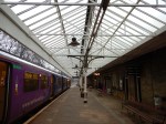
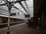
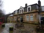
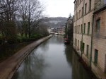
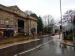
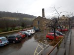
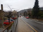
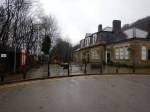
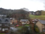
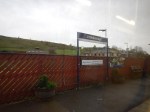
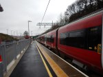
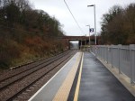
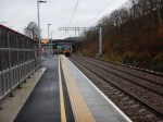
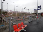
Hebden Bridge
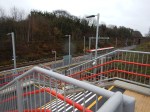
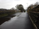
I’m treating Hebden Bridge and the Grade II Listed Hebden Bridge station as a single post, as one would do other places where the station welcomes you to the town or city and is most certainly part of the identity. I would also place Brighton, Cambridge, Liverpool Lime Street, Portsmouth and Rochester, in that category, but there are others.
These pictures show my very wet visit.

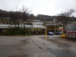

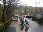
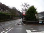
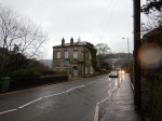
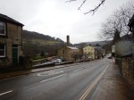
I shall go back one dsy, when the weather is better.
This Google Map shows the town and the station.

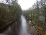
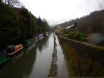
Hebden Bridge
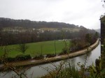
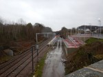
Note the Rochdale Canal and the River Calder running in the same direction as the railway.
I believe that Hebden Bridge could be key in the electrification strategy of the Calder Valley Line.
A personable member of Northern Rail’s staff told me a tale about step-free access at the station. There is a subway under the tracks and this used to be served by two parcels lifts. I was told, that it was suggested that the lifts be replaced by passenger lifts, to make the station step-free, but as the station is Grade II Listed, this was not allowed.
What will happen in the end over access, I know not, but in my dealings with Listed Buildings Officers in Suffolk, they tend to be practical and lookfor a compromise, that satisfies all parties. Surely, there could be a design of lift, that would satisfy both the heritage and disabled lobbies without an outrageous expense.
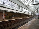
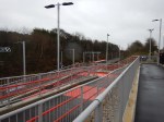
This leads me to the electrification through Hebden Bridge station.
Look at this enlarged Google Map of the station.
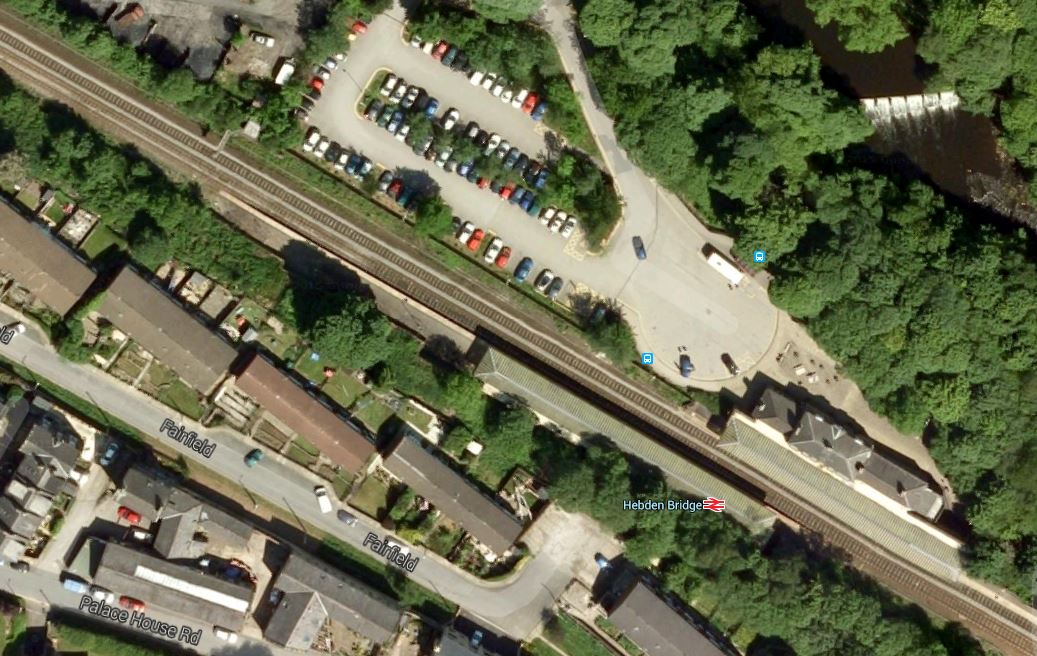
Hebden Bridge Station
I think you can see the following.
- The platforms aren’t that long and would need to be lengthened for the four-car trains that would surely be appropriate after electrification.
- The canopies of the platforms will have to be cut back, so that the overhead wires and their supports can be erected.
I don’t think the heritage lobby will like either of these changes.
But what could they object to, if the electric trains were quiet four-car Class 387 IPEMUs, using selective door opening on the current platforms?
These trains could serve Hebden Bridge station tomorrow, if Leeds to Bradford and Blackburn were electrified.
There would be no other overhead wiring needed
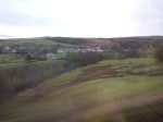
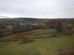
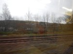
Manchester Victoria To Hebden Bridge
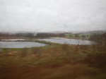
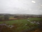
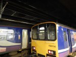
The weather wasn’t good as I took the hourly train on the Calder Valley Line between Manchester Victoria and Hebden Bridge stations.
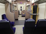
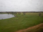


The train was a Class 150 train, which as the first picture shows had been refurbished, but really on a line between the two of the biggest cities in the north, shouldn’t something better be used.
As with my earlier trip from Burnley Manchester Road to Manchester, the line has a fair selection of viaducts, tunnels and challenging structures.
The tunnels include the Summit Tunnel, which is a masterpiece of Victorian engineering, that has been in continuous use since the 1840s.
I don’t know whether Network Rail will want to electrify the Summit Tunnel, but I believe that it could be declared safe for IPEMUs to pass through without extensive modification.
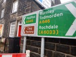
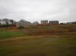
East Of Todmorden
Between Todmorden and Hebden Bridge, there is the Hall Royd Junction, which incorporates the Todmorden Curve and three more smaller tunnels. This Google Map shows the line East of Todmorden.
Note that the Todmorden Curve had not been built, when the Google Map image was taken. The three tunnels are not as long as the Summit Tunnel and are each about two hundred metres long.
The engineering isn’t probably as challenging as that between Burnley and Todmorden, but there will be a lot of it.
If IPEMUs are used, provided the track, tunnels and viaducts are up to scratch, then all that will need to be done is check everything out.
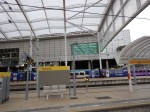
Exchange Square Metrolink Stop
The new Exchange Square Metrolink stop on the Metrolink Second City Crossing has opened.
Where’s the map at the stop?
I don’t know Manchester City Centre that well, so I need help, without getting my smart phone out.
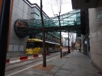
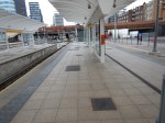
Manchester Victoria Station Is Nearly Finished
It’s getting to the point, where the upgrade of Manchester Victoria station is nearly finished.
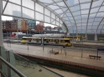
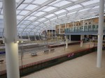
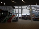

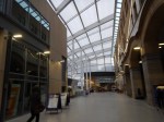
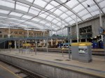
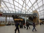


It really does show how good design can take a dark dump and make it a place you are happy to visit. Unlike Manchester Piccadilly, which now looks very third-rate.
There’s lots of space and it’s only a short walk to the trams.
In my view the following needs to be done to finish Victoria.
- Walking maps around the station.
- The Metrolink could do with better maps and information.
- A few litter bins.
- Contactless bank card ticketing.
But then the devil is in the detail.
Manchester should start to realise that it will get lots of visitors, who won’t know their way around the city centre.
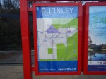
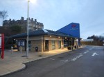
An Early Sunday Start From Burnley To Manchester
I started early and took the 08:39 train from Burnley Manchester Road station to Manchester Victoria station.

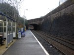
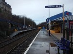


It is a picturesque ride around the Todmorden Curve, over valleys on high viaducts and through traditional stone-built villages and towns, with the hills of the Pennines in the background and quite a bit of water alongside the rail line.
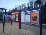
The line has improved greatly in the last few years and there are lots of tidy stations, with seats, shelters and information boards. The only larger ones are Burnley Manchester Road, Todmorden and Rochdale.
Despite the early hour on a Sunday, there were quite a few passengers and the train was about three-quarters full at Manchester Victoria.
Thinking back to my first time by train to Burnley in 2011, the rail link has improved dramatically.
- A smart new station has been built.
- The Todmorden Curve has been opened to provide a direct train service to Manchester.
- An hourly service links Burnley and Manchester Victoria via the curve.
From reports, I’ve read, the line is well-used.
This question has to be asked – Could the line be electrified?
Look at some of the pictures and they show the challenging nature of electrifying the line.
- From Burnley to Todmorden, there are a number of well-built Victorian stone over-bridges.
- Also on this stretch there are at least two high stone viaducts.
- There are several tunnels, includin the Summit Tunnel, which is 2.6 km. long and has been in continuous use since the 1840s.
- Many stations have been upgraded or rebuilt recently.
- Also in this area, some new bridges across the line for new roads and the Metrolink, seem to appear to be rather low.
Also, look as this section of the line between Burnley and Todmorden.

Between Burnley And Todmorden
Note how the rail line curves between the hills and the houses, using tunnels and viaducts to get go on its way.
It’s one of those lines, where you’d try to find an alternative to traditional electrification. If it’s not space, it’s heritage issues and there would be lots of bridges, viaducts and tunels to rebuild.
Go west from Burnley and the line has a couple of high viaducts and a couple of tunnels, but the East Lancashire Line seems to get easier west of Blackburn station, with a line over mainly flat countryside with plenty of space on either side. At Preston it connects to the electrified West Coast Main Line.
Electrifying from Preston to Blackburn, would open up several routes to the use of IPEMU trains.
- Blackpool South to Colne – A substantial part of the route of the fifty mile route from Blackpool South to Colne would be electrified and from the performance figures I’ve seen, this route would be an easy one for something like an IPEMU-variant of a four-car Class 387 train.
- Burnley to Manchester – The service I rode from Burnley to Manchester starts at Blackburn and finishes in a fully electrified Manchester Victoria. So to answer my original question about whether the route could be electrified, there is actually no need to electrify, as IPEMUs could easily link two electrified terminals over that distance.
- Manchester to Clitheroe – Look at the Ribble Valley Line on Wikipedia and there are five viaducts and three tunnels listed, in a line of around thirty miles. However, the good news is three-fold. The line has been well looked after, it’s promoted as a tourist attraction and soon, it will be electrified from Manchester as far as Bolton. I can’t see why with a small top-up at Blackburn, that this route couldn’t be run by an IPEMU.
- Blackpool North to Settle – This route is run as a tourist train called DalesRail on Sundays in the Summer, when it goes all the way to Carlisle. An IPEMU could certainly run a service between Blackpool North and Settle, but I doubt it could stretch all the way to Carlisle along the Settle-Carlisle Line, as there are some massive gradients on that line.
- Blackpool North to Leeds – This route along the Calder Valley Line via Hebden Bridge, Halifax and Bradford would be totally within range of an IPEMU, once Blackburn to Preston is electrified. If necessary, Leeds to Bradford could be electrified as well. A train fit for the Northern Powerhouse, powered by batteries and built in Derby!
This all illustrates how an IPEMU can benefit from even short sections of electrification. Blackburn to Preston would be under twenty miles of electrification without troublesome viaducts and tunnels across fairly flat country and it opens up several routes to new electric trains.
It’s funny, but if you are going to use IPEMU trains, you electrify all the lines, that you can electrify and maintain with ease and leave all the difficult bits to the battery feature in the trains.
From Leeds To Burnley Manchester Road
I’d gone to Burnley for the football via Leeds, as the West Coast Main Line seemed to be partly closed and I also wanted to take a look at the recently-opened Apperley Bridge station, which I wrote about in The New Apperley Bridge Station.
The trains across the Pennines on Saturdays are an hourly service at xx:08 from York to Blackpool North, that calls at New Pudsey, Bradford Interchange, Halifax and Hebden Bridge, on the section of route I would travel.
The train was busy and I was unable to get any decent pictures, but my 12:08 departure dropped me on time in Burnley Manchester Road station at 13:11. I wrote about the scenic qualities of the route before in The Scenic Route From Leeds To Manchester.
Burnley Manchester Road station doesn’t have a taxi rank, but I was able to hi-jack an empty one and the driver took me to my Premier Inn just north of the town centre and Turf Moor for a fiver.


It was a hard-fought match and a goalless draw was a fair result.
The Premier Inn is a useful one, as it is only a few minutes walk down and up the hill to Turf Moor.
One of the staff told me, that they get a lot of walkers and cyclists using the hotel as a half-way point on the nearby Leeds and Liverpool Canal.
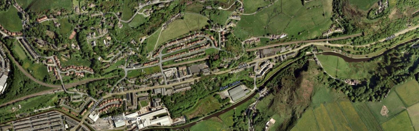
The New Apperley Bridge Station
Apperley Bridge station is a new station between Leeds and Shipley on the Leeds to Bradford Lines.


The station is a simple design, based around an existing bridge and uses ramps rather than lifts for step-free access.
It must make for a more affordable design. The new Kirkstall Forge station is reported to be being built using similar principles.
This Google Map shows the Location of Apperley Bridge station.

Apperley Bridge Station Location
The station has been built by the wetsmost of the two branches. The Avenue leading away to the North doesn’t lead to the country seat of a man of means or breeding, but to what appears to be a large sewage works.
The two stations are reported in this web page as costing sixteen million pounds for the pair.
But judging by the heavyweight construction, the good-sized shelters, Network Rail have future proofed this station for a lot more passengers than they will expect in the next year.
Perhaps this section entitled The Future in the Wikipedia entry for the Airedale Line offers a clue!
This is said.
Recent Network Rail reports have looked at ways of increasing capacity on the line. Because of the difficulty of lengthening platforms at Shipley, it will be hard to introduce longer trains (i.e. 5 or 6 carriages) as is being proposed on the neighbouring Wharfedale Line. It is therefore proposed to run more trains per hour between Leeds and Keighley, with a new platform at Keighley to accommodate this. A new station atApperley Bridge opened in 2015 and Kirkstall Forge is due to open in January 2016, with both stations located between Leeds and Skipton via Shipley.
Could it be that the two new stations will also divert commuters into Leeds from Shipley?
Wikipedia appears to suggest that Shipley station has access problems, so perhaps diverting passengers to a new fully-accessible station increases capacity on the line.
This Google Map shows that Shipley station isn’t your bog-standard two-platform station.

Shipley Station
I only know of one other station built in the middle of a triangular junction; Liverpool South Parkway. But that station was designed that way.
Incidentally, a guy at Appleby Bridge station told me, that it can take an hour to drive into Leeds in the rush hour from the village, but the train takes less than ten minutes.
Rail Lines In The City Of London Will Be Transformed
This map from carto.metro.free.fr shows the various rail lines in the City of London.
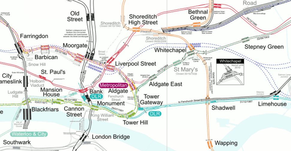
Lines In The City
Londoners and those who know the City well, will be able to pick out the lines in the map, but to help those who don’t, here’s a brief guide.
Note the North-South routes.
- Thameslink through Farringdon, City Thameslink and Blackfriars.
- Northern City Line through Old Street to terminate at Moorgate.
- Northern Line through Old Street, Moorgate, Bank and London Bridge
- East London Line through Shoreditch High Street, Whitechapel, Shadwell and Wapping.
And the East-West routes.
- Metropolitan Line through Farringdon, Barbican, Moorgate, Liverpool Street, Aldgate, Aldgate East and Whitechapel.
- Central Line through St. Paul’s, Bank, Liverpool Street and Bethnal Green.
- District Line through Blackfriars, Mansion House, Cannon Street, Monument, Tower Hill, Aldgate East and Whitechapel.
- DLR stretching east from Bank and Tower Gateway.
- Jubilee Line through Southwark and London Bridge.
There are also two lines that provide links out of the area.
- Circle Line through Farringdon, Barbican, Moorgate, Liverpool Street, Tower Hill and Blackfriars.
- Waterloo and City Line between Waterloo and Bank.
The biggest transport development London in recent years, is about to create a high-capacity link through the area.
Most people think of Crossrail, as just an east-west line across London.
Crossrail will connect Heathrow, Reading, Paddington and Bond Street in the West with Essex and Kent passing through Farringdon, Moorgate/Liverpool Street and Whitechapel.
But Crossrail will do a lot more for the City of London.
Bank
This map from carto.metro.free.fr shows the lines around Bank station.
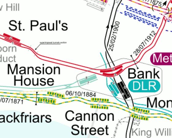
Lines Around Bank
Bank station is in desperate need of an upgrade.
In this press release on the TfL website entitled MAJOR UPGRADE OF BANK TUBE STATION GETS THE GREEN LIGHT FOR WORK TO BEGIN, this is said.
The £563m upgrade will increase the busy station’s capacity by 40 per cent, improving accessibility and reducing interchange times when it is completed in 2021. Now approved, the station becomes the latest in a series of major upgrades taking place across the Capital.
Bank is the third busiest station on the Tube network and is used by over 52 million passengers per year, with demand having risen by 50 per cent over the last 10 years. Improving the station is critical to keep London working and growing and is a key step in TfL’s future plan to increase frequency on the Northern line.
The plans for Bank station show the following.
- A new entrance to Bank station with lifts and escalators on Cannon Street at the junction of Nicholas Lane.
- This entrance will be about a hundred metres from Cannon Street station on the other side of the road.
- A new southbound running tunnel for the Northern Line, which will be to the west of the current platforms.
- Lots of cross passages and tunnels to link it all together.
The Liverpool Street/Moorgate Crossrail station, could take the pressure off Bank station during the expansion.
- As the Crossrail station, when it opens, should have good access to the Northern and Central Lines, will many walk the short distance?
- Many will use Crossrail/Thameslink to get to the Bank area, rather than a crowded Underground.
- Crossrail could be quicker to Canary Wharf from Bank than the DLR.
If the City of London took a bold step and pedestrianised much of the City, this would help make the Bank/Farringdon/Liverpool Street/Moorgate area a giant concourse for the rail lines underneath.
This Google Map shows the area from Moorgate and Liverpool Street in the North to Cannon Street and Bank in the South.

Bank To Liverpool Street
I reckon that from the Crossrail station to Bank will be about seven hundred metres of walking on the flat, as it took me less than ten minutes with plantar fasciitis.
Camberwell
Camberwell station is not in the City, but I’m including it here, as it looks like being the first positive consequence of Crossrail/Thameslink.
This press release on the Transport for London web site is entitled BAKERLOO LINE EXTENSION TO IMPROVE TRANSPORT LINKS IN SOUTH LONDON BY 2030. It says this about a new station at Camberwell.
The Mayor and TfL will be working closely with Network Rail and Southwark Council on plans for a new Thameslink station at Camberwell. This new station would reduce journey times into central London by up to 20 minutes, and by providing connections to the Underground and Crossrail, will improve access from Camberwell to locations across London.
It’s not definitely decided yet, but it looks hopeful.
I wonder if we’ll hear more before May.
This map from carto.metro.free.fr shows the lines south from Elephant and Castle.
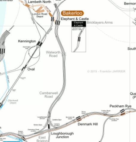
Camberwell Station
Will the new Camberwell Station be where Camberwell Road station is shown?
Cannon Street
Cannon Street station is a modern well-appointed station, but it isn’t connected directly to Crossrail or Thameslink, but all the work will benefit this station.
- The new entrance at Bank station will mean that Cannon Street will be better connected into the lines serving Bank station.
- There is also the new Walbrook Entrance To Bank Station, which opens in 2017 and will give more routes into Bank station.
- Improvements to the District and Circle Lines will mean that Cannnon Stret has better East-West connections.
- Due to the improved layout at London Bridge station, passengers will have greater flexibility in their choice of terminus.
I think that the number of passengers using Cannon Street will increase.
Farringdon
This map from carto.metro.free.fr shows the lines from Farringdon to Liverpool Street.

Farringdon To Liverpool Street
The Crossrail station at Farringdon is an immense double-ended one connecting to both Farringdon and Barbican stations.
I always think, that Crossrail and Thameslink should be treated together.
Once passengers learn how to navigate around Farringdon station, they will increasingly consider Crossrail and Thameslink as one system.
For myself, in Dalston, I suspect that my route to places South of the Thames could start at Farringdon. I could either get a 56 bus to near the station or use the East London Line and a five-minute hop on Crossrail,
Liverpool Street and Moorgate
Look closely at Liverpool Street and Moorgate on the Farringdon To Liverpool Street map and you can see the Crossrail station platforms lying between the two current stations. Several questions will be answered, when the station Crossrail station is fully revealed.
- Will connection be possible between the Northern and Central lines and easier than at the labyrinth at Bank?
- Will entrances from the Crossrail station be arranged to give direct access to the many buses?
- Will the Crossrail station create good access to Liverpool Street station from the Northern Line?
- Will access to the Northern City Line be better?
If they get the design right at the Liverpool Street/Moorgate Crossrail station, it could really take the pressure off Bank station, whilst it is extended.
London Bridge
London Bridge is a station that is being rebuilt at the moment.
It is part of this analysis, as the redesign of the station will make it easy for passengers to change easily between Thameslink and the various routes going to all over the South.
Hopefully, the new station will also make it easy to change between trains and the buses and Underground.
I sometimes think for selfish reasons, that a high-capacity surface link using a bus or tram is needed between London Bridge and Old Street, via Bank and Moorgate. I regularly use the 141 bus on this route, but it doesn’t have the required frequency or capacity.
It will be interesting to see how many passengers transfer to Thameslink, at or before London Bridge and then use Crossrail from Farringdon.
Shoreditch High Street
This map from carto.metro.free.fr shows the Central Line as it goes East from Liverpool Street to Stratford.

Central Line In East London
The Central Line is in red, with Liverpool Street station, just off the map at the left and Stratford station at the top right.
Look at the map and you’ll see that Shoreditch High Street on the East London Line is directly above one of the longer stretches of the Central Line without a station.
With all the development going on in the Shoreditch area, it could be a good idea to link the two lines here with a new Central Line station. Construction of the station would require breaking the Central Line into two halves for a couple of years, so it would be a great inconvenience.
But Crossrail connects the gap, as it serves Stratford and Liverpool Street, so it is a possibility this link will be created once Crossrail has opened.
As the London Overground stations at Bethnal Green and Cambridge Heath are very much not the best and are certainly not step-free, rebuilding them and connecting one of them to Bethnal Green tube station might be something at which to look.
This Google Map shows the rail lines between Shoreditch High Street and the two Bethnal Green stations.
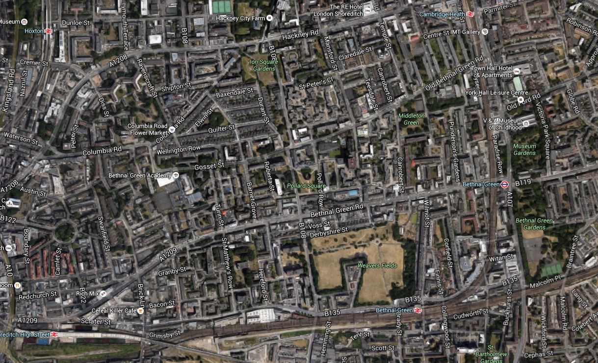
Shoreditch High Street And The Two Bethnal Green Stations
As Network Rail are thinking about some more terminal platforms in the area to ease overcrowding at Liverpool Street, we could see something innovative in this area.
Whitechapel Station
Look at Whitechapel on a tube map showing Crossrail and it appears to be just a handy interchange between Crossrail and the East London Line, and the District and Metropolitan Lines.
But it is much more than that!
- Whitechapel will be the station, where passengers going west from an Eastern branch, will walk across the platform to go back down the other branch. This will create a simple route between say Ilford and Abbey Wood stations, that avoids going further into the centre of London.
- The East London Line has a capacity of 24 trains per hour, but only runs sixteen at the moment. Once Crossrail is fully established, I believe the number of destinations on the East London Line, both North and South of the Thames, will increase.
- Whitechapel may well be the station, where travellers change to the south-east branch of Crossrail for Canary Wharf. I’ll probably do that by changing from the East London Line.
- The two platforms for the District and Metropolitan Lines will be combined into a single island platform, so on journeys like Barbican to Mansion House, passengers might take to going on a first train to Whitechapel and walking across the platform to get a district Line train, instead of waiting for a Circle Line train.
But you can’t predict how passengers will use a new station! As it’s the East End, where ducking and diving is the most popular sport, getting predictions right is even more difficult!
I shall certainly use Whitechapel station a lot, as it’s just a few stops down from Dalston Junction.
Conclusion
You ain’t seen nothing yet!
Thoughts On The Gospel Oak To Barking Electrification
The electrification of the Gospel Oak To Barking Line (GOBlin), is the closest I’ve been to an electrification project since the nineteen-sixties when I was travelling up and down between London and Liverpool, through the electrification on the West Coast Main Line.
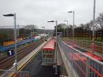
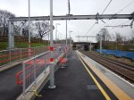
Yesterday, I took a look at the start of work at Gospel Oak station. Thinking about what I saw, it strikes me that everything is much better organised than it has been in some places in the past.
Perhaps, they’re doing their project management in a lot better way.
Signalling
As an illustration of project performance, I have read that not knowing where signalling cables were buried, was a big problem on the electrification of the Great Western Railway. So out of curiosity, I searched the Internet for any reports about the state of the signalling on the GOBlin.
I found this web page on the Sweett Group web site, which is entitled Gospel Oak To Barking Electrification. This was a brief summary of the work they did.
Sweett Group was engaged by TfL to review and validate the Grip 3 estimate prepared by Network Rail in order to assist TfL in the determination of their funding contribution.
Reading the whole of the report, leads me to the conclusion that TfL wanted to make sure, that the only surprises they get on this project, will be positive ones.
As to signalling, very little is said, except this.
In addition, modifications to existing signalling had to be carried out in order to overcome conflicts with signal sighting caused by OLE support structures and to accommodate the introduction of longer freight trains.
So in answer to my original question on signalling, it looks like most of it is in good order.
Line Closures
Will planned closures of the line tell us anything? This web page from TfL details all their line closures for the next six months.
Those specific to the GOBlin are.
- Sun 10 Jan 16 – South Tottenham to Barking until 12:00
- Sun 17 Jan 16 – Gospel Oak to Barking until 12:00
- Sun 24 Jan 16 – Gospel Oak to Barking
- Sun 31 Jan 16 – Gospel Oak to Barking
- Sun 07 Feb 16 – Gospel Oak to Barking until 12:00
- Sun 14 Feb 16 – Gospel Oak to Barking until 12:00
- Sun 21 Feb 16 – Gospel Oak to Barking until 12:00
- Sun 28 Feb 16 – Gospel Oak to Barking until 12:00
- Sun 06 Mar 16 – Gospel Oak to Barking until 12:00
- Sun 20 Mar 16 – Gospel Oak to Barking until 12:00
- Sun 27 Mar 16 – Gospel Oak to Barking until 12:00
- Sun 03 Apr 16 – Gospel Oak to Barking until 12:00
- Sun 10 Apr 16 – Gospel Oak to Barking
- Sat 16 to Sun 17 Apr 16 – Gospel Oak to Barking
- Sat 23 to Sun 24 Apr 16 – Gospel Oak to Barking
- Sat 30 Apr to Mon 02 May 16 – Gospel Oak to Barking
- Sat 07 to Sun 08 May 16 – Gospel Oak to Barking
- Sat 14 to Sun 15 May 16 – Gospel Oak to Barking
- Sat 21 to Sun 22 May 16 – Gospel Oak to Barking
- Sat 28 to Tue 31 May 16 – Gospel Oak to Barking
There are also a few closures of the North London Line, that start at Gospel Oak.
- Fri 01 Jan to Sun 03 Jan 16 – Gospel Oak to Stratford from 22:00
- Sun 21 Feb 16 – Gospel Oak to Stratford
- Sun 28 Feb 16 – Gospel Oak to Stratford
- Sun 06 Mar 16 – Gospel Oak to Stratford
- Sun 20 Mar 16 – Gospel Oak to Stratford
The first is an interesting one, as it is this weekend, when the contractors are known to be piling for overhead wires, late into the night.
On all the other four Sundays, the GOBlin is closed all or part of the day.
Surely, you wouldn’t close both routes across North London, unless you wanted to work on both at the same time!
Could the contractors be wiring up Gospel Oak Junction and Platform 3 at Gospel Oak station?
These are my overall comments.
- Monday to Friday passengers won’t have to suffer many replacement bus services.
- Something is planned for the Spring Bank Holiday Weekend
- As there is no closures scheduled in June, it looks like May 31st will mark a natural break in the project.
- Someone has been doing some very good project management.
It will be fascinating to take a look on Mondays for the next few months, to see what has been completed.
Space To Work
I wonder if anybody has ever done any research on the performance of the amount of space available to building projects.
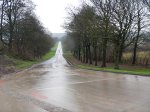
What surprised me yesterday, as my train trundled between Harringay Green Lanes and Gospel Oak stations, was how much space was available and it had all been cleared of vegetation.
I hope this is a sign that they mean to carry on as they’ve started.
Having looked at many large projects in the actuality, I strongly believe that a project with lots of space, that is kept tidy, is more likely to be delivered on time and on budget.
Today, I also followed the line on a Google Map and virtually all the way from Gospel Oak station to Leyton Midland Road station, there are green verges, several metres deep on both sides of the tracks.
Look at this section of the line from Crouch Hill to South Tottenham stations.
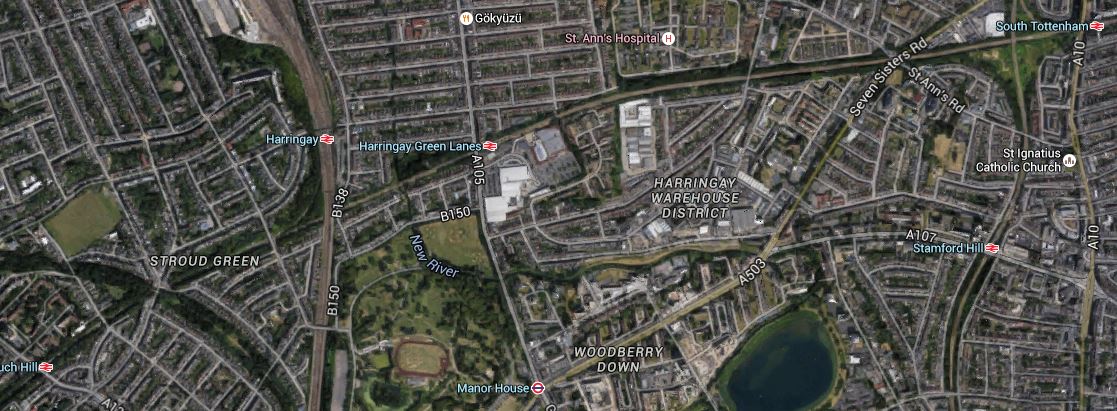
Crouch Hill To South Tottenham
Note all the green space, especially where the line crosses the East Coast Main Line, where a chord is to be electrified.
This space must contribute to a successful project.
Obviously towards the east, where the line is on a Victorian embankment is going to be more challenging.
Murphy’s Contract
A lot more detail on the GOBlin electrification is given in this article in Rail Technology Magazine, which is entitled J Murphy & Sons to carry out electrification of Gospel Oak-Barking route. This is said.
J Murphy & Sons Limited will carry out electrification works along the 12-mile line from Gospel Oak to Barking on the Anglia route, after winning the £56.9m contract from Network Rail.
The contract, which was awarded three months later than originally expected, will allow work to start on the ‘Goblin’ project in October.
In some ways, I was surprised, the contract was awarded to Murphy, as I didn’t think they were noted for doing rail electrification. I know them as a well-respected London contractor, who have been around since my childhood. Their premises are actually close to the line, which must help.
I know it said that the project would start in October and it just made a start in 2015, but at least it’s got going. The article says this about the project timeline.
The electrification contract runs until April 2017 but, if carried out according to the planned timeline, “major on-site works” will commence in June 2016 with services ready to operate a year later. Network Rail’s official classification of the works is for GRIP stages 4-8: ‘Main Works – Civils, Structure, Building, Track, & Bonding’.
This gives the intriguing prospect, that the electrification could take twelve months. This question has to be asked – Have major on-site works already started?
Even if they haven’t, judging by the noise at Gospel Oak something has started and that completion date of April 2017, is starting to look very feasible and just in time for the May 2017 timetable change.
Stations
Not all stations can accept the new four-car Class 710 trains or are to the standard passengers expect these days.
- Gospel Oak – Disabled access, lifts, coffee stall – Platform needs extending.
- Upper Holloway – Disabled access, ramps – Platforms need extending by reopening closed sections – Road bridge by station is being replaced by the end of 2017.
- Crouch Hill – Stairs-only access – Platforms need extending by reopening closed sections
- Harringay Green Lanes – Disabled access, ramps – Platforms need extending
- South Tottenham – Disabled access, lifts – Platform needs extending.
- Blackhorse Road – Stairs-only access – Disabled access in planning – Platforms need extending
- Walthamstow Queen’s Road – Disabled access, ramps – Platforms need extending by reopening closed sections
- Leyton Midland Road – Stairs-only access – Platforms need extending by reopening closed sections.
- Leytonstone High Road – Stairs-only access – Platforms need extending by reopening closed sections.
- Wanstead Park – Stairs-only access – Platforms need extending by reopening closed sections.
- Woodgrange Park – Stairs-only access – Platforms need extending by reopening closed sections.
- Barking – Disabled access, lift
So of the twelve stations on the line seven need platforms to be extended by reopening closed section, four need new extensions and six need improvements to the disabled access.
It will be interesting to see what is completed other than the necessary platform extensions, before the electric trains run.
Electrification
The Rail Technology Magazine article also details the scope of the electrification.
In addition to wiring from Gospel Oak to Barking and both the terminal platforms, the following will be electrified.
- Carlton Road Junction to Junction Road Junction – Connects to the Midland Main Line
- Upper Holloway Reception Line
- Harringay Park Junction to Harringay Junction – Connects to the East Coast Main Line
Note that there is no mention of the extension of the line to Barking Riverside.
Electrification work has obviously started at the easier Gospel Oak end of the line, so I think we can assume that Murphy and a lot of sub-contractors are pulling out all the stops to get this job finished on time.
One problem they don’t have is getting power to the new electrification, as it connects to several electrified lines.
There is also only twelve miles to electrify.
I think we could well be seeing, the electrification completed and the platforms lengthened, before the Class 710 trains are delivered.
Class 710 Trains
The Class 710 Trains ordered for the line are unlikely to arrive before May 2018. But I suspect that TfL will find something to run services.
They could even hire some of Porterbrook’s speculative build of Class 387 trains, or perhaps borrow some of the redundant and very ugly Class 319 trains.
After all, they only need eight trains of four-cars each.
Extension To Barking Riverside
It looks like, that this will be done, after the main project has been completed.
Conclusion
It looks like the following will happen.
- Due to some rather excellent project management, that finally the Gospel Oak to Barking Line will be electrified and capable of running four-car electric trains.
- It’s not the biggest of projects, that could be fairly straightforward.
- The completion of the electrification project could be as early as April 2017.
- The trains, unless they rustle up some from elsewhere, will probably be delivered later.
- There will be little if any interruption to the important Monday to Friday service of the line during electrification.
- More freight trains will be hauled by electric locomotives in the near future.
I can’t see anybody complaining about all that!
