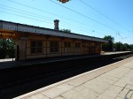
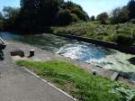
Lea Bridge Station – 13th September 2015
The progress at Lea Bridge station seems to be mainly clearing the site.

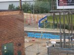
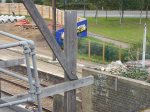

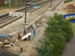
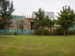


They were even working today, which is a Sunday.
But then the railway through the site had been closed off, as the pictures show.
The Railways East Of Nottingham
As an engineer, I’m always of the view that a lot of engineers, do the jobs they do because they like creating things on the one hand and because it’s great fun on the other.
Although, I’ve been much more in a support role to engineers in many varied industries, I’ve loved the solving of problems and the creating of products all my working life. It might have been stressful at times, but it has been tremendous fun!
It strikes me that the rail projects centred on Nottingham in the last few years, have been done well and with a great deal of style and innovation.
There has been a lot of them in recent years.
- Passenger services on the Robin Hood Line in the 1990s.
- Refurbishment and reorganisation of Nottingham station in the 2010s.
- Phase 2 of the Nottingham Express Transit in 2015.
- The Tram Viaduct Over Nottingham Station in 2015.
- Remodelling of track, signalling and platforms around Nottingham Station in 2013.
- Sorting the footbridge and public path at Nottingham Station in 2013.
- Improvement at Long Eaton Station in 2012.
- Improvement of the Erewash Valley Line in 2007.
Network Rail are following these with other projects in the area.
- Ilkeston Station
- Creation of the Ollerton Branch on the Robin Hood Line.
- Creation of a new route from Derby to Kirkby-in-Ashfield via Long Eaton and Ilkeston
Only the Ilkeston station project has started, although not much trackwork needs to be done for the two new routes.
There would appear to be little work either done or proposed to the East of Nottingham.
But that would ignore the big project about thirty miles to the East – the updating of the Great Northern and Great Eastern Joint Railway (GNGE). I wrote about that project in Project Managers Having Fun In The East.
Effectively, £230million has been spent to create a high-quality line for freight between Doncaster and Peterborough, so that there is a higher capacity for passenger services on the East Coast Main Line.
So what could happen in the area?
Poor Lincoln – Level Crossings
I say poor Lincoln, as the city has suffered for years because there is a busy level crossing used by very large numbers of people, vehicles and trains, right in the centre of the City on the High Street. This article from the Lincolnite talks about the start of a £12m project to create two footbridges over the railway. Reading the comments to the article is an informative exercise.
If you want to read more about this project, there are more details on this page on Network Rail’s web site.
This Google Map shows the two level crossings to the West of Lincoln Central station.
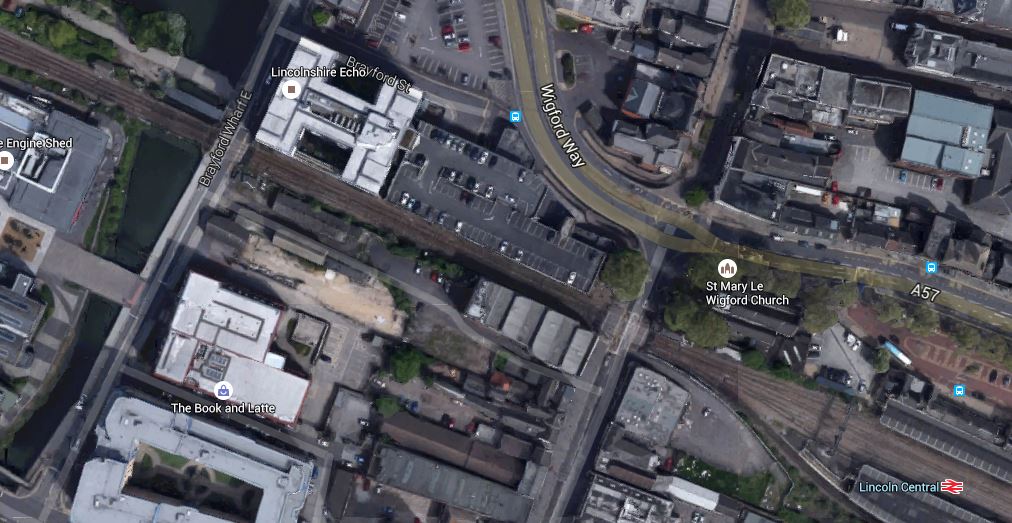
Lincoln Level Crossings
As an East West relief road is also being built, according to this article in the Linconite, the two projects might improve the problems in the City centre for a few years.
Before I leave the level crossings at Lincoln, take a look at this article from Rail Magazine. This is said about the level crossings.
Early Network Rail figures suggest that by 2030, with all freight paths being used and all East Anglian ports running at maximum capacity, the barriers in Lincoln could potentially be down for 40 minutes in every hour. The resulting road traffic problems are likely to increase local discontent.
So something serious must be planned for the future.
Poor Lincoln – Passenger Services
Lincoln also deserves sympathy for the poor passenger service that the City has to connect it with the rest of the UK. By comparison, Norwich is perhaps fifty percent bigger than Lincoln, but has a half-hourly service to Ipswich and London, and an hourly service to Cambridge.
Lincoln has an hourly shuttle to Newark and a few direct trains to London. There is also an irregularly-timed shuttle to Newark for London trains.
I think a city with the population and status of Lincoln deserves better.
North and South Through Lincoln
I have read the Route Utilisation Strategy (RUS) for the East Midlands and searched it for references to Lincoln. Two sections are of note. This is said in the RUS.
In addition, the interaction between passenger services terminating at Lincoln and freight trains passing through the station area has been identified by the RUS as a constraint to future growth. The RUS recommends that the great Northern/Great Eastern (GN/GE) Joint Line scheme, which will provide additional capacity between Peterborough and Doncaster (via Spalding) in CP4, considers whether or not combining terminating services at Lincoln (to create more through services and reduce congestion in the station area) would free up sufficient capacity to accommodate growth.
With my scheduling hat on, I think this simple matter of joining services together could give some needed additional paths to improve passenger services. In many places in the UK, like Birmingham, Cardiff, Edinburgh and London, this has been done to provide cross-city services, that release platform space in the station.
This was also said about improving services between Lincoln and Peterborough.
Peterborough and Lincoln by providing an improved service using existing resources once the upgrade of the GN/GE Joint Line has been completed.
After the upgrade of the GNGE, I wonder if any changes have been made to the passenger services between Peterborough, Lincoln and Doncaster.
I think not!
From my travels in Germany, the Peterborough to Doncaster and/or Sheffield/Meadowhall via Lincoln, is just the sort of route on which the Germans would run a regional service.
I think the RUS is hoping that someone will do this, but it would seem it’s just the same old slow service.
There may have been an improvement between Lincoln and Peterborough, as the service is roughly hourly and takes eighty minutes with four stops. There may be an improvement to come, when Werrington Junction, where the GNGE joins the East Coast Main Line, is improved. I wrote about this junction in To Dive Or Fly At Werrington.
But if you look at the services from Lincoln and Doncaster, some go direct in forty seven minutes and others go to everywhere in Yorkshire and take over two hours.
Lincoln To Nottingham via Newark
To improve services between Lincoln and Nottingham, the RUS recommends doing something about the notorious flat junction at Newark, which is best described as a cross roads, where a B-road crosses a motorway. This is said.
Of the remainder, the RUS recommends that the provision of a flyover at Newark is further developed in CP4 to refine the infrastructure costs and potential benefits. It is recognised that the development of the East Coast Main Line Intercity Express Programme service requirements beyond those proposed for LDHS services from May 2011, combined with freight growth beyond 18 freight trains per day on the east – west corridor, may drive the requirement for the flyover in CP5.
I have now looked at this Victorian railway relic in The Newark Crossing
Local Services Between Nottingham And The East
As I said earlier, Network Rail and the various local councils have done a lot of work to give Nottingham a first class tram systems and Nottingham station has been upgraded to accept extra services. They are now starting to improve services to the West and North.
So what will happen to services to the East of the city?
There are rumours about tram-trains being introduced in Nottingham and this is said in the section on Future Routes in the Wikipedia entry for the Nottingham Express Transit.
The document raised the possibility of tram-train lines from Nottingham to Gedling and/or Bingham, and to Ilkeston.
Gedling is on the line to Newark and Bingham is on the line to Grantham.
So one option would be to use tram-trains on the routes to Newark and Grantham, where the services run into the city as far as Bingham and Gedling as trains and then run as trams, to join the main tram network at either Nottingham station or some other convenient point.
One interesting observation is that as tram-trains can take much tighter curves than trains, is that a Nottingham to Newark tram-train might be able to call at Newark Castle, then cross the East Coast Main Line and then do a tight turn to call in the bay platform at Newark North Gate station before reversing and going on to Lincoln. This Google Map shows the Newark Crossing in detail.

Newark Crossing Close-Up
It is a very crowded place, but there may just be space for a tram-train coming from Nottingham to turn and go to Newark North Gate. It would appear to be no tighter than the Tinsley curve that will be used by Sheffield’s tram-trains to Rotherham.
Going the other way from the spur to Nottingham, might be more difficult, but I think it would be possible.
So could using tram-trains to Lincoln, give that city a much better service to and from Nottingham, but also take some pressure off the design of any solution at Newark?
I would suspect that if tram-trains went to Newark/Lincoln and Grantham, there would be a half-hourly service to and from Nottingham.
The Class 399 tram-train would also provide a faster service than the current trains.
Conclusion On The Newark Crossing
I only come to one conclusion about the solution to the Newark Crossing. Everybody should prepare for the unexpected.
Reading Station Just Gets Better!
Reading station is one of the best in the UK and rivals any second level station in Europe.
It first impressed me, when it opened and I wrote Is It Architecture, Engineering Or Art?
I took these pictures when I went to the Reading Ipswich match.


These changes were noted.
- The football buses are now parked by the station
- The Reading flyover is clearly visible from the massive footbridge over the station.
- The area in front of the station is now a plaza and not a building site.
The only problem I had was when returning after the match, It was difficult to find the first fast train to Paddington and I ended up on a stopping train to everywhere.
I did look around the station when I arrived, to see if there was any clue as to which will be the Crossrail platforms. The local services are currently served by Platforms 12 to 15 on the North side of the station. So it would probably be safe to assume that one island platform would be for Crossrail and the other is for services to places like Oxford, Newbury and Bedwyn.
It would appear that Rediung will not be served by Crossrail under December 2019.
Expanding The Robin Hood Line
The Robin Hood Line, runs between Nottingham and Worksop. It had been closed to passenger trains in the 1960s and reopened to passengers in the 1990s. I used to use it regularly to see a client in Mansfield in the years soon after it opened.
In my investigations into Ilkeston station, the Robin Hood Line kept cropping up and especially talk of a branch from the line to Ollerton.
Search Google News for Robin Hood Line and articles with titles like Chancellor backs Robin Hood line passenger plans are found in the Mansfield and Ashfield Chad. This is the start to the article.
The Chancellor George Osborne, has confirmed his backing for plans to open a passenger service on the Robin Hood line, from Shirebrook to Ollerton, including passenger stations at Ollerton and Edwinstowe.
Other Government figures like David Cameron and Patrick McLoughlin and important local councillors are also quoted saying similar things.
What is not said is that the line will serve the CentreParcs Sherwood Forest and that the rail line needed is currently fully maintained for driver training. This Google Map shows the area.
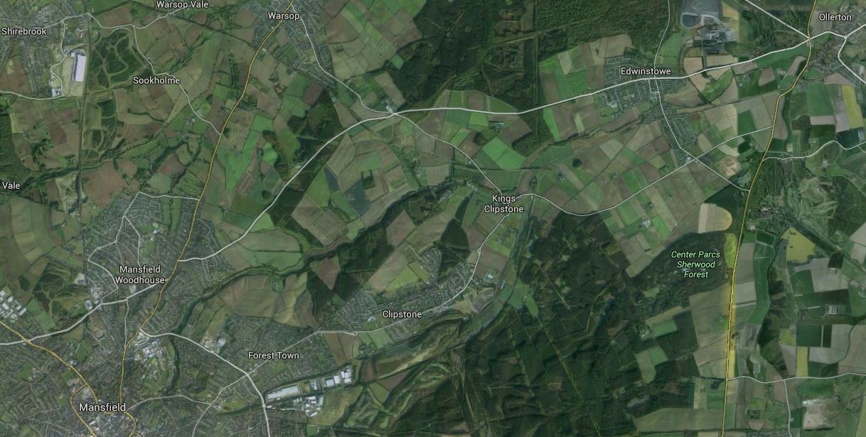
Proposed Ollerton Branch
The branch turns off from the Robin Hood Line just North of Shirebrook station in the top left hand corner of the map and then makes it way to Ollerton by way of the South of Warsop and Edwinstowe and North of the CentreParcs Sherwood Forest .
The line probably illustrates the only environmentally-friendly use for coal, which is to keep rail lines open and in good condition, until we can find a better use for them.
There is an interesting section called Branch Lines in the Wikipedia entry for Shirebrook station. This is said.
Two branch lines are plainly visible veering off north of the bridge at the north end of Shirebrook station.
The double tracks branching off eastwards (i.e. to the right as viewed from the station) to the side of the signalbox joined the LD&ECR’s one-time main line to Lincoln, next stop Warsop. The branch only ever carried a regular passenger service for a few years in Edwardian times. It did, however, carry Summer holiday trains such as the Summer Saturdays Radford to Skegness in at least 1963. The branch’s main purpose was always freight traffic, with coal being overwhelmingly dominant.
In 2013 the line gives access to Thoresby Colliery and to the High Marnham Test Track.
There is some hope of reopening the line as a branch off the Robin Hood Line and reopening Warsop, Edwinstowe and Ollerton stations, providing an hourly service to Mansfield and Nottingham.
This Google Map shows Shirebrook station and the railway lines around it.
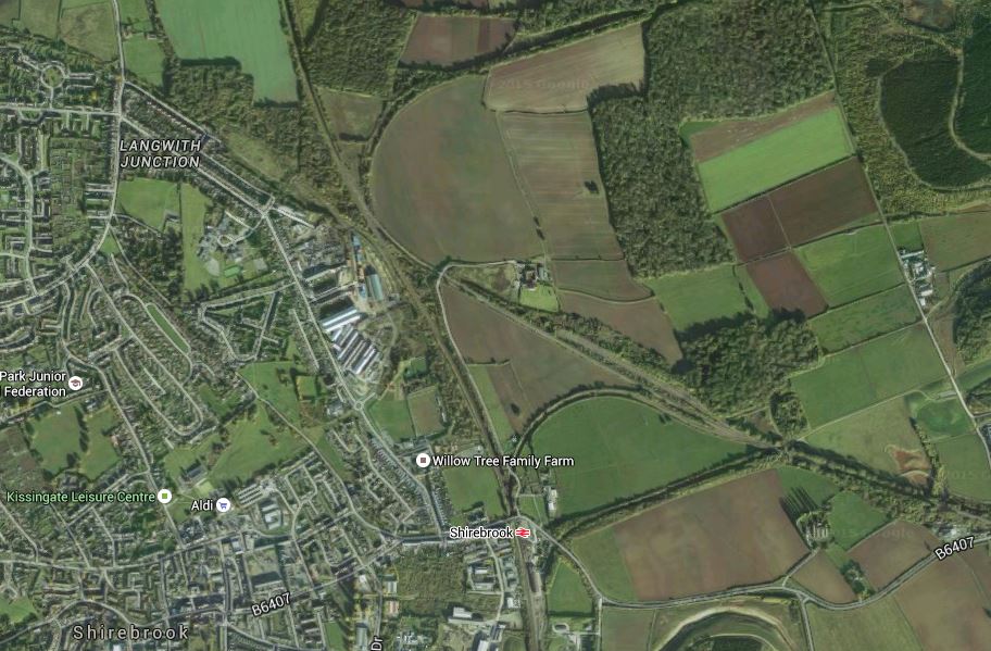
Shirebrook Station
The junction of the Ollerton branch would appear to allow access to trains from or to either Nottingham and Mansfield in the South and Worksop in the North
So there could be three stations; Warsop, Edwinstowe and Ollerton on a double-track branch.
From Ollerton To Lincoln
Interestingly, after Ollerton the line goes all the way to Lincoln. But I doubt that it would ever be part of the plans for passenger trains in the area.
But who knows?
The area between Chesterfield, Mansfield and Nottingham is not very well connected to Derby.
If you want to go from Mansfield or Kirkby-in-Ashfield on the Robin Hood Line to Derby, you always have to change at Nottingham, with sometimes an extra change at East Midlands Parkway.
The Erewash Valley Line runs North-South a few miles to the West of the Robin Hood Line.
Despite being partially in Derbyshire, getting from stations like Alfreton, Langley Mill and the soon-to-be-opened Ilkeston stations to Derby, you have to change at either Nottingham or Chesterfield.
Look at this Google Map of the area
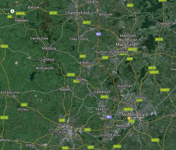
Between Derby, Nottingham, Mansfield And Chesterfield
There must be a better way of getting to Derby, than by changing trains in Nottingham or Chesterfield.
But what?
There are four main North-South routes in the area.
- The Robin Hood Line between Nottingham and Worksop
- The Erewash Valley Line between Long Eaton and Chesterfield
- The Midland Main Line between Derby and Chesterfield
- The M1 Motorway
What seems to be missing is high-capacity East-West routes for both rail and road.
The Erewash Valley Line goes South to Long Eaton, which has several trains per hour direct to Derby, so this could be the key to getting to Derby.
In a Notes on Current Station section on the Wikipedia entry for Long Eaton station, this is said.
It is planned that both platforms will be extended by up to 10 metres by no later than 2012.
It is anticipated that developments along the Erewash line will result in changes for Long Eaton station. A plan drawn up in 2011 recommended a new Derby to Mansfield service via new stations at Breaston & Draycott, Long Eaton West (renamed from Long Eaton), Long Eaton Central, Stapleford & Sandiacre, Ilkeston, Eastwood & Langley Mill (renamed from Langley Mill), Selston & Somercotes and then to Pinxton via new trackbed connecting with the Mansfield line from Nottingham at Kirkby in Ashfield.
It strikes me that work at Long Eaton, the several new stations and improvements north of Langley Mill would enable direct services from Alfreton, Ilkeston and Langley Mill to both Derby and Mansfield. This service would also improve services from stations stations North of Mansfield to Derby.
A trackbed from Langley Mill to Kirkby in Ashfield is shown on Google Maps.

Langley Mill to Kirkby-in-Ashfield
Alfreton is the station at the top left and Kirkby-in-Ashfield is at the top right. The Erewash Valley Line from Langley Mill, enters at the bottom and splits with one branch going to Alfreton and the other going East to cross the M1 and join the Robin Hood Line south of Kirkby-in-Ashfield.
On an Ordnance Survey map, dated 2009, the railway is shown as a multiple track line, probably serving collieries and open cast coalfields.
It all sounds very feasible too! Especially, as the Erewash Valley is an area of high unemployment, low car ownership and a dependence on public transport.
The Future Of Railways In North Nottingham And South Yorkshire
Look at any map of the area between Nottingham and Derby in the South to Sheffield, Doncaster and Barnsley in the North and you will see rail lines criss-crossing everywhere. Many are now disused and show up as green scars on the landscape.
Also on the maps, you will see quite a few large power stations. Most were originally coal-fired and merry-go-round trains transported the coal from the mines to the power stations.
So most of the rail lines in the area, were built to take the coal away from the mines to where it was needed. Passengers were almost an afterthought. The railway companies even built the Great Northern Great Eastern Joint Line from Doncaster to East Anglia to take coal to where it could profitably be used.
After the Second World War, the railways contracted and cut passenger services. As an example, the Robin Hood Line closed in the 1960s.
The passenger services were suffering because of car ownership, so most were withdrawn, except on the main routes. Mansfield before the Robin Hood Line reopened, was one of the largest towns in England without a rail station, an honour now held by Ilkeston a few miles away.
In recent years, coal use has in my view rightly declined. Everybody knows the poor environmental record of coal, with its creation of CO2 and other pollutants. On the other hand, I have met people whose fathers worked in the mines and the general advice they received is don’t go underground!
So as the need to move coal by rail has declined, many of these railway lines have ceased to carry much freight traffic and have fallen into disuse.
But some are coal’s last legacy, in that until comparatively recently, they were still used to get coal to the power stations. Like the line from Shirebrook to Ollerton, they are in good condition and only need stations to bring them back into use as passenger lines. Just as the Robin Hood Line was reused twenty years ago!
Because these lines serves the coalfields and the mines, they also serve the mining communities and the small towns, that need improved public transport links.
Network Rail’s plans seem to be going some way to be addressing some of the problems in the area.
I don’t think that the reopening of the Ollerton Branch and the connection between the vErewash Valley and Robin Hood Lines, will be the last lines to reopen in the area.
A Ticketing Problem For Crossrail
Ipswich are playing at Reading tonight and as it’s an easy trip out from London, I bought a ticket in case I wanted to go.
I certainly won’t have a problem getting back, as there are fast trains to London after midnight.
But the match is on television and the weather looks to be pretty good, so I might just go and not waste my fifteen pound ticket.
As going to Reading in time for the match would mean a journey out restricted by the rush hour, I could go via any number of places like Windsor, Maidenhead or Slough to have a late lunch.
It got me thinking!
The Mayor has said, that when Crossrail opens, you’ll be able to use a Freedom Pass to Heathrow, just as you can now on the Piccadilly Line.
But how far will you be able to use a Freedom Pass on the branch to Reading?
The problem is complicated by the fact that there are three branches off the line between London and Reading; Henley, Marlow and Windsor.
To further complicate matters, direct peak-hour services operate between the Henley and Marlow branches and London.
Putting together snippets in the news and from Theresa May’s web site, led me to the conclusion which I talked about in this article, that all three branches will probably be served by new IPEMU trains (Class 387 or Aventra), as this would avoid the need for electrification.
So we’ll end up with a main line Crossrail service with a frequency of at least four trains per hour to Reading and shuttles and the occasional through trains from the branches.
The whole area will certainly end up with contactless ticketing using Oyster and bank cards, with perhaps a travel card or Ranger ticket thrown in.
But the real problem is organising the charging structure, as contactless will work well at collecting the fares, but how do you charge.
Crossrail will effectively link Windsor to Central London with a fast train and one change, so for tourists going to Windsor will be as easy as going to other important suburban venues like Wembley or the Olympic Park.
Get the ticketing right and the Thames Valley will get a lot of extra visitors.
To return to my earlier question, how far will my Freedom Pass get me in the West?
Crossrail’s journey calculator says that Bond Street to Shenfield, which will be the Freedom Pass limit in the East will take me 48 minutes.
Projected times from Bond Street for the West are as follows.
- Maidenhead – 40 minutes
- Twyford – 46 minutes
- Reading – 52 minutes
I do wonder if TfL and Crossrail will adopt the same rule as they have for Shenfield, as Reading is projected to only take four minutes longer than Shenfield.
This rule would mean that you can travel to Reading, provided you use Crossrail.
I can see an awful lot of protests, if passenger to Reading, got a worse deal than those going to Shenfield.
Which leaves us with the problem of the branches.
- Will the branches follow London rules on ticketing and be cashless and contactless, but still allow through paper tickets?
- Will direct trains to London still be run in the peak hours?
- Will the branches be part of the Great Western franchise or Crossrail?
- Will Booking Offices be closed on the branches?
I suspect that however the branches are managed, passengers from London will consider them part of Crossrail and will want to use contactless ticketing all the way.
The most contentious issue would be if it was decided that there would be no direct trains between Marlow and Henley and London.
All of these problems will hopefully be sorted before Crossrail opens.
Work Will Start On Ilkeston Railway Station This Month
This article in the Ilkeston Advertiser has announced that work on the station will start soon. This is said.
Works in the coming months will include building the platforms, removing and installing a new and wider footbridge – making it easier for cyclists and pedestrians to pass – and building two car parks.
I would think that this could be the start of better times for Ilkeston.
Although someone has commented that it is a waste of money!
Faster London Trains Could Make Your Commute Even Longer
I have spent much of my working life calculating the dynamics of systems, be they complex sets of calculations for a Bank, the solving of massive sets of differential equations or calculating how many days, hours and minutes a project will take and how many pounds, groats or donkeys it will consume.
So when I saw an article in New Scientist with the title of this post, I had to read it.
You should!
In my modelling of complex systems, nearly fifty years ago, I used state-of-the-art, digital and analogue computers to model complex interactions in chemical reactions and plants. In more than one case the answer that was obtained was unexpected.
But then you can’t argue your feelings against thoroughly correct mathematical equations!
The same is happening in this transport example. Your feelings may say faster trains will get you there quicker, but properly modelled it would appear that the reverse may be true.
One thing that may be true in some places, is that adding new stations to a line reduces the time taken to commute.
So sometimes residents wanting a new station near their houses, may just be right!
Only a rigorous mathematical model will tell the truth!
Leeds seems to have an ambitious station building program, whereas only one new station;Lea Bridge, is being built in London.
And intriguingly in London, Crossrail is being built with only one new station; Woolwich, although some are being substantially rebuilt!
I hope they’ve done their modelling extensively enough!
Hanwell Station – 10th September 2015
My walk ended at Hanwell station.


It seems to have had a good clean since my Before Crossrail visit and some small works.
However the real Hanwell station appears to be standing up and it looks like it will be good.
Walking From Three Bridges To Hanwell
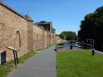
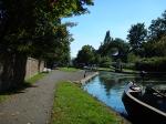
I walked from Three Bridges via the Grand Union Canal and Hanwell Locks to Hanwell station.


From the canal it was a walk through houses and I didn’t take any pictures.
Three Bridges
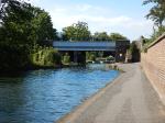
If you read Rolt’s biography of Isambard Kingdom Brunel, you get the impression that the engineer was not a totally serious man without any sense of whimsy or humour.
A few weeks ago I read something about his last design, the unique Three Bridges, which arranges a road above a canal, above a railway. So I just had to visit.


Unfortunately, you can’t take photographs from the railway, but you almost get the impression, that Brunel intended to leave behind something by which he would be remembered. This Google Map shows the layout.
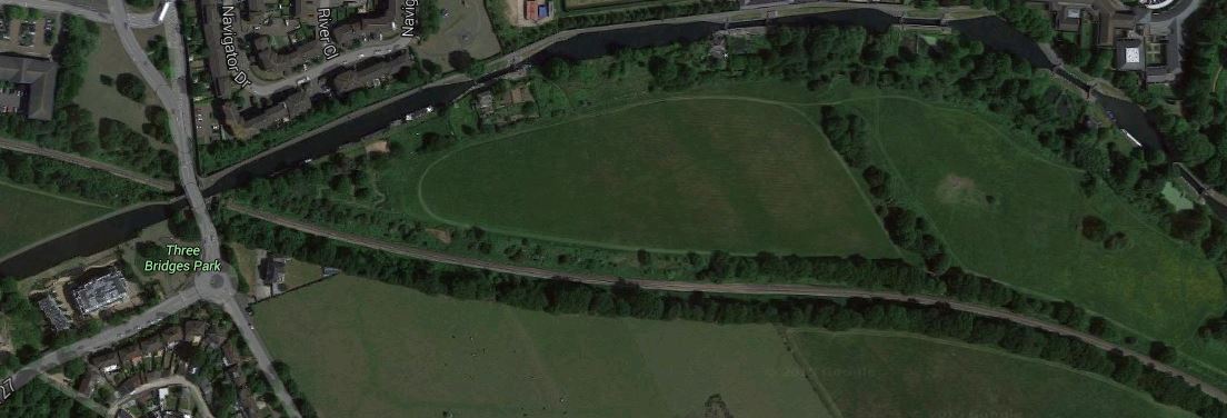
Three Bridges And Hanwell Locks
The railway is the freight only Brentford Branch Line.
