Nottingham Station And The New Integrated Tram-Stop
Travel to some stations in the UK, that are also served by trams or light rail and transferring to the local transport is often an obstacle race or a long walk. This is a summary.
- Manchester Victoria is now a flat transfer, but at Piccadilly you dive into a less-than-obvious subway.
- In Birmingham, the tram doesn’t yet serve New Street and no plans exist for a proper interchange at Moor Street.
- In Blackpool it’s a long walk, although there are plans in the pipeline. Sometime!
- Edinburgh is a trek upstairs and a walk.
- Sheffield is not too bad, as it’s just a walk up from the bridge over the station.
- London isn’t good as how many main terminals have easy access to the Docklans Light Railway?
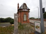
Nottingham used to be a difficult one, but now they’ve opened a new tram stop on top of the main station at right angles to the train lines. These pictures show the new stop.

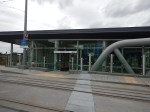


Access at present is by climbing up steps from either the station lobby or the main line station platforms. But in the next few weeks it appears there will be an escalator from the main station.
To compliment the new tram stop, Nottingham station has also had a makeover.


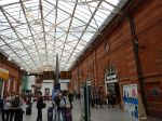


It is certainly, a new interchange, built to the standards that a city like Nottingham deserves.
A few months ago, I saw a similar right-angles arrangement, at the main station in Krakow, except that te Poles used a tunnel.
From the experience of one day in Nottingham, the interchange appeared to be working well. And it was the first day.
Wliford Bridge On The Nottingham Express Transit
Wilford Bridge opened over a hundred years ago as a toll bridge and parts of it are Listed.
The Nottingham Express Transit (NET) needed to cross the River Trent and instead of building a new bridge this bridge was widened and strengthened to accept trams.


I think that the architects and engineers have done a splendid job to create a very good crossing for trams, pedestrians and cyclists. As I walked across it, there was a lot of cyclists and pedestrians crossing the river.
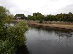
I do wonder if the Meadows Embankment tram stop on the north side of the bridge will become one of the better ways to get to the cricket and football grounds. You would park at Clifton South or another convenient Park-and-Ride and after getting off the tram, would walk along the river. The Google Map shows the Trent from Wilford Bridge to Trent Bridge.

River Trent
I don’t know how good the walking route is at present, but surely signs and information on the river route and a possibly more direct one cutting out the bend in the River Trent should be provided. I suspect that the route is shorter than it first appears, as there is the Wilford Suspension bridge on the other side of the bend.
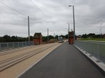
Clifton South On The Nottingham Express Transit
Clifton South tram stop is the Southern Terminal of Line 2 of the Nottingham Express Transit.
It opened on the 25th August 2015 as part of Phase 2 of the NET. These are pictures. I took on the opening day at the terminus.
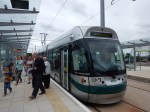


Clifton South is a two platform terminus at a very large park-and-ride site. So even if the tram fleet get too small in the future, due to incesed usage, I would suspect that this terminal will cope for several decades yet.
I can’t get a detailed Google Map of the site, but this map shows its location with respect to the city and the A453, which runs to the west of the site.
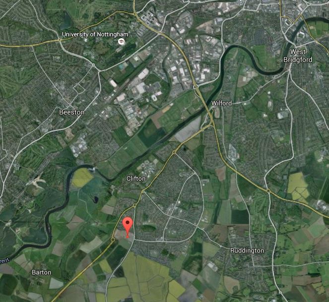
Clifton South Park-and-Ride
The tram line crosses the River Trent on Wilford Bridge, which is at the loop of the River to the west of West Bridgeford.
My only feeling about this Park-and-Ride site, is that as it is so convenient and totally free, that say when a large sporting event is taking place in the City, the frequency of one large tram every ten minutes will not be enough at times.
But, at least the infrastructure is there to cope with more trams
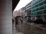
Wet-Free London
When you know London well, you get to know the public transport routes on which you don’t get as wet as others. I should also say, I never use an umbrella, as umbrellas are for wimps and softies.
I had to go to Maplin’s at Liverpool Street and then John Lewis at Oxford Street.
The obvious way to get to Maplin’s from my house is to walk two hundred metres and get the 141 bus, which stops outside the store.
But the rain was heavy so I took the much shorter walk and got a 38 bus to The Angel. I then got the 43 bus from the sister stop at the Angel to Maplin’s. After getting what I wanted at Maplin’s, I dodged under the buildings into the dry of Liverpool Street station, where I bought my paper.
It was then the Central Line for Oxford Circus, but how wet would I get walking to John Lewis. You used to be able to exit the station on the North West corner of Oxford Circus, so you could walk sheltered by the buildings to the store. But not any more and you have to exit on the South East corner and fight your way through the crowds and the bad weather. If ever a station is not fit for the number of passengers, who use it, it is Oxford Circus.
I did think about using Bond Street and walking back to John Lewis, but it would still mean crossing the road. Then I remembered that the 25 bus passed Chancery Lane station, so I surfaced and walked the few yards to the stop.

The pictures don’t do the rain justice. But at least I got on a 25 bus without getting too wet.
The advantage of the 25 bus, is it stops alongside John Lewis and you just walk into the store.
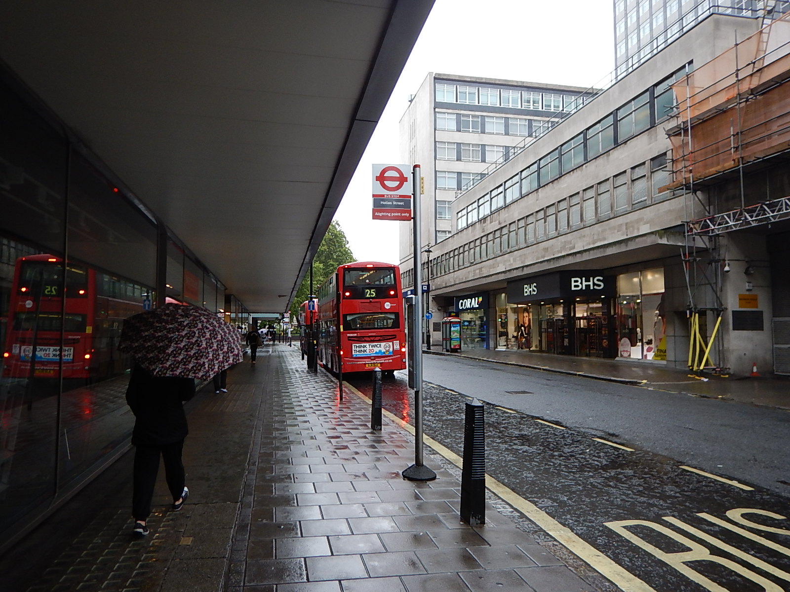
The 25 Bus At John Lewis
I bet John Lewis would like to have 25 buses go to Oxford Circus – John Lewis rather than Oxford Circus.
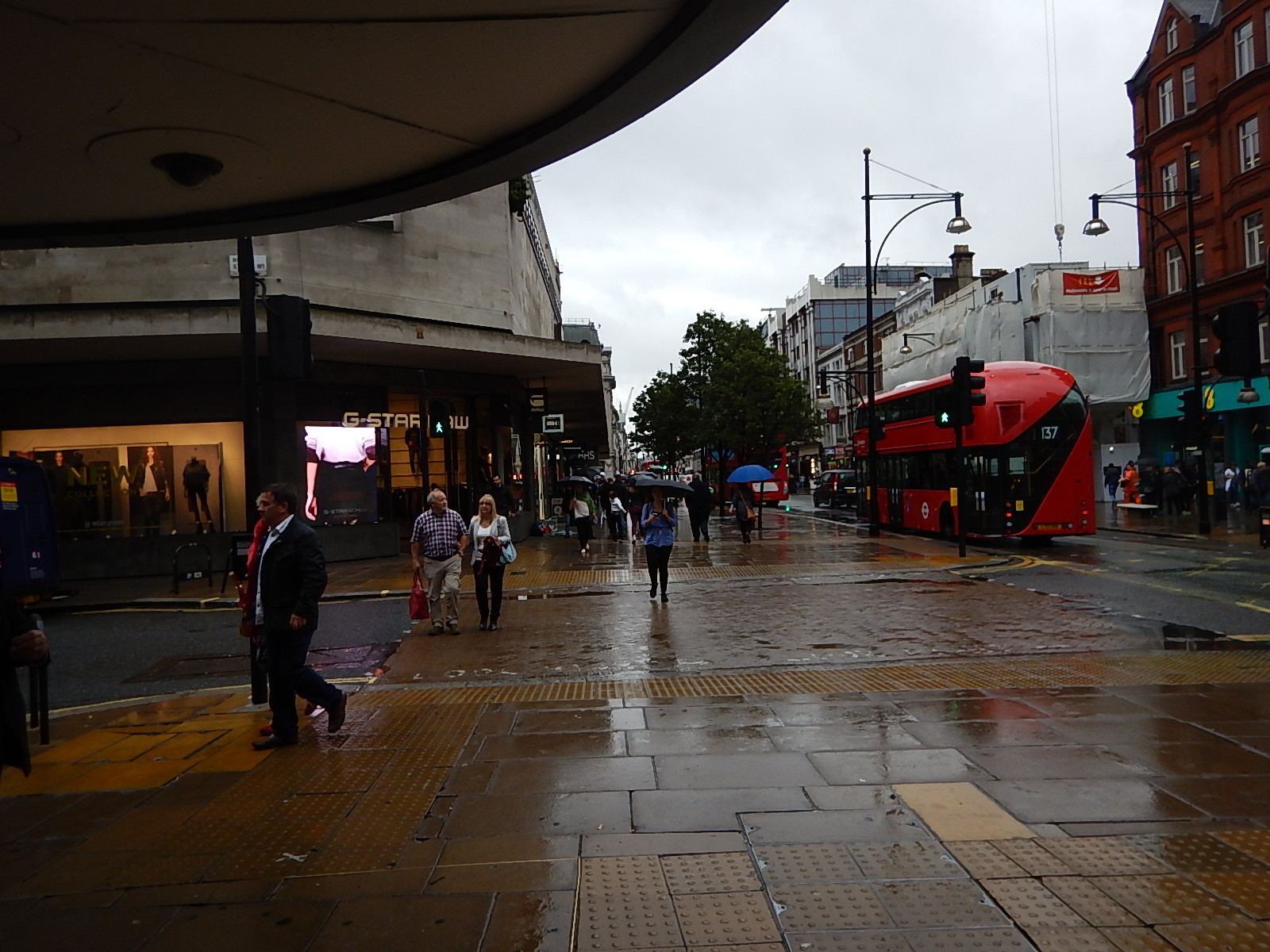
John Lewis To Oxford Circus
Leaving John Lewis, I was able to walk along Oxford Street under the shop overhangs to the North West entrance at Oxford Circus station.
Phase Two Of The Nottingham Express Transit Opens Today
The Nottingham Express Transit is in my view one of our better tram systems.
As a regular user of tram systems in the UK and Europe and a Londoner, I actually think that the London Tramlink is the best, but that is because of the ticketing, which is based on the London contactless system and I just touch-in and go. Both Nottingham and Croydon systems are low-floor systems.
Nottingham Express Transit (NET) has also proved to be reasonably commercially successful. Wikipedia says this.
The new line proved successful, leading to an increase of public transport use for the Nottingham urban area of 8% in the five years to 2008, together with a less than 1% growth in road traffic, compared to the national average of around 4%. Nottingham has exceeded the most optimistic predictions, carrying 9.7 million people in 2005. This bolsters the case for the construction of new lines.
In my view other than the non-contactless ticketing, NET major problems are that it is not big enough, doesn’t connect properly to the rail station and doesn’t serve the two football and the major cricket grounds at Trent Bridge, which are all clustered together a twenty-minute walk south of the rail station.
The size problem is being rectified today with opening of Phase 2 of the system. According to this article on Global Rail News, it is happening today.
I think that this could turn out to be a significant day in the history of modern tramways in the UK, as if it proves out to be a successful extension to a proven system, it will be a wonderful advert for trams and light-rail in general.
It is just a pity, that the tram system still doesn’t serve the three sports grounds. Nottingham County Cricket Club, does at least say this about using trams to get to the ground on this page of its web site.
The nearest tram stop, Station Street, is a 20 minute walk from the ground, and anyone travelling from outside the city can take advantage of NET’s free park and ride facilities.?As an added incentive to take the tram, NET will be running a £2 return ticket for all match and season ticket holders.
Nottingham Forest give no information on how to use the tram, although Notts County would seem to run a similar scheme to the cricket.
This Google Map shows the layout of the station, the River Trent and the three sports grounds.

Nottingham Station, The River Trent And Sports Grounds
Note the bridge at the left hand side of the map over the River Trent. This is the Wilford Toll Bridge, which the NET uses to cross the river.
I suspect though that many meetings about transport in Nottingham have concluded that crossing the River Trent is the biggest transport problem in the area.
When I used to drive to Nottingham from Suffolk to either see a client or watch football or racing, getting away from the city to the East was always difficult, as the river always seemed to get in the way.
The simplistic solution to solve the sports ground problem of running a tram route over Trent Bridge or Lady Bay Bridge, which are the two bridges near the grounds would probably be the sort of measure that would be terribly unpopular with motorists.
I have searched for stories about a possible new crossing across the Trent to the East of Nottingham and there is certainly a lot of studies and speculation. This report in the Nottingham Post talks about a fourth road crossing and this one in the same paper talks about a foot and cycle crossing.
My feelings are that this is a classic problem, that should be sorted locally by a local Nottingham-wide Mayor or Transport Commissioner, responsible to a lkocal electorate.
If the extension to the NET are successful and take traffic off the roads, this might give impetus to expand the tram to the east and south-east of the city coupled with a new route to get cars and trucks over the river. This is a Google Map of the East of Nottingham.
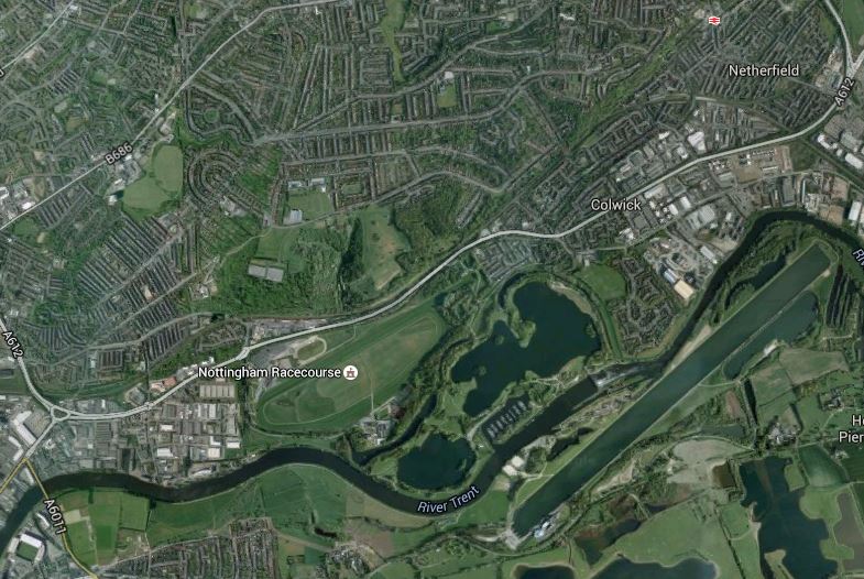
East Nottingham
Note Lady Bay Bridge and the City Ground in the bottom left-hand corner and the Holme Pierrepoint National Watersports Centre to the right. I bet the Watersports Centre would love a tram from the centre of Nottingham.
Also in this map in the top right hand corner is Carlton station on the Nottingham to Lincoln rail line. After what I’ve seen in Germany, this line would be one, they’d not hesitate to use for tram-trains. Little modification except for electrification would be needed outside of the city. At Nottingham station, the tram-trains would become trams and use the tram network to get to their final destination. I hope that Nottingham’s great and good visit their twin city of Karlsruhe and see how tram-trains working on the Karlsruhe model combine trams and trains in the city.
One thing that would make connecting tram-trains to the new tram stop at Nottingham station is that Nottingham station is not on a cramped site and a lot of the land surrounding the station is surface-level car parking.
I can envisage tram-trains arriving at Nottingham station from places like Grantham, Mansfield and Newark and then transferring to the NET tracks to go north or south from the station. You could even run tram-trains to Sheffield, so that the two tram systems are connected.
Compared to similar lines around Liverpool, Birmingham, Leeds and Cardiff, the frequencies on all these rail branches out of Nottingham are not high enough. Nottingham to Sheffield, as an example is only twice an hour, when four should be a minimum for cities of this size.
I suspect that Nottingham is watching the result of Sheffield’s tram-train trial to Rotherham with interest.
One way or other the Nottingham Express Transit will be key to solving the transport problems in Nottingham.
Does Jeremy Corbyn Really Support Coal?
I am very surprised by this report in the Daily Mirror, which talks about Jeremy Corbyn and coal. Here’s the first paragraph.
Jeremy Corbyn could bring back coal mines despite vowing to ‘keep fossil fuels in the ground’.
The article goes on to talk about carbon capture technology to burn coal without producing any carbon dioxide.
I have been to learned lectures on this technology and there’s about as much chance of making it work economically, as landing an astronaut on the Sun.
I may be wrong about carbon capture technology, but we would be better spending the investment on insulating our woefully energy-inefficient buildings, so everybody had a lower energy bill.
We obviously need more electricity and there are better ways of generating it without the carbon problem.
My preferred methods would be.
- Importing electricity generated by geothermal and hydroelectric power stations in Iceland using an undersea cable. The so-called IceLink is described on this page on the National Grid web site.
- Tidal power in the Severn and other western estuaries. The Swansea Bay Tidal Lagoon is a project that has started.
- Offshore wind and wave.
- Solar panels on buildings. Technology is improving and costs are falling.
- Local energy generation using small-scale systems like the Bunhill Energy Centre in Islington.
I also believe that if we funded research in our best Universities, we could fundamentally change our energy use, generation and conservation.
We might even be able to do without using more of the following types of power generation in the future.
- Coal, with all its problems of pollution and the carbon dioxide it generates.
- Nuclear, with all its problems of high cost and unacceptability by certain sections of the population.
- On-shore wind, with all its visual intrusion.
I think the future is going to be scientifically green.
I suspect that in twenty or thirty years time, our main uses of fossil fuels, like oil and gas, will be in the production of needed chemicals, heat energy for industrial processes and powering transport.
RMT Moves The Tube Strike
It has been announced by the RMT, that the Tube strike has been moved from this week to the 10th and 8th of September.
Intriguingly, the new Labour Leader will be announced on the 12th of September.
There doesn’t seem to be any reference on the Internet, as to where the Special Conference is to be held! As the TUC Conference starts in Brighton on the 13th, that must be a possibility.
Or has someone forgot to book the hall?
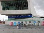
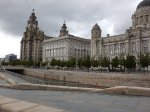
Memorials On The Liverpool Pier Head
Liverpool is proud of its maritime heritage and the Pier Head on the Mersey is part of a UNESCO World Heritage Site called the Liverpool Maritime Mercantile City.
When Celia and I met in Liverpool in the 1960s, it was a simpler place, where we would walk to take the ferry across the Mersey.
These pictures show the Pier Head today.
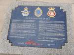


I’d never realised that the road across the Pier Head, had been named Canada Boulevard in honour of Canadians, who lost their lives in the Battle of the Atlantic or the war against German U-boats.
Shown in the pictures is the memorial to Captain Johnnie Walker, one of the leading British commanders in the battle.
The scale of the battle is shown by the fact that according to Wikipedia the Allies lost over 70,000 sailors, 3,500 merchant ships and 175 warships, whereas the Germans lost 30,000 sailors and 783 submarines.
One thing that wasn’t there in the 1960s is the canal that links the Leeds and Liverpool Canal to the Stanley Dock, so narrow-boats can visit the city centre.
What’s Gone Wrong With The Blackpool To Preston Electrification?
On Friday this news item appeared on the BBC web site. It is entitled Balfour Beatty pulls out of Lancashire rail electrification.
The article starts like this.
The main contractor behind plans to electrify the railway line between Preston and Blackpool has pulled out.
Balfour Beatty confirmed it was leaving the scheme after a review said the work was unlikely to be on time and budget.
Network Rail insisted the electrification was still due to finish by spring 2017 and a new contractor would be “appointed shortly”.
On the Saturday, on my route from Liverpool to Preston, I took a detour up the Blackpool branch and took these pictures.


The aim was to see, if I could get a clue as to what has gone wrong.
For a start, I saw a succession of bridges that appeared to have been recently replaced or refurbished. Often with electrification, the cost of getting bridges and stations ready for electrification is a major part of the cost.
Even Poulton-le-Fylde station appeared to have acquired a cafe from when I saw it in May this year.
At Blackpool North station crowds of people were leaving, as the weather was atrocious, so I took the next train back to Preston.
As to why, Balfour Beatty have given up the contract, there were no clues.
I think there could be two reasons for the delay.. In this section on Electrification for the Wikipedia entry for Blackpool North station, this is said.
This will result in the semaphore signalling at the station being replaced by modern colour lights controlled from the WCML North Rail Operating Centre in Preston and will also see the station track & platform layout altered (the current eight curved platforms will be reduced to six on a straighter alignment than at present). Work has begun to raise many of the intermediate overbridges to accommodate the overhead wires and the project was due for completion by May 2016, with the line onwards to Manchester following by the end of the year. This has since been pushed back to March 2017 so that the track remodelling & resignalling work can be carried out at the same time as the wiring, reducing disruption to passengers (as only one period of closure will be required)
So could an over-complicated project or lack of resources be the cause?
Look at other Wikipedia entries for lines in this area and it gets more complicated with aspirations to reopen the Fleetwood Branch Line.
Or could it be that there are so many ideas about what to do in Blackpool with the trains, the planners at Balfour Beatty can’t keep pace with all the changes? So backing out is the esiest thing to do!
I think there is a need to take a long hard look at all the possibilities, like the Fleetwood Branch and linking to the Blackpool trams and the way they actually perform any track changes and electrification.
Perhaps everything from the West Coast Main Line to Blackpool and Fleetwood should be devolved to an elected mayor or someone, who gets voted out, if the project fails.
I know Blackpool reasonably well and if ever an are needs an upgraded transport system, with an electrified line to nearby cities, it is Blackpool.
Crossrail Will Affect The Buses
This article from GetWest London is entitled Improved bus services for Hayes to prepare for Crossrail.
The article talks about how Bus Route 90 is going double-deck and buses through Hayes will be improved as Crossrail, with the new Hayes and Harlington station is constructed
Provision of improved and rerouted bus services will happen at many of the new Crossrail stations.
My nearest Crossrail station will be the double ended giant at Liverpool Street that will serve both the current Liverpool Street and Moorgate stations.
From close to my house I can get a 21 or 141 bus to just outside Liverpool Street station, although coming back I have to walk to Moorgate for a northbound bus.
After Crossrail is opened, I predict that when I use Liverpool Street station, I will get a bus to a stop that will be connected by weather-free subways to any of the existing lines in the area and of course Crossrail. Coming back, these or other subways will connect me to a northbound stop to get a bus home.
I actually suspect to get the bus, it might be best to be at one particular end of a Crossrail train, so that you use an entrance to the station, that is convenient for your bus. Getting the carriage right could save you quite a walk with a two-hundred ,metre long train.
If what is provided, is not better than the current interim arrangement at Liverpool Street/Moorgate, I will be very surprised and will complain like an irate rhinoceros.
Most of the stations on Crossrail are served by London buses, also under the control of Transport for London. So improving the buses, as at Hayes and Harlington will be a matter for Transport for London, with input from the appropriate London Borough.
But what will happen at places like Brentwood, Burnham, Iver, Langley, Maidenhead, Reading, Slough, Shenfield and others,which are outside of Transport for London’s influence.
So that Crossrail has one holistic design from East to West, buses at these outer stations must conform to the rules that apply in the London area.
- Buses must be cashless, with payments either by Oyster, contactless card, concessionary pass or an extension to an orange rail ticket.
- London-style bus spider maps must be provided at all stations.
- A state-of-the-art bus arrival system must be provided in the same manner as in London, either by display or text message.
- All buses must be fully-accessible to match the fully-accessible stations.
- In an ideal world, all buses must display the next stop and be front entrance and centre exit, to help blind and disabled passengers and speed the buses on their way.
Looking at text message bus alerts like TfL’s Countdown, allowing a sixth digit to the text system would probably enable every stop in the South East to be covered.
Incidentally, according to this article in The Guardian, there are less than 500,000 transport stops in the whole UK, so six digits and one text number would cover the whole of the country.
But would the Scots, Mancunians and the Cornish, embrace a system that was designed in and for London?
Crossrail is a rail system, but it is going to affect lots of parts of our lives.
