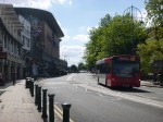
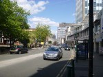
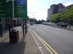
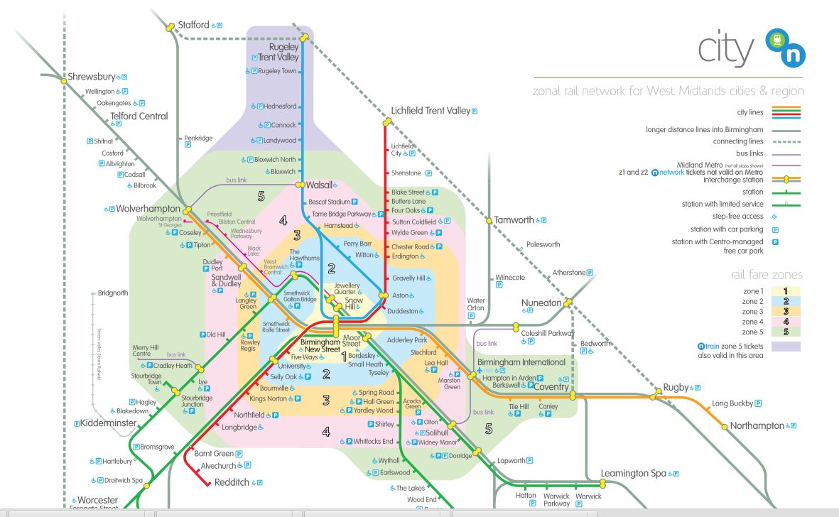
Walking The Route Of The Midland Metro Line One Extension
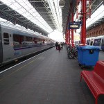
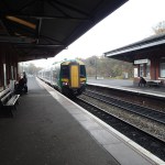
I’ve walked the Line One Extension of the Midland Metro between New Street and Snow Hill stations before, but I’ve never walked the proposed extension as far as Five Ways. I took these pictures on the route.
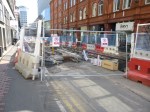


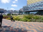

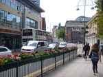


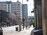

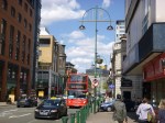

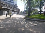
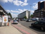
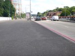
The Extension was planned to be opened to Centenary Square in 2017 and to Brindleyplace, Five Ways and Egdbaston later. Nothing much seems to be happening past New Street station, except for some utility works, which must be sorted before tram tracks and station are put over the top.
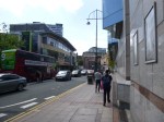
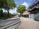
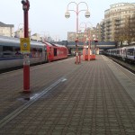
The walk is fairly easy, but the last section around Five Ways and to Five Ways station was designed using Birmingham’s 1960s philosophy of deling with traffic and pedestrians, that I’ve seen going to Birmingham City several times – Pedestrians should be channelled into dangerous areas, so they are run over and killed. This would of course make it less likely a driver will damage his car, by hitting one.
Birmingham could do a lot worse than extend the tram to Five Ways. Some of the running routes would be challenging and Birmingham’s many drivers would probably object, but if they want more visitors to the City, surely it is a price worth paying?
I do wonder about the costs of extending tram lines, as opposed to building new ones. Obviously, some costs like new trams and getting power to the trams will be minimised, but you’ve still got the costs of actually putting in the rails and divering utilities.
St. Martin’s Queensway Tunnel
In looking on the Internet to see if anybody had ever proposed adding low-level platforms at Birmingham Moor Street station to access the local services out of Birmingham New Street station, I found this article in the Birmingham Post entitled Tunnel link between New Street and Moor Street stations set for facelift.
Now I’ve been to Birmingham many times and often I’ve walked between the two stations and I’ve never seen or heard anything about this tunnel.
Does it actually exist?
The article says this.
A city centre tunnel is set to get a £5.5 million facelift to improve the route between two of Birmingham’s busiest railway stations.
The St Martin’s Queensway Tunnel, which runs under the Bullring shopping centre, will be transformed into a well-lit attractive route for rail commuters.
Road crossings and the public areas outside the revamped New Street Station will also be improved to encourage people to walk between there and Moor Street station.
Currently about 1.4 million people a year walk through the dingy tunnel between the stations, but some have complained of feeling unsafe and it is also poorly signed for visitors to the city.
Some councils may spend £5.5million on imaginary projects, but I don’t think Birmingham would.
The Future Of The Midland Metro
The Test Match being in Birmingham this week, got me thinking about the new extension to the Midland Metro, I saw this week.
Unlike the tram systems in Blackpool, Croydon, Manchester, Nottingham and Sheffield, the Midland Metro hasn’t really caught the public’s imagination and been a rip roaring success.
When I visit other places with trams, I often use them, even if like in Nottingham, it’s just to get up the hill. But I’ve never used the Midland Metro, unless my trip has been taken to ride on the tram. A section in Wikipedia entitled Line One (Birmingham City Centre) Extension starts like this.
The fact that the existing line does not run into Birmingham City Centre has been identified as one of the reasons why it has failed to attract the predicted patronage. The Birmingham City Centre Extension (BCCE) will extend Line 1 into the streets of central Birmingham. Originally it was planned to terminate the extension at Stephenson Street, adjacent to New Street railway station. In September 2013, Centro started consultation on proposals to extend the city-centre extension from New Street station to Centenary Square. This would be another stage towards extending the line to Five Ways the original planned destination. The plan was approved by Birmingham City Council in October 2013, allowing the line to add an additional stop at Birmingham Town Hall.
I have watched this project unfold from a distance and it doesn’t seem to have had the strongest leadership or most intelligent design, when and since it was first opened in 1999.
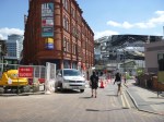
As my pictures earlier this week showed construction is well underway and hopefully the line will arrive at New Street station this year. Perhaps this line across the city centre will give the Midland Metro an uplift.
On a selfish note, when I go to Birmingham, the places I want to get to are the football grounds and Brindley Place for lunch with friends.
Aston Villa and Wolverhampton have good train access and Birmingham is through the terrible station at Bordesley, but A stop at Brindley Place is on the next part of the Line 1 extension, which won’t be built until 2017 at the earliest. I don’t think it has even been started and possibly even fully planned, judging by the several alternatives talked about in Wikipedia. At present the line is going to Five Ways station, which is shown on this Google Map of the city centre.
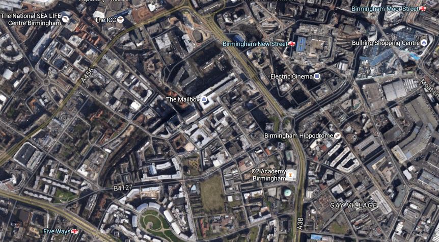
Midland Metro In Birmingham City Centre
I’ve included Birmingham Moor Street station on this map, but it won’t be connected to this phase of Midland Metro extension. However, Birmingham Snow Hill station will be, but that is not on the main lines from Euston, Liverpool and Manchester.
Will the line finish at Five Ways or will it continue past Edgbaston Cricket Ground, Birmingham University and the Queen Elizabeth II Hospital?
This second map shows the area between Five Ways and University station, with the cricket ground marked by a red arrow
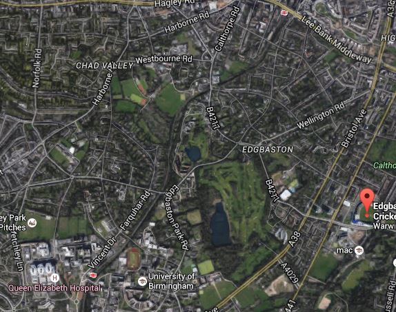
Midland Metro Line 1 Extension And Edgbaston
Note the university, the hospital, the Alexandra Stadium and University station clustered together in the bottom left corner of this map.
It is worth noting that Five Ways and University stations are both on the Cross-City Line that goes from Redditch to Lichfield via New Street. It is the busiest commuter line outside London and has upwards of six services an hour in both directions. The frequency of the Midland Metro is one tram every eight minutes, so the Cross-City Line is only a little bit less frequent.
The Cross-City Line is currently being extended to Bromgrove and there are unfulfilled plans to reopen the Camp Hill Line, that my train from Oxford to Birmingham used.
There seem to be a lot of competing proposals for money to be spent in the West Midlands, so perhaps if a West Midlands Combined Authority was setup properly, then it could decide what happens.
Perhaps, then Birmingham would get the local transport system it needs and deserves. After all, I think it was very much short-changed in the 1960s with the creation of the unloved New Street station. Let’s hope the new station opening in September, solves at least some of those fifty year old problems.
One of the biggest problems is that Birmingham effectively has two independent sets of local rail lines, with no common interchange.
The Snow Hill Lines though Snow Hill and Moor Street were built by the Great Western Railway and are operated by diesel trains. They carry about twenty percent of the rail services into the city. According to this Future section in the Wikipedia entry for Moor Street station, there are plans for more local services out of Moor Street
There are also an extensive mainly electrified network centred on New Street, which includes the Cross-City and Chase Lines and some services on the West Coast Main Line.
The trouble is there is no obvious connections between the two sets of lines, as is described here in Wikipedia. This Google Map shows the two stations and the shopping centres in between.
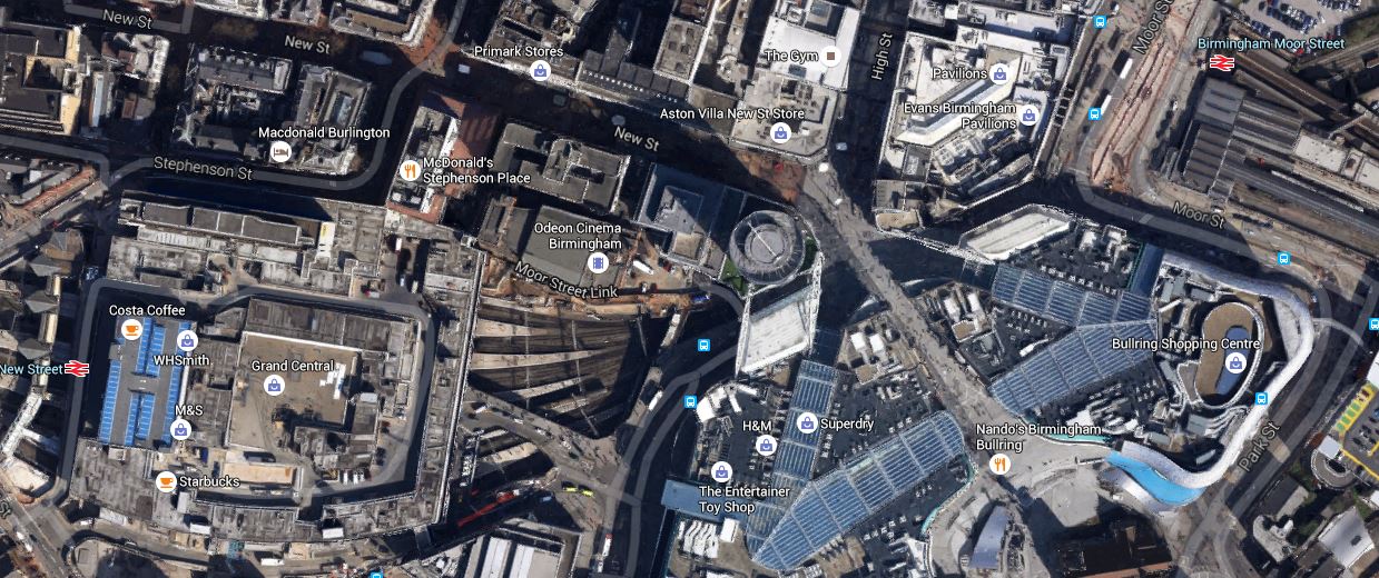
Birmingham New Street And Moor Street Stations
It would seem to my untrained mind, that there must be possibilities for putting a low level station under Moor Street with platforms on the local lines through New Street. I can’t find any proposals or ideas on the Internet, but then I don’t probably know where to look.
One proposal that might help is the opening of the Camp Hill Line into Moor Street, as this would link up to the Cross-City Line at Kings Norton.
Birmingham seems to be a mass of railway lines, which an intelligent planner could probably use to create transport links in the Greater West Midlands.
In the meantime, the arrival of the Midland Metro to New Street station, the Cross-City Line reaching Bromsgrove and the electrification of the Chase Line to Rugeley, will bring more people into the city centre and hopefuly make interchange easier.
It does appear, that the electric services on the Cross-City Line and Chase Line may need more trains, but at least there will be plenty of Class 315 trains available for cascade from London.
From Oxford To Birmingham
As there wasn’t much of interest to photograph in Oxford, I grabbed myself some gluten-free sandwiches and a drink in Marks and Spencer at the station and took a train to my next destination, Birmingham New Street.
I’ve never done that trip before on the Cross Country Route via Banbury and it was an easy journey of about an hour.
I missed photographing all of the work near Harbury, which is reported here on the BBC. It was a major landslip that closed the railway for some weeks.
As we approached Birmingham, the train seemed to take a circuitous route into Birmingham and at one point, the train passed behind Birmingham City’s football ground.


We were on the Camp Hill Line, which is being proposed for passenger services, according to Wikipedia.
At least such a project would probably be appreciated in Birmingham.
Electrification May Be In Trouble Elsewhere, But The Brummies Keep Marching On
Electrification may well be in trouble with the Government delaying Trans Pennine and Midland Main Line electrification and having a strong look at that on the Great Western Main Line.
So I was interested to read this article in Rail Engineer about how a consortium is electrifying the Chase Line between Walsall and Rugeley. This is the first three paragraphs.
With electrification being high on everybody’s consciousness, the schemes to electrify the Great Western and Midland main lines have been getting all the attention. Similarly, the works in the North West and Scotland have been proceeding apace and gaining publicity but the scheme to electrify the railway from Walsall to Rugeley has managed to stay ‘under the radar’.
The scheme is, in fact, a significant step in the direction of developing the public transport system in the West Midlands by improving services on what was a relatively-forgotten part of the network. Due to be completed by December 2017, the project will allow electric trains to run between Birmingham New Street and Rugeley via the Cannock lines, providing passengers with a more reliable, efficient and greener service.
In fact, the scheme will revitalise a line which, not so many years ago, had no regular passenger services at all.
It goes on to describe how the scheme is progressing with a lot of cooperation between the various parties and not much of the usual drama.
So it would seem that not all electrification projects end up in trouble.
I shall go and take a look!
There is one fly in the ointment, though and it is detailed here in Wikipedia. This is relevant paragraph.
Gavin Williamson, Conservative MP for South Staffordshire, has campaigned to limit the speed of trains through Great Wyrley and Cheslyn Hay when the line is complete. He has written to transport secretary Patrick McLoughlin, requesting confirmation that trains travelling through these areas will not exceed a speed of 45 mph. He has also requested that “environmental mitigation measures” be put in place to reduce the potential impact of the electrification on residents in South Staffordshire. Network Rail had previously said that electric trains are quieter, greener and cleaner, reducing carbon emissions.
So, if in the future, you are fed up with your electric train crawling along, send your complaints to the local MP.
The West Midland’s Transport Map
I snipped this off the Network West Midlands web site.
West Midlands Transport Map
Will it ever be as recognisable as the London map?
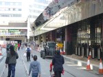
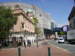
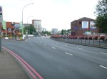
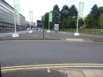
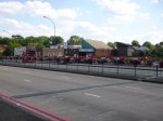
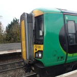
Threading The Midland Metro Through Birmingham City Centre
I’ve been wanting to take this set of pictures for some time.


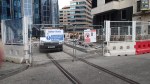

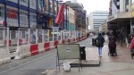


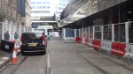
So on my way to Coventry, I took the train to Birmingham Snow Hill station and then followed the Midland Metro construction back to Birmingham New Street station.
According to Wikipedia, the Line One Extension of the Midland Metro, should connect Snow Hill and New Street stations in 2015. This may still happen, but to my untrained eye, there seems to be a lot of work to be done.
But when completed, it will be an invaluable asset to the City of Birmingham.
Birmingham Gets A Big Snow Job
It is said by many in the regions of the UK, that London gets and eats all the pies.
At present there are four main rail projects on the go in London; Thameslink, Crossrail, the Northern Line Extension and the London Overground.
Thameslink is a government funded project, whereas Crossrail and the NLE are paid for wholly or in part by property developers and business.
The smaller Overgroundisation of London surface railways is more a methodology that is starting to be copied and expanded in places like Merseyside, the Cardiff Valleys and the West Midlands. Although you could argue that other railways in the UK have had the same idea of frequent clean and sometimes new trains, smart stations and good staffing levels, working for some time. Some of the stations on the Overground, have been or will be expanded, in conjunction with property development.
But other projects where co-operation between Network Rail, rail companies.local government and property developers are starting to be proposed and implemented, Often these projects are led by a major redevelopment of a station.
1. Leeds Station
Leeds station was rebuilt and extended a few years ago, but little use was made of the space above the station.
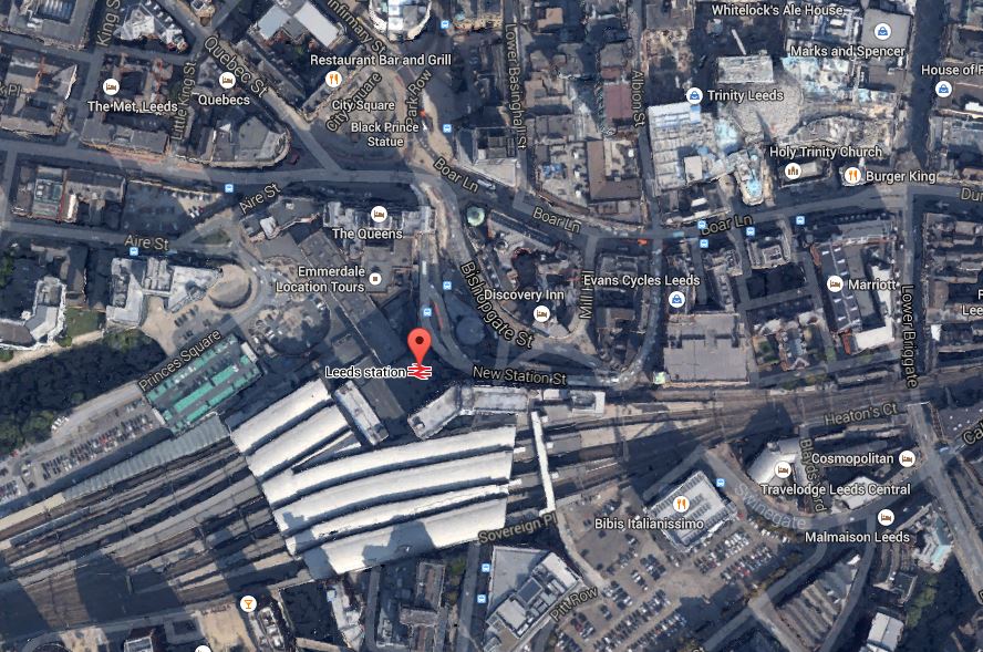
Leeds Station And City Centre
This Google Earth map shows the central location of the station and also its closeness to the main Trinity Shopping Centre at the top right of the map. Walking routes between the two are not good and the station should have been improved with development on the northern side to link it to the city centre. According to Wikipedia. future plans are in place to add much needed extra platforms and develop the south side of the station.
I believe, that you should walk out of a station into an open space, from where you can get your bearings of the city. This has been done well at London Kings Cross, Liverpool Lime Street, Huddersfield and Cardiff Central and some station rebuilding and expanding, is embracing such a concept.
I hope that Leeds develop the concept to a new level, when they create a new southern entrance. Perhaps on a personal level, they could create an easy way to get a bus to Elland Road.
2. Reading Station
Reading station has also been rebuilt and is surrounded by development, as this Google Earth map shows.
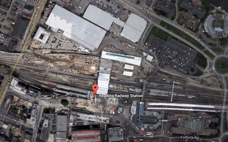
Around Reading Station
In the future it will be getting Crossrail,the new western link to Heathrow and probably more offices around the station. Network Rail, who now manage the station, have already created entrances on both sides of the station and I hope that development in the next few years, will make what is a spectacular station, a true gateway to the City.
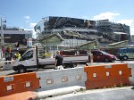
3. Birmingham New Street
Birmingham New Street station is approaching the end of its rebuilding, which is now Gateway Plus. It includes a lot of retail including a new John Lewis. The station will also be connected to the Midland Metro. This Google Earth map shows the station and it’s surroundings.
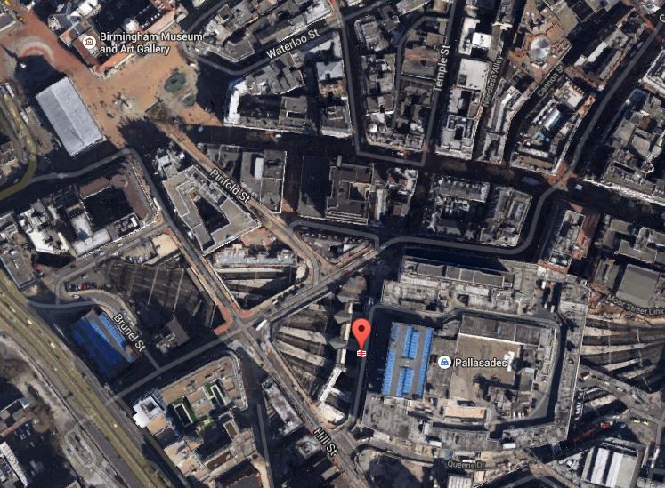
Birmingham New Street
It shows the problem that the station suffers, when compared to many. It is in a deep dark hole surrounded by busy roads, with the buses some way away. I don’t think you would design a station like that these days, as they did in the 1960s.
The station has a problem, as does Leeds, that there is not enough lines and platforms, but whereas at Leeds space is available, it would appear that at Birmingham New Street, it will be difficult to find.
The design of the station means that natural light on the platforms is difficult to provide. Hopefully, though by providing that light on the concourse and lots of lifts and escalators to get to the trains, the architects may have improved things. At present, it’s a bit like a bad Underground station experience arriving and departing at the station. One of the reasons, I generally travel between London and Birmingham by Chiltern Railways, is that Moor Street is a light and airy station, that has been tastefully updated for the modern age.
One of the biggest problems at New Street, is getting onward connections around the City Centre. On my visits to Birmingham, I often walk to Brindley Place to have a drink or lunch with friends. It’s not a difficult walk, but in a few years time, I’ll be able to do this sort of journey on the Midland Metro from the stop in Stephenson Street. When HS2 opens, this tram will be used as the connection between all four Birmingham city centre stations.
4. Manchester Victoria Station
The updating of Manchester Victoria station is the centrepiece of two big projects in Manchester; the Northern Hub and the extensions to the Manchester Metrolink like the Second City Crossing. This Google Earth map shows The station and the surrounding area.

Manchester Victoria
This image is quite old and doesn’t show the new roof, but it does show the roof of Manchester Arena next door, how the tram lines call at the station, the nearby green space and the river. All the station needs now is completing, the Metrolink extensions and new electric train services to Liverpool, Preston, Blackpool, Bolton, Leeds, Huddersfield, Sheffield, Newcastle and Hull.
I would also personally, like to see an hourly service to the South and Euston, so that I can avoid, the mostly dreadful Piccadilly. This will be possible once the Ordsall Chord is opened, although some might say that it is a real pity, the Picc-Vic tunnel was never built. Perhaps Virgin will get permission to run a service to Huddersfield via both main Manchester stations.
5. Newcastle Station
Newcastle station is a station that I don’t remember as anything special from my last visit some yeas ago, although it is a Grade I Listed Building. But since then, several millions have been spent according to Wikipedia, mainly on internal and retail facilities and on opening up the area round the station. So perhaps I should pay the city a visit. This Google Earth image shows the unique position of the station.
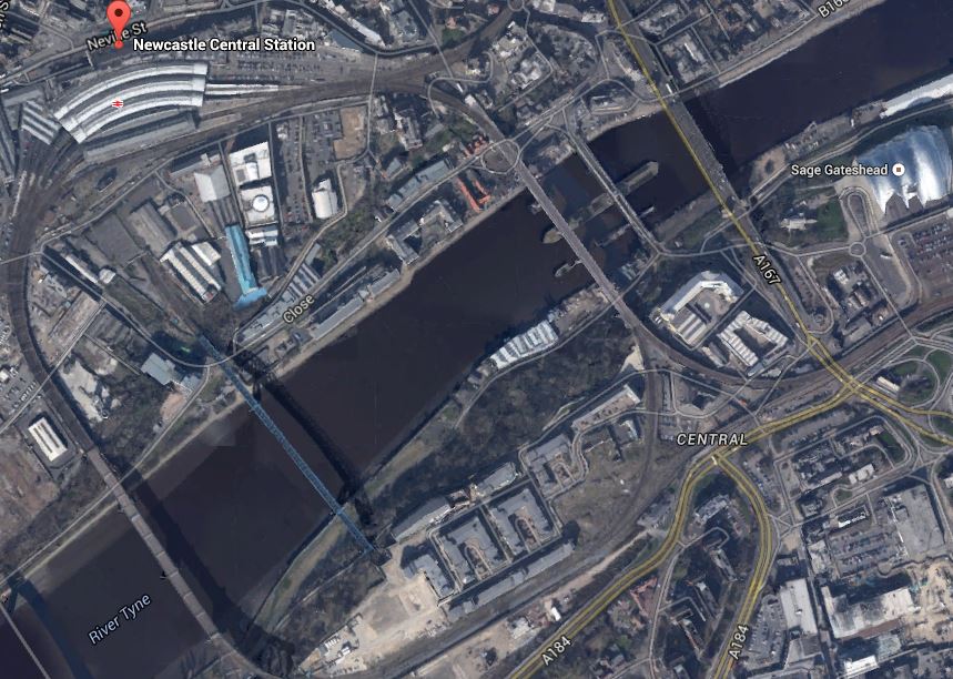
Newcastle Station
It is high above the Tyne on the edge of the city centre and uniquely the station is on a curve. It must be a very difficult to add extra tracks and platforms, which seem to be needed, as both through and local services are going to increase significantly.
I have only given five major examples, but they show how stations are becoming the focus of development.
One of my manual searches on the Internet picked up this article on Modern Railways entitled Snow Hill ‘transformation’ plan. This is the first paragraph.
Birmingham City Council has released its Snow Hill Masterplan, which outlines plans to grow the business district surrounding the station and includes proposals for the ‘transformation’ of the station into a transport hub.
Snow Hill is Birmingham’s station that is ignored by visitors from around the country, although it is important for commuters and others brought into the city on the Snow Hill Lines.
The Snow Hill Masterplan is here on the Birmingham Post website. Some of those who have commented don’t like it and they could be right. But the principles behind the plan of creating high quality offices, retail and apartments over a well-connected station is one that has been proven to work at Canary Wharf. After all it does actually make double use of the same piece of land. This is a Google Earth image of the Birmingham Snow station and its location.

Birmingham Snow Hill
You don’t see much of the actual station, as it is covered by a multi-story car park. As someone who can’t drive and manages well without a car, I can’t see why cities don’t do what London, Cambridge and Oxford have done and discourage people from driving in by providing top quality public transport.
The Snow Hill Masterplan would need an updated Midland Metro and also extra trains and routes through Snow Hill station.
I think that if I could get trains direct from Marylebone to Snow Hill, then that would be my preferred way of going. Snow Hill is in a much friendlier and welcoming part of the City than New Street.
I think on balance it is a good plan.
Improving Walking Routes To Football Stadia
I’m using football stadia as an example, but it could equally be any other important building, like a hospital or a museum, or any number of sporting venues.
The problem was brilliantly illustrated yesterday at Bournemouth, where I walked the obvious route to Dean Court, that I’d used twice before. But after seeing Bournemouth fans at Pokesdown station turning the other way, I thought there must be a better route. Stewards gave me directions to one, that was the other two sides of a quadrilateral, that was five minutes shorter.
A few signs are all that are needed, with perhaps a few metres of asphalt to make the walking easier.
At Ipswich, you come out of the station and you can see the ground. But there are also maps everywhere for the lost, although for visiting fans there isn’t any indication of where they should go. In this map, away fans go to the bottom right corner of the ground, which is the area of the ground you get to first as you walk up Portman Road.

Ipswich Station And Portman Road
Since this map was produced, the biggest improvement has been putting the Sir Bobby Robson Bridge across the river. This provides an important walking route between the south western parts of the town and the centre and the football ground.
Note that in this map, the station is indicated by the red arrow symbol, as they are in all the other maps.
There are a few groups in the Premier League and Championship that have their own stops or are less than fifteen minutes from a rail, tube, tram or metro stop.
Arsenal – This has three stations at Arsenal, Finsbury Park and Highbury and Islington.
Aston Villa – The stations are Aston and Witton
Chelsea – Take your pick from Fulham Broadway, Imperial Wharf and West Brompton
Crystal Palace – Norwood Junction is five minutes away.
Everton – Sandhills station and then the Soccerbus.
Hull City – There is a walking route from Hull station.
Liverpool – Sandhills station and then the Soccerbus.
Manchester City – Take the Metrolink to Etihad Campus.
So could the walking routes to other grounds in the top two divisions, particularly from the nearest rail station, be improved?
Birmingham City
The walking route from Bordesley station isn’t very long or difficult, as this map shows.

Bordesley Station And Birmingham City
But it’s just downright dangerous, as there is no pedestrian route around Bordesley Circus. I wrote about it in this post; A Pedestrian Crossing From Hell.
I have heard from Birmingham City Council, who say that something is being done.
If you look at the map, you’ll see the Camp Hill Line passing at the side of the ground. If Birmingham City are ever successful and need to rebuild the ground, if feasible planning permission should include a station at the new stadium.
It is a long term aspiration of Birmingham City Council to open this line to passenger traffic. The way the tide is turning in favour of rail, I wouldn’t bet against this happening.
Blackburn
Ewood Park is a tricky ground to get to, as you have two stations in the town; Blackburn and Mill Hill.
I usually go to the ground by Blackburn, as I usually change trains for the area in Manchester, so that I can get a meal if I need one.
To get between the station and the ground, I normally use a bus, which isn’t as easy as it could be, as the information is rudimentary.
Mill Hill is nearer to the ground and walk-able, as this map shows.

Mill Hill Station And Ewood Park
But I think there are two problems with using Mill Hill.
To return to the station would be a walk up the hill.
But the main reason, I would not go to Mill Hill, is that I can’t get a direct train to that station from Manchester. As you have to change trains in Blackburn, I might. just as well get out there and catch a bus.
Cardiff
The preferred route to get to the ground is to take a train to Grangetown station, but Ninian Park station is nearer, but the trains aren’t so good.

Grangetown And Ninian Park Stations, And Cardiff City Stadium
All this might change when the local lines around Cardiff are electrified, as they seem to be improving stations.
Derby
Derby is an easy walk between Derby station and Pride Park, as the map shows.

Derby Station And Pride Park
I did get lost though, so I think a few more signposts would help, as would another light-controlled crossing on Derwent Parade.
Leicester
I wasn’t sorry when Leicester City got promoted, as the walk to get to the stadium is not a short one.

Leicester Station And Stadia
I think it would be helped with some better signs. I generally take the road opposite the station and aim for Welford Road, I pass the rugby ground and you can see the King Power stadium.
Nottingham
This map shows Nottingham station and the two Nottingham football grounds; Meadow Lane and the City Ground.

Nottingham Station And The Football Grounds
I have walked between the station and the City Ground probably a dozen times and it’s flat and not a route that has many opportunities to get lost. But as the map shows, you walk alongside a waterway and surely access to this would make the walk more pleasant. It would also help if some improvements could be implemented at both ends of the route.
One thing that I’ve never had explained to me, is why are there no plans to serve the two football grounds and the cricket ground using the Nottingham tram.
Wigan
I’ve always thought that getting from Wigan North Western station to the DW Stadium was very difficult, so I generally take a taxi. I’ve just looked at the map.

Wigan North Western And The DW Stadium
The distance isn’t great but it doesn’t appear to be signposted at all. Note that there is a canal and Wigan Pier, that could be on the route,so it could bring visitors to an area that the council is developing, into the Wigan Pier Quarter.
To Stourbridge And Back
I went to Stourbridge today essentially to see the town and the Parry People Mover, but I took these pictures on my way up by Chiltern from Marylebone and back on Virgin to Euston.

The trips illustrated the best and worst points of the two companies and their trains.
Chiltern has the more comfortable trains, with big windows and free wi-fi, but the journey takes longer.
One small thing that surprised me was the quality of both the Class 172 trains and the stations it passed through, on the way from Birmingham Moor Street to Stourbridge Junction. In some ways though it is a reasonably modern line, as it was only reopened in 1995 as the Jewellery Line Project, which created Birmingham’s cross-city passenger route between Moor Street and Snow Hill. Wikipedia says this about the Birmingham to Worcester via Kiderminster Line, on which Stourbridge Junction is located.
It is a future aspiration of Chiltern Railways and Network Rail to electrify the entire line, including the Chiltern Main Line to London Marylebone.
I’ve always thought that electrification of the Chiltern Line should be done before HS2, so that there is adequate capacity between London and Birmingham, whilst Euston is rebuilt.
Another reason to electrify the Snow Hill Lines sooner rather than later would be so that some of these Class 172 trains could be released for other routes.
