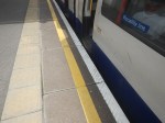
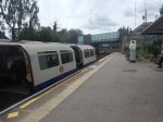
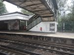
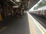
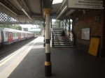
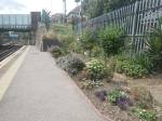
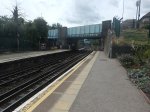
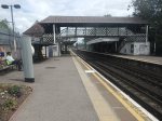
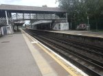
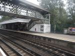
Ruislip Station – 16th July 2023
In TfL Announces The Next Tube Stations To Be Prioritised For Step-Free Access To Meet The Mayor’s Bold Accessibility Targets, it stated that Ruislip station will be made step-free.
So I went to have a look and took these pictures.
Note.
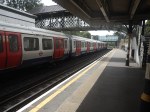
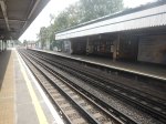
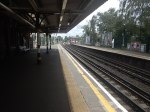
- The station is used by Piccadilly and Metropolitan Line trains, which are different sizes.
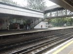
- There appears to be a well-preserved signal-box at the Eastern end of the station.
- The Eastbound platform has step-free access from the street.
- Crossing the tracks is by a Victorian steel footbridge.
- The station is Grade II Listed.
- The listing includes the the signal box and the footbridge.
This 3D Google Map shows the station.
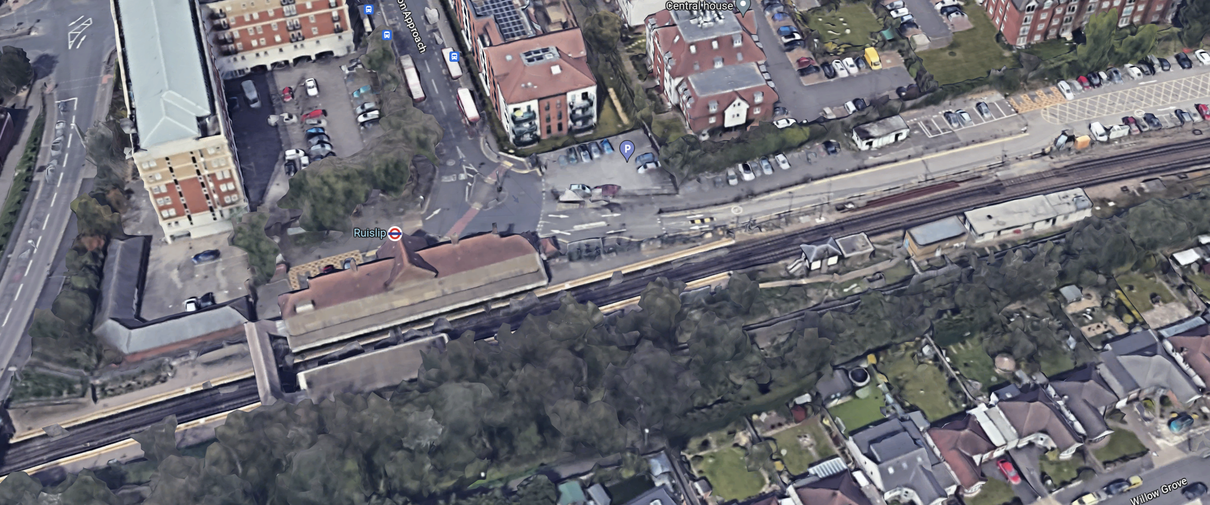
Note.
- The footbridge in the South-West corner of the map.
- There is not much space to put a second bridge across the tracks.
- It might be possible to build a step-free footbridge with lifts by the road bridge.
If English Heritage and the Heritage Taliban dig in their heels, this could be a difficult station to make step-free.
But the London Underground has several bridges of this type, so perhaps this one is being scheduled early to test the reaction.
This second Google Map shows the road bridge and the Western ends of the platforms to an enlarged scale.
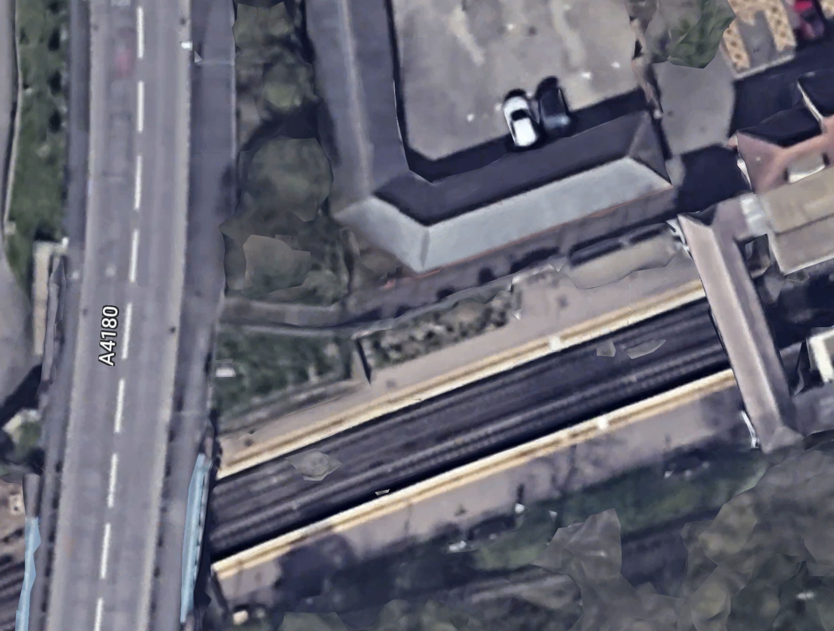
This picture shows the station side of the road bridge.
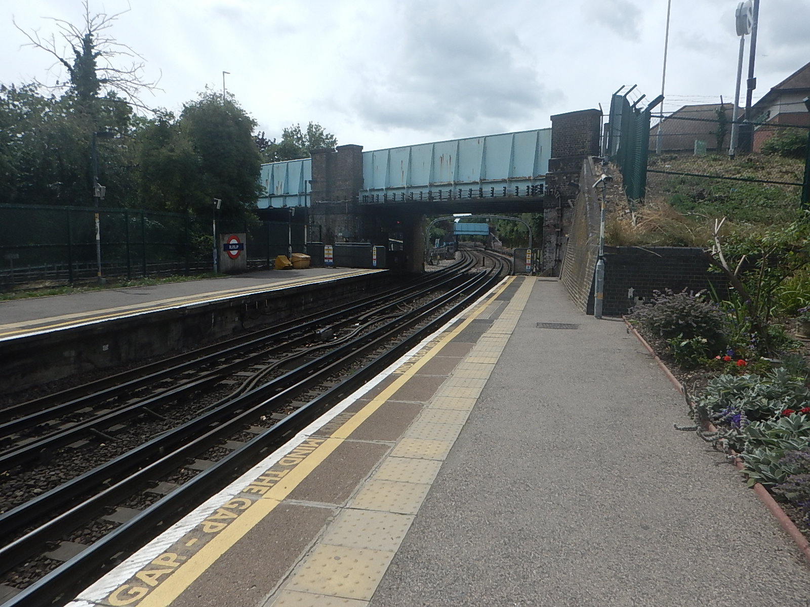
There could be space to put a steel bridge with two lifts by the road bridge.
Coupled with a comprehensive restoration of the current footbridge and a repainting of the road bridge, this could satisfy all parties.
Would A Solar Roof With Added Vertical Turbines Work?
This picture shows Oakwood station on the Piccadilly Line.
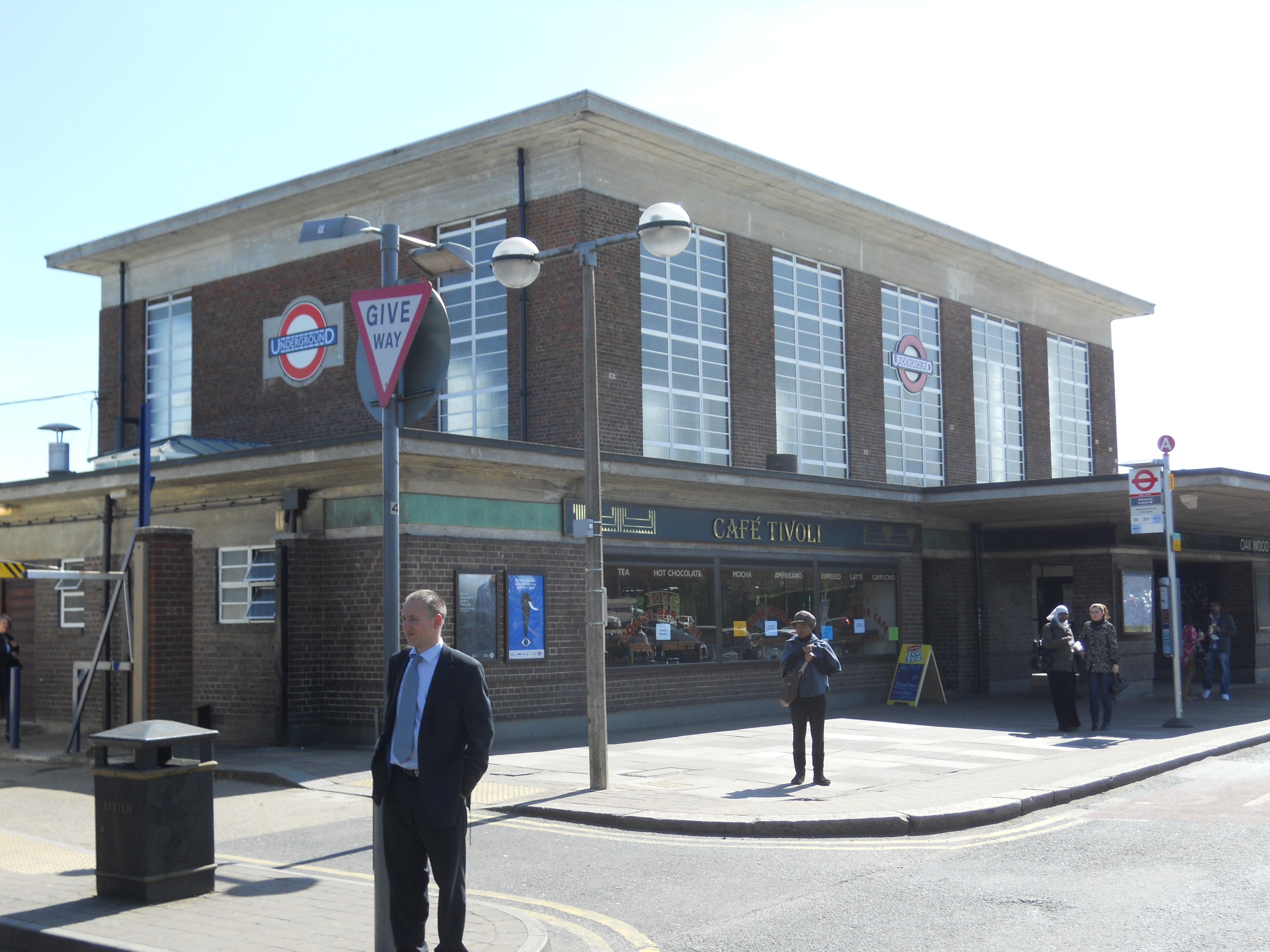
Note.
- The station is the second most Northerly on the line.
- It opened in 1933.
- It is a classic Charles Holden design.
- It is a Grade II* Listed building.
- The station is on top of a hill and has an elevation of 71 metres above sea level.
This Google Map shows a close-up of the roof.
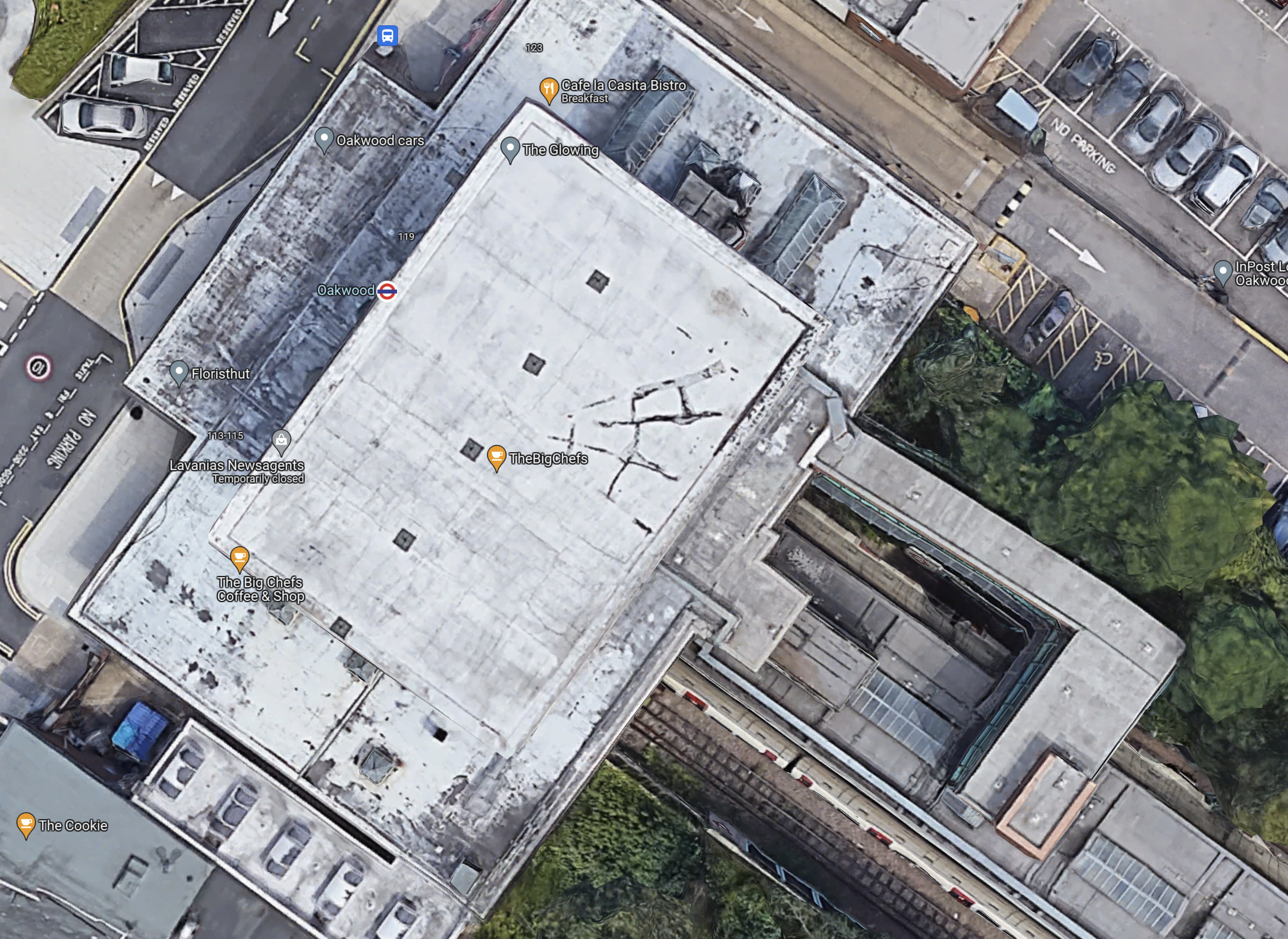
There might be a few aerials on the roof, but no solar panels.
Oakwood’s Location And Weather
I used to live near Oakwood station and it had its disadvantages.
- Cycling home was always up a steep hill.
- It could get very cold at times.
There even used to be a plaque at the station, which said that if you flew East, the first land you would hit would be the Urals.
Oakwood station could be an ideal renewable power station.
- The concrete and brick box of the station is probably exceedingly strong.
- Solar panels could cover the flat roof.
- SeaTwirls or other vertical turbines could be mounted around the solar panels.
- There could still be spaces for the aerials.
- I wonder what the reaction of English Heritage would be.
Should we call this mixed solar and wind power generation, hybrid renewable energy? Or do we overdo, the use of hybrid?
London Underground have other stations of a similar design including Sudbury Town and Acton Town.
The Wider Area To The West Of Oakwood Station
This Google Map shows the area to the West of Oakwood station.
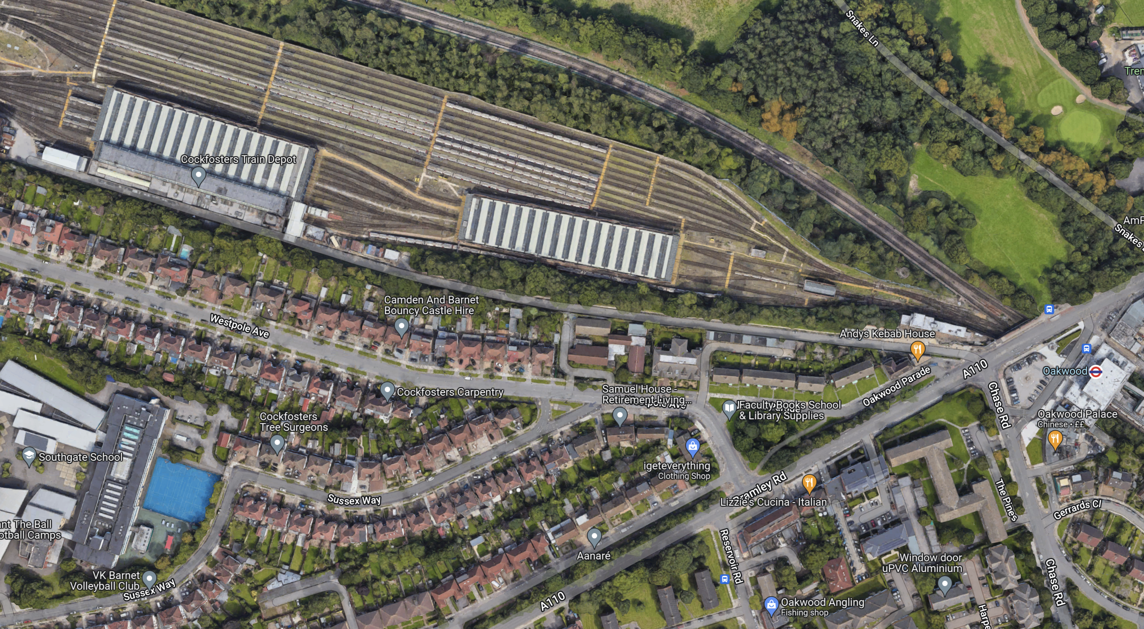
Note.
- The striped roofs at the top of the map, with sidings for trains to the North, is Cockfosters Train Depot for the Piccadilly Line..
- The large building in the South-West corner is Southgate School, which I watched being built in the early 1960s, from my bedroom window in our house opposite. It is a concrete frame building typical of the period.
- Oakwood station is at the East side of the map and indicated by a London Underground roundel.
I think the possibilities for hybrid power generation in this area are good.
Cockfosters Depot
Cockfosters Depot could be an interesting site to develop as a renewable power station.
- There’s no way the site could be developed for housing, as it’s in the Green Belt.
- Road access is bad, but access for trains is good.
- I estimate that the depot is an area of at least five square kilometres.
- It’s still windy in the depot.
But it could have a solar roof and a few vertical wind turbines over the whole depot as designs and panels improve.
Southgate School
Southgate School could have a similar setup to Oakwood station.
Opportunities At Cockfosters Station
This Google Map shows a 3D image of Cockfosters station and the buildings around it.

Note.
- Cockfosters station is indicated by the roundel.
- The station is a Grade II Listed building.
- The station has an elevation of 97 metres.
- Half of the station car park is going to be turned into housing.
- Trent Park lies to the North of the station.
- The road in front of the station is Cockfosters Road, which to the North joins the M25 at Junction 24.
- The building between Cockfosters Road and the railway used to be offices, but it is now being converted into housing.
That high roof of the housing development, must be an ideal candidate for solar panels and vertical wind turbines.
Conclusion
I have tried to show the potential of just one of the small hills that ring London.
The Problem With Britain’s And Probably Other Older Railways
This post on IanVisits is entitled West Hampstead Overground Station’s New Footbridge.
Ian had intended to report on the finish of a station rebuilding project at West Hampstead station.
But like many other projects it is running several months late.
Ian says this.
It’s reported that the delay stems from an unexpected massive slab of concrete that was added to the bridge that runs over the railway tracks, and supports the old station entrance.
Plans to pull the old building back and release more space on the pavement may now need to be revised as that would require the pavement to be reinforced to the same level as the road, in case a heavy lorry were to swerve onto the pavement by accident.
The old Edwardian era station building was due to be turned into a “retail opportunity”, although that may now be in doubt if the pavement issue proves intractable.
How many of us have renovated old buildings to find that what is actually there, has little relation to what the surveyors/architects believed was there?
Years ago, I was rebuilding a Listed house and the Listed Building Inspector from English Heritage was very practical. When she asked the Council Planner, if he thought that the house should be like it was built in the 1840s, he said yes!
To which she replied, “So you think there should be outside toilets?”
Everybody except one laughed!
A couple of months later, she came back to see the work and told me of a very rich man, who was rebuilding a Grade II Listed Building, that was several times over budget. Her advice at the time had been knock it down or move, as she felt preservation was impossible. But the neighbours and the wider area, felt that the building should be saved.
I suspect that, if Transport for London had known what they know now, they would have demolished the inadequate station. I don’t think the station is Listed!
Conclusion
We have a preserve all buildings regardless of the cost attitude in this country and it exists in other countries as well.
Look at my post Stuttgart Hauptbahnhof, which outlines the problems there.
Imagine Crossrail with lots of tunnel construction problems and angry protestors!
Visiting Dover Castle By Train
Dover Castle is on the featured list on the English Heritage web site. They say it is 1.2 miles from Dover Priory station, but is it an easy, stiff or hard walk?
This Google Earth image shows the location of the station and the castle.

Dover Station And Castle
The castle is obvious and the station is in the bottom-left or south-west corner.
I shall be visiting soon. After all it does give me an excuse to have a ride in one of the excellent Class 395 trains.
Visiting Kenilworth Castle By Train
The BBC is doing an outside broadcast today from Kenilworth Castle.
It seemed somewhere that I might like to visit, but as I don’t drive it is a bit of a problem.
However, Kenilworth station is in the process of being rebuilt. The castle and the location of the station are both on this Google Earth image.
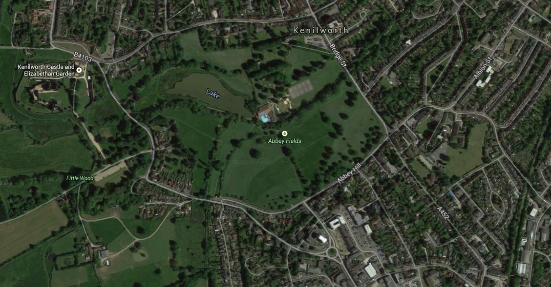
Kenilworth Station And Castle
The castle is obvious and the station is at the bottom-right or south-east corner. I estimate that the distance will be about a well-signposted mile, when the station opens.
If Kenilworth Castle get their strategy right, they could see an increase in visitors.
I for one, will be going when hopefully Kenilworth station opens in 2016.
How many other stately homes and heritage sites have their rail and bus transport links up to scratch?
