Walking Routes Around London Bridge Station
The walking routes around London Bridge station have been revealed.
They are shown in this plan.

London Bridge Concourse
It would appear that the new concourse is all at street level and that lifts, stairs and escalators take you to the fifteen platforms that run across the top.
It all sounds very simple and passenger friendly.
In some ways the key will be information, in that say you want to go to Purley, you will need to be directed there without fuss.
I have a feeling that the best way to work the station, is as you approach to call up http://www.nationalrail.co.uk on your mobile phone, choose Live Departure Boards and then type in London Bridge and your destination. As this information is generally available fifteen minutes before the train leaves, this should give you enough time to walk to the platform.
I’ve done it so many times on my phone, I just type “nat” to get started.
I would hope that the visual information system is just as quick.
A Walk Between Colchester’s Two Stations
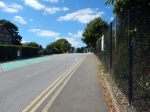
I’ve not been to Colchester many times.
Once I remember, I had to go to Celia’s Chambers on North Hill and for some reason I took the train and walked. I think, it could have been that we were going out with friends from the Chambers and she must have driven me home. But it was probably around twenty years ago.
So as I’d certainly never been to Colchester Town station and wanted to get some photos for Making Sense Of The New East Anglia Franchise, I thought it might be a please to go and have a walk to Colchester station to get the train home.
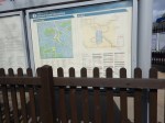
This Google Map shows the two stations and the town.
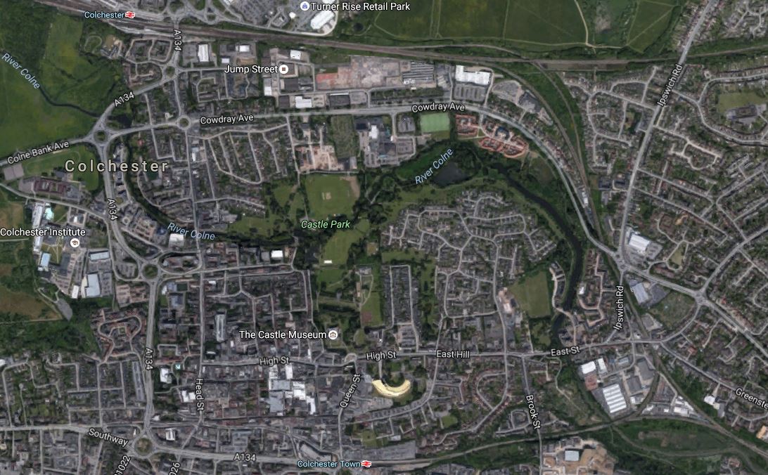
Colchester Stations
Colchester station is at the top, with the Great Eastern Main Line going through in a West-East direction, from Chelmsford to Ipswich.
The Sunshine Coast Line breaks off the main line, turns South and goes out of the South-East corner of the map.
There is a branch from this line, that goes from a triangular junction to Colchester Town station, which is in the midde at the bottom of the map.
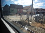
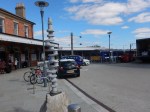
These are pictures, I took on my walk.


Note.
- It is not a very well-signposted route.
- There is plenty of space at Colchester Town station and it would be possible to walk across between the two platforms.
- It is quite a steep walk up from both stations.
- What didn’t help, was that the Town Centre was being landscaped and there was builders rubbish everywhere.
If you look at the Google Map, I’m certain there must be a better walking route, than the one I used. But then if Councils put up decent walking maps and routes, the natives complain, as they say they know their town and city well.
Who Nicked The Display?
There used to be a Next Bus Display on this stop at the Angel.
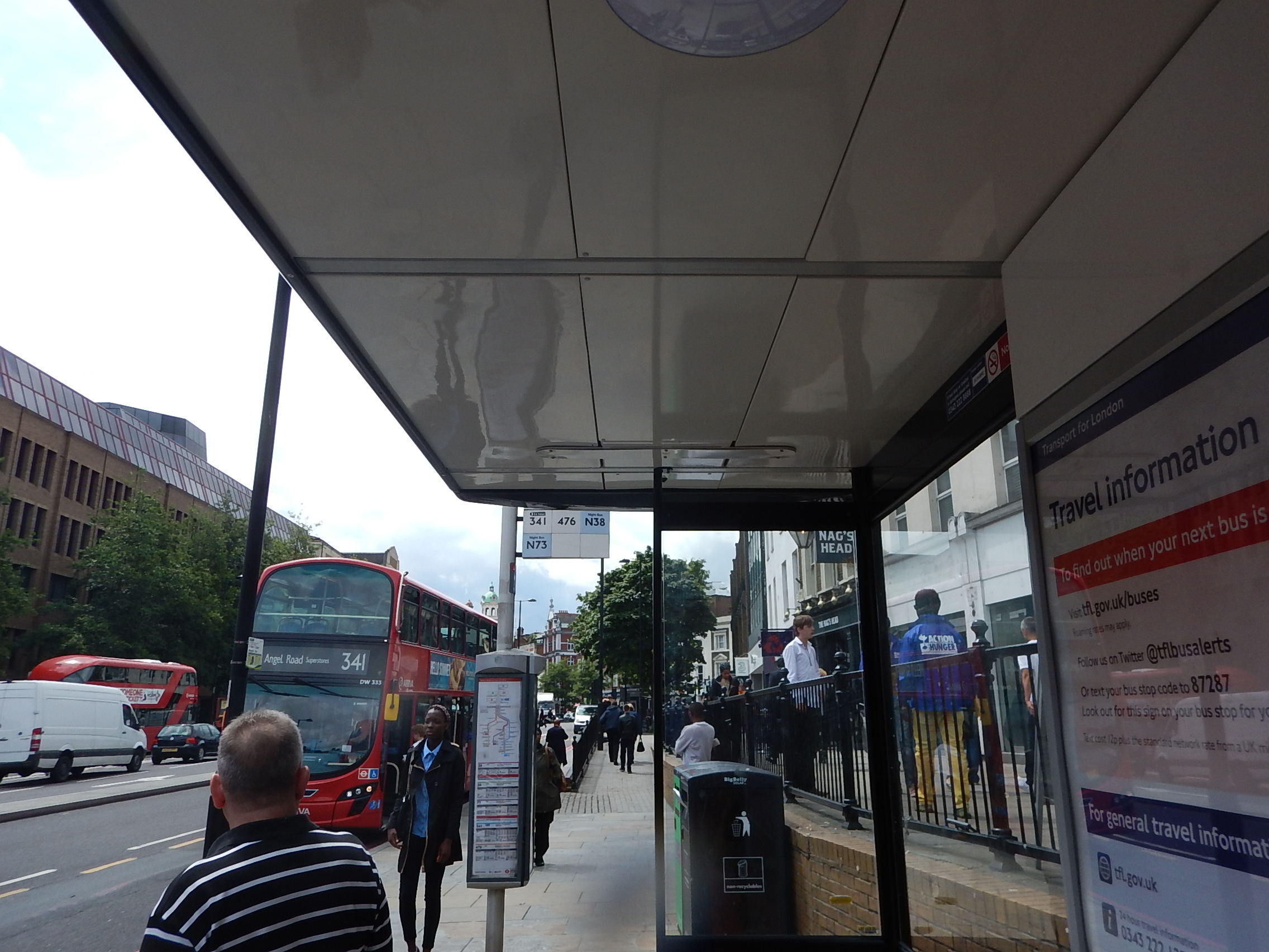
Who Nicked The Display?
Why was it removed?
It is such a pain, as like many others, I’m often returning from shopping to Dalston without a spare hand to text the stop on my mobile phone.
I assume it will be replaced.
A Tram Map In Munich
When it comes to local transport and walking maps, it’s a case of the bigger the better.

A Large Munich Tram Map
This was in the tram information centre in Munich Hauptbahnhof.
Every main station should have a local transport information centre and the largest map possible.
At the station, I also took this picture.

Tram Sign In Munich
I was going for supper and I needed to get a tram 16 to St. Emmeram, which would drop me in the area of one of the best gluten-free pizzadromes in Europe; Pizzesco.
So what could go wrong?
There was a demonstration in the area and the trams stopped running, leaving me in a part of MunichI didn’t know!
Although, Pizzesco was very crowded and I had to wait, I eventually got my delicious pizza and a bottle of gluten-free beer.
Coming back to my hotel, I eventually found a tram outside the Deutsche Museum.
A Good Information Board
I saw this information board at Kings Cross station.


I think the seat on the right, should be by the Tube Map.
But it’s a good attempt!
Is This The Worst-Placed Bus Map In London?
These pictures show the bus map at Kidbrooke station.


I was checking if I could get a bus to Abbey Wood station.
To read anything, you had to stand in the flower bed, but then the fence was in the way of the entries under A.
You can’t! But how could I find out?
It’s Less Than Twenty Days Until The Rail Timetable Change
The new rail timetable for the UK comes into affect on the 15th May 2016.
The Oracle (the National Railweb site) has a page that lists all the timetable changes. This page gives all the changes for December 2015.
But where is the page for May 2016?
Some of the changes are reflected in the timetables, like the start of services from Lea Bridge station, which I wrote about in The Full Service From Lea Bridge Station Starts On The 16th May 2016.
But other services are not in the on-line timetable!
Some companies also seem to have decided that not to publicise their plans for May 2016.
It is just not good enough!
Two Bus Stops On High Holborn
I went to visit one of my investments on Fetter Lane and I knew that if I could find the stop I could get a 341 bus from the area to Islington or my home.
There were two bus-stops and I knew I was on the right side of the road.

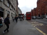
But which one do I go to? I had to walk to both of them to find the answer.
I don’t show it in the pictures, but there was a street sign between the two stops.
Wouldn’t it be nice to have a finger post to tell you where the stops are for various buses?
High Holborn is also one of those places, where there aren’t enough crossings.
Does London need a reporting system for poor street layouts or an army of elderly/disabled/teenage street walkers to collect possible simple improvements to the walking realm in the city?
A Design Crime – Manchester’s Totally Crap MiGuide
When I see things like this, it really gets my anger up.
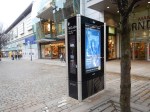
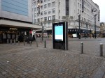
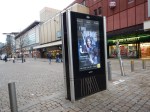
All I want in a City Centre, is a map that will show me where to go, not some indecipherable device, that I probably can’t work, as I have the sort of fingers that don’t work well with touch screens. I don’t want to be bombarded with advertising.
If I need information, like the nearest gluten-free restaurant, I’ll search Google.
Give me maps on liths like Ipswich, Glasgow, Preston, Bristol, Birmingham, Southampton and Sheffield! Or big ones with seats like Krakow!
Manchester used to have some nice maps, but they seem to have been removed.
Perhaps they’;re kept with the Ed Stone?
These devices are total crap, that should be consigned to the dustbin of the future.
They’re certainly a Design Crime.
The 2017 UK City Of Culture
Hull is going to be the 2017 UK City of Culture


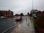

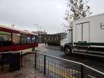
I walked across Hull twice from my supposedly City Centre hotel, which seemed to be almost closer to Grimsby than the railway station.
The first time was in the dark and there were no signs or maps, so I had to climb up on a dual-carriageway bridge, as the direct route across the footbridge was blocked due to demolition. The taxi-driver who brought me to the hotel said that all other routes were dangerous.
Despite the hotel saying it would take twenty minutes to get to football at the KC Stadium, It took me over an hour.
The pictures were taken in the morning and it was very wet, as they show.
I had hoped to find a paper shop to buy my copy of The Times, but in the forty minute walk, I didn’t pass one open shop selling newspapers. They was also no nice cafe for breakfast.
So instead of looking around Hull, I made an executive decision to go to Meadowhall to get some breakfast.
I know it was eight o’clock, but round here in East London, most things start at seven. Even my local Carluccio’s opens at eight in the week and nine at the weekends.
I got lost both times and I couldn’t even find a taxi to take me to the station.
I have never seen a city so badly signposted in my life.
But then to many of these towns and cities, maps are a waste of money, as everybody uses smart phones.
I don’t as my left hand isn’t good enough to hold it steady enough. Also as it was raining, the screen doesn’t appear to be too readable underwater.
UK Capital of Culture 2017?
They’re having a laugh or are they trying to lure visitors into those unsavoury areas my taxi driver warned me about?
I shan’t be going back to Hull again.
The place is an absolute disgrace as regards welcoming visitors, who don’t have cars and prefer or have to walk.
