Mersey Tidal Power Flythrough
Liverpool City Region Combined Authority have released a flythrough of the proposed tidal barrage across the Mersey.
Plans Progress To Build World’s Largest Tidal Scheme On The Banks Of The River Mersey
The title of this post, is the same as that of this press release from the Liverpool City Region.
These four bullet points, act as sub-headings.
- Mersey Tidal Power has the potential to become the world’s largest tidal scheme
- Formal planning process for UK’s “first of a kind” Mersey Tidal Power set to begin
- Potential to manage environmental issues associated with climate change
- Scheme would need government backing to complete development stage
These three paragraphs introduce the project.
Advanced proposals to build the world’s largest tidal scheme on the banks of the River Mersey have been unveiled by the Liverpool City Region’s Mayor Steve Rotheram.
Mayor Rotheram has revealed that the city region will pursue a barrage between the Wirral and Liverpool as the preferred option for the city region’s flagship Mersey Tidal Power project.
The barrage scheme – the “first of a kind” in the UK – could generate clean, predictable energy for 120 years and create thousands of jobs in its construction and operation.
Note.
- This page on the Liverpool City Region, has this explanatory video.
- This brochure can also be downloaded.
At a first glance all the documentation is very professional.
These are my thoughts.
How Much Power Will The Mersey Tidal Project Generate?
This graphic from the brochure shows electricity generation in Liverpool Bay.
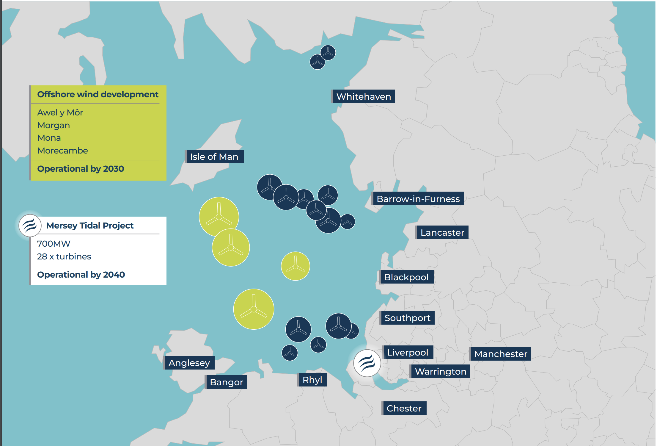
Note.
- The dark blue circles are the thirteen existing wind farms, that have a total capacity of 3 GW.
- The yellow circles are four new wind farms, that will be built by 2030 and will have a total capacity of 4 GW.
- The Mersey Tidal Project will have 28 x 25 MW turbines and generate 700 MW.
I also suspect that the power generation will be supplemented by a large battery, that will smooth out the electricity, when the wind isn’t blowing and the tides are at the wrong cycle.
Access For Ships To The Tranmere Oil Terminal And The Manchester Ship Canal
This article on the Liverpool Business News is entitled £6bn ‘Barrage Across The Mersey’ Takes Step Forward.
This is the introductory paragraph.
Steve Rotheram says his £6bn Mersey Tidal Power project will see a barrage across the river, with locks to allow ships through, but original 2030 switch-on now looks unlikely.
The article has a picture which could show locks on the Wirral side of the Mersey.
This Google Map shows the location of the Tranmere Oil Terminal and the Manchester Ship Canal.

Note.
- Birkenhead is in the North-West corner of the map.
- The line of white squares running parallel to the River Mersey, indicate the stations of the Wirral Line to Chester and Ellesmere Port.
- The Tranmere Oil Terminal is indicated by the red arrow at the top of the map.
This second Google Map expands the area on the West bank of the Mersey, at the bottom of the map.
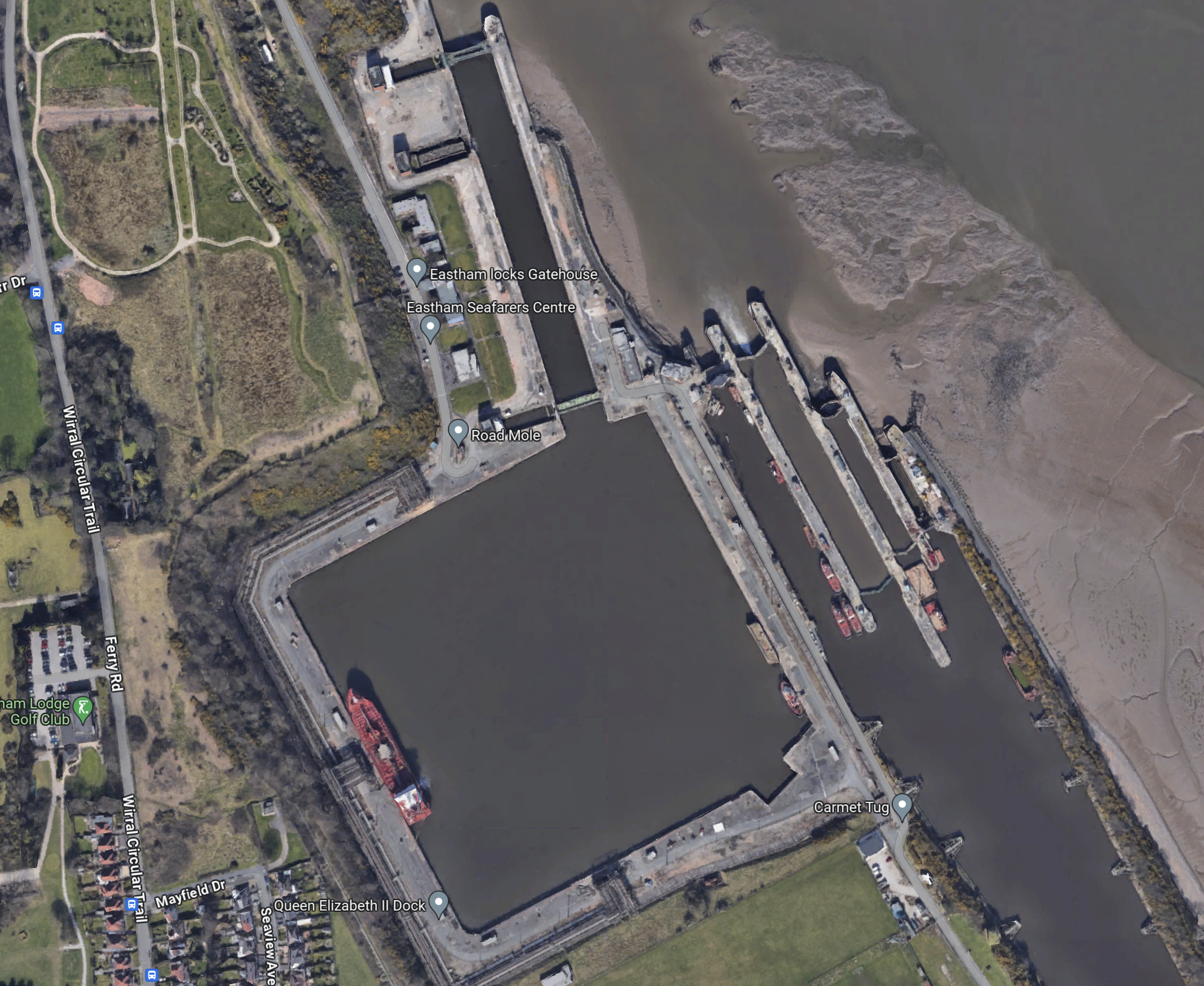
These are Eastham Locks, which allow ships to enter and leave the Manchester Ship Canal.
This third Google Map shows the area around the Tranmere Oil Terminal.
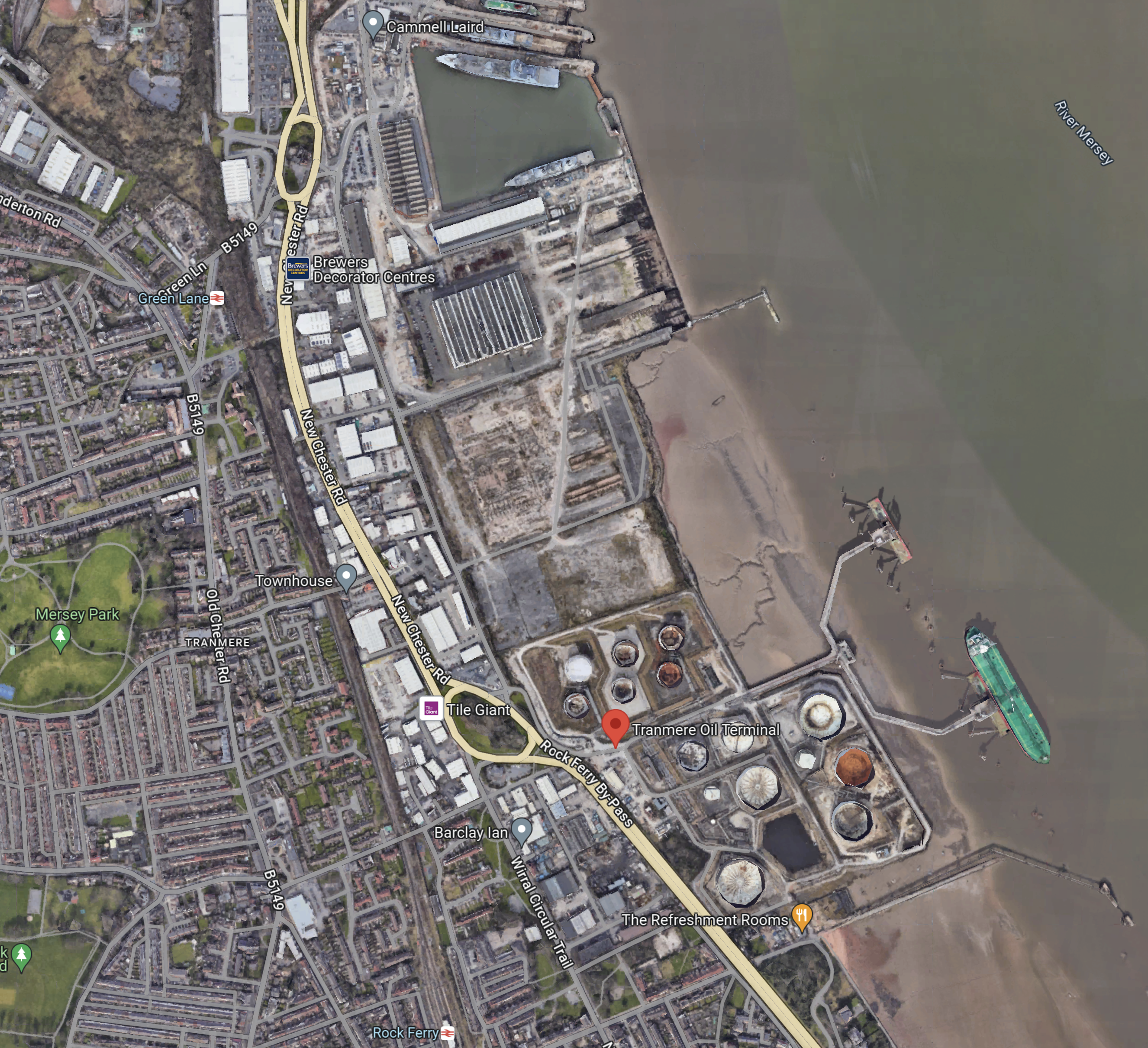
As before the Tranmere Oil Terminal is indicated by the red arrow, with Cammell Laird to the North.
The Liverpool Business News article says this about oil tankers, that use the Mersey.
In terms of oil tankers alone, there are more than 700 vessels coming in and out of the Mersey every year. Supertankers berth at the Tranmere Oil Terminal next to the Cammell Laird shipyard and around 500 smaller vessels berth at Stanlow at Ellesmere Port.
LBN understands that some form of lock system will be incorporated into the barrage to allow ships in and out. That might prove tricky for supertankers which suggests the barrage would be down river from the Tranmere terminal.
This Google Map shows the Manchester Ship Canal as it goes East from Eastham Locks.
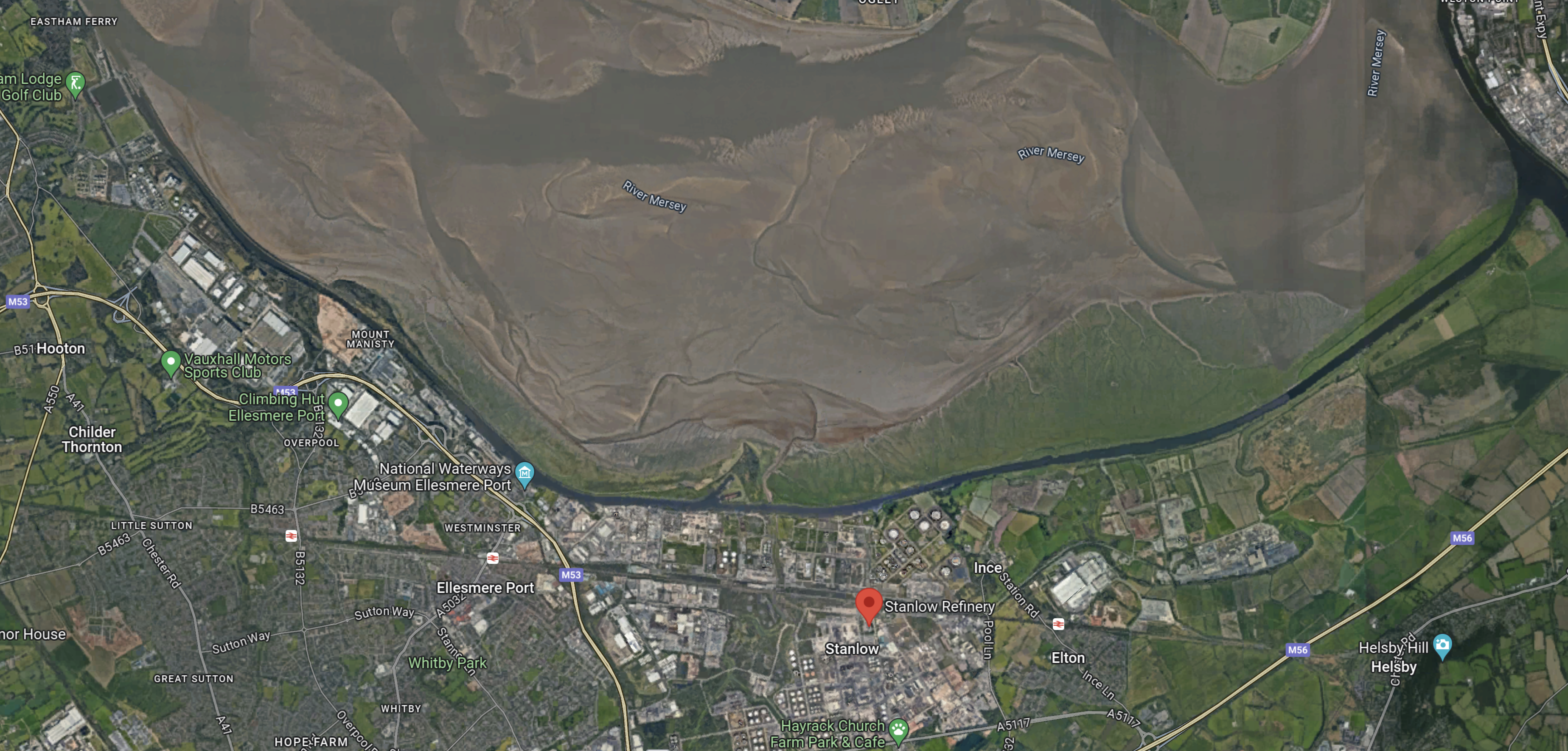
Note.
- The Manchester Ship Canal clings to the South Bank of the Mersey.
- The red arrow indicates Stanlow Refinery,
- There is a lot of industry on the South Bank of the Manchester Ship Canal.
It would appear that access to the Manchester Ship Canal gives access to several important places other than Manchester.
Access To Garston Docks
This Google Map shows the Liverpool Bank of the Mersey.
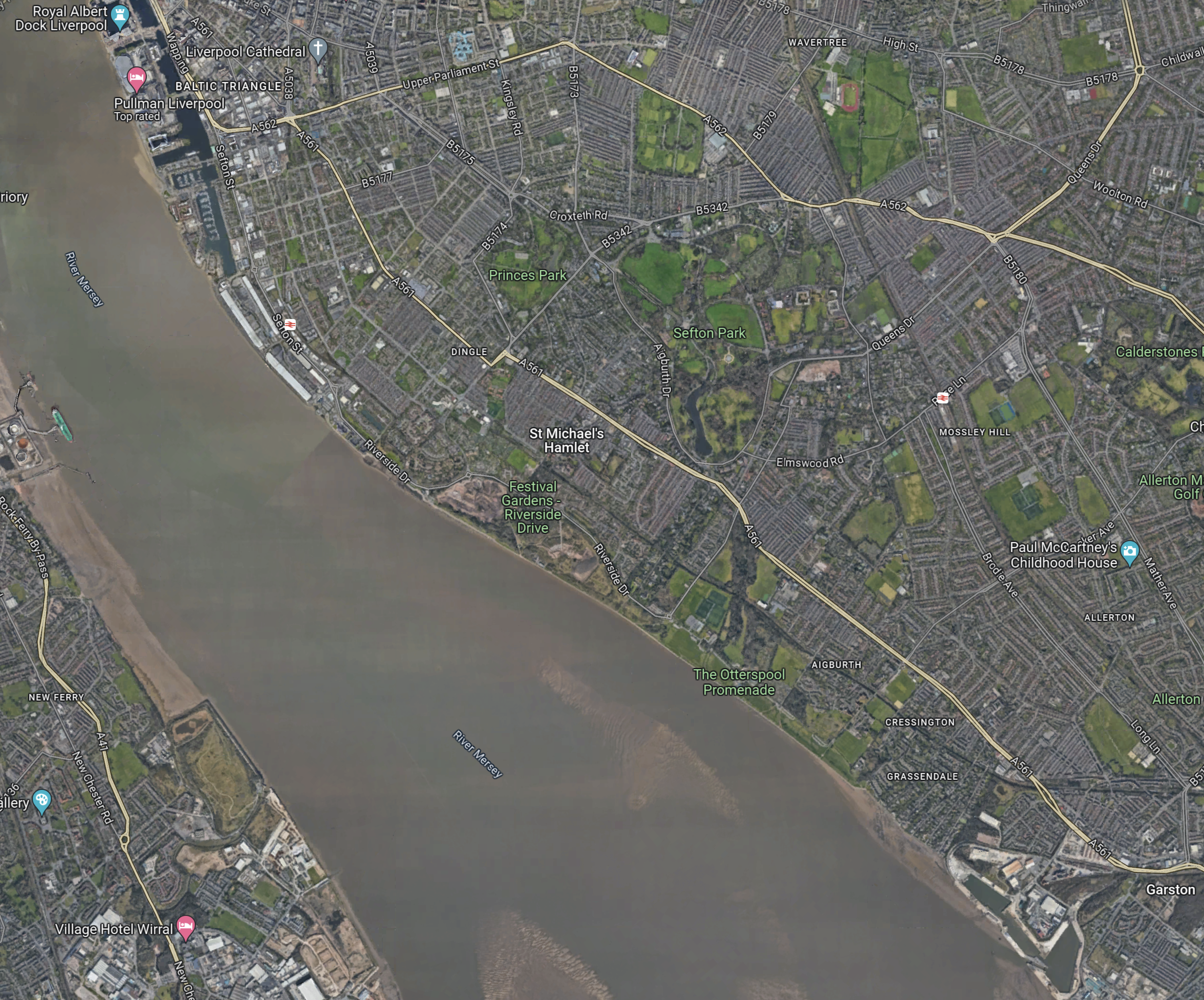
Note.
- The blue marker in the North-West corner of the map indicates the Royal Albert Dock.
- Garston Docks are in the South-East corner of the map
- There are no docks between Liverpool and Garston and much of the route can be walked along the Mersey.
- On the other bank of the Mersey, note the green ship at the Tranmere Oil Terminal, that can be seen in other maps.
This second Google Map shows Garston Docks.
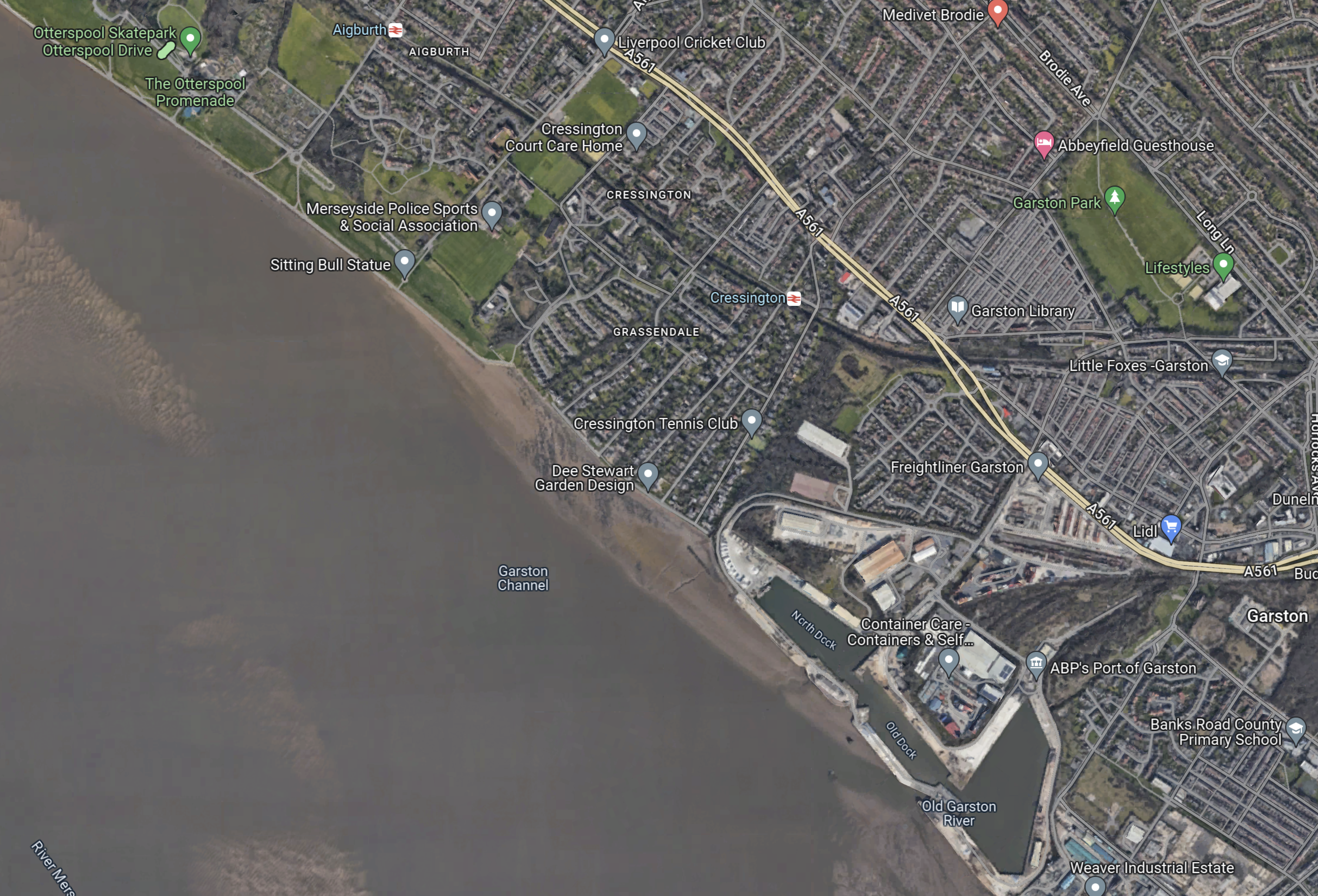
Note.
- There are three docks.
- The Garston Channel and the Old Garston River provide a route for ships to enter or leave the docks.
The Wikipedia entry for the Port of Garston, indicates that the port is rather run-down and a shadow of its former self.
It would appear that ships would have to pass through the locks in the barrier, which would likely be on the Wirral bank, to gain access to the Manchester Ship Canal and then cross the Mersey for Garston.
However, the barrier is built, it must have a route to both the Tranmere Oil Terminal and the Manchester Ship Canal at Eastham Locks.
The barrier could be built either North or South of the Tranmere Oil Terminal.
- If built North of the oil terminal, the locks in the barrier will have to accommodate the largest supertanker that calls at the terminal.
- If built South of the oil terminal, the locks in the barrier would only have to accommodate the largest ship that needed to use the Manchester Ship Canal or visit Garston.
One option would probably be more affordable.
Barrage Cross The Mersey
The very informative Liverpool Business News article, explains why a barrage was chosen, in this paragraph.
After pondering whether to build a barrage across the river from Liverpool to Wirral, or a floating lagoon, the Combined Authority has chosen the former as it would be cheaper and also creates a bridge that could have a pedestrian and cycle link.
The choice of a barrage sounds sensible on grounds of cost and accessibility.
Mersey Tidal Project And Where It Is Up To Now
The title of this post, is the same as that of this article on the Liverpool Echo.
This is the sub-heading.
With a major agreement on the project reached this week, we take a look at what it all means.
There is a section, which is called So What Is A Mersey Tidal Project?, where this is said.
The idea is to build a huge damn structure in the River Mersey with turbines that can harness energy from the tides of the river and convert it into clean power. The city region combined authority is hopeful that this could power up to 1 million homes and create thousands of local jobs
The city region has one of the country’s largest tidal ranges so it is seen as a perfect opportunity to explore a tidal project here. It is hoped such a project could generate a ‘plentiful, reliable supply of clean, green energy for generations to come.
In the 1970s, I did a small project management consultancy at Frederick Snow and Partners in London. They showed me their ambitious plans for a Severn Barrage, which was a tidal scheme, that would have created a tenth of our electricity and would have cost around a billion pounds.
But Harold Wilson, who was Prime Minister at the time, felt that the money would be better spent on building massive coal-fired power stations, rather than building a clean power station, that would last centuries.
A second section is called What Happened This Week?, where this is said.
This week the Liverpool City Region signed an agreement with the company behind the current world’s current largest tidal project with a view to learning lessons.
The Sihwa Lake tidal range power plant, which is operated by Korea Water Resources Corporation, generates 552GWh of clean, green energy every year, replacing the equivalent of 862,000 barrels of oil a year.
Jeong Kyeong Yun, Vice President of Korea Water Resources Corporation, known as K-water, was in Liverpool this week to sign an historic Memorandum of Agreement with Mayor Rotheram. It is hoped the agreement will pave the way for close co-operation between the two tidal power projects, through reciprocal visits and information sharing.
Note.
- The Liverpool Echo is still making spelling mistakes, like damn instead of dam. In the 1960s, Fritz Spiegl used to give us all pleasure by writing about them.
- 552 GWh would keep the UK powered up for nearly a month.
- The Sihwa Lake Tidal Power Station has a comprehensive Wikipedia entry.
- The Sihwa dam has a road over the top.
- Unlike Frederick Snow’s scheme for the Severn, Sihwa only generates power, on the incoming tide. But it does generate 254 MW.
As ever, Liverpool is thinking big and getting the experience from those, who know what they are doing.
This last paragraph, gives the thoughts of the Mayor.
Mayor Rotheram said that with the right support, he hopes the project could be generating clean, renewable power by the end of this decade.
I would go along with that.
The Mersey Tidal Project And The Mersey Gateway Bridge
Frederick Snow’s plans for the Severn could have incorporated a new road and rail crossing of the estuary.
This Google Map shows the the Sihwa Lake Tidal power station.
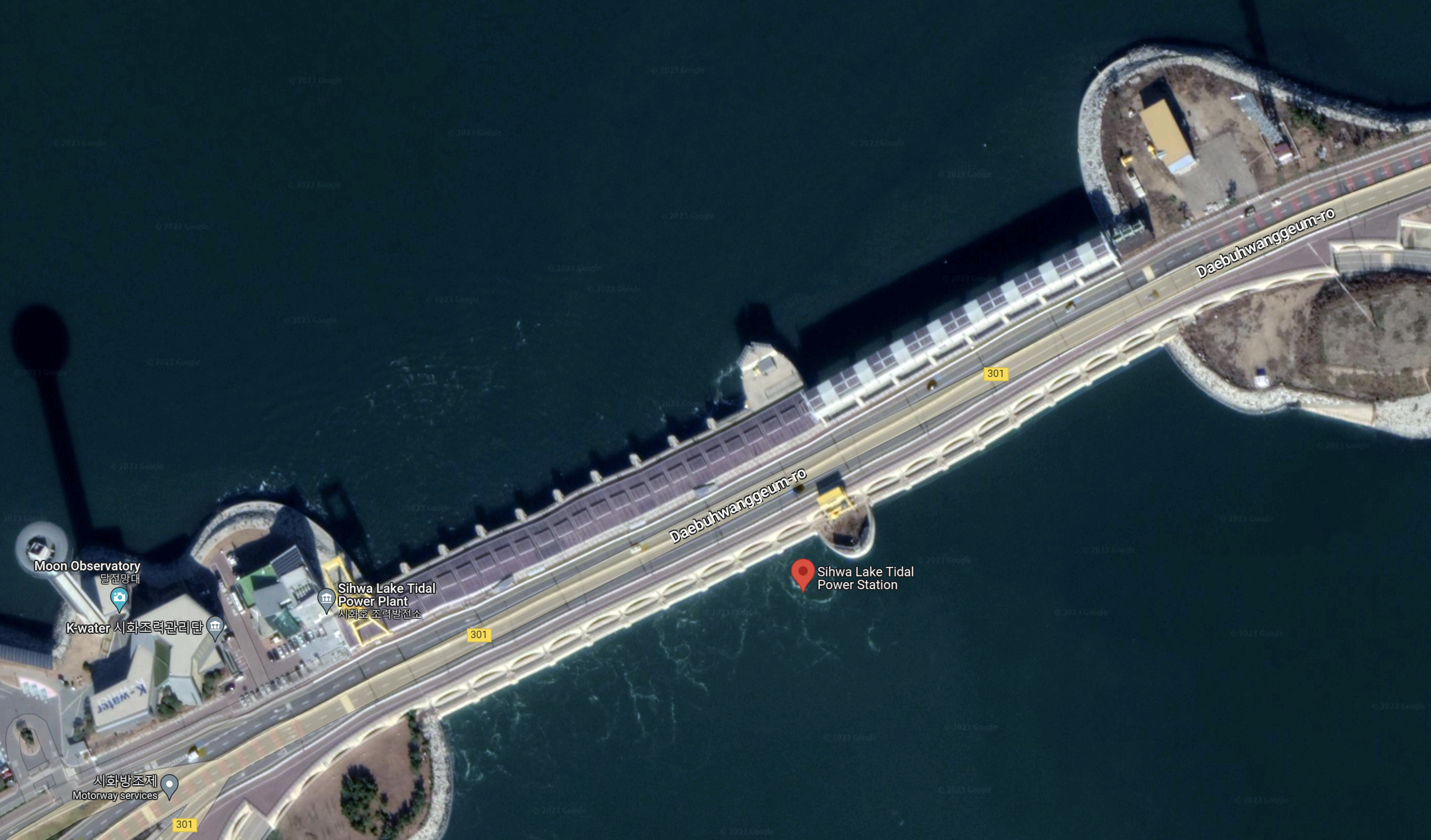
The road over the dam is clearly visible.
I took these pictures of the Mersey Estuary as I came back from Liverpool on Tuesday.


This Google Map shows the Mersey Estuary.
Note.
- The River Mersey flowing from the North-East corner of the map to the South-West corner.
- On the South Bank of the Mersey, there is the deep-water channel of the Manchester Ship Canal.
- The bridge in the North-East corner of the map is the Mersey Gateway Bridge.
- Then there is the pair of bridges at Runcorn; the Silver Jubilee Bridge and the Runcorn Railway Bridge.
I am fairly sure, that the Mersey Tidal Project would be built downstream of the pair of bridges at Runcorn.
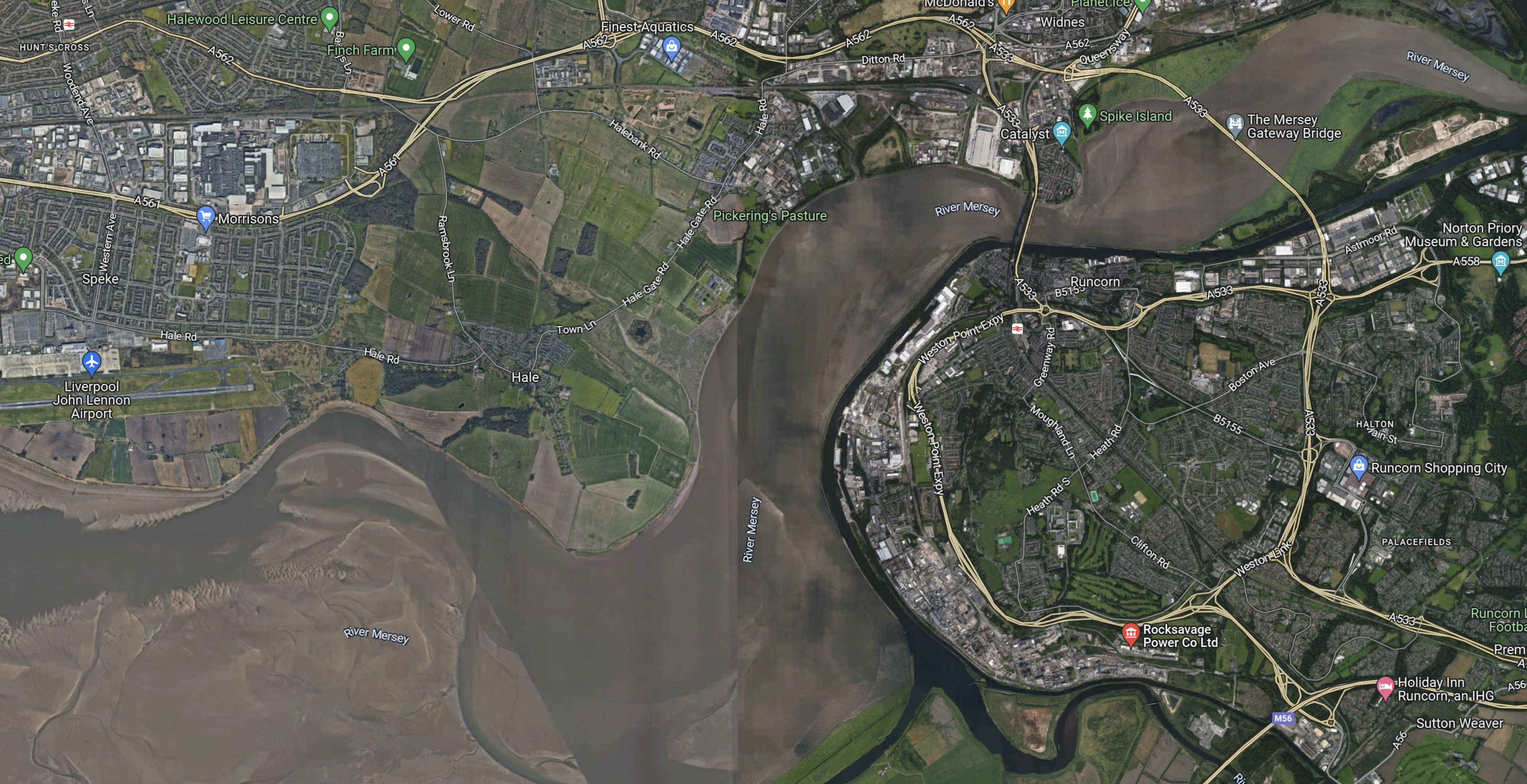
This Google Map shows the Mersey Estuary from the Runcorn Bridges to the mouth of the Manchester Ship Canal.

Note.
- The Mersey Gateway Bridge and the two Runcorn bridges are in the North-East corner.
- The route of the Manchester Ship Canal is clearly visible.
- Liverpool John Lennon Airport is on the North Bank of the Mersey.
- The M56 and M53 Motorways run East-West across the map to the South of the River.
This map leads me to the conclusion, that a tidal barrage with a road on top could link Liverpool to the M56.
I have some thoughts.
Rail Access To Liverpool
There is an electrified railway between Liverpool and Ellesmere Port.
- The railway can be picked out running across the bottom of the map.
- In Liverpool’s Vision For Rail, I talked about Liverpool City Region’s plan to expand this service to Helsby, Frodsham and Runcorn East.
- Helsby and Frodsham are shown on the map.
I wouldn’t be surprised to see a new Park-and-Ride station, where the M56 and the railway cross.
Ship Access To Manchester And Other Ports
Barrages usually have to provide access for ships to pass through to any ports behind the barrage.
But the Mersey Tidal Project already has that access. – It was built in the 1893 and is called the Manchester Ship Canal.
There is probably strong protection between the Mersey and the Canal between the mouth of the Canal and Runcorn, which may impact positively on the costs of the barrage.
The Simple Barrage
Sihwa Lake Tidal power station is a simple barrage with a bridge over the power station in the middle.
This Google Map shows the location of the power station.
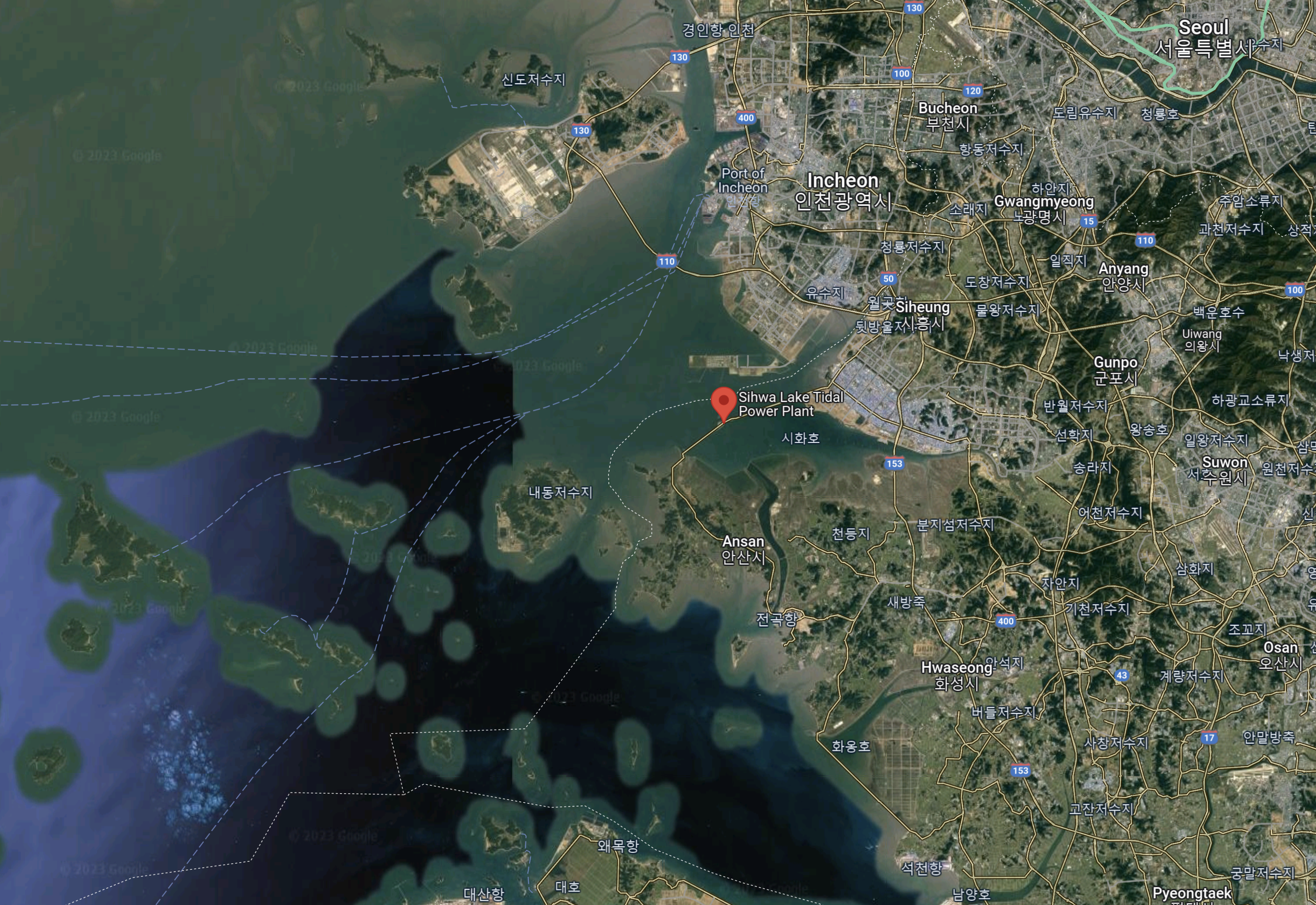
Note.
- Seoul is in the North-East corner of the map.
- The Sihwa Lake Tidal power station is marked by the red arrow.
This Google Map shows a close-up of the power station.
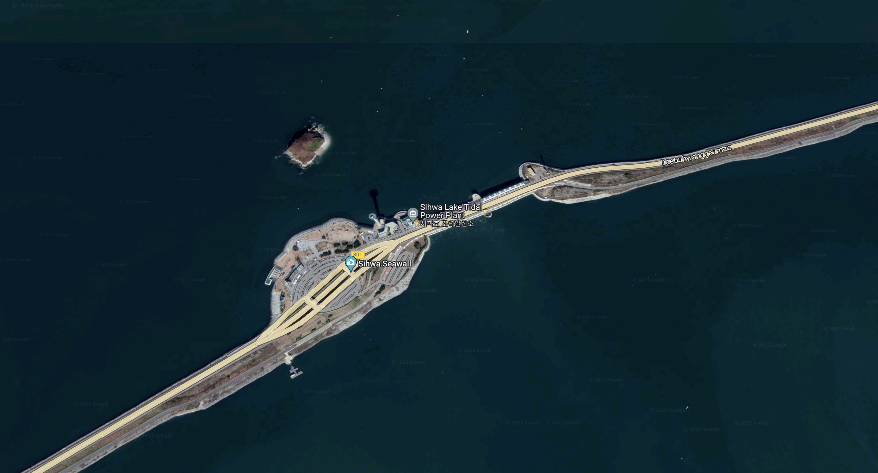
Note.
- The ten turbines appear to be in the gap.
- There appears to be a road on top of the barrage.
- The area to the West of the power station is marked as a rest area.
- A Moon Observatory is marked.
- It has bus stops, showing that it is served by the 123 and 123-1 buses.
It is an impressive structure.
I’m sure that this type of barrage would work over the Mersey.
- A road could be built on top.
- It may only be able to generate electricity,from an incoming tide, like Sihwa.
- It could incorporate a rest area.
I do suspect though Liverpudlians would add a few unique touches of their own. Perhaps some liver birds or superlambananas.
The Frederick Snow Solution
The Severn is a wide river and he proposed that there would be a dam across the river, with a spine running East along the middle of the river.
- The spine would divide the river into two lakes.
- On the incoming tide, sluices would open and allow water to flow into the Northern or high lake from the Mersey estuary.
- On the outgoing tide, sluices would open and allow water to flow out of the Southern or low lake into the Mersey estuary.
- Water would flow between the high and low lake through turbines to generate electricity.
- I have assumed that the high lake is on the North side, but if the geography is more suitable, the high and low lakes could be reversed.
In the design for the Severn Barrage, an International airport would have been built on the spine.
But Liverpool already has a nearby International airport, so perhaps it could be much better to install a large electrolyser and hydrogen storage on the spine.
