A New South London Orbital Rail Route
In the June 2016 Edition of Modern Railways in an article is entitled Turning South London Orange.
One of the proposals is to create new orbital route across South London.
The route is proposed to go through these stations, after starting at Woking.
- Guildford
- Horsley
- Leatherhead
- Epsom
- Sutton
- Wallington
- West Croydon
- Norwood Junction
- Beckenham Junction
- Bromley South
- St. Mary Cray
- Swanley
After Swanley, two of the proposed four trains per hour (tph) would go to the Medway stations, with the other two going to Maidstone East.
What Does The Route Do For Me?
From, where I live at the Northern end of the East London Line, this might seem a proposal with not much benefit to North Londoners.
But the link to the proposed route at Norwood Junction and West Croydon stations could prove very valuable.
- Getting to London terminals for the South like Victoria, Waterloo and Charing Cross, is not an easy journey, especially in busy times.
- Thameslink is promising to remove the one-change-route via New Cross Gate to get to East Croydon and Gatwick.
- Getting to Kent is particularly difficult, unless you use High Speed 1 from Stratford.
Crossrail 2 will help matters in a few years, but more needs to be done.
As an example of the difficulties we face in Hackney, today, I want to go to New Malden to take some pictures for A Very Bad Level Crossing Problem.
- Angel station is on the wrong branch of the Northern Line to get to Waterloo.
- I could take a 76 bus to Waterloo.
- I could take an East London Line train to Clapham Junction.
- I could take a Victoria Line train to Vauxhall.
- I could take a bus to Bank and get the Drain to Waterloo.
In the end i took the bus to Bank for the Drain.
You can see why Crossrail 2 is important for Hackney, Haringey, Tower Hamlets and Waltham Forest.
The new route may not help me today, but for many other journeys that need to be done from North East London, it creates an important by-pass of the inaccessible South London termini.
Two planned improvements will help this appalling connectivity in the next couple of years.
- |Crossrail will open up Kent from Abbey Wood. But why doesn’t it connect to Ebbsfleet International?
- Increased frequencies on the East London Line will increase services to Clapham Junction to 6 tph.
But there will be no major improvement until Crossrail 2 opens.
So Is The New South Orbital Route Feasible?
The Modern Railways article says this.
The major infrastructure addition would be a 3.2 km tunnel running northwards from Norwood Junction to Kent House, west of Beckenham Junction.
This map from carto.metro.free.fr shows the stations on and around the proposed route of the tunnel.
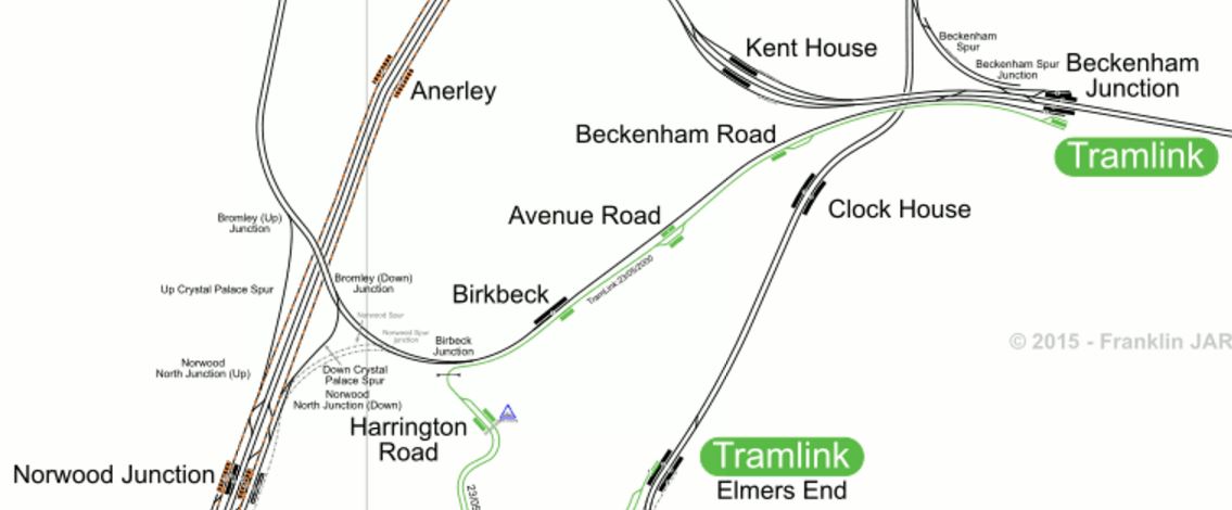
Norwood Junction To Kent House
I would assume that the tunnel would be double-track to accommodate the four tph, that are proposed for the route and its turn-up-and-go service.
This Google Map shows the same area.
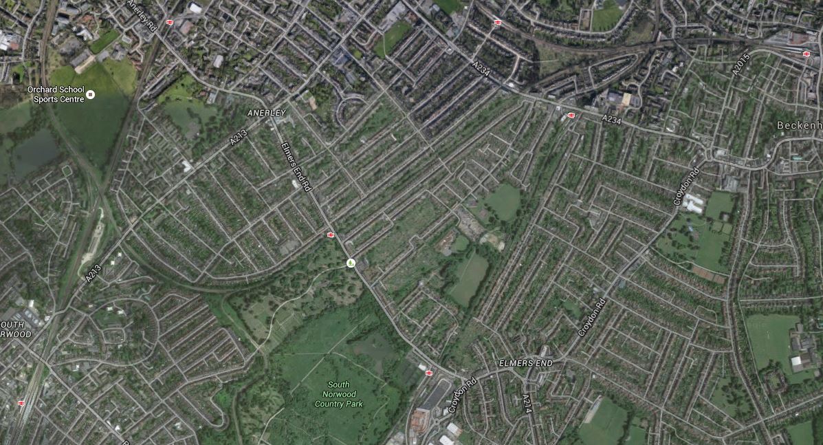
Norwood Junction To Beckenham Junction
Norwood Junction station is in the South-West corner of the map, with Beckenham Junction station in the North-East.
A friend of mine lives in the area and I wonder what he and his wife think of a tunnel under their house!
It may be possible to dig the tunnel in an affordable way, but I suspect another route could be used to bridge the gap between Norwood Junction and Beckenham Junction stations.
I don’t think that four trains per hour in both directions could be squeezed through the single-track section through Birkbeck station, but if they could it would avoid building the expensive tunnel.
There is always the option of splitting the service, as has been proposed for services across Suffolk, that I wrote about in Better East-West Train Services Across Suffolk. In that concept you have an island platform, where the trains meet and passengers just walk across to continue their journey. If say, Norwood Junction were to be used as the station for the split, then the Western service would go between Woking and Norwood Junction and the Eastern service between Norwood Junction and Swanley.
It’ll be interesting to see if the Newmarket scheme is ever built and if it is, how passengers react to it. If it comes over as a success, I think we’ll be seeing more innovative layouts to create new services from existing infrastructure with nothing more than minimal changes.
The Aim Of The Service
The Modern Railways article also says this.
The aim would be to provide a limited stop ‘turn up and go’ service that is competitive with the car, with train interiors designed to a comparable standard of comfort with more seats and Wi-Fi, rather than being of the metro-style used closer to the centre of the capital.
That I like! Sounds like the author is talking Class 387 trains with Wi-fi!
Thoughts On Stations Served
I’m giving each station their own separate posts.
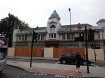
West Croydon
Norwood Junction
Note that I’ve also included some lesser stations for completeness.
Conclusions
The conclusions are best put together for the various sections and features of the line.
Conclusions In The East
Swanley station with its four long platforms arranged in two islands is the key to the East.
Two tph to and from each of the Medway Towns and Maidstone East would give a turn-up-and-go service across the South of London through Bromley, Croydon, Sutton and Epsom.
But given that the station currently has the following services.
- 2 tph West Hampstead Thameslink to Sevenoaks
- 1 tph Victoria to Dover Priory
- 1 tph Victoria to Canterbury West
- 1 tph Victoria to Ashford International
It wouldn’t take a lot of imagination to see Swanley as a major interchange, providing 4 tph services to a whole range of destinations across London and in East Kent.
Sadly, at the moment Ebbsfleet International for Continental trains isn’t possible, but Ashford International is.
I feel that.
- Continental services will increase in importance, over the next few years.
- St. Pancras International will run out of capacity,
- Some Continental services will terminate at Ebbsfleet International.
Which leads me to feel that getting from Victoria and across South London quickly to Ebbsfleet International will be increasingly important.
A direct Swanley to Ebbsfleet link would be ideal.
But as I showed in Rochester Station, that problem could be solved by an enlarged Crossrail.
A Very Bad Level Crossing Problem
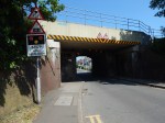
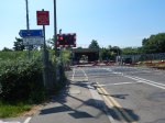
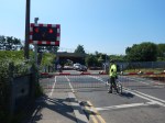
I have a Google Alert for “Crossrail” and it picked up this article in This is London, which is entitled How Should This New Malden Level Crossing Be Redeveloped When Crossrail 2 Arrives?. This is said.
Residents are being invited to put forward their views on a New Malden level crossing that could be closed by the arrival of Crossrail 2.
Kingston’s Liberal Democrats are asking residents to come forward with suggestions of how to redevelop the Elm Road level crossing, with the party asking how nearby Dickerage Road and New Malden High Street could cope with the extra traffic.
Possible outcomes according to the party’s consultation could include building of bridge or closing the crossing all together.
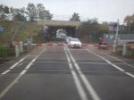
To get a better feel, this is a Google Map of the crossing.
Elm Road Level Crossing
Note.
- New Malden station is to the East, Berrylands station is to the West and Norbiton station is to the North-West.
- New Malden and Berrylands station are on the busy South Western Main Line.
- Crossrail 2 trains will serve all three stations.
- The level crossing is only on the line to Norbiton.
This map from carto.metro.free.fr shows the lines in the area.

Lines Around New Malden
Note the other level crossing North of Motspur Park station.
I believe that these maps, show that something must be done, as obviously there probably shouldn’t be any level crossings on a Crossrail route.
There are also other level crossings on the Crossrail 2 route, at or near these stations.
- Brimsdown – Before Crossrail 2
- Enfield Lock – Before Crossrail 2
- Hampton Court
- Motspur Park
- Northumberland Park – Before Crossrail 2
A quick look and my local knowledge of the crossings in the North, make me feel, that none is as difficult as the crossing near New Malden station.
I went to New Malden station and walked to the crossing.


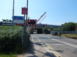
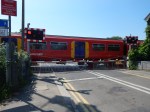
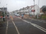
in some ways at eleven in the morning, the crossing wasn’t that busy. A lot of the traffic was on foot.
At the present time, in the off peak there are six trains an hour going through Norbiton station, to or from the New Malden direction, so this must mean that the barriers go down six times or four if the two trains to Norbiton cross at the level crossing.
Crossrail 2 will mean that the barriers will be down longer in each hour.
- Crossrail’s Class 345 trains are two hundred metres long, so if Crossrail 2 uses the same trains, these will be longer than the current eight-car trains of a hundred and sixty metres.
- Crossrail 2 will probably run at a higher frequency.
So something may have to be done.
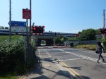
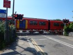
As the number of pedestrians, buggy-pushers, runners and cyclists will increase, I think that all solutions would accommodate a bridge or subway, for non-vehicular users.
It might even be possible to dig a shallow subway, with both steps and ramps, under the two tracks of the branch, as has been done at Brimsdown station.
The overall solution depends on how much traffic uses the level crossing.
But as there appears to be no industrial premises, that generate lots of truck traffic nearby, I wonder if the best solution for road traffic, is to keep the road crossing as it is. Perhaps with the addition of improved barriers, displays and warnings.
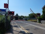
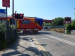
- Building a bridge or a tunnel would be a very difficult and disruptive exercise.
- A bridge would be very expensive, as it would have to go over the main line as well.
- Still having a crossing would give access for the emergency services, even if they had to wait two or three minutes.
- This would also mean that someone pushing a wheelchair or a heavy buggy could cross on the level, perhaps after a wait.
I’m sure that the solution to this level crossing will not be one that requires massive expenditure, as after a proper survey, engineers will probably come up with a simple, safe and affordable solution.
Taking A Train From Platform 1 At West Croydon Station
Platform 1 is the bay platform at West Croydon station. I used it today to get back to London Bridge.
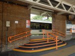
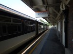
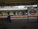
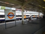
I think it was an eight-car Class 455 train, which the platform accepted easily.
This Google Map shows the station.
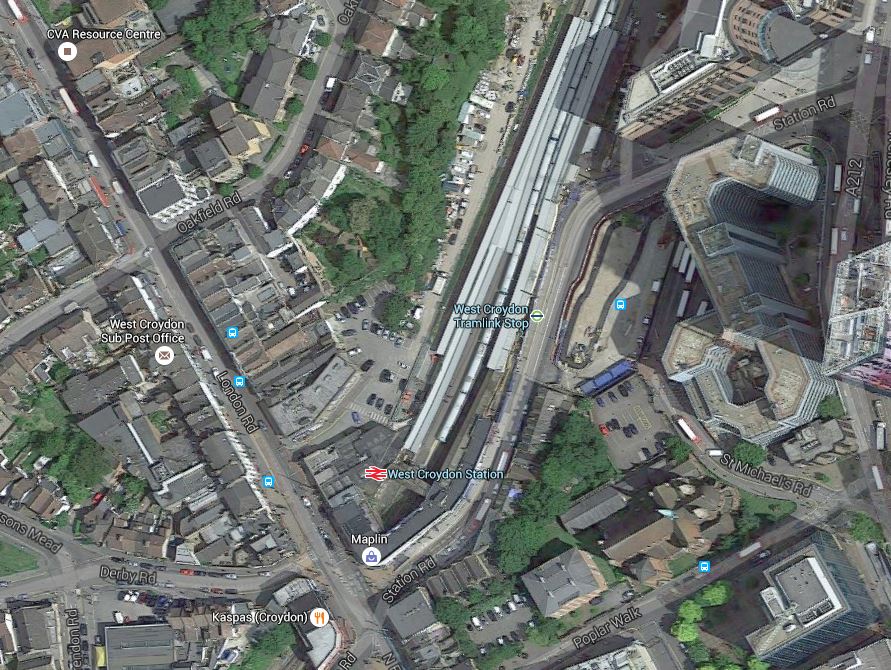
West Croydon Station
It would appear that if the station is ever redeveloped, there may be space beyond platform 1 for an extra platform.
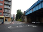
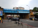
Bermondsey Dive-Under – 5th June 2016
These pictures were taken ass I came into London Bridge today.

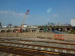
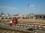
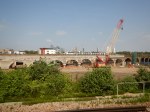

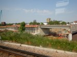

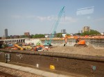
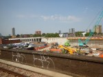
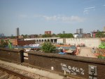


If you compare these pictures with those in Bermondsey Dive-Under – 10th April 2016, there would appear to have been a lot of progress.
It really is becoming an impressive structure, blending the best examples of brick, concrete and steel from the best part of two centuries.
Have You Heard about…the New European Transport Strategy?
That is the title of an article in Georgia Today, which gives a solid overview of the strategy. This is the first two paragraphs of the article.
In 2013, the European Commission, in a EUR 250 billion European strategy which gives priority to the creation of an integrated transport network and seeks to level the imbalance between the Member States of the European Union, proposed the creation of international transport corridors, bringing together Western and Central Eastern Europe. In order to overcome traffic imbalance in the EU, nine multimodal corridors will be created, each of which has to combine at least three types of transport and connect three states.
The new infrastructure policy will unite 28 EU states under trans-European transport network (TEN-T). Nine transport corridors will be provided: Baltic – Adriatic Sea, North Sea – Baltic, the Mediterranean Corridor, Middle Eastern Corridor, Scandinavia – the Mediterranean Sea, the Rhine – Alps, the Atlantic Corridor, the North Sea – the Mediterranean Sea, and the Rhine – Danube. They will be grouped into three general areas of “East – West”, “North – South” and “Diagonal” corridors. The project is scheduled for completion in 2030. The transport corridors will receive priority funding to connect the east and west of the European Union. To finance the first phase of the project, EUR 26 billion was allocated.
I suppose that the Brexiters will say, that all it will do is bring more migrants to the UK.
But, think of the news a couple of days ago, when the Swiss opened the Gotthard Base Tunnel as is reported in this article on the BBC. This tunnel will have passenger trains, but one of it’s main purposes, is to get trucks from the roads through Switzerland, by moving a million tonnes of freight a year onto the trains. The tunnel removes a bottleneck on the Rotterdam-Basel-Genoa corridor, which has been named the Blue Banana by a group of French geographers.
This is the introduction to the Wikipedia entry.
The Blue Banana (French: banane bleue, also known as the European Megalopolis or the Manchester–Milan Axis) is a discontinuous corridor of urbanisation in Western Europe, with a population of around 111 million. The concept was developed in 1989 by RECLUS, a group of French geographers managed by Roger Brunet.
It stretches approximately from North West England across Greater London to the Benelux states and along the German Rhineland, Southern Germany and Switzerland to Northern Italy in the south.
Since when have Greater London and Manchester been in mainland Europe?
I also didn’t realise that I lived in a megalopis of 111 million people.
We are doing our bit to create the freight rail corridor from Manchester to Milan, by improving rail routes between the Channel Tunnel and up the spine of the country to Manchester and eventually to Scotland.
This must bring benefits to the UK in terms of freight and trade.
- At the Northern end of the route, Liverpool is creating one of the largest container ports in the world.
- Our car factories can export direct to Europe using massive trains, as I wrote about in What A Lot Of Minis!
- British Steel’s renowned long products from Scunthorpe can’t be exported easily other than by train.
- Mediterranean produce can be delivered fresher to the UK.
- Scottish food and drink will have fast access to the heart of Europe.
And these are just five small examples.
One fifty kilometre tunnel in Switzerland has just made trade for the UK, easier.
Some of the other transport corridors will greatly help Eastern Europe, of which some parts need all the help they can get. The article says this about Rail Baltica.
There is a priority project in the railroad Rail Baltica. The Trans-European railway Rail Baltica, linking Helsinki – Tallinn – Riga – Kaunas – Warsaw and continuing on to Berlin, is to be developed within the territories of the co-operating EU Member States. Rail Baltica will support the wider EU goals of parity of access to services and infrastructure of EU Member States and development of sustainable modes of transportation, improved balance and interoperability between different means of transportation, and the establishment of links with the rest of the EU rail network. Even as far back as the 1990s it was in the works to build an underwater railway tunnel between Tallinn and Helsinki, but the project was delayed due to financial constraints. This corridor also involves the development of river waterways and canals (Belgium, Germany, the Netherlands), as well as ferry traffic (between Finland and Estonia). The project cost is estimated at over EUR 3.6 billion, including 50% from the EU budget (program TEN-T), and 50% from the budget of the project participants. In the Baltic countries there is no such means, and there are discussions about the feasibility of building a high-speed road which will pass by numerous settlements.
I feel very strongly, that good rail and road links through an area, improve its prosperity. If we look at that small project of the Borders Railway, can anybody deny that it has been a success and that it has helped to enhance the place of the Scottish Borders on the UK Tourist Map.
As I write this Radio 5 Live is hosting a discussion on Brexit from Cardiff. Some of the issued raisded include steel and agriculture.
The Welsh may not like it, but an electrified Great Western for freight and passengers, will make South Wales fully part of the Blue Banana, which can only be positive for the Principality.
Will The High Speed Trains Ever Die?
I am writing this post as I’ve just read this article on Rail News, which is entitled Strategic Railfreight Interchange Debate Ignites.
The plan is to build a rail freight interchange called Rail Central at Blisworth between the West Coast Main Line and the Northampton Loop Line and then run high speed freight trains based on modified HSTs to destinations all over the country.
To say there is opposition to the plan would be a gross understatement and explodes would probably be a better word in the headline rather than ignites.
The plan reminds me of one that used to be used by Royal Mail called Spokes from Speke, that was used to get First Class letters delivered on time. Basically, small aircraft flew the letters, which had been sorted by destination, from all over the country to Speke airport in Liverpool, where they were sorted and then flown to the destination. So a letter from say the Orkneys to Plymouth, would be flown from Kirkwall to Speke, unloaded and then put on the plane to Plymouth.
If I remember, it worked very well.
On this page of the British Library web site, there is an Oral History of the origins of Spokes from Speke.
As it would appear the system has Network Rail’s backing could it be that someone is creating a Spokes from Blisworh for important parcels?
The Worst Value Project You Can Find?
Not my words but part of a quote from Dr. Richard Wellings of the Institute of Economic Affairs from 2013 about the Borders Railway, from this article on Rail News entitled Borders Railway Passenger Figures Ahead Of Target.
To be fair to Dr. Wellings, this is the original report with the full quote on the BBC, which is entitled Borders railway decision ‘insane’, says Institute of Economic Affairs. This is said.
Dr Richard Wellings of the IEA told BBC Scotland: “Even looking at the official figures, this is just about the worst value project you can find.
“The whole project’s insane. The average strategic road scheme has a benefit cost ratio of around five, which is ten times higher than the Borders railway, so this is a gross misallocation of resources, particularly when there are still huge problems on the road network in Scotland.”
These are the latest figures of usage from Transport Scotland and Scotrail published in the Rail News article.
- Tweedbank: forecast 18,978 — actual 183,918
- Galashiels: forecast 20,567 — actual 104,593
- Stow: forecast 5,129 — actual 24,365
- Gorebridge: forecast 79,014 — actual 39,400
- Newtongrange: forecast 46,449 — actual 50,480
- Eskbank: forecast 114,568 — actual 65,672
- Shawfair: forecast 54,298 — actual 9,398
- Brunstane/Newcraighall: forecast 865 — actual 11,344
- Edinburgh: forecast 228,156 — actual 205,203
This adds up to totals of forecast: 568,023 — actual 694,373.
Actual has exceeded the forecast by 22%, which certainly seem to be a bad case of London Overground Syndrome, that benign disease, where more passengers use a new railway than forecast.
What A Way To Run A Company!
This article in Rail Magazine is entitled Driver Shortages And Train Issues Prompt GTR Remedial Plan.
Don’t I just know it!
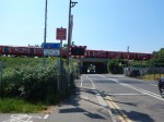
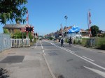
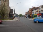
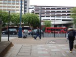
Today, I arrived at Balham station by the reliable Northern Line to get a train to Streatham Hill station to take some pictures.
The first train was cancelleed and then there was a succession of trains going direct to Streatham Common station.
Eventually, after about half-an-hour a train did turn up and I took the train the one stop and took the pictures I wanted.
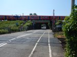
I then took a 159 bus to Streatham station, where i took more pictures.
The first train, that came went to Streatham Common station, where I took a couple of photos.
I was intending to get to Sutton, but that train appeared to be delayed. So when another train turned up that said it was going to West Croydon,I thought that would be a safe place, as I could get the Overground home.
But despite what it said on the front, it was an East Croydon train, so after a couple of stops, I got out at Selhurst station to see if it could be a terminal for The Streatham Virtual Tube.
It might be!
But then a Sutton train arrived and I thought that perhaps this might take me to West Croydon or Sutton, where I could get a train home.
We sat there like prats for perhaps ten minutes before the driver said he was waiting for a replacement. When the replacement didn’t come he took the train out of service.
An Epsom train then followed and I thought that this might get me home.
We sat there like prats for perhaps ten minutes before the driver said he was waiting for a replacement. When the replacement didn’t come he took the train out of service.
I did have a chat with a group of drivers, who were trying to get to work and they said, that it was all GTR’s fault as they were trying to cut costs.
The next train was for Caterham, so I got it to East Croydon, hoping to get a London Bruidge train.
One left as I arrived, but after fifteen minutes I was on a train to London Bridge.
Surprisingly, we got there without trouble.
I bought some food in M&S and then got a 141 bus home.
It’s not as if this sort of shambles is the only problem GTR has.
- There’s the non-working Class 700 trains!
- There’s the keeping of the Class 387 trains instead of passing them to GWR.
- There’s the dispute with the drivers.
- There’s the dispute with the conductors.
- There’s the dispute with the rest of the massed orchestras of the BBC, Birmingham, Liverpool, Manchester and Scotland. And not forgetting the Bethnal Green Big Band!
I blame the management!
Improving Lewisham Station
In the June 2016 Edition of Modern Railways, there was an article entitled Turning South London Orange.
One of the proposals is to try to sort out Lewisham station.
My mother used to tell me never to go South of the Thames as you’ll get lost. Perhaps she had Lewisham in mind, as just look at this Google Map of the lines through the station.
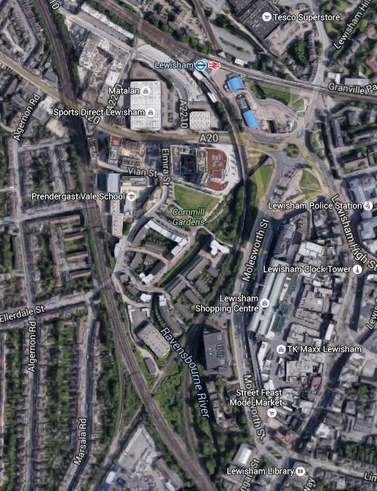
Lines Through Lewisham
The rail lines in the Lewisham area are.
- The lines to the West of the map is the South Eastern Main Line from Charing Cross to Dover and Folkestone.
- The line curving down from the station to the South Eastern Main Line is the Hayes Line, which meets it in a complicated junction.
- Going off to the East from the station is the North Kent Line.
Was the designer of the lines in this area having a laugh, as it must make running trains through Lewisham in an efficient manner extremely difficult.
I also assume that anybody going to and from Dover, can’t change trains at Lewisham, unless they an force a window and jump out.
In order to try to improve matters, the Centre for London report is proposing Lewisham South interchange platforms on the South Eastern Main Line, which are connected to the main station using a travelator running alongside the Hayes Line.
The thinking behind all this is detailed in this document from JRC consultants.
Some major points and recommendation from the document include.
- There are too many flat junctions and other track problems.
- The service levels from the area into London is erratic and nowhere near TfL’s oreferred level of four trains per hour.
- Getting to and from anywhere other than the City or Central London in the peak can be difficult.
- Connectivity to Lewisham to get the DLR to Canary Wharf could be improved.
- Southeastern’s commuter services should be taken over by TfL.
- Extending the East London Line to Lewisham wll be difficult and expensive, if not impossible.
The document also includes a map of the proposed travelator on Page 14.
It shows the travelator curving along the Eastern side of the Hayes Line to an island platform on the South Eastern Main Lines.
It also says this.
However a southern location closer to Lewisham High Street, placed over the Hayes branch line, in low value or empty land on the slow lines alongside Parks Bridge Junction and north of the Courthill loop, would permit a 12-car island platform connected into the Lewisham Interchange and making that much more of a hub station. A direct entrance to the southern part of Lewisham High Street could also be opened up. A travelator alongside the Hayes line, in several segments, would link to the interchange in 540 metres and also provide fast access to Lewisham shopping centre at an intermediate point.
This Google Map shows the area from the current Lewisham Interchange to the proposed Lewisham South.
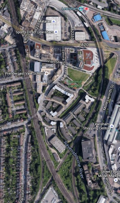
Note the blue roofs of the DLR station at the top of the map and the crossing by the South Eastern Main Line of the Hayes Line at the bottom, where it is surrounded by green space.
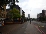
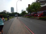
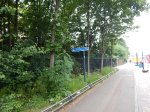
To get a better feel for the area. I took these pictures ass I walked from where the South Eastern Main Line crosses the High Street back to the station.
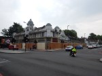
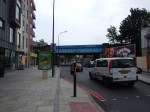
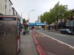

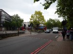
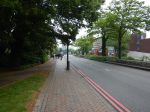

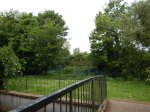
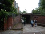
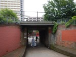
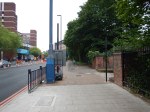
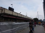
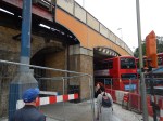
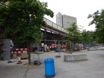
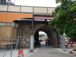
After this walk along the dual-carriageway from the Western end of Lewisham High Street to the station, I certainly think that a better walk could be created.
Let’s hope that when the current construction and road works are complete, that the current walking route between the station, the Shopping Centre and Lewisham High Street is improved.
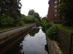
What disappointed me was that surely better use of the Ravensbourne River, which I called a Hidden Waterway in the pictures. This Google Map shows how it twists and turns through the area.
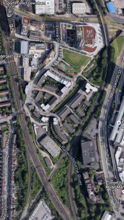
The Ravensbourne River Through Lewisham
I certainly think something better can be done.
For those who think a travelator is a bit naff, the JRC report also suggests that the DLR could be extended.
Consider.
- If it’s worth extending the DLR to Lewisham South, perhaps it should go further.
- One of the themes of the JRC report is prudence and affordability, which I think pushes the author to the travelator solution.
- The travelator route may make it easier to serve the Shopping Centre.
- A travelator might make it easier to catch the buses on the other side of the Shopping Centre, which every time I go to Lewsiham, I seem to have to do.
I also think that to extend the DLR would probably involve some impressive engineering to get over the roads by the station, whereas a walking route/travelator might even start from or beside the Hayes Line platform (2) on the bridge over the road. The latter option would mean that at the station end, all of the lifts are there for step free access to the other platforms.
I also think that not many passengers would want to transfer between Platform 1 at Lewisham station and the Lewisham South platforms, so starting the walkway from Platform 2, which has a level connection to Platform 3 and good connections to the DLR, would not be a bad idea.
Overall, I don’t think we make enough use of travelators and outside escalators.
But I do like the idea of the new platforms at Lewisham South and a travelator.
Something will have to be done at Lewisham, before the Bakerloo Line is extended to the area.
The Flying Scotsman At Victoria
In between taking pictures around Battersea, I found the Flying Scotsman in Victoria.
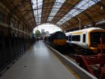
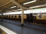
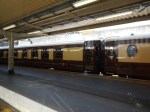
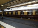
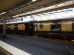
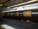
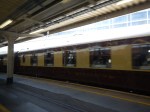
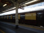
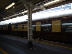
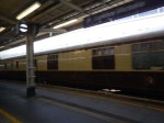
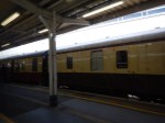
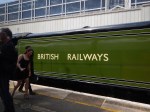
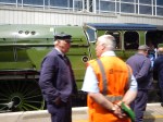
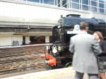

They certainly don’t seem to be wrapping the engine in cotton wool.
I travelled to Brixton with a couple, who had seen it with me. One thought it was fake!
