HS2 Does The Right Thing At Leeds
I don’t like the concept of most of the HS2 stations.
Euston, isn’t too bad, as the HS2 platforms are alongside those for the main station and I suspect that when and if I see it in reality, I will be able to arrive in the station on perhaps a London Midland train from Bletchley or Tring and just walk across to the HS2 platforms.
At some of our better interchange stations like Reading, to change trains, you go up escalators to a wide overbridge and then walk across to the escalator for the platform of your departing train. The design also allows seats and cafes in a totally non-claustrophobic environment. I have a feeling that the new London Bridge will raise the bar of this type of station even higher!
To my mind the designs for HS2 station at Birmingham is absolute rubbish and truly terrible. Birmingham is developing a local train, tram and bus network centred on New Street station, so instead of HS2 arriving into this hub, it arrives at a separate station some distance away and many passengers will have to get a tram to connect to their ongoing service.
As HS2 will run very large trains, imagine say a thousand Chelsea fans arriving on HS2 to go to a match at Villa Park and needing to get a train from New Street. You save masses of time by using HS2 and then waste it queuing for a tram.
But if HS2 arrived directly into New Street, a lot of the problems would be solved with a short walk.
In Birmingham there is no space in New Street itself, but why shouldn’t HS2 arrive in an underground station beneath New Street? Or in my preferred solution, in a giant double-ended station stretching right under the City Centre.
As they’ve got a redundant piece of Grade 1 Listed railway memorabilia, they’ll use that instead. The heritage lobby should crawl back into its hole!
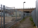
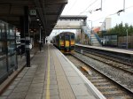
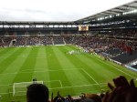
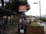
But at Leeds, HS2 have put forward a new proposal, where HS2 meets the existing station in a giant version of the way trams met the train at Nottingham.
This is the only picture I can find of the proposal. It’s in an article in Global Rail News.

HS2 At Leeds Station
Passengers arriving in Leeds would just walk to the front of the train and then they’d be over the platforms of the existing Leeds station. If that is too difficult, then I’m sure we’ll see a few travalators.
It is a much better layout than that proposed for Birmingham.
Interchange between HS2 and local services must be a short walk, assisted by lifts, escalators or travalators as required.
A Report On The Bakerloo Line Extension
Transport for London, have released a report on the Bakerloo Line Extension that they call the Option Selection Summary Report.
It is one of those worthy documents, you get from analysing the data from consultations.
But it is full of several nuggets, which although not directly associated with the Bakerloo Line could be very important for passengers coming from or venturing to South London.
They have also provided this helpful map, which lays out possible actions and improvements.
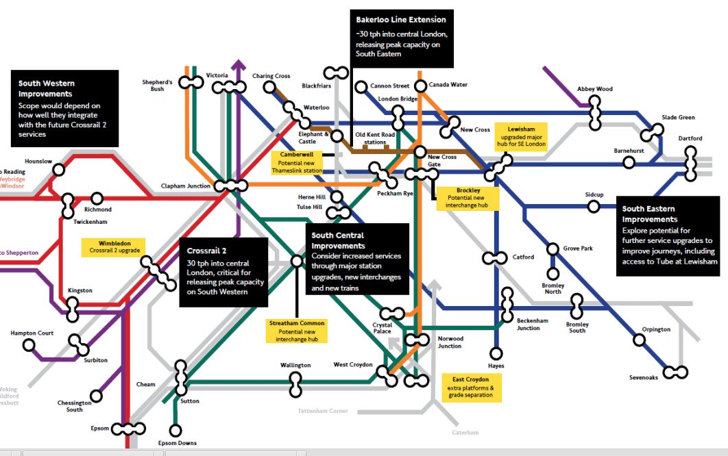
Rail Improvements South Of The Thames
I hope that the boxes can be read.
I shall deal with the various boxes in separate sections, going in a vaguely East to West direction. I will leave out the Crosrail 2 related topics for the moment.
Bakerloo Line Extension
The summary on the map says thirty trains per hour (tph) into Central London, releasing peak capacity on South Eastern. They describe the extension like this in the Executive Summary of the report.
Following the 2014 consultation, we have conducted a comprehensive assessment of the consulted route options alongside alternatives suggested by respondents and stakeholders. The work has concluded that an extension to Lewisham via the Old Kent Road is currently the best option as a first phase, as the route would serve the Old Kent Road Opportunity Area and support significant numbers of new homes and jobs for London. This would include a major new interchange at Lewisham. It is estimated that the selected corridor could enable over 25,000 new homes by serving Opportunity Areas and regeneration areas along its length.
From the map, the route of the extended Bakerloo Line, would be a simple one from the current terminus at Elephant and Castle station to Lewisham station, via two new stations in the Old Kent Road and an interchange at New Cross Gate station with the London Overground and main line services from London Bridge.
These are various highlighted points from the report.
- Assessment of the alternative route options suggested during the 2014 public consultation has demonstrated that the options towards Lewisham remain the most effective for addressing the challenges in south east London.
- An extension should serve Lewisham station due to the new homes that could be unlocked in growth areas along its route, and the wider transport connectivity and access improvements it would provide. 4.2.1. Our assessment work has found that although shor
- We currently recommend a route to Lewisham via Old Kent Road for further development as part of an initial phase for an extension. We have found that this option has the greatest potential to unlock new homes to support London’s growth and significantly improve transport provision in south east London.
- An extension via Old Kent Road would provide a step-change in the capacity, connectivity, accessibility and speed of travel for residents.
- By improving transport and unlocking new homes and jobs growth, the economic benefits of the Old Kent Road option are higher than the route via Camberwell and Peckham Rye. The latter option is estimated to be more expensive to deliver and has a lower potential of obtaining funding.
- Delivering a major transport infrastructure project is a challenging and often risky process. By integrating planning with the Opportunity Area development, the proposed route via the Old Kent Road offers the best prospect of successful delivery.
- An initial extension to Lewisham could form part of a wider package of complementary rail improvements across south and south east London, providing improved journeys via Tube and rail connections.
The report doesn’t rule out extensions beyond Lewisham. This is said.
The assessment shows there could be significant additional benefits from an extension beyond Lewisham and therefore it has not been ruled out at this stage, with further work required to develop the deliverability and case further.
Under Next Steps, this is said.
We will focus developing plans for the first phase of an extension to Lewisham via the Old Kent Road, with further public consultation anticipated in 2016.
TfL’s proposals for the Bakerloo Line Extension would appear to be simple and deliverable at an acceptable cost to give the greatest benefit to South East London.
It should also not be the most difficult line to build, as it is only three stations, with it would appear plenty of green space and cleared sites on the surface for access.
It would almost be a repeat of the Northern Line Extension, except that it is shorter.
For people like me living on the East London Line, the interchange to the Bakerloo Line at New Cross Gate will be very much welcomed, as it improves connectivity to that difficult-to-access area between Piccadilly Circus and Elephant and Castle. Try getting from Dalston to Charing Cross in the rush hour!
I think the biggest problem of this short extension, is going to be that even at an increased frequency of 30 tph, it will quickly get close to capacity.
Lewisham Station
The map also labels Lewisham station with a box saying upgraded major hub for SE London.
This Google Map shows Lewisham station.
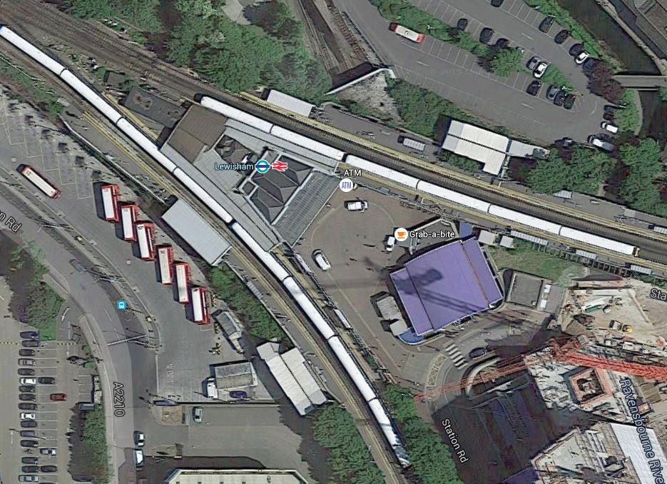
Lewisham Station
I think that there would appear space for improvements and digging the shafts for the creation of the Bakerloo Line Extension.
South Eastern Improvements
The summary on the map says explore potential for further service upgrades to further improve journeys, including access to Tube at Lewisham.
Some stations have been upgraded to a modern standard, but many still don’t have the fscilities that passengers expect these days.
Nothing is said about TfL’s long term ambition to take over the Metro services of Southeastern.
South Central Improvements
The summary on the map says consider increased services through major station upgrades, new interchanges and new trains.
I could repeat what I said in the previous section for South Eastern Improvements.
New Trains
This is very much a general point about new trains.
London’s latest train fleets are increasingly becoming walk-through from one end to the other.
Passengers are also getting very savvy in their train usage and often board a train in a coach, that will be close to their exit at the destination.
And if they get on at the wrong point, they will often walk to their desired exit position, before the train stops.
So could this be used to advantage in the design of stations, with more perhaps having multiple exit points, as do some Crossrail stations?
Brockley Station
The map also labels Brockley station with a box saying potential new interchange hub.
This Google Map shows Brockley station.
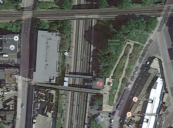
Brockley Station
The Bexleyheath Line between Nunhead and Lewisham stations crosses the East London Line and Brockley station at a high level.
I wrote A Four-Poster Station about connecting these two lines.
It would appear that Transport for London have advanced this project from one word in their 2050 Infrastructure Plan to a proposal.
This is the sort of connectivity, that us plebs in Dalston will like a lot. From 2018, as I wrote in Increased Frequencies on the East London Line, there will be ten services per hour between Dalston Junction and Brockley stations and one change at Brockley, will open up many transport opportunities.
East Croydon Station
The map also labels East Croydon station with a box saying extra platforms & grade separation.
This Google Map shows East Croydon station.
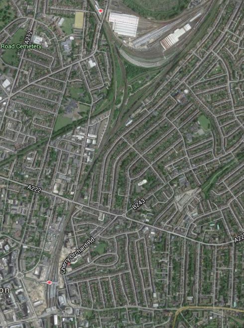
East Croydon Station
The station is towards the bottom of the map and the semi-circular shape at the top is Selhurst Depot.
There is a large section labelled Future in the station’s Wikipedia entry and given the legendary congestion and the large expansion plans for Croydon, I think it is highly likely that expansion of the station and grade separation will go ahead even if the Bakerloo Line Extension doesn’t!
Camberwell Station
The map also labels the now-disused Camberwell station with a box saying potential new Thameslink station. The TfL report says this.
Similarly, we are working with Southwark Council to look into the re-opening Camberwell station on the Thameslink line to improve access into Central London and support local development.
This Google Map shows the area around the disused station.

Camberwell Station
Camberwell station used to be where Camberwell New Road crosses under the railway.
The TfL report makes these points.
- Camberwell has no direct rail connection.
- A two-branch extension of the Bakerloo Line; Old Kent Road and Camberwell, will be very costly.
- A Thameslink station at Camberwell, would serve the same area as an Underground station and is a much more affordable option.
The TfL report gives this concise summary.
A new station at Camberwell would be a significantly lower cost option to a Tube extension, whilst serving the same catchment area. Investigations show significant journey time improvements could accrue to Camberwell passengers and that operationally there may be scope to integrate re-opening of the station into the launch of the completed Thameslink programme.
We will therefore undertake further planning work with Network Rail and the London Borough of Southwark to assess the proposal.
I would be very surprised if the Bakerloo Line Extension calls at Camberwell.
I would also suspect that being able to open a new Ca,berwell station, at the same time as Thameslink, would be very easy to justify on a costs basis.
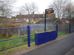
Streathham Common Station
The map also labels Streatham Common station with a box saying potential new interchange hub.
This Google Map shows Streatham Common station.
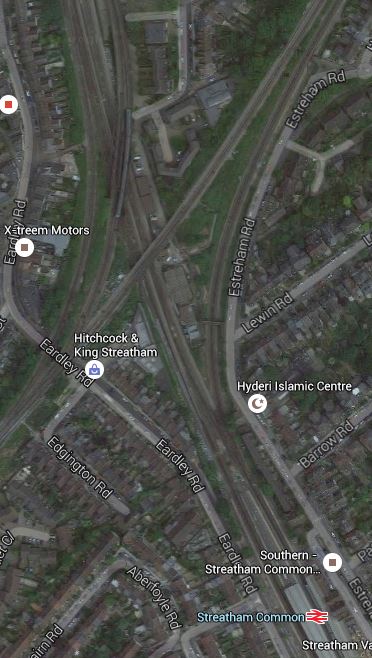
Streatham Common Station
Wikipedia introduces Streatham Common station with these words.
The station is managed by Southern who also operate trains from the station. Direct trains from the station run to Victoria, London Bridge, East Croydon, Shepherds Bush, and Milton Keynes Central. Southern consider the station to be the 6th busiest station on their 158 station network as it receives 12,932 passenger journeys a day, totalling 4,655,520 per year. The Office of Rail and Road figures are lower at 3,827,296.
The station has four platforms, but only platforms 1 and 2 are in daily use; platforms 3 and 4 are normally for passing Express trains, but they are occasionally used during engineering work or major disruption. Step free access to both platforms and both station entrances is available.
Just to the North of the station, is the Sutton Loop Line of Thameslink and I suspect that Streatham Common is mentioned in TfL’s report, is that they have a cunning plan to link the various lines in the area together.
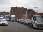
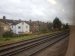
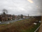
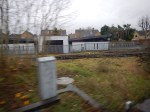
To try to get a better feel of the area, I took a train to Streatham Common station, walked to Streatham station and then took a train to Micham Junction, which travelled across Streatham Common station. I took these pictures.


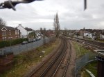
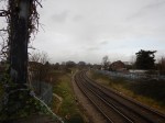


My walk showed me how complicated the lines are in the area and that is emplasised by this Google Map of the junction.
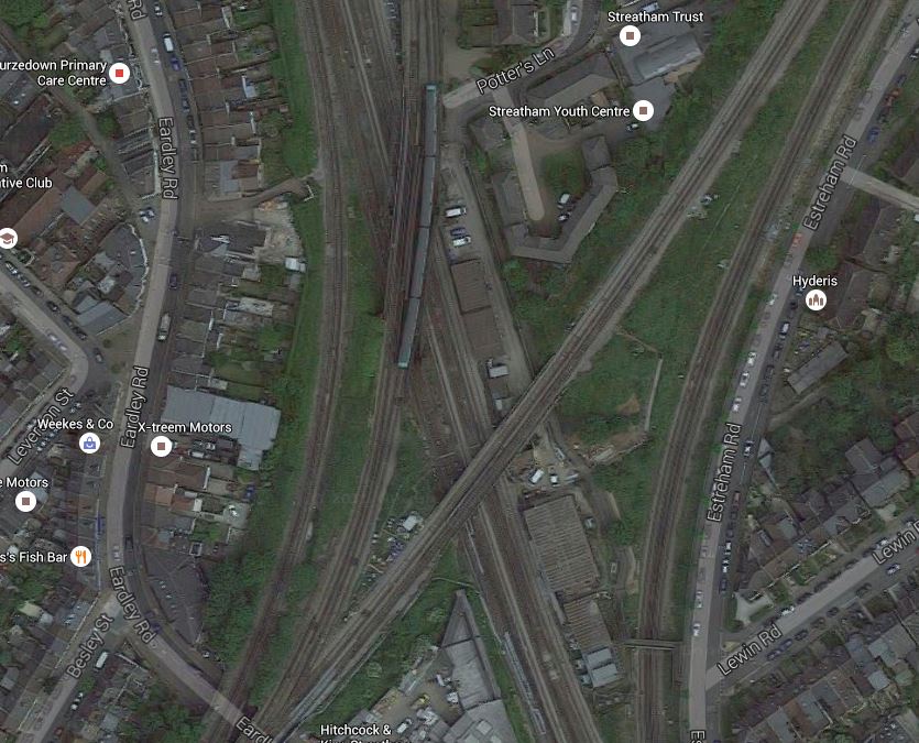
A Tangle Of Lines
I do wonder if there are operational problems in Streatham, that perhaps necessitate a bit of a sort out.
It’s also not an easy walk between Streatham and Streatham Common stations because there is a massive Tesco Extra blocking the walking routes. It certainly follows Tesco’s tradition of trying to create some of the ugliest buildings in the UK.
My other thought, is that the space around the railway lines is quite generous and are Network Rail looking to create some more housing around the junction.
I think that any plans that Network Rail have for Streatham will be revealed in due course.
Conclusion
I think Network Rail, Transport for London and others have decided to bundle a lot of smaller projects under the umbrella of the Bakerloo Line Extension, with the intention of getting value-for-money, that delivers a lot of improvement in an ordered manner in a short timescale, all over South London.
It could be described as the following.
- One large billion pound project to create the actual Bakerloo Line Extension.
- One large project, possibly with a property developer, to sort out East Croydon station.
- Three mid-sized projects to create the Brockley and Streatham Common interchanges and Camberwell station.
- A lot of small projects to create quality stations all over South London.
- Some new trains as required.
So there would be something for everybody. Even the man on the Clapham omnibus!
But who knows?
A Gatwick Express At An Unexpected Location
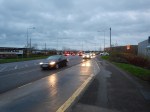
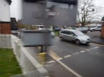
When I went to Milton Keynes to take the pictures for Platform Space At Milton Keynes Central, I was surprised to see one of the new Class 387/2 trains, replendent in the red Gatwick Express livery going the other way.
As I was drinking a hot chocolate, I didn’t get a picture, but there is a YouTube video of a Class 387/2 at Crewe.
The train is also seen to be wearing pantographs to get its electric power.
This article in Rail Magazine explains the sighting. This is said.
The ‘387s’ being commissioned are 387104 and 387129. They were moved from Derby Litchurch Lane to Bletchley on April 8 and April 20 respectively. They will be tested on the West Coast Main Line, driven by Freightliner Heavy Haul drivers, after which they will move to Brighton Lovers Walk ready for their entry into traffic.
The article refers to the older Class 387/1 trains. But obviously to test an 110 mph train, you need a fast line.
The Class 387/2 seen at Crewe, could of course have been on a sales demonstration, as surely the configuration of a Class 387/2 Gatwick Express, with lots of space for luggage and families, would be ideal for services to and from Manchester Airport.
The Bletchley Flyover
The Bletchley Flyover is a large flyover that allows trains to cross the West Coast Main Line at Bletchley station.
This Google Map shows the area of Bletchley station and the flyover.
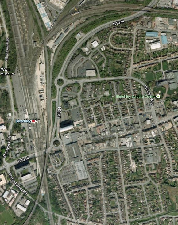
Bletchley Flyover
The double-track Bletchley Flyover starts in the South-West corner of the map and crosses the West Coast Main Line at an acute angle before, splitting into two separate double-track lines, alongside the station and north of the circular roundabout.
- One branch goes North along the West Coast Main Line to Milton Keynes.
- One branch goes East along the Marston Vale Line to Fenny Stratford and Bedford.
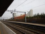
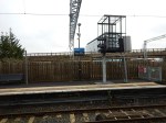
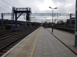
It is a massive structure as these pictures show.

I think the problems of incorporating the following services through Bletchley are going to be challenging.
- Oxford to Milton Keynes
- Marylebone to Milton Keynes via Aylesbury.
- Oxford to Bedford.
- Freight Services.
This section in the FAQ of the East West Rail web site is entitled What train services will run on East West Rail (Western Section)? It says that frequencies of one train per hour will be run, but that more information will be released in 2016.
Will one probably four car train per hour be enough?
This would mean that two trains per hour would visit Milton Keynes. As Platform 2A at Milton Keynes Central can accommodate five car trains and it is electrified, it would appear that that station is ready for the East West Rail Link.
The difficulty also depends if the passenger services stop at Bletchley.
The current plans talk of two high-level platforms on the flyover.
This enlarged Google Map shows the platforms and footbridge at Bletchley station and the flyover.

Bletchley Station Platforms And The Bletchley Flyover
Note.
- The entrance to the station is on the west side.
- The two island platforms are 2/3 and 4/5, with two outer platforms 1 and 6.
- Trains on the Marston Vale Line terminate in Platforms 5 and 6.
- The flyover is the easternmost pair of lines.
- It splits into the Milton Keynes and Bedford lines level with the footbridge.
- The two proposed high-level platforms would be on the narrower part of the flyover, south of the footbridge.
A second entrance to Bletchley station has been proposed for the east side in Saxon Street.
One other thing that could help, is there are aspirations to move the concrete plant out of its location between the flyover and Bletchley station. It is certainly no asset to the area.
The following train services, would appear to have to use the flyover.
- Oxford to Milton Keynes
- Milton Keynes to Oxford
- Marylebone to Milton Keynes
- Milton Keynes to Marylebone
If trains between Oxford and Bedford, didn’t need to call at Milton Keynes, they would also be able to go straight over the flyover.
If they did need to call at Milton Keynes, then a train from Oxford to Bedford could take the following route.
- Over the flyover taking the branch to Milton Keynes.
- Call at Milton Keynes in an appropriate platform.
- Reverse out and then call in either Platform 5 or 6 at Bletchley.
- Reverse out and then take the Marston Vale Line.
Effectively, they would call at both the new high-level and current platforms at Bletchley station.
If I was running a train service from say Norwich or Ipswich to Oxford, to maximise my passenger levels, I would want my trains to call at the following stations.
- Cambridge
- Bedford – To also connect to services to Nottingham and Sheffield.
- Milton Keynes – To also connect to services on the West Coast Main Line.
The FAQ says that trains between Oxford to Bedford would not go to Milton Keynes.
I know that passengers would complain, if they had to stand on a draughty Bletchley station for say ten minutes, whilst waiting for a train to Milton Keynes, to get their Glasgow train.
To further complicate matters will other services could want to go between Milton Keynes and Bedford. On current plans, it is probably impossible without a reversal of direction at Bletchley.
A perfect design, would have a double-track chord connecting the Marston Vale Line to the Northbound West Coast Main Line.
Report from Sir Peter Hendy to the Secretary of State for Transport on the Replanning of Network Rail’s Investment Programme
This report is crucial to a lot of reconstruction work continuing on railways in parts of the UK.
I’ve put the link, so I can find the report easily.
Here’s a taster of what the report contains.
This extract is entitled Case study – Aristotle Lane, Oxford and talks about the problems of closing a private level crossing in Oxford.
Network Rail planned to install a replacement footbridge over the Oxford to Banbury Line north of Oxford Station and close an adjacent private level crossing for safety reasons. People walking from a nearby car park, across some allotments to the other side of the tracks, used the level crossing. The new bridge will have a link to the allotments removing the need for people to cross the tracks.
The level crossing is not a public right of way and the rights to use it are owned by Oxford City Council. As part of the East West Rail (phase 1) improvement scheme, Chiltern Railways made an application in 2009 to close the level crossing as part of a wider project to upgrade the railway line.
Objections from allotment holders at the Public Inquiry meant that the approval was not granted. This meant that Network Rail needed to pursue a separate planning application in order to complete the work and deliver Marylebone to Oxford services.
Efforts to close the crossing and deliver the scheme continued. Meetings were held in 2012 between Network Rail, ORR and the Council to find a solution. Finally, in 2014 the principle to close this one level crossing was granted, but with the conditions that Network Rail had to fund and construct better access to the allotments, arrange a land swap so the local school could be expanded and to fund and build a new car park. All of these require further, and separate, planning permissions.
A planning application was submitted in May 2014 and approved a year later after three separate planning committee presentations. Construction of the bridge is now planned to start in January 2016 with completion in September 2016. The level crossing will then be closed seven years after the first application.
Kafka is certainly alive and well and living in Oxford.
For more information on this fiasco/farce/cock-up/vexacious litigation/waste of money (delete as appropriate!) read this article in the Oxford Mail, entitled Network Rail changes its plan for new Aristotle Lane bridge after protests.
Some of the comments are priceless.
I am very much of the opinion that all level crossings should be shut on safety grounds. If there are serious objections, then surely the railway should be closed until an agreed solution is negotiated.
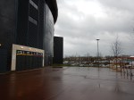
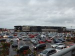
A Better Experience In Milton Keynes
Milton Keynes has never been my favourite place, since I used to take my late son; George, to his boarding school, which inevitably meant a trip round the endless roundabouts. I was then mugged in the city by the street furniture, that I wrote about in A Pedestrian-Unfriendly City.
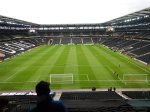
So when Ipswich were playing MK Dons, I thought I’d give the city one more chance.


These are a few observations.
- The London Midland train was filthy and swimming in beer. I would assume it was supporters going to London.
- There is no information at Milton Keynes Central station, as to how you get to the ground.
- Bus 1 from Milton Keynes Central station, drops you just a rather cluttered short walk from Stadium MK.
- There are no signs or maps for Away supporters, as to what is the best route.
- Someone told me, that if you drive to the ground, parking costs £7 and you have to pay on-line.
- I’ve never been to a British stadium before, where burger vans and tea stalls outside the ground, were conspicuous by their absence.
- Several of the larger restaurants outside serve gluten-free food.
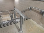
- The stadium has some of the best handrails I’ve seen in a ground.
- Coming back I just missed a bus and had to wait half-an-hour for the next small but full bus in a freezing cold shelter. I’d have taken a taxi, but there was no sign of a taxi rank.
I’ve never seen a ground, where it is assumed that everyone comes by car or supporters coach before.
I would have been distinctly miserable if Ipswich hadn’t won!
Milton Keynes is going to have to improve the buses. The number one bus, that I caught links Stadiujm MK and Milton Keynes Hospital to the stations at Milton Keynes Central and Bletchley.
This Google Map shows the area of Milton Keynes.
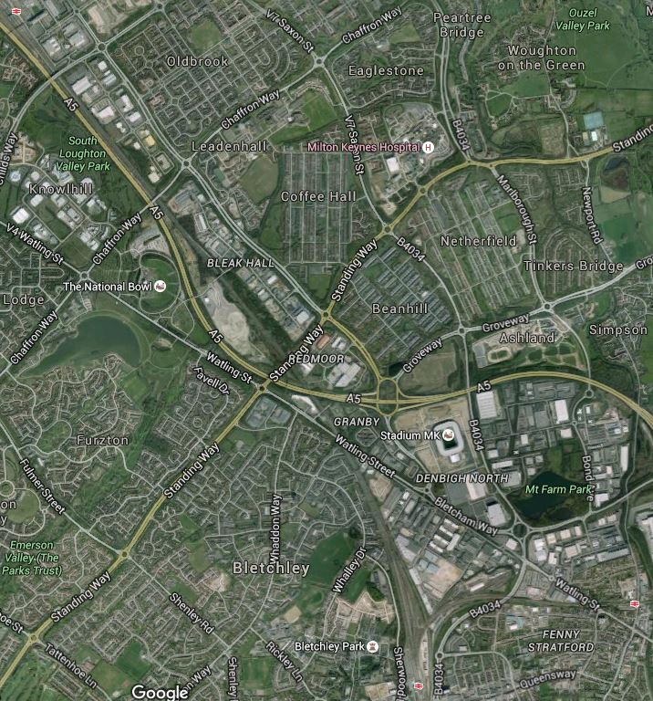
Milton Keynes Stations, Stadium MK And The Hospital
Milton Keynes Central station is in the North West corner, with Bletchley station st the bottom. The other station at the right is Fenny Stratford station on the Marston Vale Line, which will be incorporated into the East West Rail Link.
This map shows the route of the proposed line.

East West Rail Link
Wikipedia talks about extending the Marston Vale line to Milton Keynes Central, but although the track has been created, no trains have run.
Chiltern are also looking to extend their Aylesbury service to Milton Keynes Central via Bletchley, so hopefully this might prompt improvement in the bus services to Stdium MK and the Hospital.
I doubt it will, as Milton Keynes is one of those places where you’re a total loser, if you don’t have car and why should their taxes provide for better bus transport for the disabled, elderly and those that can’t drive.
I think we need a law in this country, that every hospital should have at least a four buses per hour direct service to the main railway and bus stations.
Towards A Thames Valley Metro!
After my visit yesterday to Twyford Station and the Henley Branch and today to The Marlow Branch, I think something bigger could be emerging.
On the Great Western Main Line, between Paddington and Didcot, there are several branch lines and other more major routes that run local services into Reading and/or Paddington.
Taken in order from Paddington, they are.
- Acton to Northolt Line – 11 miles – Rather a leftover line that gets used for all sorts of traffic, including freight, diversions and driver training.
- Greenford Branch from West Ealing – 2.7 miles – Another leftover line, that is being rerouted to a bay platform at West Ealing – Could be transferred to the London Overground.
- Brentford Branch Line – 4 miles – Freight only
- Staines and West Drayton Line – 5.5 miles – Freight only.
- Windsor and Eton Branch from Slough – 2.5 miles
- Marlow Branch from Maidenhead – 7.15 miles – I wrote about it in The Marlow Branch.
- Henley Branch from Twyford – 4.5 miles – I wrote about it in Twyford Station and the Henley Branch
- Waterloo to Reading Line – Electrified, but links to the North Downs Line for Gatwick Airport, which isn’t!
- Reading to Basingstoke Line – To be electrified, with possibly some extra stations.
- Cherwell Valley Line from Didcot Parkway – To be electrified.
What follows are my observations.
Class 387 IPEMU Trains
Great Western Railway is to receive twenty-nine Class 387 trains from Thameslink and eight new ones from the factory.
These could easily be upgraded to IPEMU variants by the addition of batteries.
Once the power is switched on as far as Didcot Parkway station, I suspect that all these mainly short branches could be run using IPEMU trains, if passenger services were required or required to be run by electric trains.
Some like Greenford, Windsor and Eton, Marlow and Henley, would be as now, one train per branch. But elderly two car diesels would be replaced by new four car electric trains with a superior performance.
In Rumours of Battery Powered Trains, I reported on an article in Modern Railways magazine, which speculated that the extra Class 387 trains were to be IPEMUs and that they could be used on routes like Bedwyn and Oxford.
So it’s not my speculation!
Electrification Of The Branches
Some of the branches like Marlow Branch with its unusual layout and the Bourne End bridge and Windsor and Eton Branch with the historic nature of where it goes, will not be straightforward, as I suspect the heritage lobby will have a field day. As I wrote in Why We Should Use Independently Powered Electric Trains, the opposition to electrification in sensitive areas is stirring.
Electrification of the Greenford Branch might be more straightforward, but with five stations and a terminus in a bay platform at Greenford, I would suspect that a dedicated Class 387 IPEMU would cost less and only require the bay platform at West Ealing station to be electrified.
North Downs Line
In some ways, the North Downs Line is the most interesting, as I think that a dual-voltage IPEMU could easily supply a high quality service between Reading and Gatwick.
At present the direct service is hourly and takes around eighty minutes, using a two car Class 156 train.
Reading to Gatwick by Crossrail and Thameslink could on current figures and predictions for Crossrail times, take a few minutes over a hundred.
So the current direct route is quicker now with Class 165 diesel trains!
What difference would a faster four-car electric train make?
Crossrail’s Effect On The Great Western Main Line
The biggest effect will be when Crossrail arrives at all stations on the Great Western Main Line from Paddington to Reading.
Stations like Slough, Maidenhead and Twyford, where branches connect, will see a positive effect, as I suspect that more connections to and from the branches will be easier and involve less waiting.
Improving Services On The Branches
I think we could see some reorganisation of the services on the branch lines to give increased frequencies?
I think if Great Western Railway take the IPEMU route instead of electrifying the branches, there is scope for providing improved services from Slough to Reading and on the branches in the area. Diagrams could be arranged that after trundling down a few branches, the IPEMU did a section on the electrified lines to charge the batteries.
On thing I noticed on my trip to Marlow, was that Network Rail seem to be installing a lot of bay platforms at Crossrail stations. Some are London-facing for flexibility in the Crossrail schedules, but some are facing the other way. Could Network Rail be thinking out of the box and making sure, they don’t compromise any possible future services?
Reading As An Important Hub
As the routes develop, it would almost be like a Thames Valley Metro centred on the extremely well-connected Reading.
- Great Western Railway to Wales, the West Country and London
- Crossrail to London and beyond.
- Cross-Country Trains to the South, Midlands and North
- In a few years time the East West Rail Link could join Reading to Oxford, Milton Keynes, Bedford and the East.
The Class 387 IPEMU trains could serve the following stations from Reading, with very little extra electrification and perhaps the odd curve or two.
- Basingstoke
- Bedwyn
- Gatwick Airport
- Heathrow Airport
- Henley-on-Thames
- London Paddington
- Marlow
- Newbury
- Oxford
- Windsor and Eton Central
- Wokingham
If the Marlow Branch were to be extended, the trains could even reach High Wycombe.
Reading is going to have a very interesting time!
The Marlow Branch
After my exploration yesterday of Twyford Station And The Henley Branch, I felt I had to explore one of the other branches today.
So I took the Great Western Railway to Maidenhead station and went up and down the Marlow Branch Line.


Unlike at Twyford, where you have several minutes to make the connection, at Maidenhead, I only had a couple, so pictures of Maidenhead station are a bit sparse in the gallery. However, I did take some others in Before Crossrail Maidenhead Station.
Much of what was said about the Henley Branch applies to the Maidenhead Branch.
- It is a short branch of just over seven miles with a change of direction in the middle at Bourne End station.
- An IPEMU would appear to be more than capable of providing a service on the line.
- At a quick look, it would appear that the platforms at Bourne End, Cookham, Furze Platt and Marlow stations could easily be made long enough for a four car train.
- The line has several level crossings and a couple of low bridges, that could cause problems with traditional electrification.
- Bourne End Railway Bridge is an historic bridge and I doubt that the heritage lobby would allow it to be electrified using overhead wires.
Operation
One almost unique quirk of the line is that the reversal of direction at Bourne End, where the driver has to walk to the other end of the train.
The Class 165 train is over twenty years old and was built before trains had modern control and wi-fi systems. Surely, a modern train could be driven from the rear, using CCTV for forward vision between Bourne End and Marlow.
Extending From Bourne End To High Wycombe
I think that it is true to say, that a lot of people would be very pleased if the branch line still continued past Bourne End and on to High Wycombe station.
This Google Map shows Bourne End station.
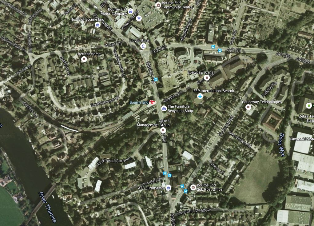
Bourne End Station
Note how the line from Maidenhead comes in from the South West and the line continues to Marlow along the river after the change of direction. The former line to High Wycombe is visible as a green scar going off to the North East.
I certainly think that the ambitious natures of Chiltern Railways, Great Western Railway and Crossrail/Transport for London will mean that this extension to effectively make High Wycombe one change away from Crossrail will be seriously looked at by the train companies.
If You Think Network Rail Have Got Problems
I found this article on Global Rail News entitled Sweden’s longest rail tunnel finally opens.
The article is about the nine kilometre long, Hallandsås Tunnel. This is said.
The €1.2 billion Hallandsås Tunnel was finally opened by Sweden’s Minister for Enterprise and Innovation, Mikael Damberg, and Trafikverket director general Lena Erixon on December 8.
Construction had started in 1992.
So I looked up the Wikipedia entry for Hallandsås Tunnel. It is certainly an epic saga of biblical proportions.
This is a section entitled 1990s: Problems, scandal, and stoppage.
Construction began in 1992, and the traffic opening was originally planned for 1995. However, construction was plagued by major difficulties concerning large amounts of water seeping in from surrounding rock, only a small fraction of which had been foreseen. Additionally, the original drill, which was said to drill 100 meters per week, broke down after drilling only 18 m (59 ft). The rock was too soft, so the machine could not use it to pull itself forward. The contractor tried to drill traditionally, but had to spend a lot of effort on sealing the water leaks. The contractor went bankrupt and a new contractor, Skanska, was contracted. The new contractor had similar trouble but a better contract that gave compensation for troublesome rock conditions.
A scandal broke out when it was learned that a poisonous sealing compound Rhoca-Gil was used during construction. This substance was linked to the death of nearby livestock. Rhoca-Gil contains acrylamide, a toxic chemical that is mutagenic and possibly carcinogenic. The main contractor, Skanska, took no special precautions for the sealant, nor did it tell its own workers or the local population of the risks. By October 1997, local cattle and fish started dying and workers were becoming ill. The local press started an investigation. After tests were done showing high levels of acrylamide contamination, the site was declared a high risk zone and the sale of agricultural products from the region was banned. Skanska, along with Rhone-Poulenc and Swedish Railways all had criminal charges brought against them; some senior executives resigned as a result.
Construction was halted in late 1997. By this time, nearly 3 km (1.9 mi) had been bored in each tunnel: 1,200 m (3,937 ft) at the north end, 1,700 m (5,577 ft) at the south end, and 40 m (131 ft) at the central adit).
Wikipedia also says this about the cost of the tunnel.
Cost overrun has been large. The cost was expected in 1992 to be 1 billion Swedish krona (SEK). The cost from 1992 to 1997 was in reality more than SEK 2 billion, for less than half the tunnel length. Since the remaining cost at the beginning of 2005 was calculated to be more than SEK 4 billion, there was initially much debate and hesitation as to whether to halt or resume work. The total cost is likely to reach over SEK 10.5 billion (approximately 1.25 billion USD as calculated in 2015), before the project is finished.
Network Rail’s problems at Farnworth tunnel were tiny by comparison.
Has The Government Parked Its Trains On Nicola Sturgeon’s Lawn?
The government has just published a document entitled Government intends to award Northern franchise to Arriva Rail North Ltd, and TransPennine Express franchise to First Trans Pennine Express Ltd.
The document starts like this.
The government promised passengers in the north and Scotland a world class rail service that would make the Northern Powerhouse a reality – today that is being delivered as new contracts for Northern and TransPennine Express franchises are awarded.
In some ways the proposals for Scotland are the most interesting.
Introducing new and additional services for Scotland, including a new, direct Liverpool to Glasgow service from December 2018 with new electric trains and extending existing services beyond Newcastle to Edinburgh from December 2019, and bringing in additional services from Manchester to Glasgow and Edinburgh from December 2017.
These will mean new electric trains and First TransPennine will be ordering forty-four new five-car trains.
I think the announcement will go down well in Scotland, although some politicians and others might be a bit miffed.
