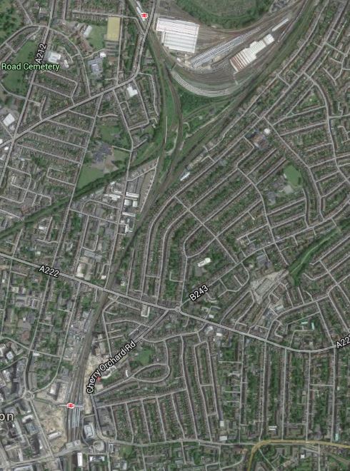
Small-Scale Connectivity To Crossrail
I live about twenty-five minutes from my nearest Crossrail station at Moorgate on a 141 bus and as I walked around today, I just wondered what will be the best way to access London’s new East-West rail line when it opens in a few years time.
So what do I mean by small-scale connectivity?
I think it is best defined as any method that isn’t more than perhaps ten stations on heavy rail, light rail, the Underground or trams.
And of course, you might substitute Thameslink for Crossrail! Or if you don’t live in London, it could be your major cross-city line.
So in my case, the following would be small-scale connectivity to Crossrail.
- Walking
- Cycling
- Car
- Taxi
- Bus
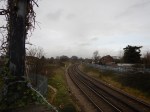
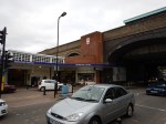
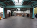
I do have a heavy rail link to Crossrail in the form of the East London Line between Dalston Junction and Whitechapel, so that will be included as it is only a short stretch of line of four stations.
These are the methods available to me in Dalston.
Walking
For good connectivity, the walking routes around a station should be properly mapped and signposted on a physical wayfinding system, like Legible London used all over the capital.
I also think it is essential that a common format is used, along a line.
So this probably means that London will decide how walking maps and signposts at Crossrail stations in Essex and Berkshire will look.
Will that be acceptable to towns and cities, that have called in consultants to design their ideal wayfinding system?
One problem with wayfinding systems, is that in some places the locals who know the city or area well, say they don’t need the system and think it a waste of money.
You also have the problem in areas with more than one local authority, that each go their own way, rather than agree on a common system.
Remember too, that London is so large, that the average resident finds themselves regularly in an area of the city they don’t know. So Londoners on the whole are very pro-Legible London.
I feel that we need to impose the same wayfinding system all over the UK.
Cycling
Just as there should be good walking routes to a station, the cycling routes should be obvious and well-signposted.
And if bikes are provided for hire at the station, the payment system must be compatible with London’s.
Perhaps we need a nationwide bike hire system?
Car
Many people will want to drive to their local Crossrail station and park their car before they get the train.
i have a feeling that when Crossrail opens, the biggest complaint will be the lack of car parking at stations.
Taxi
For about the last three months, I’ve been suffering badly from plantar fasciitis and because of the limited mobility, it gives me at times, I now feel very strongly that every Crossrail station, should have a proper black taxi rank.
Recently Transport for London have announced that one of my local stations; Highbury and Islington, is going to have a taxi rank. I have yet to find a taxi driver who is against the idea and I believe this could be a winner for both passengers and black cab drivers.
Bus
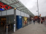
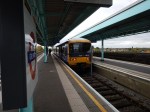
Every London rail and tube station is a bus hub with its own spider map, which details all of the buses and their routes from the area. This is my lovcal bus spider map for Dalston.
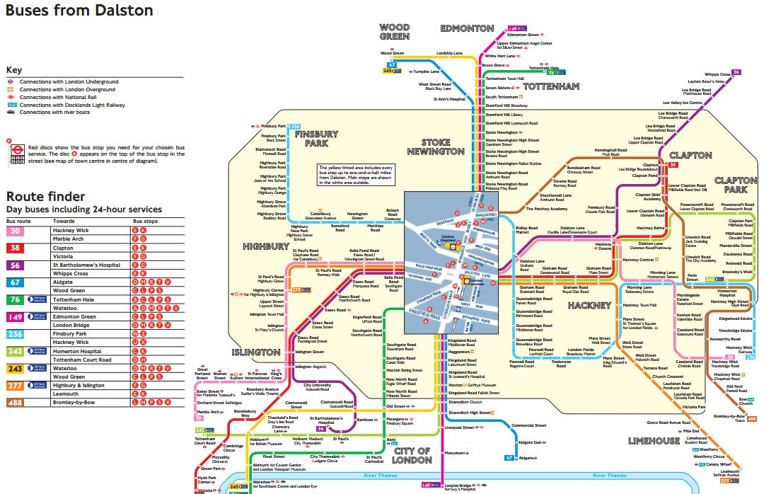
Dalston Bus Spider Map
Venture outside of London and in many places, bus mapping is often missing or very bad to give it the benefit of the doubt.
As with walking maps, local authorities outside of London with a Crossrail station, will have to adopt London’s system.
Other Rail Lines
Crossrail does connect to quite a number of heavy rail, Underground and Overground Lines.
- Bakerloo Line
- Central Line
- Circle Line
- District Line
- East London Line
- Great Eastern Main Line
- Great Western Main Line
- HS1 – After extension to Gravesend
- HS2 – After Old Oak Common
- Jubilee Line
- Metropolitan Line
- North Kent Line
- Northern Line
- Northern City Line
- North London Line
- Thameslink
- West Anglia Main Line
- West Coast Main Line – After extension to West Coast Main Line
- West London Line
I have included links to extensions to Gravesend and the West Coast Main Line and Old Oak Common in this list.
Small Branch Lines
But it also connects with several smaller branch lines or perhaps in the future, some tram and light rail lines.
- Abbey Line – After extension to West Coast Main Line
- Brentford Branch Line
- Croxley Rail Link – After extension to West Coast Main Line
- Greenford Branch Line
- Henley Branch Line
- Marlow Branch Line
- New North Main Line
- Reading to Basingstoke Line
- Romford to Upminster Line
- Shenfield to Southend Line
- Slough to Windsor and Eton Line
- Staines and West Drayton Railway
- Waterloo to Reading Line
I believe that Local Authorities will develop these smaller lines and create others to maximise their benefit from Crossrail,
A Metro In The East
The two lines that I think have the most likely chance of being developed, are the Romford to Upminster and Shenfield to Southend Lines.
- The main line rail company; c2c, is very ambitious.
- In the next couple of decades, South East Essex will be an important economic growth area.
- Better links are needed to Southend Airport and the London Gateway.
- There is substantial development of jobs, housing and leisure opportunities in the areas the lines serve.
- Give the people of Essex an opportunity and they embrace it fully.
I wouldn’t be surprised to see a substantial metro network created in the area, based on Billericay, Shenfield, Southend and Thurrock.
A Metro In The West
If a metro network can be successfully developed at the eastern end of Crossrail, is there the potential of creating something similar at the western end?
Consider.
- Heathrow dominates thinking in West London and feels that everybody should jump to its tune.
- Heathrow should wake up to the fact that it will never get a third runway, as London’s electorate will always vote to block this.
- There will always be a Heathrow, but in time, it will cease to dominate the air travel market in the UK, as it does now!
- Heathrow has very limited rail connections to Basingstoke, Reading and the West.
- If you look at the list of small branch lines, several are clustered around the western end of Crossrail, with its two hub stations of Slough and Reading.
A metro in the west could be developed based on hubs at Basingstoke, Heathrow, Slough and Reading. The Windsor Link Railway is surely thinking along those lines.
A Metro In The South East
Of all the stations on Crossrail, Abbey Wood is one of the most disappointing.
As a terminus for Crossrail, that connects to the North Kent Line and to services to South East London and the Dartford area, four platforms doesn’t seem enough, when you compare the station to the other terminals of Reading and Shenfield.
Transport for London have proposed that the Gospel Oak to Barking Line could cross the river to serve Abbey Wood and if this should happen, there must be opportunities to create another metro system based on Abbey Wood.
A Metro In The North
There are proposals to extend Crossrail to Milton Keynes from Old Oak Common.
This would surely, bring in the possibility of a network of local lines based on Watford.
- The Abbey Line is one of those difficult-to-run lines, that needs substantial improvement.
- The Croxley Rail Link could be expanded to serve Amersham.
- Local services on the West Coast Main Line and the Watford DC Line are very crowded.
This will only be developed once Crossrail serves Watford.
Conclusion
Crossrail in 2030, will be an entirely different line to that being created today.
Improving London’s Transport In Small Ways
I feel there are two ways of getting more out of London’s crowded transport system.
The first is the obvious ones of capital projects, which at the top end is Thameslink, Crossrail and Crossrail 2, and at the bottom end it is projects of the order of small numbers of millions, which might include.
- Remodelling major junctions like Archway, Elephant and Castle, Highbury Corner and Old Street.
- Reorganising bus routes around train and Underground stations, with more shelters and better information.
- New and rebuilt stations like Crystal Palace, Deptford and Lea Bridge
- Inclined lifts like that installed at Greenford.
- Step-free access at stations like Clapham Junction, Gospel Oak, Honor Oak Park, New Cross and South Tottenham.
I’m sure that new technology epitomised by the inclined lift at Greenford, will increasingly be seen.
But with any complex system, there is always improvements to be made in small ways.
The recent extension of contactless cards to Gatwick Airport, could be the sort of improvement, that increases ridership on the trains to the airport and is very much a win for the airport, the train companies and passengers alike.
We need more small improvements to London’s transport system to squeeze more capacity and improved efficiency out of the network.
1, London’s Airports And Other Places Should Have Contactless Ticketing
Heathrow, Luton and Southend Airports will join City and Gatwick in coming within London’s contactless ticketing network.
But why stop at just airports?
I feel that within a few years, the following will be within London’s contactless ticketing area.
- Chafford Hundred for the shopping at Lakeside.
- Ebbsfleet International for trains to Europe.
- Greenhithe for the shopping at Bluewater.
- Thorpe Park and other places for the fun!
- Windsor and other places for the tourists!
The benefits to residents, tourists, business and train companies won’t be small.
I suspect that as the contactless ticketing network grows, attractions and towns outside the area, will be enthusiastic to join and might even bribe Transport for London.
2. Buses Should Trial Entry Through All Doors
The bus journey I do most commonly is to get a 38 or 56 bus between my house and the Angel, where I tend to do my food shopping.
The 38 route uses New Routemasters with three doors, all of which can be used for entrance and exit, whereas on the 56 route, standard two door buses are used, where you enter through the front door and exit through the one in the middle.
There is no question that the Routemasters get through a typical stop quicker, as drivers and passengers use their brains to get on and off the bus as fast as possible. However, on the standard buses, threading a push-chair into the middle of the bus can be difficult and time consuming.
I think that an experiment should be trialled, where in perhaps areas, where there are a lot of Routemasters, passengers can board the standard buses from the middle door and touch-in on a convenient reader.
Obviously, it would be open to fraud, which is why an experiment would have to be performed first. But from several years of watching passengers on New Routemasters, I don’t think losses would be substantial. Many a time, I’ve seen passengers collectively stare at another passenger, who didn’t touch in! It’s East London peer pressure at work!
Remember too, that the doom-mongers of the left, felt cashless buses and contactless payments would be a disaster and discriminate against the poor. Try finding an incident, where someone was severely inconvenienced by London’s contactless ticketing system!
3. All Stations Should Indicate The Train Direction
On some stations this is obvious, or can be worked out, as on heavy rail routes, trains drive on the left.
But on many Underground stations, it is not obvious from which direction your train will arrive.
Often regular passengers will know that when going to a specific station, they will need to be in a particular carriage. If I am coming North to Angel on the Northern Line, I want to be in the first or second car, as this saves the effort of walking down the platform.
A simple arrow above the sdverts say, would orient you on the platform.
Hopefully, it would distribute passengers in a better manner along the platform.
4. Some Rail |And Underground Maps Could Be Larger
The standard maps are fine, but over the years, I’ve seen some really large transport maps around the world.
There’s no doubt in my mind that with maps, big is beautiful and the bigger the better.
In many stations there is a large tiled wall, for which no-one has really found a sensible use. Often you’ll come down an escalator into the bowels of an Underground station and face such a wall.
So why not put a really large map there?
It would be out of the way too and if passengers just wanted to stand in front of it and look, no-one would bother.
5. More First Train Indicators At Terminal Stations
Some terminal stations have more than one platform from which stations start their return journeys.
At Walthamstow Central on the Victoria Line, where there are two platforms, an indicator tells you, from which platform the first train will leave.
But at other stations like Stratford on the Overground, it is difficult to ascertain which will be the first train to travel west.
All terminal platforms should be fitted with First Train Indicators.
6. Better On Board Bus Information
London’s buses have a simple display, which gives a selection of the following information.
- The route and the destination.
- The name of the next stop
- Any customer information like delays, strikes or closures.
- The time.
I know the size of the display is limited, but it is poorly arranged and could be much better.
It should also show the five-number code of the next stop, so that passengers changing there could check out their next bus.
7. All Stations Should Have TfL-Standard Rail/Tube, Bus Spider And Walking Maps
When you arrive at a Transport for London (TfL) managed station, you find the following maps prominently displayed.
- The Rail and Tube version of the iconic Underground map.
- A bus spider map for all the routes serving the area.
- A comprehensive walking map.
At most TfL stations, there is increasingly a Legible London lith.
But this is not the case at some stations in London, that are managed directly by railway companies.
All stations should be made to adhere to London’s standards.
8. Below Ground Information Needs To Be Improved
Crossrail will bring some truly labyrinthine stations to London, to add to those difficult to navigate ones like Bank, Green Park, Kings Cross St. Pancras and Waterloo.
Transport for London needs to provide more bus and walking maps on the platforms and in the passageways, so that passengers can find their way to the entrance they need to continue their journey.
9. Rail And Tube Map On All London-Bound Platforms
The need for this was illustrated at Coventry station, where two tourists were asking the Virgin station-man, how to get to Ewell West from Euston. He told me, he had asked for a London Rail and Tube Map for the station, as this would have answered a large proportion of the questions he was asked.
The map could also have full details on how to use London’s contactless ticketing, which should reduce the queues at London terminals.
The only station outside London, I’ve seen such a map is Cardiff Central.
If it’s good enough for Wales, then the map should be displayed in Amsterdam, Brussels, Cologne, Lille, Marseilles and Paris.
Obviously, with information in the correct languages!
10. There Needs To Be More And Better Ticket Machines
Increasingly, I use the Internet less and less to buy tickets for travel out from London, unless it’s a longer journey and I want to reserve a seat.
I get the best Internet price from the latest ticket machines at Dalston Junction station, where I can buy the following tickets.
- Singles and returns, for today or a date in the near future between any two stations in the UK.
- Extension tickets from the Zone 6 boundary to certain stations close to London.
I get the best Internet price, without having to sign-up to be bombarded with spam by the train or ticket company.
The Zone 6 extension tickets are often a big money saver. Recently a return to Woking cost me just £5.15 with my Senior Railcard. The Standard Class Return Ticket costs £14.10, so the saving almost paid for my lunch in Woking.
These ticket machines need to be in a lot more places and not just on the Overground.
11. Ban Diesel Trains As Much As Possible From London
Despite lots of electrification on the lines into and through London, their are still quite a few noisy and smelly diesel trains to be found in London. They fall into the following categories.
- Long-distance trains like those to the West Country, Wales and Scotland.
- Freight trains on through routes, like the North London and Gospel Oak to Barking Lines.
- Commuter services using diesel multiple units.
- Engineering trains haled by diesel locomotives.
I believe that many of these can be replaced by trains hauled by quieter and greener electric traction.
Many residents of London, especially those who live on the feight routes of North London, would back this small improvement.
Conclusion
I have detailed ten small ideas, that might be used to improve London’s transport network.
I think that only the provision of more and better ticket machines will cost serious amounts of money, but from what I see as I travel around London, I suspect it’s already being done.
If I was the London Mayor, I would ask Londoners and regular travellers for simple ideas to improve the network.
Some would be bonkers, some would be so-so, but I believe that some would be brilliant.
I also believe that those good ideas, that were worthwhile implementing, should result in a reward to the proposer.
After all, London’s transport network belongs to London and Londoners, so why shouldn’t they have a say in its design?
I’m All For This!
This article on the BBC web site entitled Lib Dems pledge to halve London morning commuter fares, caught my eye. This is said.
London mayoral candidate Caroline Pidgeon has promised if she is elected in May she will cut Tube and rail fares for journeys before 07:30 by half.
As someone who has generally started work before eight, ever since I marked up newspapers at 05:30 in the morning as a sixteen-year-old, if I’d worked in London over the years, I would have saved money.
Now of course, I don’t pay, as I have a Freedom Pass. it would be interesting to see how many journeys, I do start before 07:30. It’s probably about four a week.
This is one of those ideas that could be tested using sound Control Engineering principles.
At the present time, any journey starting before 04:30 is in the Off Peak.
So for a period of six-months say, you would use 05:00 and see how the usage and revenue changes.
And then later, you move it to 05:30 for a period.
With some clever analysis of the data, I suspect that the time that is the best compromise between customer satisfaction, service costs and revenue can be found.
Giving a fixed time now, is totally wrong!
But in my view, if a politician said, they were aiming to increase the time in which Off Peak fares applied, it would be a sensible policy.
A Report On The Bakerloo Line Extension
Transport for London, have released a report on the Bakerloo Line Extension that they call the Option Selection Summary Report.
It is one of those worthy documents, you get from analysing the data from consultations.
But it is full of several nuggets, which although not directly associated with the Bakerloo Line could be very important for passengers coming from or venturing to South London.
They have also provided this helpful map, which lays out possible actions and improvements.
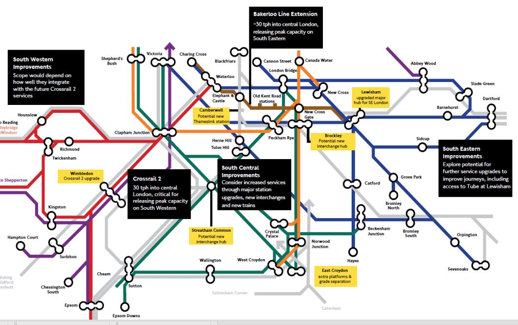
Rail Improvements South Of The Thames
I hope that the boxes can be read.
I shall deal with the various boxes in separate sections, going in a vaguely East to West direction. I will leave out the Crosrail 2 related topics for the moment.
Bakerloo Line Extension
The summary on the map says thirty trains per hour (tph) into Central London, releasing peak capacity on South Eastern. They describe the extension like this in the Executive Summary of the report.
Following the 2014 consultation, we have conducted a comprehensive assessment of the consulted route options alongside alternatives suggested by respondents and stakeholders. The work has concluded that an extension to Lewisham via the Old Kent Road is currently the best option as a first phase, as the route would serve the Old Kent Road Opportunity Area and support significant numbers of new homes and jobs for London. This would include a major new interchange at Lewisham. It is estimated that the selected corridor could enable over 25,000 new homes by serving Opportunity Areas and regeneration areas along its length.
From the map, the route of the extended Bakerloo Line, would be a simple one from the current terminus at Elephant and Castle station to Lewisham station, via two new stations in the Old Kent Road and an interchange at New Cross Gate station with the London Overground and main line services from London Bridge.
These are various highlighted points from the report.
- Assessment of the alternative route options suggested during the 2014 public consultation has demonstrated that the options towards Lewisham remain the most effective for addressing the challenges in south east London.
- An extension should serve Lewisham station due to the new homes that could be unlocked in growth areas along its route, and the wider transport connectivity and access improvements it would provide. 4.2.1. Our assessment work has found that although shor
- We currently recommend a route to Lewisham via Old Kent Road for further development as part of an initial phase for an extension. We have found that this option has the greatest potential to unlock new homes to support London’s growth and significantly improve transport provision in south east London.
- An extension via Old Kent Road would provide a step-change in the capacity, connectivity, accessibility and speed of travel for residents.
- By improving transport and unlocking new homes and jobs growth, the economic benefits of the Old Kent Road option are higher than the route via Camberwell and Peckham Rye. The latter option is estimated to be more expensive to deliver and has a lower potential of obtaining funding.
- Delivering a major transport infrastructure project is a challenging and often risky process. By integrating planning with the Opportunity Area development, the proposed route via the Old Kent Road offers the best prospect of successful delivery.
- An initial extension to Lewisham could form part of a wider package of complementary rail improvements across south and south east London, providing improved journeys via Tube and rail connections.
The report doesn’t rule out extensions beyond Lewisham. This is said.
The assessment shows there could be significant additional benefits from an extension beyond Lewisham and therefore it has not been ruled out at this stage, with further work required to develop the deliverability and case further.
Under Next Steps, this is said.
We will focus developing plans for the first phase of an extension to Lewisham via the Old Kent Road, with further public consultation anticipated in 2016.
TfL’s proposals for the Bakerloo Line Extension would appear to be simple and deliverable at an acceptable cost to give the greatest benefit to South East London.
It should also not be the most difficult line to build, as it is only three stations, with it would appear plenty of green space and cleared sites on the surface for access.
It would almost be a repeat of the Northern Line Extension, except that it is shorter.
For people like me living on the East London Line, the interchange to the Bakerloo Line at New Cross Gate will be very much welcomed, as it improves connectivity to that difficult-to-access area between Piccadilly Circus and Elephant and Castle. Try getting from Dalston to Charing Cross in the rush hour!
I think the biggest problem of this short extension, is going to be that even at an increased frequency of 30 tph, it will quickly get close to capacity.
Lewisham Station
The map also labels Lewisham station with a box saying upgraded major hub for SE London.
This Google Map shows Lewisham station.
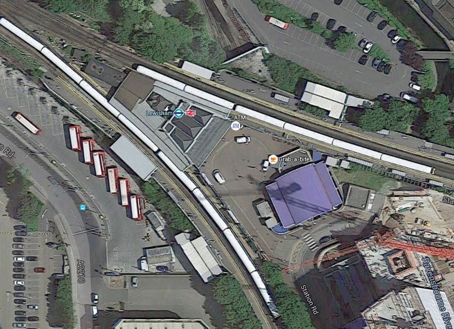
Lewisham Station
I think that there would appear space for improvements and digging the shafts for the creation of the Bakerloo Line Extension.
South Eastern Improvements
The summary on the map says explore potential for further service upgrades to further improve journeys, including access to Tube at Lewisham.
Some stations have been upgraded to a modern standard, but many still don’t have the fscilities that passengers expect these days.
Nothing is said about TfL’s long term ambition to take over the Metro services of Southeastern.
South Central Improvements
The summary on the map says consider increased services through major station upgrades, new interchanges and new trains.
I could repeat what I said in the previous section for South Eastern Improvements.
New Trains
This is very much a general point about new trains.
London’s latest train fleets are increasingly becoming walk-through from one end to the other.
Passengers are also getting very savvy in their train usage and often board a train in a coach, that will be close to their exit at the destination.
And if they get on at the wrong point, they will often walk to their desired exit position, before the train stops.
So could this be used to advantage in the design of stations, with more perhaps having multiple exit points, as do some Crossrail stations?
Brockley Station
The map also labels Brockley station with a box saying potential new interchange hub.
This Google Map shows Brockley station.
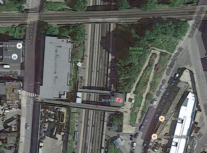
Brockley Station
The Bexleyheath Line between Nunhead and Lewisham stations crosses the East London Line and Brockley station at a high level.
I wrote A Four-Poster Station about connecting these two lines.
It would appear that Transport for London have advanced this project from one word in their 2050 Infrastructure Plan to a proposal.
This is the sort of connectivity, that us plebs in Dalston will like a lot. From 2018, as I wrote in Increased Frequencies on the East London Line, there will be ten services per hour between Dalston Junction and Brockley stations and one change at Brockley, will open up many transport opportunities.
East Croydon Station
The map also labels East Croydon station with a box saying extra platforms & grade separation.
This Google Map shows East Croydon station.
East Croydon Station
The station is towards the bottom of the map and the semi-circular shape at the top is Selhurst Depot.
There is a large section labelled Future in the station’s Wikipedia entry and given the legendary congestion and the large expansion plans for Croydon, I think it is highly likely that expansion of the station and grade separation will go ahead even if the Bakerloo Line Extension doesn’t!
Camberwell Station
The map also labels the now-disused Camberwell station with a box saying potential new Thameslink station. The TfL report says this.
Similarly, we are working with Southwark Council to look into the re-opening Camberwell station on the Thameslink line to improve access into Central London and support local development.
This Google Map shows the area around the disused station.

Camberwell Station
Camberwell station used to be where Camberwell New Road crosses under the railway.
The TfL report makes these points.
- Camberwell has no direct rail connection.
- A two-branch extension of the Bakerloo Line; Old Kent Road and Camberwell, will be very costly.
- A Thameslink station at Camberwell, would serve the same area as an Underground station and is a much more affordable option.
The TfL report gives this concise summary.
A new station at Camberwell would be a significantly lower cost option to a Tube extension, whilst serving the same catchment area. Investigations show significant journey time improvements could accrue to Camberwell passengers and that operationally there may be scope to integrate re-opening of the station into the launch of the completed Thameslink programme.
We will therefore undertake further planning work with Network Rail and the London Borough of Southwark to assess the proposal.
I would be very surprised if the Bakerloo Line Extension calls at Camberwell.
I would also suspect that being able to open a new Ca,berwell station, at the same time as Thameslink, would be very easy to justify on a costs basis.
Streathham Common Station
The map also labels Streatham Common station with a box saying potential new interchange hub.
This Google Map shows Streatham Common station.
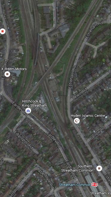
Streatham Common Station
Wikipedia introduces Streatham Common station with these words.
The station is managed by Southern who also operate trains from the station. Direct trains from the station run to Victoria, London Bridge, East Croydon, Shepherds Bush, and Milton Keynes Central. Southern consider the station to be the 6th busiest station on their 158 station network as it receives 12,932 passenger journeys a day, totalling 4,655,520 per year. The Office of Rail and Road figures are lower at 3,827,296.
The station has four platforms, but only platforms 1 and 2 are in daily use; platforms 3 and 4 are normally for passing Express trains, but they are occasionally used during engineering work or major disruption. Step free access to both platforms and both station entrances is available.
Just to the North of the station, is the Sutton Loop Line of Thameslink and I suspect that Streatham Common is mentioned in TfL’s report, is that they have a cunning plan to link the various lines in the area together.
To try to get a better feel of the area, I took a train to Streatham Common station, walked to Streatham station and then took a train to Micham Junction, which travelled across Streatham Common station. I took these pictures.


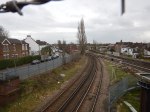


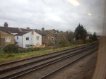


My walk showed me how complicated the lines are in the area and that is emplasised by this Google Map of the junction.
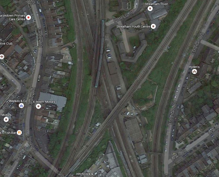
A Tangle Of Lines
I do wonder if there are operational problems in Streatham, that perhaps necessitate a bit of a sort out.
It’s also not an easy walk between Streatham and Streatham Common stations because there is a massive Tesco Extra blocking the walking routes. It certainly follows Tesco’s tradition of trying to create some of the ugliest buildings in the UK.
My other thought, is that the space around the railway lines is quite generous and are Network Rail looking to create some more housing around the junction.
I think that any plans that Network Rail have for Streatham will be revealed in due course.
Conclusion
I think Network Rail, Transport for London and others have decided to bundle a lot of smaller projects under the umbrella of the Bakerloo Line Extension, with the intention of getting value-for-money, that delivers a lot of improvement in an ordered manner in a short timescale, all over South London.
It could be described as the following.
- One large billion pound project to create the actual Bakerloo Line Extension.
- One large project, possibly with a property developer, to sort out East Croydon station.
- Three mid-sized projects to create the Brockley and Streatham Common interchanges and Camberwell station.
- A lot of small projects to create quality stations all over South London.
- Some new trains as required.
So there would be something for everybody. Even the man on the Clapham omnibus!
But who knows?
Crossrail 2 Consultation – October 2015
This is the latest Crossrail 2 Consultation from the TfL web site.
I will be extracting relevant information piece-by-piece from the consultation documents.
This is a list of my extracts.
- Angel Station
- Dalston Station
- King’s Road Chelsea Station
- Managing Excavated Materials
- New Southgate Station
- Shoreditch Park Area
- Tooting Broadway Or Balham
- Tunnels, Shafts And Head-Houses
- Wimbledon Station
I shall be starting with ones that are relevant to where I live in Dalston.
These are links to various Crossrail 2 documents I’ve used as sources.
This page is Crossrail 2’s index.
The Inclined Lift In An Improved Greenford Station
I visited Greenford station in January 2012, just after Transport for London announced that the last wooden escalator would be replaced with an inclined lift.
The lift has now been installed.

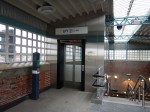
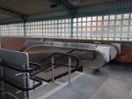
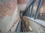


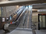

I rode down and then used the escalator up.
It is impressive and you do wonder how many other stations could have this type of lift installed.
This article on the Crossrail web site, entitled Crossrail and TfL to Install First Incline Lifts in UK Public Transport, says this.
Crossrail and Transport for London (TfL) today awarded a major contract to Kone for around 50 lifts for the new Crossrail stations as well as five lifts for Bank, Greenford and Hammersmith Tube stations.
Crossrail will pioneer the use of incline lifts to deliver step-free access at two of the major central London stations. Four innovative incline lifts will run alongside escalators at Farringdon and Liverpool Street Crossrail stations where it is not possible to install vertical lifts. London Underground will also install an incline lift at Greenford station by 2014.
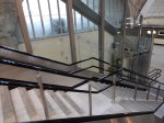
My gateway to the Victoria Line; Highbury and Islington could be a possibility, but one of the station staff told me, that the space at the bottom of the current set of two escalators and a fixed staircase is very small and fitting a third escalator is impossible.
But it might be possible to squeeze in a much needed inclined lift. Note that the lift doesn’t intrude into the circulation space at the top and bottom of the stairs.
I suspect that Transport for London will be watching the Greenford installation with more than a usual interest.
They’ve certainly got several stations with both an up and down escalator and a stairway between that could be possibilities for conversion to fully step-free by the use of an inclined lift.
The station I could have used more times than any other; Southgate has the required space between the escalators, but as it is a Grade 2* Listed building, I can’t see the heritage lobby allowing even a well-designed and tasteful inclined lift into the Jewel of the Piccadilly Line.
But Bounds Green, Manor House, Turnpike Lane, Walthamstow Central and Wood Green could be ones to upgrade.
Significant Documents
When I wrote Increased Frequencies On The East London Line, I relied on this document from Transport for London (TfL) entitled London Overground and Docklands Light Railway Growth.
The document was significant because of its openness and the way it laid out how the London Overground and the Docklands Light Railway will cope with growth.
I think the document also shows how a properly planned public transport project attracts users, that are a precursor to the growth.
After all, in the last few months, I’ve seen the extension of the Nottingham Express Transit and the opening of the Borders Railway, neither of which have attracted substantial amounts of negative comment.
So perhaps we’re now getting rather good at planning these types of projects.
Over the last few months, I’ve read some significant documents, that look to the future.
- Transport for London’s London Infrastructure Plan for 2050
- Liverpool City Region Long Term Rail Strategy
- Greater Manchester Rail Policy
All are quality documents and are superb starting points for the development of railways in their area.
The Cost Of Aventra Trains
In various posts, I’ve given a figure for the cost of new Aventra trains as ordered by the London Overground.
London Overground hacve ordered forty five, four-car sets or 180 carriages.
This press release from Bombardier about the order says that the cost of the contract to design, manufacture, commission and service the trains for thirty-five years will be approximately £358million or just under £8million a train.
The press release also says trains will be delivered between December 2017 and October 2018. This means a production rate of sixteen carriages or four trains a month.
A lot of this cost of these trains will be the servicing and maintenance, so we don’t get near the capital cost of the train.
But the figure which works out at £2million a carriage is in line with the cost of Crossrail trains at £2.22million a carriage.
Compare this cost with the purchase of the Class 378 trains by Transport for London in 2008 to run on the London Overground. Read the section on History, which says that 152 individual cars cost £223million or £1.4million each. Which is probably in line with the cost of the Aventra given the seven years that have elapsed.
The \wikipedia aricle also gives details on the sort of leasing arrangement that London has set up.
These costs will be for standard Aventra trains and so any estimate about the extra cost of the energy storage, that I make will be a stab in the dark. Especially, as I doubt all carriages would need batteries.
What Does The Left Know About The Economic Views Of The Man On The Dalston Omnibus?
London’s buses went cashless on the 6th July 2014, as was reported in the Guardian. The system has now expanded so you can use contactless payments on Buses, Underground, Overground, trams and National Rail in Greater London. And recently ApplePay has been allowed!
According to the Left and the Greens, this was going to result in all sorts of problems for passengers. But from what I can tell, the only thing suffering is the Oyster Card, as those on the Dalston Omnibus, would prefer their spare cash sitting in their bank account, rather than on an Oyster card, they will probably mislay.
I have extensive Google Alerts trying to locate problems with the system and I can’t find anything.
So so much for the competence of the economics of the Left Wing of British Politics!
I am surprised that we haven’t seen more special offers with contactless ticketing like Fare Free Friday to promote Mastercard.
Supposing someone like Highland Spring, wanted to promote their water and gave you say twenty pence every time, you used your contactless card on the system. This might appear on your credit or bank card statement as.
Keep hydrated on the Tube with Highland Spring.
It could be coupled with water vending machines all over the place.
I think if the prices and rewards were got right, it could be a winner.
A Benefit Of The Hackney Downs/Central Link
I don’t pay for my public transport in London, as I have a Freedom Pass, but most people get charged. The cost is very often an important factor for passengers.
This article in The Wharf explains how for some passengers the new walkway at Hackney will save them money, by helping them to easily avoid Zone 1. The article says this.
Funded by Transport for London (TfL), it means passengers at Hackney Central can now easily access trains to north London or Liverpool Street from Hackney Downs, while those at Hackney Downs have fresh options to travel eastbound to Stratford.
Previously passengers had to travel into Zone 1, incurring a higher cost for their journey, or walk 600m.
The article also uses the phrase Hackney Overground interchange. I wonder how long it is before, TfL investigate a new name for the whole complex.
Perhaps it should be one station, as after all the walk between Hackney Downs and Hackney Central is probably about the same length, as some of the longer walks inside the Underground at stations like Bank, Green Park and Kings Cross St. Pancras.
It’s now step free, which can’t be said for some of the Underground treks.
