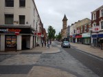
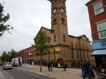
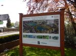
A Walk In Leeds City Centre
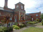
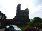
I had time to waste, so I took a walk in a wide circle around Leeds station.


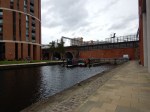

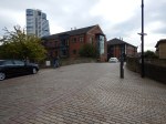


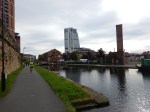


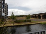


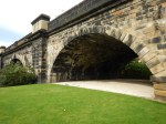


I went under the railways through the station and then walked along the Leeds and Liverpool Canal towards the West. I turned North and followed the Kirkstall Viaduct, that used to take the trains into Leeds Central station.
One of the problems of this walk in Leeds, is that you might like to go through the station. But it doesn’t seem to be encouraged.
London’s New Tube Map For Walking Between Stations
This map from Transport for London may seem a bit unusual, but the aim behind it is probably sound.
This page on the TfL web site, entitled New Tube map launched to help get Londoners walking. This is said.
The new map is the first official version in the world to show the number of steps between stations. It follows TfL’s very popular Walking Tube map, which launched last year and shows the walking times between stations. The new steps Tube map shows how to save time on everyday journeys. It will also help the increasing number of Londoners who set themselves a daily target of steps to take as part of daily exercise and getting fit.
I have always felt that what is needed as well, is more information on the walking short-cuts on the tube. A good place to start is at the list of Out Of Station Interchanges, which are generally a short walk.
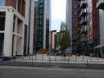
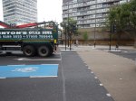
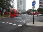
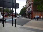
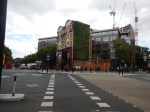
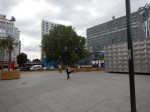
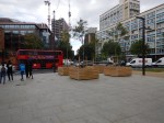
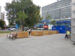
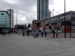
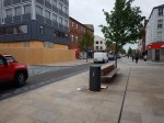
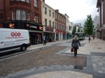
Almost Finished At The Elephant And Castle
In December 2015, a scheme started to create a new road and pedestrian layout at Elephant and Castle.
I wrote about it in Fun At The Elephant And Castle.
It is now substantially complete, as these pictures show.


Note.
- I think if you regularly change between the Bakerloo and Northern Lines at Elephant and Castle station, you might come to the surface and walk across, rather than using the long tunnels below.
- There seems to be less traffic.
- I wonder if we’ll get some cafes in the middle.
From a pedestrian point of view, it certainly seemed a lot better.
A Walk Between Walton-on-the-Naze And Finton-on-Sea Stations
One of the reason’s I went to Walton-on-the-Naze station today, was to see if I could have a nice walk in the sun along the sea to Frinton-on-Sea station and then take the train home.
This Google Map shows the two stations and the sea.
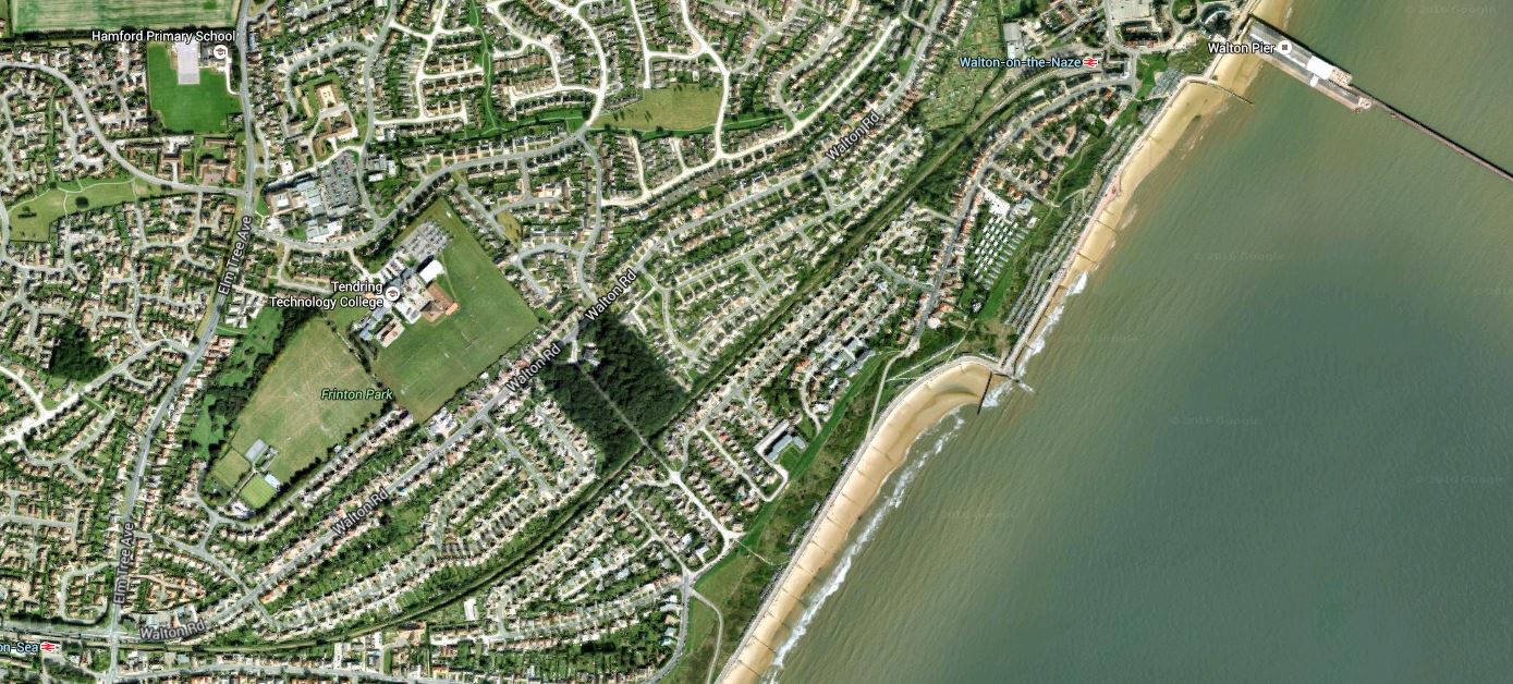
A Walk Between Walton And Frinton Stations
Walton-on-the-Naze station is in the North-East corner of the map by Walton Pier and Frinton-on-Sea station is in the South-West corner.
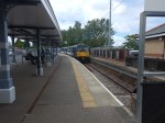
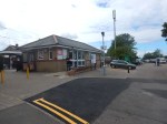
I walked along the promenade, which goes all the way to Clacton-on-Sea, between the beach-huts on the shore and the wide sandy beach and the sea.
I took these pictures as I walked.


Note.
- The number of Thames Sailing Barges in the sea. I saw five, but others saw six.
- The beach welcomes dogs.
- The memorial to PC Brian Bishop.
- I got lost walking from the beach to Frinton-on-Sea station. There were no signs or maps.
The walk took me about ninety minutes. Unlike at Clacton, I didn’t pass a decent cafe. I should have had lunch before I left Walton.
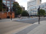
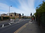
Shared Space In Preston
Done properly, I think shared space can transform a town or city centre.
These are pictures of the centre of Preston.
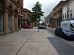

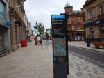
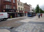
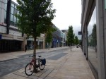
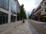

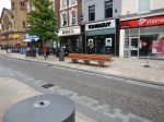
It seemed to be working well as I left, during the morning go-to-work period.
Is Sadiq Khan Frightened Of Saint Joanna?
This report on the BBC is entitled London Mayor Sadiq Khan backs ‘more accessible’ Garden Bridge plans.
I think the Garden Bridge should be quietly forgotten and the money used to connect Barking Riverside to Thamesmead.
I would have also thought, that the bridge would be the sort of project that few would mourn its passing.
So is Sadiq Khan frightened of Saint Joanna?
Especially, as last year, he didn’t think it was value for money!
A Visit To Woodberry Wetlands
This morning, I visited Woodberry Wetlands.

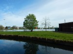


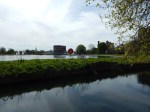
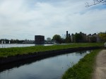


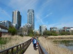

It was crowded, as would be expected on the first day.
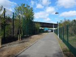
The Millwall Path
This path wasn’t here, the last time I walked this way. So I had to explore.


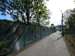


It eventually led to South Bermondsey station.
I think that this could become a popular walking route, as it links up to the path I took from Surrey Quays station, that goes to the still-to-br-built New Bermondsey station and on to Queens Road Peckham station.
It would appear that there is the possibility of opening another path through the arches close to the Millwall Path.
This would probably.
- Give good walking and cycling access between the development between the railway lines of the dive-under and South Bermondsey station.
- Open up more uses for the land between and the buildings under the dive-under.
- Create a direct walking route between the Surrey Quays area and Millwall Football Ground.
I think the whole area could make a very good designer shopping outlet or perhaps a high-technology or design cluster, as there are stations at each of the three corners of the site.
It is certainly a site with possibilities!
Two Bus Stops On High Holborn
I went to visit one of my investments on Fetter Lane and I knew that if I could find the stop I could get a 341 bus from the area to Islington or my home.
There were two bus-stops and I knew I was on the right side of the road.

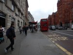
But which one do I go to? I had to walk to both of them to find the answer.
I don’t show it in the pictures, but there was a street sign between the two stops.
Wouldn’t it be nice to have a finger post to tell you where the stops are for various buses?
High Holborn is also one of those places, where there aren’t enough crossings.
Does London need a reporting system for poor street layouts or an army of elderly/disabled/teenage street walkers to collect possible simple improvements to the walking realm in the city?
Small-Scale Connectivity To Crossrail
I live about twenty-five minutes from my nearest Crossrail station at Moorgate on a 141 bus and as I walked around today, I just wondered what will be the best way to access London’s new East-West rail line when it opens in a few years time.
So what do I mean by small-scale connectivity?
I think it is best defined as any method that isn’t more than perhaps ten stations on heavy rail, light rail, the Underground or trams.
And of course, you might substitute Thameslink for Crossrail! Or if you don’t live in London, it could be your major cross-city line.
So in my case, the following would be small-scale connectivity to Crossrail.
- Walking
- Cycling
- Car
- Taxi
- Bus
I do have a heavy rail link to Crossrail in the form of the East London Line between Dalston Junction and Whitechapel, so that will be included as it is only a short stretch of line of four stations.
These are the methods available to me in Dalston.
Walking
For good connectivity, the walking routes around a station should be properly mapped and signposted on a physical wayfinding system, like Legible London used all over the capital.
I also think it is essential that a common format is used, along a line.
So this probably means that London will decide how walking maps and signposts at Crossrail stations in Essex and Berkshire will look.
Will that be acceptable to towns and cities, that have called in consultants to design their ideal wayfinding system?
One problem with wayfinding systems, is that in some places the locals who know the city or area well, say they don’t need the system and think it a waste of money.
You also have the problem in areas with more than one local authority, that each go their own way, rather than agree on a common system.
Remember too, that London is so large, that the average resident finds themselves regularly in an area of the city they don’t know. So Londoners on the whole are very pro-Legible London.
I feel that we need to impose the same wayfinding system all over the UK.
Cycling
Just as there should be good walking routes to a station, the cycling routes should be obvious and well-signposted.
And if bikes are provided for hire at the station, the payment system must be compatible with London’s.
Perhaps we need a nationwide bike hire system?
Car
Many people will want to drive to their local Crossrail station and park their car before they get the train.
i have a feeling that when Crossrail opens, the biggest complaint will be the lack of car parking at stations.
Taxi
For about the last three months, I’ve been suffering badly from plantar fasciitis and because of the limited mobility, it gives me at times, I now feel very strongly that every Crossrail station, should have a proper black taxi rank.
Recently Transport for London have announced that one of my local stations; Highbury and Islington, is going to have a taxi rank. I have yet to find a taxi driver who is against the idea and I believe this could be a winner for both passengers and black cab drivers.
Bus
Every London rail and tube station is a bus hub with its own spider map, which details all of the buses and their routes from the area. This is my lovcal bus spider map for Dalston.
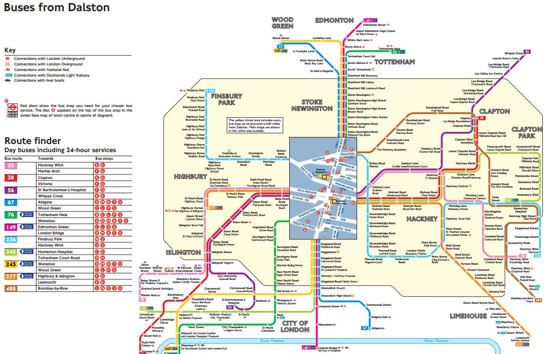
Dalston Bus Spider Map
Venture outside of London and in many places, bus mapping is often missing or very bad to give it the benefit of the doubt.
As with walking maps, local authorities outside of London with a Crossrail station, will have to adopt London’s system.
Other Rail Lines
Crossrail does connect to quite a number of heavy rail, Underground and Overground Lines.
- Bakerloo Line
- Central Line
- Circle Line
- District Line
- East London Line
- Great Eastern Main Line
- Great Western Main Line
- HS1 – After extension to Gravesend
- HS2 – After Old Oak Common
- Jubilee Line
- Metropolitan Line
- North Kent Line
- Northern Line
- Northern City Line
- North London Line
- Thameslink
- West Anglia Main Line
- West Coast Main Line – After extension to West Coast Main Line
- West London Line
I have included links to extensions to Gravesend and the West Coast Main Line and Old Oak Common in this list.
Small Branch Lines
But it also connects with several smaller branch lines or perhaps in the future, some tram and light rail lines.
- Abbey Line – After extension to West Coast Main Line
- Brentford Branch Line
- Croxley Rail Link – After extension to West Coast Main Line
- Greenford Branch Line
- Henley Branch Line
- Marlow Branch Line
- New North Main Line
- Reading to Basingstoke Line
- Romford to Upminster Line
- Shenfield to Southend Line
- Slough to Windsor and Eton Line
- Staines and West Drayton Railway
- Waterloo to Reading Line
I believe that Local Authorities will develop these smaller lines and create others to maximise their benefit from Crossrail,
A Metro In The East
The two lines that I think have the most likely chance of being developed, are the Romford to Upminster and Shenfield to Southend Lines.
- The main line rail company; c2c, is very ambitious.
- In the next couple of decades, South East Essex will be an important economic growth area.
- Better links are needed to Southend Airport and the London Gateway.
- There is substantial development of jobs, housing and leisure opportunities in the areas the lines serve.
- Give the people of Essex an opportunity and they embrace it fully.
I wouldn’t be surprised to see a substantial metro network created in the area, based on Billericay, Shenfield, Southend and Thurrock.
A Metro In The West
If a metro network can be successfully developed at the eastern end of Crossrail, is there the potential of creating something similar at the western end?
Consider.
- Heathrow dominates thinking in West London and feels that everybody should jump to its tune.
- Heathrow should wake up to the fact that it will never get a third runway, as London’s electorate will always vote to block this.
- There will always be a Heathrow, but in time, it will cease to dominate the air travel market in the UK, as it does now!
- Heathrow has very limited rail connections to Basingstoke, Reading and the West.
- If you look at the list of small branch lines, several are clustered around the western end of Crossrail, with its two hub stations of Slough and Reading.
A metro in the west could be developed based on hubs at Basingstoke, Heathrow, Slough and Reading. The Windsor Link Railway is surely thinking along those lines.
A Metro In The South East
Of all the stations on Crossrail, Abbey Wood is one of the most disappointing.
As a terminus for Crossrail, that connects to the North Kent Line and to services to South East London and the Dartford area, four platforms doesn’t seem enough, when you compare the station to the other terminals of Reading and Shenfield.
Transport for London have proposed that the Gospel Oak to Barking Line could cross the river to serve Abbey Wood and if this should happen, there must be opportunities to create another metro system based on Abbey Wood.
A Metro In The North
There are proposals to extend Crossrail to Milton Keynes from Old Oak Common.
This would surely, bring in the possibility of a network of local lines based on Watford.
- The Abbey Line is one of those difficult-to-run lines, that needs substantial improvement.
- The Croxley Rail Link could be expanded to serve Amersham.
- Local services on the West Coast Main Line and the Watford DC Line are very crowded.
This will only be developed once Crossrail serves Watford.
Conclusion
Crossrail in 2030, will be an entirely different line to that being created today.
