Does Okehampton Interchange Have A Secondary Function To Be Used As A Backup To Cornwall Should Dawlish Be Destroyed Again?
I asked Google AI the question in the title of this post and received this answer.
The new Okehampton Interchange (opening summer 2026) acts as a local transport hub to increase capacity on the Dartmoor Line to Exeter, but it is not a direct backup to Dawlish.
While the Okehampton line via Tavistock is frequently considered as a strategic alternative to the vulnerable coastal route, the new Interchange itself is designed as a single-platform parkway station to serve the local community, not to act as a diversionary route for mainline trains to Cornwall.
Key Details on Okehampton Interchange & Strategic Role:
Purpose:
The £15m Interchange, located near the A30, is designed to relieve parking pressure at the existing Okehampton station and promote sustainable travel with a 200-space car park and bus connections.
Station Setup: It will have a single platform, making it incapable of handling the volume of diverted mainline trains.
Strategic Context: Following the 2014 Dawlish collapse, a northern route via Okehampton/Tavistock was identified as a potential resilient alternative.
However, implementing this would require hundreds of millions in investment to rebuild the track from Okehampton through to Tavistock, not just the new Interchange station.
The Dartmoor Line: The restored line between Okehampton and Exeter, which includes this new interchange, is primarily a local commuter route rather than a main line for Cornish traffic.
This Google Map shows the Okehampton by-pass.
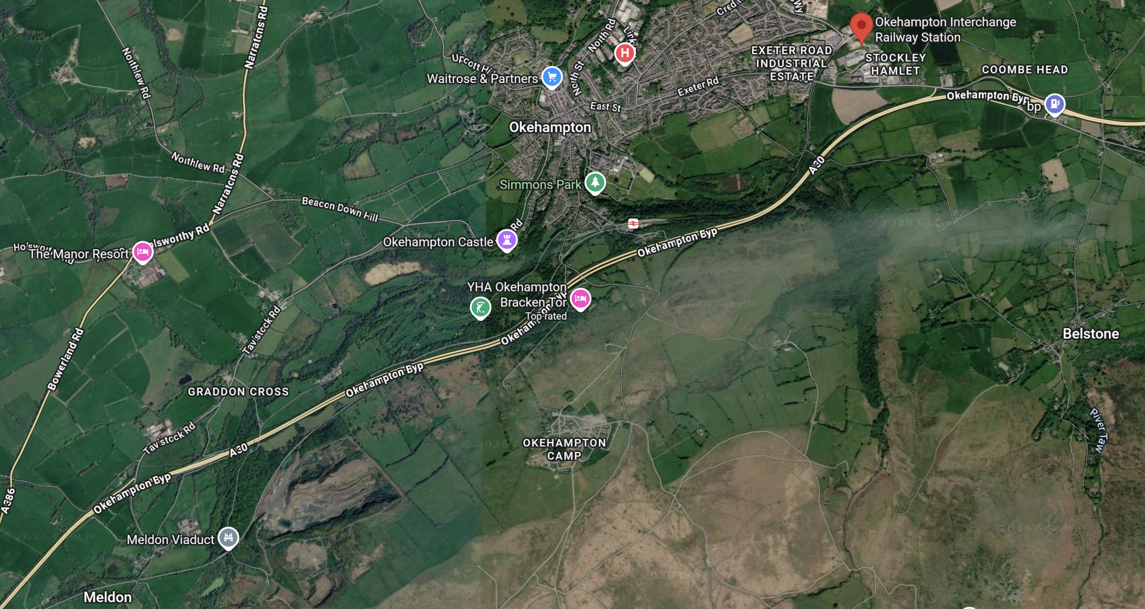
Note.
- Okehampton Interchange station is shown by the red arrow in North-East corner of the map.
- The town of Okehampton is to the West of the station.
- South of the town is the station symbol, which indicates Okehampton station.
Running across the map is the A30 road, which is described in its Wikipedia entry like this.
The A30 is a major road in England, running 284 miles (457 km) WSW from London to Land’s End.
This Google Map shows the A30 between Okehampton and Bodmin.
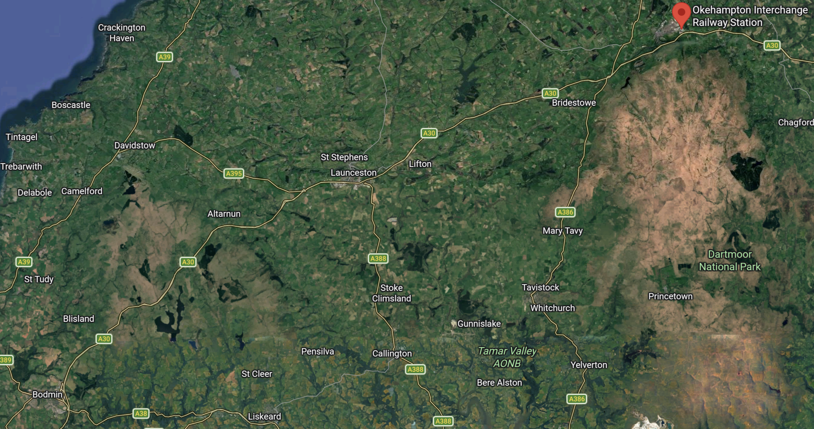
Note.
- Okehampton interchange station is in the North-East corner of the map.
- Bodmin with Bodmin Parkway station is in the South-West corner of the map.
- In the middle of the map is Launceston, which is on route of the A30.
Wikipedia says this about the road.
The A30 is dual carriageway through Devon and into Cornwall, bypassing Whiddon Down, Okehampton and Launceston.
I believe that if the railway was blocked again at Dawlish, it would be possible for passengers to be taken to Cornwall like this.
- Five-car Class 802 train to either of the Okehampton stations.
- Coach to Launceston and Bodmin Parkway.
- Class 802 trains to Penzance, which called at all stations.
That looks to me to be a practical alternative.
It should also be noted, that high-capacity, hydrogen-powered coaches, with a thousand-kilometer range will be coming into service soon and these will surely be ideal for a duty like this.
No comments yet.

Leave a comment