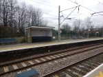
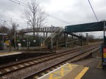
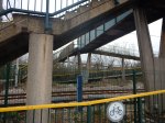
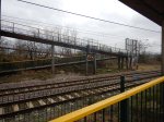
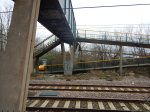
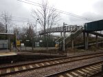
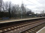
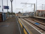
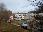
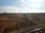
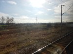
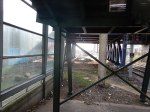
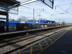
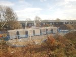
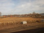
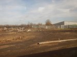
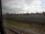
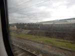
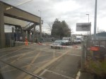
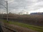
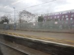
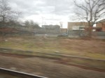
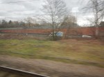
West Anglia Route Improvement – Broxbourne Station – 22nd February 2017
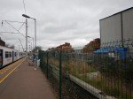
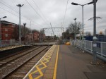
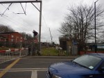
I took these pictures at Broxbourne station.


This Google Map shows the layout of the station.
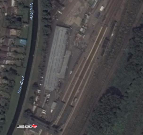
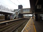
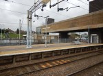
broxbourne Station
It is almost as if when the station was moved to its current site in 1959, that it was designed to be the Northern terminal of a line like Crossrail 2.
- The site is generous with lots of space for stabling sidings and parking for cars.
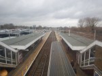
- The fast trains stop in the middle two platforms giving cross-platform access with the local services on the two outside lines.
- The station has full step-free access with a waiting area, a cafe and toilets on the massive bridge over the lines.
- Platforms appear to be ready for 12-car trains.
- It is a Grade 2 Listed building with a prominent water feature, built in the early-1600s.
Greater Anglia And Broxbourne Station
I don’t think the potential has been lost on Greater Anglia.
- They have been very vocal about about getting Broxbourne to Yottenham Hale four-tracked as soon as is practically possible. And it appears to be starting.
- With the splitting of fast and slow services onto separate lines, it must be possible to run say 10 tph on the slow lines.
- Fast trains to and from Cambridge, Ely and Stansted could probably interchange better with local services.
- The station is virtually mid-way between the scientific powerhouse of Cambridge and the financial powerhouse of London.
- Could the station have new a North-facing platform to accept new services from Cambridge, Norwich, Peterborough and perhaps even Lincoln?
Broxbourne must be one of the best mid-line interchanges anywhere in the UK.
It would not need a massive amount of money to be spent at Broxbourne to make the station a superb Northern terminus for Crossrail 2. It makes Shenfield and Abbey Wood look decidedly second-class now.
Greater Anglia’s Plans For Fast Broxbourne Services
But Crossrail 2 is some years away, so how will Greater Anglia maximise the use of this priceless asset?
Greater Anglia have ordered a fleet of 12-car Stadler electric multiple units for Cambridge and Stansted services. After the four-tracking of Broxbourne to Tottenham Hale, you can imagine these trains stopping in the middle two platforms, before or after a fast uninterrupted run to either Liverpool Street or Stratford.
As there are ten of these expresses, I suspect that will see five Stadler trains per hour (tph) to and from London. But we’ll also be seeing some Aventras with a similar performance taking the fast lines.
Greater Anglia’s Plans For Slow Broxbourne Services
I feel that to maximise traffic at all the intermediate stations, there will be a regular service of something like 4 tph all the way between Broxbourne and Tottenham Hale.
The slower trains take about 20 minutes with typically five stops. But the trains are thirty-year-old Class 317 trains. and will be replaced by faster Aventras, which are optimised to minimise dwell times at stations.
A similar change is happening on Crossrail, which means that Romford to Liverpool Street stopping at eight stations will go from 31 to 17 minutes.
So I think we’ll see slow Broxbourne to Tottenham Hale services serveral minutes faster than they are now, despite stopping everywhere.
But 4 tph will increase ridership substantially.
Competition For Greater Anglia
It is between Cambridge and London, that Greater Anglia will face the greatest competition as they do now.
But the new trains may be able to almost match the fastest Cambridge to Kings Cross times.
Greater Anglia will also offer other sdvantages.
- Access to the City of London through Liverpool Street.
- Access to Crossrail at Liverpool Street and Stratford.
- Easy access to Canary Wharf, the West End and Heathrow.
The effects of the new Stadler trains shouldn’t be underestimated.
Stansted is a monopoly, so that will do well!
Changing at Broxbourne between fast and slow services may mean that they generate traffic for Stansted, as currently for many it’s easier to drive.
There is also competition from London Overground’s route from Cheshunt to Liverpool Street, especially as with new trains, this will be route with new Aventra trains.
I do wonder if Greater Anglia will invite London Overground to extend their Cheshunt service by one station to a dedicated platform at Broxbourne station, as this would mean that they would have less need to stop fast Cambridge trains at Cheshunt.
Also before Crossrail 2 is up and running, it would create an eight tph service to London on two separate routes from Broxbourne.
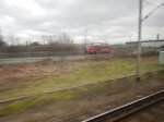
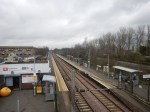
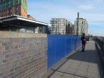
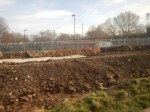
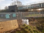
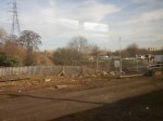
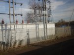
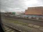
West Anglia Route Improvement – Brimsdown Station – 22nd February 2017
I took these pictures at Brimsdown station.


This Google Map shows a closeup of the station.
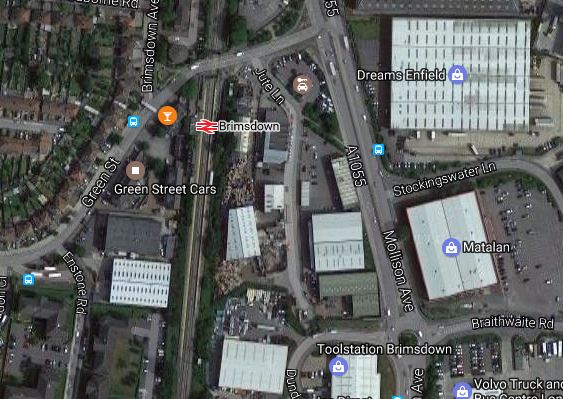
Brimsdown Station
Note.
- The level crossing is a real bottleneck and has been since the 1960s, when I used it to go to work.
- I was at the station for about thirty minutes and in that time around ten fast trains roared through, so the barriers were more closed than open.
- The space for the tracks is narrow, but there’s nothing of merit in the way.
- There is a poor subway, but no footbridge.
Meridian Way was built to provide an alternative route, but drivers want to use the crossing.
It is another station and level crossing, that might be improved using a Level Crossing Replacement Station.
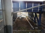
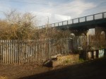
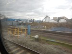
West Anglia Route Improvement – Ponders End Station – 22nd February 2017
I took these pictures at Ponders End station.


This Google Map shows a closeup of the station.

Ponders End Station
Note.
- Between the station and Meridian Way is an area that is wide enough for a twin-track railway or another carriageway for Meridian Way.
- There used to be a level crossing at Ponders |End, but the station was given reasonable pedestrian access and a decent road by-pass.
- The footbridge may be step free, but I wouldn’t like to see grandma pushing grandpa in a wheelchair over the tracks.
This station could need a Level Crossing Replscement Station, as I detailed earlier, to replace the current bridge and allow pedestrians an easier route across what will be a four-track railway.
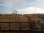
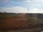
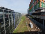
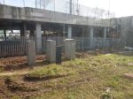
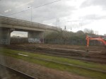
West Anglia Route Improvement – Enfield Lock Station – 22nd February 2017
I took these pictures at Enfield Lock station.


This Google Map shows a closeup of the station.
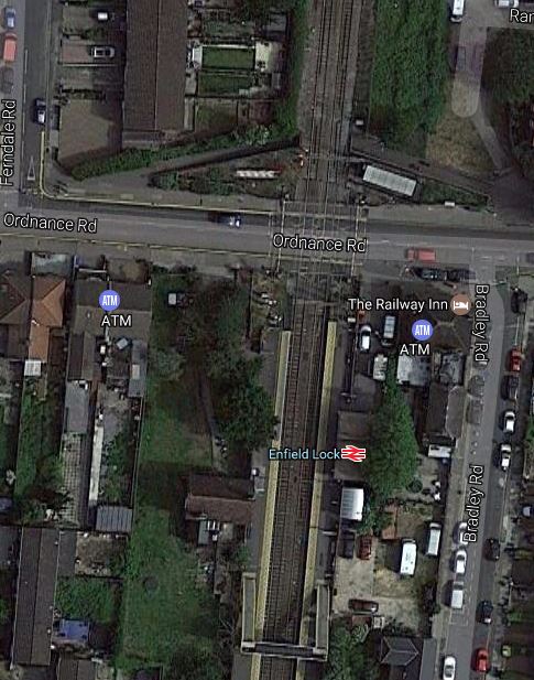
Enfield Lock Station
Note.
- The level crossing.
- The Google Map shows an underpass so that pedestrians and cyclists can bypass the level crossing.
- The truly dreadful footbridge.
- The tired station facilities.
- Will the houses behind the London-bound platform like having 20 tph, thundering past their back gardens.
There isn’t much space to the West of the line, but with a bit of selective demolition and moving of line-side equipment, I suspect that two extra tracks could be squeezed through.
In a related post I’ve proposed a Level Crossing Replacement Station.
This might be a way of doing the following.
- Removing the level crossing.
- Building a new modern station.
- Providing easy level access across the railway at all times for pedestrians, cyclists and those in wheelchairs.
The good people of Enfield would get a modern station and the railways would get rid of a troublesome level crossing.
West Anglia Route Improvement – A Level Crossing Replacement Station
We have lots of level crossings in the UK and they are dangerous, hated by drivers of vehicles and trains, and cause all sorts of problems.
When I was writing Works Around Coppermill Junction And Along The West Anglia Main Line, I realised that the West Anglia Main Line has four major level crossings, all of which are at stations.
I’ve also since found that Ponders End used to have a level crossing.
As an example, I’ll consider Enfield Lock station, which needs updating for Crossrail 2.
This is a Google Map of the station.
To update the station for Crossrail 2, the following must be provided.
- Two extra tracks through the station.. They will probably be to the East of the current tracks.
- Two twelve car platforms for the current tracks, with step-free access to all trains that will call at the station for wheelchairs, buggies and those past their best.
- Network Rail have said that the level crossing at the station will be closed.
- New station buildings, as the current ones will be demolished for the new tracks.
- Full step-free access.
In additions, these features would be welcome.
- Access from both sides of the tracks.
- Why not access from both sides of the road?
- Ability for pedestrians, cyclists and those in wheelchairs to easily cross the tracks.
- Kiosks accessible to both platforms.
No facilities are needed on the fast lines, except possibly acoustic fences.
Perhaps the solution is to close the level crossing and put a wide pedestrian and cycling underpass under the railway.
It would be of a similar width as the road, accessed by gentle slopes and landscaped to blend in with the surroundings.
The underpass would contain.
- The booking hall, with perhaps a counter and ticket machines.
- Secure bicycle parking.
- A warm waiting room, that would mean passengers don’t have to wait in the cold in the winter.
- Kiosks and possibly a cafe.
- Lifts and steps to both platforms.
- Is there enough space at the top of the slopes for a simple Kiss-And-Ride?
The level crossing has been replaced with a fully-accessible modern station.
I don’t think the idea is truly original, as I might have seen a station like this somewhere in Europe, possibly in the Netherlands or Germany.
Where Would Such A Station Be Built?
But, I do think the concept may have advantages in some situations, where perhaps some of these reasons apply.
- The level crossing is heavily used by pedestrian and cyclists.
- The level crossing crosses a large number of railway tracks.
- Would removing the level crossing allow a needed increase in passenger or freight services?
- The railway line is very busy and the crossing spends a lot of time closed.
- There is no space for a bridge.
- A station is needed in the area.
- Heritage issues might rule out a conventional station with a step-free footbridge.
- It’s reasonably easy to dig the underpass.
I think that a prerequisite is that there must be a reasonable diversion for vehicles.
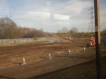
After my observations today, Brimsdown could be a prime candidate.
- Two new lines are being added through the station.
- It is very busy with trains and in a few years time could have forty trains per hour.
- The site has little space.
- A bridge for vehicles is impossible, but there is an alternative route.
Network Rail and Enfield Council certainly need an innovative solution to remove this level crossing.
A Modular System
I also believe that a factory-built modular system could be designed, which would enable these stations to be installed quickly.
Get the design right and it might also find applications, where no level crossing exists, but good pedestrian and cycling access is needed across a railway, where a new station is also needed.
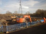
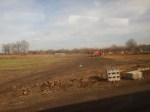
West Anglia Route Improvement – Works Around Coppermill Junction And Along The West Anglia Main Line
There is a lot of work going on around Coppermill Junction and on the West Anglia Main Line between the junction and Northumberland Park station.
The map from carto.metro free.fr shows the lines around the junction.

Coppermill Junction
Tottenham Hale station is on the West Anglia Main Line, which effectively starts and runs North West from Coppermill Junction.
In Rumours Of Curves In Walthamstow, I talked about how I’d heard rumours of the following.
- The Hall Farm Curve would be reinstated as a single bi-directional track to allow rains to go between Stratford in the Soithe and Walthamstow and Chingford in the East.
- The Coppermill Curve would be reinstated as a double-track curve to allow empty stock movements to Chingford, where there are several sidings.
There’s also the problem of Crossrail 2 going through the area, which will need a connection to the Central Tunnel and four-tracking of the West Anglia Main Line from Coppermill Junction North to Broxbourne station.
In the next few sections, I shall show the pictures I took this morning.
The Hall Farm Curve From The Chingford Branch
I took these pictures going between Clapton and St. James Street stations on the Chingford Branch Line.

Note how the area is quite large.
The work seems to have cleared all the old track, which in typical British Rail fashion seems to have been abandoned to the wildlife.
Tottenham Hale Station
I took these pictures around Tottenham Hale station.
There is quite a bit going on.
A helpful station man told me the following was happening.
- Space is being created, so that two tracks can go through between the station and Hale Village.
- The taxi rank in the forecourt of the station is being moved Northwards.
- The current footbridge over the lines is going.
- A new step-free footbridge is going to be built.
Effectively, there seems to be a cunning plan to rebuild the station around the working railway, which is confirmed in this document on the Transport for London web site. This is said about works on the bridge.
We plan to keep the station open during the work so that any potential disruption will be kept to a minimum.
That is a good start.
Obviously, the architects and engineers, who have designed the replacement station, but it does seem to me, that squeezing two tracks into the space behind Platform 2 at the station will need a very large and strong shoehorn.
From Tottenham Hale To Lea Bridge
I took these pictures between Tottenham Hale and Lea Bridge stations.


Note.
- A new cable duct has certainly been installed.
- The Hall Farm Curve has been cleared of rubbish and vintage track.
- It also looks like the route of the replacement Coppermill Curve is being cleared through the scrub.
- There didn’t appear to be any electrification piles or gantries.
I can’t believe Network Rail would clear the two curves unless they were going to reinstate them.
From Tottenham Hale To Enfield Lock
I took these pictures between Tottenham Hale and Enfield Lock stations.


Note.
- It would appear that there is space to the East of the current two-track West Anglia Main Line to squeeze in two extra tracks.
- There are level crossings at Northumberland Park, Brimsdown and Enfield Lock stations.
- The quality of some of the buildings that would probably be demolished is best described as suspect.
- Meridean Way, which runs alongside the railway from Angel Road Northwards is an inadequate highway.
- I wonder how many people have booked the Premier Inn because it is close to Angel Road station, only to find that there are few trains.
I say more about the level crossings in Level Crossing Issues.
The Current Stations
These posts describe the current state of the stations between Tottenham Hale and Broxbourne around the 22nd February 2017.
There are also some relevant related posts.
How Many Fast Services Will Go Through Tottenham Hale Station?
How Many Slow Services Will Go Through Tottenham Hale Station?
A Level Crossing Replacement Station
Hopefully, this will mean I can add content without making this post overly long.
What Frequency Will Crossrail 2 Trains Have On The West Anglia Main Line?
The Crossrail 2 entry on Wikipedia says this about the Northern Regional branches.
Running at between 10 and 15 trains per hour on new rails above ground, connected to a junction north of Dalston:
I can’t see any space being found for two new tracks and I don’t think Greater Anglia will want this number of trains mixing with their fast services, so I must assume that they will share the two slow lines to Broxbourne with Greater Anglia’s slow services.
What Will Be The Platform Layout At Tottenham Hale?
The station looks to be gaining two new lines on the East side of the station.
But will they be slow or fast lines?
My pictures show that it will be very tight to put new platforms on these lines, as there just isn’t enough space.
I have read the planning documents on the Harringey Council web site for Tottenham Hale station and came to these conclusions.
- There are no definite plans for a platform 3 and/or 4.
- There is controversy about if they are built, as to if or when they will get lifts.
- There is talk of starting STAR, which would provide four trains per hour (tph) between Stratford and Angel Road stations.
This page on the Crossrail 2 web site says this.
In order to accommodate Crossrail 2 services at Tottenham Hale, we would add at least one new platform and carry out other station improvement works too.
Wikipedia says that a third platform is being worked on.
I suspect that it could be necessary that fast services will stop at Tottenham Hale, to allow passengers to change to and from services on the following lines.
- Victoria Line
- Crossrail 2
- Local services to Liverpool Street.
- Local services to Stratford.
It should also be born in mind, that Crossrail will call at both Stratford and Liverpool Street, s say you’re going shopping at Oxford Street, to work at anary Wharf or to New York via Heathrow, would you mind which terminus you used in London, provided it was efficient?
At present both fast and slow services on the main line all share the same platform at ottenham Hale, using 1 to go South and 2 to go North.
If this arrangement was to continue, after the new lines are built, the following would apply.
- Interchange between services would be as now.
- Fast services for London would stop in platform 1 before going to either Liverpool Street or Stratford.
- Both platforms could be made step-free with lifts and a bridge at the London end of the platform.
It is workable, but you would still have the crowded platforms you get today, although the step-free bridge would make passenger circulation easier.
But what happens when Greater Anglia decide to increase fast frequencies or Crossrail 2 arrives.
Exclusive Fast Lines Between Tottenham Hale And Broxbourne Stations
One arrangement that could work, would be to use the two new lines exclusively for fast services from Tottenham Hale to Broxbourne, with trains stopping only at Broxbourne and Tottenham Hale as required.
- With more Stansted services, some could be non-stop from Liverpool Street to Stansted to reduce the load on Tottenham Hale station.
- Some Cambridge services might make their first stop at Broxbourne.
- Fast commuter services not stopping South of Broxborne are possible.
Greater Anglia will be replacing their current trains on the line with new Stadler or Aventra trains, which will in some ways compensate.
At some point hopefully Crossrail 2 will arrive.
Using the two new lines exclusively for fast traffic, with slow services on the exiting lines would have the following effects.
- Speed up services by a few minutes.
- Double capacity between Broxbourne and Tottenham Hale.
- All trains on the slow lines would be Crossrail’s or Greater Anglia’s Aventras, which can probably run together efficiently.
- 20 plus tph could probably run on the slow lines
- The only trains on the fast lines would be Greater Anglia’s Stadler expresses, which could do Broxbourne to Tottenham Hale inperhaps eiht minutes, travelling all the way at 100 mph or possibly more.
Removing fast trains from the slow lines would probably mean that a frequency of upwards of 10 tph could run on Crossrail 2 between Broxbourne and Tottenham Hale. South of Tottenham Hale they would be out of the way in the Central Tunnel.
South Of Tottenham Hale Station
Trains between Tottenham Hale station and Stratford or Liverpool Street stations, take one of the three following routes.
- To and from Lea Bridge and Stratford station
- To and from Hackney Downs and Liverpool Street stations taking the fast lines South of Hackney Downs.
- To and from Hackney Downs and Liverpool Street stations taking the slow lines South of Hackney Downs.
To complicate matters trains to and from the Chingford Branch and some Greater Anglia slow services use the fast lines South of Hackney Downs and change over around Bethnal Green station.
So could we see a bit of a reorganisation, so that all slow services are moved to the slow lines, through Hackney Downs station, so that the fast services to and from Cambridge and Stansted get a clear run between Clapton and Liverpool Street. That must save a minute or two.
It also looks like that with the opening of Lea Bridge station, some services will go to Stratford rather than Liverpool Street. These could include some services from the Chingford Branch, if the Hall Farm Curve is reopened, which some of my pictures indicate might be happening.
It should be born in mind, that Stratford has two platforms 11 and 12, connected to the lines to Lea Bridge station but only platform 11 is used.
After Crossrail opens will it matter if some of Greater Anglia’s suburban services go to Stratford rather than Liverpool Street?
In fact, it’s starting to happen, as today coming back from Cheshunt, I was on a train between Bishops Stortford and Stratford.
The Problem Of Clapton Station
Clapton station is not a massive problem, but it is on the route taken by fast Cambridge and Stansted trains to and from Liverpool Street.
Last year, Clapton station handled 1.6 million passengers, which is probably just about average or slightly above average for the Chingford Branch Line.
So there is probably not much to be gained by cutting services, as there are a lot of people to complain. But the Overground’s new Class 710 trains will have a better stop-start performance and could reduce the problem, especially if they used the slow lines through Hackney Downs.
A Pseudo-Crossrail 2
We might even see a pseudo-Crossrail 2, between Tottenham Hale and Broxbourne.
Suppose Greater Anglia on their slow lines ran something like the following services.
- 4 tph between Liverpool Street or Stratford and Hertford East.
- 2 tph between Liverpool Street or Stratford and Cambridge
- 4 tph between Liverpool Street or Stratford and Bishops Stortford
This would give a ten tph service between Tottenham Hale and Broxbourne stopping at all stations.
As the slow lines would be for exclusive use of these services, except for a few freight trains, the lines would cope admirably.
Everybody on the line would have a superb Turn-Up-And-Go-Service.
The Design Of Broxbourne Station
It could be arranged that at Broxbourne, there was cross-platform interchange between fast and slow services going in the same direction. So a passenger between say Brimsdown station and Stansted Airport, would have the one change at Broxbourne.
The Design of The Fast Line Platforms At Tottenham Hale Station
The space limitiations at Tottenham Hale would probably mean that only one extra platform could be squeezed in. Perhaps it could be an island platform between the two lines. Being an island it would only need one lift and this would save all-important width and cost.
If it was thought a narrow island platform with fast trains that might run through, the platform could surely be fitted with platform edge doors.
But the required step-free change to Crossrail 2, Victoria Line and local services would be created.
I’m suspicious that my pictures show that through Tottenham Hale station, there is only room for a single extra line, if a platform is needed. It certainly looks as if, the cable ducts have been moved to only allow only one line.
So could we see platform 2 extended to have a second platform 3 on the opposite face, which gave access to a single bi-directional line through the station?
- It would use the lift on Platform 2.
- There would be cross-platform access from a fast train to London to a slow one.
- Only access from a slow train out of London to a fast one would need the bridge.
- Bi-directional working is increasing being used.
Once through Tottenham Hale station, the fast lines would result to normal double-track working.,
I suspect that when Tottenham Hale station was rebuilt in the 1990s, no-one thought that the station would be on a line with four-tracks.
How Norway Will Keep Britain’s Lights On
This is the title of an article in today’s Times about the building of the North Sea Link, which is described like this in Wikipedia.
The North Sea Link (also known as North Sea Network Link or NSN Link, HVDC Norway–Great Britain, and Norway–UK interconnector) is a 1,400 MW subsea high-voltage direct current electricity cable under construction between Norway and the United Kingdom. It is a joint project of the transmission system operators Statnett and National Grid plc and is due to be completed in 2021.
To put the size of the North Sea Link into context Hinckley Point C nuclear power station will generate 3,2000 MW, so we get 44% of the power reliably for as long as Norway’s hydro-electric power system functions.
The Times article also lists other interconnectors in which National Grid are involved.
- 160 MW system (1961) – 100 MW – co-owned with the French.
- 2000 MW system (1986) – 2000 MW co-owned with the French.
- IFA2 – 1000 MW co-owned with the French
- BritNed – 1000 MW co-owned with the Dutch.
- NemoLink – 1000 MW co-owned with the Belgians.
- Viking Link – 1400 MW co-owned with the Danes.
- ICELink – A possible 1000 MW link to Iceland.
- A possible second connection to Norway
- A possible second connection to the Netherlands.
In addition, there are other links like FABlink and NorthConnect, where National Grid don’t have an interest.
It’s not all importing of electricity, as recently because of troubles with their nuclear plants, we’ve been exporting electricity to the French.
As a control engineer, I think all of these interconnectors are sound investments, as Europe can mix the erratic sources of wind, wave, tidal and solar with the steady outputs of nuclear, coal and hydro.
This Wikipedia article called Wind power in the United Kingdom says this.
The United Kingdom is one of the best locations for wind power in the world, and is considered to be the best in Europe. Wind power contributed 11% of UK electricity generation in 2015, and 17% in December 2015. Allowing for the costs of pollution, particularly the carbon emissions of other forms of production, onshore wind power is the cheapest form of energy in the United Kingdom In 2016, the UK generated more electricity from wind power than from coal.
So back wind up by steady sources from the UK and Europe like nuclear and hydro-electric, when the wind stops and all is well with the lights.
And of course, as many of these interconnectors are bi-directional, when we have excess power, countries in Europe who need it can import it.
Who sits like spider in the middle of this web? – National Grid of course!
All those, who think that coal is a good idea, should be made to sit on the naughty step.
A Crossrail For Aberdeen
Cross-city lines are all the vogue.
- London has Thameslink, several Underground and Overground Lines and will shortly have Crossrail.
- Edinburgh has Crossrail.
- Liverpool has the Northern Line.
- Paris has the RER.
- Leipzig has a cross-city tunnel.
- Birmingham has the Cross-city Line.
So why shouldn’t Aberdeen propose Aberdeen Crossrail?
Aberdeen Crossrail
This Google Map shows Aberdeen.
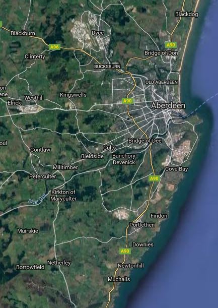
Note.
- The white blob on the map above the City, which is Dyce Airport.
- The Aberdeen to Inverness Line links Dyce Airport to Aberdeen station in the City.
- The Edinburgh to Aberdeen Line and the Glasgow to Aberdeen Line share a common route South from the City as far as Dundee.
- The shared line South runs along the coast, through a succession of towns, some of which have stations.
The Aberdeen Crossrail plan is to link the Aberdeen to Inverness Line to the shared line to the South and create a frequent service along the route.
That is a standard philosophy for a cross-city line.
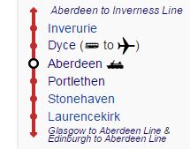
This diagram from Wikipedia, shows the proposed line and the stations.
It is a simple plan and a simple route with one big difference to most of the other proposed or built Cross-city lines – There is no expensive central tunnel. It is almost solely a marketing concept, based around existing services.
Implementation
Wikipedia says this about Implementation.
Transport Scotland announced in March 2016 that the scheme will go ahead as part of a wider timetable recast in 2018. The new service will run between Inverurie & Montrose, serving all existing intermediate stations and one at Kintore from 2019. The Aberdeen to Inverurie section will then have a 30-minute interval service in operation. Infrastructure enhancements on the Aberdeen to Inverness line (including the redoubling of track from Aberdeen to Inverurie) are also scheduled to be completed by this time, as part of a £170 million route upgrade project.
All it needs is to add lots of stations.
It is a project manager’s dream to build, as once trains are running and the pattern of passenger use develops, the authorities can add trains and stations, as needs and the budget dictate.
Similarity To The London Overground
The nearest cross-city lines in concept to Aberdeen Crossrail are probably the North London and East London Lines of the London Overground, where two cross-city lines were created from some very tired track, stations and trains, by refurbishing the first two and replacing the trains.
Like the London Overground, Aberdeen Crossrail is updating the route. Aberdeen’s current trains are probably better now than the travelling urinals, that the Overground inherited from Silverlink.
One thing that I think Aberdeen Crossrail will need is a Turn-Up-And-Go frequency of four trains per hour (tph), that has been used so successfully on the Overground and Merseyrail.
Frequency Issues
The route of Inverrurie to Montrose has been deliberately chosen.
- Inverurie to Aberdeen takes around 23 minutes.
- Montrose to Aberdeen takes around 35 minutes.
So with slightly faster trains and line speed, than currently used, it should be possible for a train to go from Inverurie to Montrose and back in two hours to include a few minutes to turn the train round.
A two hour round trip means that a train leaving Inverurie at say 06:00 in the morning, will if all goes well, be back in Inverurie to form the 08:00 train.
How convenient is that?
This means that one tph will need two trains, two trph will need four trains and four tph will need eight trains.
Possible Stations
In A Look At New Station Projects, I’ve found several.
- Kintore is a planned new station.
- Aberdeen Airport is a possible new station.
- Aberdeen Exhibition And Conference Centre is a possible new station.
- Cove is a possible new station
- Kittybrewster is a possible new station in Aberdeen.
- Girdle Ness is a possible new station in Aberdeen.
- Newtonhill is a possible new station South of Portlethen.
I am sure there are others.
Girdle Ness
Girdle Ness could be a station in a spectacular location on the coast.
This Google Map shows Aberdeen.
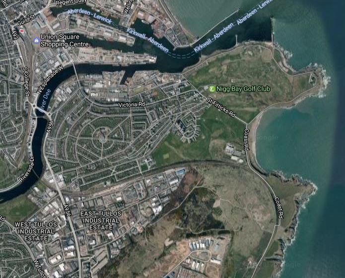
Aberdeen station in the top left corner and Girdle Ness is the lower of the two promontories on the right.
What looks like a wall curving behind the promontory is in fact the railway crossing across the city and the turning South to Montrose, Dundee and Edinburgh.
If an average architect couldn’t make good use of this location, then they’re not even average.
Conclusion
This proposal is very likely to be a success, but I feel that it needs to offer a frequency of four trph.
The Rebuilt Tunnel Under Bank Station
I never took the connection tunnel between the Waterloo and City Line or Drain platforms at Bank station to the escalators that eventually get you out into the air by Lombard Street, where I used to visit clients at a major clearing bank.
I doubt, it was as good as it is now!
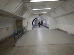


I was travelling home from Waterloo using the Drain and once back on the surface, I just crossed King William Street and got a 141 bus home.
It might be upwards of a hundred metres underground, but it’s light, airey and traffic-free.
We need more pedestrian tunnels like this under London.
Obviously, it wasn’t Rush Hour!
Will Trains Enable Chinese And Other Tourists To Invade Loch Ness?
In my list of possible stations from my friend Nick, there is the innocent station called Ness.
This could be any one of the following.
As the others, are probably not destinations that would generate a lot of traffic to pay for the station, I suspect that Ness refers to Loch Ness.
There used to be a Fort Augustus Pier station, at the Southern end of Loch Ness. I assume from the giveaway word in the station name, that this was the transit point for Victorian hunters going to shoot Nessy
The station was the Northern terminus of the Invergarry and Fort Augustus Railway. At its Southern end the railway connected to the West Highland Line at Spean Bridge station.
This Google Map shows the area.
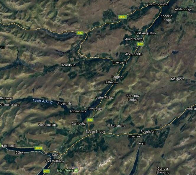
Fort Augustus To Spean Bridge
Loch Ness intrudes from the North and Spean Bridge station is close to Ben Nevis at the bottom.
This diagram shows the various stations on the Invergarry and Fort Augustus Railway.
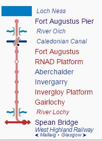
Surprisingly, the railway has not been completely dismantled and Wikipedia says this.
Some of the line today has been built over by roads and holiday parks, although it mostly survives in a reasonably good, if overgrown, condition. The many bridges and single tunnel are in particularly good condition. Some of the line along Loch Oich has been incorporated into the Great Glen Way, and a further section is proposed to become part of National Cycle Route 78.
A restoration project is (2016) under way at Invergarry Station, the last remaining station that is largely intact. The Invergarry Station Preservation Society plan to create a static museum, with a short length of track and several freight wagons.
It would be an interesting way to get to Inverness, if you could get a boat from Fort Augustus.
