An Extreme Day Out – Bedlington And Northumberland Park Stations
This OpenRailwayMap shows the Northumberland Line and the Eastern part of the Newcastle Metro.
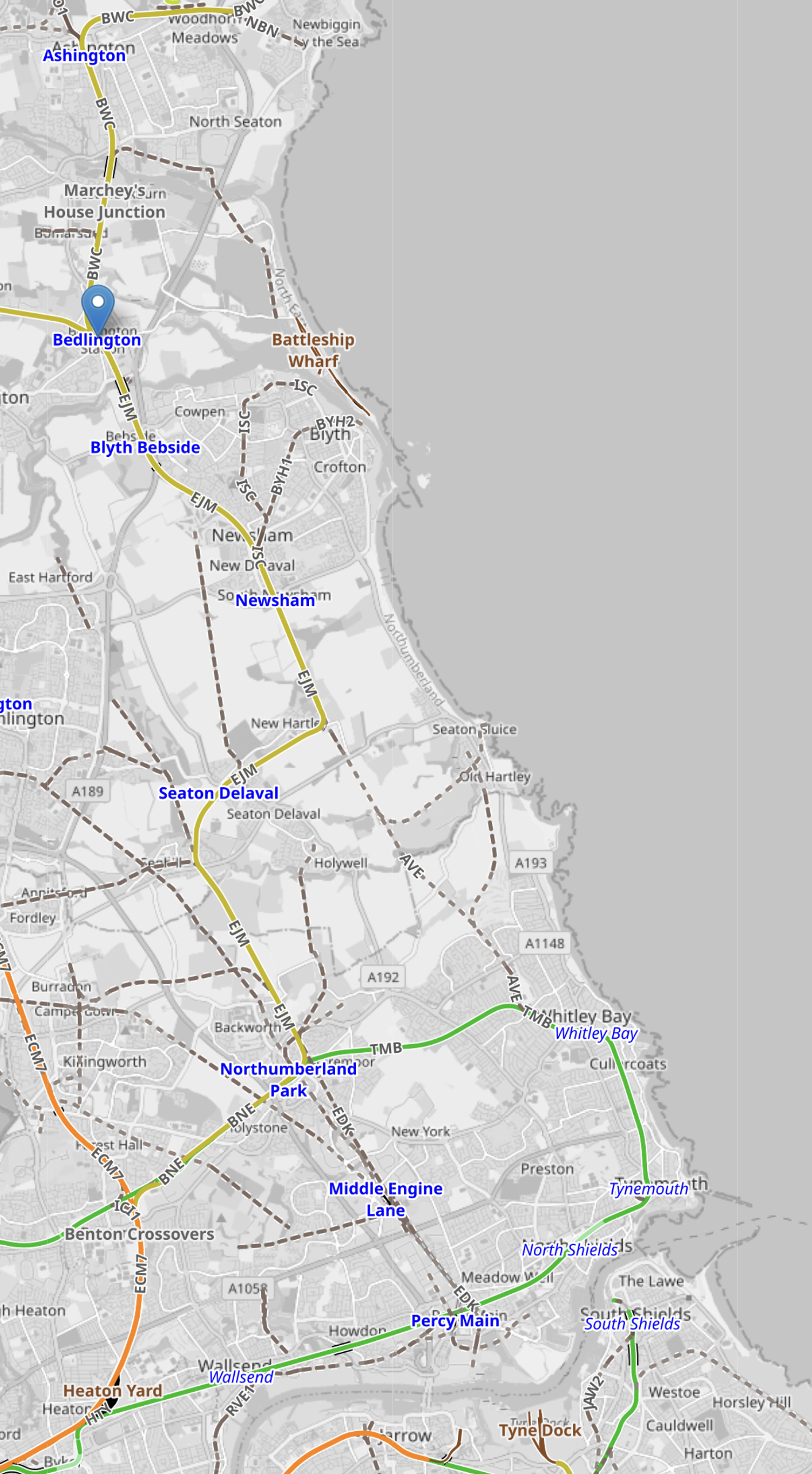
Note.
- The yellow track is the Northumberland Line.
- It terminates in the North at Ashington in the top-left corner of the map.
- Bebington station is indicated by the blue arrow.
- It terminates in the South at Newcastle station.
- The green track is the Newcastle Metro.
- There is now an interchange between the two lines at Northumberland Park station.
In the following sections, I’ll describe my trip.
King’s Cross And Newcastle Return For £66.35
I bought my two long distance tickets on a walk-up basis at King’s Cross and Newcastle stations from the machines.
- I traveled North on a Lumo service to Glasgow for £27.20.
- I did indulge myself with a tea for £2.60.
- I traveled South on an LNER service for £36.55.
- One of the reasons, I buy tickets on a walk-up basis, is that with my uncomplicated pancolonic diverticular disease, I might decide to cancel at the last minute, so it avoids the hassle of getting refunds.
Both services were within a few minutes of the timetable, although LNER had said they would be late, due to signalling problems.
My Route In Northumberland For £2.60
I bought a return ticket at Newcastle station for Ashington, which is the current terminus of the Northumberland Line.
- I actually didn’t go past Bedlington station, where I turned round and had a drink.
- As there are two trains per hour on the Northumberland Line, waits are not generally not too long.
- I only came back as far as Northumberland Park, where I swapped to the Metro for Newcastle station.
If I had had more time, I would have stopped at Seaton Delaval station to have a gluten-free dinner, which I wrote about in Seaton Delaval Station – 30th March 2025.
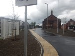
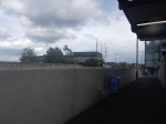
From Newcastle to Bedlington Station
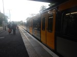
I took these pictures going to Bedlington station.
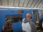
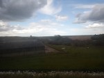
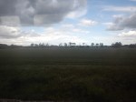

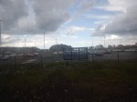
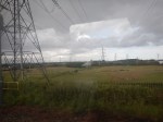
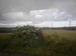
I would have taken more pictures, but the train was rather full.
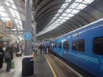
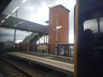
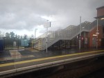
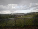
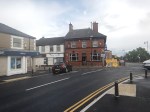
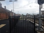
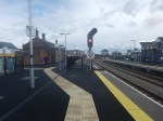
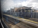
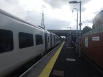
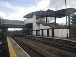
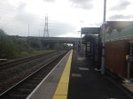
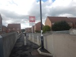
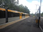
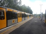
Bedlington Station And Bedlington
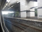
I took these pictures at and around Bedlington station.

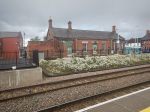
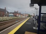
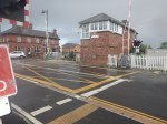
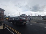

Note.
- Although it is a completely rebuilt station, it has a level crossing.
- But is the signal box keeping a watchful eye over trains and the road?
- Bedlington station appears to be step-free using ramps and the level crossing.
- Just to the North of the station, the tracks split to Ashington and Morpeth.
In my forty minutes or so in Bedlington, I didn’t see a terrier.
Are Any Bedlington Terriers Still Bred At Or Near Bedlington?
I had to ask Google AI, this question and I received this reply.
Yes, Bedlington Terriers are still bred in and around their namesake town in Northumberland, UK. While they are a relatively rare breed overall, the historic North East region remains one of the primary strongholds for these distinct “lamb-like” dogs.
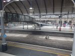
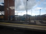
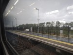
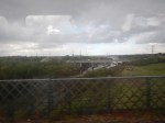
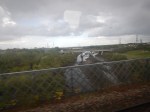
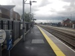
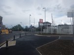
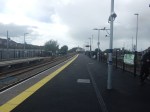
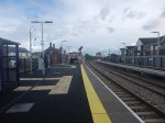
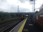
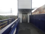
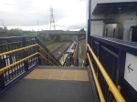
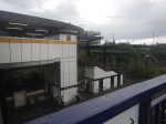
Northumberland Park Station
I took these pictures at Northumberland Park station.
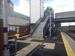
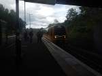
Note.
- The Northumberland Line uses a single bi-directional platform on the North side of the station.
- The Newcastle Metro uses an island platform on the South side of the station.
- Both platforms have steps and lifts.
- There are around 400 parking spaces and a Sainsbury’s Superstore at the station.
At 78, after a stroke, I didn’t find the change between the two lines difficult. But I did use the lifts!
What Are The Future Plans For The Northumberland Line?
I couldn’t resist asking Google AI this question and I received this answer.
With the Bedlington and Northumberland Park stations fully operational, the core phase of the Northumberland Line connecting Ashington to Newcastle is complete. Future plans now focus on route extensions, additional stops, and increasing capacity to handle high passenger demand.
Key Future Plans
Extension to the Coast: The North East Combined Authority is actively funding the development of an extension to Newbiggin-by-the-Sea, utilizing existing freight tracks. Planning submissions for this expansion are targeted for 2028.
New Station Proposals: Proposals are being explored to build an additional stop serving the Wansbeck General Hospital and to replace the long-closed Choppington station.
Increased Capacity: Operator Northern Rail is in ongoing discussions with transport partners to lengthen train services (which are currently constrained to two to four coaches) to help accommodate massive patronage on the line.
Integrated Ticketing: The Northumberland County Council is exploring integrated ticketing with the Tyne and Wear Metro to allow for seamless travel between the two networks at stations like Northumberland Park.
From my observations on the line over the last few years, I would go along with Google AI’s recommendations.
These are some specific thoughts.
Extension To Newbiggin-by-the-Sea
This OpenRailwayMap shows the tracks that used to exist between Ashington and Newbiggin-by-the-Sea.
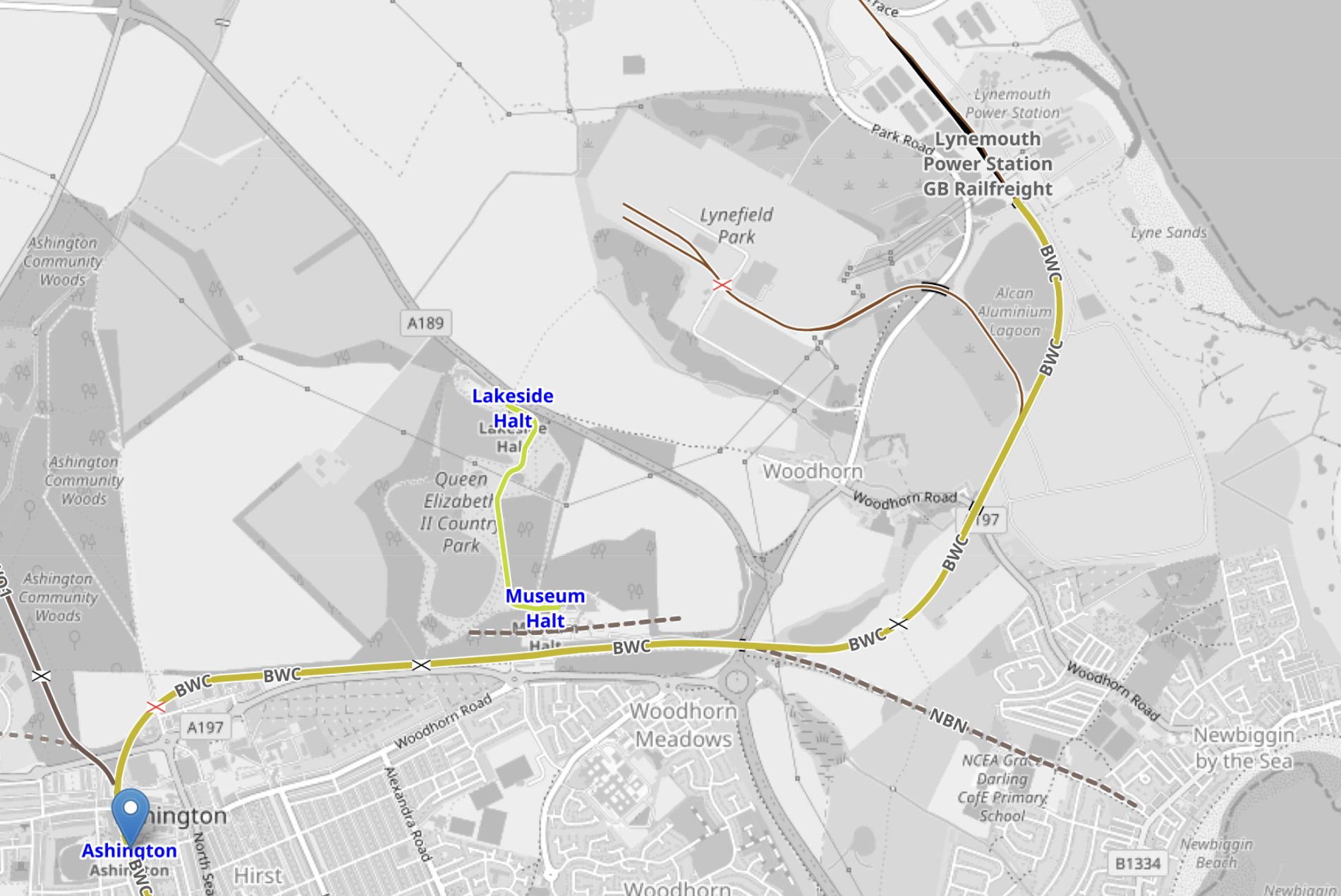
Note.
- Ashington station is in the South-West corner of the map.
- A freight line exists, which is shown in yellow, all the way to Lynemouth power station, which is a 420 MW biomass power station.
- Lynemouth powerstation was originally built to power an aluminium smelter.
- Running South-East from the Northumberland Line, is a disused railway alignment labelled NBN, which leads into Newbiggin-by-the-Sea.
This Wikipedia section describes the history of railway connection of the town.
Situated on the west side of Front Street (now the B1334), the station opened on 1 March 1872 as a terminus of the Blyth and Tyne Railway (now known as the Northumberland Line). The station had a long island platform onto which the station building faced. There were sidings on both sides of the station which handled goods traffic, controlled by a signal box. The station closed to both passengers and goods traffic on 2 November 1964. With the reopening of the Northumberland Line, Provisions have been made, especially at Ashington so that the line could be extended to Newbiggin. As of the end of 2025, there were calls to extend the railway by 1.6km (1 mile) into the centre of Newbiggin-by-the-Sea. This will require new track and is all subject to a feasibility study. A formal bid was launched in December 2025 for this.
In Formal Bid To Extend Railway Line, I wrote about the latest progress in January 2026, based on a BBC article.
The Northumberland Line Needs A Focus Other Than Commuting
Several of the stations have large car-parks, which is good for commuting, but the railway needs to serve more places for leisure and other activities.
- Seaton Delaval Hall is Grade 1 Listed and is just 10 minutes in a bus from the station with the same name.
- If the Northumberland Line is connected to Newbiggin-by-the-Sea, that could bring in those, wanting a day by the sea.
- The extended Northumberland Line would also connect to Woodhorn, which is a museum, described in this Wikipedia entry.
QTS are also developing an AI data centre at Cambois, which surely will generate commuter traffic from all over the North East.
This OpenRailwayMap shows the location of the QTS AI Data Centre.
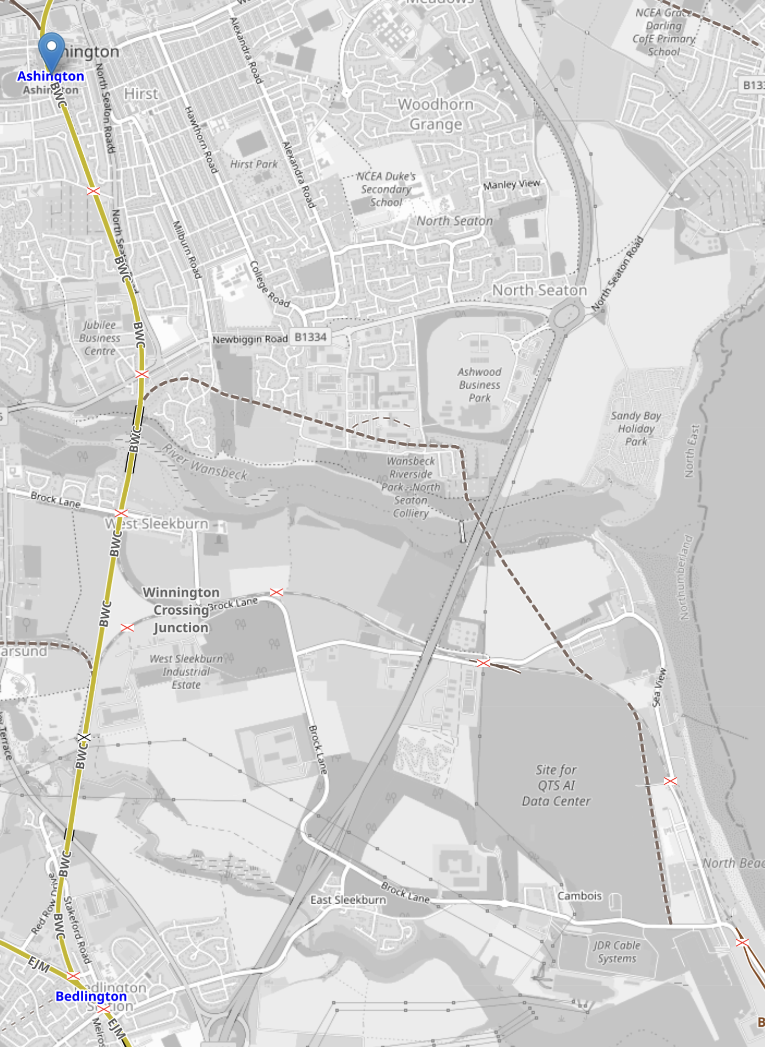
Note.
- Ashington station is indicated by a blue arrow.
- The yellow track is the Northumberland Line, which now terminates at Ashington station.
- Bedlington station is in the South-West corner of the map.
- The trapezoidal grey box to the East of Bedlington is labelled as Site for QTS AI Data Centre.
- As the site, was that of Blyth coal-fired power station, before QTS acquired it, there is a disused railway line that connects the site to the Northumberland Line.
I suspect there are powerful economic arguments about whether or not, the Northumberland Line is extended to the QTS AI Data Centre site.
How Much Power Will QTS Cambois Data Centre Need?
I couldn’t resist asking Google AI this question and I received this answer.
The proposed QTS Cambois data centre in Northumberland is expected to require between 620MW and 720MW of critical IT power capacity, with an initial proposal capacity of up to 1.1GW.
Details on the planned power infrastructure include:
Power Capacity: The facility will support up to 720MW of critical IT capacity across ten planned buildings, though some council estimates cite an expected total power capacity of 620MW.
Backup Power: To guarantee uptime and handle power outages, the campus will rely on nearly 600 diesel-powered generators, requiring up to 58 generators per data hall.
Site Details: Located on the former Blyth Power Station site in Cambois, the £10 billion development will span 540,000 square metres.
My views on this are.
- There is the 1.4 GW North Sea Link from Blyth to Norway, that I wrote about in UK To Norway Sub-Sea Green Power Cable Operational.
- The 4.1 GW Berwick Bank wind farm is planned to send 1.8 GW to Blyth.
- To help if QTS need more power, there is the 1.4 GW Sofia wind farm.
- So 1.1 GW should be manageable, as Blyth is blessed with more power than Niagra Falls.
I also believe that Centrica and Delta have a much better backup solution, that I described in Delta And Centrica Launch Scalable Off-Grid Fuel Cell Power Solution. Hydrogen could come by pipeline or rail.
How Would The Northumberland Line Connect To Wansbeck Hospital?
This Google Map, shows the location of Wansbeck General Hospital with respect to Ashington station.
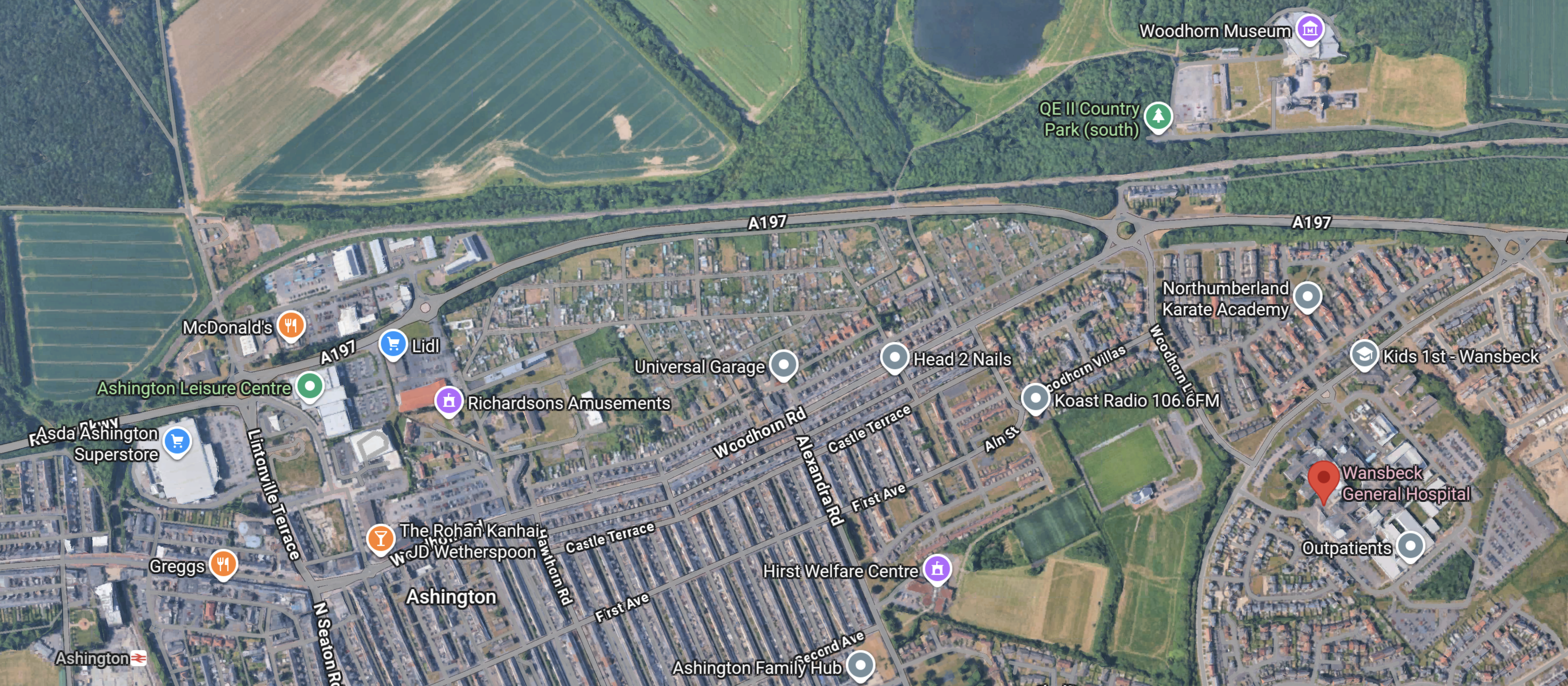
Note.
- Ashington station in the South-West corner.
- Woodhorn museum is in the North-East corner.
- Wansbeck General Hospital is indicated by a red arrow.
- The Northumberland Line runs East-West to the South of the museum and then curves round to reach the station.
Perhaps the station could go between the museum and the hospital and an innovative shuttle would connect all three locations.
How Would The Northumberland Line Connect To Choppington?
This Google Map, shows the location of Choppington, with respect to Morpeth and Bedlington stations.
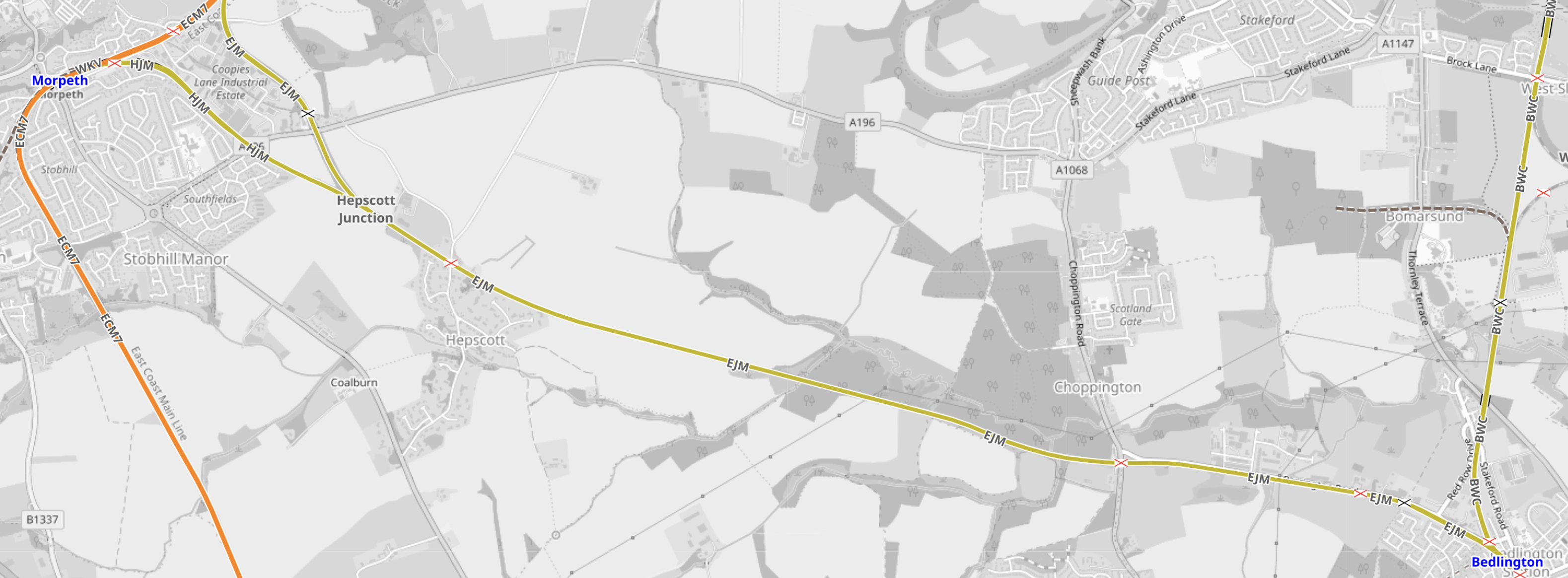
Note.
- The orange track on the West side of the map is the East Coast Main Line.
- Morpeth station is in the North-West corner of the map.
- Bedlington station is in the South-East corner of the map.
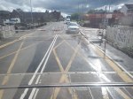
The Eastern end of the Bedlington and Morpeth Line can be seen in this picture to the left of Bedlington North signal box at the Northern ends of the the platforms.

Note.
- Bedlington North signal box has a communication mast behind it.
- The track to the left of the box goes to Morpeth.
- The track to the right of the box goes to Ashington.
This OpenRailwayMap shows Choppington Road, which crosses the Bedlington and Morpeth Line at the only level crossing between Bedlington station and Hepscott junction.
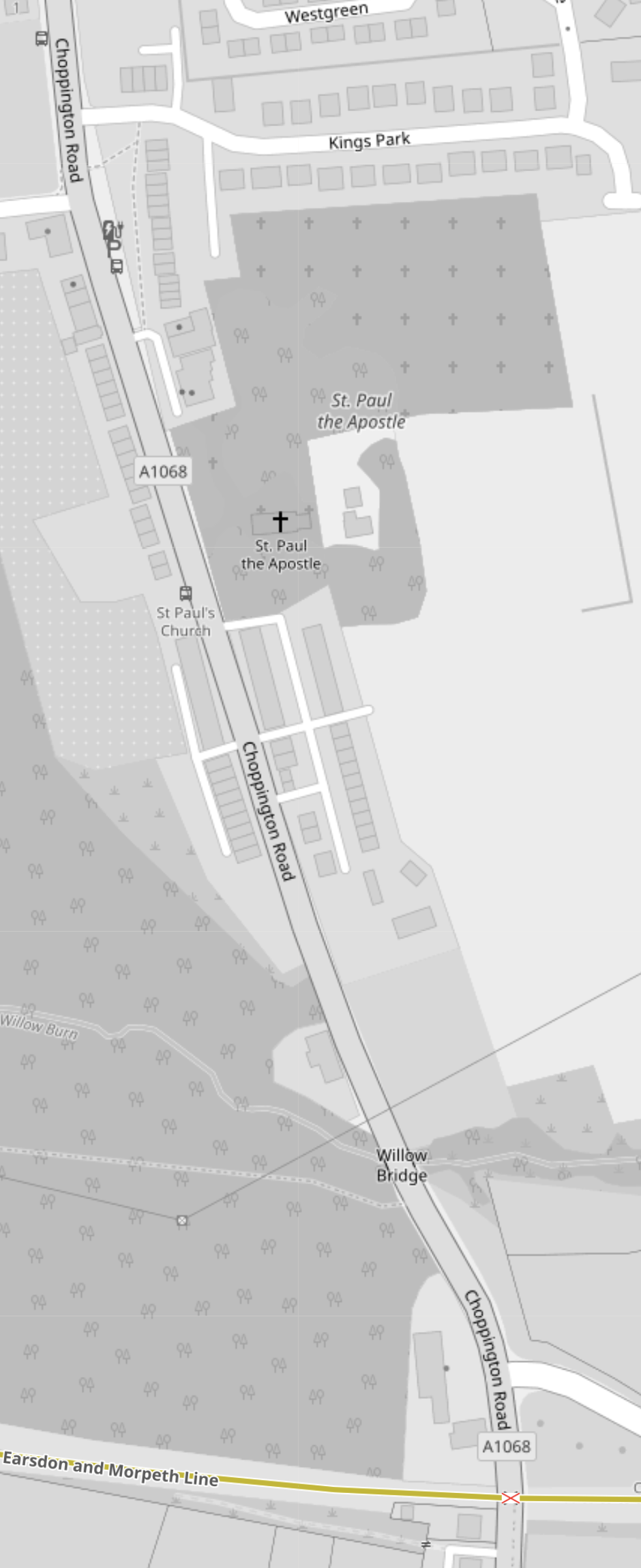
Note.
- Choppington Road, which runs North-South on the map.
- The yellow tracks are the Morpeth and Bedlington Line, which runs East-West across the map.
- Where they cross, a red cross indicates a level crossing.
- The Wikipedia entry of Choppington station shows a level crossing.
As the level crossing on the map is the only one shown, this must be the location of Choppington station.
