The Proposed Lionel Road Station On the West London Orbital Railway
Starting with Lionel Road station may seem a strange place to start, but this important station for supporters of Brentford FC, may in the end define how the new line is designed and built.
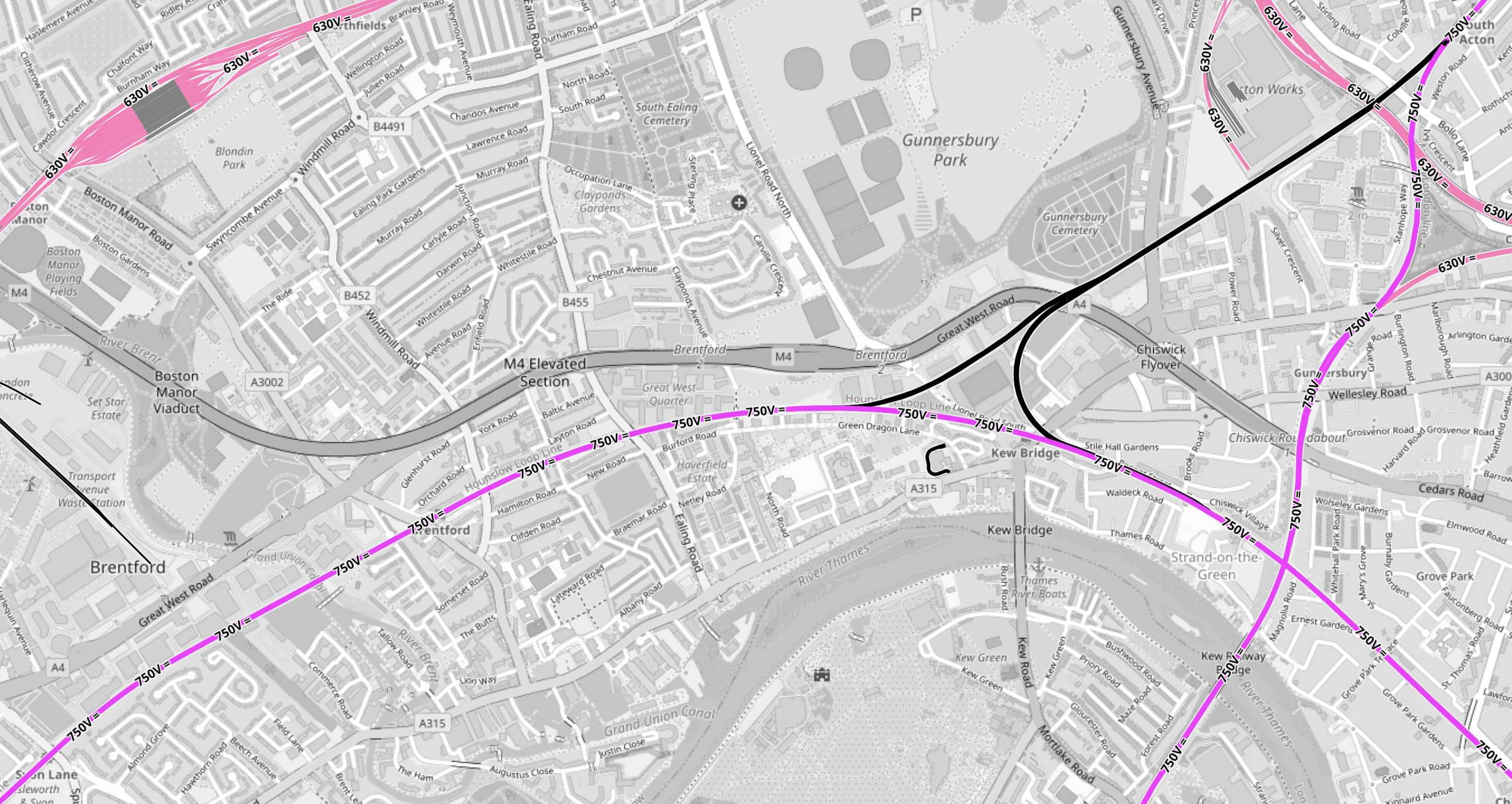
This OpenRailwayMap shows the tracks around the stadium, that has been built for the Premier League football club, which is now called the Gtech Community Stadium.
Note.
- In the North-West corner of the map is the Piccadilly Line branch to Heathrow Airport.
- Northfields Depot is prominent, with the station of the same name to its East.
- South Acton station is in the North-East corner of the map.
- Syon Lane station is in the South-West corner of the map.
- The West London Orbital Railway runs between these two stations.
- Lilac sections are electrified and black sections have none.
- South Acton station is also on the North London Line, which runs North-South to Richmond station off the bottom of the map.
- Syon Lane Station is also on the Hounslow Loop Line, which curves across the bottom half of the map to the South-East corner.
- Click the map to show it to a larger scale.
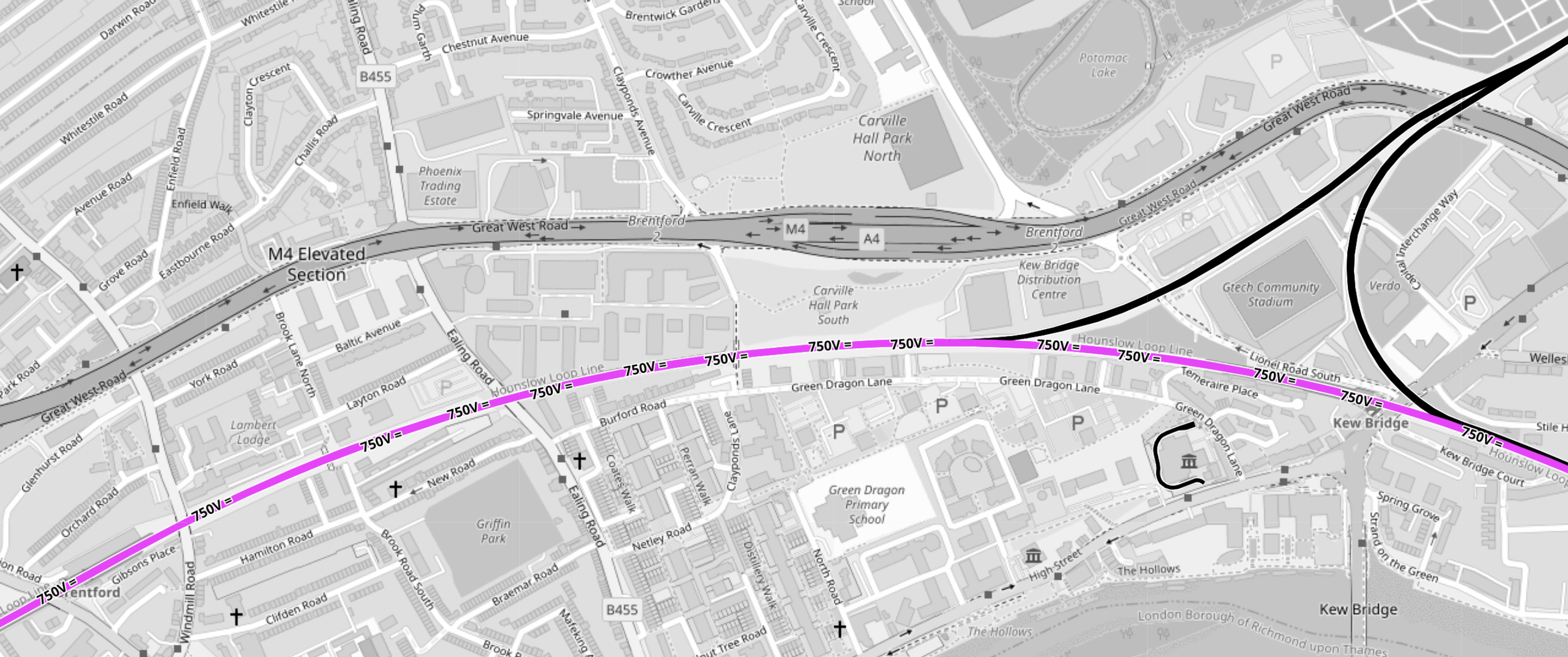
This second OpenRailwayMap shows triangular junction in the middle of the first map to a larger scale.
Note.
- The Gtech Community Stadium sits in the middle of the triangular junction.
- Provision has been made in the layout of the stadium for the station to be on the North-West leg of the triangular junction.
- Kew East Junction is in the North-East corner of the map.
- Old Kew Junction is in the South-West corner of the triangular junction.
- New Kew Junction is in the South-East corner of the triangular junction.
- The lilac track crossing the map is the electrified Hounslow Loop Line.
- The M4/A4 runs across the map
- Only the Southern leg of the triangular junction is electrified.
- Click the map to show it to a larger scale.
These are some of my thoughts.
Lionel Road Station Will Be Unlikely To Be Electrified
Consider
- It will be extremely unlikely that between South Acton station and Old Kew junction will be electrified with third-rail electrification because of safety issues.
- There is a very long chance, that it might be decided to create a 25 KVAC overhead electrified route across London, by means of the North London Line.
- I believe hydrogen trains will be developed for freight services.
- The station will have large numbers of passengers on match-days, so safety may determine an electrification-free station.
- The electrification gap is only 1.4 miles, which is well within range of a battery-electric train.
I think it is more likely that hybrid trains will use what is available.
Will Lionel Road Station Be Step-Free?
Sixty years ago, I used Manchester United station to see a match.
This Google Map shows the station.
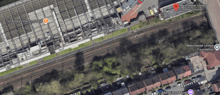
Note.
- The station is a single platform tucked in behind the South stand.
- The station entrance is indicated by a red arrow.
- When I went in the 1960s, the train was a steam-hauled shuttle from the city centre.
- This Wikipedia entry gives more details.
I suspect a similar space-saving design could be used at Lionel Road station.
There will be a need for a bridge if the station is used on more than match days.
Will Lionel Road And Kew Bridge Stations Be An Out Of Station Interchange?
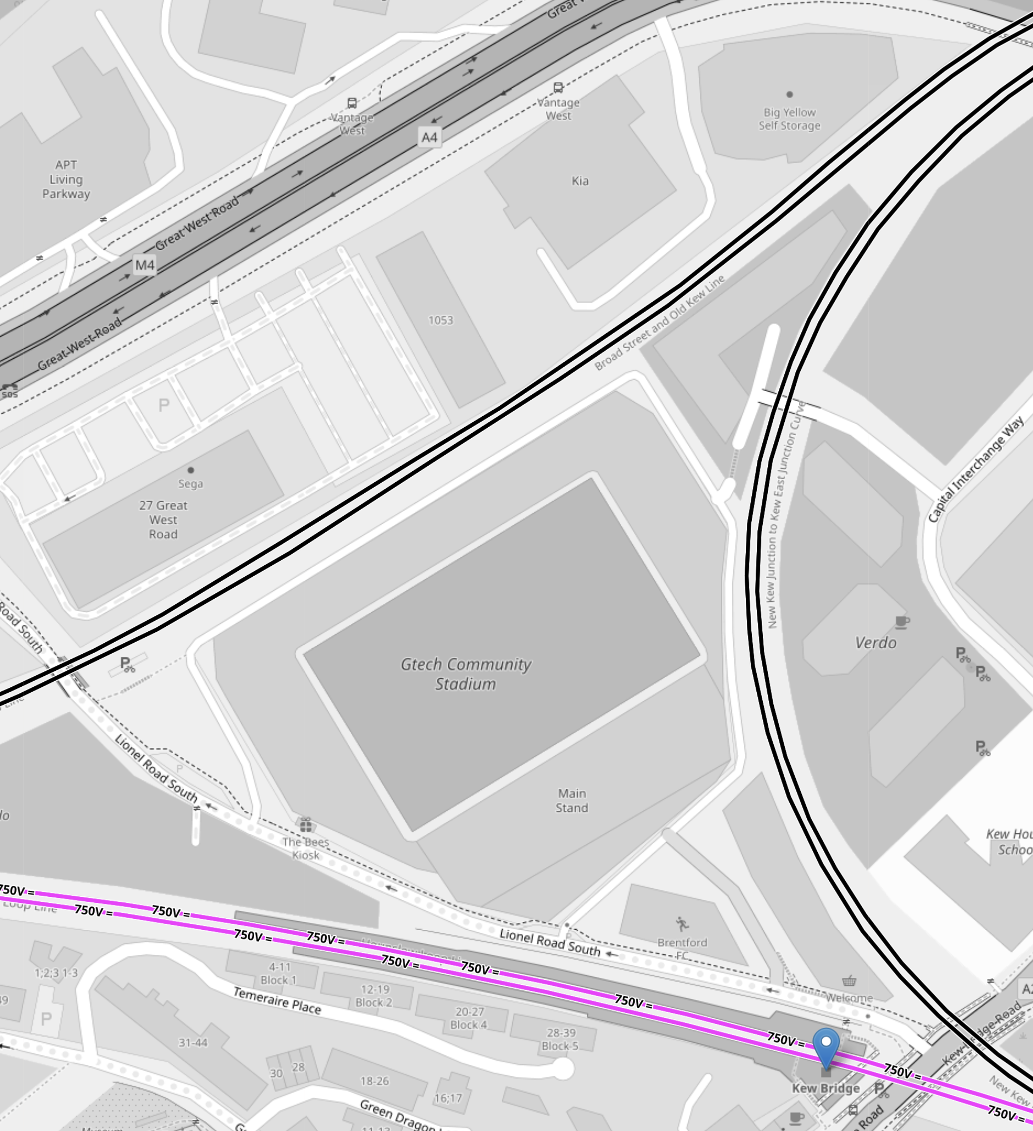
This OpenRailwayMap shows the triangular junction, with the GTech Community Stadium in the middle.
Note.
- Lionel Road station will be on the North-West side of the station.
- Kew Bridge station is marked by a blue arrow.
- There appear to be walking routes all over the plot on which the stadium sits.
- All sides of the junction are double track.
I think an Out-Of-Station Interchange would be useful, especially for those who don’t know the area.
How Easy Will It Be To Get To Lionel Road Station From Major London Stations?
These are my best estimates at a degree of difficulty.
- Bank – 1 Change – Take Central Line with a change at Old Oak Common Lane to Lionel Road.
- Blackfriars – 1 Change – Take Thameslink with a change at Brent Cross West to Lionel Road.
- Bond Street- 1 Change – Take Elizabeth Line with a change at Old Oak Common Lane to Lionel Road.
- Cannon Street – 2 Changes – Get out at London Bridge – Take Thameslink with a change at Brent Cross West to Lionel Road.
- Charing Cross – 1 Change – Take Bakerloo Line with a change at Harlesden to Lionel Road.
- City Thameslink – 1 Change – Take Thameslink with a change at Brent Cross West to Lionel Road.
- Euston – 1 Change – Take Watford DC Line with a change at Harlesden to Lionel Road.
- Farringdon – 1 Change – Take Thameslink with a change at Brent Cross West to Lionel Road.
- King’s Cross – 1 Change – Take Thameslink with a change at Brent Cross West to Lionel Road.
- Liverpool Street – 2 Changes – Get out at Stratford – Take the Overground with a change at South Acton to Lionel Road.
- Liverpool Street – 1 Change – Take Elizabeth Line with a change at Old Oak Common Lane to Lionel Road.
- London Bridge – 1 Change – Take Thameslink with a change at Brent Cross West to Lionel Road.
- Marylebone – 1 Change – Take Bakerloo Line with a change at Harlesden to Lionel Road.
- Moorgate – 1 Change – Take Elizabeth Line with a change at Old Oak Common Lane to Lionel Road.
- Old Street – 2 Changes – Go to Moorgate – Take Elizabeth Line with a change at Old Oak Common Lane to Lionel Road.
- Oxford Circus – 1 Change – Take Bakerloo Line with a change at Harlesden to Lionel Road.
- Paddington – 1 Change – Take Elizabeth Line with a change at Old Oak Common Lane to Lionel Road.
- Piccadilly Circus – 1 Change – Take Bakerloo Line with a change at Harlesden to Lionel Road.
- St. Pancras – 1 Change – Take Thameslink with a change at Brent Cross West to Lionel Road.
- St. Paul’s – 1 Change – Take Central Line with a change at Old Oak Common Lane to Lionel Road.
- Tottenham Court Road – 1 Change – Take Elizabeth Line with a change at Old Oak Common Lane to Lionel Road.
- Vauxhall – 2 Changes – Go to Oxford Circus – Take Bakerloo Line with a change at Harlesden to Lionel Road.
- Victoria – 2 Changes – Go to Oxford Circus – Take Bakerloo Line with a change at Harlesden to Lionel Road.
- Waterloo – Direct – Direct train to Kew Bridge.
- Waterloo – 1 Change – Take Bakerloo Line with a change at Harlesden to Lionel Road
Note.
- It does appear that the connections in stations like Brent Cross West, Harlesden and Old Oak Common Lane, will make a lot of difficult cross-London journeys easier.
- But not many journeys to the GTech Community Stadium, finish at Kew Bridge station.
- Most journeys pick up the West London Orbital at Brent Cross West, Harlesden or Old Oak Common Lane, which probably means these three stations should be step-free.
- As I’ve been writing this, I do wonder if now is the time to create a pedestrian connection between City Thameslink and St. Paul’s stations, that I wrote about in A Pedestrian Connection Between City Thameslink Station And St. Paul’s Tube Station.
I do believe though that there are places on the Central Line, where small projects can give a high return on expenditure.
Conclusion
Surprisingly, this is a lot more than just a station for a Premier League football club.
Are There Any Plans For The Bay Sub-Surface Platforms At Moorgate Station?
I use Moorgate station regularly, as there’s a Leon Restaurant just outside the station, that looked after me properly during the Covid-19 Pandemic, so when I’m in the area and need feeding I pop in.
These pictures show the four bay platforms on the Sub-Surface lines.
Note.
- The pair of platforms to the left or South are numbered 5 and 6 and used to handle Thameslink trains, that ran to Moorgate station.
- Platforms 5 and 6 used to be electrified with 25 KVAC overhead wires.
- The pair of platforms to the right or North are numbered 3 and 4 and are used to terminate some Metropolitan Line services at Moorgate station.
- Platforms 3 and 4 are electrified with London Underground four-rail electrification.
- The number for Platform 4 can clearly be seen.
This map from cartometro shows the track layout in Farringdon, Barbican and Moorgate stations.
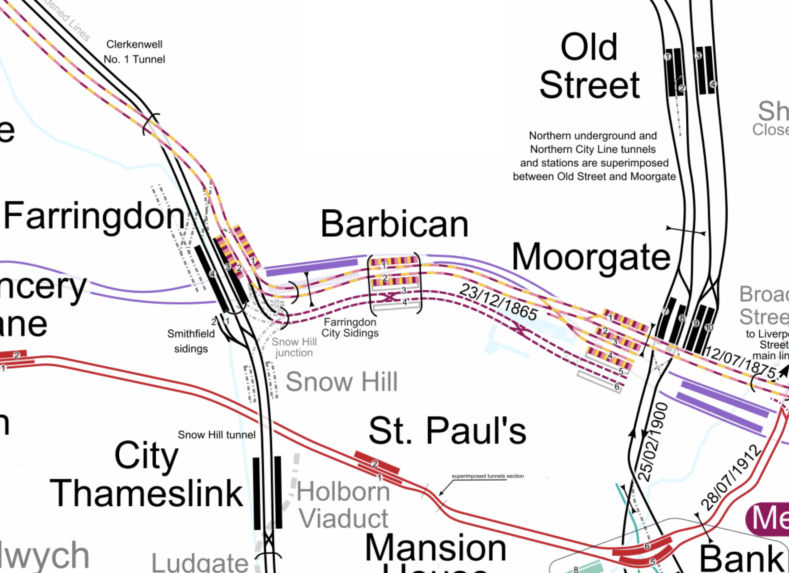
Note.
- The multi-coloured tracks and platforms of the Metropolitan, Circle and Hammersmith & City Lines running through Platforms 1 & 2 at Farringdon, Barbican and Moorgate stations.
- The multi-coloured tracks and platforms of the Metropolitan, Circle and Hammersmith & City Lines terminating in Platforms 3 & 4 at Moorgate station.
- The purple tracks and platforms of the Elizabeth Line running underneath the Metropolitan, Circle and Hammersmith & City Lines and their stations.
- The maroon and white tracks and platforms of Thameslink running through Platforms 3 & 4 in Barbican station and terminating in Platforms 5 & 6 at Moorgate station.
- The black tracks of Thameslink running through Farringdon and City Thameslink stations.
- It would appear there used to be two junctions to allow trains from Moorgate to go North through Farringdon station or South through City Thameslink station.
- The Thameslink tracks have two useful crossovers.
- The black tracks of the City branch of the Northern Line running through Old Street, Moorgate and Bank stations.
- The black tracks of the Northern City Line running through Old Street station and terminating in Moorgate station.
- The red tracks of the Central Line running through Chancery Lane, St. Paul’s and Bank station.
Because of the layout of the various tracks new connections and improvements may be possible.
Extending The Northern City Line To Bank Station
In Walking Along Moorgate – 30th September 2020, I describe some of the possibilities opened up by the design of Moor House, which has been built to allow more tunneling underneath.
I believe two extensions South from Moorgate station would be possible.
- It was intended by the builders of the Northern City Line, to take the route to just North of Bank station at Lothbury.
- Has The Possibility Been Created For A Pedestrian Tunnel Between Bank And Moorgate Stations?
Note.
- As the extension to Bank station has dug tunnels all over the place, I would expect that the engineers on that project would have a good idea on the best way to connect Moorgate and Bank stations.
- I usually use the Northern Line between Moorgate and Bank stations, but sometimes the Northern Line is rather crowded.
- The Northern City Line is being resignalled and may have an increased number of trains, so more passenger capacity may be needed.
- If a new station were to be built at Lothbury, it might be possible to improve step-free access to the Northern City Line.
- A new station on the Northern City Line and a pedestrian tunnel could connect to the newly-installed travelator at Bank station.
There are certainly serious possibilities to improve connections between Moorgate and Bank stations.
Could Metropolitan Line Trains Be Turned At Moorgate Station?
Currently, there are eight trains per hour (tph) between Aldgate and Uxbridge in the Off Peak.
With the new signalling on the Sub-Surface Lines would it allow more trains to operate, if some Metropolitan Line services were terminated in Platforms 3 & 4 at Moorgate station.
Would It Be Worthwhile To Run Thameslink Trains Again Into Moorgate Station?
It would only need to terminate trains from the North, as trains from the South can terminate at Black friars Station.
Perhaps a two tph service from a convenient station would suffice.
A Pedestrian Connection Between City Thameslink Station And St. Paul’s Tube Station
I covered this in A Pedestrian Connection Between City Thameslink Station And St. Paul’s Tube Station.
Automatic Door Opening On Thameslink
This morning I used Thameslink between City Thameslink and London Bridge stations.
On the three stations on this short route, the doors opened automatically, without passengers having to push any buttons.
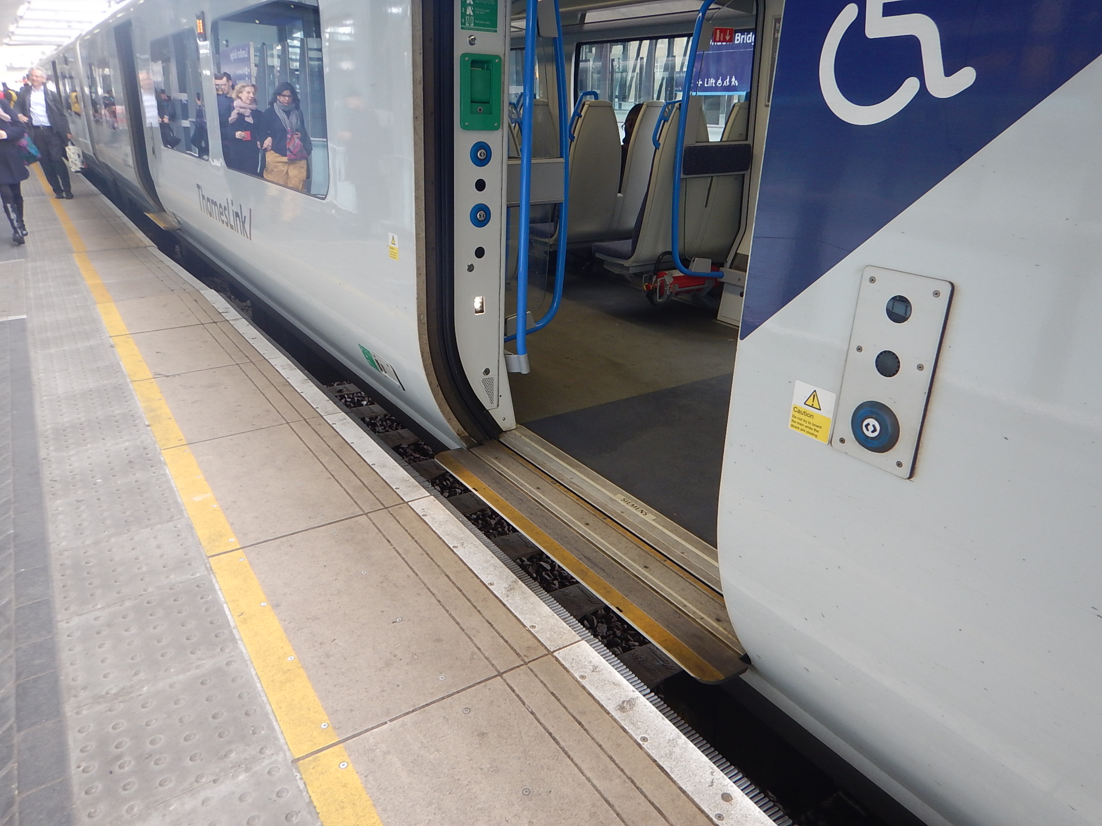
This is normal London Underground practice and will it be used on the tunnel stations on Crossrail.
But it struck me, as I got on the train at City Thameslink station, where there is a large gap for passengers to fall into, that automatic opening may well be safer, as passengers don’t have to lean across.
Ludgate Circus And Blackfriars Station
This morning, I had an excellent full English breakfast with a large mug of tea in Leon at Ludgate Circus.
It is unusual for a fast-food restaurant, in that it has acres of space, alcohol, including gluten-free beer, for those who want it, five or six large tables that seat ten and an outdoor area for a sunny and warm day.
So at ten in the morning, I can always find a place to lay out my copy of The Times and read it at leisure.
Others seemed to be having breakfast meetings or encounters.
The Wikipedia entry for Ludgate Circus has a section on Stations, which says this.
Had the Fleet line of the London Underground been built, it would have had a station at Ludgate Circus. However, the Fleet line’s proposed route evolved into what is now the Jubilee line, which went south of the River Thames before reaching Ludgate Circus. In 1990 however, St. Paul’s Thameslink (later renamed City Thameslink) was opened on the site of the proposed Ludgate Circus station.
North-South Thameslink services through the double-ended City Thameslink station, with its numerous escalators and lifts, will reach twenty-four trains per hour (tph), from the current sixteen tph by the end of next year.
I could have taken Thameslink to Blackfriars station, but I walked and took these pictures on the way.


It is not a pleasant walk with all the traffic.
Next time, I’ll take Thameslink!
The reason, I went to Blackfriars, was to catch a Circle or District Line train to Tower Hill station.
Where is the Fleet Line, when you need it?
Phase one of the line ran to Charing Cross station, where it was extended to become the Jubilee Line, we have today.
The original plan for the Fleet Line as given by Wikipedia was.
Phase 2: would have extended the line along Fleet Street to stations at Aldwych, Ludgate Circus, Cannon Street and Fenchurch Street. Parliamentary approval for this phase was granted on 27 July 1971.
Phase 3: would have seen the line continue under the river to Surrey Docks (now Surrey Quays) station on the East London Line, taking over both of the ELL’s branches to New Cross Gate and New Cross stations, with an extension to Lewisham.
Parliamentary approval for this phase as far as New Cross was granted on 5 August 1971 and the final section to Lewisham was granted approval on 9 August 1972.
Phase 2 would have whisked me to Fenchurch Street station and Phase 3 sounds a lot like the current proposal for the Bakerloo Line Extension.
I very much feel that there is a need for a line across London on the route of the Fleet Line and Transport for London have a plan to extend the Docklands Light Railway, that I wrote about in A Connection Between City Thameslink Station And The Docklands Light Railway.
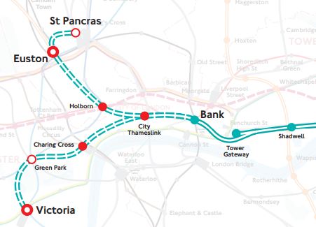
This map from Transport for London, shows the possible Western extension of the DLR.
With all the problems of the funding of Crossrail 2, that I wrote about in Crossrail 2 Review Prompts Fresh Delays, could this extension of the DLR, be a good idea?
It would certainly provide an East-West route at City Thameslink station.
A Connection Between City Thameslink Station And The Docklands Light Railway
In the Wikipedia entry for the Docklands Light Railway, there is a section describing a proposed Euston/St. Pancras Extension.
This is said.
In 2011, strategy documents proposed a DLR extension to Euston and St Pancras. Transport for London have considered driving a line from City Thameslink via Holborn north to the rail termini. The main benefit of such an extension would be to broaden the available direct transport links to the Canary Wharf site. It would create a new artery in central London and help relieve the Northern and Circle lines and provide another metro line to serve the High Speed line into Euston.
This map from Transport for London, shows the possible Western extension of the DLR.
With all the problems of the funding of Crossrail 2, that I wrote about in Crossrail 2 Review Prompts Fresh Delays, could this extension of the DLR, be a good idea?
Consider,
- Victoria, Euston and St. Pancras are prosposed Crossrail 2 stations.
- It would link Canary Wharf and the City of London to Eurostar, Northern and Scottish services and High Speed 2.
- It would give all of the Docklands Light Railway network access to Thameslink.
- A pair of well-designed termini at Euston and St. Panras would probably increase frequency and capacity on the Bank branch of the system.
- The DLR is getting new higher capacity trains.
- Bank station is being upgraded with forty percent more passenger capacity.
- Holborn station is being upgraded and hopefully will be future-proofed for this extension.
- One big advantage at City Thameslink, is that Thameslink and the proposed DLR extension will cross at right-angles, thus probably making designing a good step-free interchange easier.
- The Bank Branch of the DLR currently handles 15 tph, but could probably handle more, if they went on to two terminal stations at St Pancras and Victoria..
- Waterloo and City Line can run at twenty-four tph.
Cinderella she may be, but then she always delivers, when there is a desperate need, just as she did magnificently at the 2012 Olympics.
The only problem with this extension of the DLR, is that compared to the rest of the system, the views will be terrible.
For myself and all the others living along the East London Line, with a step-free change at Shadwell, we would get excellent access to Euston, Saint Pancras and Victoria
But could the line still be called the Docklands Light Railway, as it spreads its tentacles further?
A Pedestrian Connection Between City Thameslink Station And St. Paul’s Tube Station
In the Wikipedia entry for City Thameslink station, there is a section called Future Proposals.
This is said.
An underground passageway linking City Thameslink to St Pauls tube station to provide an interchange between the London Underground Central line and National Rail services on the Thameslink (route) has been suggested by London TravelWatch in a report in 2014 which suggested it would benefit passengers travelling from the Central Line catchment to Gatwick and Luton Airports.
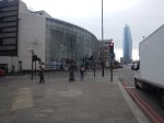
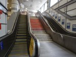
St. Paul’s tube station does not have the best access, with two sets of escalators to get to the Easttbound platform, which is underneath the Westbound one.
This picture shows the lobby at the bottom of the second set of escalators.
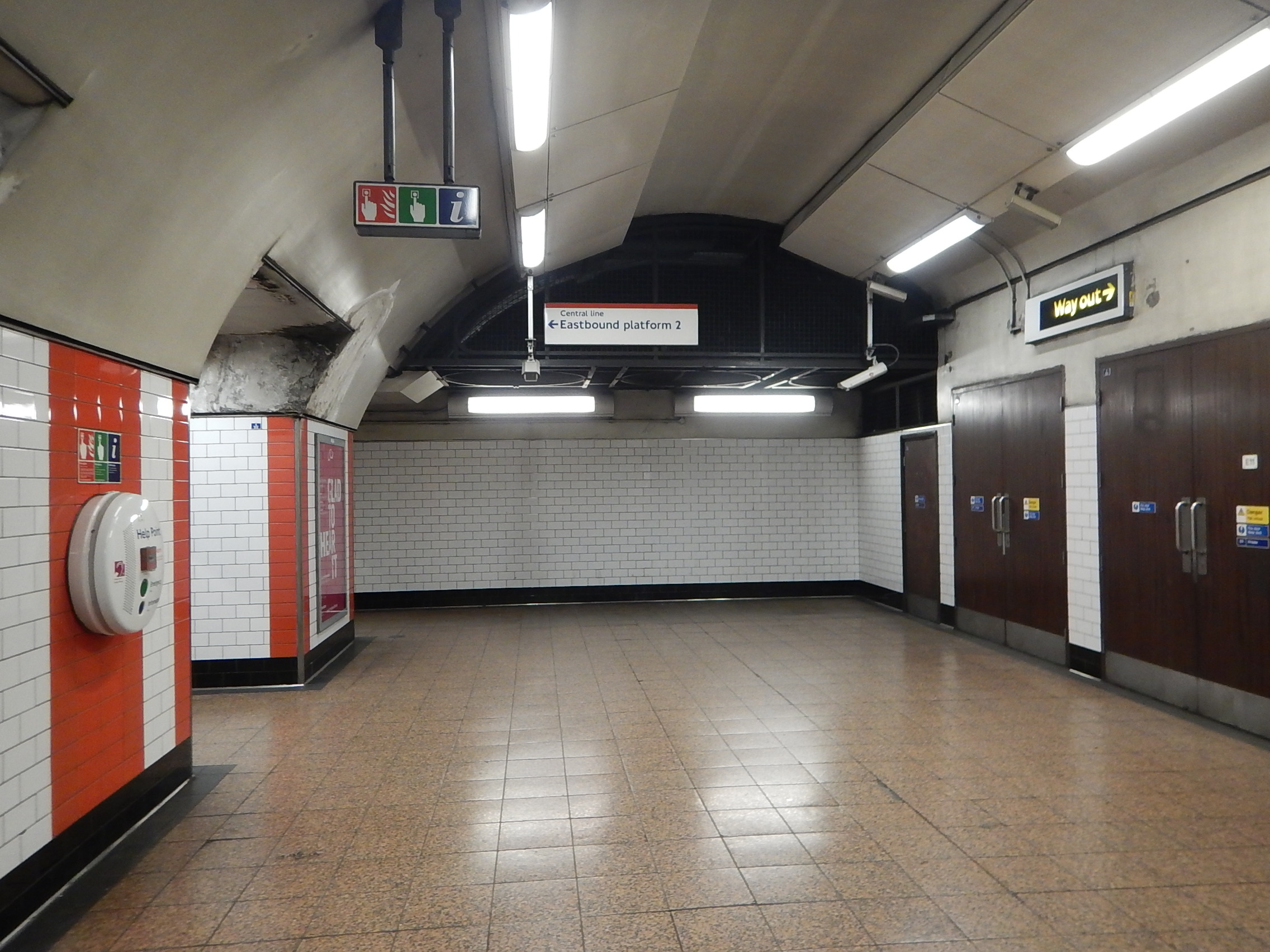
The Eastbound platform is through the opening on the left.
Could a tunnel to the West be built from this lobby?
This map from carto.metro.free.fr shows the layout of lines at City Thameslink and St. Paul’s.
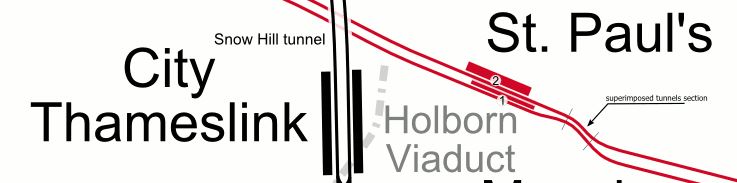
It would appear that a pedestrian tunnel could be bored from the Western end of the platforms at St. Paul’s to connect to the Northern end of City Thameslink.
- A travelator could be included.
- It would create an accessible route into St. Paul’s station.
- Intermediate entrances could be provided to give access to important sites like the Western end of St. Paul’s cathedral.
Property development between the two stations will probably be the catalyst to get this link built.
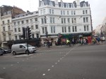
These pictures show Paternoster Square, which lies to the North of St. Paul’s cathedral.


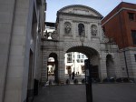

I wonder if provision was made for an entrance, when the area was redeveloped around twenty years ago.
It would surely be an ideal place for an intermediate step-free entrance to any pedestrian tunnel linking St. Paul’s and City Thameslink stations.
Conclusion
Done properly, it would do the following.
- Add step-free access at one of London’s most important stations for tourists.
- Create a link between Thameslink and the Central Line.
- Create a shared entrance to both stations in the Paternoster Square area.
Obviously, the figures would have to add up.
Here Are 31 Better Names For City Thameslink, The Worst Name For A Railway Station Ever Devised
The title of this post, is the same as that of this article on CityMetrics.
I tend to agree, as the name doesn’t give too much information about the location, unless you’re a Londoner or someone, who knows about Thameslink.
Look at the passenger statistics for 2013-14 for the station and its neighbours.
- Farringdon – 5.45 million
- City Thameslink – 6.02 million
- Blackfriars – 14.4 million
They are in line with their neighbours, but nothing special.
So would a renaming help.
Of the thirty-one names proposed by CityMetric, one name stands out to me. This is St. Paul’s West.
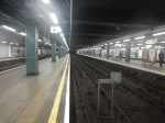
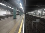
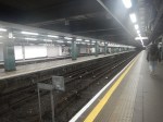
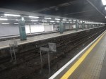
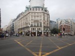
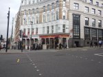
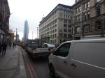
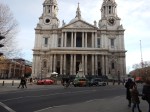
These pictures show City Thameslink station.
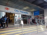


Note.
- It is a double-ended station.
- The Northern entrance is on Holborn Viaduct.
- The Southern entrance is on Ludgate Hill.
- There are escalators and lifts at both ends.
- The station name is given on the platform as City Thameslink for St. Paul’s Cathedral.
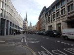
This is a Google Map of the area.

Note St. Paul’s cathedral and Southern entrance to City Thameslink station are connected by Ludgate Hill. As Ludgate Hill suggests, it is uphill to the cathedral.
So perhaps a name like Ludgate and St. Paul’s West, might be better.
There could always be a referendum or an on-line vote. But some wag would come up with an unsuitable name that would win.
City Thameslink station is a modern high-capacity station.
- The station is fully accessible.
- The platforms accept twelve-car Class 700 trains.
- Thameslink will soon be running twenty-four trains per hour (tph) in both directions.
- Northern destinations include Bedford, Cambridge, Luton Airport, Peterborough, Saint Pancras International and Stevenage.
- Southern destinations include Brighton, Gatwick Airport, Littlehampton, London Bridge, Maidstone, Rainham and Sevenoaks.
- There is commercial development over much of the station, some of which is better than others.
I have also read that the signalling of Thasmeslink could accept thirty tph through the Snow Hill Tunnel. So the station could see a twenty-five percent increase in train capacity.
What the station needs is better East-West connections to make better use of the station.
Crossrail
Crossrail connects to Thameslink, one station to the North at Farringdon station, which is not a long walk.
A Pedestrian Connection To St. Paul’s Tube Station
I believe this is possible and I wrote about it in A Pedestrian Connection Between City Thameslink Station And St. Paul’s Tube Station.
A Connection To The Docklands Light Railway
This map from Transport for London, shows the possible Western extension of the DLR.
I wrote about this extension in detail in A Connection Between City Thameslink Station And The Docklands Light Railway.
Conclusion
City Thameslink station could grow significantly in importance.
As to the name, if it grows in importance, perhaps it deserves a more important name?
The French would name it after an important politician, artist, philosopher or soldier!
We don’t do that!
If City Thameslink station ends up with a good pedestrian connection to St. Paul’s station and the cathedral, perhaps the whole station complex should just be called St. Paul’s.
