The Start Of Change At Victoria Tube Station
On the early-evening BBC London News last night, the BBC showed preview pictures of the new entrance to Victoria tube station, which they indicated is on Brettenham Place.
The station certainly needs more capacity, as this extract from Wikipedia indicates.
Victoria is currently the fourth busiest station on the London Underground, after Waterloo, Oxford Circus and King’s Cross St. Pancras, with nearly 85 million using the station (not including interchanging passengers) in 2013, of which around 60 million (including interchanges) use the Victoria line platforms. The station was not built for this number of passengers, which results in severe overcrowding. To prevent any dangerous situations like crowds pushing people off the platforms onto the track, crowd control measures are in place at the busiest times. This effectively means closing all the entrances to the Underground platforms and operating as an exit-only station until the overcrowding is relieved. These measures can last anywhere between a couple of minutes (when minor delays are occurring) up to several hours (during major incidents).
As to the layout of lines through the station, Victoria tube station is fairly simple, as this map from carto.metro.free.fr shows.

Note.
- The Circle and District Lines have a typical Victorian layout, with two platforms on the outside of the tracks.
- The 1960s designers of the Victoria Line at least left a lot of space between the two tracks.
- The Victoria Line also incorporates two full sidings, numbered 22 and 23 between the tracks.
As nearly all trains throughout the day run run between Walthamstow Central and Brixton, the use of these sidings must only be for purposes like overnight stabling and parking failied trains.
According to Wikipedia, currently each set of lines have their own ticket offices on different levels and built over a hundred years apart.
Walking between the Circle/District Lines and the main line station is not for the faint-hearted or those with need for step-free access. The 1960s designers at least made walking between the Victoria Line and the main line station a bit easier, but there is still a flight of steps to be overcome.
If I go to Victoria station with a wheeled bag, which is not often, I take the easy route of a 38 or N38 bus from around the corner, direct from around the corner from my house.
So what is happening over this weekend?
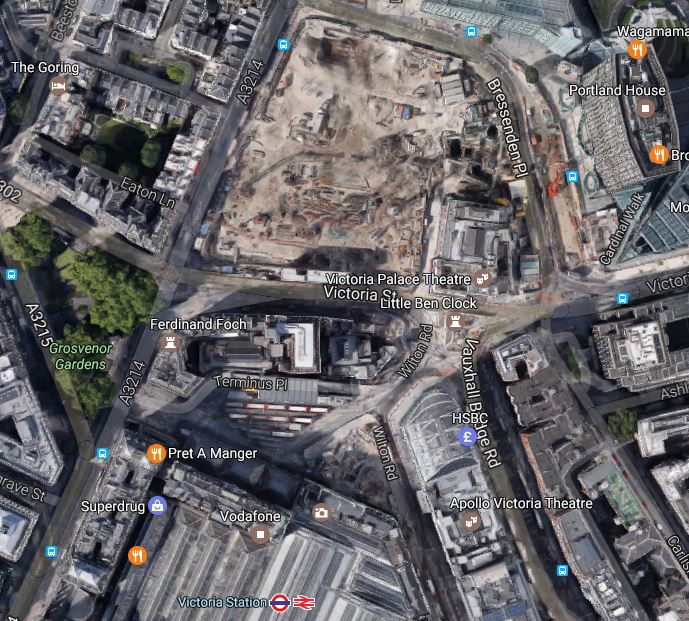
This Google Map shows the area to the North of the station.
Note.
- North of Victoria Street is a massive building site.
- The rows of white-roofed red buses on the station forecourt..
Wikipedia says this about the current upgrade.
To provide a lasting solution to this problem preparatory building work has begun on major upgrade of the station. This will include a new northern exit/entrance on the north-west corner of Victoria Street which will be accessible via a new additional ticket office under Bressenden Place that will lead to both the Victoria line and the Circle and District line platforms.
I will go and do some more digging.
The Victoria Line Platforms
Currently, the Victoria Line platforms have two sets of escalators.
- The original set of three, that so up into the Victoria Line ticket hall under the bus station.
- A second set of three, that go from the platforms into a series of passages underneath the Circle and District Line platforms, to which they connect with short sets of stairs.
These pictures show the Victoria Line platforms, various passages and works.
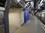
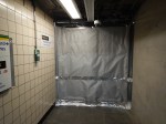


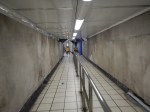
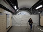
It looks like there are two new sets of works.
One set could just be an extension of the current lobby at the bottom of the original escalators. This would increase the capacity between the Victoria Line and the main line station.
Judging by the sign saying Cardinal Place on the other works at the Northern End of the platforms, it would appear that these works are a new entrance from Cardinal Place.
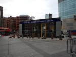
The Cardinal Place Entrance
On the surface, the Cardinal Place Entrance is clearly visible, outside the Cardinal Place development.
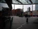

According to a personable member of the station staff, The new entrance will open sometime after ten on Monday morning.
At Cardinal Place, the overall design would appear to be simple, where an escalator shaft has been dug between the Northern end of the Victoria Line platforms and a new entrance hall beneath Bressenden Place, which then has the simple pop-up entrance shown in my pictures
The constructure, appears to have been carried out, without massive closures of the Victoria Line platforms.
The surface building also looks very similar in concept to the new standalone glass and steel entrances at Kings Cross St. Pancras and Tottenham Court Road stations.
So I wonder how many new entrances can be created at existing stations, by using a similar design and building method.
Walthamstow Central Station
Walthamstow Central station suffers very bad overcrowding , with only two escalators and no lifts having to cope with the passengers from over 40 trains per hour.
This map from carto.metro.free,fr shows the layout of platforms at the station.
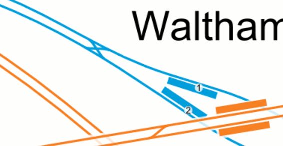
Note how there is a wide lobby at the Eastern end of the platforms underneath the Overground lines, which is used to accommodate the escalators and the waiting queues of passengers.
The crossover to the West of the station was installed in August 2015 and I suspect that this work didn’t compromise any of Transport for London’s thoughts of improving capacity at Walthamstow Central.
It could be tight to dig a shaft for three escalators into this area, but at least the area on top is mainly grass, market stalls and not the best of buildings, with the exception of the Library.
If you look at the length of the current escalators at the station, they indicate that the Victoria Line is not deep. So that would help.
I suspect we could see a very innovative and simple solution to create a new Western entrance at Walthamstow Central station.
I would also be possible to build the entrance without any disruption to either existing train services or passengers in the existing station.
Kempton Park Racecourse Could Close For Housing
This article on the BBC is entitled Kempton Park racecourse faces closure to make way for housing.
This Google Map shows Kempton Park racecourse and the surrounding area.
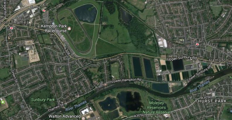
Kempton Park
It is a large site of about a third of a square mile, bounded on the Southern side by the Thames, with the Shepperton Branch to Waterloo on the Northern side.
Note.
- London needs lots of quality housing and it would certainly provide that.
- Kempton Park station currently has two trains per hour (tph) taking 44 minutes to and from Waterloo.
- As I said in An Analysis Of Waterloo Suburban Services Proposed To Move To Crossrail 2, whether Crossrail 2 is built or not, four tph could run on the Shepperton Branch to Waterloo in perhaps 30 minutes.
- There might be space for a section station on the London side of Kempton Park station.
- Road connections are good to the M3 and M25.
- A black-cab or mini-cab to Heathrow wouldn’t be outrageous.
On this rough look it certainly looks to be a good site for housing.
It is also possibly the only site owned by The Jockey Club, whose sale would create enough cash for thei improvements to go ahead.
But as on Radio 5 tonight, not all horse racing participants and fans will like this decision.
Are Murphy Group Playing A Long Game?
This news release on the Murphy Group web site is entitled Murphy Wins £60M+ London Overground Electrification Project.
Given, that it was known to be a difficult project, I don’t think I am alone in thinking that Murphy’s contract price was good value for London Overground.
Since then, progress has not been at a fast pace and some challenging problems seem to have emerged, but on whole professional commentators in magazines like Modern Railways an Rail Engineer have been broadly praising of the way the work is being done and what has so far been finished.
The troubles on the Holloway Road Bridge, which is not in Murphy’s contract, that I wrote about in Did The Project Management Go Wrong On The Holloway Road Bridge?, can’t have helped either.
I do wonder though, if the Murphy Group could be a beneficiary of the successful electrification of the Gospel Oak to Barking Line (GOBlin).
This Google Map shows the area between Gospel Oak and Kentish Town stations.
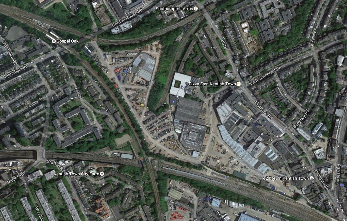
Murphy Group’s Site In Kentish Town
Note.
- Gospel Oak station in the top left, where the GOBlin meets the North London Line.
- The Midland Main Line curves across the bottom of the map, with Kentish Town station, just off the bottom right corner.
- There is another rail line (Tottenham North Curve ?) connecting the GOBlin to the Midland Main Line, that is current used by freight trains.
Between all these lines is a massive builders yard, which is the home of the Murphy Group.
In some ways giving the Murphy Group, the contract for the GOBlin upgrade and electrification, is like giving your local builder, the job of upgrading your house.
The Murphy Group have even accessed some parts of the work, by putting gates in the security fence between the railway and their yard.
This map from carto.metro.free.fr, shows the railway lines in the are.
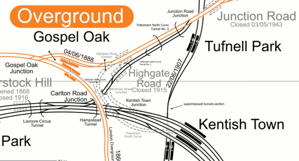
Lines Between Gospel Oak And Kentish Town
It shows how at times in the past, the rail connections from this area, were some of the most comprehensive in London.
There are already plans for some of the railways in the area.
- The Tottenham North Curve from Carlton Road Junction to Junction Road Junction is being electrified, so that electric-hauled freight trains can run between Barking and the Midland Main Line.
- Passenger services could be introduced on the Tottenham North Curve to create a second route across North London, linking Barking and Acton via West Hampstead Thameslink and the Dudding Hill Line.
- Could we even see a re-opened Highgate Road station?
I have a feeling, that all this, together with London’s enormous need for new housing will see the Murphy Group site developed, in a manner that is best for London. And the Murphy Group!
Consider.
- The development will have very good transport links.
- A reopened Highgate Road station, would be in the middle of the development.
- The development site is occupied by largely one company.
- The site is well-connected to railways for the transport of building materials and spoil.
- The site could be developed gradually, as the Murphy Group released the space.
Probably, the biggest problem would be finding the Murphy Group a new site.
It will be very interesting to see what happens on this very valuable site!
What Are They Doing With Auntie?
I took these pictures around the old BBC Television Centre in White City.


Everybody must have their favourite image of the site from years ago.
I particularly remember an episode of Michael Bentine‘s It’s A Square World, where they flooded the building, using some superb special effects and lots of real water. I think that section started with Bentine interviewing Jack Hawkins and talking about making wartime naval dramas, with a big screen showing the sea, which then burst out of the screen. According to Wikipedia, he also sent the building into space.
But then Bentine was a unique comic genius.
The New Beam Park Station
Beam Park station is a new station that is to support a large housing development of the same name, which will be built on the London, Tilbury and Southend Railway, between Dagenham Dock and Rainham stations.
This map shows the development, with the station numbered at six.

Beam Park
The station is the Westernmost number on the Southern boundary of Beam Park.
- It is possibly located where Kent Avenue crosses over the railway.
- Note that some sources call it Beam Reach station.
- With up to 5,000 new homes in the area, I would think that the station is needed.
I think it is interesting that London is getting two new stations; Barking Riverside and Beam Park, in the same area of London.
An Innovative Scheme For A Rail Link To Glasgow Airport
This article on Renfrewshire 24 is entitled New Option Could See Glasgow Airport Rail Link Run From Relocated Glasgow St. James Station.
The new option, which is proposed by Junction 29 (Scotland) Ltd, would relocate Paisley St. James Street station nearer to the airport and it would be connected to the airport using a PRT system similar to that used at Terminal 5 at Heathrow.
This Google Map shows the area.
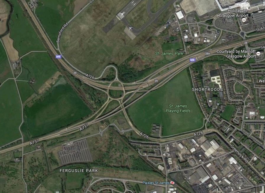
Note.
- Junction 29 of the M8 is the mass of spaghetti in the upper middle of the map, with the Inverclyde Line passing to the South-west of the junction.
- Paisley St. James station is towards the bottom of the map.
- Junction 29 (Scotland) Ltd. own the block of land to the West of the railway and the new station would be built in this area, where the PRT system would connect to the Airport.
I think it could be a feasible plan and these are my thoughts.
A Proven System
Wikipedia says this about the PRT System at Heathrow.
Construction of the guideway was completed in October 2008. The line is largely elevated, but includes a ground level section where the route passes under the approach to the airport’s northern runway. Following various trials, including some using airport staff as test passengers, the line opened to the public in May 2011 as a passenger trial. Subsequently it was made fully operational and the bus service between the business car park and Terminal 5 was discontinued. The pods use 50% less energy than a bus. They run 22 hours a day. Unlike all UK road and rail traffic, which drives on the left, the PRT system drives on the right. As of May 2013 the system passed the 600,000th passenger milestone.
The interesting thing, is that it runs under the runway approach, so it must have a fairly small footprint.
I actually think that using this system has other advantages.
- It could go on a roundabout route between the station and the Airport, serving car parks and other important places.
- It could serve the car parks, which are also proposed for the site.
- It could bring those with movement difficulties to the station for the Park-and-Ride to Paisley and Glasgow.
- It is very much a proven system.
- The tram-train alternative works in many places in the world, but the concept seems to cause Network Rail indegestion.
- The PRT System is independent of the railway.
But in my view the system’s biggest advantage is that it could have a serious wow factor for children of all ages.
Cost
The cost of the PRT option is quoted at £70-£80m, as opposed to £144m for the tram-train alternative.
Journey Times
Journey times to the airport will certainly be competitive, but I think the wow factor will encourage passengers to use it, whether they come by train or car to the station.
Why Would You Want To Close The Existing Station?
I would not close the existing Paisley St. James station for these reasons.
- It serves Paisley Town centre and St. Mirren Football Club.
- Closing it could be a hassle.
- Extra stations are never a bad thing.
- Modern trains stop and start again at a station very quickly.
- The new station could be called Glasgow Airport to avoid confusion.
But then there may be better reasons to close it.
Train Frequency
There needs to be at least four trains per hour (tph) to Paisley Gilmour Street and Glasgow.
If not more, as the frequency of the PRT system will annoy passengers waiting for the trains.
I also think that a turnback facility should be provided, so that a posh Airport shuttle train could work a 2 tph limited-stop service to Glasgow Central.
If Glasgow got its act together, the posh train could also serve Edinburgh.
Construction
It is stated in the Renfrewshire 24 article, that the new station and the PRT system could be built in twelve months alongside the existing network.
As all the land is owned by the Airport, Junction 29 and Network Rail, this must help, unless they find newts.
They could even lift a lot of the design of some of the other new stations like Kirkstall Forge.
Future Development
I’m sure Junction 29 (Scotland) Ltd. have got some good plans for the rest of their site.
Conclusion
Go for it! Glasgow has been procrastinating for far too long!
I think we’ll see a lot of systems like this around the world!
The system is described here in Wikipedia.
It’s British by the way and was developed in Cardiff and Bristol.
Around Waterloo East Station
In Southern Crossrail, Idiscussed the possibility of creating a direct link from Waterloo across London to London Bridge. The proponents of Southern Crossrail also take about rebuilding Waterloo East station.
So I went to look at the station and took these pictures.
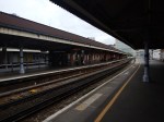


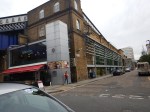
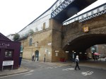
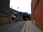


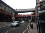


Note.
- The complex arrangement of high bridges.
- The highest white bridge is the pedestriain link between the two stations.
- The red bridge is what remains of the former rail link.
- It’s about a hundred metres between the two stations, with a slope down to the platforms at Waterloo East station.
This Google Map gives a view from above.
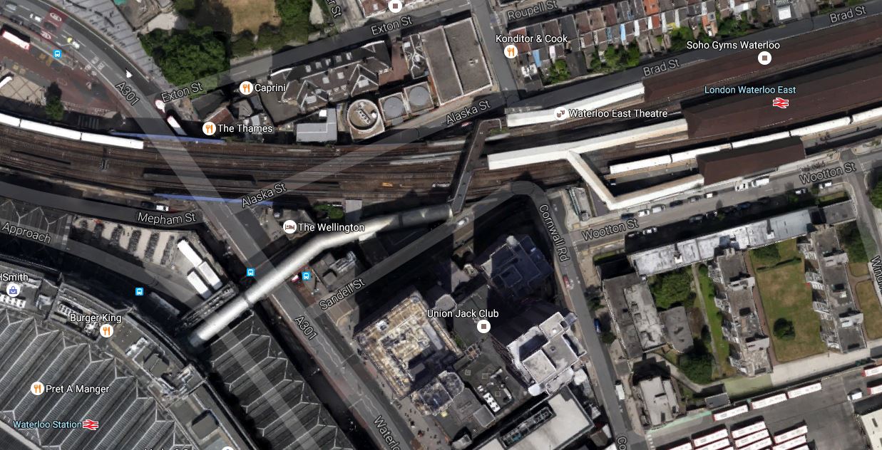
The Link Between Waterloo And Waterloo East Stations
The link is the white-coloured link that goes between the two stations. Don’t confuse it with the two trains in the map.
In the previous post, I said that rebuilding this station could be a project that a quality developer would relish.
But I do think that Southern Crossrail’s dream of connecting Waterloo East and Waterloo stations with a rail link is an impossible dream.
- There is now a retail balcony at Waterloo station, which was built in 2012 at a cost of £25million. It would need to be demolished.
- The lift and a couple of escalators to Waterloo East station are in the middle of where the new track would go at Waterloo station.
- The residents of the area probably wouldn’t like to have trains trundling through at height.
In the previous post, I said that rebuilding this station could be a project that a quality developer would relish.
Consider.
- Waterloo East station could be replaced with a better station.
- There is probably space around and above the station to add some sympathetic development.
- Escalator and lift connections could link Waterloo East station to the Northern, Bakerloo and Jubilee Lines.
- A full step-free connection could be built between the two Waterloo stations.
- The current connection to the Jubilee Line at Southwark is poor.
- The Waterloo and City Line will soon be getting a very good connection at Bank, so why not build a good one one to both Waterloo and Waterloo East.
This is one of those pedestrian links, that can benefit the around seven million or so passengers, who go through Waterloo East station every year.
Given the right financial figures, I think that there could be a developer, who would create the sort of development that residents, passengers and visitors to the area would like.
My ideal station would have the following.
- Four platforms to match the four platforms 6-9 at London Bridge station.
- Sympathetic over-site and surrounding development, preferably with affordable housing.
- Escalator and lift connections to the Underground and Waterloo and City Line.
- Full step-free access to Waterloo station, which would probably use the current entrance on the balcony.
- Better passenger facilities at Waterloo East station.
- A proper passenger entrance on Waterloo Road for Waterloo East station.
- The ability to handle an increased number of trains from the current fourteen trains per hour between London Bridge and Charing Cross stations.
All of this would probably be more affordable, than rebuilding Waterloo station.
Do We Need More Angels?
Before my reader, thinks I’ve gone all religious, I’m talking about the Angel tube station.
The station was substantially rebuilt in the early 1990s and this is said in Wikipedia in a section about the rebuilding.
For years since its opening, the station regularly suffered from overcrowding and had a very narrow island platform (barely 12 feet (3.7 m) in width), which constituted a major safety issue and caused justified fear among passengers. Consequently, the station was comprehensively rebuilt in the early 1990s. A new section of tunnel was excavated for a new northbound platform, and the southbound platform was rebuilt to completely occupy the original 30-foot tunnel, leaving it wider than most deep-level platforms on the system. The lifts and the ground-level building were closed and a new station entrance was opened on 10 August 1992 around the corner in Islington High Street together with the northbound platform while the southbound platform opened on 17 September 1992. Because of the distance between the new entrance and the platforms, and their depth, two flights of escalators were required, aligned approximately at a right angle.
So that explains why the station is unusual and safe. Rather than unusual and scary!
This map from carto.metro.free.fr shows the layout of the tunnels through Angel station.

Note.
- The dotted lines of the original tracks.
- The track to the North (top) was the original Northbound track.
- The Southbound track still has the same layout.
- The original twelve-foot island wide platform has now been widened to create the platform labelled 2.
- The platform labelled 1 and the track labelled 1992 is new work.
- The other dotted line was a siding.
I suppose the only complaint, is that the new station is not step-free, but then the work pre-dated the time from when disabled-access became commonplace.
London Bridge station went through a similar process in the late 1990s.
This map from carto.metro.free.fr shows the track layout of the Northern and Jubilee Lines at the station.
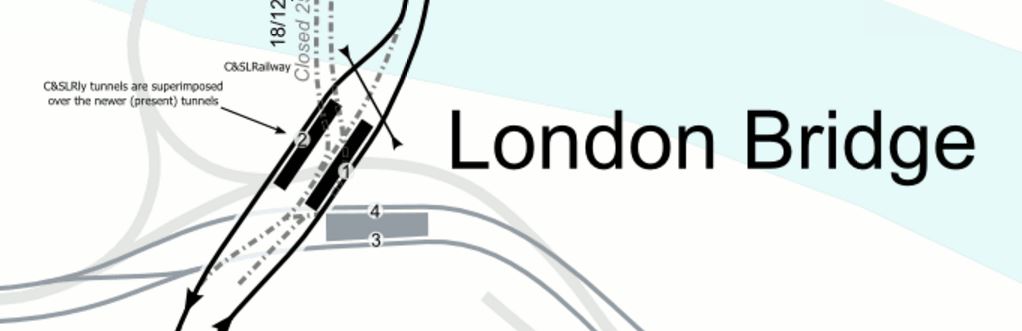
London Bridge Tube Station
The work that will be carried out at Bank station follows some of the things that were done over twenty years ago at Angel.
This map from carto.metro.free.fr shows the current layout at the station.
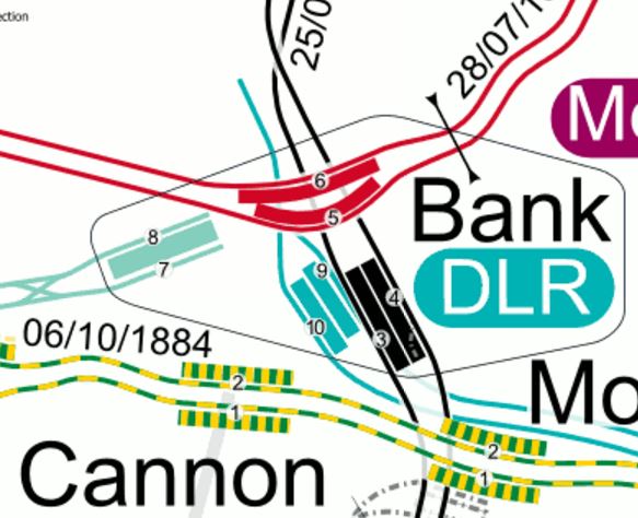
bank Tube Station
Note the following about the current layout and future developments.
- Platforms 3 and 4 are the current Southbound and Northbound platforms respectively, with non-traditional on the right running.
- A new single-track Southbound tunnel is being built to the West of the current one, to create a space between the lines.
- The current platform 3 will become part of the passenger space as it has at Angel.
- Platforms are being widened.
- Better step-free access is being created.
- There will be escalators direct to the Central Line.
- Oversite development is being added on the top of the new station entrance on Cannon Street.
- In some ways too at Bank station, the precedents set by the new Walbrook Square entrance are also being followed.
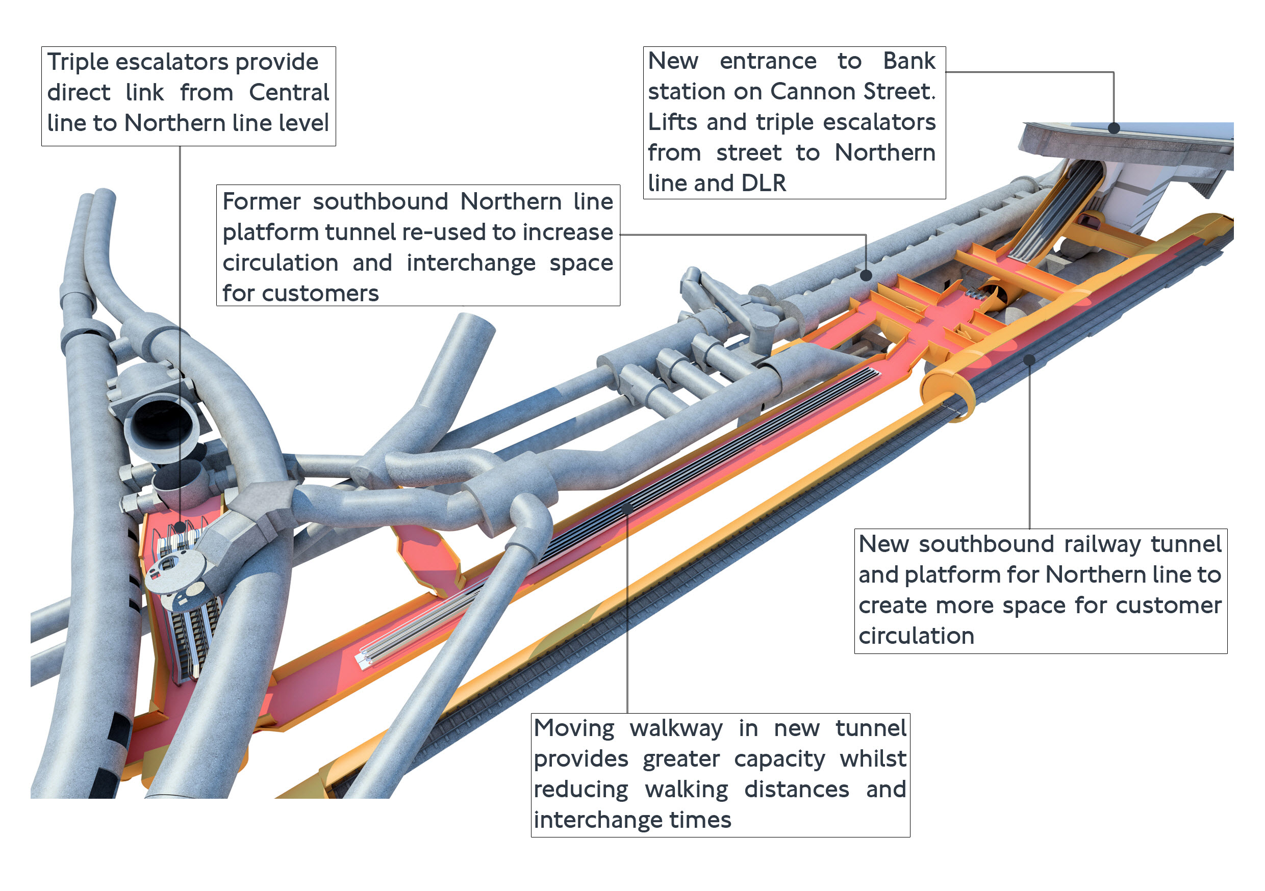
This visualisation, shows what the new Bank station will look like.
I think more stations can be rebuilt along using similar techniques.
Clapham North and Clapham Common stations are the last two Northern Line platforms with an island platform in the tunnel and must be towards the top of any list. This map from carto.metro.free.fr shows their locations.

Note their closeness to Clapham High Street station, I am sure, that eventually a better solution to these two stations will come about because of property development in the area.
- Euston station must be added, but this will probably be sorted with HS2 and the rebuilding above.
- Camden Town station is planned for a major upgrade with property development on top.
- Finsbury Park station is being improved, but given the station’s future importance, is what is planned enough?
And then there is always Highbury and Islington station, which is probably the worst station on the Victoria Line for platform access.
This map from carto.metro.free.fr shows the lines through the station.
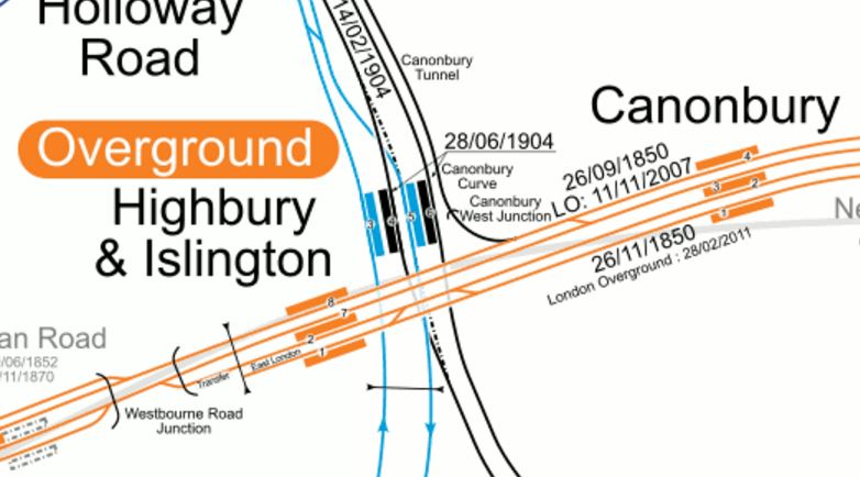
Note the following about Highbury and Islington station.
- The Overground has been sorted with step-free access.
- The bridge outside the station, which was decidedly dodgy will be fixed soon.
- Islington Council have ambitious plans for Highbury Corner.
- The Northern City Line is being upgraded to a high frequency with new Class 717 trains.
- The frequency on the North London Line is going to be increased a notch or so.
- There will be more trains to the South on the East London Line.
- The Victoria Line is going to get closer to forty trains per hour.
All of this adds up to a desperate need to rebuild the station with more escalators and lifts, probably on both sides of the Holloway Road.
There is a further unlikely possibility at Highbury and Islington station.
Note the Canonbury Curve in the map, which lies on a single-track electrified line that links the North London Line to Finsbury Park on the East Coast Main Line, Thameslink and the Northern City Line.
If, as I suspect, that in a few years the Northern City Line is upgraded to a higher frequency, once the new Class 717 trains, there will be an even bigger need to sort out this station.
I’m All For More Of This!
This article from Global Rail News is entitled Toronto park plan for downtown railway.
The article describes how Toronto wants to purchase the air rights over a 21-acre railway through the City Centre and put a park on the top.
There are certainly places in the UK, where this approach can be used to create parts, housing or commercial buildings over the railway.
Especially in Londom, where land is so expensive.
Look at this Google Map of the rail lines into Liverpool Street as they pass Shoreditch High Street station on the East London Line.
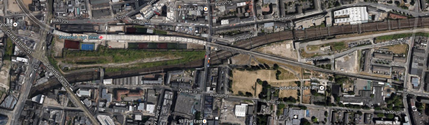
Lines Through Shoreditch
Surely, a better use could be found for the space above this railway. I estimate this space must be about ten hectares and if properly developed could contain lots of buildings and a green walkway connecting Shoreditch High Street station to Liverpool Street station.
And what about the waste of space that is Euston station?
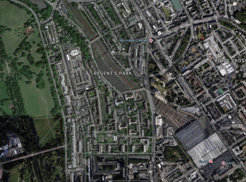
Euston Station And The Approach Lines
Hopefully adding HS2 to the station will improve things.
Knicker Twisting In Worcestershire
This article on Worcester News is entitled Worcestershire Parkway public inquiry shelved after pay-out.
It describes the latest round in the saga of getting Worcestershire Parkway station built.
Wikipedia says this.
On 21 February 2015 Worcestershire County Council advertised for contractors for the construction of the railway station to include platforms, station building, passenger footbridge and lifts with a commencement date of late September 2015 with completion in May 2017. On 25 August 2015 planning permission was granted, with work expected to have started in 2016.
A potential legal battle between Worcester County Council and Norton Parkway Developments, who currently own the land, started in 2016. Norton Parkway Developments has refused to hand over the land to the council as they feel that they are in a position to complete the development themselves.
So it seems like another row between a Council and developers over a station, to follow the one at Battersea.
