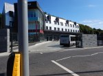
Brentford’s New Stadium Is A Step Nearer
This article in the Construction Enquirer is entitled Go-ahead for Brentford FC stadium and 650 homes.
The article describes how detailed planning permission has been secured and that given the result of a Public Enquiry is settled, construction will be completed for Brentford to move in at the start of the 2018-19 season.
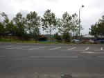
The new stadium will have a capacity 20,000 as opposed to 12,300 for Griffin Park.
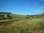
This Google Map shows the new stadium’s location in Lionel Road South.
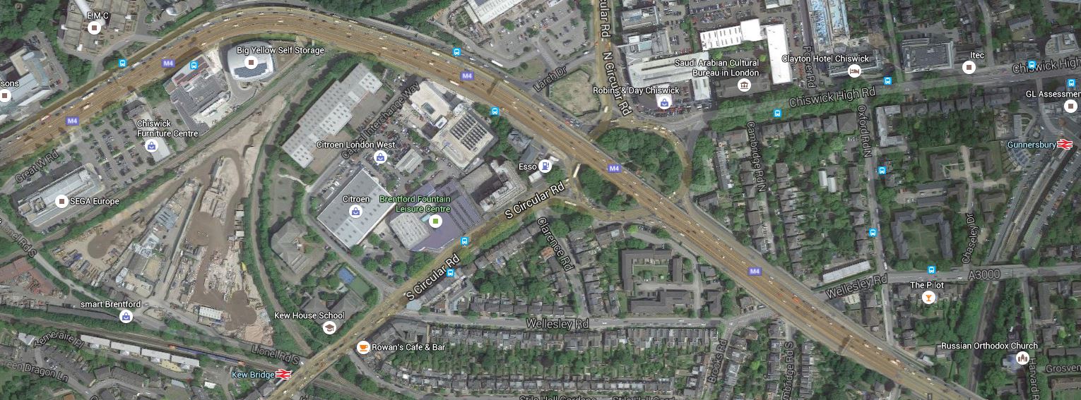
Brentford’s New Stadium
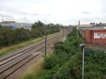
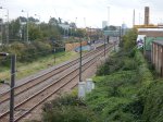
Most of the site and all of the stadium are within the triangle of rail lines above Kew Bridge station, which is at the bottom of the map. The M4 Motorway curves round the North side of the site.
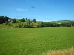
Maps from the club, show that the stadium lies alongside the railway line at the top of the triangle.
This Google Map shows an enlargement of just the area of the development.
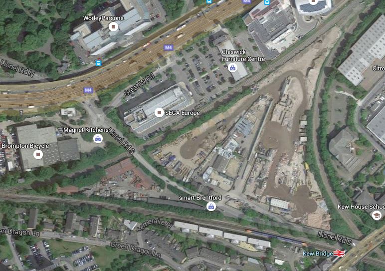
Enlarged Map Of Site
This line goes between Brentford and South Acton stations, although there are currently no passenger services, but there have been services in the last twenty years. It should be noted though that Transport for London have thought about using this line to extend the London Overground to Hounslow station.
Having met one of TfL’s property experts, I feel that they would be amenable to plans to use the air space above the line.
The line at the bottom of the triangle is the Hounslow Loop Line, where Kew Bridge station is very convenient for the ground.
The triangle is completed by a curve that connects the North London Line to the Hounslow Loop Line.
It should also be noted that at the eastern edge of the main map is Gunnersbury station, which along with Kew Bridge station is one of the proposed ways to get to the stadium.
I do wonder, if TfL’s ambitions for the London Overground, would be heklped by a station on the line at the top of the triangle.
On a first look, it looks like a good attempt to squeeze a football stadium into West London.
What Development Is Going On Around You?
I found Planning Finder through an on-line advert. I’ve just tried it for my home and it has found some interesting but innocent planning applications.
I would certainly use this web site to check out, where I was buying a house.
The London Office Crane Survey
I liked this survey from Deloitte!
Bat Bridges In Norfolk
The One Show on the BBC has just had a piece about how £300,000 was spent on special bat bridges over the A11 in Norfolk.
Now anybody with Suffolk connections will tell you that they are a bit funny up north, but surely not three hundred grand funny!
To bring the other East Anglian county into the piece, the BBC had also had an interview with a bat Professor from Cambridge University, who had found that the bats weren’t using their expensive highway.
For some years, I’ve always believed that bats are not stupid animals. After all, they can fly!
I was putting up offices on my stud, and in the middle of the cart shed we would be demolishing, the council planning officer thought he saw some bat droppings.
So I called in an expert, from Cambridge University! As one does!
The expert felt there might be the odd evidence of bats, but not to worry as bats often have as many as three roosts and swap between them for various reasons.
He told the council planning officer that the bats wouldn’t mind my new offices.
I do wonder if protesters use the possible existence of bats as a means to stop a development.
The National Infrastructure Commission Is Welcomed By Warwickshire
This article on Rail News is entitled Warwickshire rail campaigners welcome news of National Infrastructure Commission and it discusses the struggles of local campaigners trying to restore the rail line between Stratford-on-Avon and Honeybourne, on the North Cotswold Route. Wikipedia says this about the plans.
The Shakespeare Line Promotion Group is promoting a scheme to reinstate the 9 miles (14 km) “missing Link” between Honeybourne and Stratford. Called the “Avon Rail Link”, the scheme (supported as a freight diversionary route by DB Schenker) would make Stratford-upon-Avon railway station a through station once again with improved connections to the Cotswolds and the South. The scheme faces local opposition. There is, however, a good business case for Stratford-Cotswolds link.
Note this could also be a freight diversion route.
Last year, I went to Stratford-on-Avon and wrote Stratford Upon Avon Station Is Getting A Facelift.
I hinted at more services to come and linked to the Wikipedia comments above.
To return to the Rail News article, it says some interesting things like this.
A NIC could overcome one of the biggest hurdles that has existed for decades. For mainly no other reason the route from Stratford to Honeybourne straddles two government regional boundaries (West Midlands and South West) two Network Rail regions (Chiltern/West Midlands and Western), three County Councils, three District Councils and two Local Enterprise Partnerships.
Is anybody in charge? Perhaps the NIC will be. This is said on visitors to Stratford-on-Avon.
Stratford only attracts six per cent of visitors to the town to travel by rail, while the national average for visitors by rail to similar UK rail-connected tourist destinations is over double that, at 13 per cent.
As the line has a good case for reopening and Stratford-on-Avon station has been upgraded, perhaps this is a project that should be looked at seriously.
We are probably going to live in a new era if George Osbourn’s plans for business rate reform come to fruition, which might see progressive Councils developing infrastructure to enable business, housing and tourism opportunities.
Surely a reconstructed line from Stratford-on-Avon to Cheltenham would tick a few boxes.
There is a major prize at the Cheltenham end if Cheltenham Racecourse, which is one of the busiest in the UK, could be linked to the main line rail network at Cheltenham Spa station. The Google Map shows the Gloucestershire Warwickshire Railway going past the racecourse, where there is already a station.
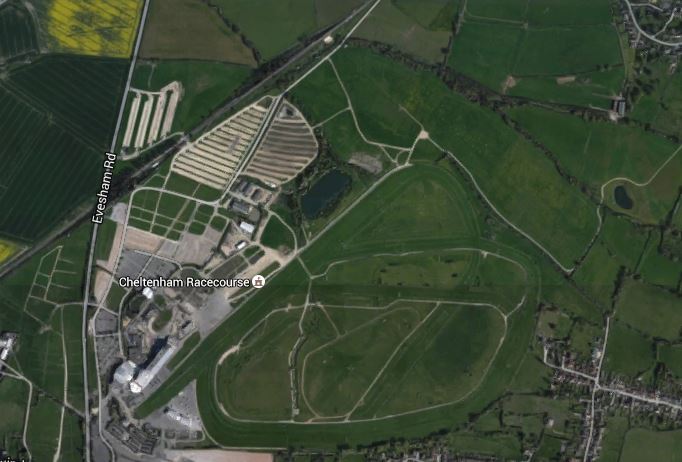
Cheltenham Racecourse
Unfortunately, there is a supermarket which is partially blocking the route between the racecourse and Cheltenham Spa station.
These are the sort of problems that a National Infrastructure Commission should have the power to solve or dismiss as insoluble.
Watching National Hunt racing at Cheltenham is one of the great sporting spectacles of the British Isles and a viable rail service to the course from London and Oxford needs to be created.
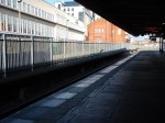
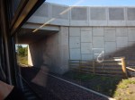
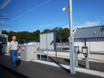
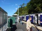
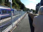
Developments At And Around Lea Bridge Station
These are the latest pictures I took of the station on September the 21st.

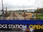
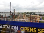
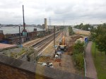
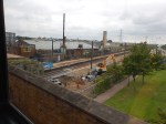


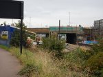

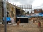

The pictures also show that around the area of the station are a large amount of industrial units, some of which couldn’t be described as high class, by any means. This Google Map shows the area.
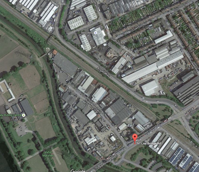
Around Lea Bridge Station
The station is being built in the curve of Argall Way, where the railway goes under Lea Bridge Road. The dreadful bridge over the railway can be spitted where Argall Way branches away from the railway at the top of the image.
97, Lea Bridge Road is picked out as that is a site owned by Bywater. According to this report from the Guardian series of local papers, the site and several others in the area are slated for the development of a thousand houses. This is the first two paragraphs.
Two huge housing developments will be discussed next week as developers look to build hundreds of homes in Waltham Forest.
Separate sites in Leyton could be transformed into new neighbourhoods after ambitious plans are put to Waltham Forest council.
Is the station the chicken or the egg?
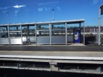
Is This A Platform For Future Tram-Trains?
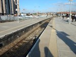
Whilst I waited for my train to Grantham, I had a quick look at the Northernmost Platform at Nottingham station. Platform 1 is a through platform and it looks like there could be access from both sides in the future.

The redesigned Nottingham station certainly has all sorts of possibilities for future development. This Google Map shows the layout.
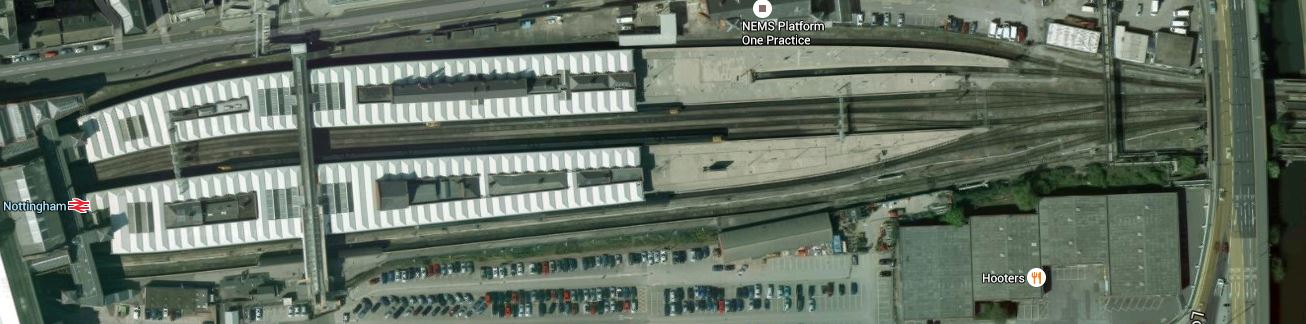
Nottingham Station Layout
Platform 1 is at the top, with the East-facing bay plstform 2 clearly visible.
It would appear that tram-trains could use the outer platforms and then be connected to wherever, as the station sits on a large site with space to the North and South.
The section called Railway Platforms in the Wikipedia entry for Nottingham station, says this.
Finally the southern side platform is numbered 7, and can accommodate a thirteen coach train. Sufficient space exists to the south of this platform to add a second platform face, effectively converting this side platform into an island platform, if traffic increases to justify it.
When you compare Nottingham to other places like Birmingham, Manchester or Leeds, the city is truly lucky to have a station with so many possibilities.
There also are not many places in the UK , where you could run the main tram line at right-angles over the main station. But it is a very good way of connecting the two modes of transport.
To the East of the station, there is also an enormous site with these derelict buildings.
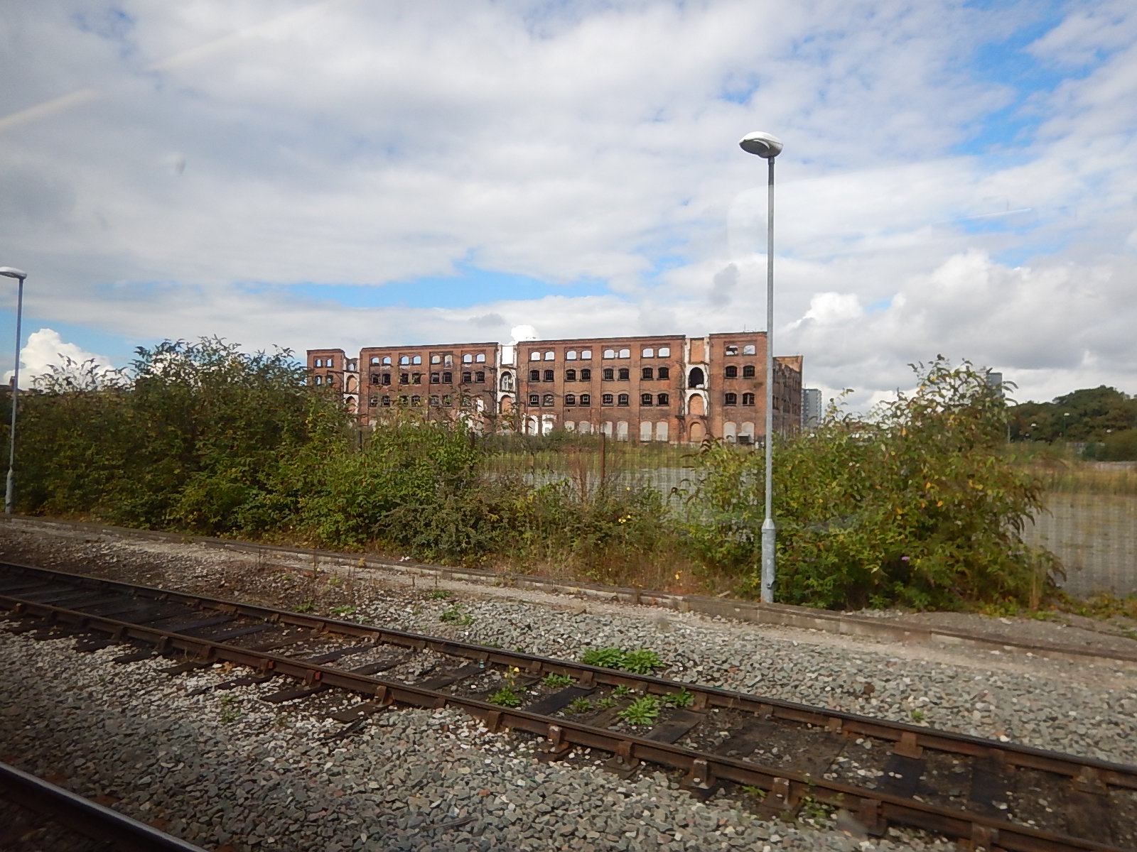
A Derelict Site To The East Of Nottingham Station
The city must have plans for these.
But then Nottingham is very much saying that the City has an exciting and prosperous future.
Riding The Borders Railway
My main reason for going to Scotland was to ride on the New Borders Railway.


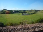


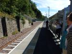
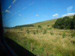
It looks like any new railway should, although it’s a bit stark at the moment, as all new railways and stations do.
In some ways, the most impressive features are the related new developments along the line.
There has already been a lot of new house-building, which is probably needed in Scotland as much as elsewhere in the UK.
But the most significant development is Galashiels station and the related bus station, from where you can get buses all over the Borders. Before the railway arrived to get between say Peebles and Edinburgh was an hour on the bus and then a difficult walk between Waverley station and the North Bridge, where the buses stopped. Now it’s a flat walk at either end of the journey to continue your journey.
It will be interesting to see the number of passengers, who transfer between bus and train at Galashiels.
The next developments along the line will be tourism related. The Great Tapestry of Scotland is coming to Tweedbank and I would not pass any comments on what else will be developed, other than to say that the new railway will provide masses of opportunities.
Yet again, it looks like a new rail or tram development is giving an area a lift up the scale of prosperity.
A Wet Morning In Liverpool
Everybody likes to view places in the sun. But it was wet in Liverpool, as I walked around.


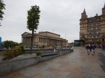
Liverpool’s town centre is almost unique, in that the whole area is mainly traffic-free and the new shopping centre of Liverpool One has been designed as an extension to the existing main shopping street. The main centre is also ringed by four railway stations, two bus stations, car parks and a three-lane dual carriageway, which separates the shops from the waterfront. Crossing between the waterfront with its attactions, museums and hotels, and the shops, is not by some dingy urinal-soaked subway, but by one of several light-controlled pedestrian crossings.
What is missing from Liverpool is the Overhead Railway or a modern replacement. This Google Map shows the Waterfront, the Albert Dock, where I stayed and the dual carriageway.

Liverpool Waterfront
Note how the dual carriageway has a wide central reservation. Surely Liverpool could run a tram or perhaps even a tram-train linked to the Northern Line down the Waterfront?
The Piccadilly And Victoria Lines, Manor House Station And Harringay Green Lanes Station
The planners and the politicians created a real dog’s breakfast here, when the Victoria Line was designed and built in the 1960s.
A Few Facts
I’ll start with a few facts, as far as we can trust Wikipedia.
From the Planning and construction section of the entry for the Victoria Line.
A test tunnel from Tottenham to Manor House under Seven Sisters Road had been bored in 1959 and was later incorporated into the running tunnels.
From the entry for Seven Sisters station.
The section of Victoria line between Seven Sisters and Finsbury Park stations is the longest between adjacent stations in deep level tunnels on the London Underground network.
From our own observations.
There is a ventilation station at the junction of Green Lanes and St. Ann’s Road. This was put in, as it’s a long way between Turnpike Lane and Manor House stations. The Cockfosters Extension section of the entry for the Piccadilly Line says this.
It was also planned to build a station between Manor House and Turnpike Lane at the junction of Green Lanes and St Ann’s Road in Harringay, but this was stopped by Frank Pick, who felt that the bus and tram service at this point was adequate. However, a ‘Ventilation station’, in similar architectural style to tube stations of the time was provided at the site, and is visible today. There was also some opposition from the London and North Eastern Railway to the line.
I think we underestimate the influence the LNER had on shaping London’s railways. Much was positive, but some was about protecting their interests.
I had a great uncle, who lived in Harringay and in the 1950s, we’d go and visit him on the 29 bus, as it was a long walk from Turnpike Lane.
What Might Have Been
Here again from various parts of Wikipedia.
From the Victoria Line section of the entry for the Piccadilly Line
During the planning stages of the Victoria line, a proposal was put forward to transfer Manor House station to the Victoria line, and also to build new “direct” tunnels from Finsbury Park to Turnpike Lane station, thereby cutting the journey time in and out of central London. This idea was eventually rejected due to the inconvenience to passengers that would have been caused during rebuilding, as well as the costs of the new tunnels.
From the entry for Seven Sisters station.
During the planning phase of the Victoria line, thought was given to converting Manor House into a Victoria line station and diverting the Piccadilly line in new tunnels directly from Finsbury Park to Turnpike Lane via Harringay Green Lanes, but the idea was abandoned because of the inconvenience this would cause, as well as the cost.
From fifty years and more after construction of the Victoria Line it might seem to be a feasible plan on a cursory look.
- It would speed trains on the Piccadilly Line to Kings Cross and Central London, as the route is shorter.
- There would be an extra station at Harringay Green Lanes on the Piccadilly Line, which would replace Manor House.
- It might also be feasible to turn the ventilation station at Green Lanes into a station.
- There would be an extra station at Manor House on the Victoria Line.
Also affecting these services will be this summer’s upgrade to the Victoria Line which will allow thirty-six trains per hour on that line.
So if you take the two improvements together passengers on both the Victoria and Piccadilly Line would get a better service with extra stations.
Enter Crossrail 2
Crossrail 2 will add another dimension to the planning in this area.
I’ll start with a personal observation from my childhood.
Many times, I travelled from Oakwood to Leicester Square or South Kensington and it’s a long way! It probably still is! And in trains that are a lot more crowded.
The opening of Crossrail 2 will affect the Piccadilly and Victoria Lines.
- Passengers on the Piccadilly Line from Wood Green northward may switch to Crossrail 2 at Turnpike Lane.
- Passengers on the Victoria Line from Walthamstow may switch to Crossrail 2 at Tottenham Hale.
- Many passengers from the London Boroughs of Barnet, Enfield, Harringey and Waltham Forest, will change their route to Central London with the arrival of Crossrail 2. And before that an upgraded Thameslink.
I think overall, we’ll see an easing of the lot of passengers on both the Piccadilly and Victoria Lines, by the end of the next decade. The Piccadilly Line should also have been upgraded with new and larger trains, running to an increased frequency. The Future Upgrades section for the Wikipedia entry for the Piccadilly Line says this.
On current plans, resignalling work on the Piccadilly line will begin in 2019 and new trains should be in service by 2022.
If the Piccadilly Line eases South of Turnpike Lane, then there may be scope for opening more stations on the line at perhaps the ventilation station on Green Lanes and Harringay Green Lanes.
And what about an interchange to the North London Line at Maiden Lane to serve the Kings Cross Central development?
How Could New Stations Be Built?
Doing anything at present to create any new stations on the Piccadilly Line is probably not feasible, as it would be impossible to shut the Piccadilly or Victoria Lines for long enough to do anything substantial. There’s been enough chaos caused by shutting the outer reaches of the Victoria Line this summer.
Transport for London have a similar problem about creating a link between the Central Line and the East London Line at Shoreditch High Street station. Transport for London feel that nothing can be done until Crossrail opens. I discussed that link in Will Shoreditch High Street Be Connected To The Central Line?.
Creating new stations on the Piccadilly Line probably can’t be done, until Crossrail 2 is opened, as how do the passengers get to work, rest and play?
I think that in a few years time actually creating the stations will not be as difficult as it would be today, from a construction point-of-view. The experience gained on building Whitechapel station on Crossrail, where a technique called uphill excavation has been used, might be applicable.
Conclusion On The Piccadilly Line In Harringay
My view is that a sort out of the Piccadilly Line and its stations in Harringay is possible and probably very worthwhile, but only after Crossrail 2 has been opened.
Planned Rail Development At Harringay Green Lanes Station
Over the next few years, there will be two major developments on the GOBlin through Harringay Green Lanes station.
The line is going to be electrified with 25 KVAC overhead lines, which will mean putting up structures to support the cables. The bridge across Green Lanes will probably be replaced, as it doesn’t look to be in the best of condition and to be safe, it will probably be replaced before the wires are erected.
The new electric trains will be four-car and this will probably mean the platforms have to be extended. I suspect that Transport for London may well future-proof the station and extend the platforms for perhaps six or even eight-car trains.
There is definitely space at the eastern end of the station to do the platform extension, but why not extend the platforms over the bridge and perhaps even use glass sides, as they’ve done at Deptford. Extending over the road will also mean that in future a western entrance or link to Harringay station could be created.
As no plans to replace the bridge have been published that I can find, could it be that Network Rail and their architects are working with property developers to design a proper flagship station?
I also think that designing a station to carry the overhead wires in its structure, as I’ve seen at Liege station, may simplify the design and save on the cost of the building.
Property Development And Harringay Green Lanes Station
If you want a profitable development, building car parking is a waste of money, so good access to public transport is essential.
For this reason and especially for housing, property development will be the force that drives the development of London’s transport system.
There is a lot of scope for property development in the area around Harringay Green Lanes station.
This document from the London Borough of Harringey entitled Harringay’s Local Plan lists a large number of development sites around the station.
On Page 92 the document details the St. Ann’s Hospital Site, which lies to the north of the GOBlin. It details how the South West corner of the hospital site will be connected to Green Lanes and the station.
On Page 94 the document goes on to talk about the Arena Retail Park, which adjoins the station.
Both sites have something that developers love. They are both in single ownership; one public and the other private.
So you can have control of the sites without the sort of problems that Tottenham Hotspur have had on building their new stadium, which has delayed the development for some years.
As it will be in the developers’ interest and profitability to have good public transport, I would be very surprised not to see a very good station built at Harringay Green Lanes to serve their developments and also to improve the transport opportunities for locals. This is said in the document.
Access to Harringay Green Lanes Station should be improved by creating a
new entrance on Portland Gardens.
Also, no sane developer would build this station without a secret place, where the escalators and lifts to the Piccadilly Line could be installed. As an example, Tottenham Court Road and perhaps Angel stations, are already ready to accept Crossrail 2.
I believe that given the amount of property development that will take place in the area, a new station at Harringay Green Lanes will be one of the first new buildings to be constructed.
Imagine the advertising potential for your development to see a shiny glass and steel station built over Green Lanes, as you drive or ride a bus through the area. Buiilding the station partly over the road would mean you need to use less valuable land and it would be easier to create a Hackney style link to Harringay station along the railway. If you want to see what can be done, go to Deptford station.
Tailpiece
If you have a flagship station at one end of Green Lanes in Harringay, why not have one at the other by converting the ventilation station into a real one?
I just wonder if that should and could be done before Turnpike Lane is rebuilt for Crossrail 2, so that there is an alternative station, if Turnpike Lane had to be closed.
Crossrail have shown that they like to be good neighbours and converting the ventilation station could be something they’d look at to cool the anger of diverted passengers and local residents. The superb new Pudding Mill station on the DLR was built by Crossrail, as the old station was in their way and had to be demolished. I was very surprised that the new station is so spectacular, but I suspect that through good design, clever use of space and leaving out expensive escalators and various utilities not needed if there are driverless trains and no booking office, that the station wasn’t as expensive as it looks. The property developers and West Ham United won’t be complaining.
